


Uturuncu – Bikepacking a Volcano, Bolivia
Distance
39 Mi.
(63 KM)Days
2
% Unpaved
100%
% Singletrack
0%
Total Ascent
6,519'
(1,987 M)High Point
19,623'
(5,981 M)Difficulty (1-10)
9?
- 10Climbing Scale Very Strenuous167 FT/MI (32 M/KM)
- -Technical Difficulty
- -Physical Demand
- -Resupply & Logistics
Contributed By
The Pikes
The Andes by Bike
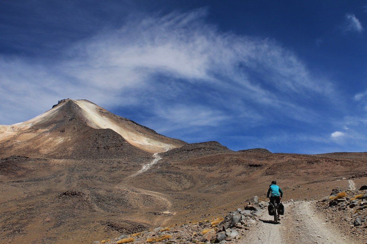
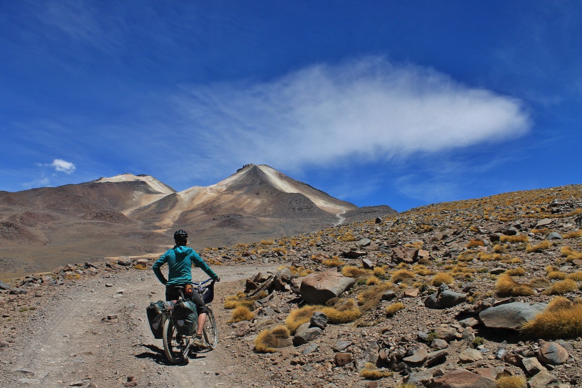
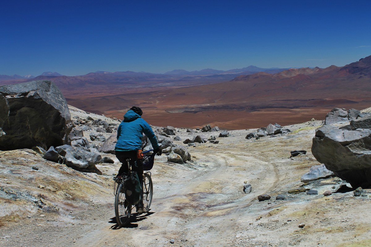
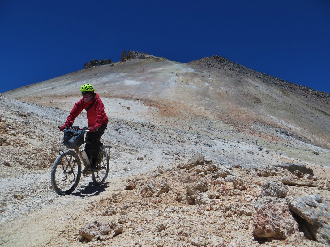
Though it once reached nearly 5900 meters, nowadays it is ‘only’ rideable to the col between the volcano’s twin summits, at a heady height of 5760m. This is the point at which occasional tourists are dropped off by jeep drivers, to make the short walk to the volcano’s 6000m summit. Cyclists can dump their bikes at the col and head to the summit on foot; on a clear day you get bird’s eye views of the Bolivian Altiplano, which stretches for hundreds of miles in every direction.
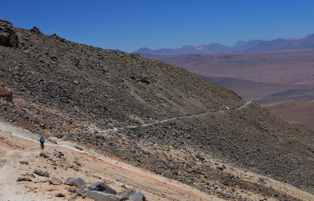
Because of the jeeps, the rough track to the col is rideable almost in its entirety. In theory, anyway. To be able to keep pedalling to such a height you need to be extremely well acclimatized, fit, and have the right bike – on a number of sections the surface is loose or sandy, and above 5000m the many steep miles will make your lungs explode…it’s certainly a challenging undertaking!


Submit Route Alert
As the leading creator and publisher of bikepacking routes, BIKEPACKING.com endeavors to maintain, improve, and advocate for our growing network of bikepacking routes all over the world. As such, our editorial team, route creators, and Route Stewards serve as mediators for route improvements and opportunities for connectivity, conservation, and community growth around these routes. To facilitate these efforts, we rely on our Bikepacking Collective and the greater bikepacking community to call attention to critical issues and opportunities that are discovered while riding these routes. If you have a vital issue or opportunity regarding this route that pertains to one of the subjects below, please let us know:
Highlights
Must Know
Camping
Food/H2O
- The higher you go, the better the views get – those interested in climbing the highest of the two summits should head south from the col.
- Very challenging – steep, bad surface and the col is only 130m lower than the summit of Kilimanjaro!
- The volcano lies in the Sud Lipez of south-west Bolivia, an area popular with bikers following the ‘Lagunas Route’. The way up the peak begins and ends in the little village of Quetena Chico which is the nearest inhabited settlement to the mountain, and a place where basic supplies and accommodation can be found.
- You need to be super-acclimatized to attempt this – the better your lungs work at these altitudes, the more you’ll be able to pedal, less you’ll have to push, and the more enjoyable it’ll all be; not to mention the lower your chances of getting AMS. If you don’t mind camping high on the volcano, the trip can be done in two days. Choosing to go light and make the return journey in a very long day may be a good option, however bear in mind that there is 1750m of climbing to reach the col, and if the weather decides to make one of its sudden changes, you’ll find little in the way of shelter if you don’t have the back up of a tent.
- More info at: http://andesbybike.com/bolivia/routes/uturuncu/
- Basic accommodation is available in Quetena.’
- On the mountain, camping is your only option.
- Take all supplies with you from the village.
- And water too as you’re not guaranteed to find snow on the mountain, and much of the water on the peak is contaminated by sulphur.


Terms of Use: As with each bikepacking route guide published on BIKEPACKING.com, should you choose to cycle this route, do so at your own risk. Prior to setting out check current local weather, conditions, and land/road closures. While riding, obey all public and private land use restrictions and rules, carry proper safety and navigational equipment, and of course, follow the #leavenotrace guidelines. The information found herein is simply a planning resource to be used as a point of inspiration in conjunction with your own due-diligence. In spite of the fact that this route, associated GPS track (GPX and maps), and all route guidelines were prepared under diligent research by the specified contributor and/or contributors, the accuracy of such and judgement of the author is not guaranteed. BIKEPACKING.com LLC, its partners, associates, and contributors are in no way liable for personal injury, damage to personal property, or any other such situation that might happen to individual riders cycling or following this route.
Please keep the conversation civil, constructive, and inclusive, or your comment will be removed.