


Trans Ecuador Mountain Bike Route: Singletrack Version
Distance
764 Mi.
(1,230 KM)Days
25
% Unpaved
80%
% Singletrack
30%
% Rideable (time)
92%
Total Ascent
101,388'
(30,903 M)High Point
14,567'
(4,440 M)Difficulty (1-10)
10?
- 9Climbing Scale Very Strenuous133 FT/MI (25 M/KM)
- -Technical Difficulty
- -Physical Demand
- -Resupply & Logistics
Contributed By

Cass Gilbert
Contributing Editor
Please be sure to download the latest version of the route (2020_05) for important updates!
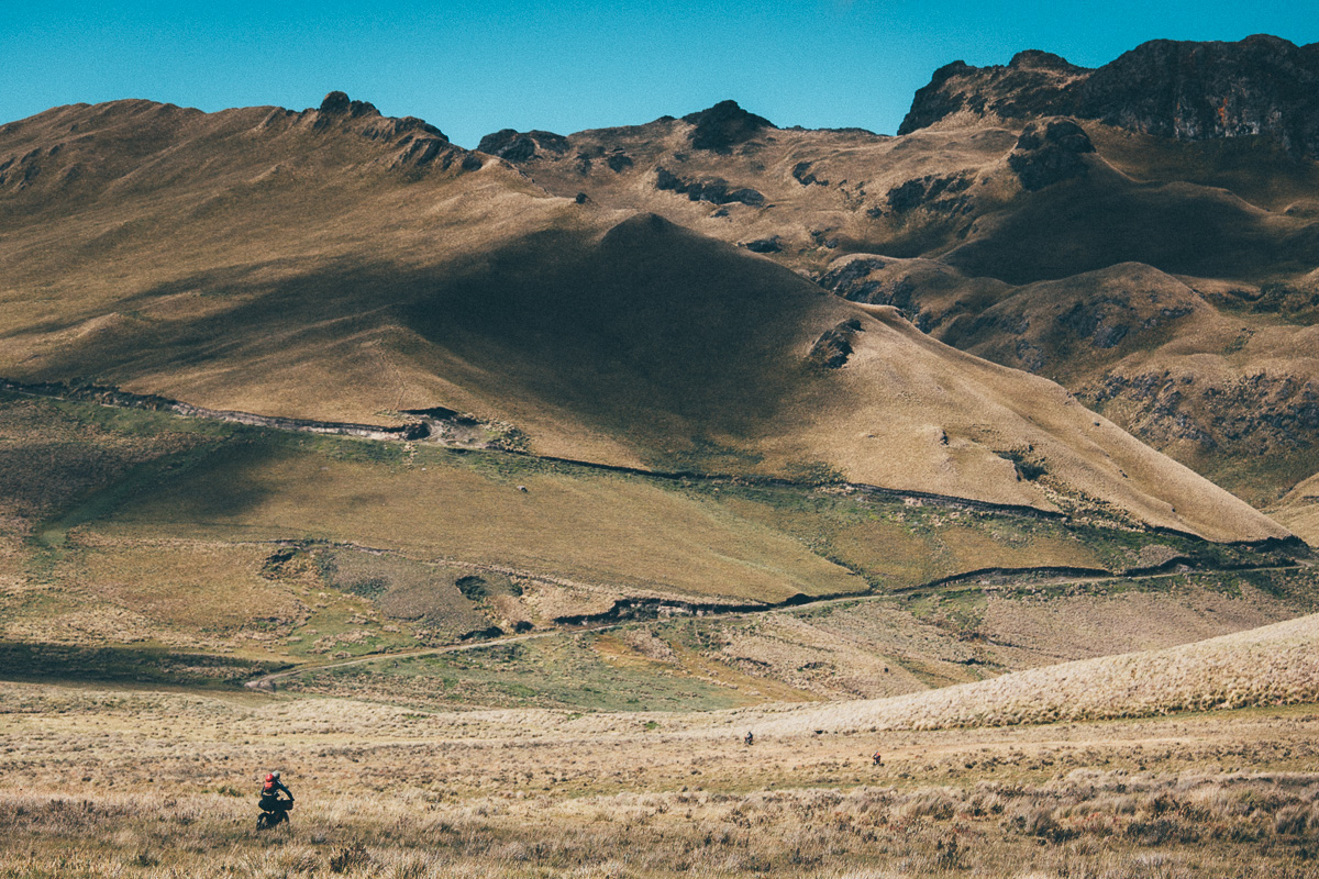
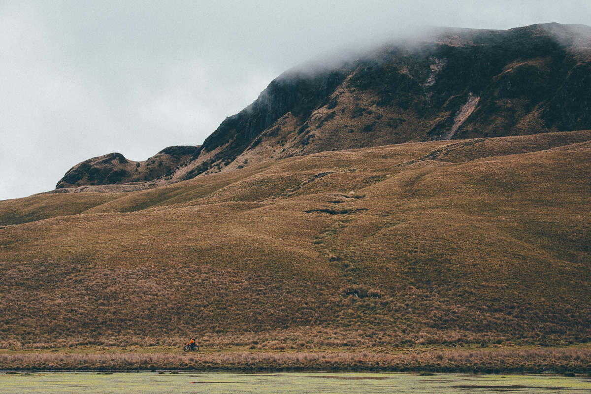
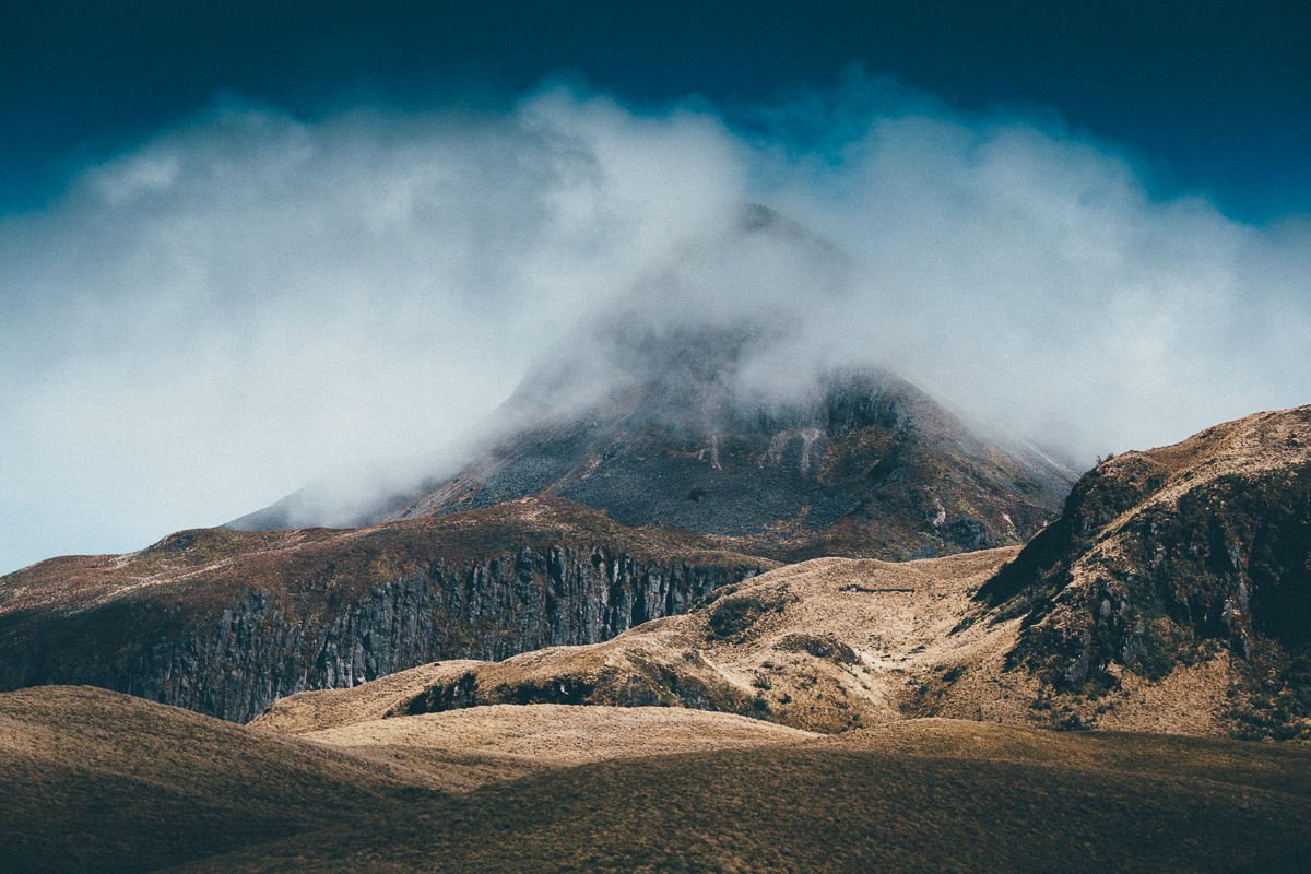
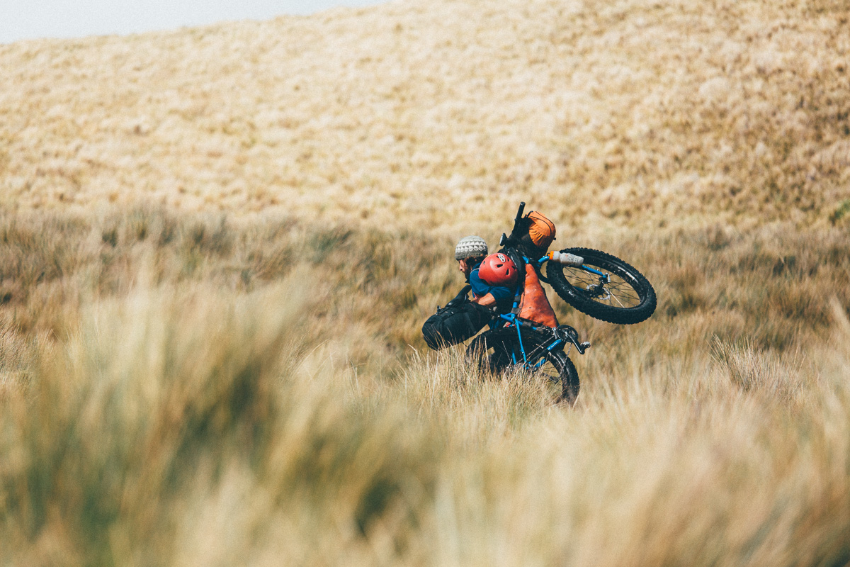
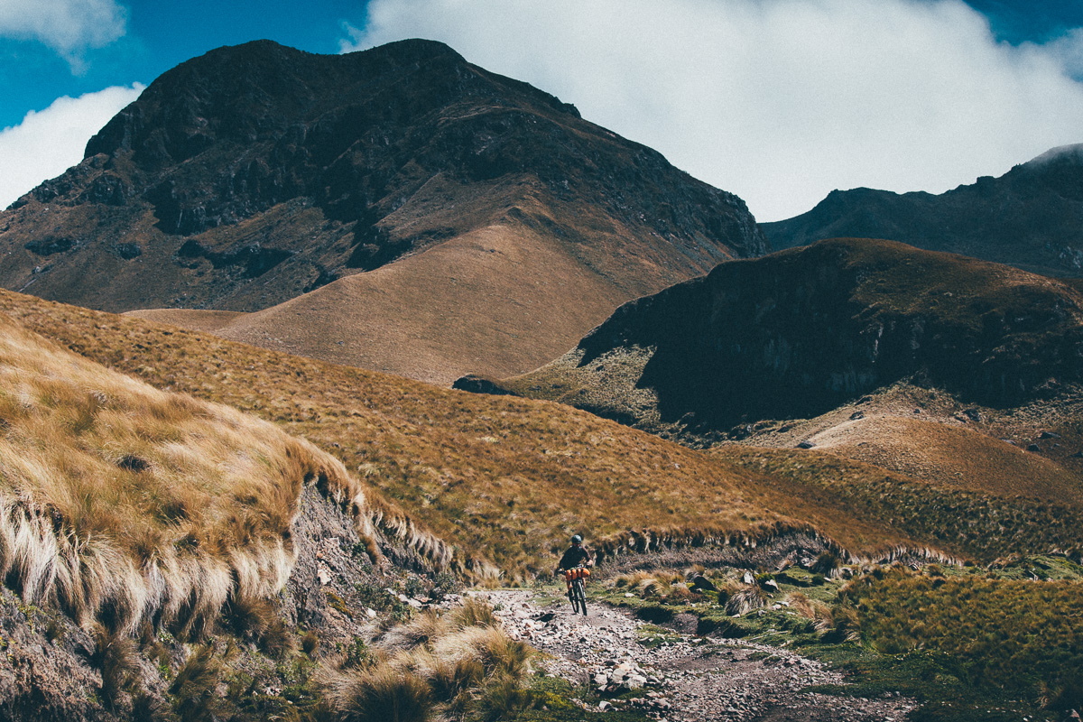
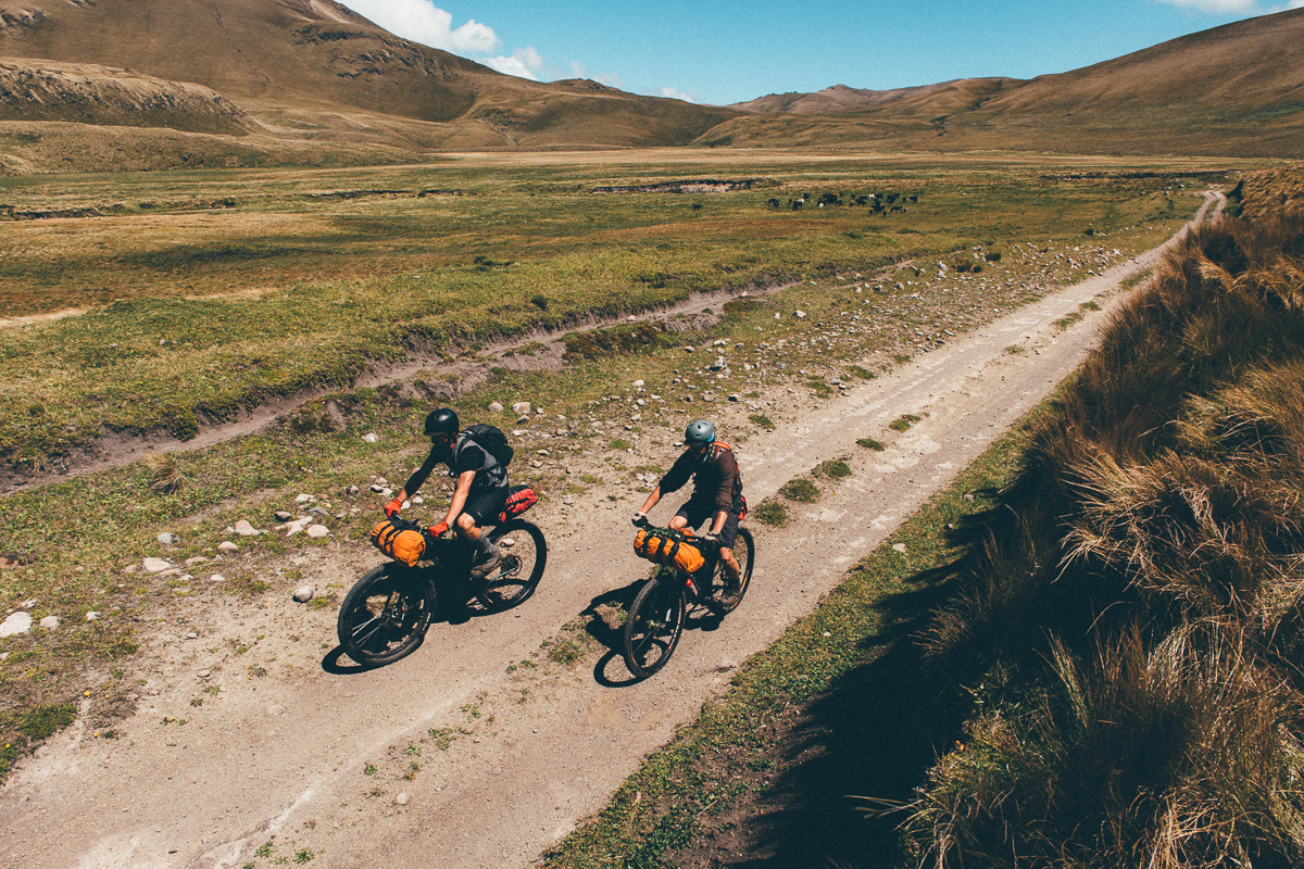
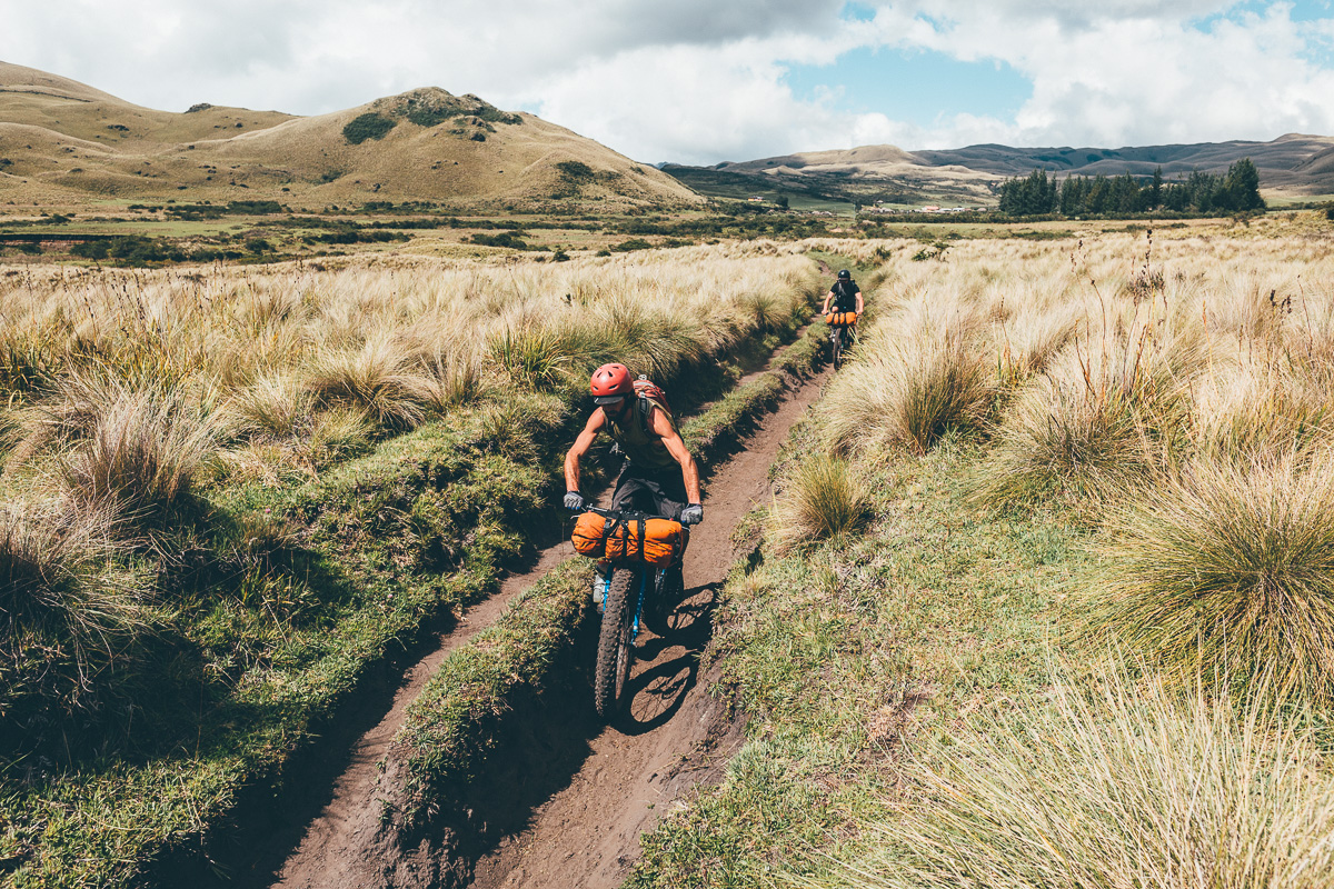
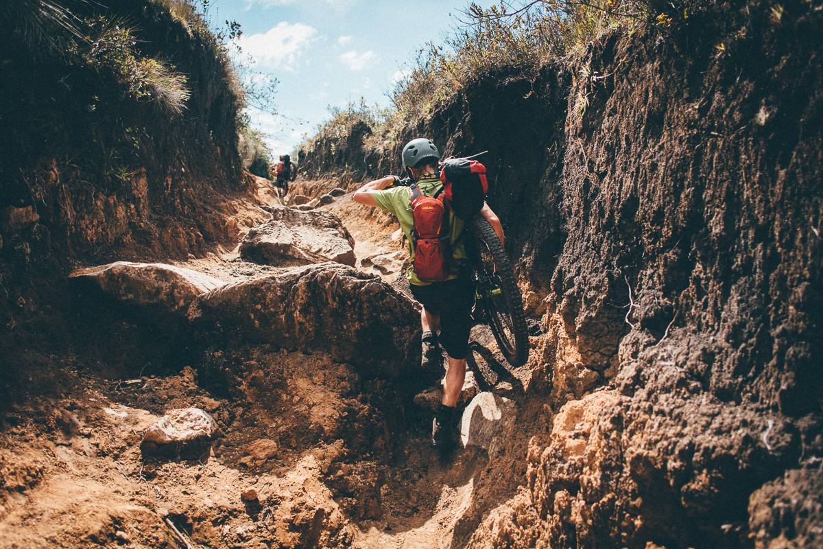
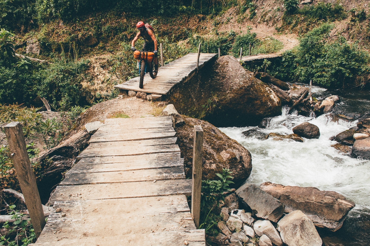
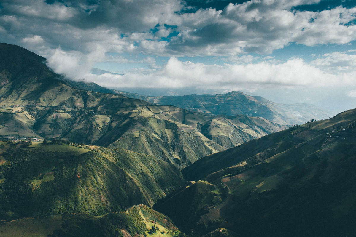
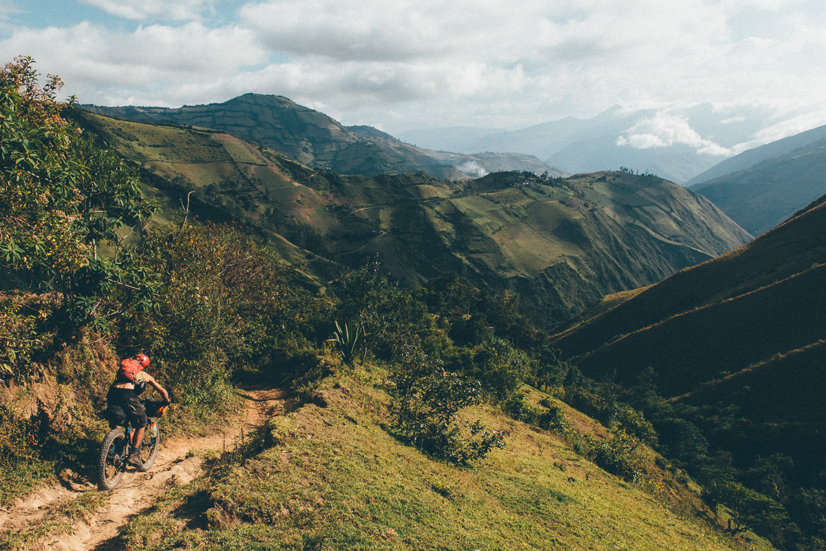
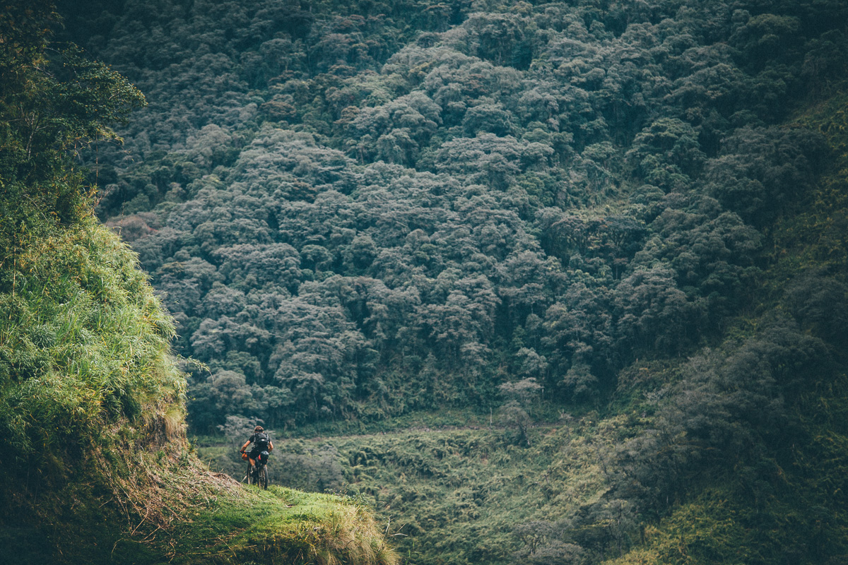
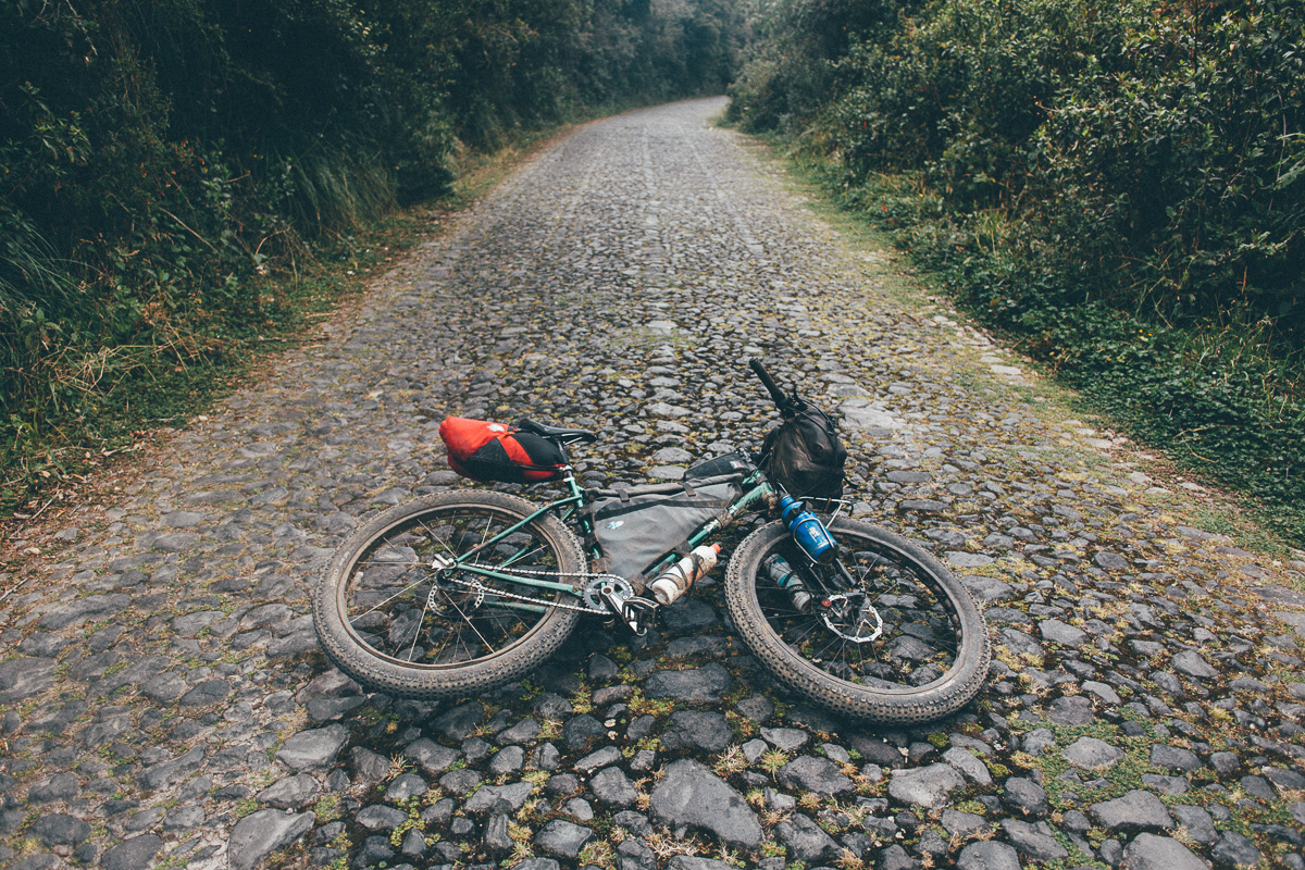
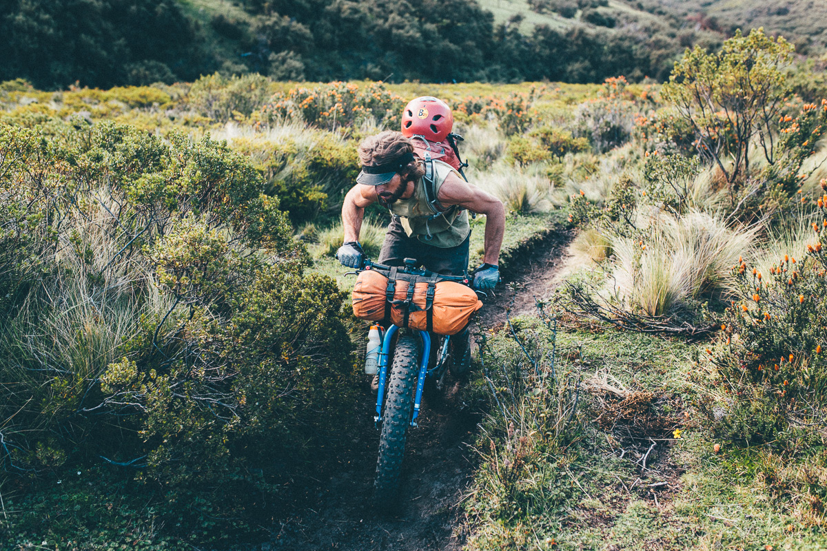
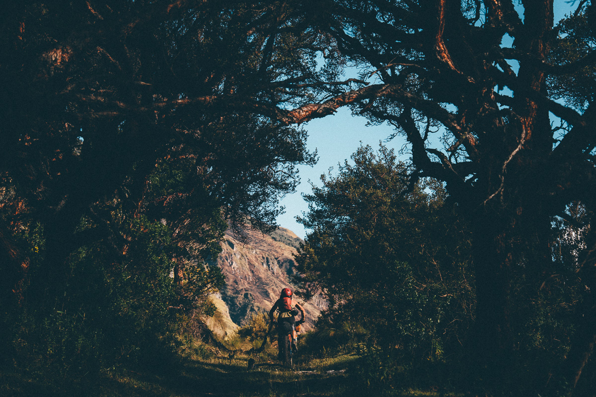
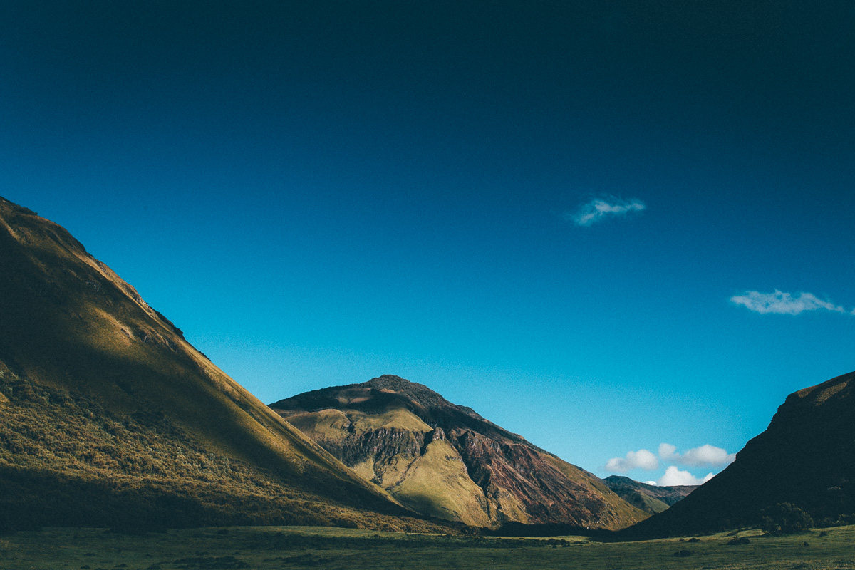
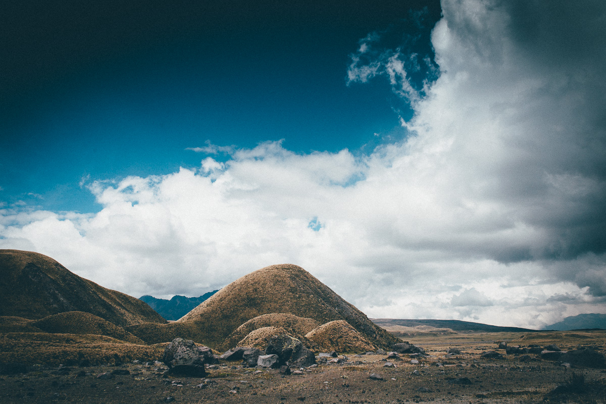
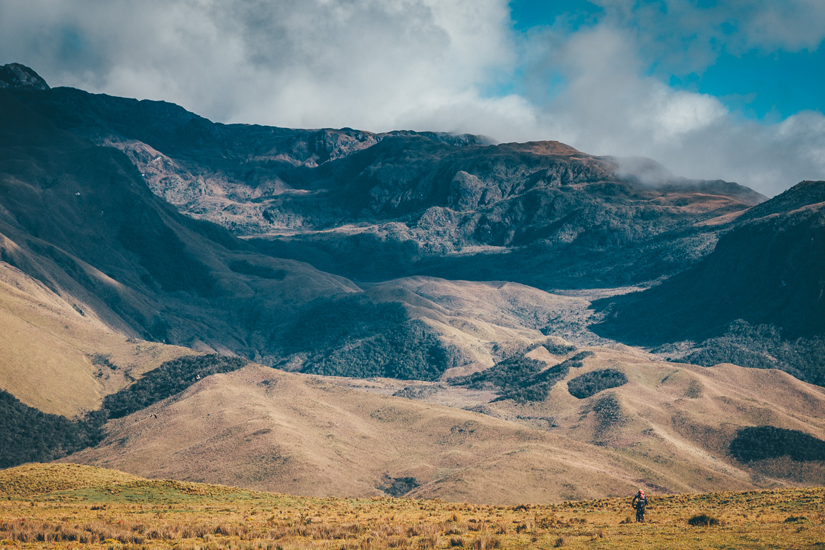
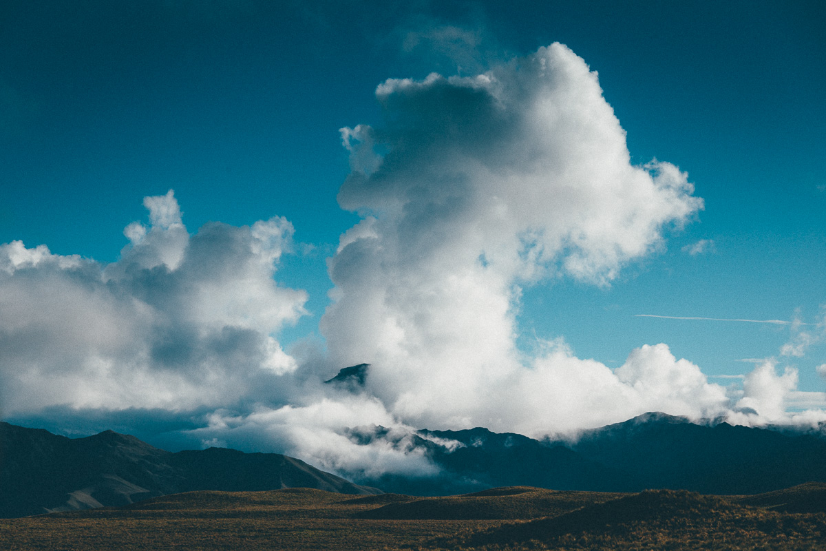
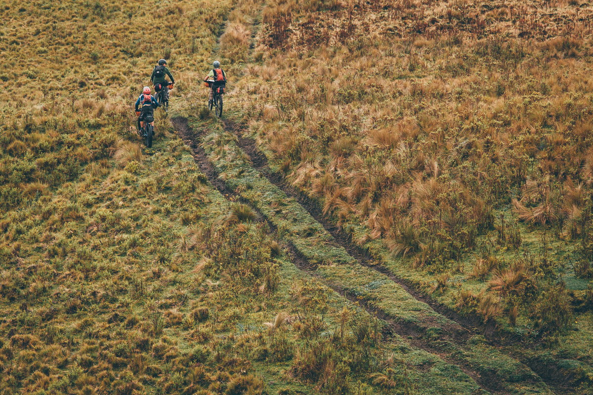
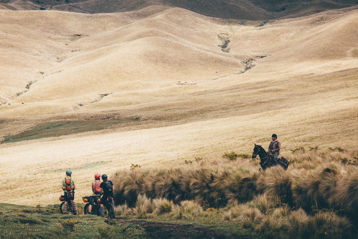
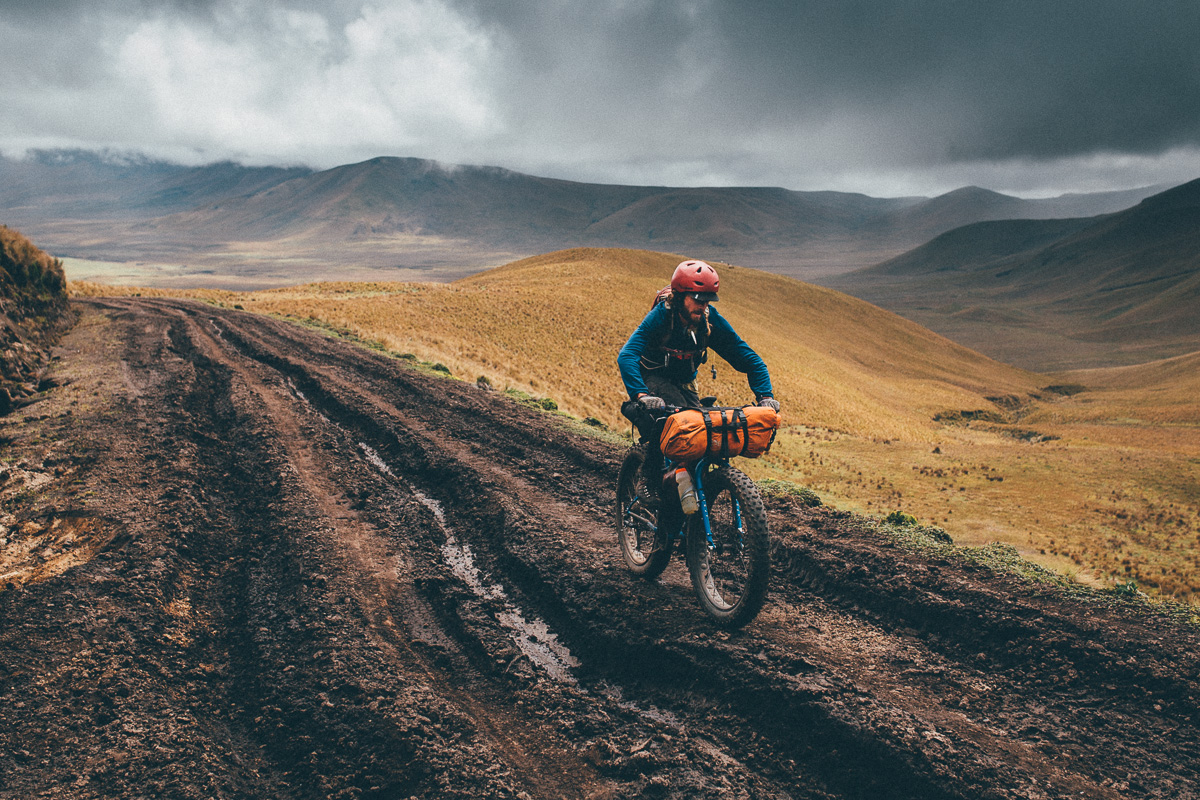
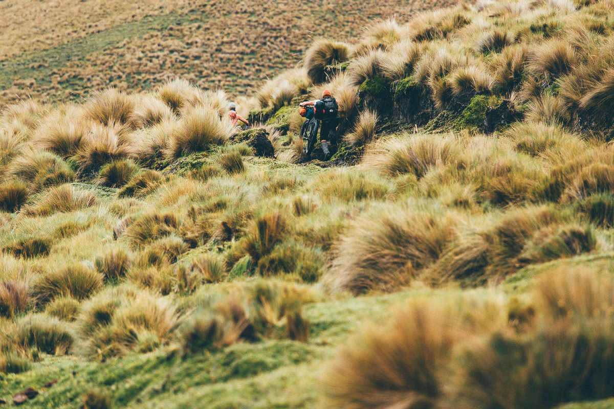
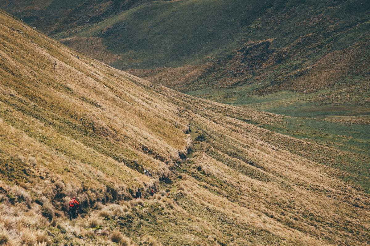
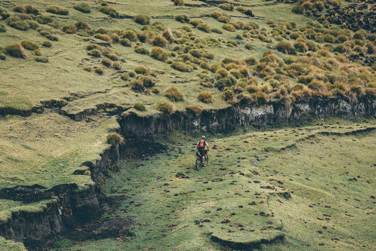
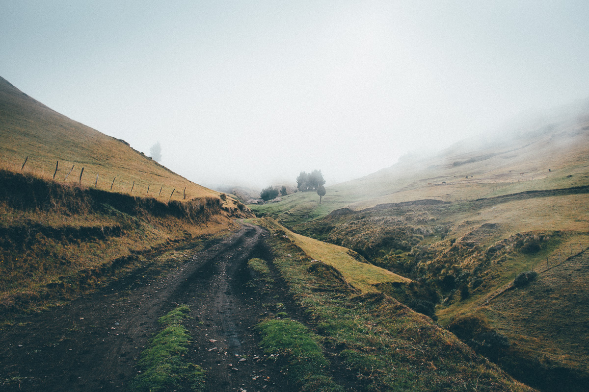
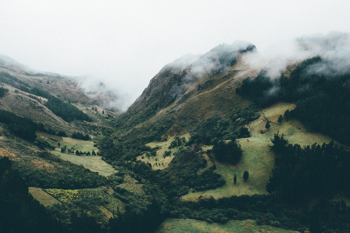
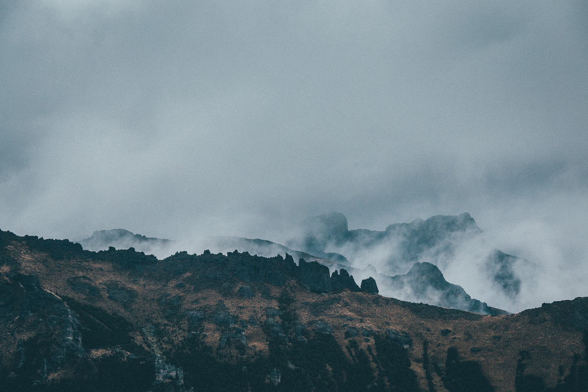
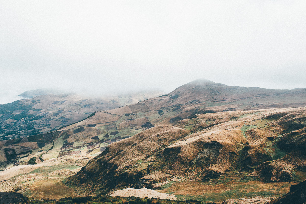
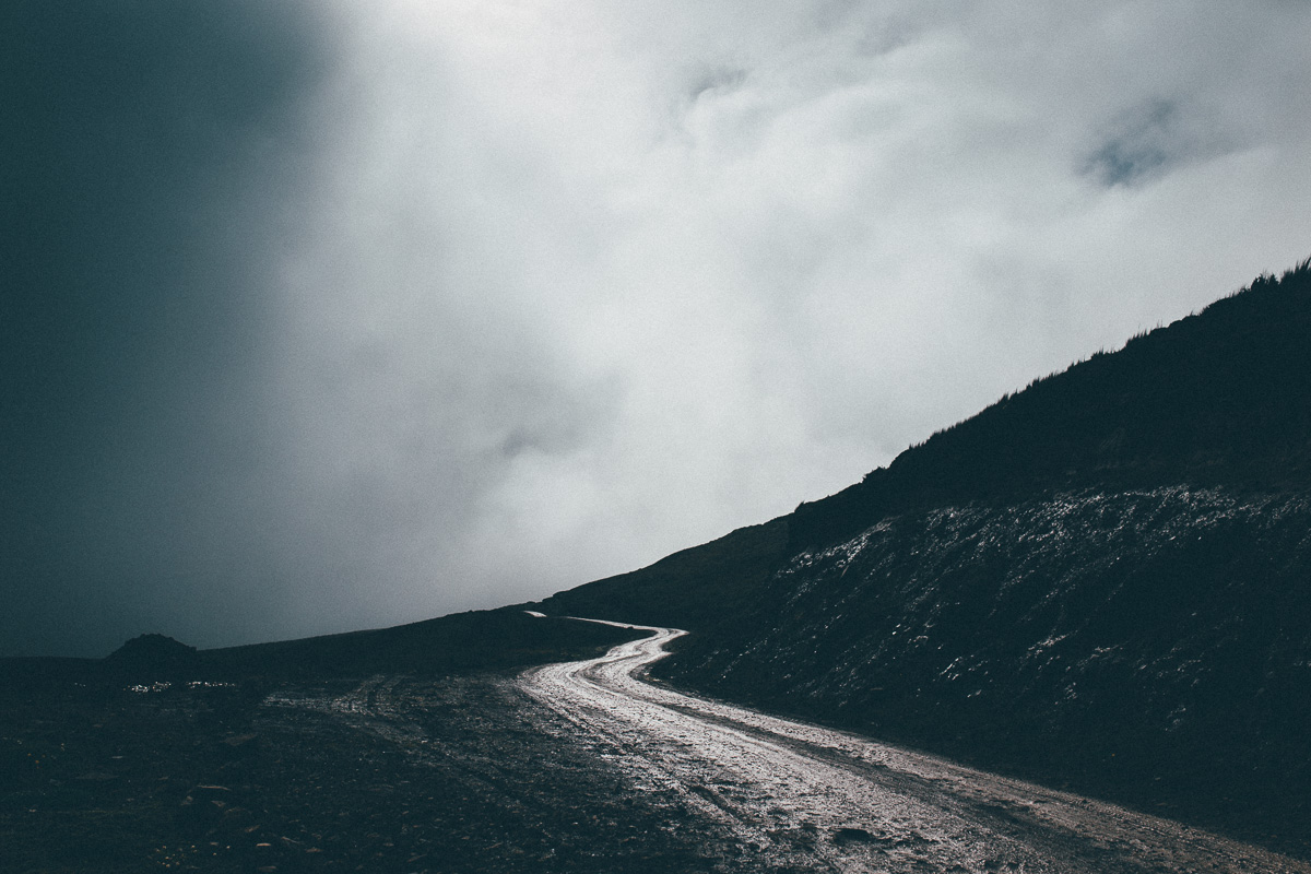
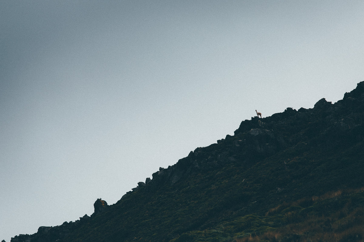
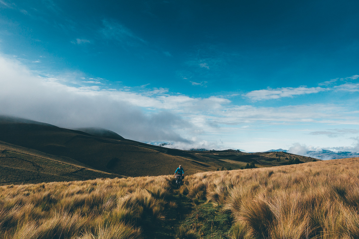
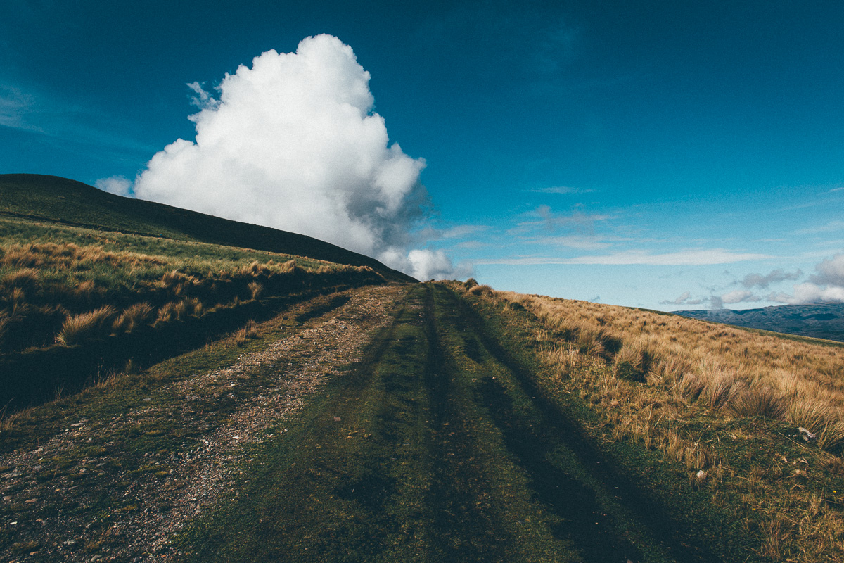
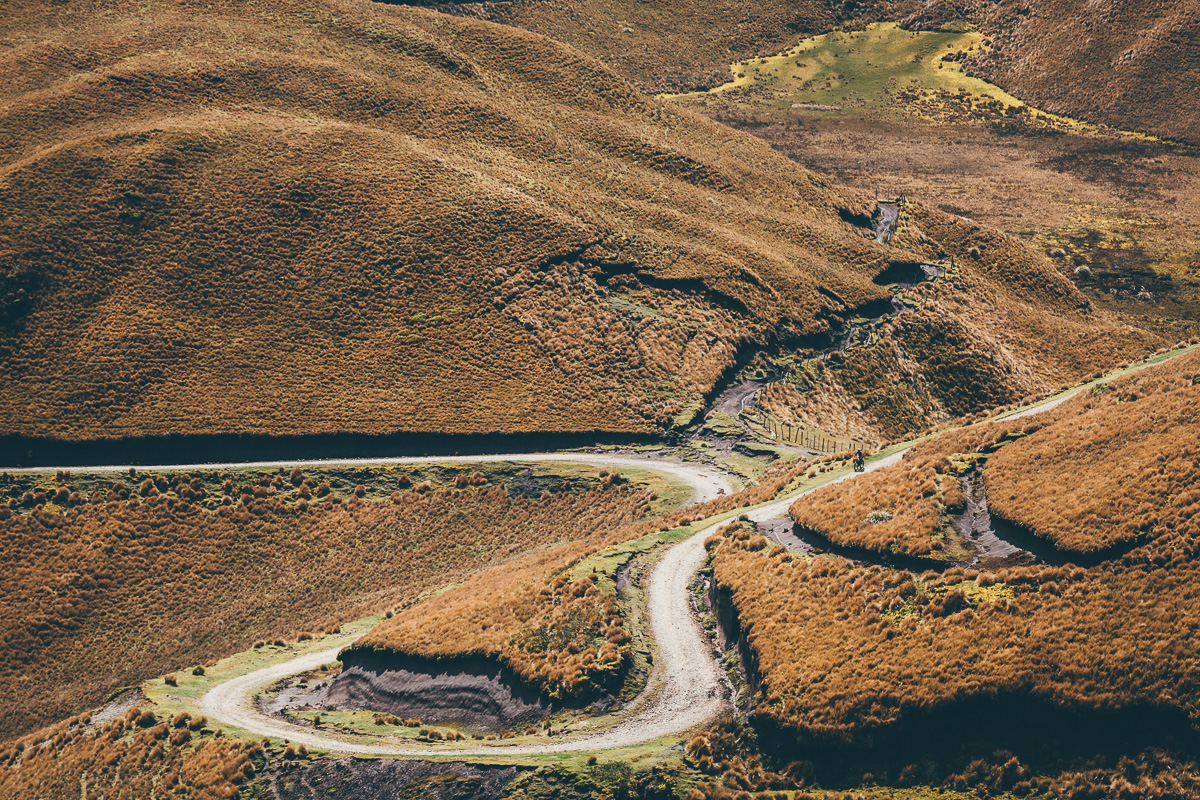
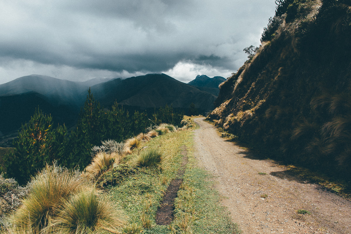
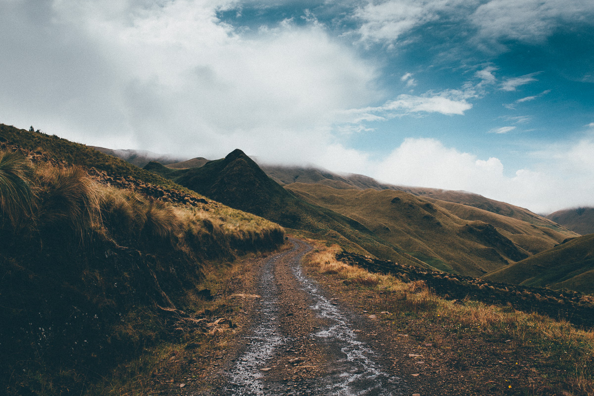
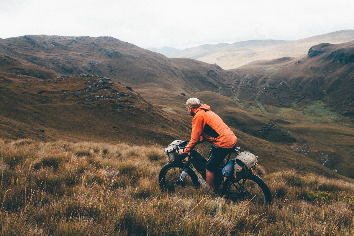
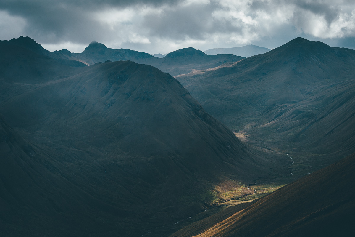
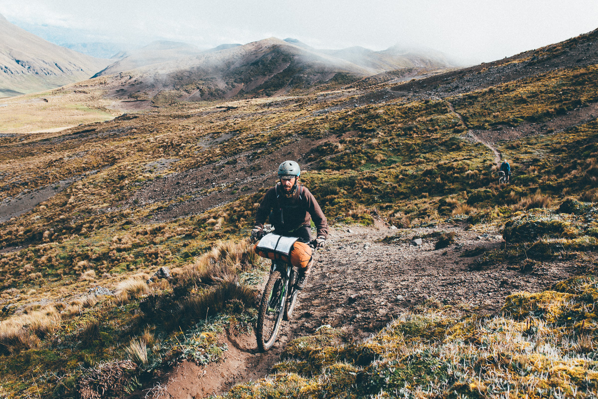
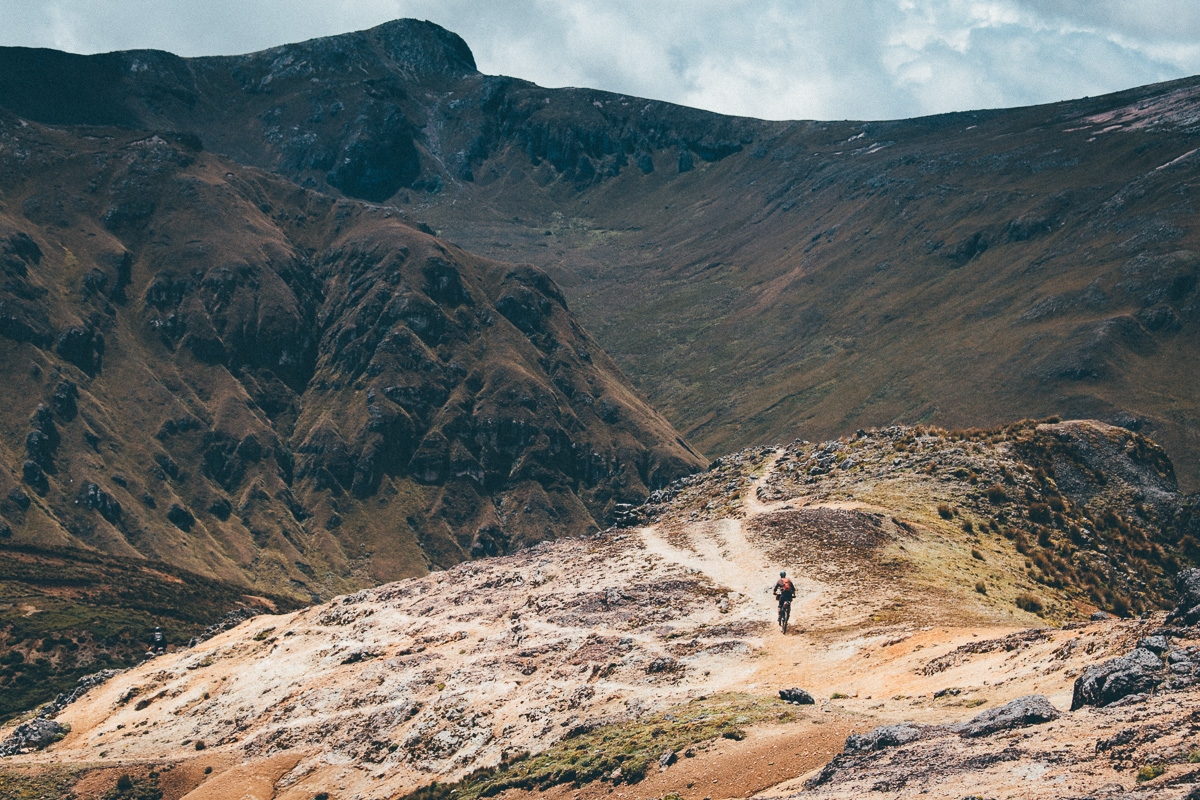
Simply put, TEMBR – the Singletrack Version – is a hard, fun, technical, and extremely adventurous bikepacking mission. It’s a ride that crosses the Ecuadorian Andes on a combination of off piste páramo, ancient footpaths, epic hike-a-bikes, cobbled backroads, muddy jeep tracks, and occasional low traffic stretches of pavement. Expect everything this beautiful region has to offer, from herculean rollercoaster climbs across the highlands, gruelling hike-a-bikes around mist-swirled volcanoes, brake-searingly techy descents into lush and deeply folded valleys, and lonely yomps across the treeless and tufty páramo.
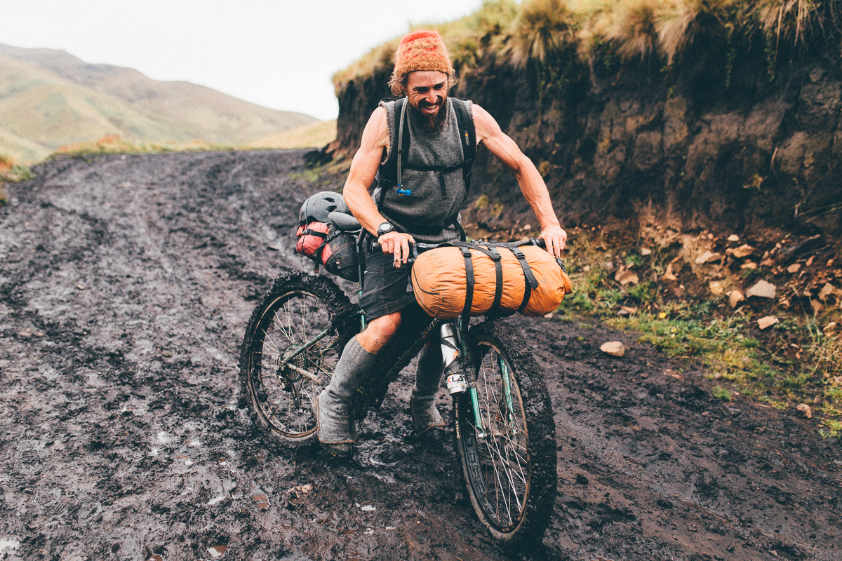
I won’t mince my words. There are sizeable sections to this ride that are nothing less than punishing; it’s the hardcore, singletrack and hike-a-bike obsessed brother to the more mellow dirt road version of TEMBR.
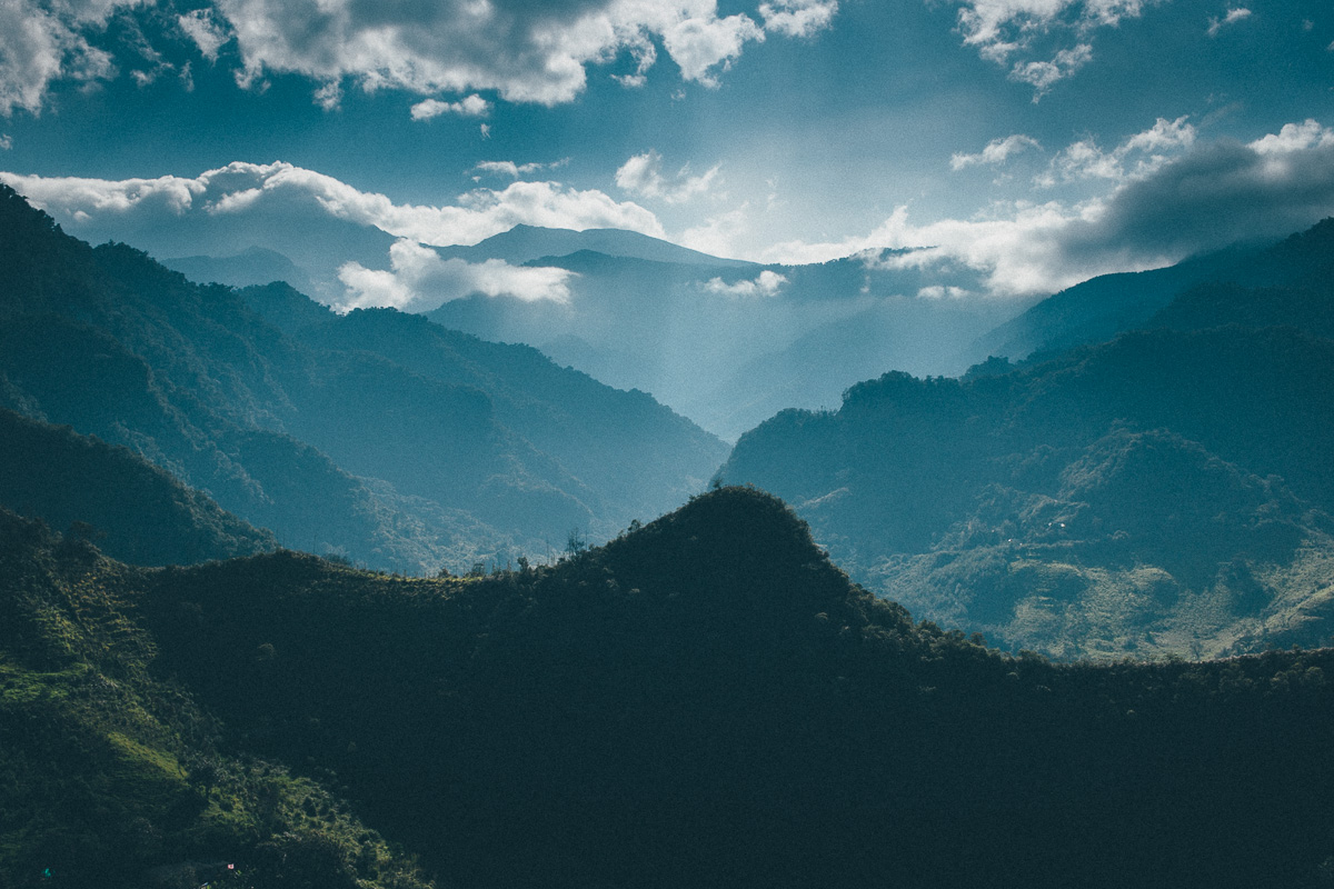
The ride starts in lowland, humid Salinas – a settlement known for both its sugar cane plantations and the Afro-Ecuadorian people who populate the area – and ends in Vilcabamba, a spa town famous for the longevity of its inhabitants. In between, it runs the length of the Ecuadorian volcanic corridor; the Avenue of the Volcanoes, as coined in the 19th century by the Prussian botanist and explorer Alexander von Humbolt.
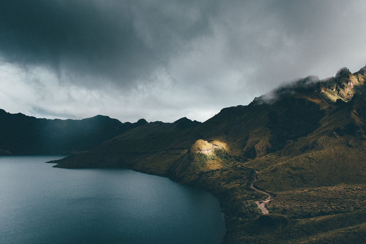
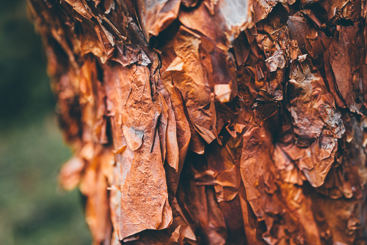
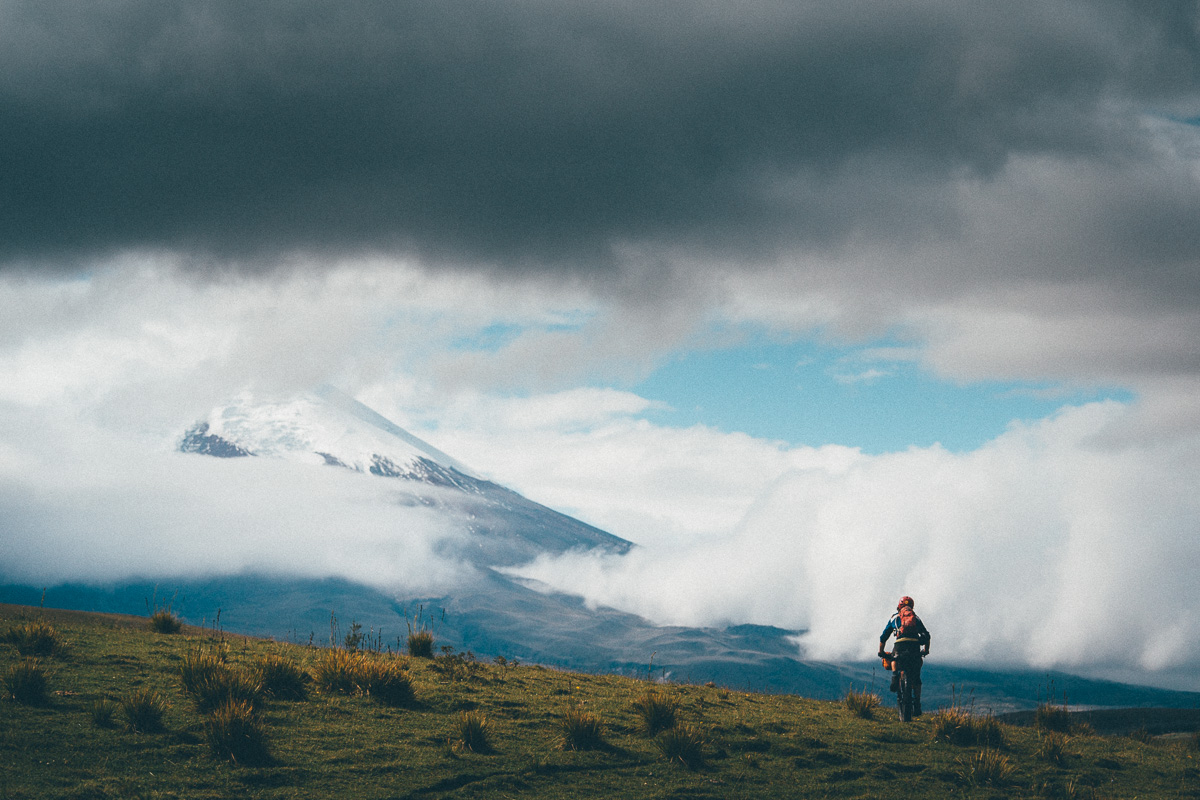
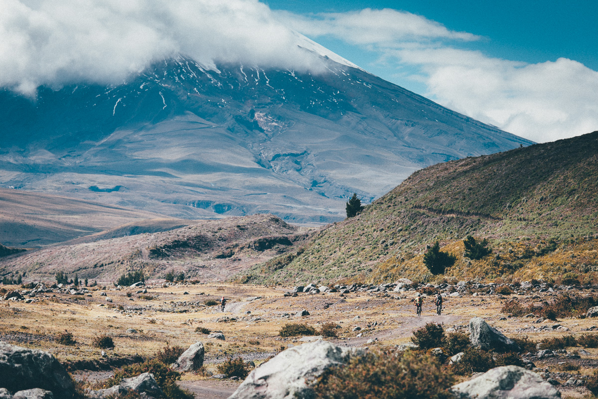
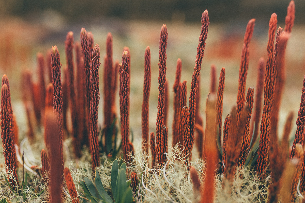
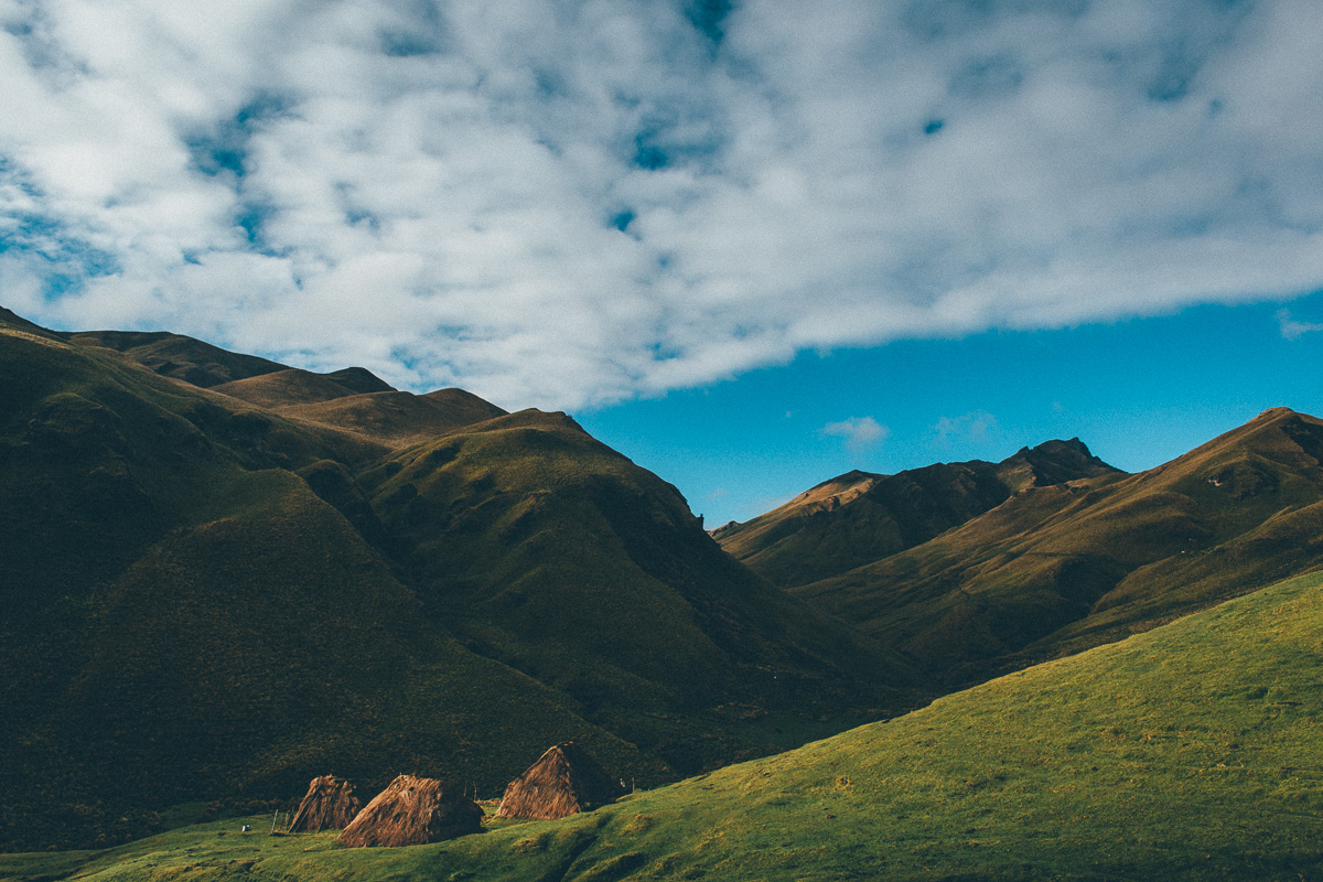
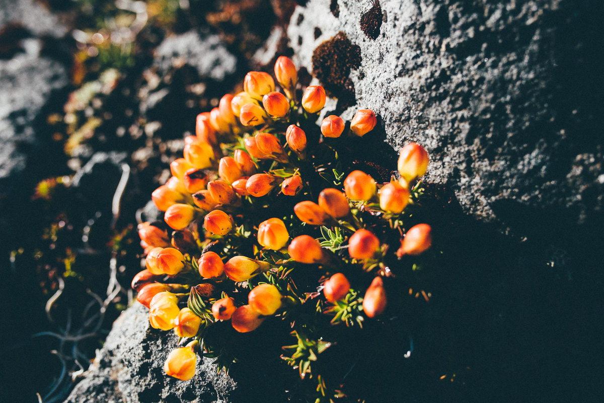
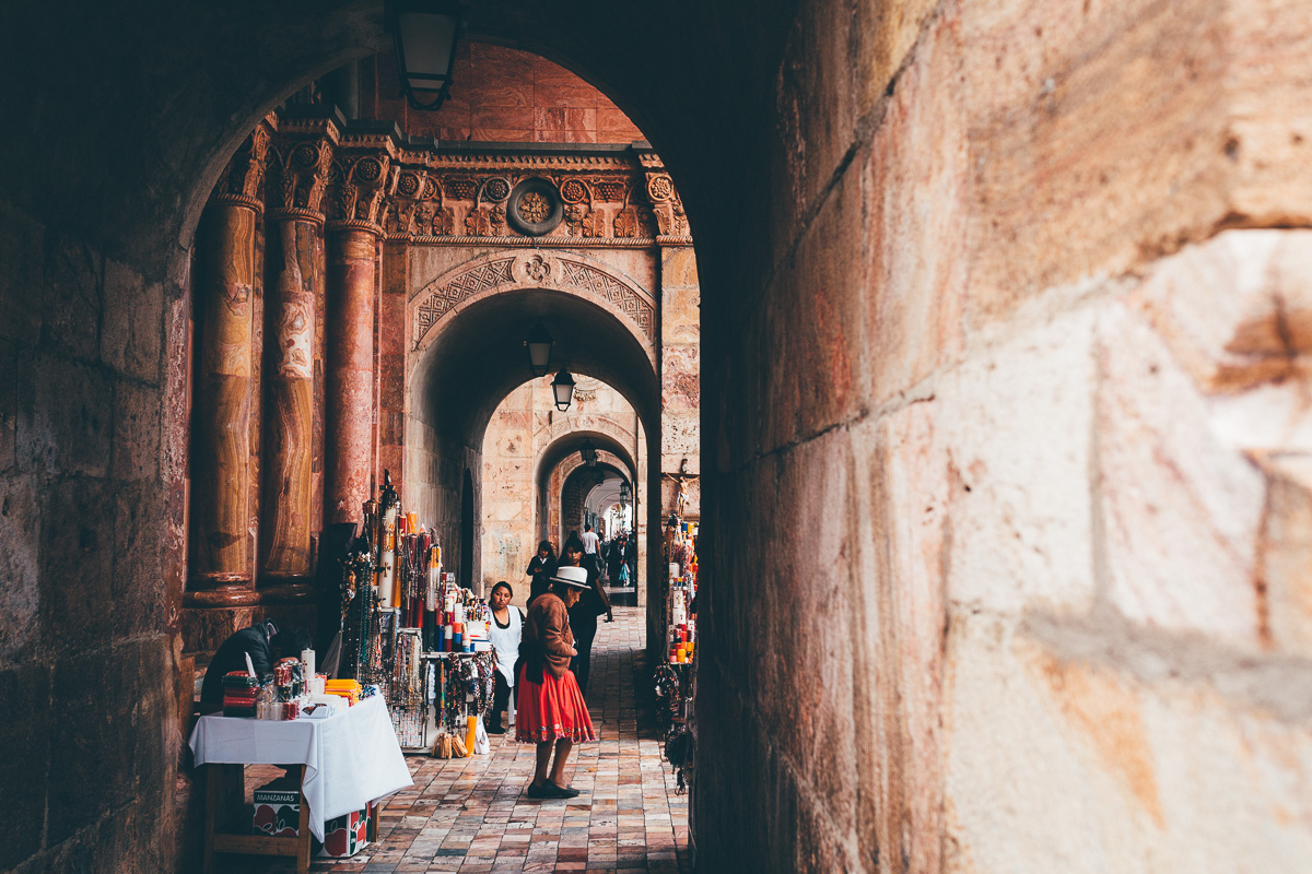
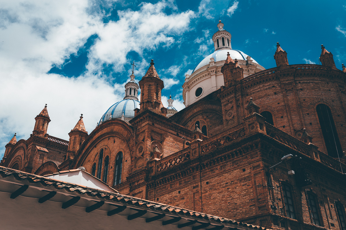
Highlights include riding singletrack in the shadow of Cotopaxi and Chimborazo, the two tallest volcanoes in the country – at 6263m, the latter’s peak marks the closest point to the sun, given the bulge in the earth’s curvature. Typical to Ecuador’s lofty páramo, there are miles of remote, windswept and tufty grasslands to pick your way through; those around Piñán are a favourite, a traditional settlement that sees just a trickle of hardy visitors. Remarkable, high altitude flora abounds, like the groves of peeling, fairly tale-like polylpepis trees, and the orange-flowered chuquirahua, the traditional symbol of Ecuadorian climbers, and a favourite of hummingbirds. In terms of adrenalin, there’s no shortage of rough, uncut descents that will challenge the most technically gifted of riders; the rutted freefall into Angamarca is a fine example. Historians, particularly those with a penchant for brutal hike-a-bikes, will no doubt delight in the traverse of Ecuador’s own Inca Trail, en route to Ingapirca. And the layover in Cuenca, Ecuador’s most picturesque city, offers an impressive architectural showcase of the country’s colonial heritage, as well as a modern city vibe to kick back and relax.
Broadly speaking, the ride can be divided into 5 segments – see Trail Notes for details and a stats breakdown. If you’re through-riding TEMBR, we’d recommend factoring at least one rest day between each segment. Unless you’re feeling especially bold, don’t expect to cover more distance that our suggested itinerary. For anyone thinking of section-riding the route, each of these five parts can be connected by public buses, omnipresent across the country.
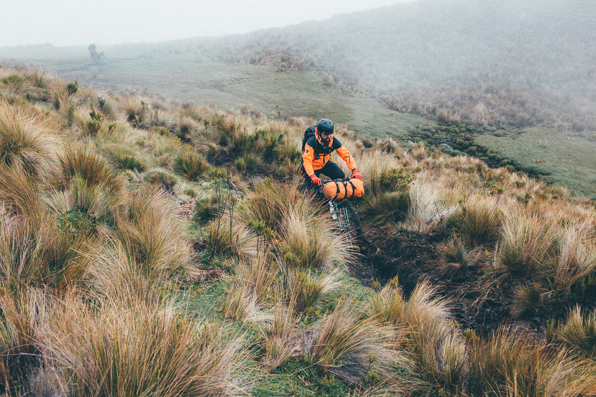
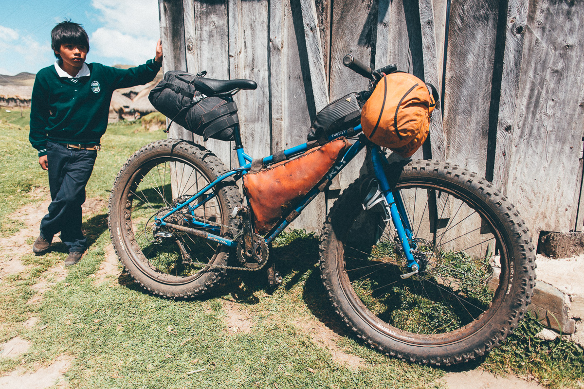
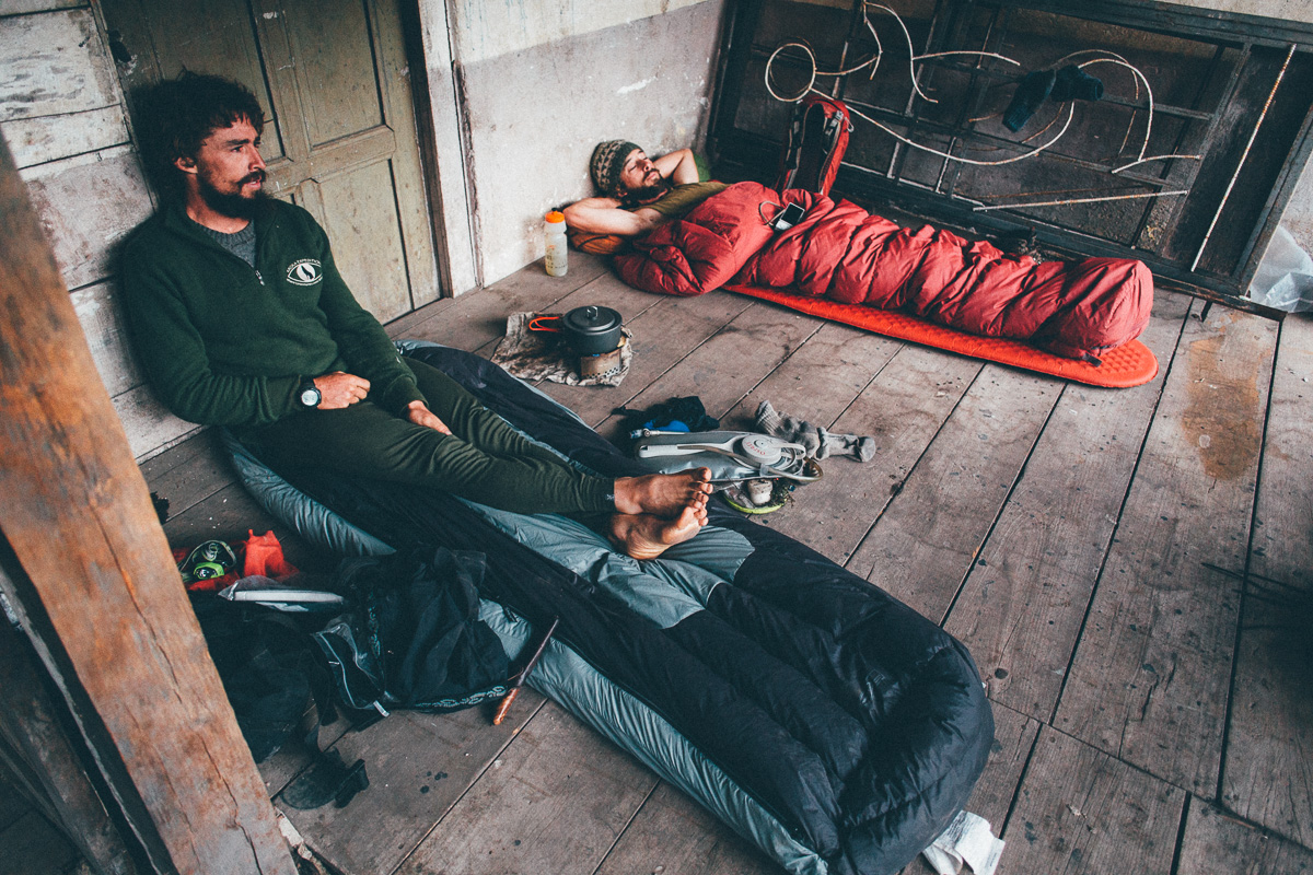
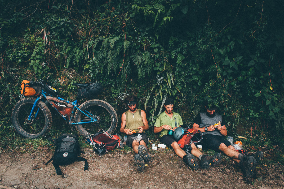
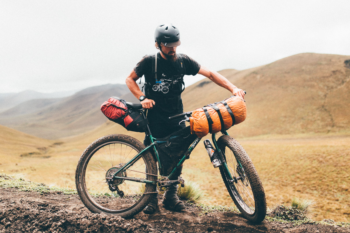
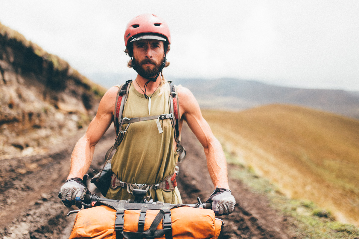
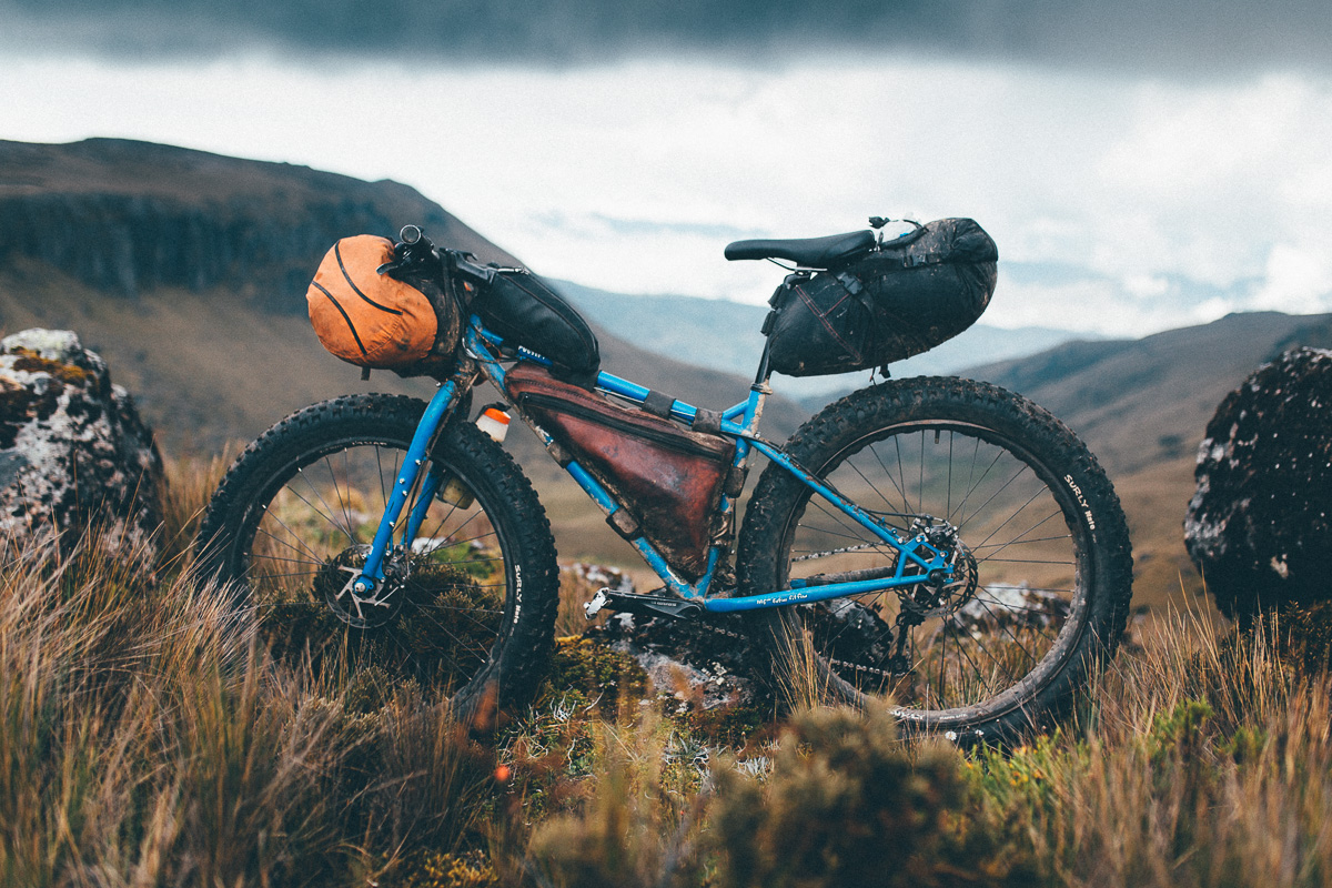
Packing light is key to TEMBR’s success/enjoyment, as is being comfortable with shouldering your bike. Expect several multi-hour hike-a-bikes, as well as steep, protracted climbs in between. Descents can be fast, furious and white-knuckled affairs, especially during inclement weather. Páramo riding is a skill until itself; it can be slow going and energy sapping. But the rewards, as they always say, are more than worth it.
The Dammer Brothers, Ecuadorian bikepacking legends, have documented the inaugural ride thoroughly on their website; section 1, section 2, section 3, and section 4/5. I’ve written up my account of our experiences for the first issue of Sidetracked Magazine.
Difficulty: This is an uncompromising route that seeks out singletrack at all costs – and much of it is hard-fought. If you’re a strong and adaptable rider – and importantly, you’re not afraid to shoulder your bike to reach gloriously untravelled parts of the Ecuadorian Andes – then this is the ride for you!
Route Development: TEMBR Singletrack is the brainchild of Ecuadorian adventurers and farmers the Dammer Brothers, and pools from years of mountaineering knowledge, a love of the outdoors, and a deep respect and understanding of land use in the country. It was the inspiration for the mellower (and more rideable!) TEMBR Dirt, though the two can easily be mixed and matched.
Riders who want to visit the region of Quilatoa could consider replacing the portion of TEMBR’s route that runs from Latacunga to Angamarca with that of the Tres Volcanes ride. This cuts out one monster hike-a-bike – but you’ll miss out on some epic singletrack too.
Want to mix and match the two versions of TEMBR? A full route guide and gpx file of the dirt road alternative can be found here.


Submit Route Alert
As the leading creator and publisher of bikepacking routes, BIKEPACKING.com endeavors to maintain, improve, and advocate for our growing network of bikepacking routes all over the world. As such, our editorial team, route creators, and Route Stewards serve as mediators for route improvements and opportunities for connectivity, conservation, and community growth around these routes. To facilitate these efforts, we rely on our Bikepacking Collective and the greater bikepacking community to call attention to critical issues and opportunities that are discovered while riding these routes. If you have a vital issue or opportunity regarding this route that pertains to one of the subjects below, please let us know:
Highlights
Must Know
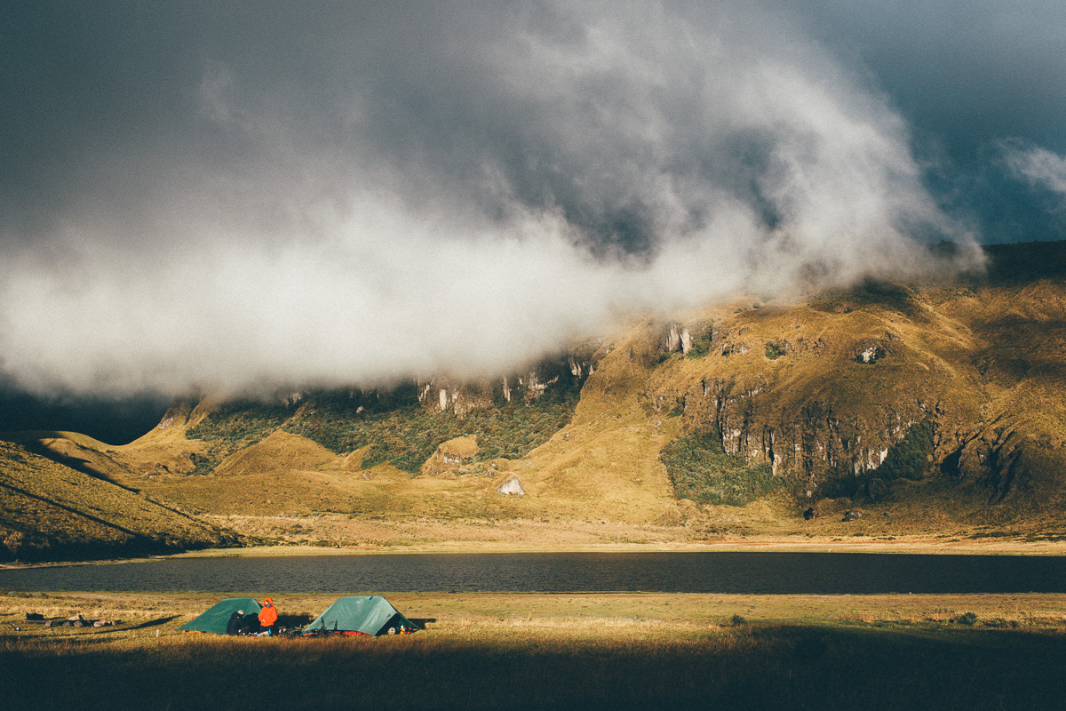
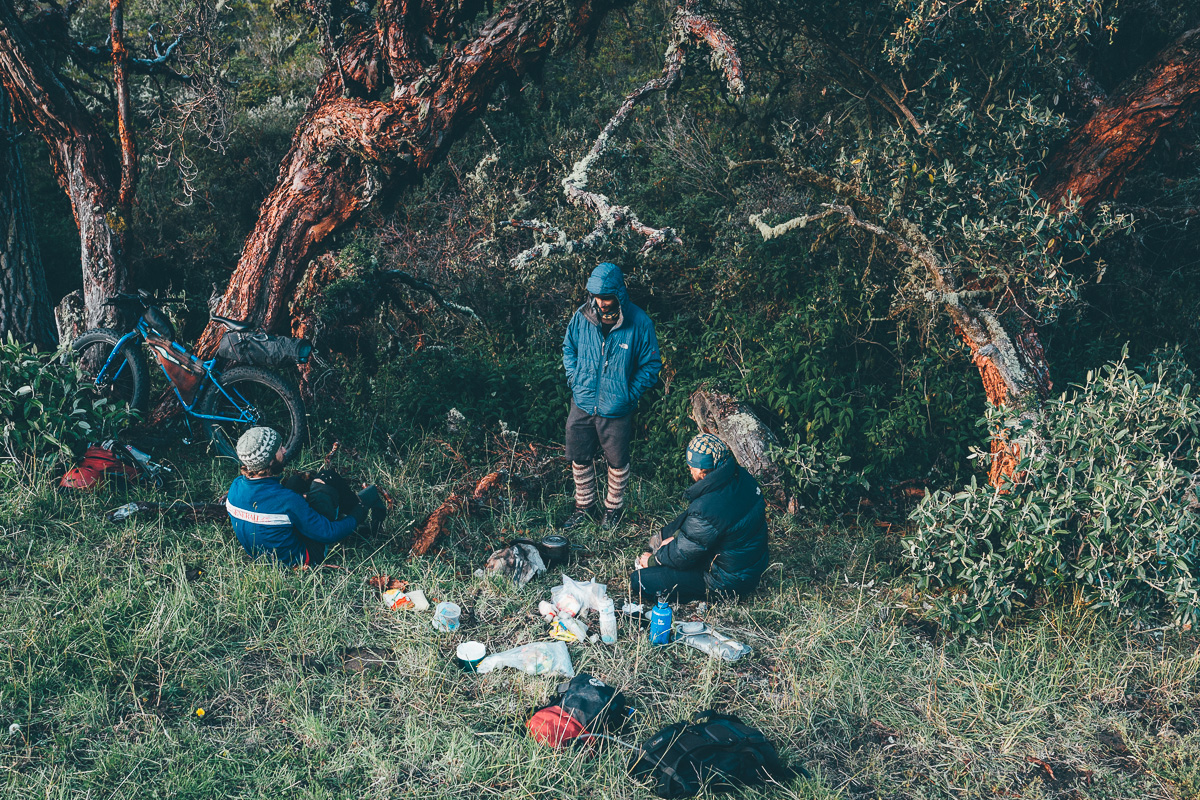
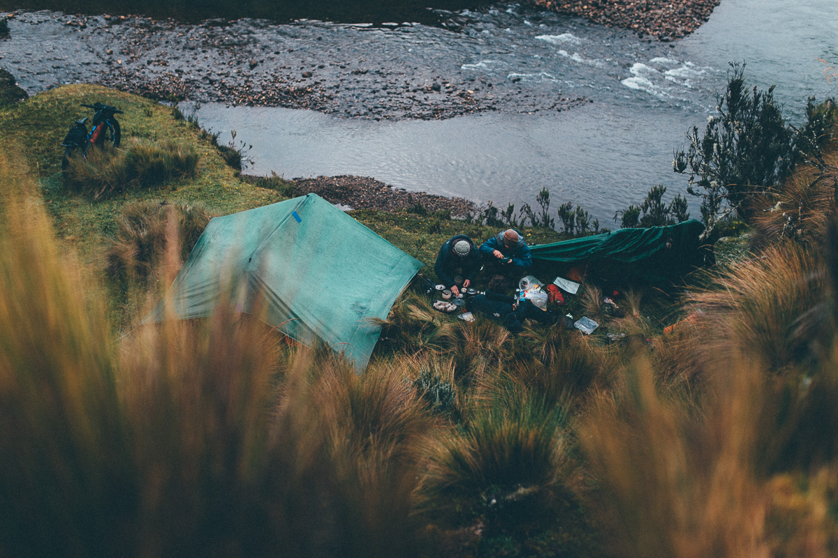
Camping
Food/H2O
Trail Notes
- Discovering the real Ecuadorian backcountry.
- Riding singletrack in the shadow of two of the country’s highest volcanoes.
- Meandering across the beautiful, enigmatic páramo, Ecuador’s high altitude, treeless tundra.
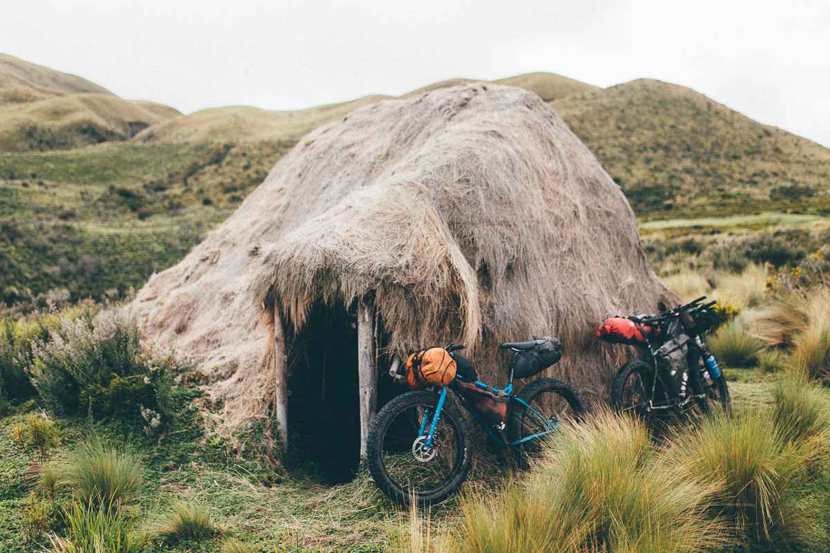
- Sleeping in a community owned ‘choza’, the traditional huts that dot the country’s highlands.
- The sheer physical challenge – this is adventure in its purist form!
- June to mid September is the high season in the Ecuadorian Andes. By Ecuadorian standards, this is the driest time of the year. Outside of this, be prepared for extended bouts of very heavy rain, which will effect road/trail conditions. Traditionally, there is also a ‘mini dry season’ in December and January. Hour to hour temperatures can be extremely variable, depending on altitude and weather, though they don’t change much throughout the year. I carry a 0-degree centigrade bag and wear extras layers if needed. Ambient dampness can make nighttimes feel cooler than they are.
- Always expect mixed weather in the highlands, whatever the season. Be prepared for persistent rain at times, and/or four seasons in one day! Bring a quality, reliable waterproof jacket, rather than the kind that pack up tiny but wet out quickly.
- For the same reason, waterproof footware, or shoes that dry out quickly, are recommended.
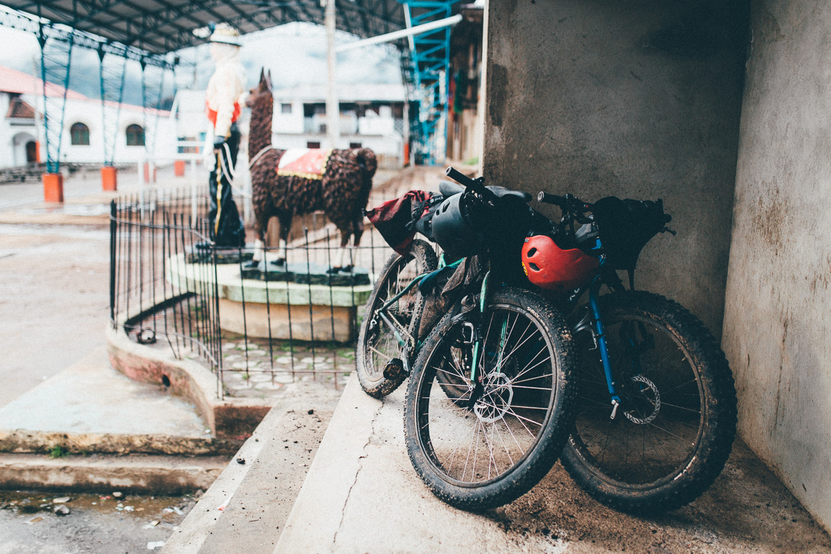
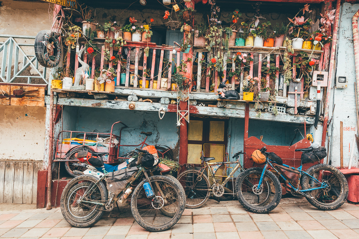
- Pack light! And I mean very light. There are several brutal, multi-hour hike-a-bikes to contend with. The less you have, the more your body will thank you. I’d even recommend wearing a backpack, rather than loading everything on your bike.
- Ecuador is well suited to ‘plus’ and fat bikes, given the cobbled backroads and the sometimes swampy nature of the páramo. Otherwise, be sure to run front suspension.
- Ecuador is well served by public buses. Each of the 5 sections that make up with ride can be accessed by public bus from Quito, as can the smaller settlements in between.
- It’s 2.5 hours (approx $3.50) by bus from Quito to Salinas and 14 hours from Vilcabamba to Quito (approx $20).
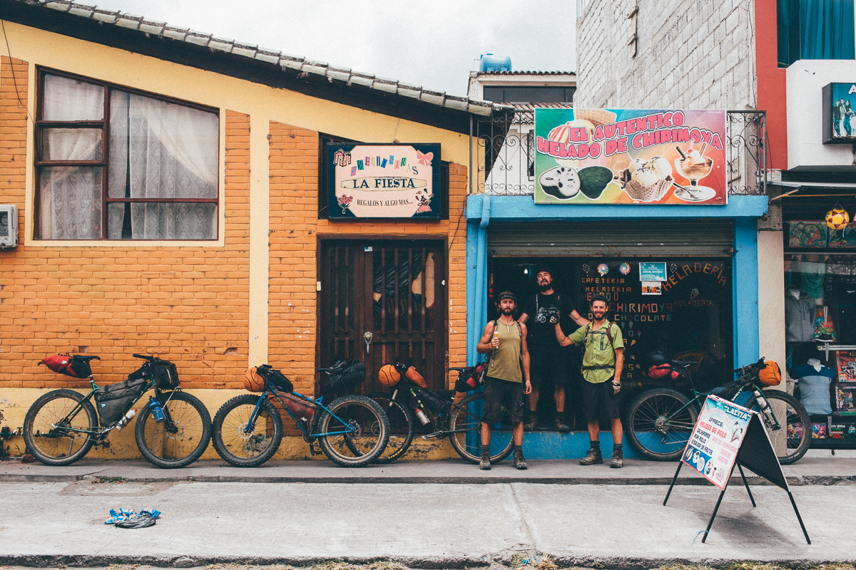
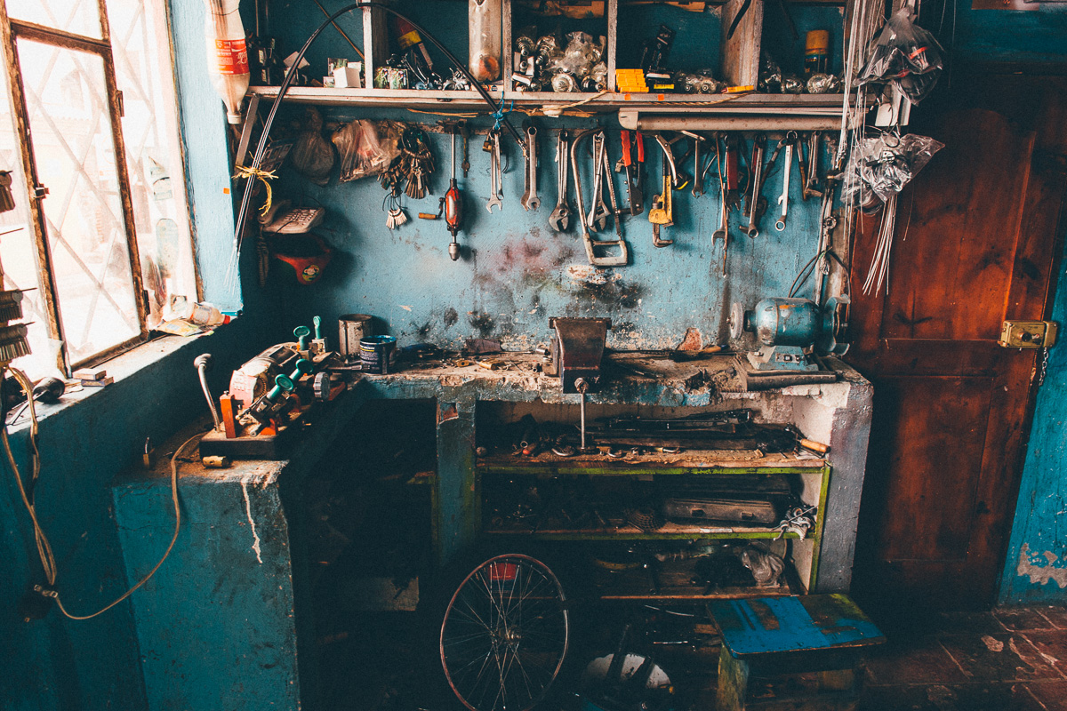
- There are high-end bike shops in Ibarra (off route), Quito (off route), Tumbaco (off route), Riobamba (off route), Cuenca and Loja.
- With its strong tradition in climbing, Ecuador is well stocked with quality camping gear. The Ecuadorian chain Tatoo has an REI-like selection of high-end gear.
- If you spot an empty choza – the community owned, traditional straw huts used by shepherds – make yourself at home. Leave it in a better state than you found it.
- Given the narrow trenches, ruts and its tufty grasses, riding páramo requires its only skillset – narrow, SPD-style pedals are recommended over wide flat pedals. Just make sure they’re shoes you can hike in too.
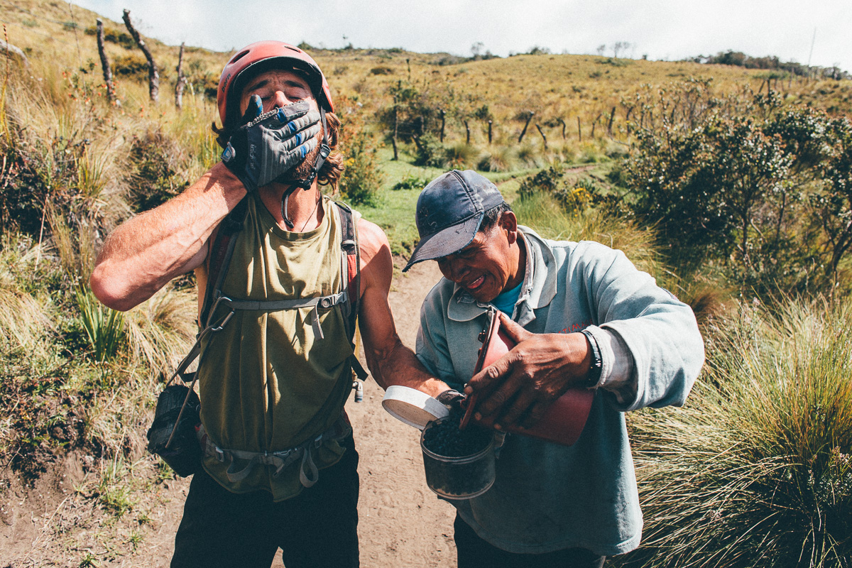
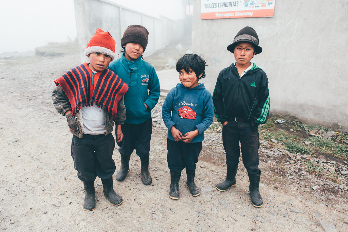
- A grasp of Spanish will certainly come in useful. A few words of Quechua will be especially welcome by indigenous locals.
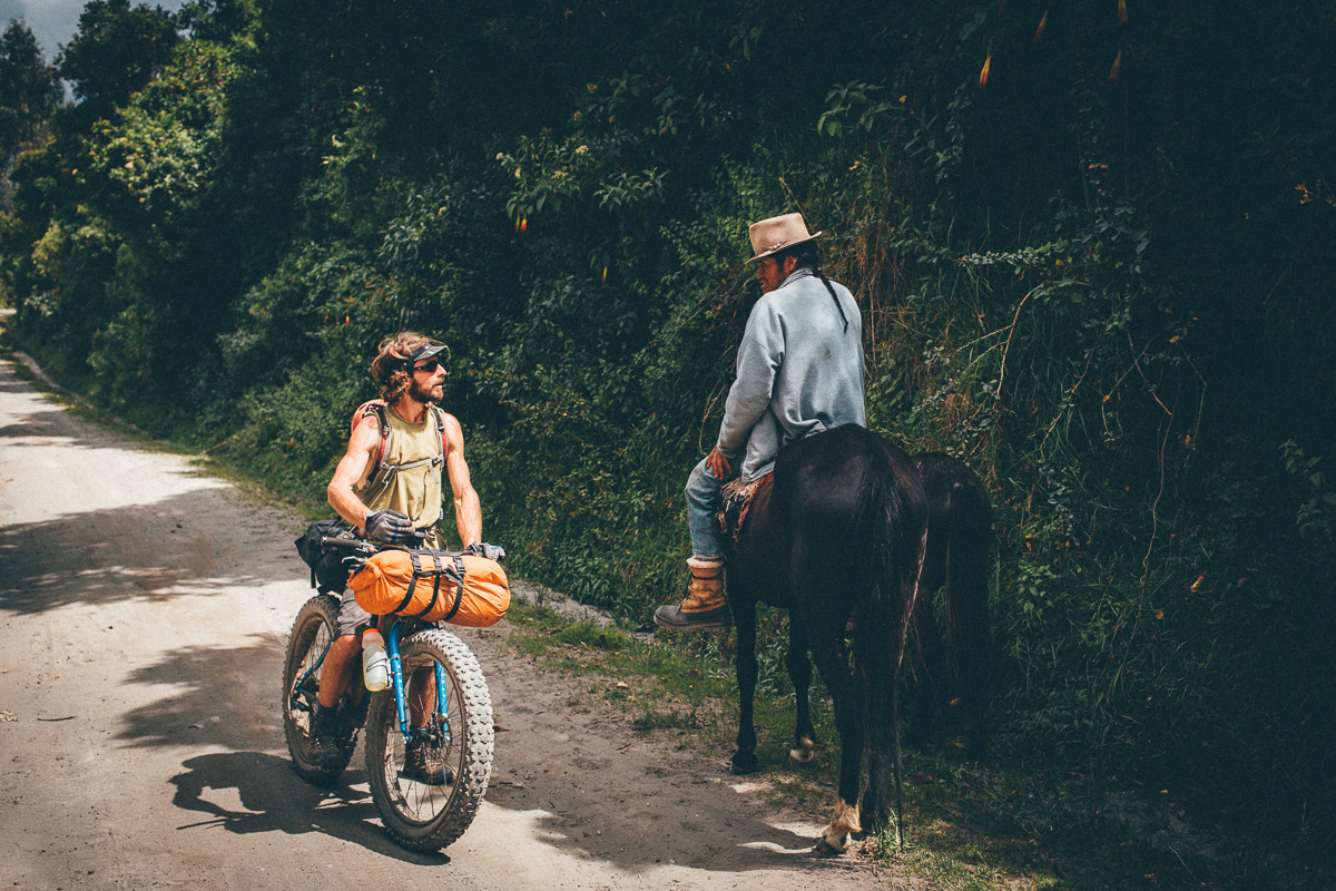
- The route passes through isolated areas, some of which can be private or communally owned. Whenever you encounter anyone, please ask for permission to ride, by saying “Preste pasito, por favor”. Be sure to reassure anyone you meet that you will close all gates behind you (“Yo cierro las puertas”).
- A general note on buses. Most have room for a bike or two in the trunk – depending on the bus, wheels may need to be removed and an extra charge may be levied. Although buses can often be hailed down from the roadside, it’s often to find one that starts in a particular town, so there’s time/room to fit the bike.
- Getting there: TEMBR isn’t routed through Ecuador’s capital, Quito. If you’re arriving by plane, you can ride/catch a taxi from the airport to Pifo or Tumbaco, rest up, and catch a northerly bus from there. Or go straight to Ibarra – there’s plenty of places to stay and it’s a nice place to get your bearings. Then catch a short bus ride to Salinas.
- South America’s village dogs very vocal… expect to be chased at times!
- Every town will be able to offer cheap accommodation; around $5 per person.
- There’s no shortage of camping spots/abandoned buildings/chozas (traditional straw shelters) along this route.
- Vilcabamba has a variety of tourist-orientated lodging to end the ride.
- Anyone attempting the singletrack version of TEMR is welcome to camp in Palugo, the beautiful organic farm owned by the Dammer family.
- Streams and rivers abound. A couple of water bottles is generally all you’ll need in the highlands of Ecuador, plus a means to purify what you find en route.
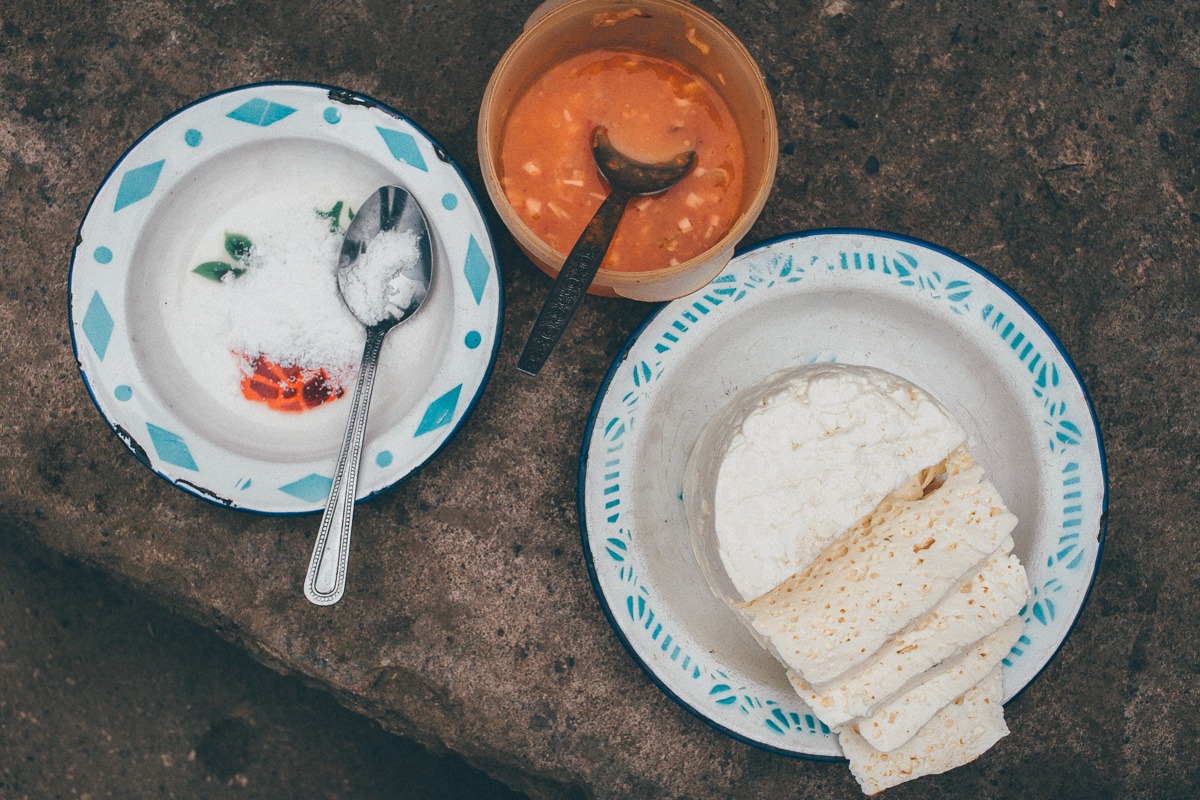
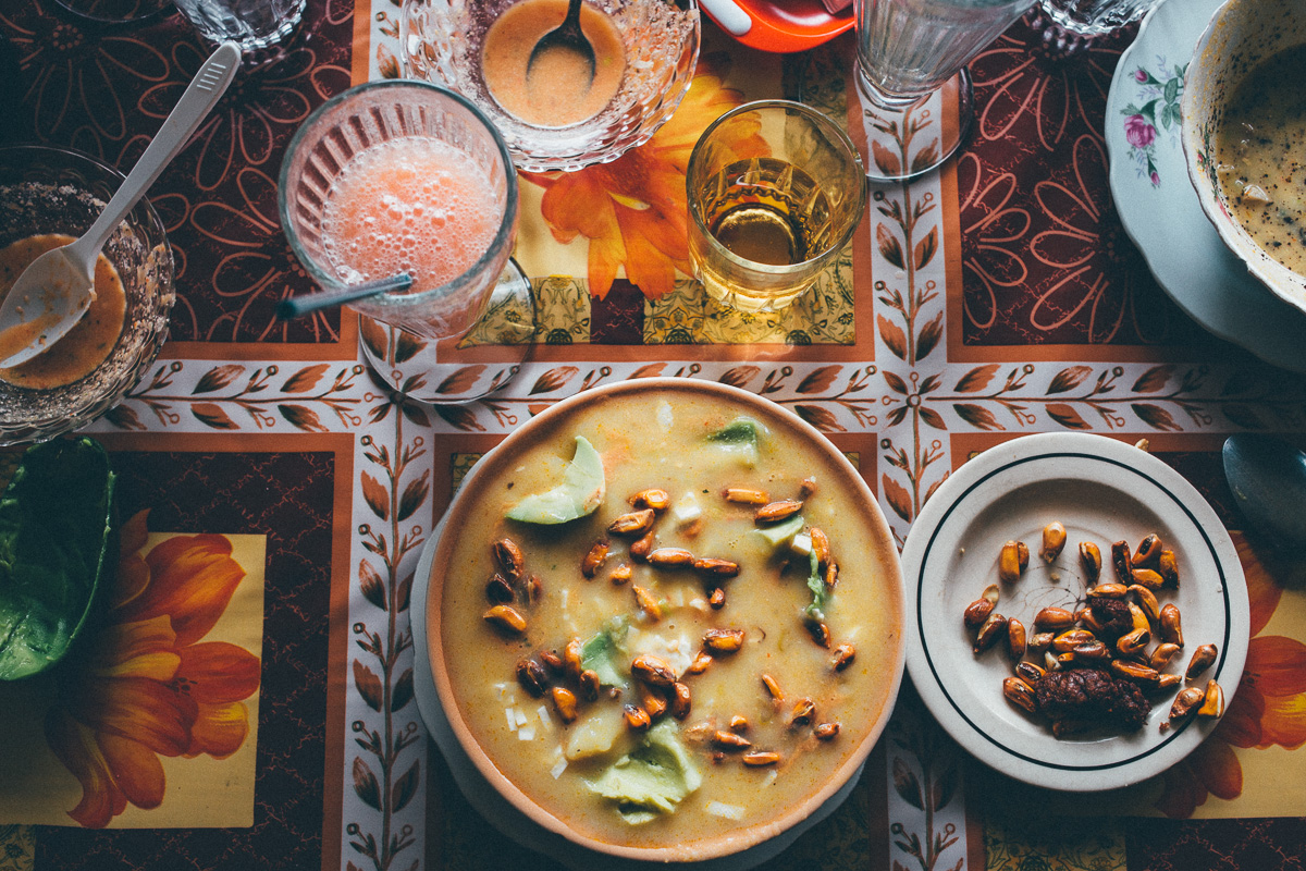
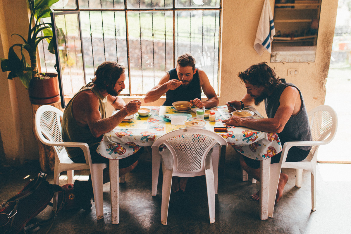
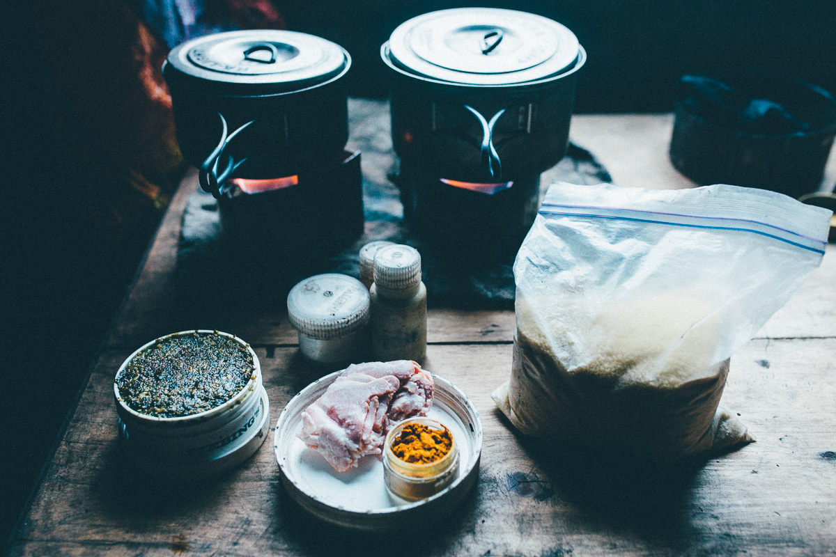
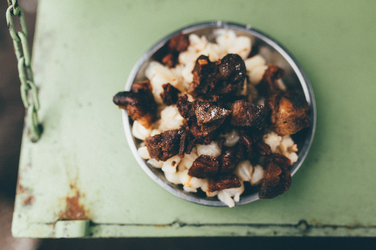
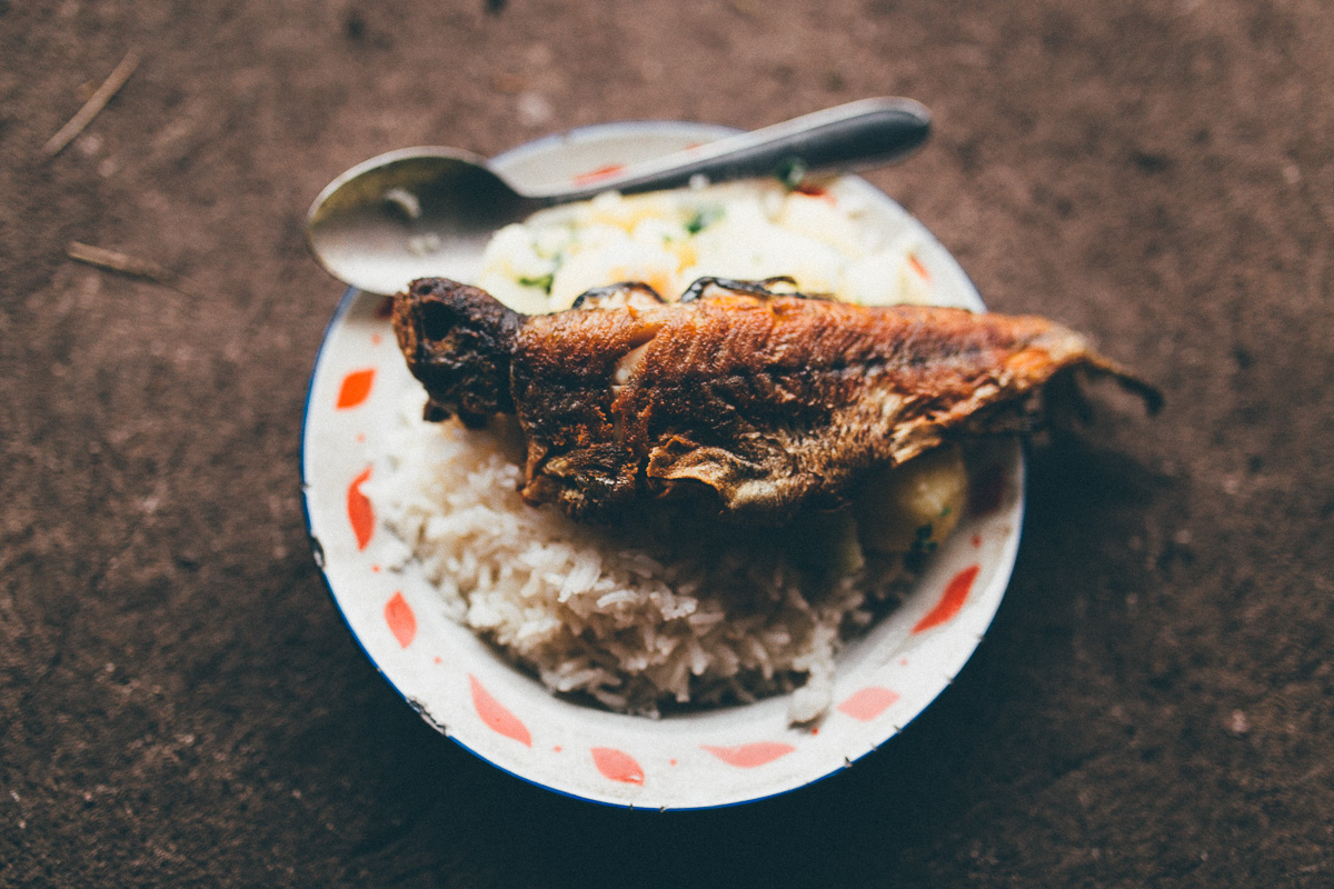
- Every town can serve up a belly-filling set lunch (almuerzo) and dinner (cena) menu. ‘Completos’ costs just a few dollars and includes a soup, main course and juice, offering your best bang for the buck.
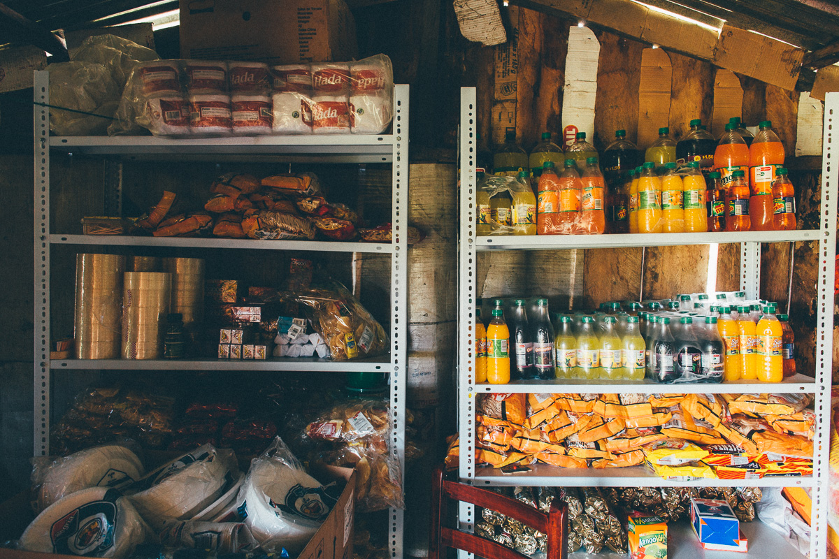
- Don’t expect to find much more than the odd, poorly stocked village shop in between towns. Carry food for 3 days at all times.
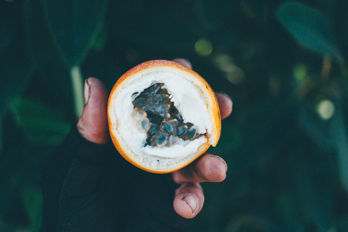
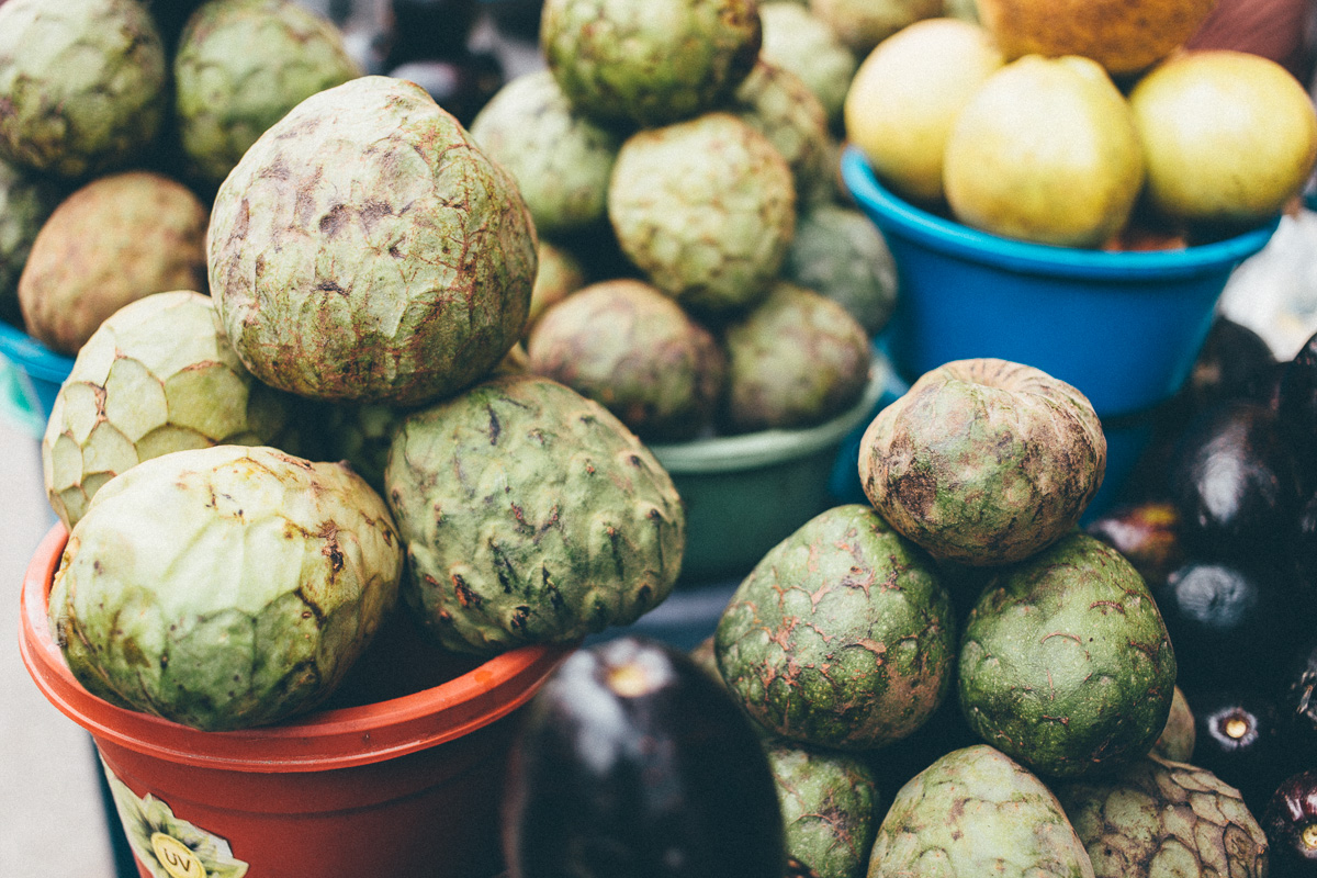
- Ecuador has an abundance of exotic fruit. Be sure to sample chirimoya when you’re passing through Guayllabamba. Better still, sample the locally made Chirimoya ice cream.
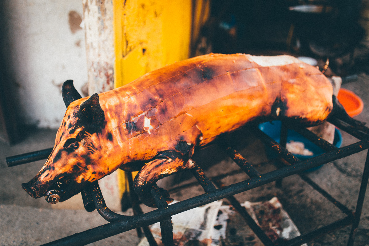
- Other treats to look out for include tostadas – toasted corn – and mote – soaked corn. At the weekend, these are often served with hornada – delicious crispy, roasted pork . If you’re not squeamish, there’s cuddly guinea pigs – cuy – to tuck into as well, an Ecuadorian speciality.
- Locro de Papa is hearty soup that will keep you fueled. It’s loaded with potatoes, onion, garlic, cumin, achiote, milk, cheese and cilantro, garnished with avocado and spicy aji.
- The Thursday morning indigenous market in Guamote is well worth checking out – and great for resuppling on fresh and local produce.
- Do you seek the secret of the Dammer Brothers’ ungodly strength… try adding máchica powder to your porridge oats in the morning. It’s an energy-rich flour made from ground toasted barley and other grains.
- Always keep your eyes out for local produce and support small businesses when you can. For example, fresh cheese is commonly available in the mountains. Just add bread, a pinch of salt and a dollop of aji (Ecuadorian hot sauce).
The route can be divided into 5 segments – the hardest is the first. This is how we rode it in January 2015:
1. Salinas to Pifo.
From Salinas de Ibarra up to Cahuasqui. Follow the old trail that climbs to Cerro Yanahurco. From Yanahurco to the little hamlet of Piñan, through trails exit via Guananin to Irubi. Up on gravel roads to the base of Volcan Cotacachi, traverse to Motilon Chupa and then down to San Jose de Minas. Via Pitanga’s irrigation canal up to Mojanda lakes, down to Malchingui, Guayllambamba and finally Pifo by way of an old railway line.
Distance for this first section: 290 Km
Days on first section: 5
Elevation Gain on this section: 9.711 m
Section Highest Elevation: 4.200 m
Hike-a-bikes: one significant one up to Cerro Yanahurco, several smaller ones throughout.
2. Pifo to Latacunga
Up to El Tablon plateau, across the ridge to Pintag and onto the slopes of Sincholagua to Cotopaxi National Park. Behind Quilindaña, through Chalupas to el Morro and finally Latacunga for a rest day and resupply.
Distance: 190 Km
Days: 4 days (including 1 half day)
Elevation Gain: 4.900 m
Highest Elevation: 4.150 m
Hike-a-bikes: Small hikes up to El Tablon, plus various mini efforts behind Quilindaña, depending on your paramo riding skills.
3. Latacunga to Guamote
From Latacunga via the old road to Pujili. Dirt and singletrack to Yanahurco and then a mixed section of intense hike a bike and singletrack nirvana to Angamarca. From Angamarca a beautiful ‘Ecuadorian’ traverse to Pimbalo and then out to Rio Colorado. In between Chimborazo and Carihuairazo to San Juan and from there on dirt roads to Guamote.
Distance: 252 Km
Days: 5 days
Elevation Gain: 7.570 m
Highest Elevation: 4.440 m
Hike-a-bikes: One protracted hike-a-bike en route to Angamarca, plus some nano hike-a-bikes between Chimborazo and Carihuairazo.
4. Guamote to Cuenca
From Guamote through the high ridges of the paramo de Cebadas to reach the Atillo and Ozogoche lakes, and eventually Totorillas. Follow the ancient trails of ‘inga-ñan’ to reach Ingapirca on single track. Finished the section riding behind Cerro Cojitambo to Deleg and Cuenca, following tertiary paved roads.
Distance: 210 Km
Days: 4 days
Elevation Gain: 5.870 m
Highest Elevation: 4.400 m
Hike-a-bikes: The Inca Trail – Totorillas to Ingapirca – is a hike-a-hike bonanza, albeit a beautiful one!
5. Cuenca to Vilcabamba:
Leave Cuenca on the trail that follows the shores of the Yanuncay River. Some hidden single track took us to the old road that goes from Turi to Gima and Nabon. Oña and San Lucas followed to then take the Zamora river canyon to Loja. Up to the ridges of the Podocarpus to reach Malacatos and finally Vilcabamba.
Distance: 287 Km
Days: 4 days
Elevation Gain: 6.960 m
Highest Elevation: 3.500 m
Hike-a-bikes: A challenging graft to the Podocarpus.


Terms of Use: As with each bikepacking route guide published on BIKEPACKING.com, should you choose to cycle this route, do so at your own risk. Prior to setting out check current local weather, conditions, and land/road closures. While riding, obey all public and private land use restrictions and rules, carry proper safety and navigational equipment, and of course, follow the #leavenotrace guidelines. The information found herein is simply a planning resource to be used as a point of inspiration in conjunction with your own due-diligence. In spite of the fact that this route, associated GPS track (GPX and maps), and all route guidelines were prepared under diligent research by the specified contributor and/or contributors, the accuracy of such and judgement of the author is not guaranteed. BIKEPACKING.com LLC, its partners, associates, and contributors are in no way liable for personal injury, damage to personal property, or any other such situation that might happen to individual riders cycling or following this route.
Please keep the conversation civil, constructive, and inclusive, or your comment will be removed.