


Ruta de Los Seis Miles, Sur
Distance
327 Mi.
(526 KM)Days
12
% Unpaved
78%
% Singletrack
0%
% Rideable (time)
88%
Total Ascent
23,427'
(7,141 M)High Point
16,240'
(4,950 M)Difficulty (1-10)
9?
- 5Climbing Scale Moderate72 FT/MI (14 M/KM)
- -Technical Difficulty
- -Physical Demand
- -Resupply & Logistics
Contributed By
Taneli Roininen
Gone Bikefishing
For Ruta de Los Seis Miles, Norte, see here.
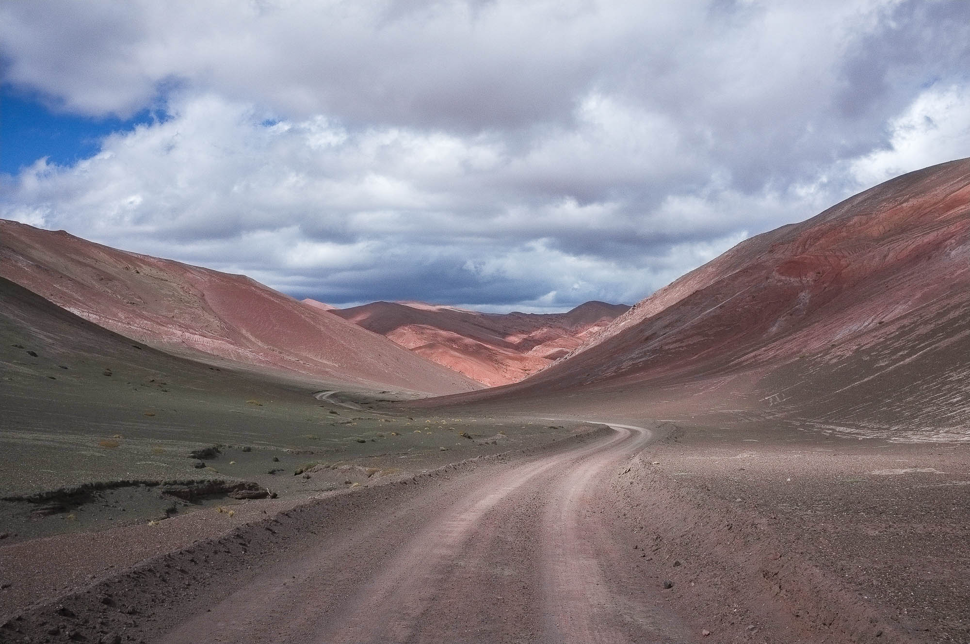
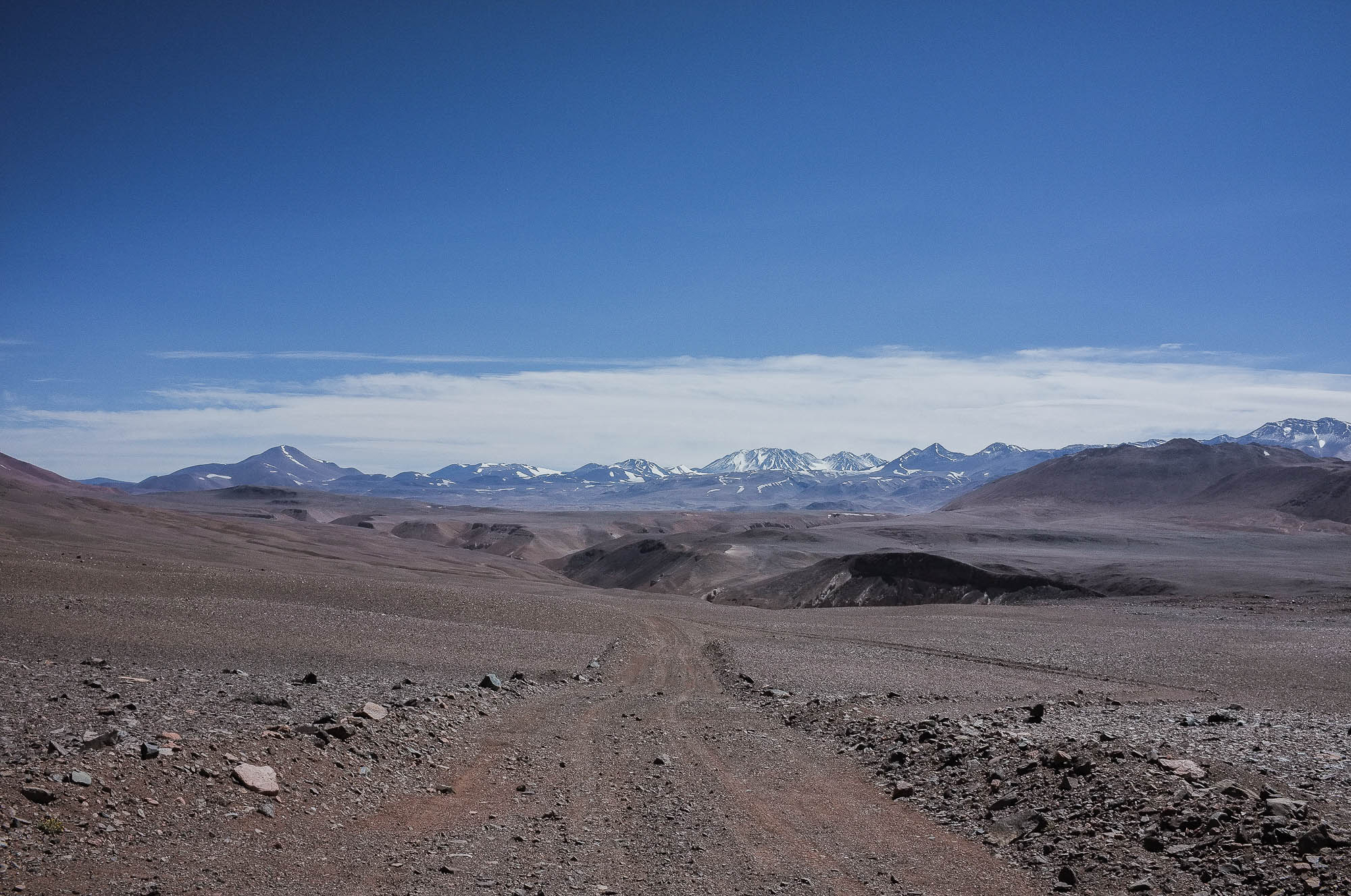
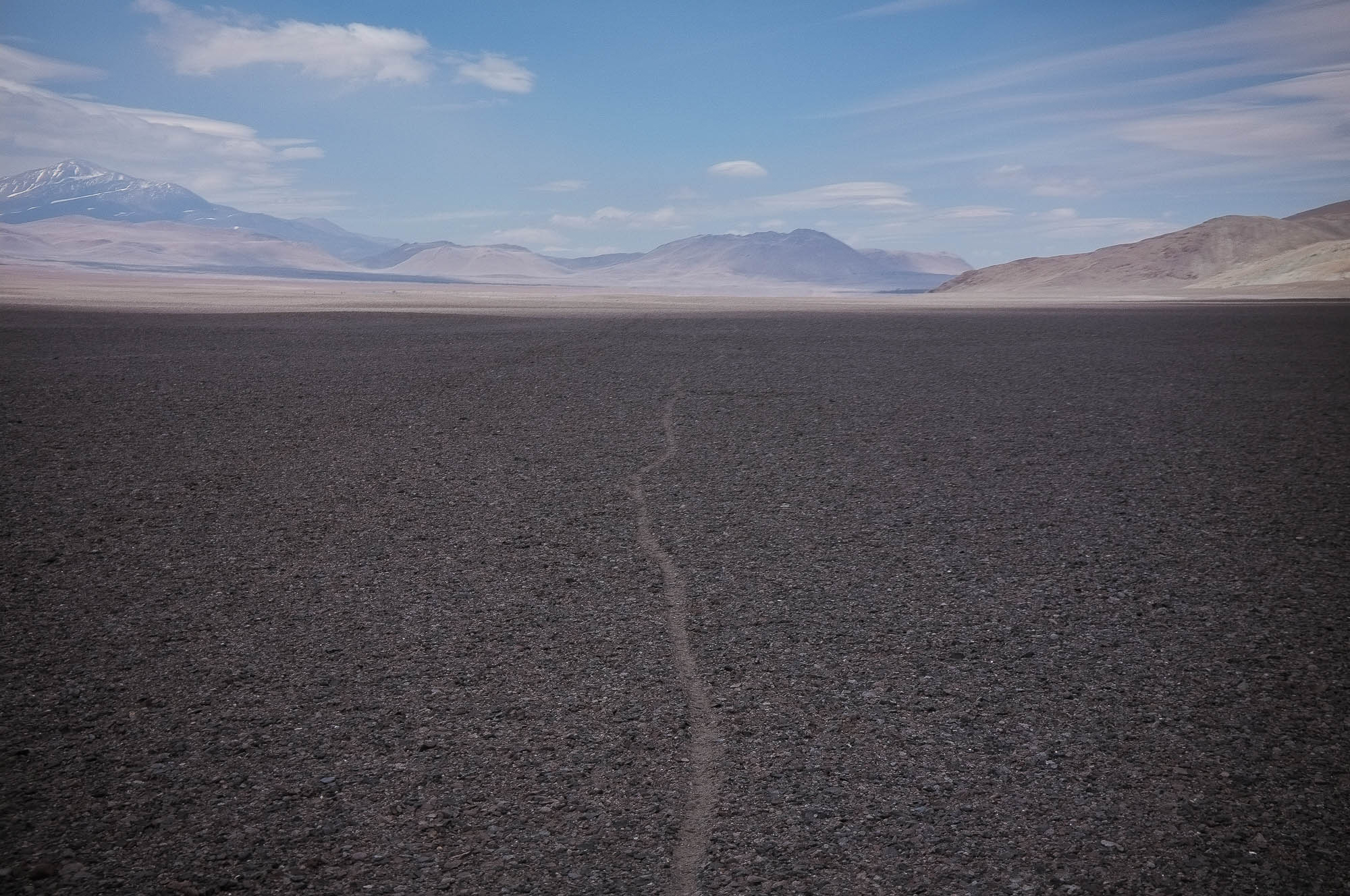
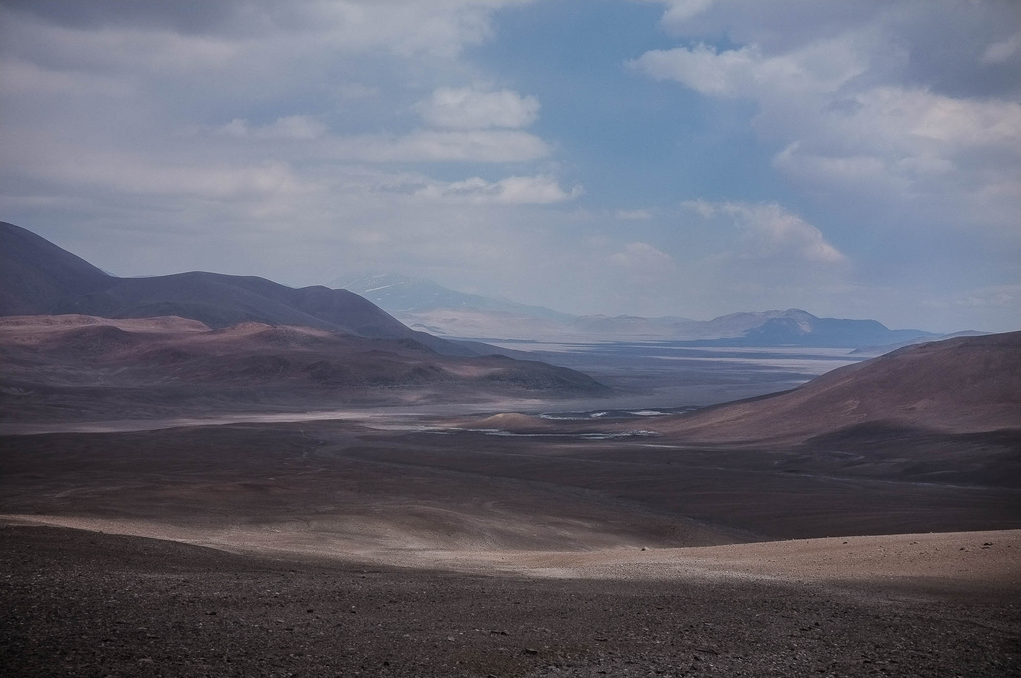
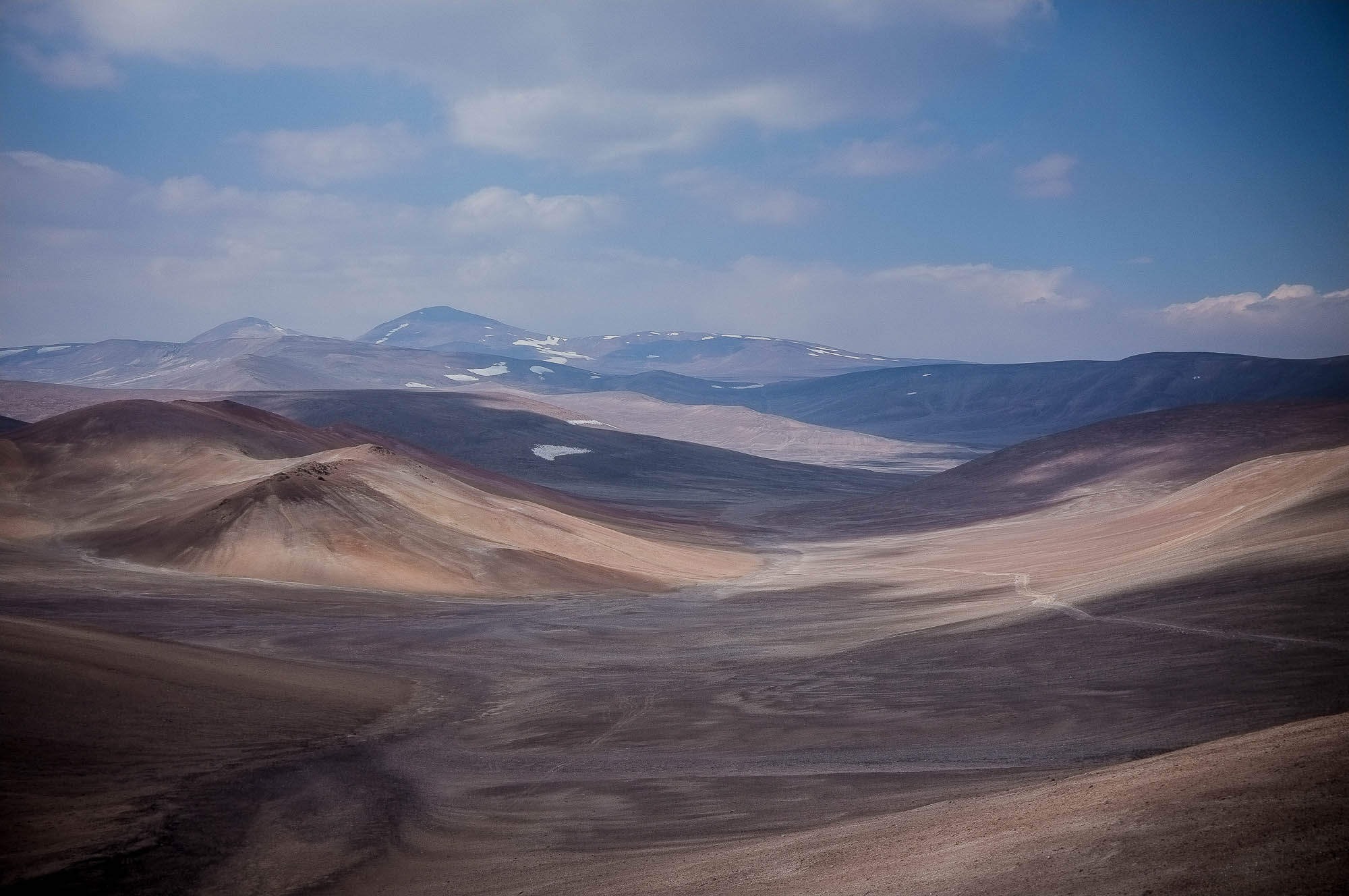
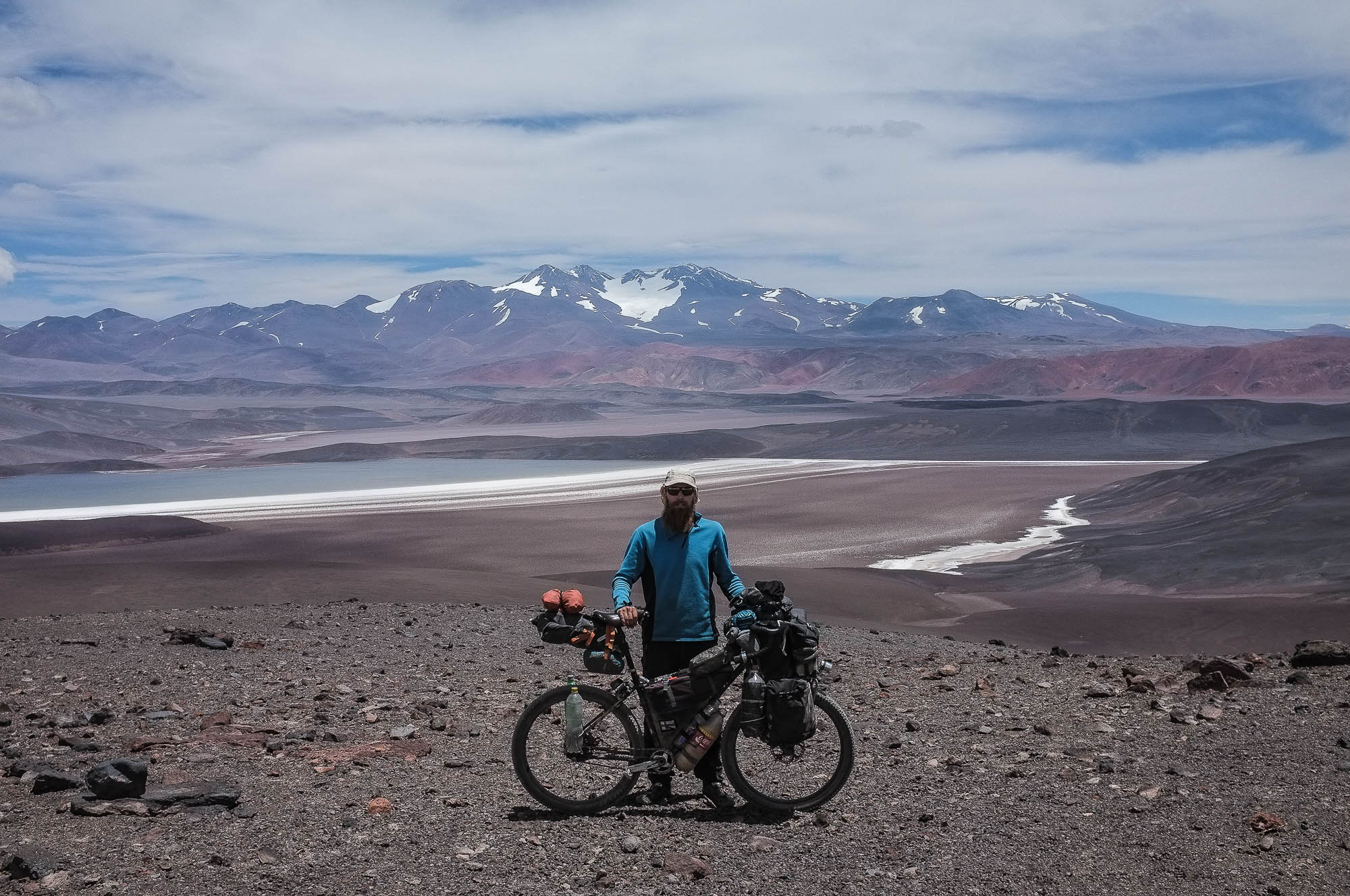
If there is one part of the world that long-distance cyclists talk about and are drawn back to, it is the Central Andean Dry Puna. This desertic area, located mainly in the Atacama desert, covers 307,400 km2 (118,700 sq mi) in the central Andes in northern Chile, north Argentina and southwest Bolivia, and lies at altitudes between 3,500m and 5000m (11,500-16,400 ft). During the summer months, the area is cleared of snow and a grid of old mining roads and other double tracks offer some of the most remote, demanding and spectacular bike touring anywhere on Planet Earth.
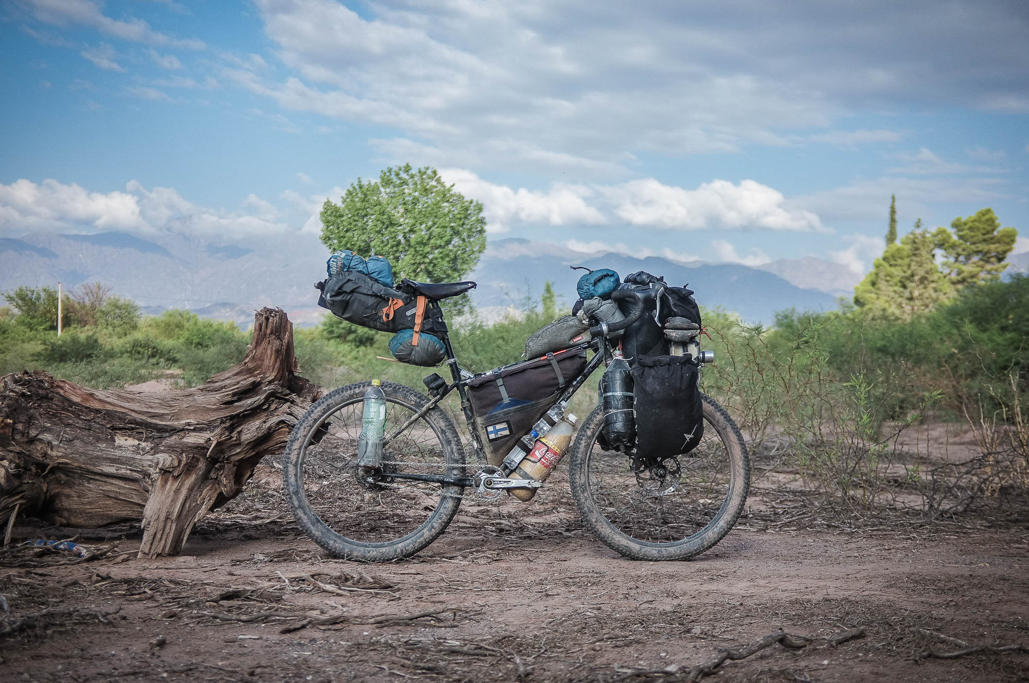
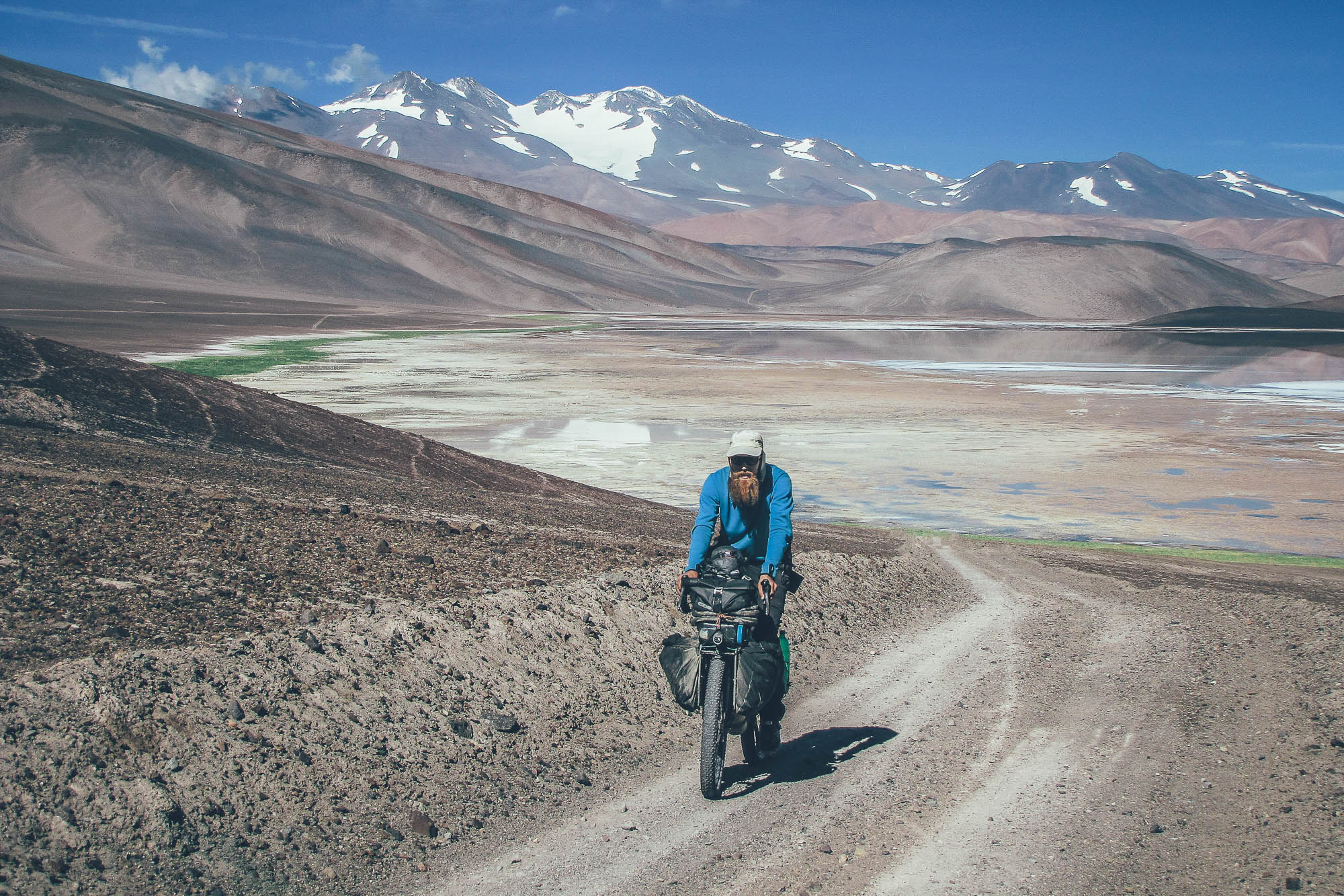
Ruta de Los Seis Miles, Sur, connects the towns of Fiambalá and Guandacol in west Argentina. The route is 500km long, which can easily take 12 cycling days or more. The route is very remote: you need to be able to carry 12 days food, cooking fuel and one and half days of water, simultaneously. The combination of a heavily loaded bike, thin air, possible sections of strong headwind and long soft climbs makes the route very demanding. Total hike-a-biking can add up to one and half days, depending on your acclimatization, route condition, fitness, and tire width. The route is best ridden with a fatbike, or at the minimum, a bike with plus-sized tires.
The route can be ridden, as it is, only from north to south, due to local rules of Argentinian and Chilean Immigration at Paso Pircas Negras and only when the high passes of the route are free of snow (usually from October to April, but varying) and the risk of snow storms is smallest.
The route follows Los Seis Miles, the line of over 6000m (20,000ft) volcanoes. If you can fit a backpack, ice ax, crampons and mountaineering boots into your packs (and can carry some extra food), you are set to summit the second highest volcano in the world, Monte Pissis (6,793m/22,287ft), which is on the route, in the spirit of Janne Corax’s expeditions and Neil and Harriet Pikes Puna 9 project.
For a more detailed description of each section of this route, be sure to read the Trail Notes below.
If you want to extend this route and connect it with the Ruta de los Seis Miles, Norte, it will create a 1313km, 33 day Puna crossing.
Difficulty: This route has been awarded a difficulty rating of 9, so is not to be undertaken lightly. A heavily laden bike combined with soft terrain and high altitude makes this route physically extremely demanding. 40km days are likely to be your reality, especially when there is a strong headwind. This said, the real challenge could be mental one, as human contact along the route is rare and freshwater sources are located far apart. Note that this route is easier to attempt with a fatbike, but it can just about be done with 2.8in tires as well.


Submit Route Alert
As the leading creator and publisher of bikepacking routes, BIKEPACKING.com endeavors to maintain, improve, and advocate for our growing network of bikepacking routes all over the world. As such, our editorial team, route creators, and Route Stewards serve as mediators for route improvements and opportunities for connectivity, conservation, and community growth around these routes. To facilitate these efforts, we rely on our Bikepacking Collective and the greater bikepacking community to call attention to critical issues and opportunities that are discovered while riding these routes. If you have a vital issue or opportunity regarding this route that pertains to one of the subjects below, please let us know:
Highlights
Must Know
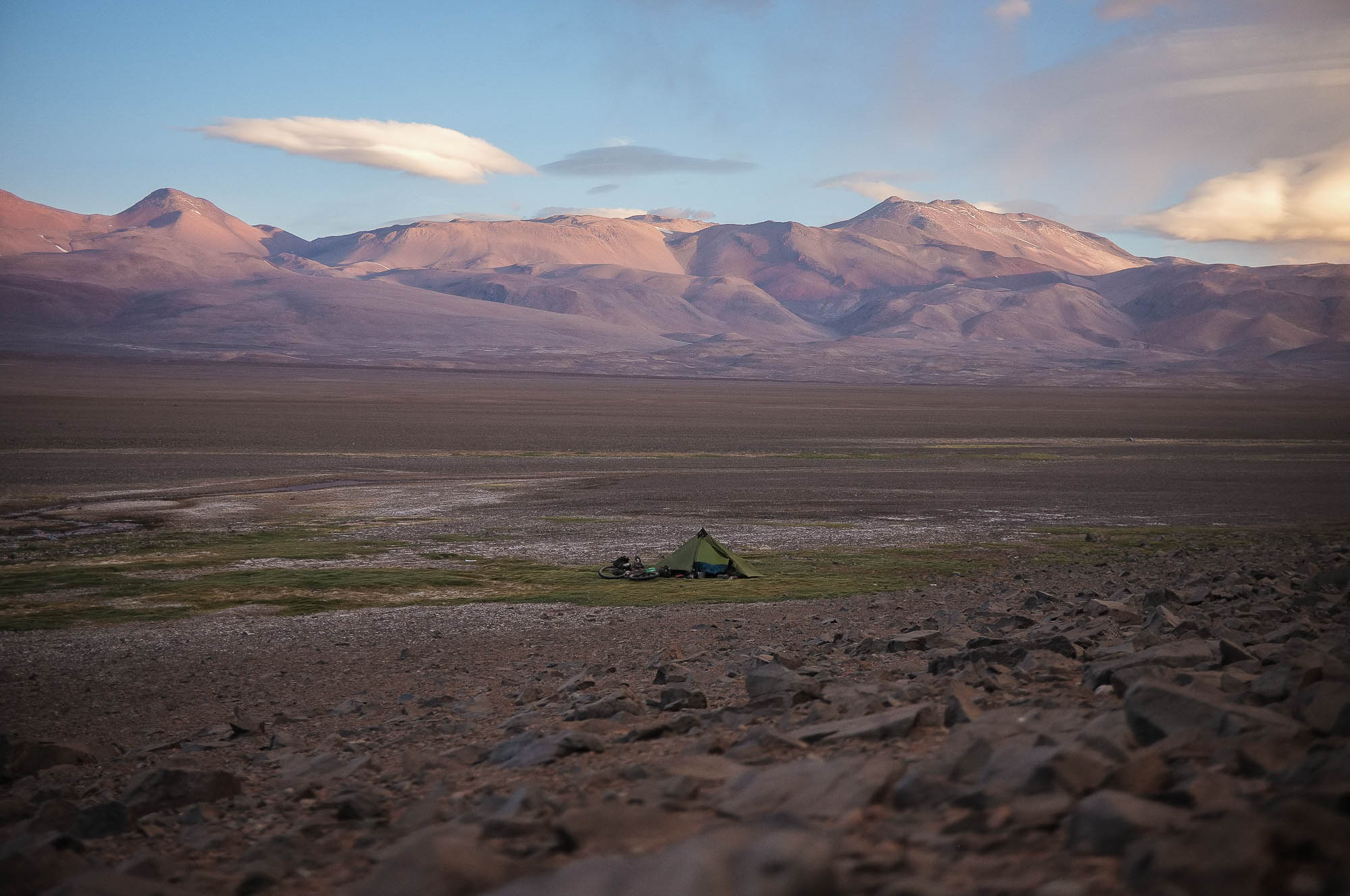
Camping
Food/H2O
Trail Notes
Resources
- Riding around the Monte Pissis (6,793 m/22,287 ft), the second highest volcano in the world
- Endless moon-like sceneries from the two 4950 m passes
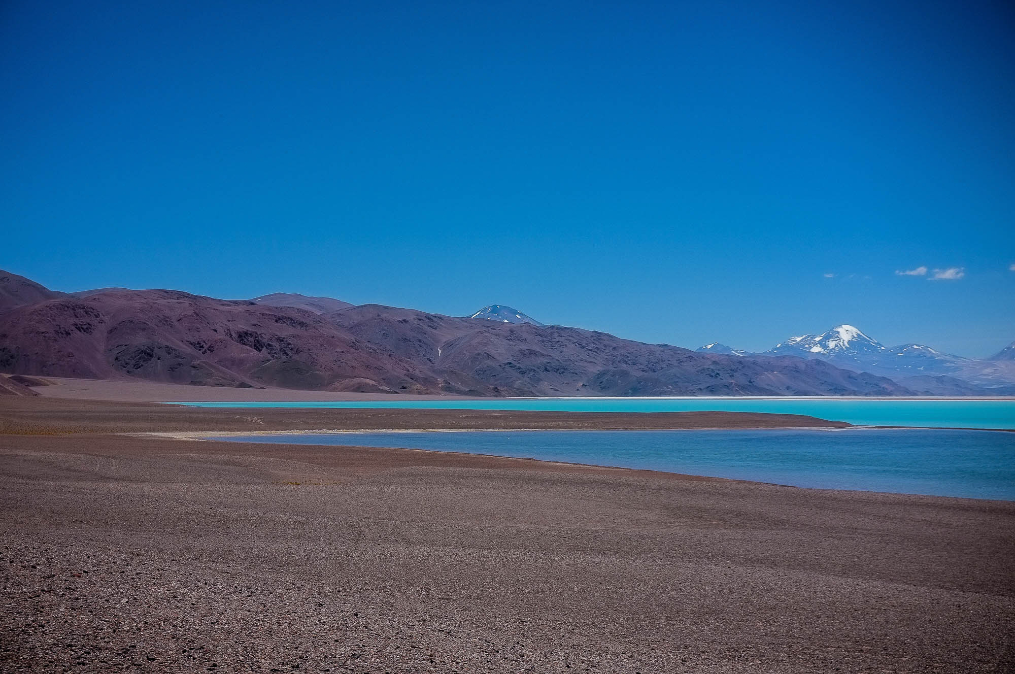
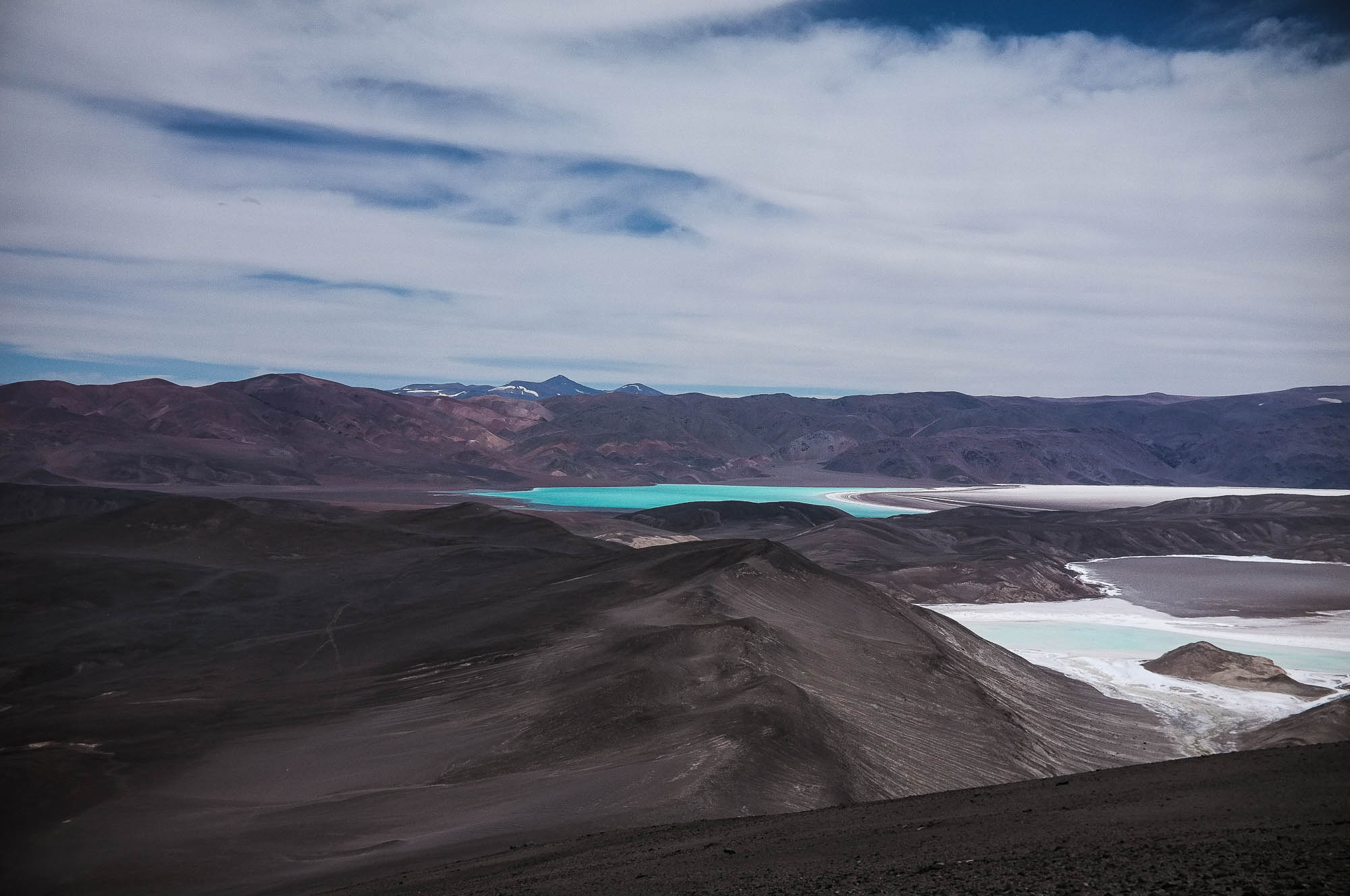
- Panorama views of colourful lakes and snow capped volcanoes from the viewpoint of Balcon de Pissis
- Vicuñas as well as condors and other birds of prey in the lower parts of the route
- Solitude far away from human civilisation
- Unreal colors of mountain faces
- Joy of finding high quality fresh water again
- The route can be ridden only from north to south, due to local rules of Argentinian immigration at Paso Pircas Negras. Be prepared to prove that you are not coming from Chile by showing your route and pictures along the way.
- The route can be ridden only when the high passes of the route are free of snow (usually from October to April, but varying). Contact Jonson in Fiambalá before setting on the route, especially out of the summer months. Risk of snowstorms in the winter and early and late in the season is high.
- You need to be able to carry nearly two weeks of food, cooking fuel and one day’s water simultaneously.
- Winds on the route can be strong, on some sections you have a headwind and on others tailwind. Prevailing winds are from Chile to Argentina, west to east.
- Total hike-a-biking can add up one and half days, depending on your fitness, route condition and tire width.
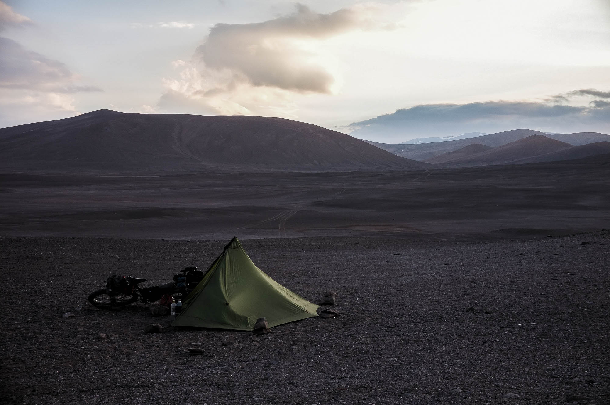
- There is no phone signal up in the mountains and parts of the route are extremely solitary, carrying personal emergency beacon is highly recommended.
- The nighttime temperatures can drop down to -10 Celsius degrees at high altitudes even in the summer, plan your sleeping system accordingly.
- Temperature around Guandacol rises easily to 40 Celcius in the summertime.
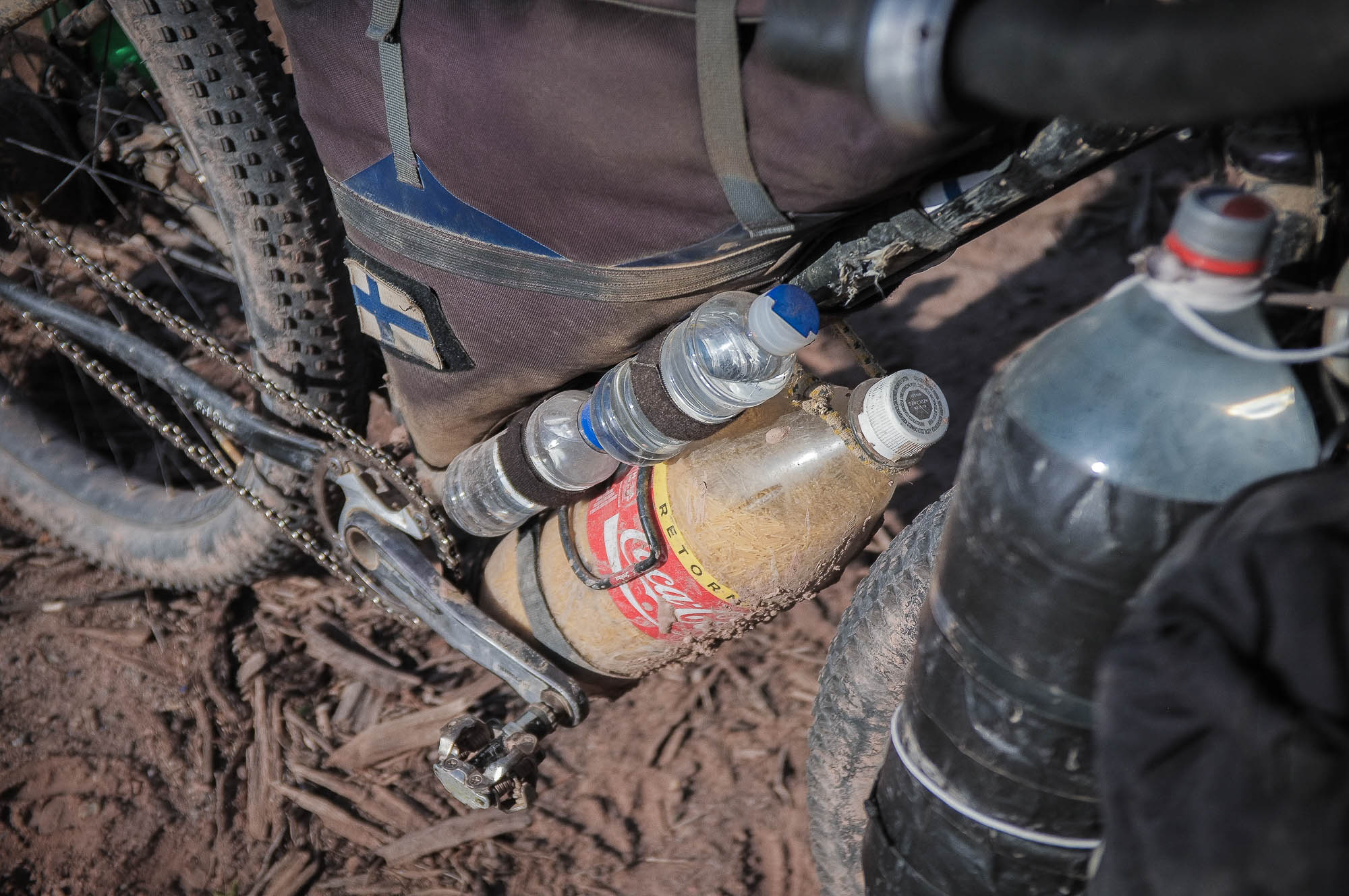
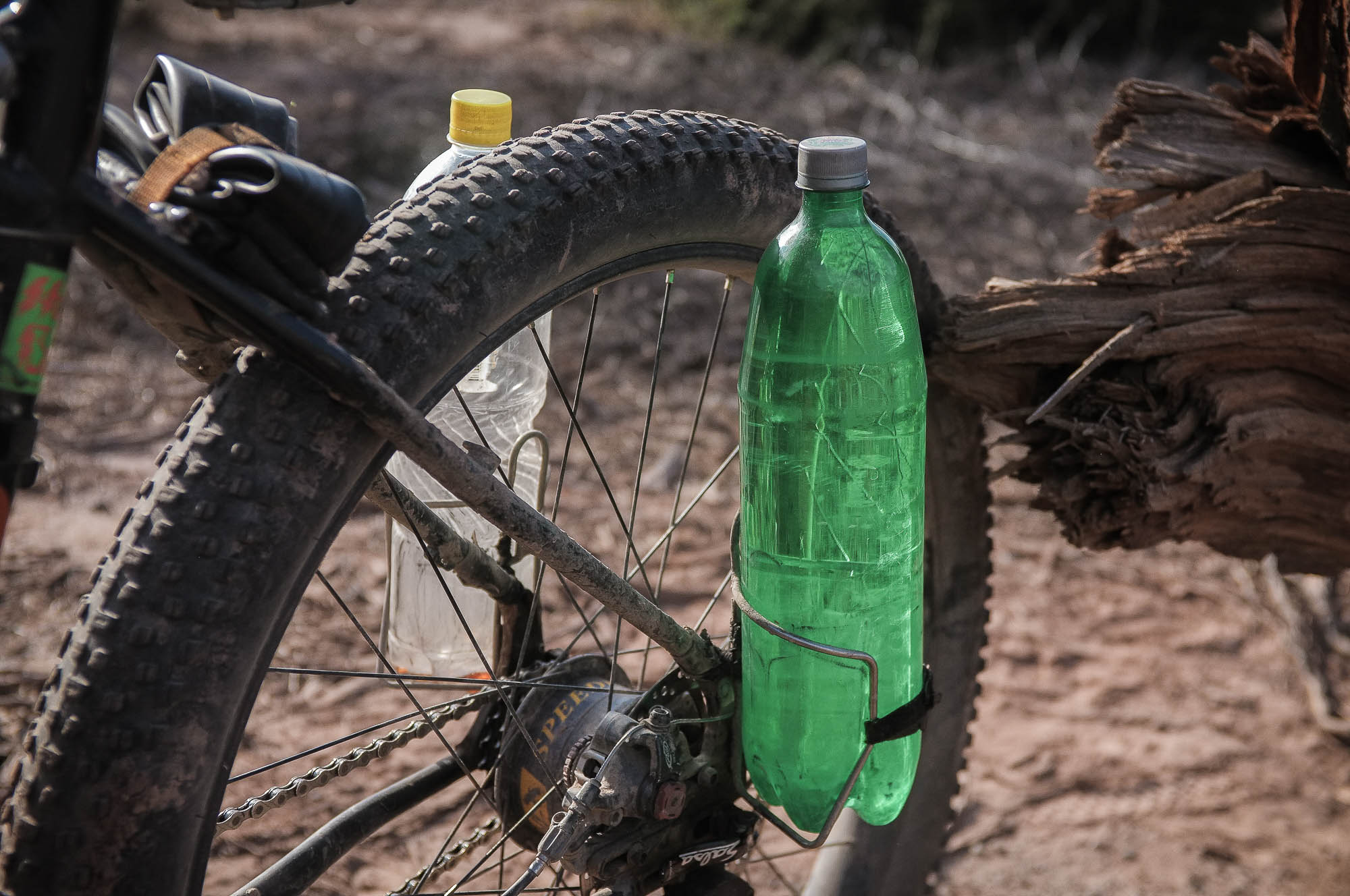
- The route needs thorough preparation food and setup wise. The weight of 12 days food weights easily 10kg and is likely to take the majority of the total volume of your carrying system. There are as many ways to carry 10 kg of food and 6 litres (minimum of one and half days need) of water as there are riders, but adding a rear or front rack to your usual bikepacking setup is likely to be necessary, at least if you want to ride without a backpack.
- There are flights from Buenos Aires to Mendoza multiple times a week, from where there is a regular bus connection to Guandacol and Fiambalá.
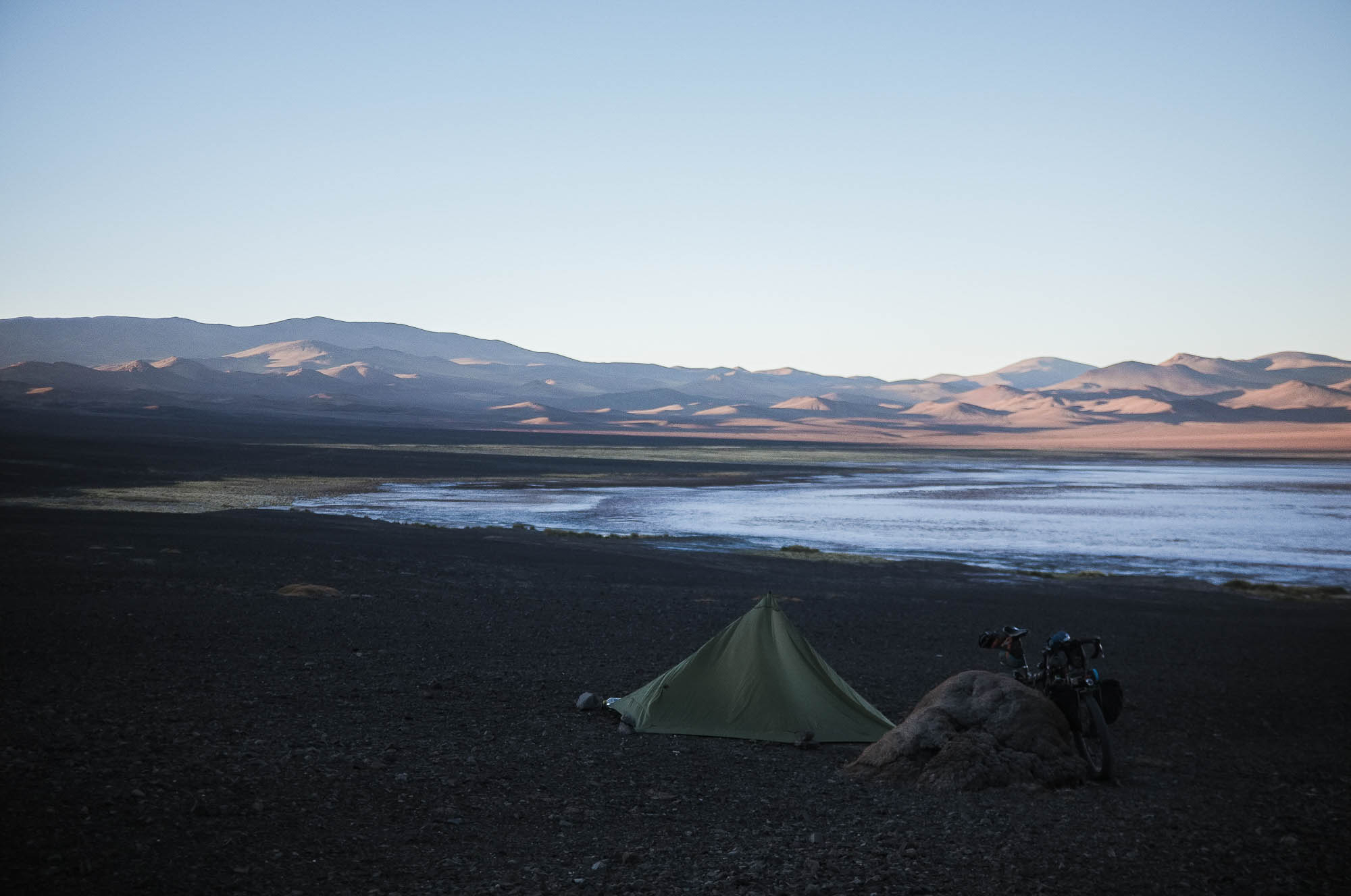
- The best wild camping spots are marked on the map, only some of the campsites are near a water source.
- Only few camp spots have wind cover. Your tent needs to be able to take gale force winds. Single pole, single layer tarp tents and similar are recommended as they are strong, light, pack small (more space for food!) and relatively easy to pitch in strong wind.
- There are basic hospedajes and a nice organised camping available in Fiambalá. Basic hospedajes available in Guandacol as well.
- Longest distance between fresh water sources is 61 km and one and half riding days. Water carrying capacity of minimum of 6 litres is necessary.
- A few of the water sources marked on map are slightly saline and only suitable for cooking, and some might exist only seasonally. Read the full details of the marked water sources and plan your refills and water usage accordingly. Water treatment is often necessary.
- You need to be able to carry 12 days food between Guandacol and Fiambalá.
North to south; Fiambalá to Guandacol:
1 – Fiambala – Valle Lago Verde (144 km, 4013 m of climbing, 3-4 days)
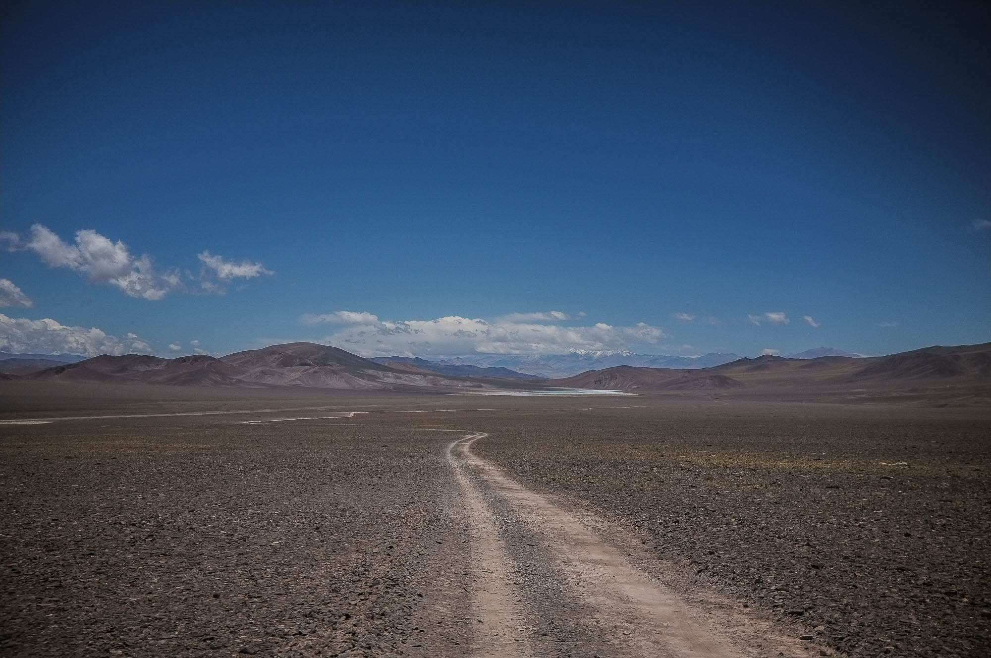
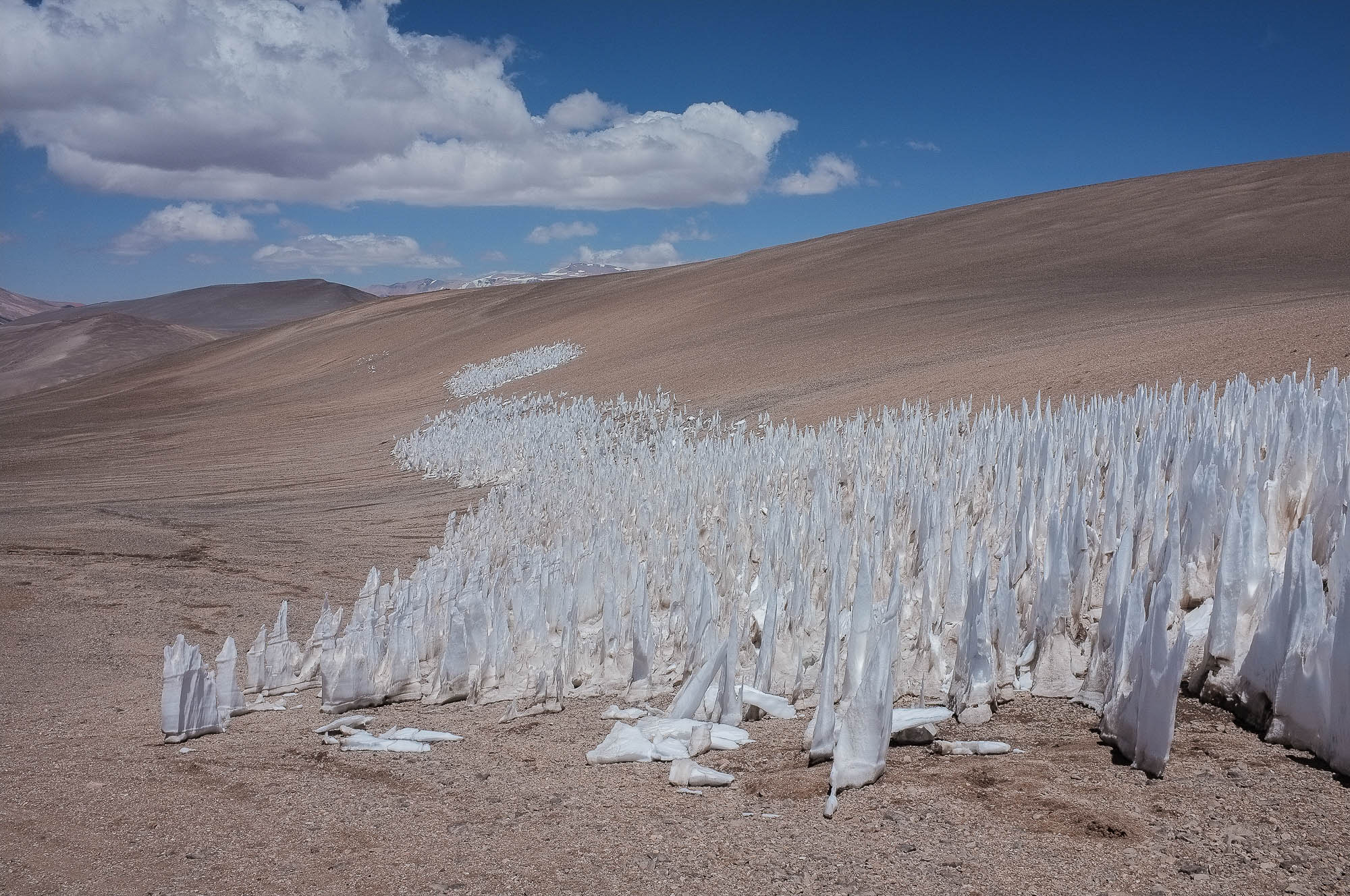
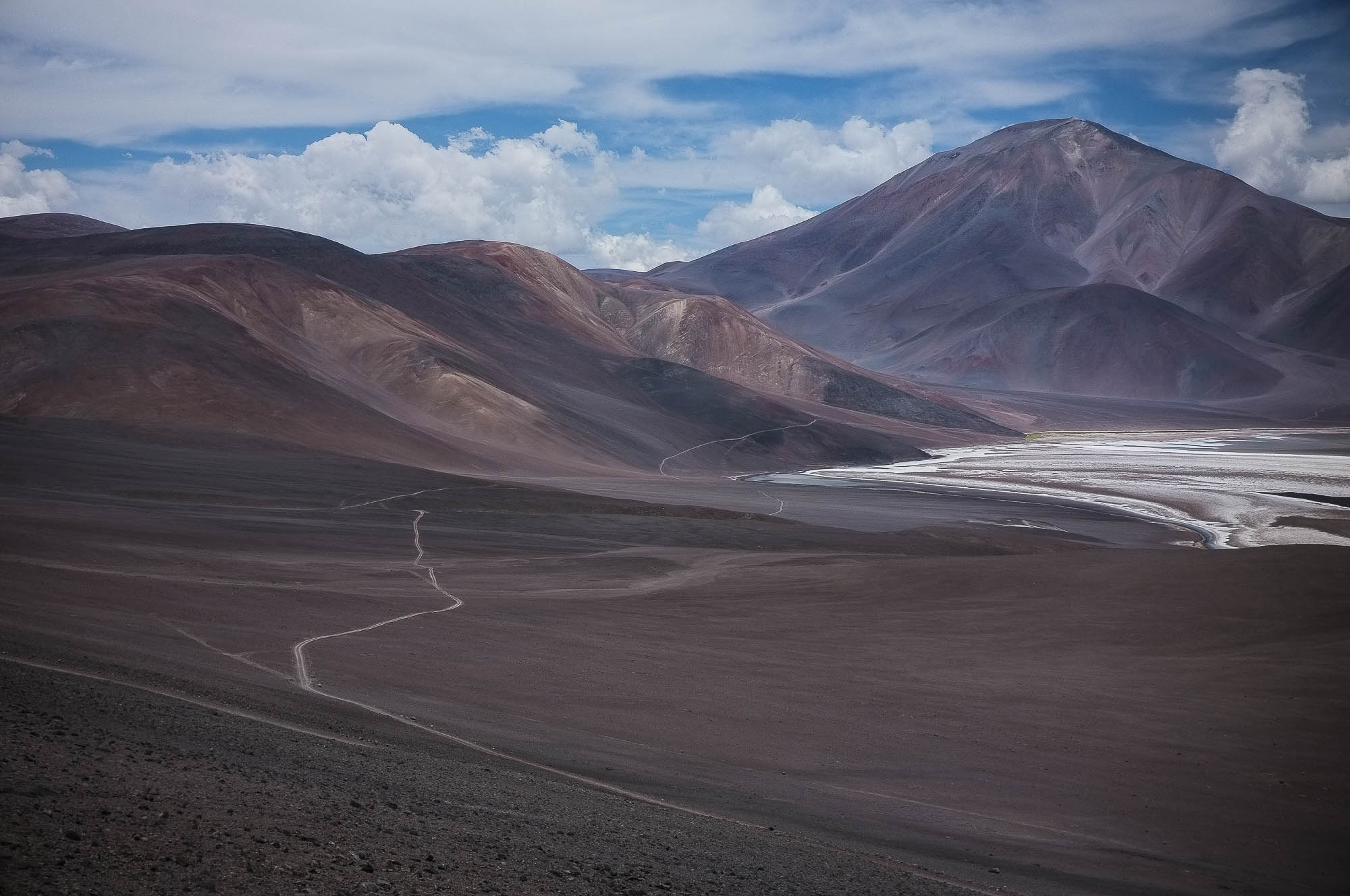
The 3000 m and 100 km climb toward Monte Pissis starts with an easy day on the Ruta 60 toward the Paso San Francisco. If you time your departure from Fiambalá to afternoon, you are likely to have a tailwind of your life pushing you up to the highlands. Refugios along the road offer a good shelter for the night. At 3290 m the route leaves the paved road and approach to the first 4500 m pass starts on partly rough gravel road. The views from the Balcon de Pissis to the surrounding high volcanoes and to Lago Verde and Lago Negra are fantastic. If without a fatbike, be prepared to push your bike across the valley as the road is extremely sandy.
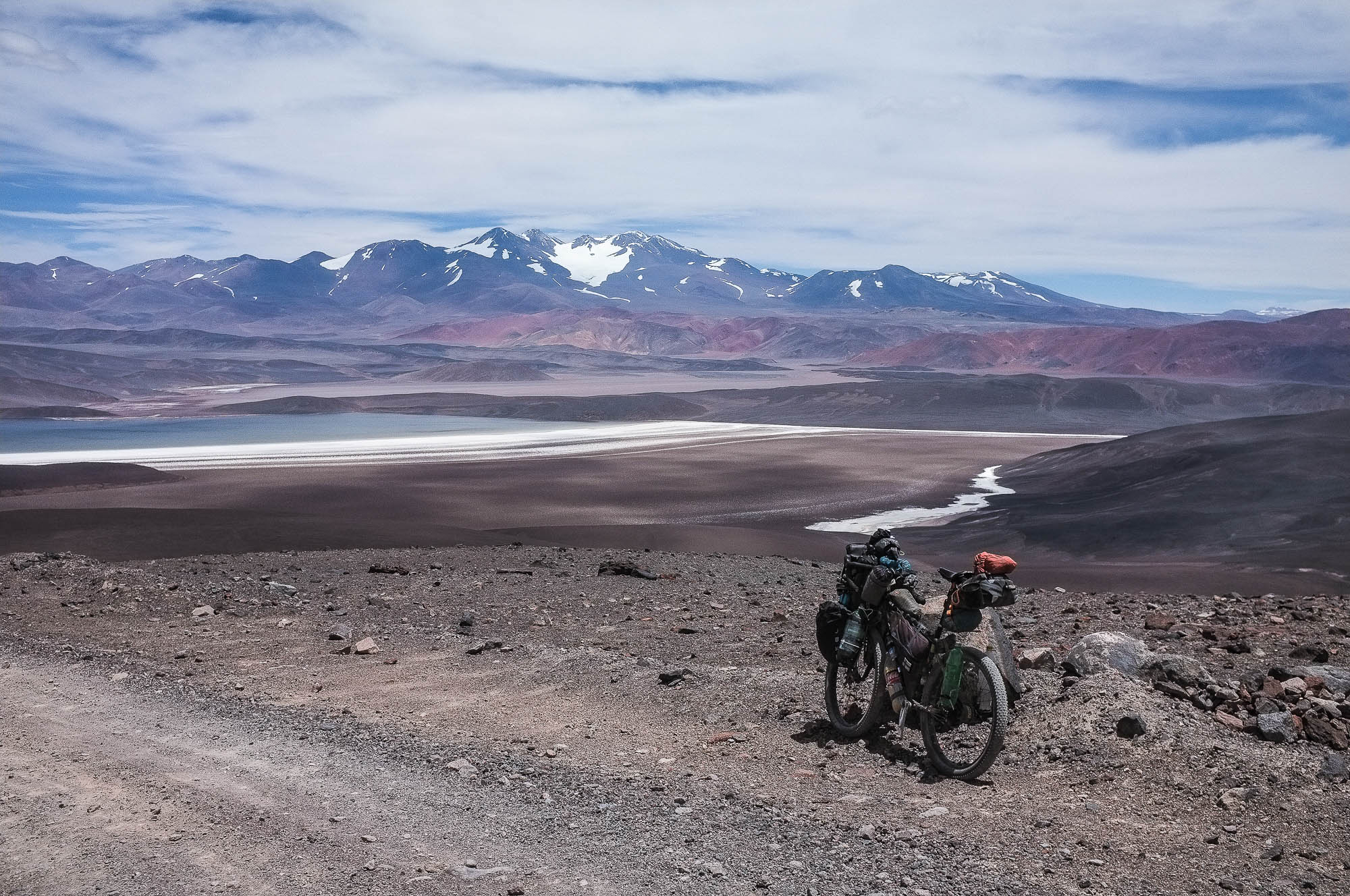
2 – Valle Lago Verde – Laguna Brava (171 km, 2741 m of climbing, 4-6 days)
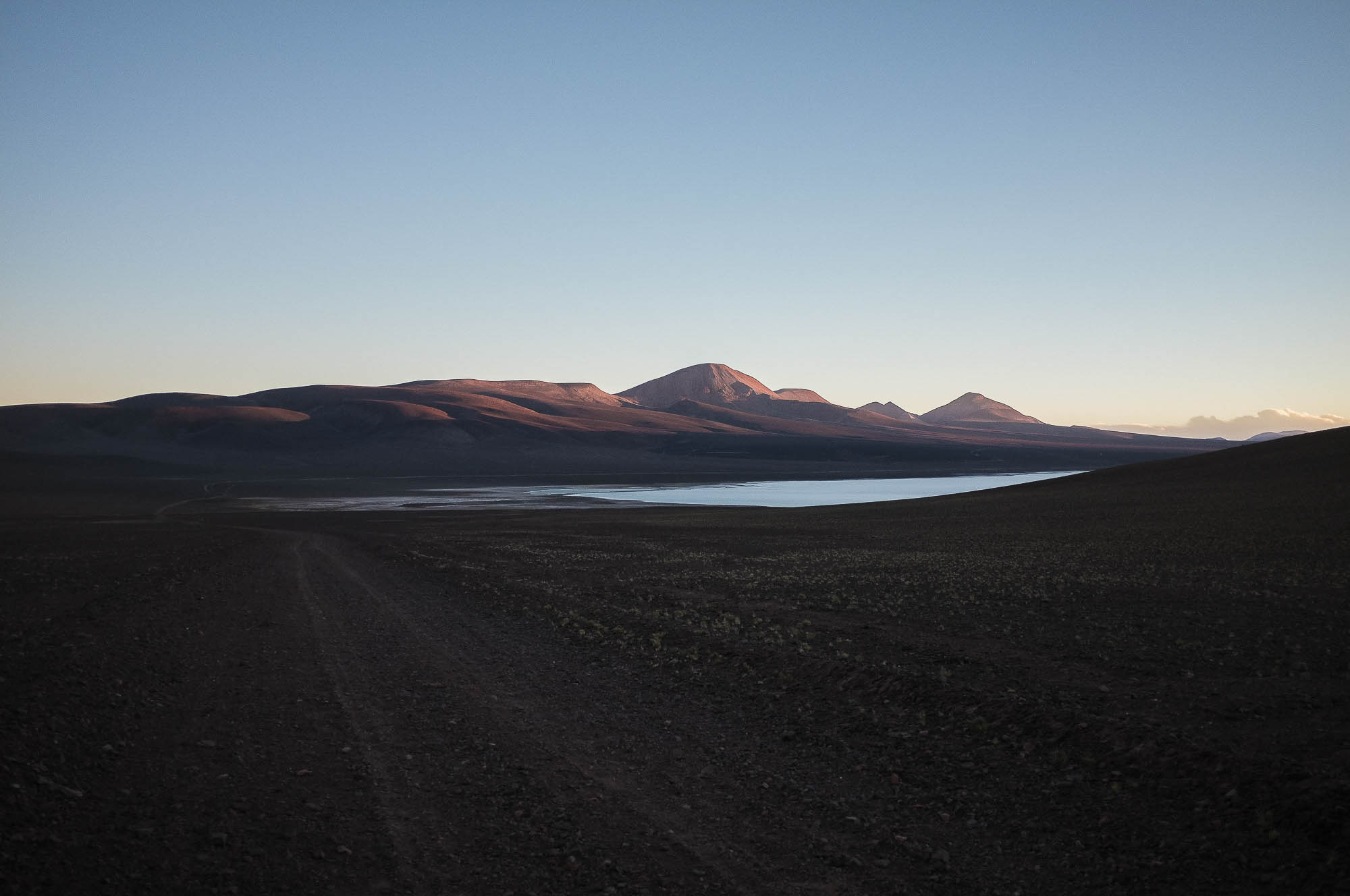
Colourful river valleys take you all the way to the first of the two 4950m passes. There are likely to be penitentes (water!) on the pass, so you can make the push to the pass relatively light. After the second 4950m pass the route gets down to the Rio Salada, which the soft route roughly follows all the way to Ruta 76, the road coming down from the Paso Pircas Negras. Some sections are rideable in the river valley with plus tires, some are not. Convince the Chilean and Argentinian border officials 9km after joining the main road that you are not coming from Chile by showing your route on a map and amazing them with your pictures. Immigration officers are likely to offer you a place to sleep and access to their high speed wifi (no joke!), if you arrive to the station in the afternoon. 40 km section of pavement to Laguna Brava is over quickly over with strong tail wind. Numerous flocks of flamingos colour the shorelines of the lake.
3 – Laguna Brava – Guandacol (184 km, 1106 m climbing, 3-5 days)
From Laguna Brava, a soft double track leads you first to a 4450m pass before a 30 km downhill to the moon-like Salar de Leoncito at 3660m. From last pass of the route at 4030m starts a 3000m and 116km long downhill toward Guandacol. The downhill starts with a cruise across a spectacular red canyon with wild donkeys and condors.
Note that if you are lucky, strong tailwind may help you to reach the end of this route earlier than anticipated.
- Taneli’s blog post for his sponsor WTB, on the creation of the route.


Terms of Use: As with each bikepacking route guide published on BIKEPACKING.com, should you choose to cycle this route, do so at your own risk. Prior to setting out check current local weather, conditions, and land/road closures. While riding, obey all public and private land use restrictions and rules, carry proper safety and navigational equipment, and of course, follow the #leavenotrace guidelines. The information found herein is simply a planning resource to be used as a point of inspiration in conjunction with your own due-diligence. In spite of the fact that this route, associated GPS track (GPX and maps), and all route guidelines were prepared under diligent research by the specified contributor and/or contributors, the accuracy of such and judgement of the author is not guaranteed. BIKEPACKING.com LLC, its partners, associates, and contributors are in no way liable for personal injury, damage to personal property, or any other such situation that might happen to individual riders cycling or following this route.
Please keep the conversation civil, constructive, and inclusive, or your comment will be removed.