


Ruta de Las Vicunas, Northern Chile
Distance
182 Mi.
(293 KM)Days
5
% Unpaved
90%
% Singletrack
0%
% Rideable (time)
99%
Total Ascent
8,715'
(2,656 M)High Point
15,500'
(4,724 M)Difficulty (1-10)
6?
- 3Climbing Scale Fair48 FT/MI (9 M/KM)
- -Technical Difficulty
- -Physical Demand
- -Resupply & Logistics
Contributed By

Cass Gilbert
Contributing Editor
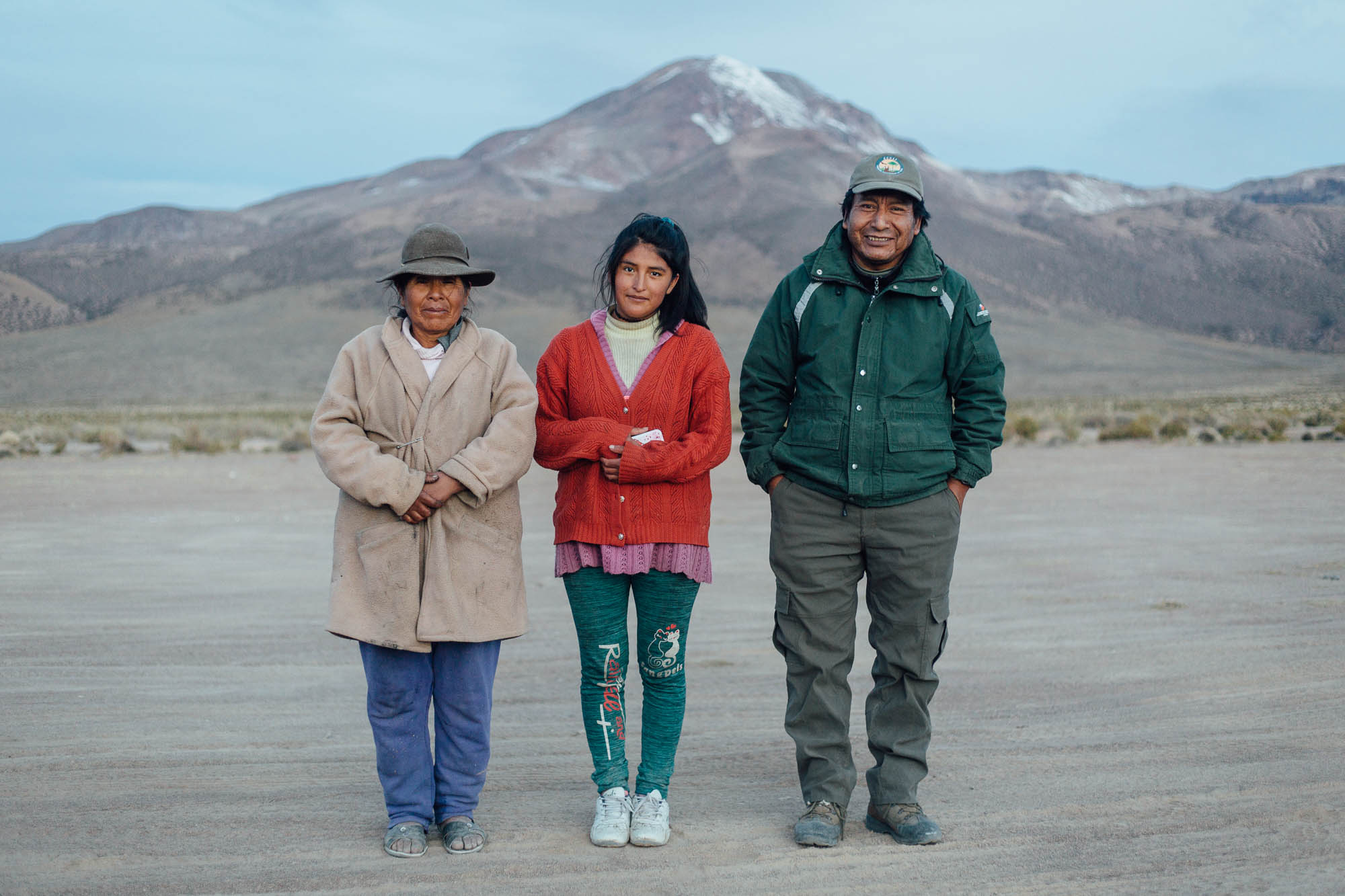
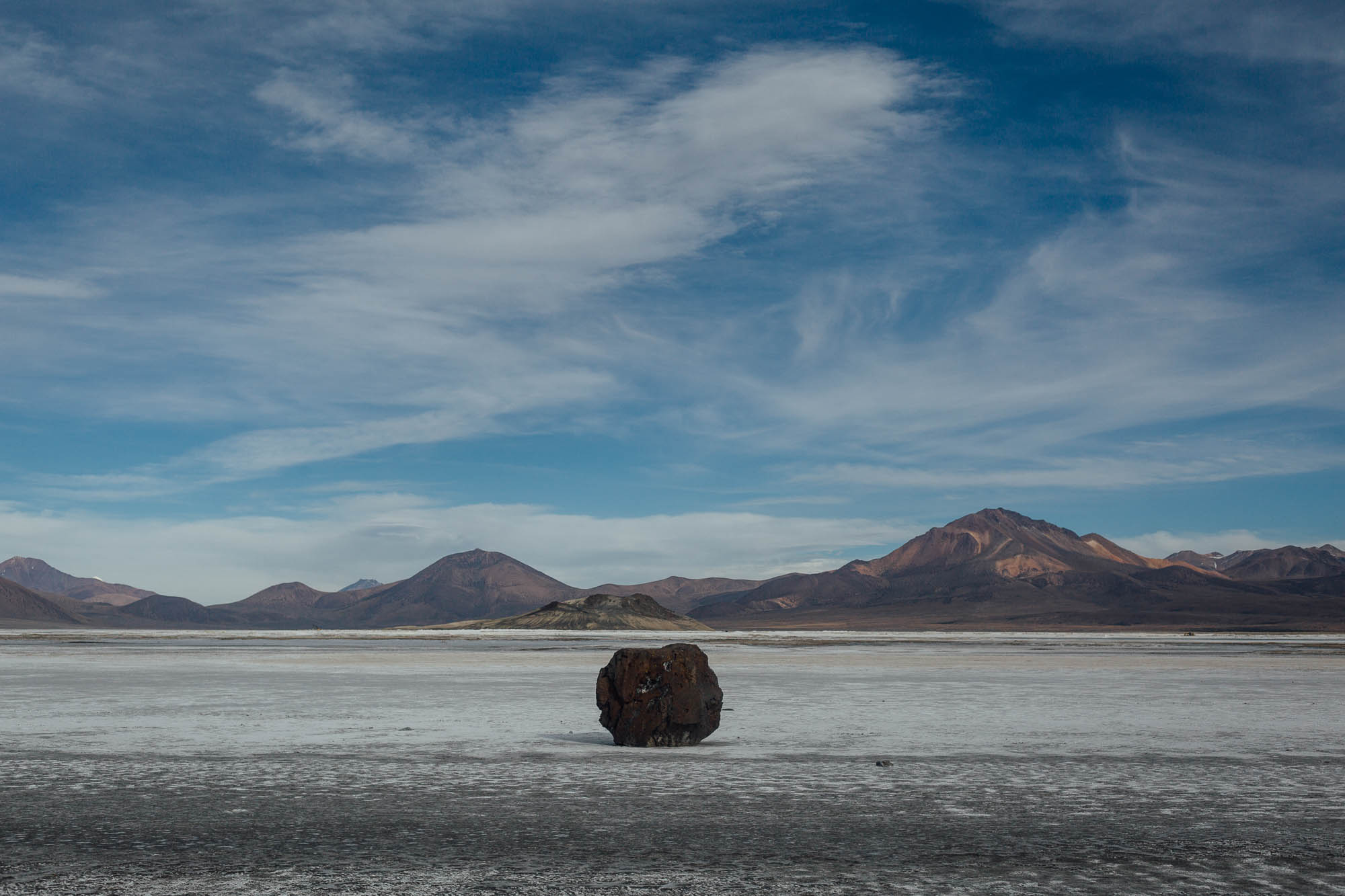
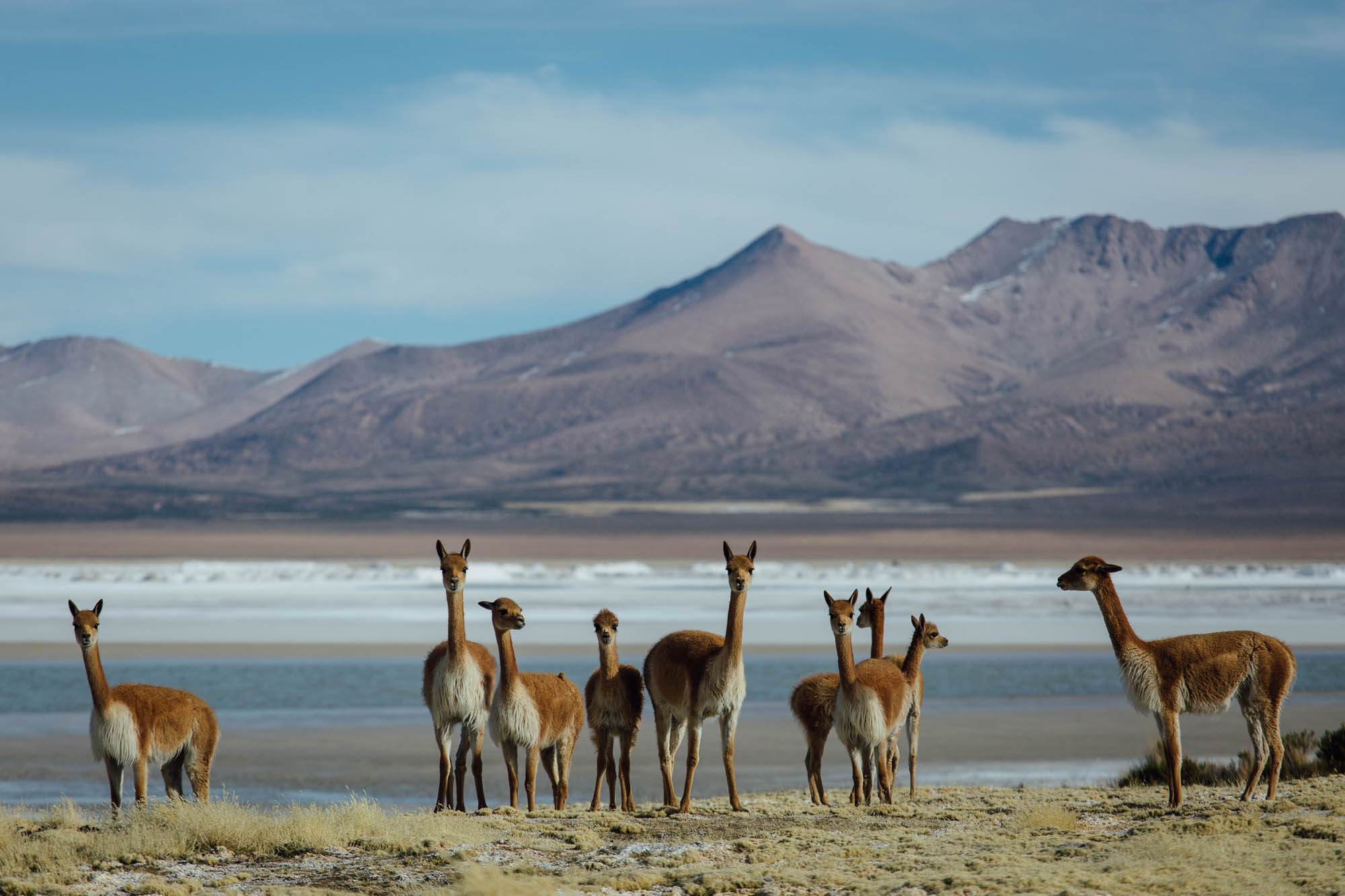
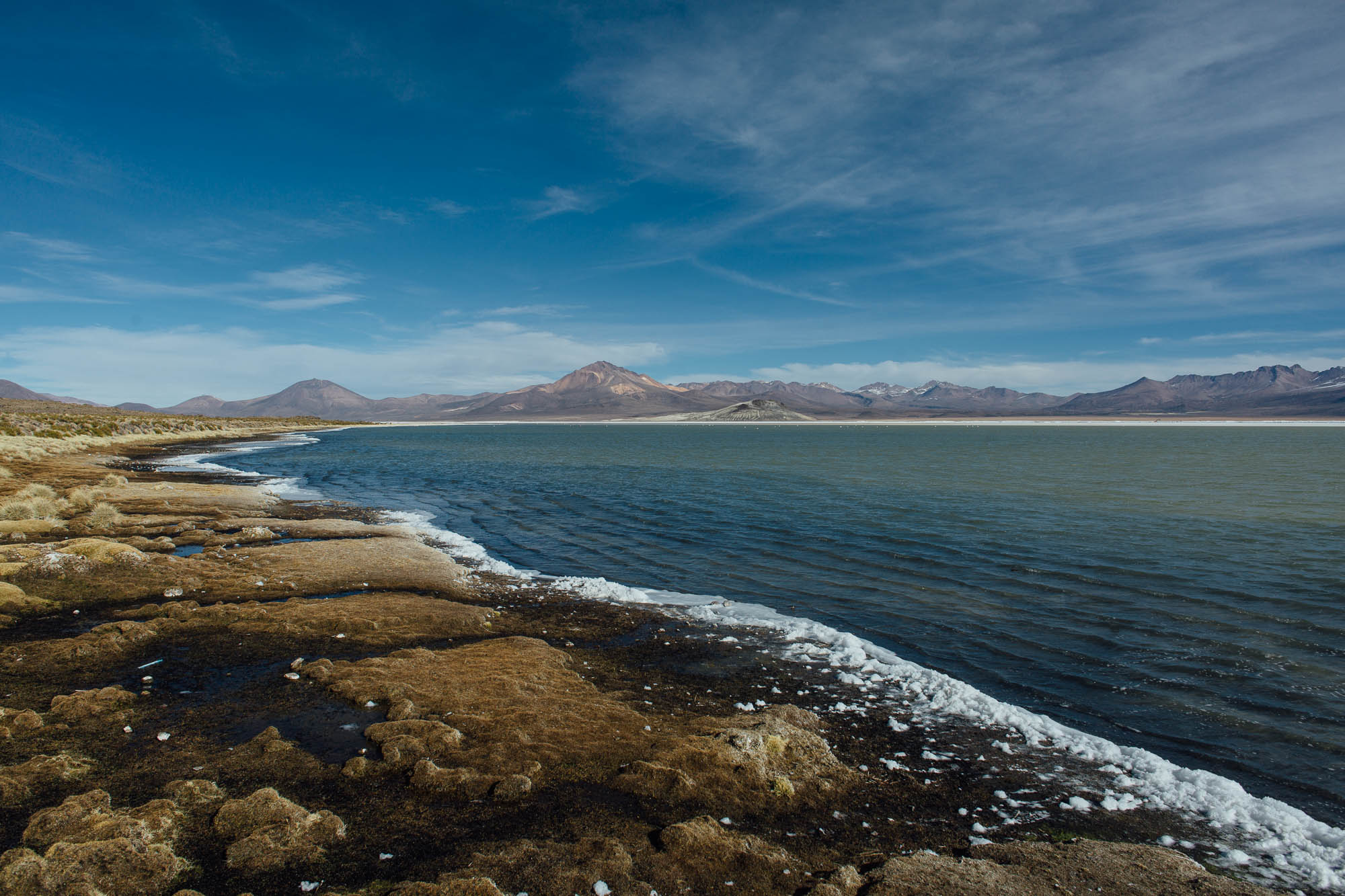
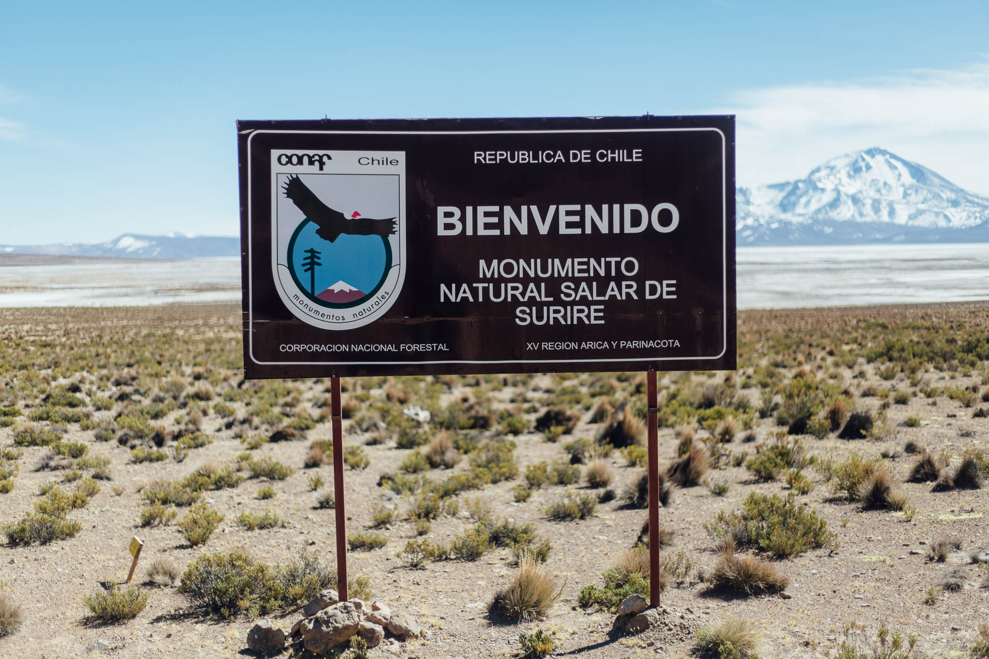
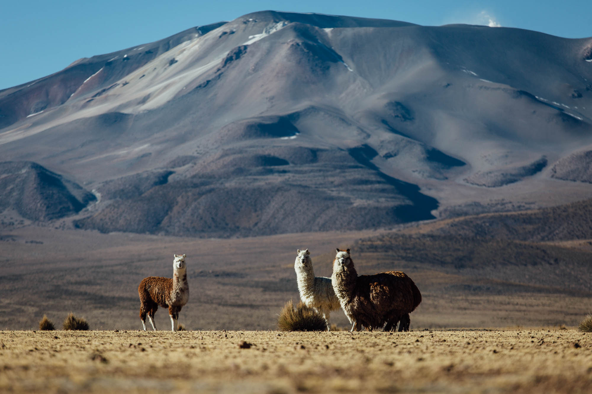
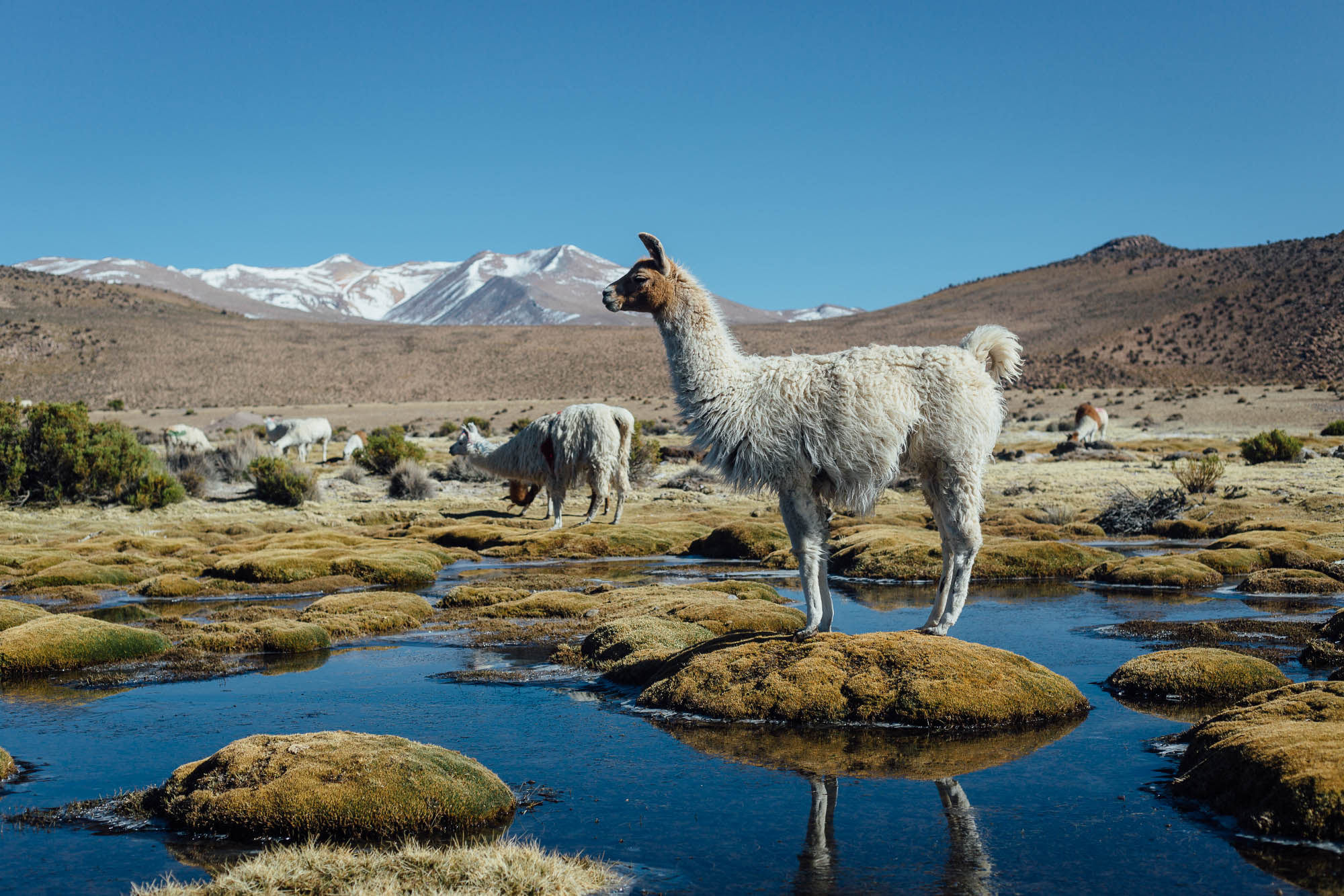
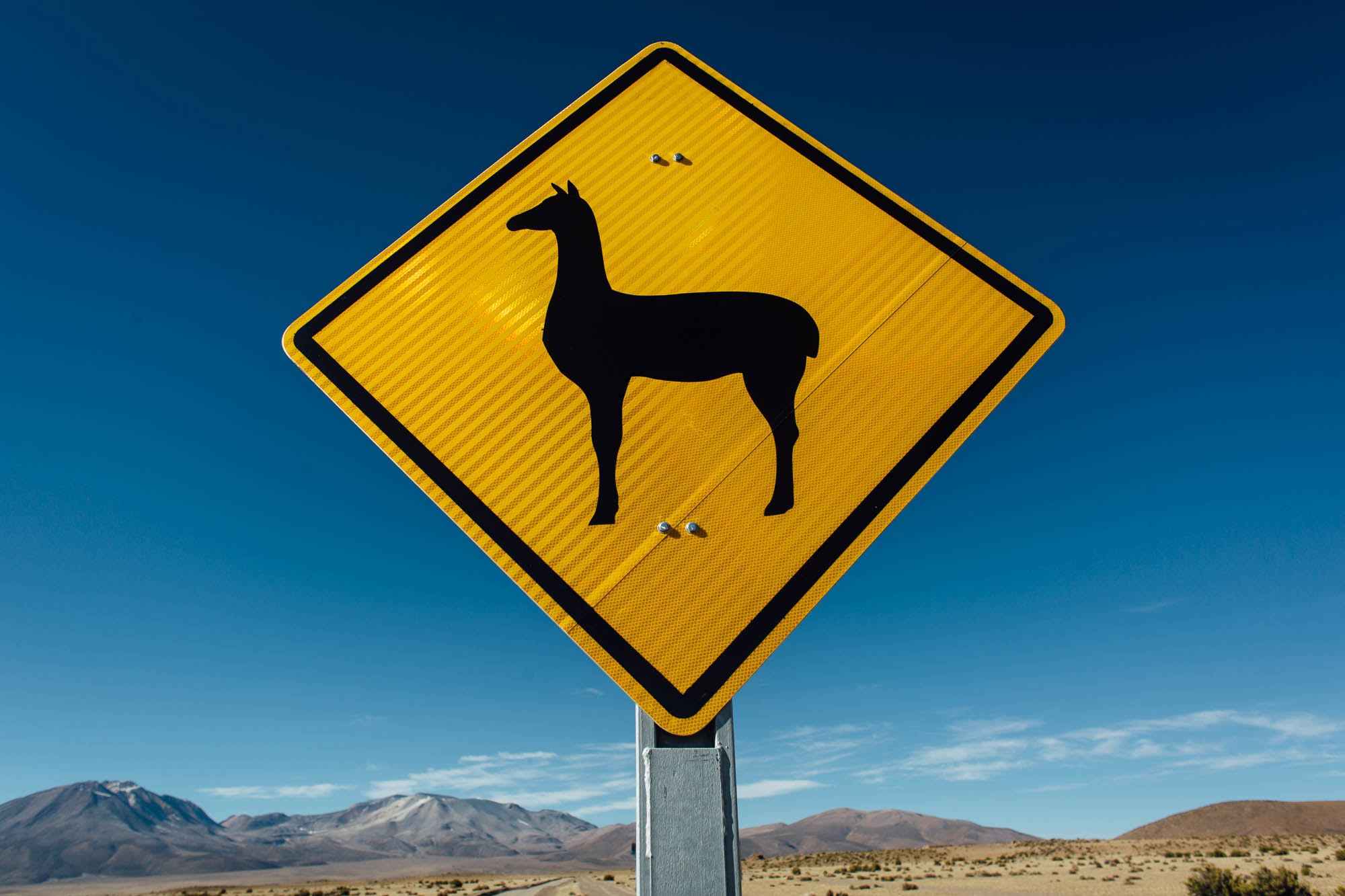
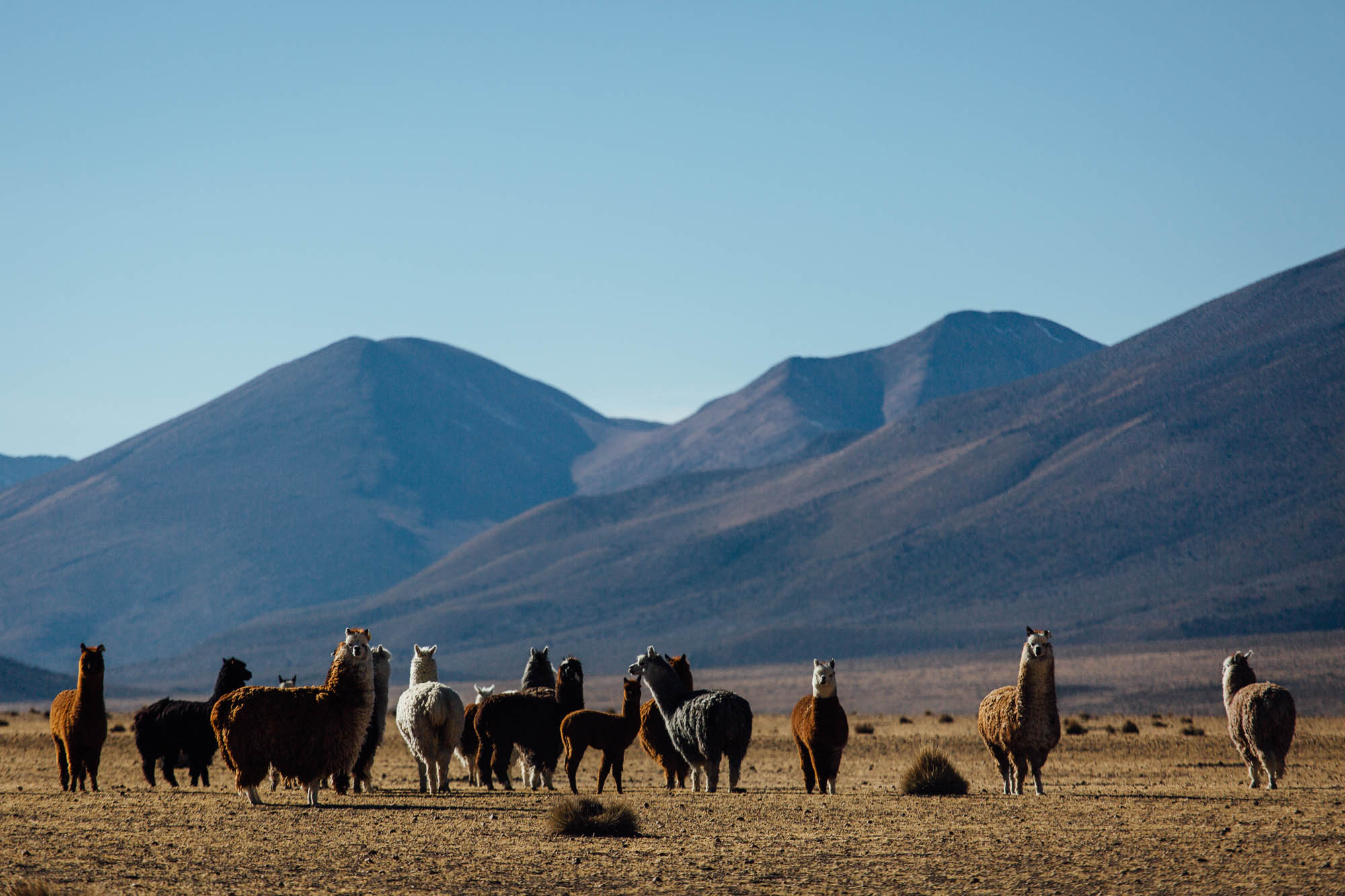
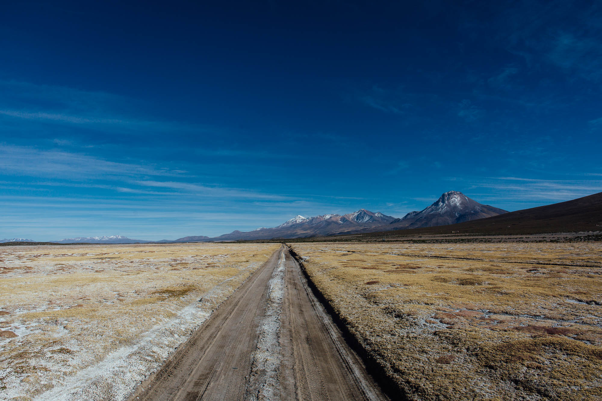
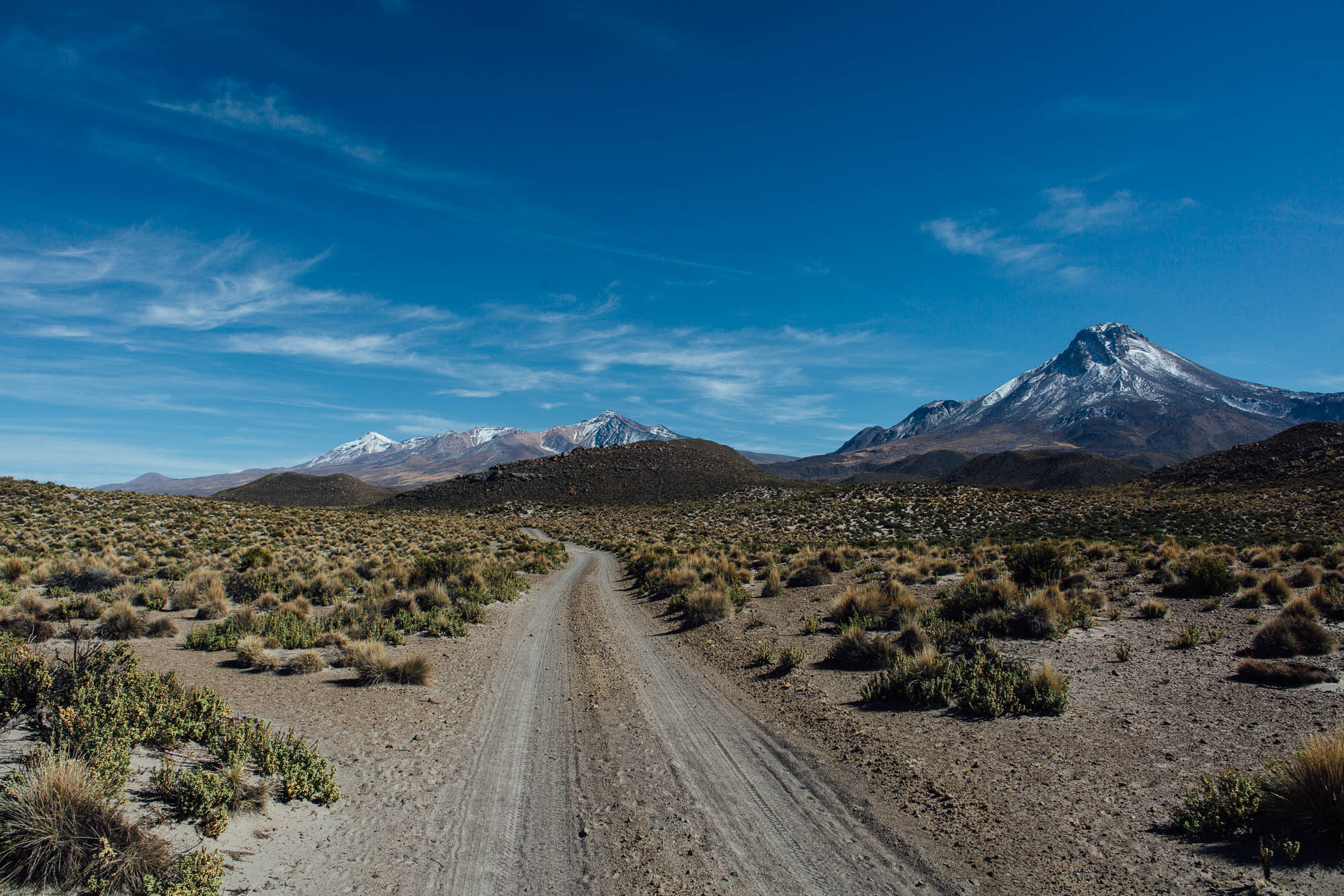
The Ruta de Las Vicuñas uses a series of unpaved roads to link three swathes of protected land – Lauca National Park, the Reserva Nacional Las Vicuñas, and Isluga National Park – via the atmospheric Salar de Surire salt lake. As such, the area is teeming with wildlife, from leggy pink flamingos, fleet-footed vicuñas (the wild relative of the llama), and ostrich-like birds called suri, generally to be seen bounding across the open pampa. Condors can often be spotted gliding across the high altitude skies, and if you keep your eyes peeled you may even catch sight of a puma, said to roam the salt flats around Surire.
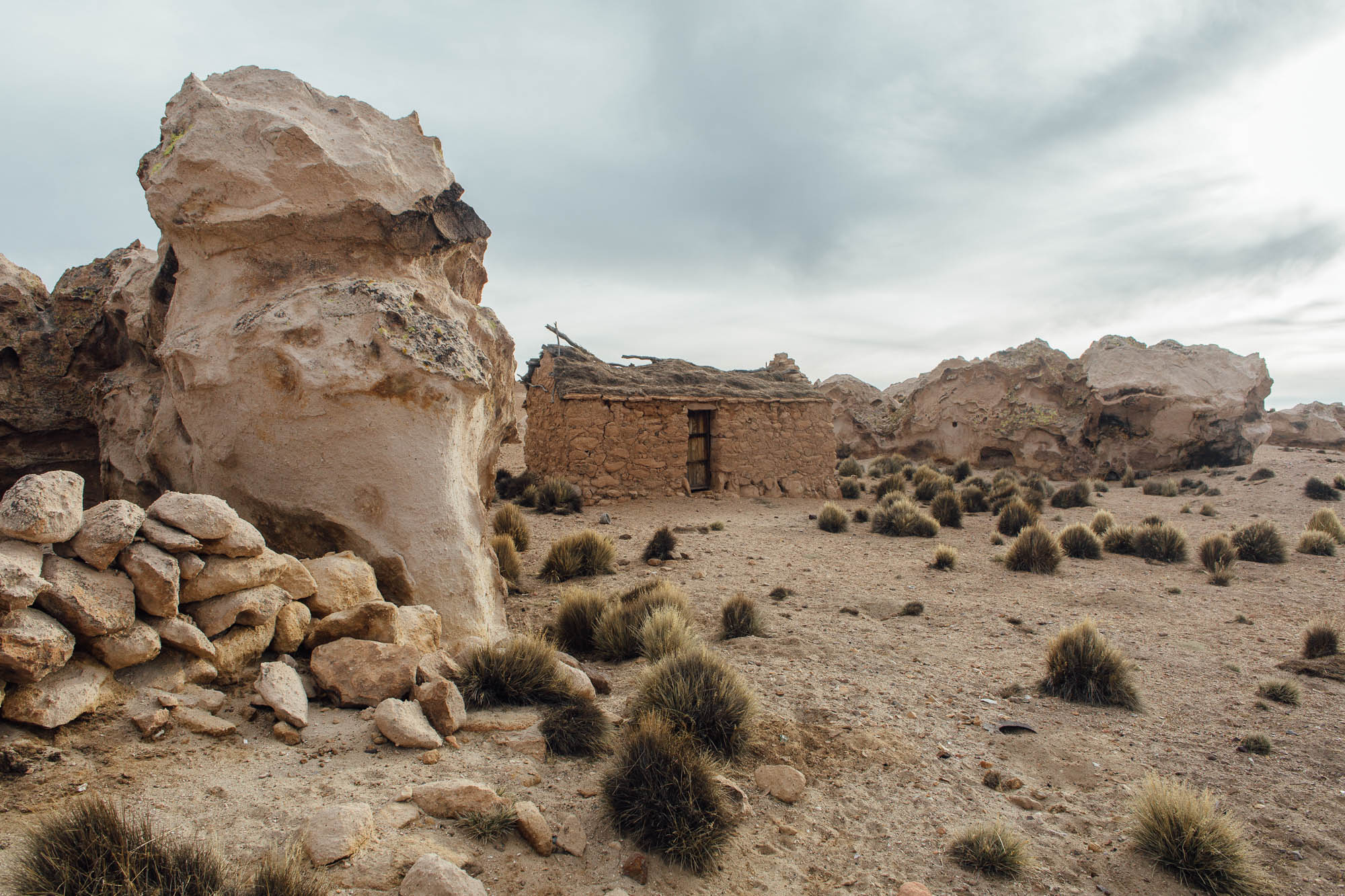
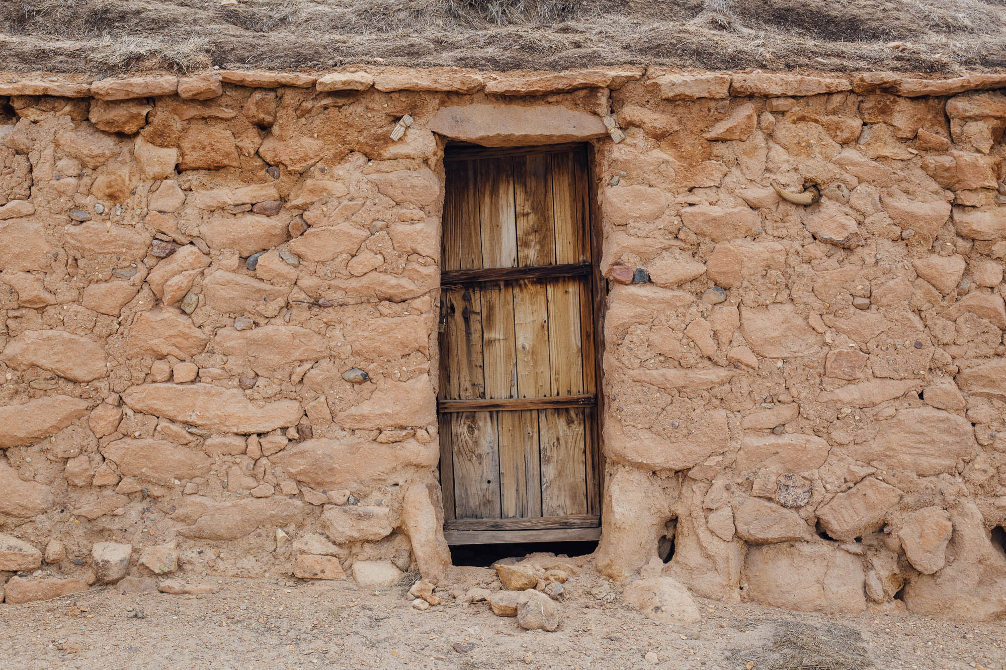
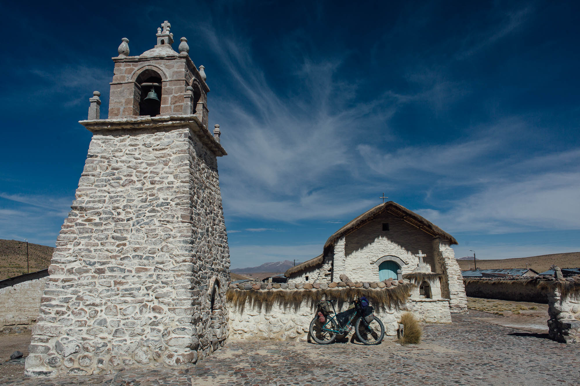
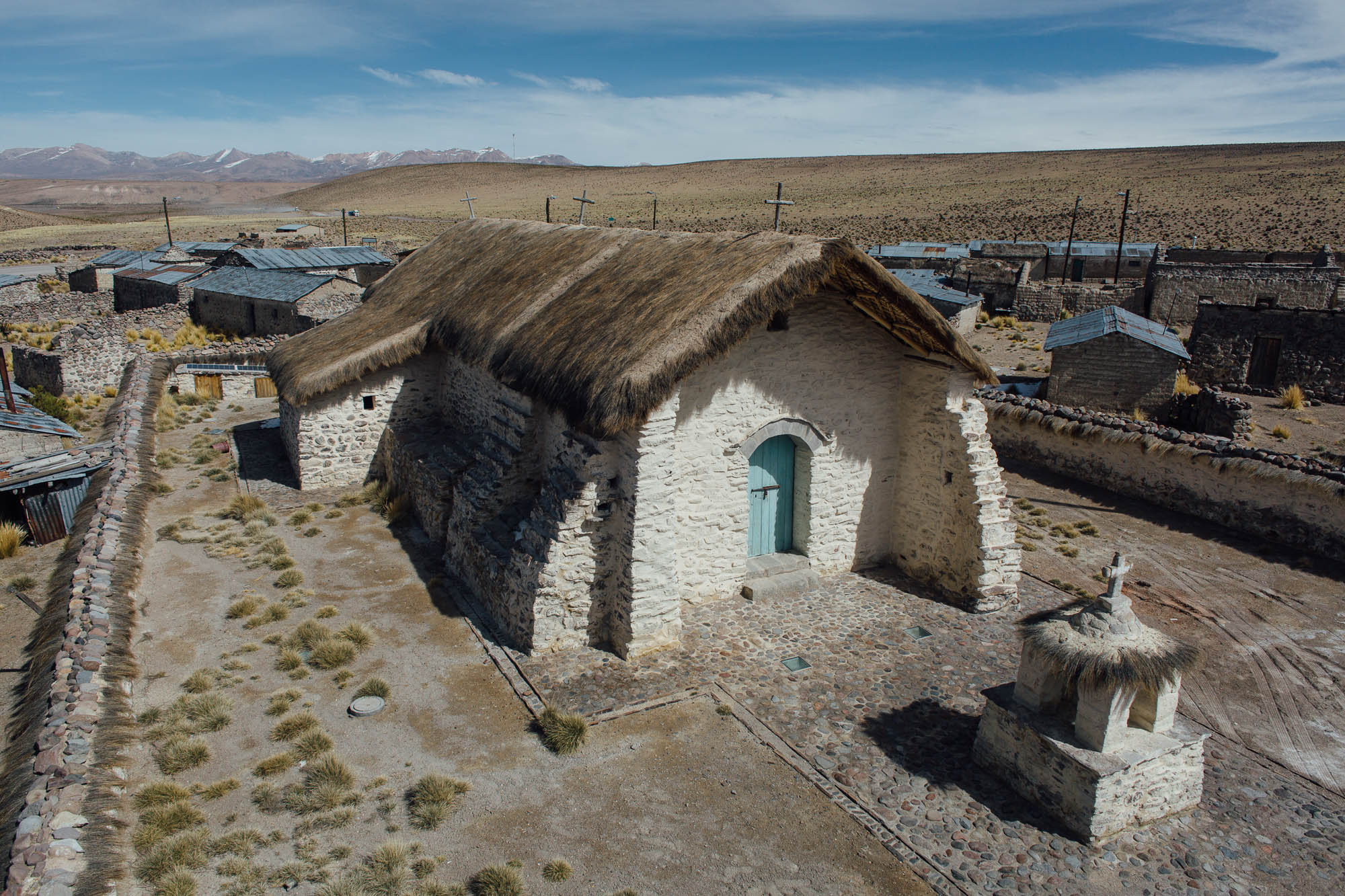
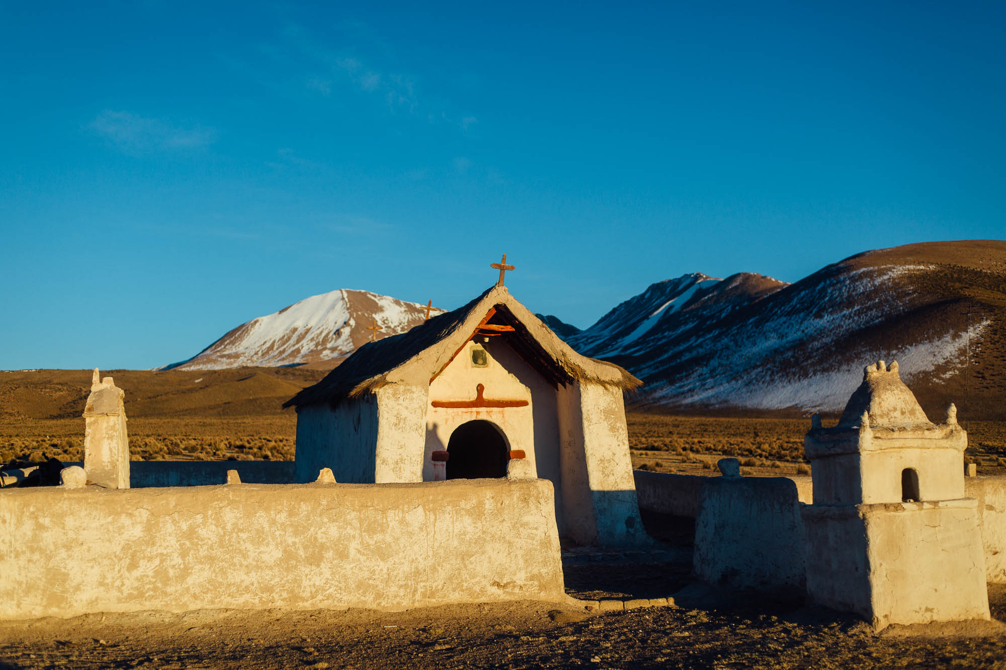
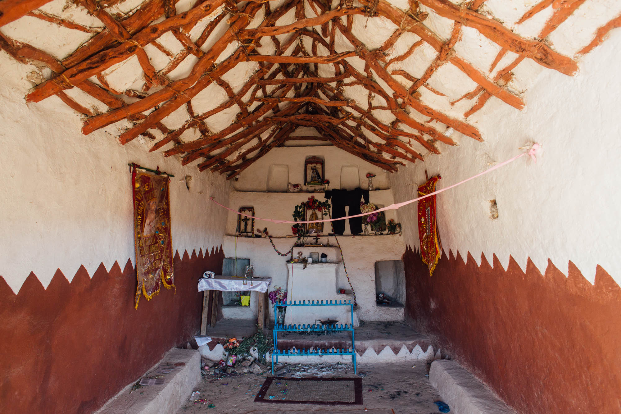
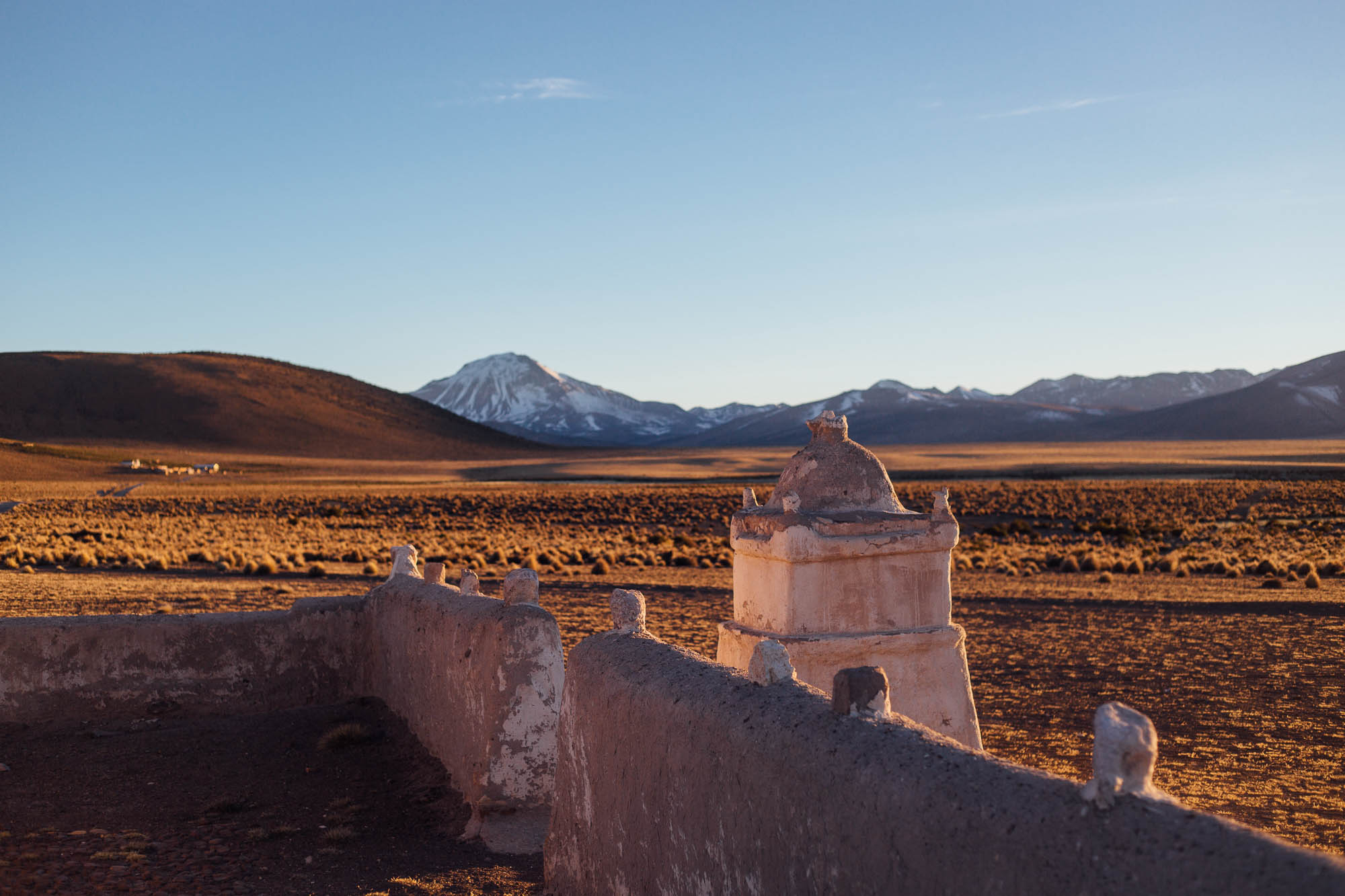
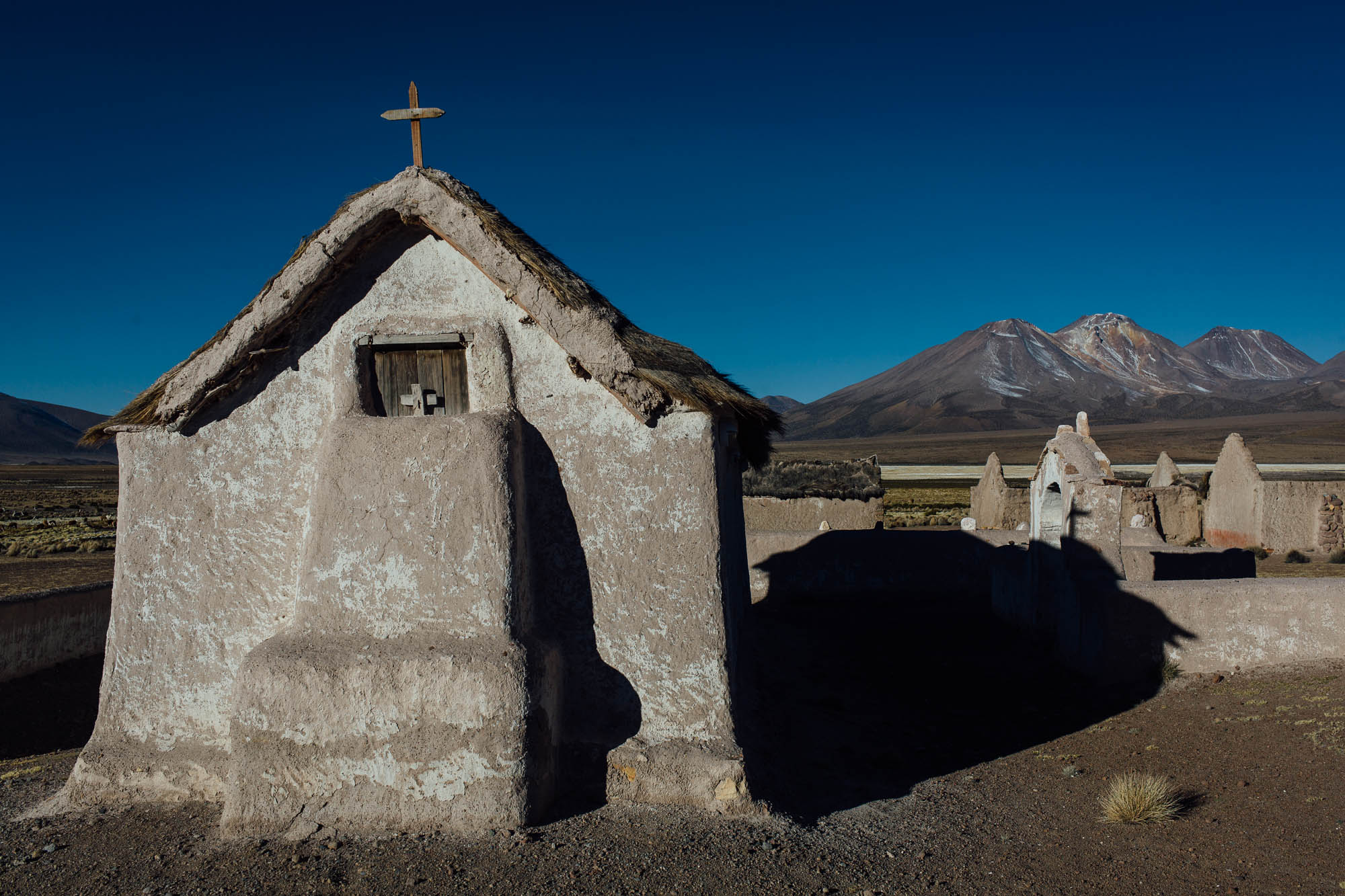
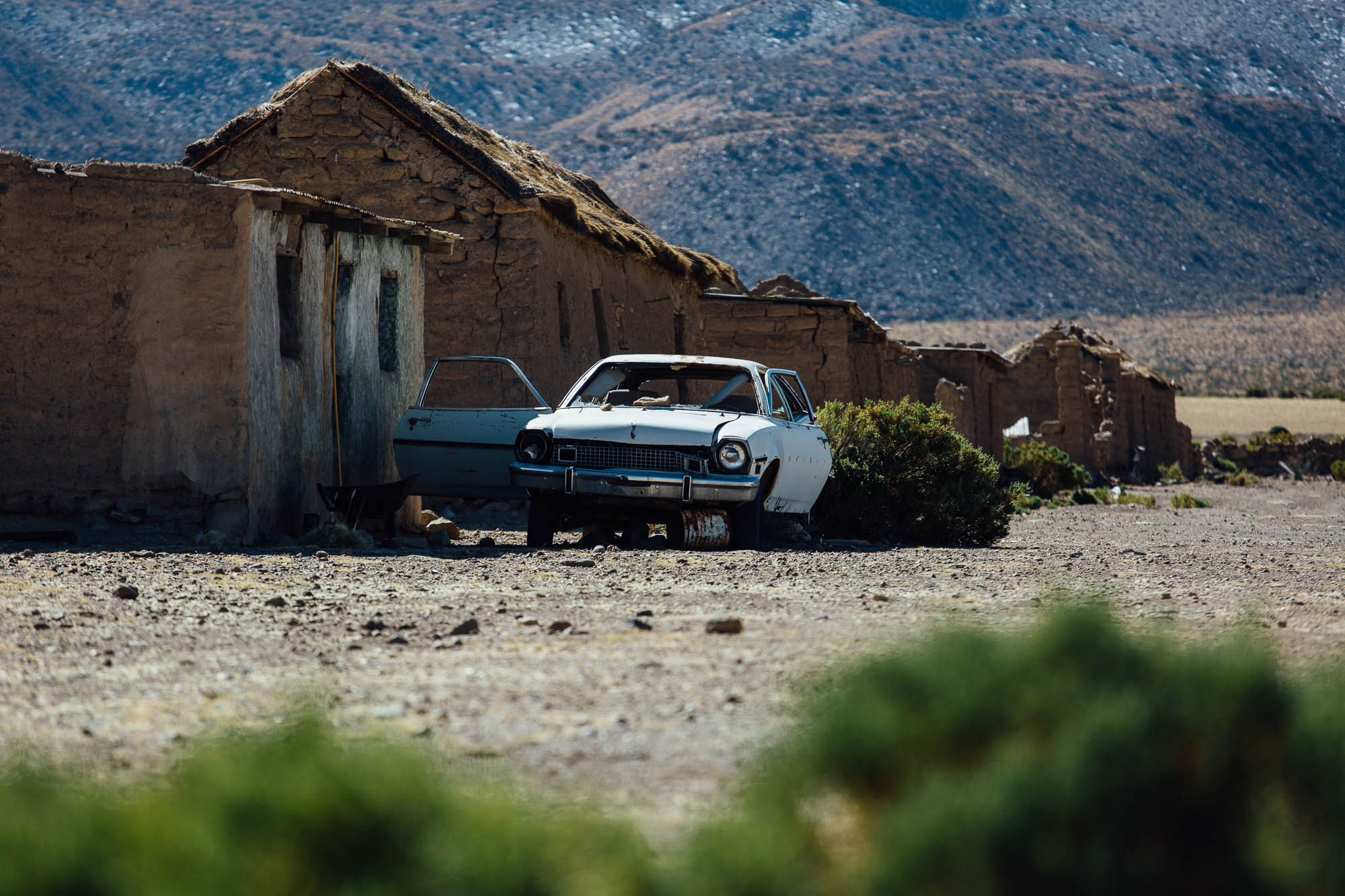
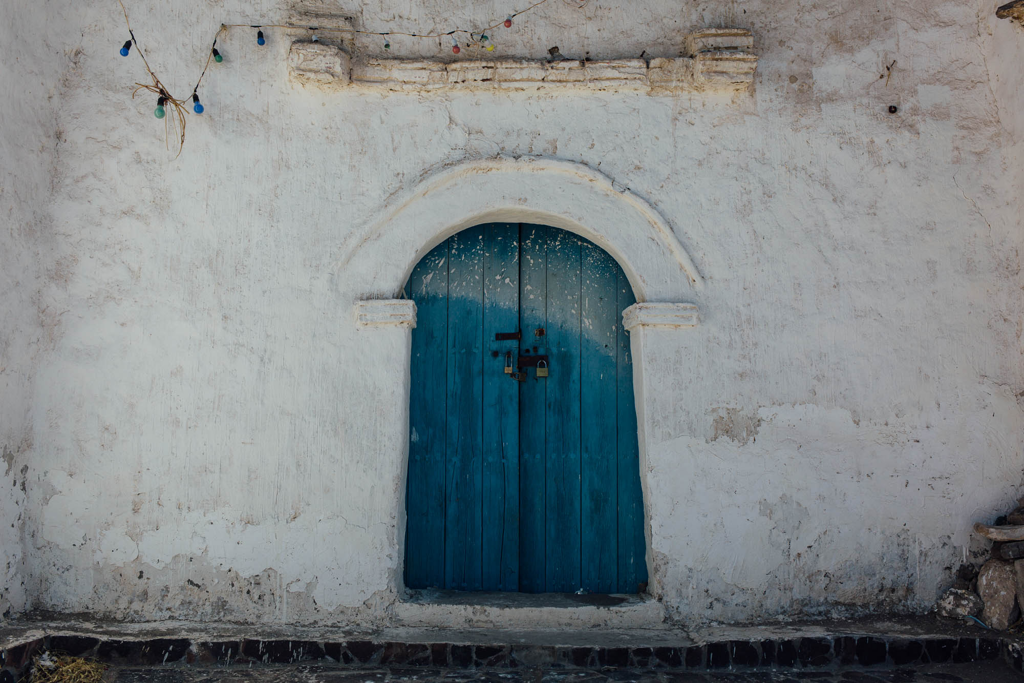
The ride also traces a portion of a historically important Jesuit mission route. Set on the open, windy pampa like bleached white beacons in the surrounding desolation, the churches themselves date back to the 18th century and connect Potosí in Bolivia to Arica, on the Chilean coast. Presiding over a series of now abandoned altiplano villages, these simple structures are surprisingly well maintained, ready to be pressed into service for occasional festivals and regional celebrations that blend earth-based Aymara traditions with Catholic ones. For the most part, their rooves are thatch and within, simple stencils adorn the walls. Each is different from the next; the one in Guallatire even has a working bell tower, which – if you can contort your body into its impossibly narrow stairwell – offers fine views of the surrounding plains. Off route, the church in Parinacota was originally established in the 17th century, and is said to be the oldest in Chile.
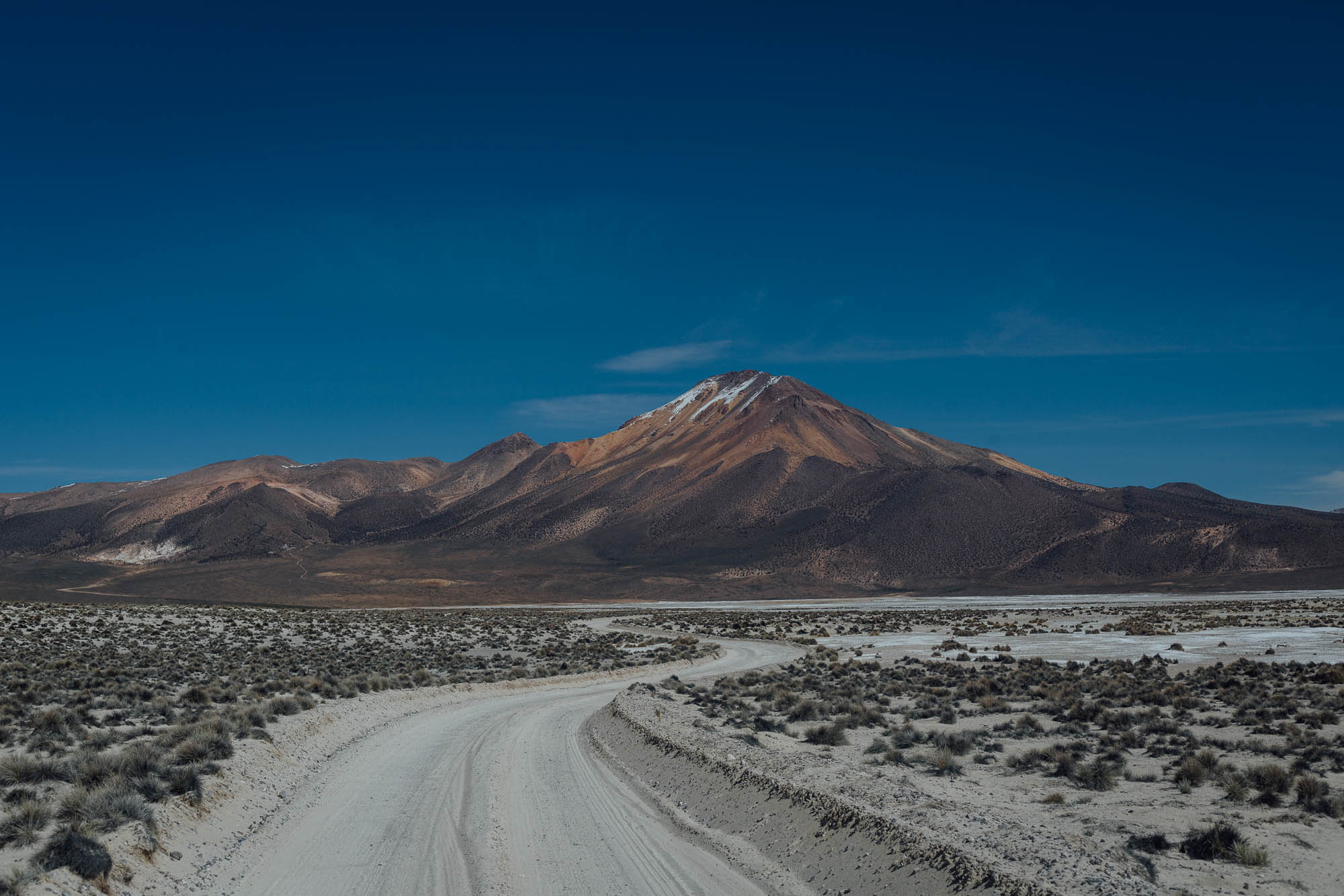
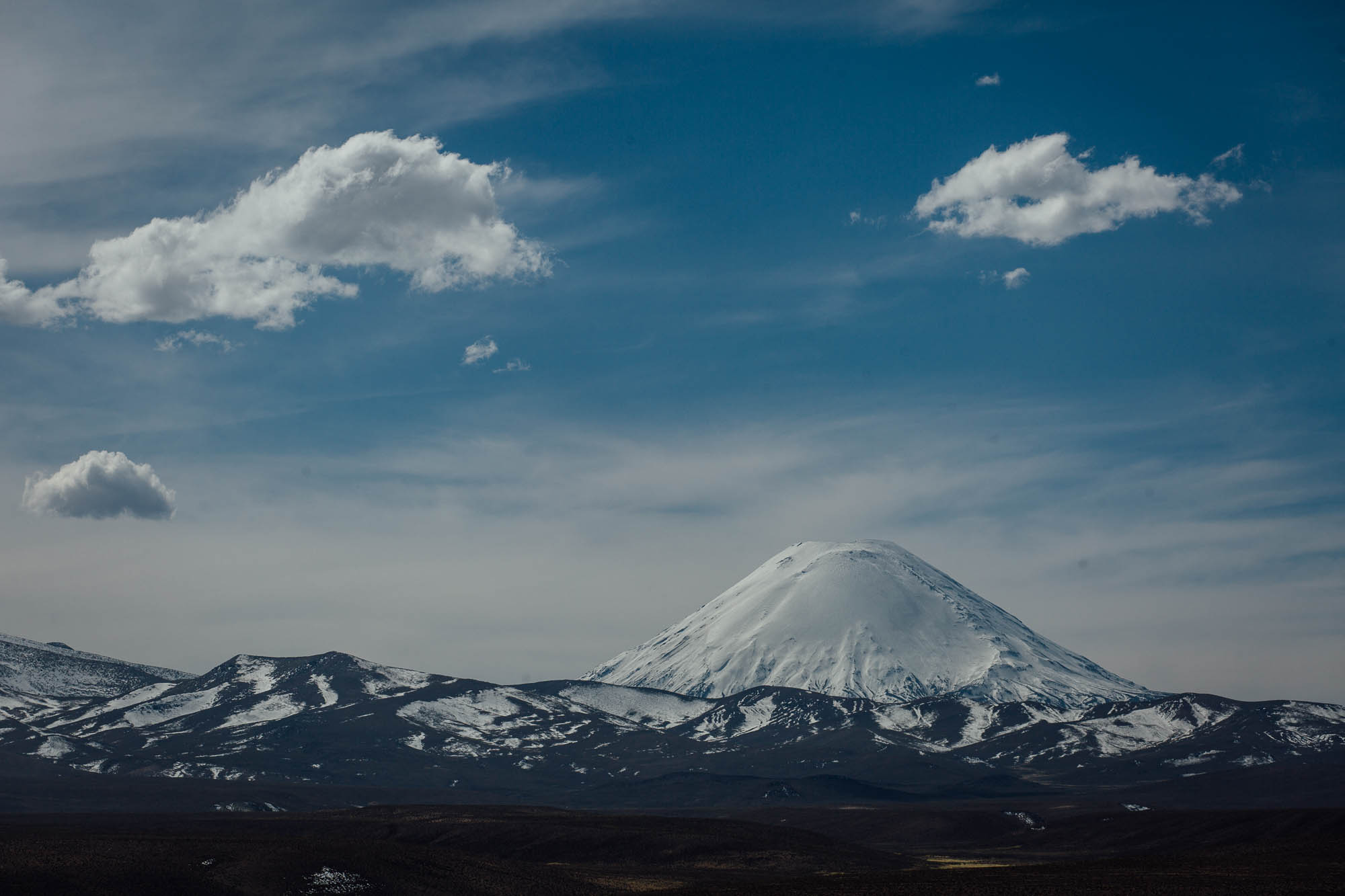
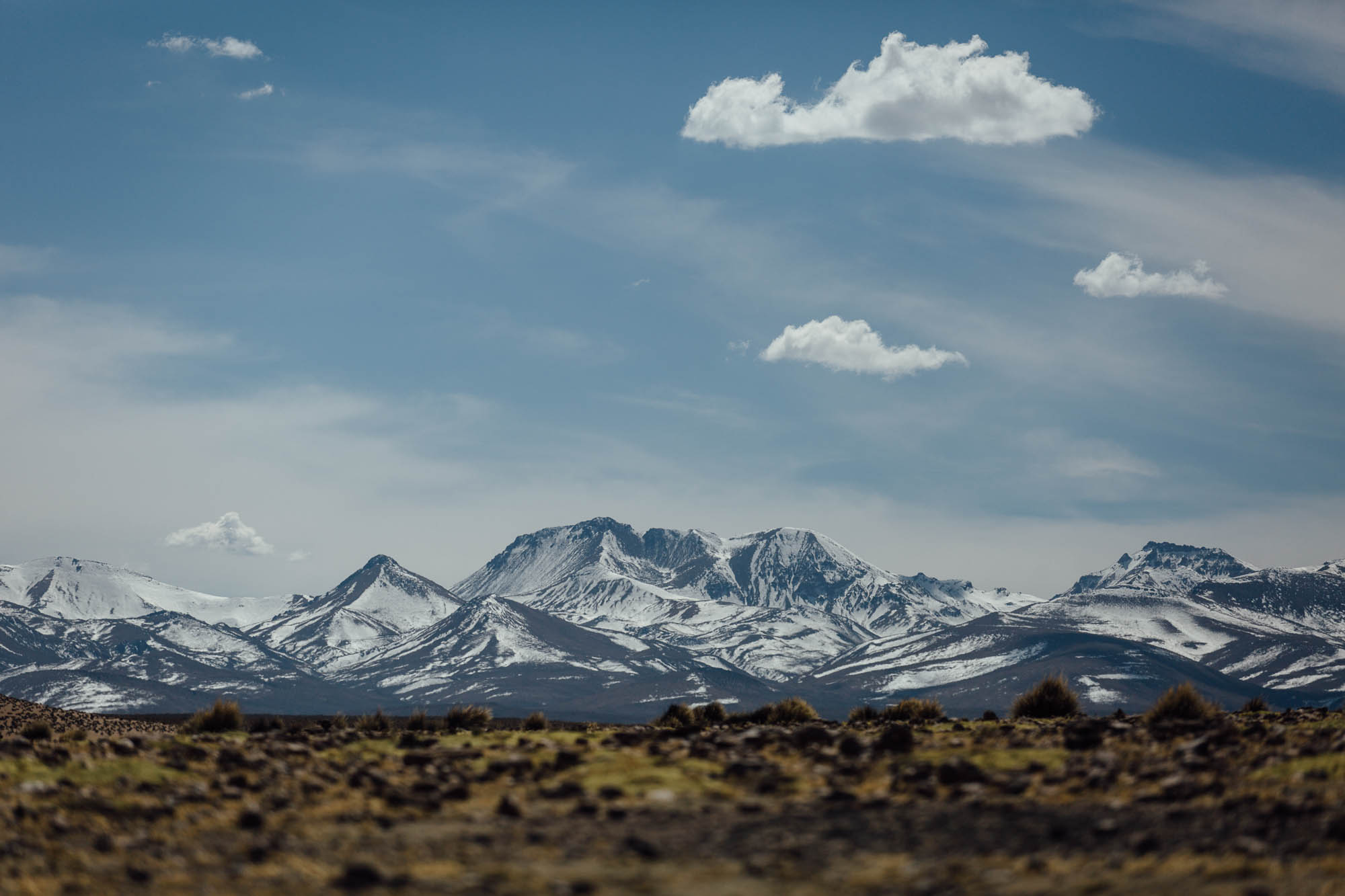
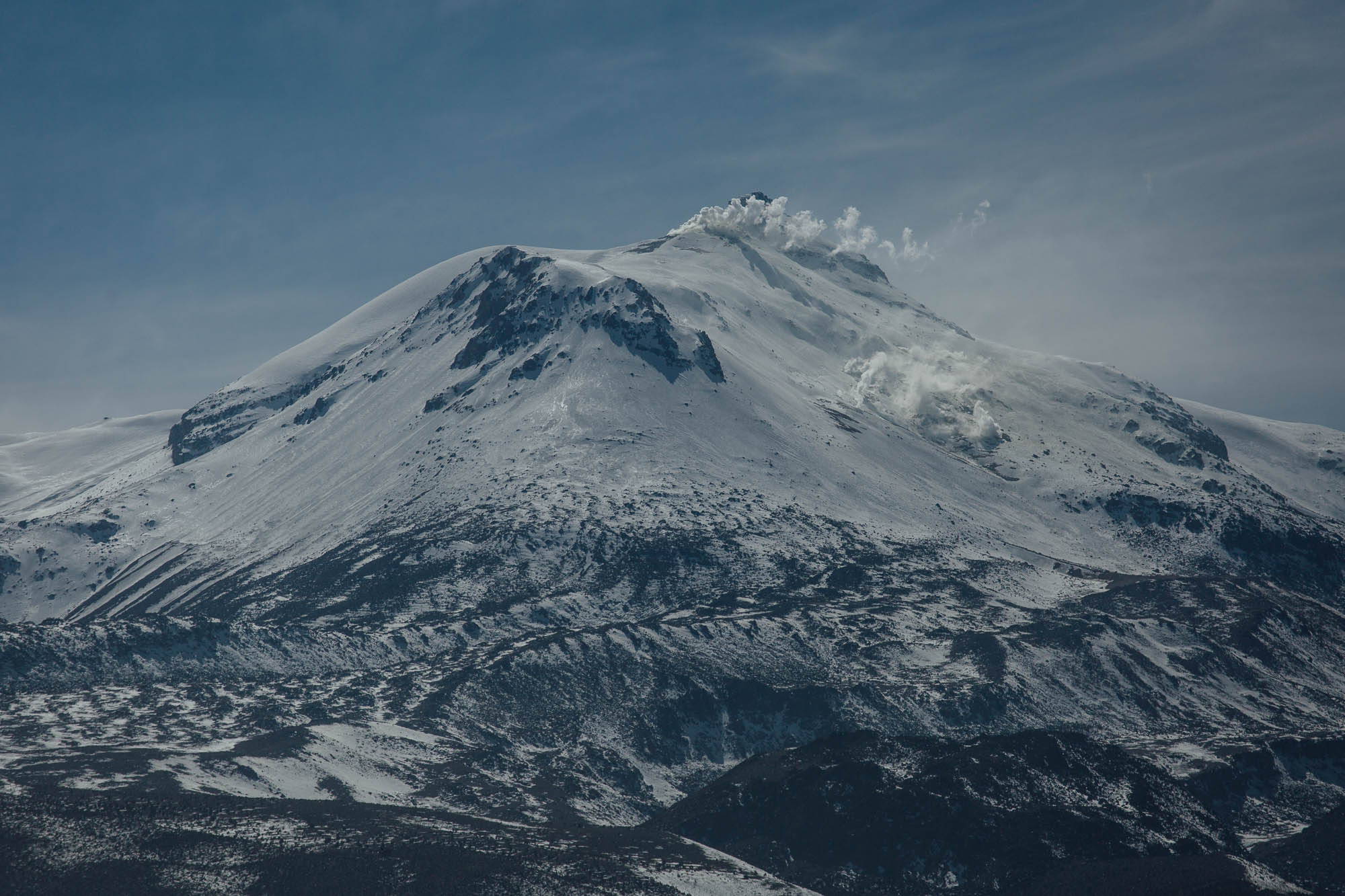
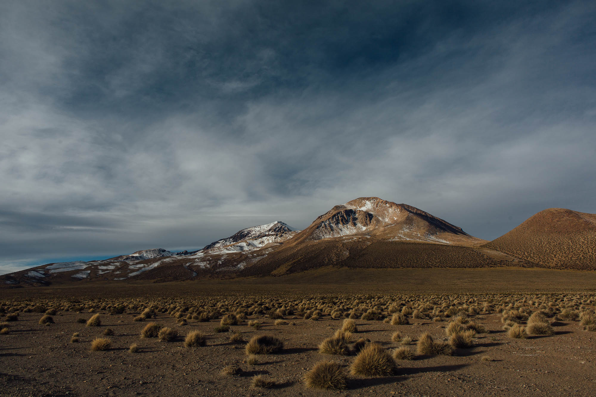
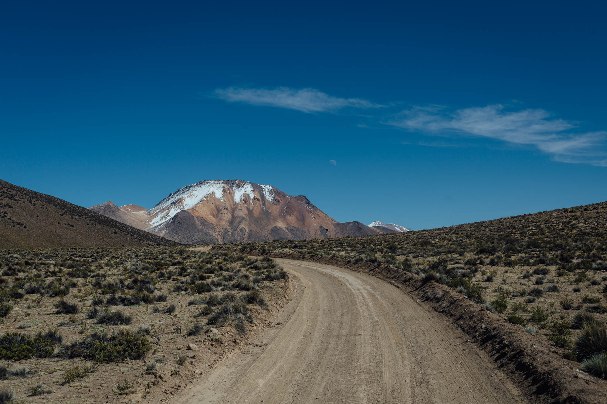
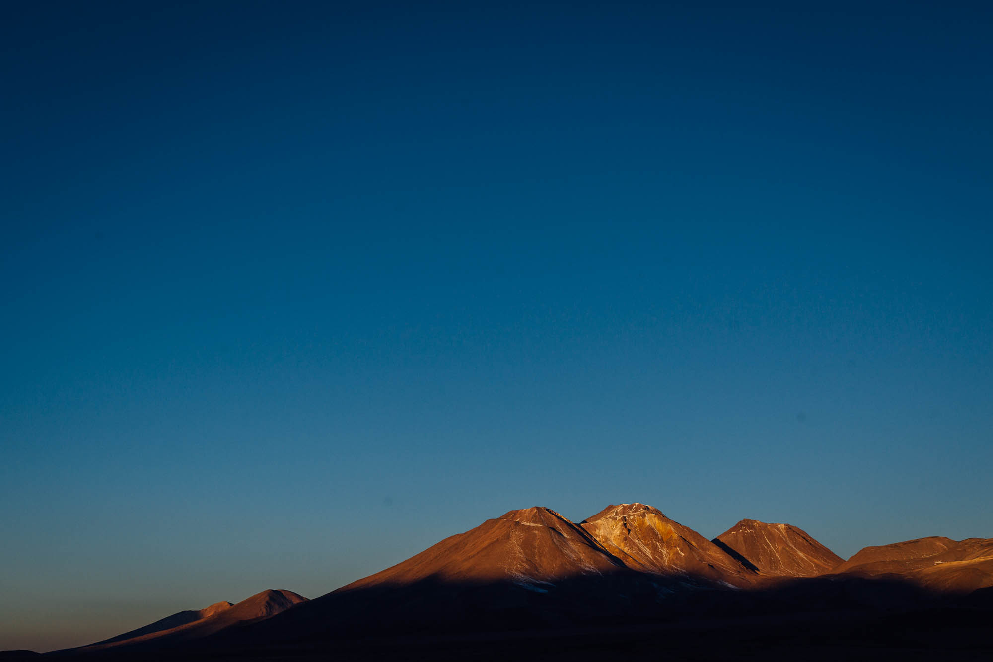
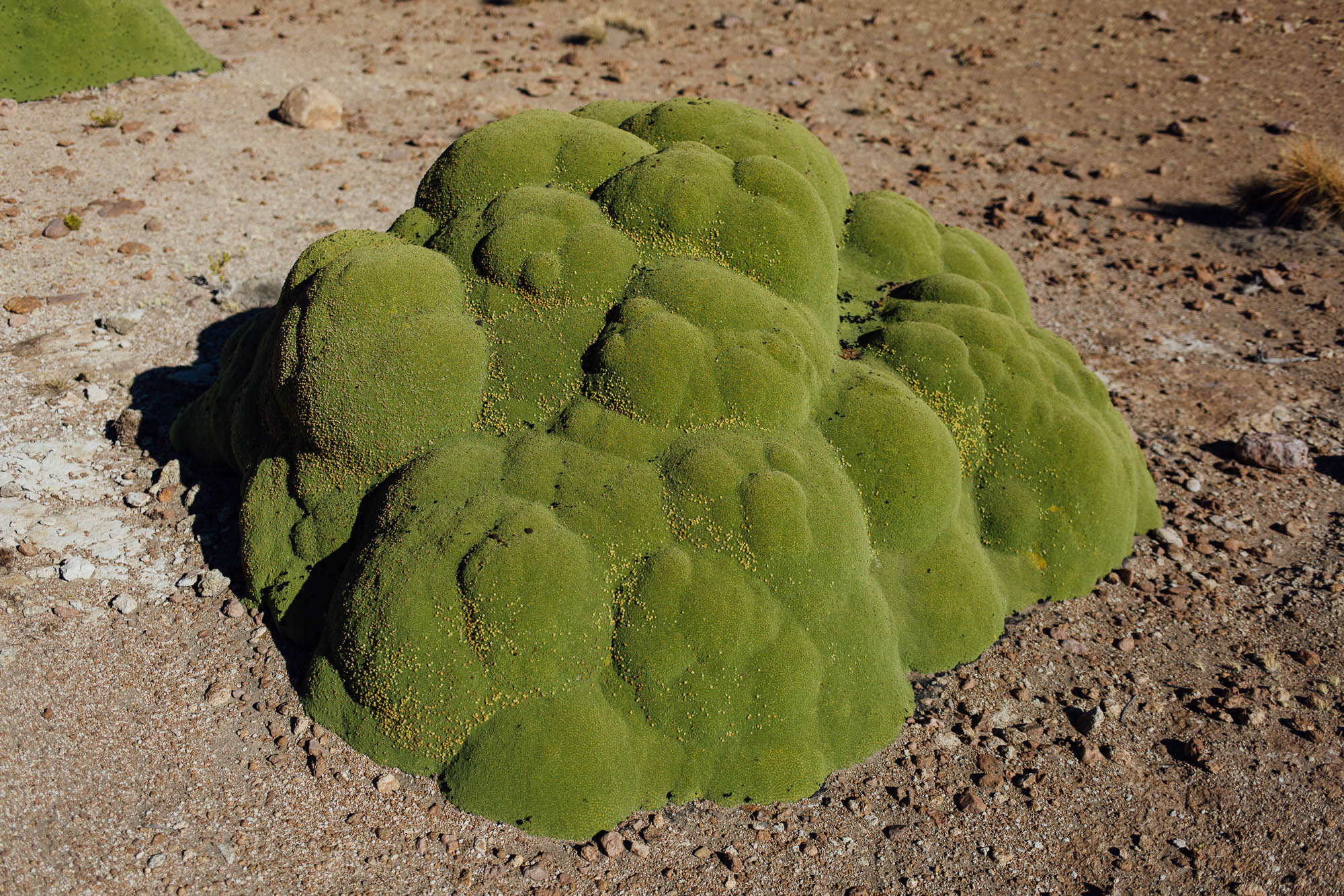
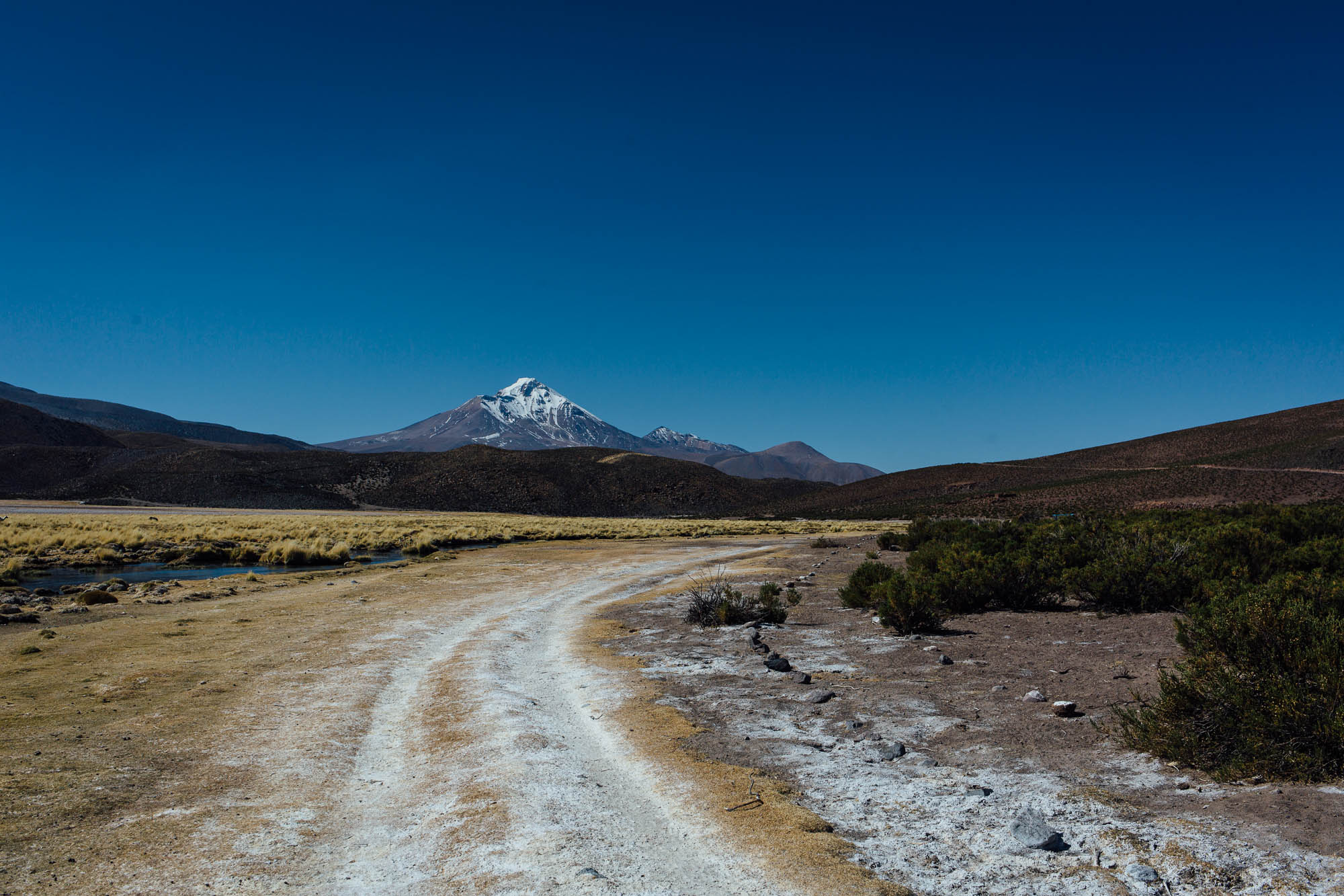
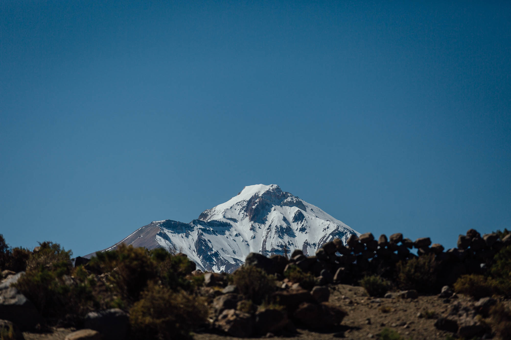
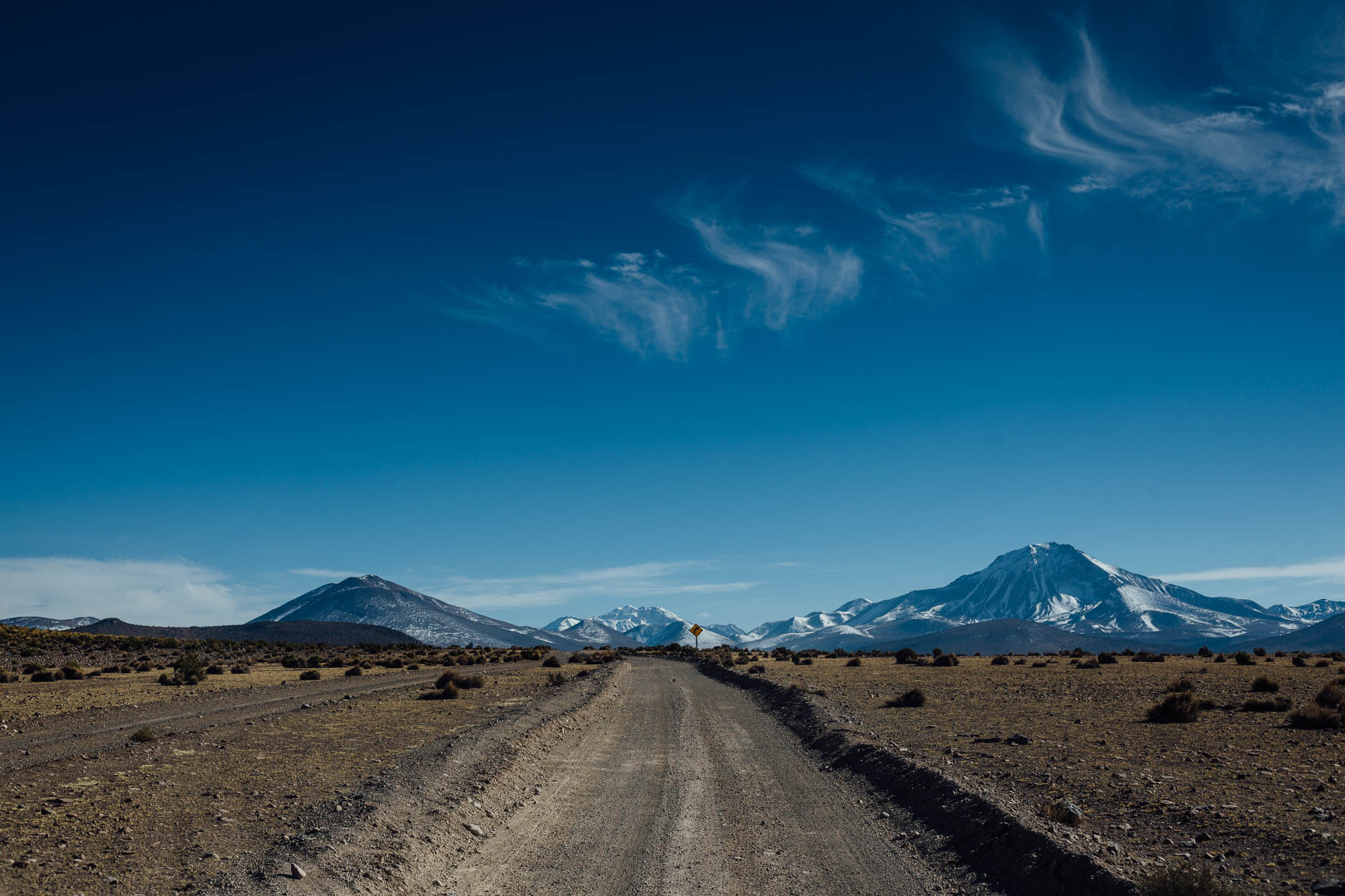
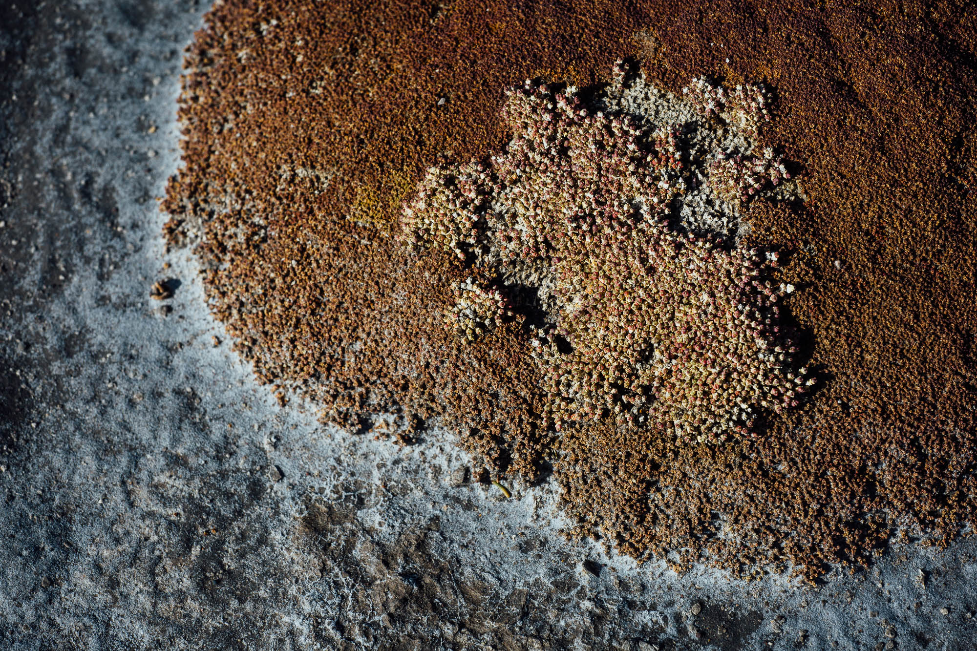
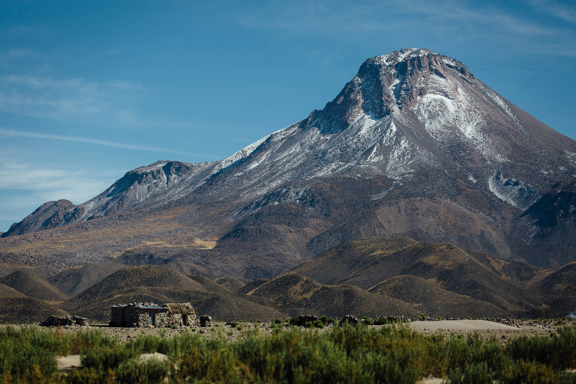
Towering high on the skyline, the region also boasts a corridor of impressive volcanos, including the often smouldering Volcán Guallatire. Being so close to the border, riders can even steal majestic views of Volcán Sajama in neighbouring Bolivia (which at 6542m is the country’s highest peak). Being a volcanic region, there are also a number of hot springs along the way, most of which you’ll likely have to yourselves, given how few tourists visit this area (compared to the likes of the nearby Atacama desert). And if that’s not enough for your bikepacking enjoyment, remarkable flora abounds too, including a prevalence of Llareta (Azorella compacta), a bizarre, neon-green, flowering plant that grows in bulbous mounds at up to 5200m (17,000ft) in elevation. At 3,000 years old, it’s considered one of the world’s most ancient plants.
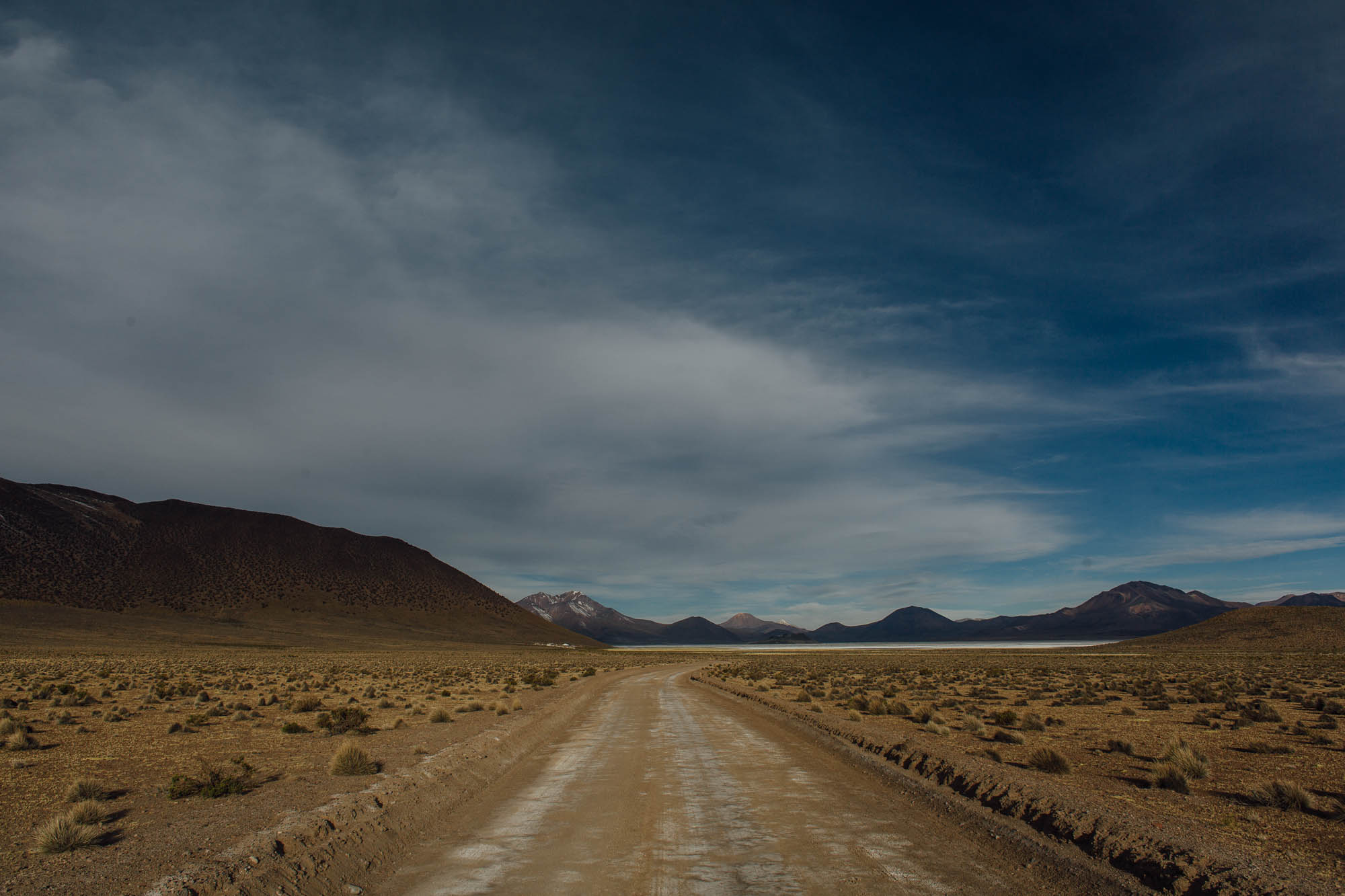
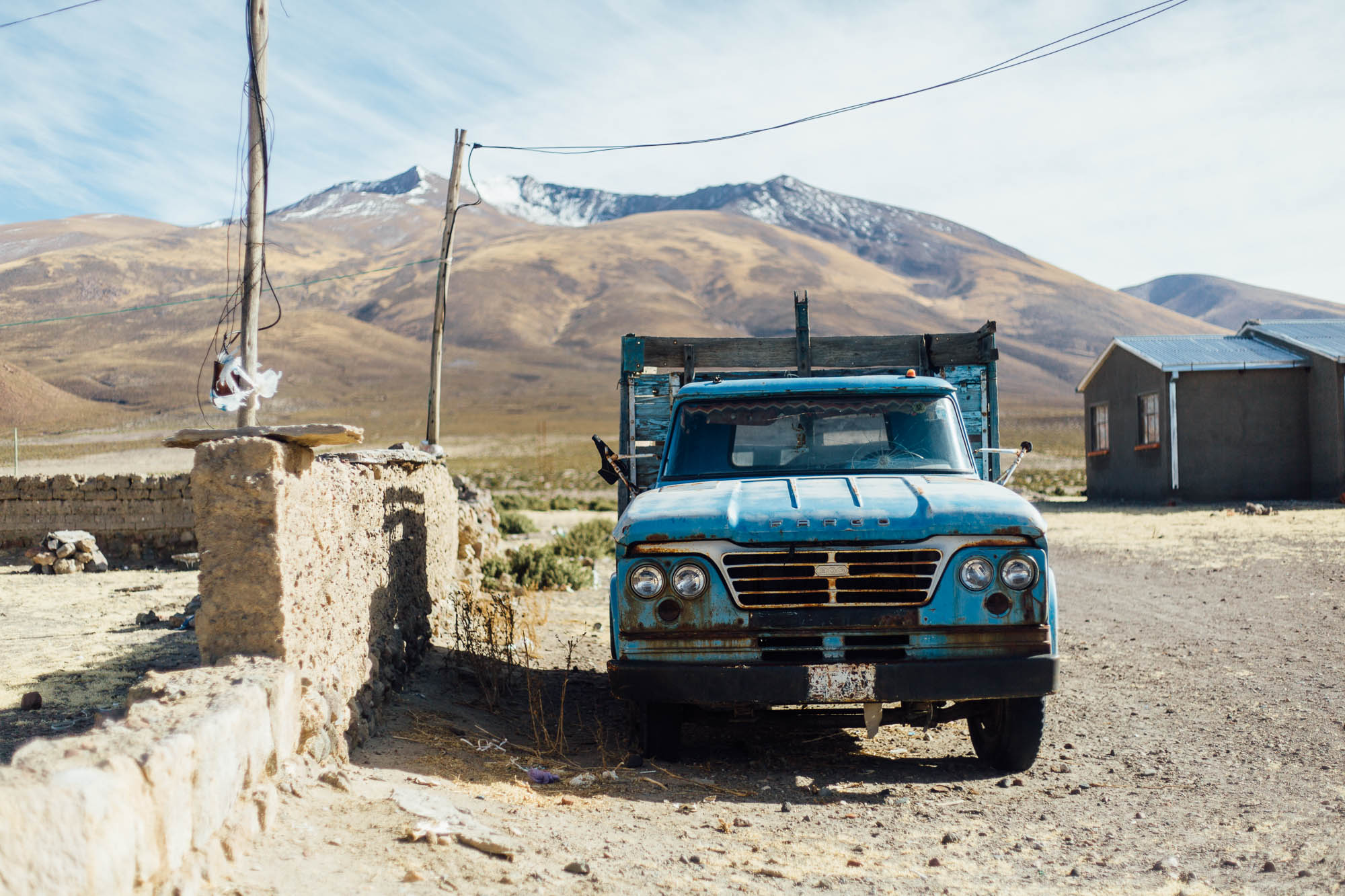
One blight to an otherwise remote and vehicle-free ride is the existence of a Borax mine on the shores of the Salar de Surire. The suggested route uses a smaller parallel backroad to avoid much of the main drag along which mining trucks rumble past, but there are still some sections where, during the week, traffic risks being heavy at certain times during the day. Drivers are inevitably courteous but can’t help but cover cyclists in dust as they pass by.
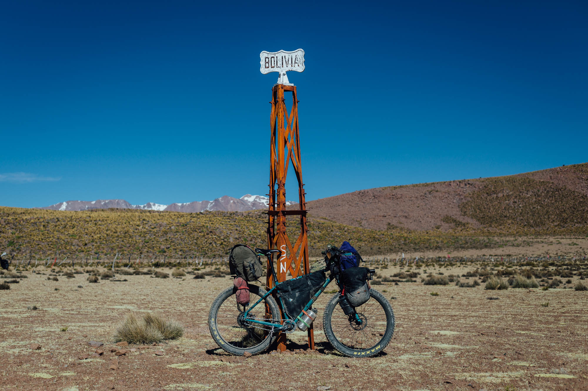
This route has lots of potential for extending into neighbouring Bolivia, and can be easily linked with the classic crossing of the Coipasa and Uyuni salt flats. See ‘Trail Notes’ for ideas.
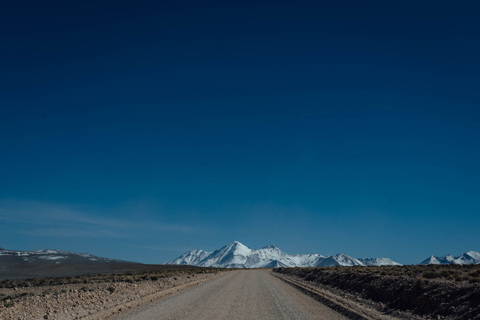
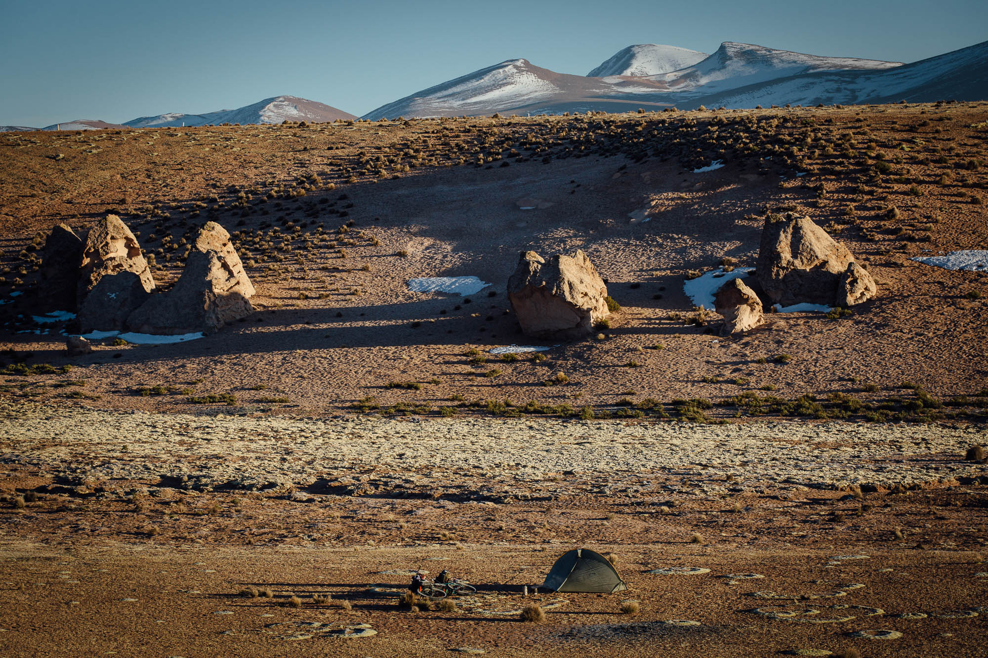
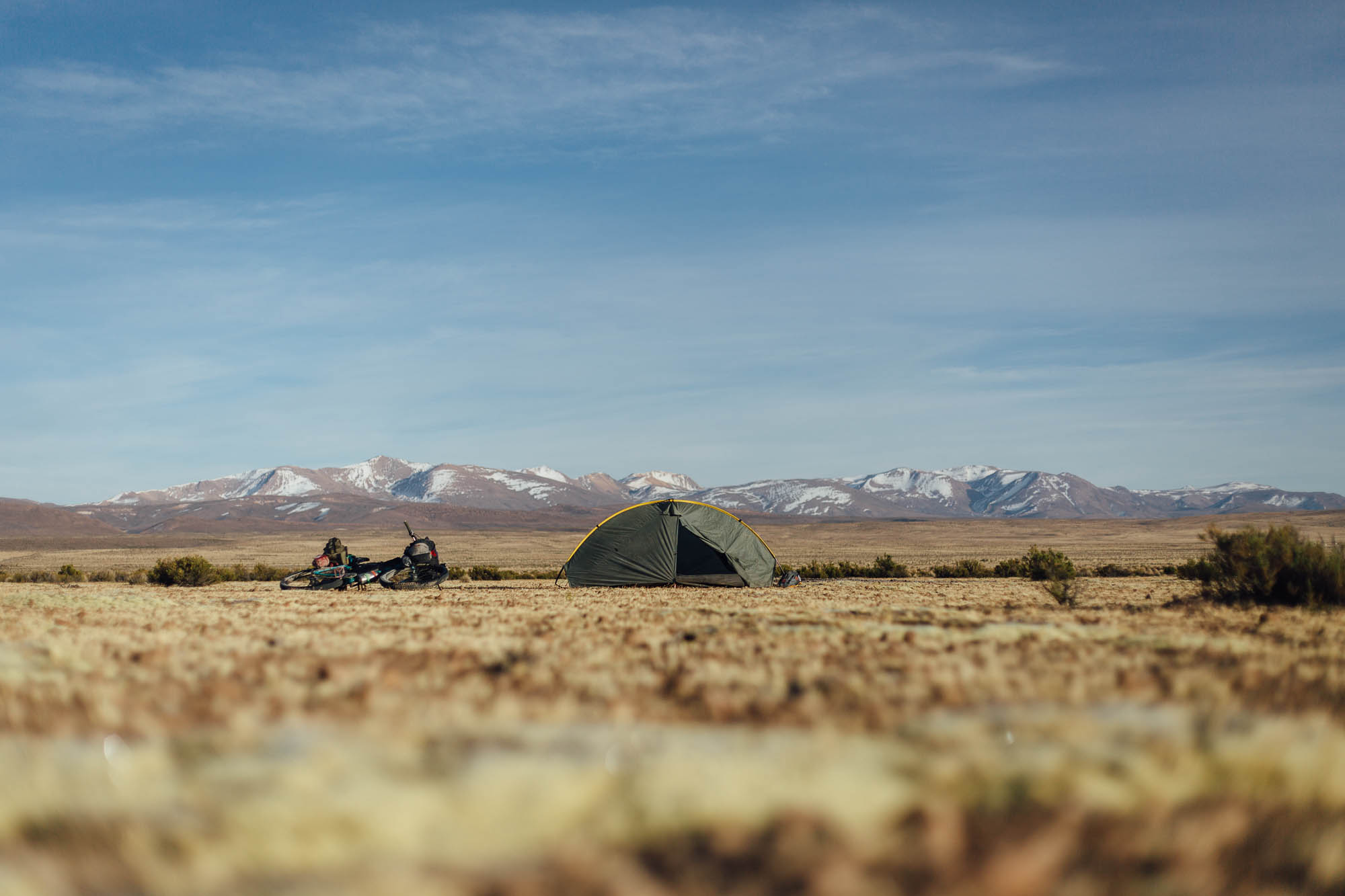
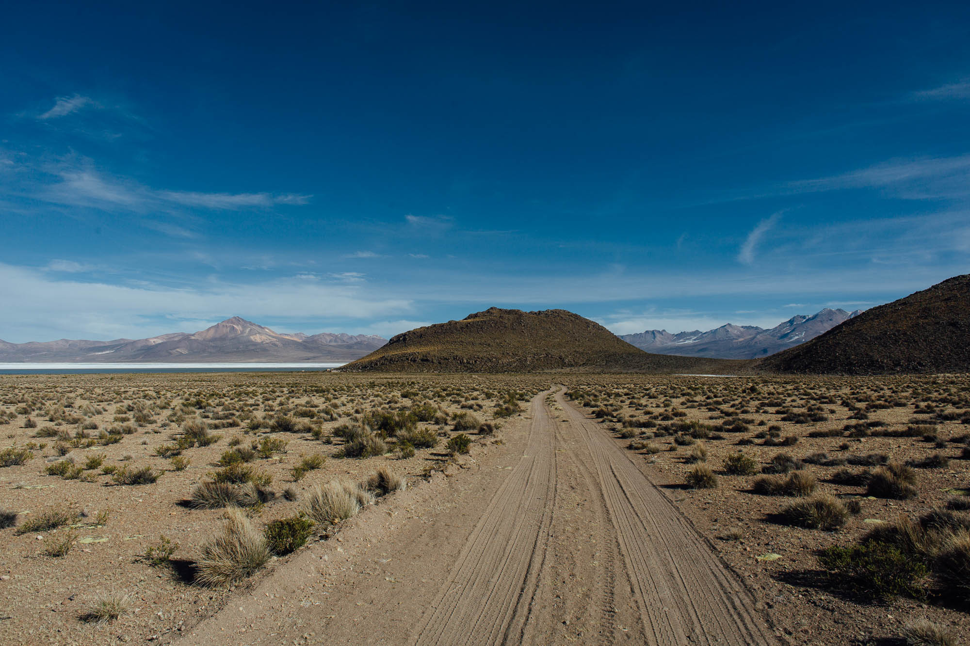
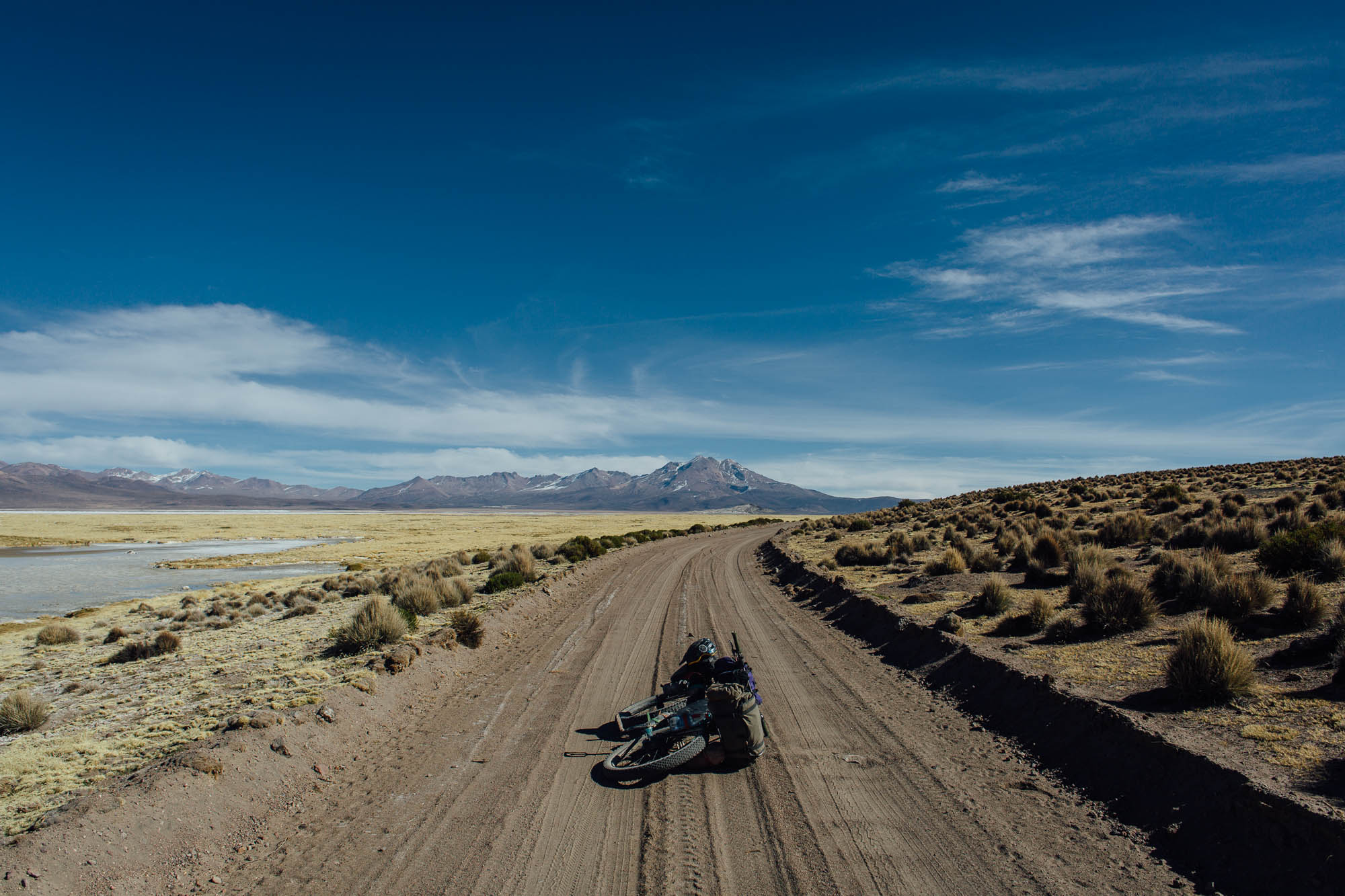
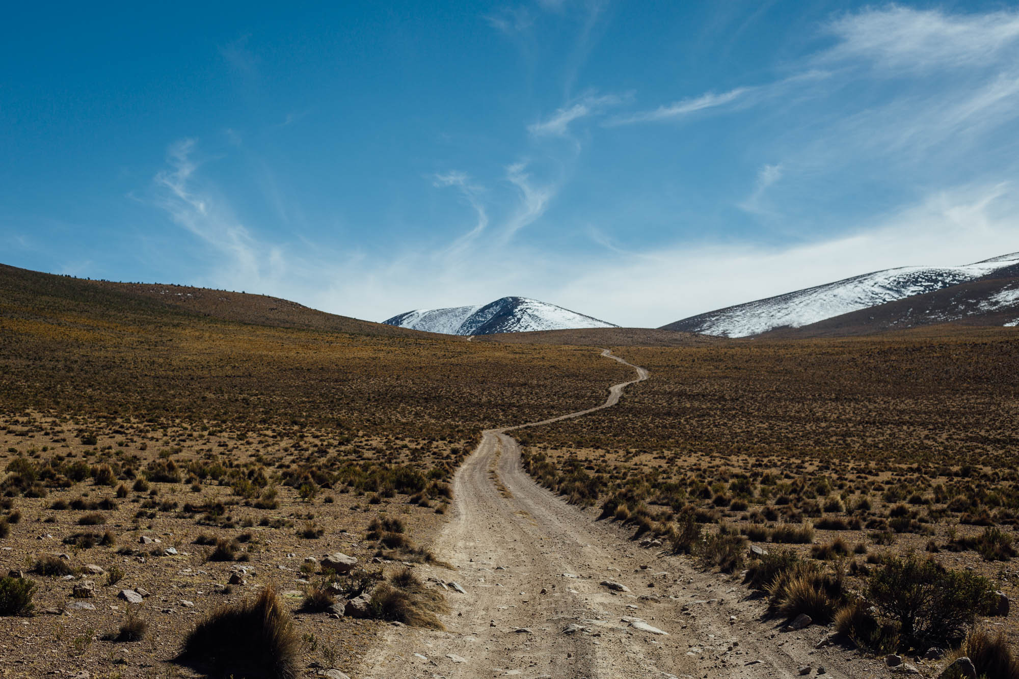
Difficulty: This route has a grading of 6; as altiplano routes go, it’s pretty straightforward logistically. Road conditions are mainly good, though can vary year by year, so be prepared for stretches of sand and corrugation. Aside from the altitude (much of it is at 4200m+) and potentially cold nights, strong winds will likely be your main foe. But even so, it’s very manageable, as long as you’re packing a sturdy tent and plenty of food. If the conditions are favorable, this is a route that could make a rewarding albeit challenging family ride, given the amount of wildlife and interesting flora.


Submit Route Alert
As the leading creator and publisher of bikepacking routes, BIKEPACKING.com endeavors to maintain, improve, and advocate for our growing network of bikepacking routes all over the world. As such, our editorial team, route creators, and Route Stewards serve as mediators for route improvements and opportunities for connectivity, conservation, and community growth around these routes. To facilitate these efforts, we rely on our Bikepacking Collective and the greater bikepacking community to call attention to critical issues and opportunities that are discovered while riding these routes. If you have a vital issue or opportunity regarding this route that pertains to one of the subjects below, please let us know:
Highlights
Must Know
Camping
Food/H2O
Trail Notes
Resources
- Spotting flamingo, vicuñas, suris, condors, and other Altiplano wildlife.
- Experiencing the sense of remoteness on the Chilean altiplano and its rolling pampa.
- Inspecting (and even camping behind) remarkable 18th Century churches.
- Circling around the vast and beautiful Surire salt flats.
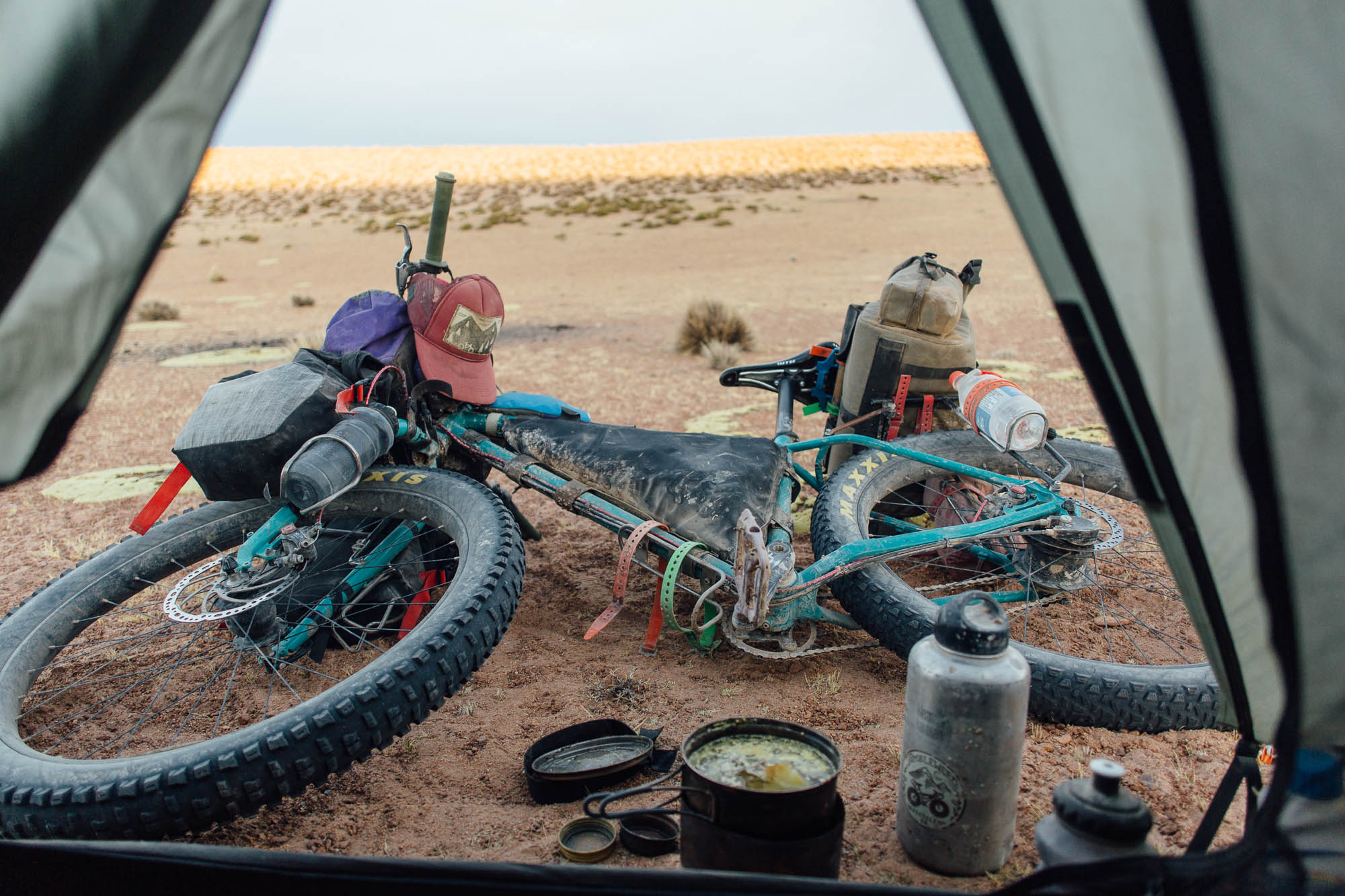
- Any mountain bike or touring bike is suitable for this route, though the wider the tires the better, as depending on the season, the roads can be sandy or corrugated in places. Expect to push at times, particularly if you’re riding a traditional touring bike.
- When to go: Winter (May-August) is dry and clear but can get cold – temps can drop down to -15c (5f), so make sure you’re prepared. April and May are good times for birding. Summer (Dec-March) is warmer but much wetter and stormier; the salt flats can be impassible by bike during this time so it’s not a recommended to time to travel by bike.
- Acclimatisation: Most people will likely be riding this route as part of a longer journey. But if you’re starting to Putre and heading onto the altiplano from there, be sure to allow several days at least to acclimatise. Ideally, take a week, with day rides to altitude each day.
- Wind conditions: Wind generally comes from the west, though when riding north, I found I faced a brisk afternoon headwind much of the time too. On the whole, riding north to south is likely to be preferable, but either works.
- Logistics: Bike-friendly buses run from Arica to Putre (2.5 hours, 4500 pesos), and from Colchane to Iquique, for those zoning in on this route and using these settlements as your connecting points. Otherwise, you can plug into the route from Vislivi or Sajama, and extend it from Coipasa with a crossing from Uyuni and its vast salt flats.
- The only ATM in the region is in Putre, but there’s a hefty charge to use it. Cash can also be exchanged at the bank there, as well as on the border with Bolivia via the many money-changers.
- The tourist office in Putre has an excellent free, regional map of the area that details all the animals and marks many of the backroads. It’s called ‘Arica and Parinacota, Chile’. The main square, outside the tourist office, has free wifi.
- Putre York in Putre is an excellent and very friendly travel agency that can offer lots of regional advice, as well as shuttle services for climbers. They’re on the main square and can be contacted through their website. (thanks for bailing me out with some replacement pedals, guys!)
- Entel SIM cards are available in Chile or on the Bolivian border. a 1GB data package costs around 5,000 Chilean Pesos. Where there’s a signal, data speeds are good – but don’t expect coverage in the parks. Separate Entel SIMs for Bolivia are available on the border too. a 1GB data package there costs around 50 Bolivianos.
- Wild camping is permitted throughout this zone, though potentially windy conditions may dictate your best choices.
- A wide variety of lodging is available in Putre, as well on the border, in both Colchane and Pisaga. Along the way, you may be able to stay in the Conaf refugios too, as marked on the map. Off route, there is accommodation available in Guallatire (15,000 Chilean pesos, inc breakfast).
- There’s no official camping in Putre. One of the hotel’s suggested I camp on the football ground to the north of town and no one seemed to mind.
- Food can be bought in Putre or if riding north, at the Bolivian/Chilean border post at Colchane. Don’t forget that you won’t be able to cross from Bolivia to Chile with anything fresh, including vegetables, fruit, cheese, honey, and butter. Grains like quinoa, roasted nuts, and most packaged foods are fine. There’s fresh food – like cheese, butter, and vegetables – to be found on the Chilean side, though it’s more expensive than Bolivia. Expect your bags to be X-rayed when crossing into Chile.
- There are no reliable resupply points between Putre and Colchane, though you can sometimes pick up meals from the two truck stop restaurants along the way if you’re lucky with your timing, as marked on the map. Don’t rely on these, as they pop up and shut down. Be prepared to carry food for the whole trip.
- Water is available throughout the ride, from villages, police stations, rivers, and streams. Being able to carry up to 4L is likely to be enough. See map for some of the more established options and always fill up when you can.
If you want to connect the route to or from Arica and avoid the main highway, options include following the ‘missions route’ via Belen and Tignamar Nuevo, on a mixture of paved and unsurfaced roads. You can also loop around the back of Putre and trace the train line past Estacion Coronel Alcerraca, via a 4800m pass in Lauca National Park. Given that this would make an especially big climb if you’re starting from the coast (with likely acclimatisation issues), the latter is best ridden as a descent.
If you make sure you have sufficient supplies, there’s lots of potential to weave together a satisfying loop through the lesser traveled nooks of these parks and reserves; check with Conaf offices as you go, for up to date conditions of the backroads, which are sometimes sandy and unmaintained. The guys at Putre York know the area very well and the map from the tourist office will give you lots of ideas.
An easy, 5-day extension to the route would involve crossing the Salar de Coipasa and riding onwards to Uyuni in Bolivia. We’ll be posting details of this classic ride soon, which forms part of the Andes Traverse long distance route.
The route can also be used as an alternative to riding between the Bolivian settlements Sabaya and Sajama, offering a less sandy alternative. For this reason, it begins or ends in the small Bolivian village of Coipasa rather than the Chilean border, as this is the branching off point.
If you’re coming from (or going to) La Paz, you can also connect this route with the road from Visviri; it’s probably a good idea to drop down to Putre to resupply with fresh food, then ride or hitch back up again and continue the trip.
For ideas on what to pack for the Altiplano, see this post.


Terms of Use: As with each bikepacking route guide published on BIKEPACKING.com, should you choose to cycle this route, do so at your own risk. Prior to setting out check current local weather, conditions, and land/road closures. While riding, obey all public and private land use restrictions and rules, carry proper safety and navigational equipment, and of course, follow the #leavenotrace guidelines. The information found herein is simply a planning resource to be used as a point of inspiration in conjunction with your own due-diligence. In spite of the fact that this route, associated GPS track (GPX and maps), and all route guidelines were prepared under diligent research by the specified contributor and/or contributors, the accuracy of such and judgement of the author is not guaranteed. BIKEPACKING.com LLC, its partners, associates, and contributors are in no way liable for personal injury, damage to personal property, or any other such situation that might happen to individual riders cycling or following this route.
Please keep the conversation civil, constructive, and inclusive, or your comment will be removed.