


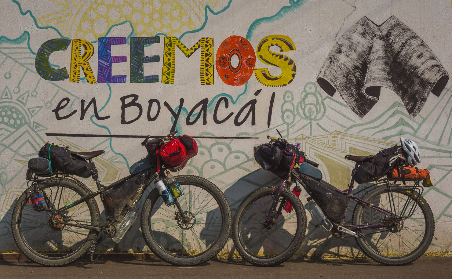
Oh Boyaca! Colombia
Distance
378 Mi.
(608 KM)Days
14
% Unpaved
70%
% Singletrack
0%
% Rideable (time)
100%
Total Ascent
60,011'
(18,291 M)High Point
13,553'
(4,131 M)Difficulty (1-10)
6?
- 10Climbing Scale Very Strenuous159 FT/MI (30 M/KM)
- 3Technical Difficulty Fair
- 7Physical Demand Difficult
- 3Resupply & Logistics Fair
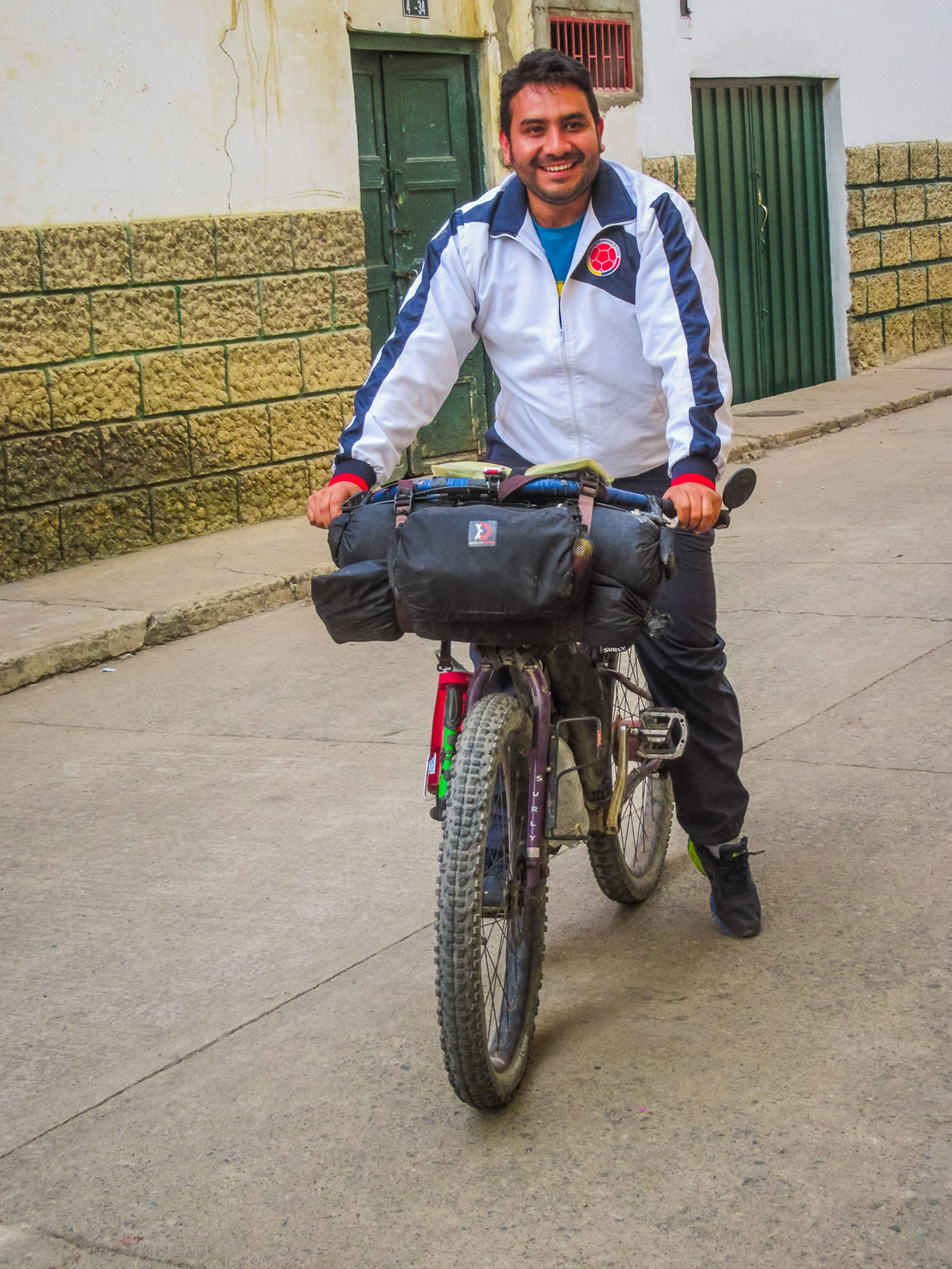
Contributed By
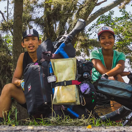
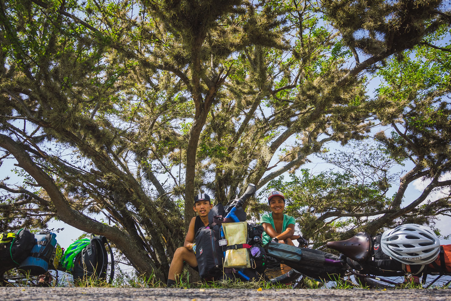
Dean and Dang
Guest Contributor
Dean and Dang are Toronto dirtbags bikepacking from Alaska to the south of nowhere. You can follow their trip on Instagram or their blog, Powered By Adobo.
This route was originally published in 2016 (outside the scope of the Andean Bear Corridor Routes with Conservation International) and has since gotten excellent feedback from dozens of riders. In January 2024, it received a major overhaul thanks to Eileen Schwab. Find Eileen’s photos and additional information integrated below.
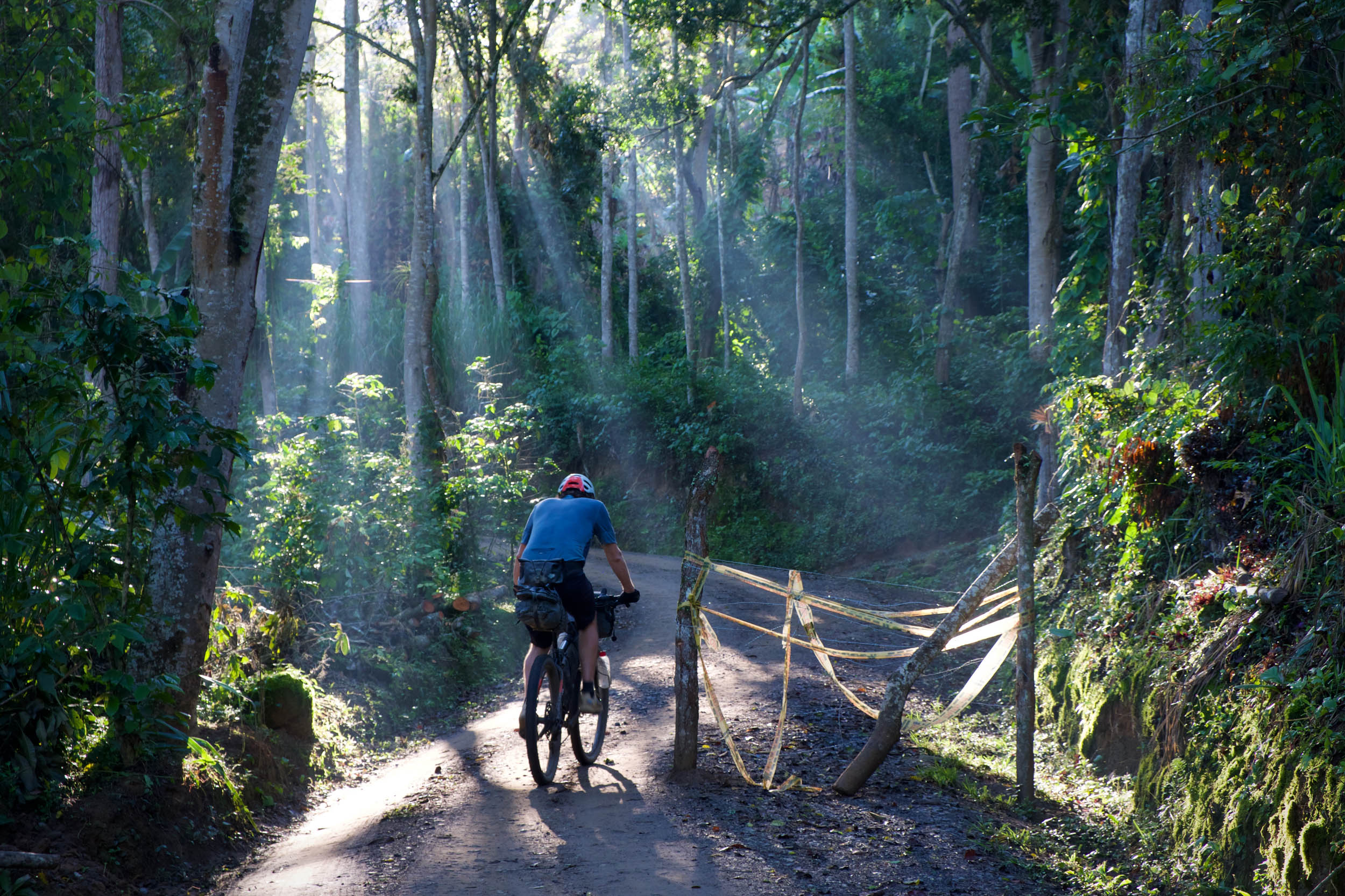
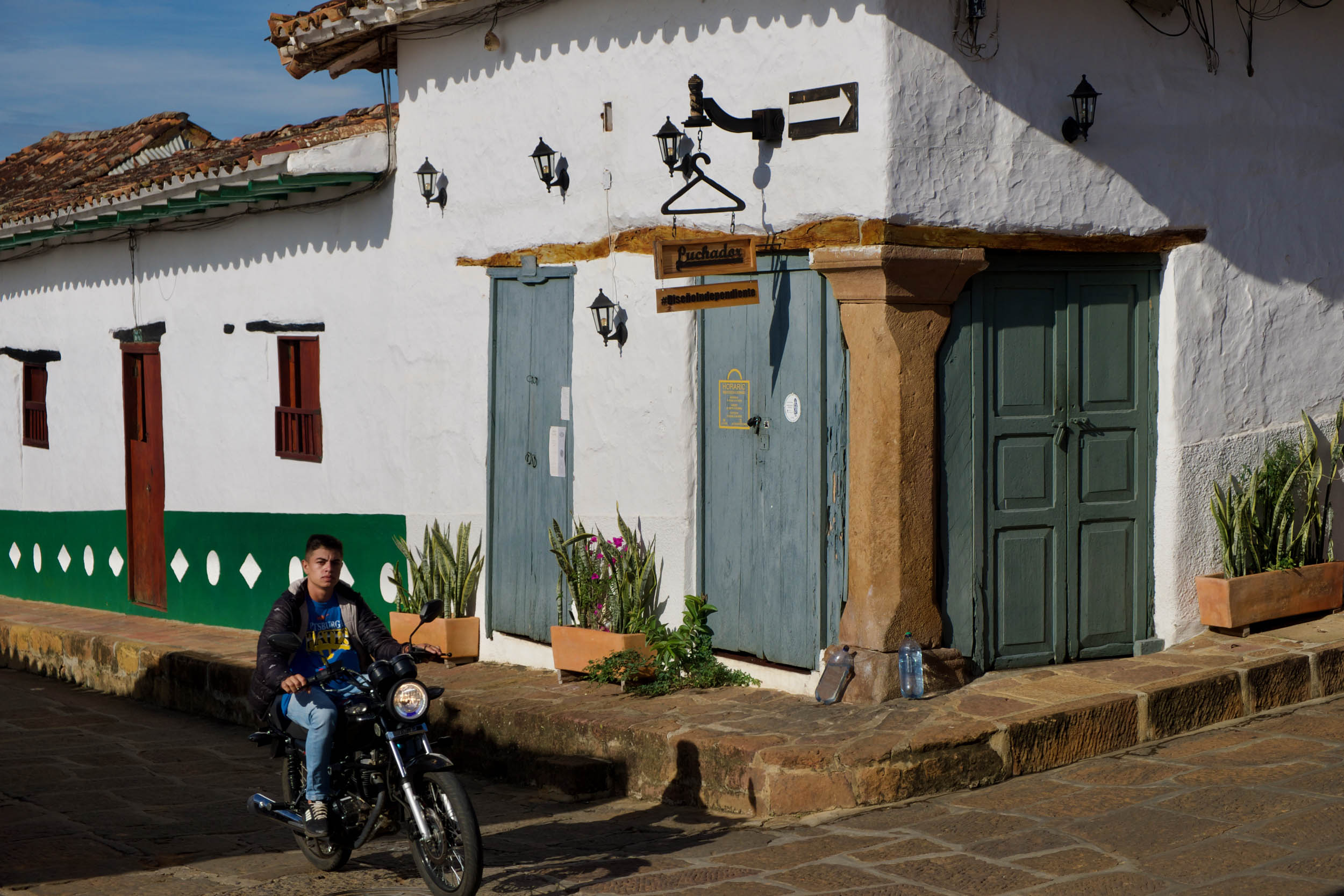
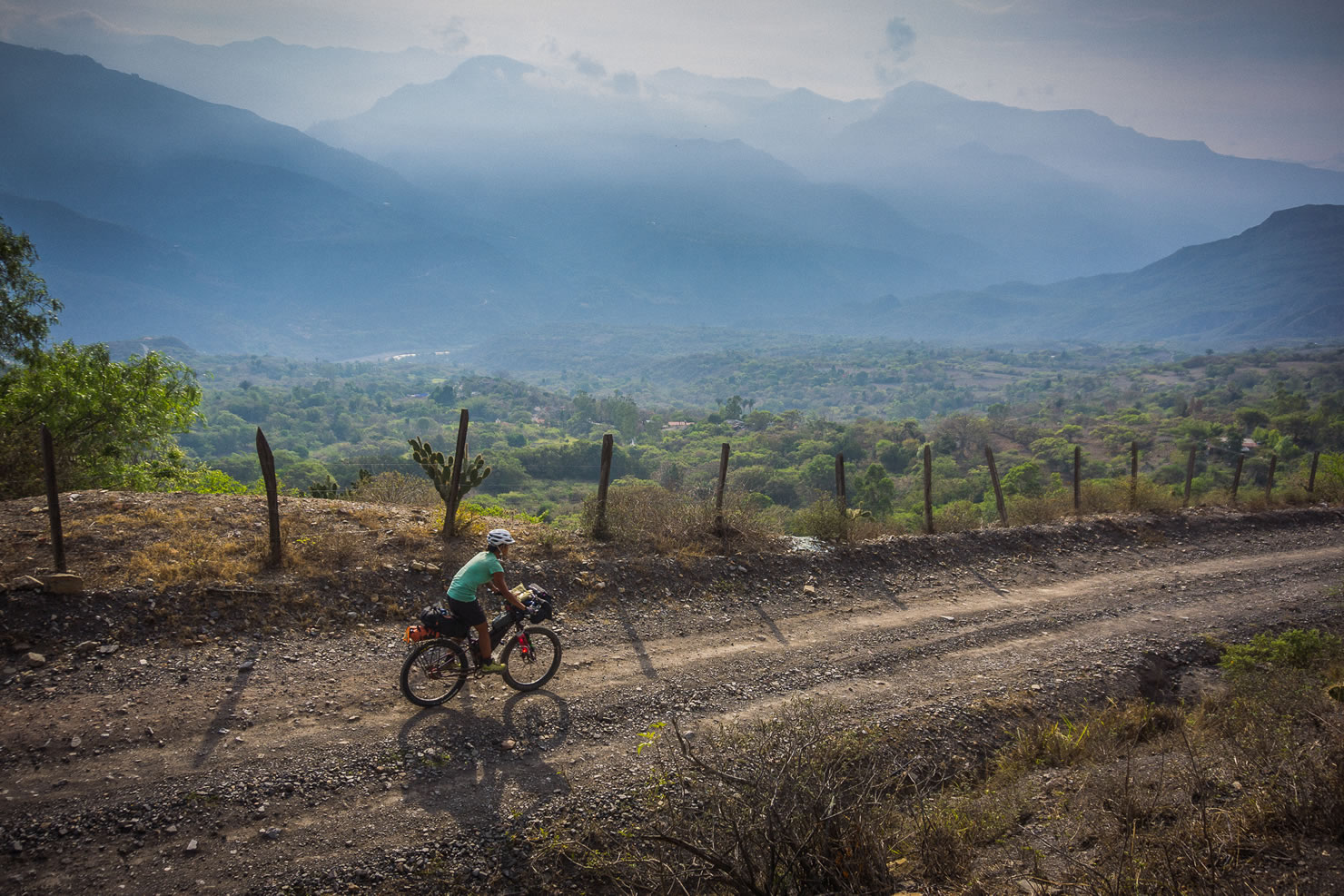
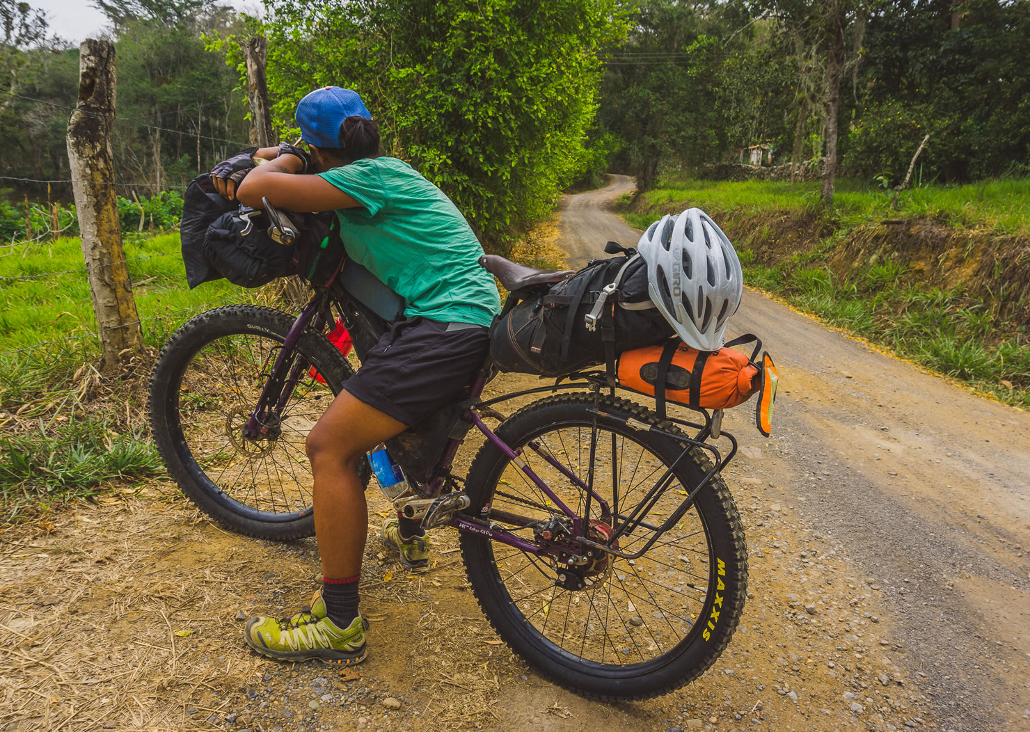
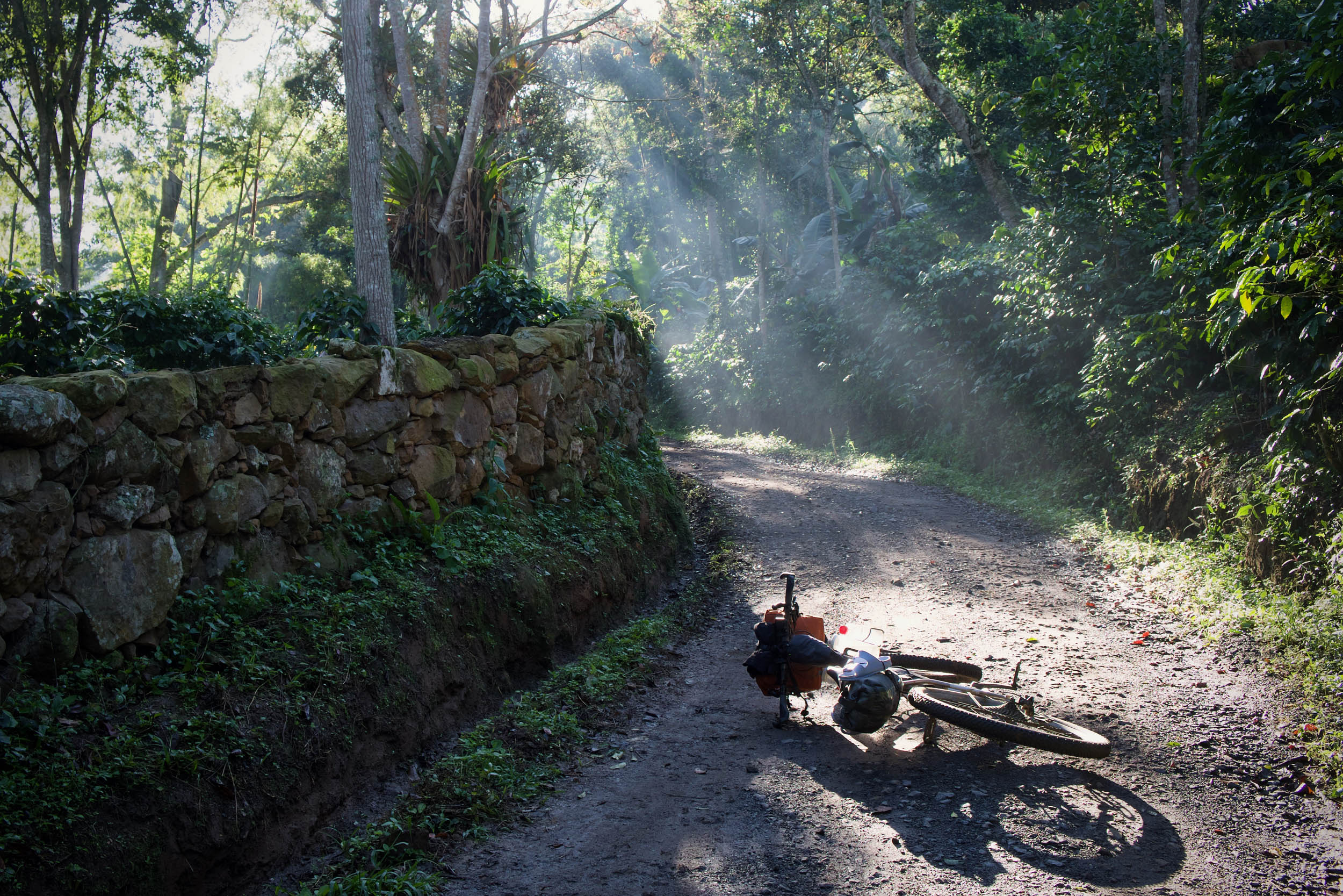
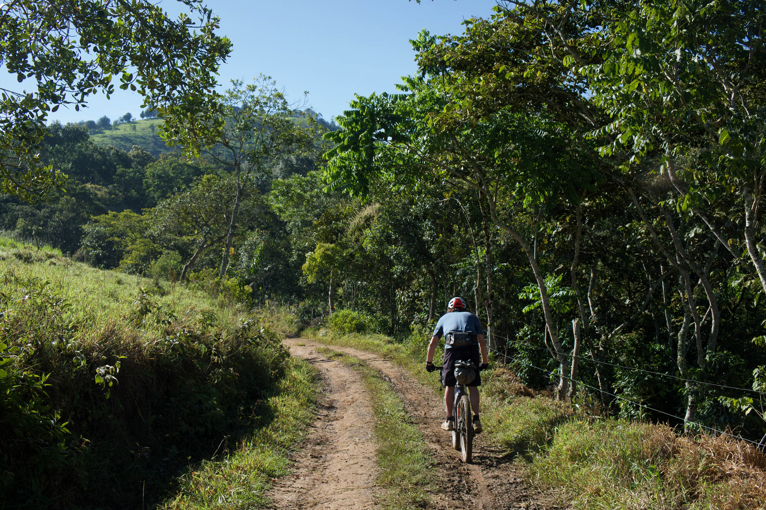
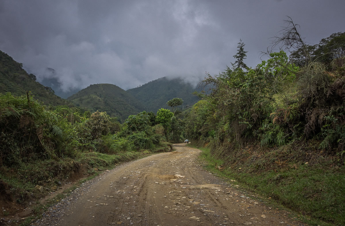
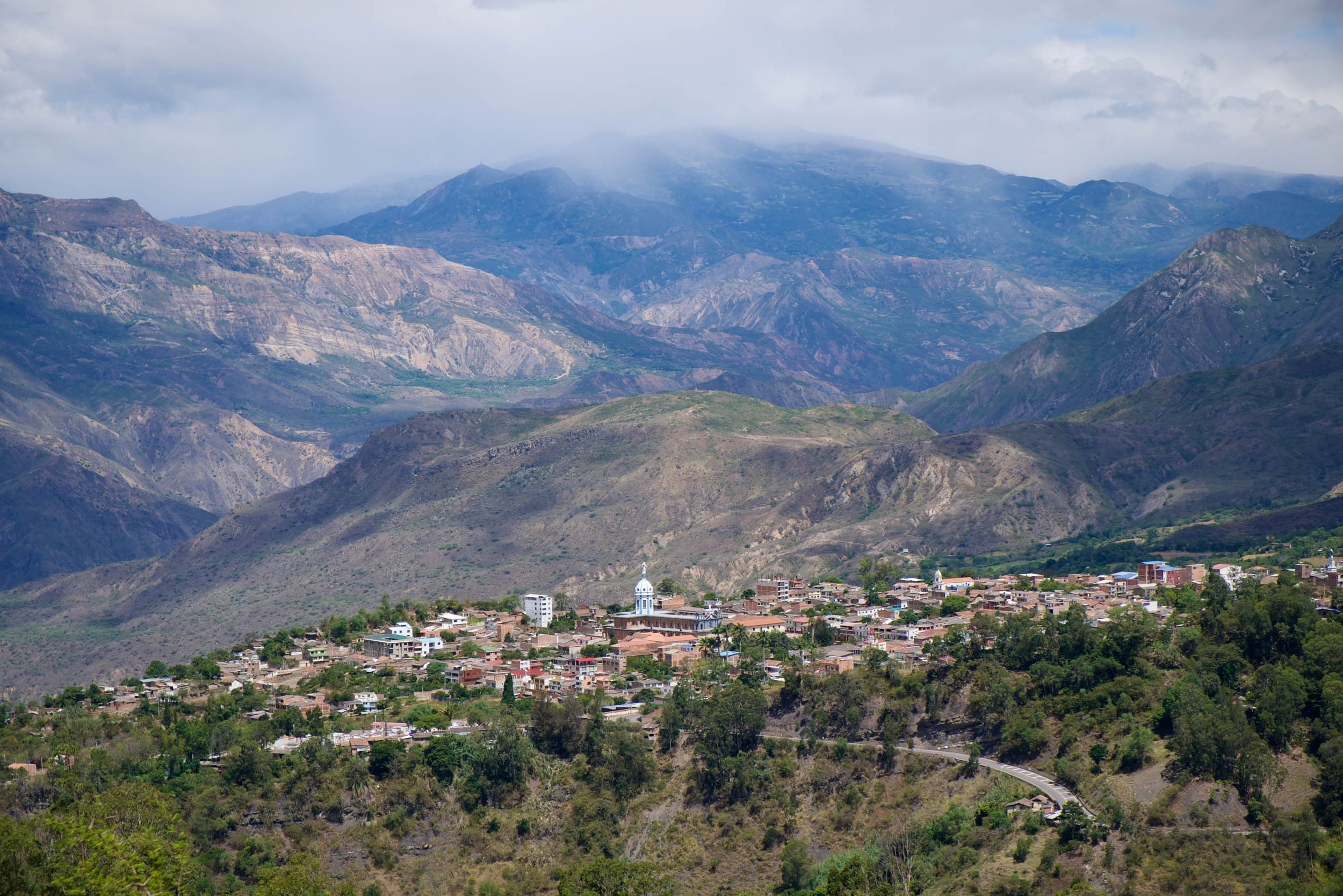
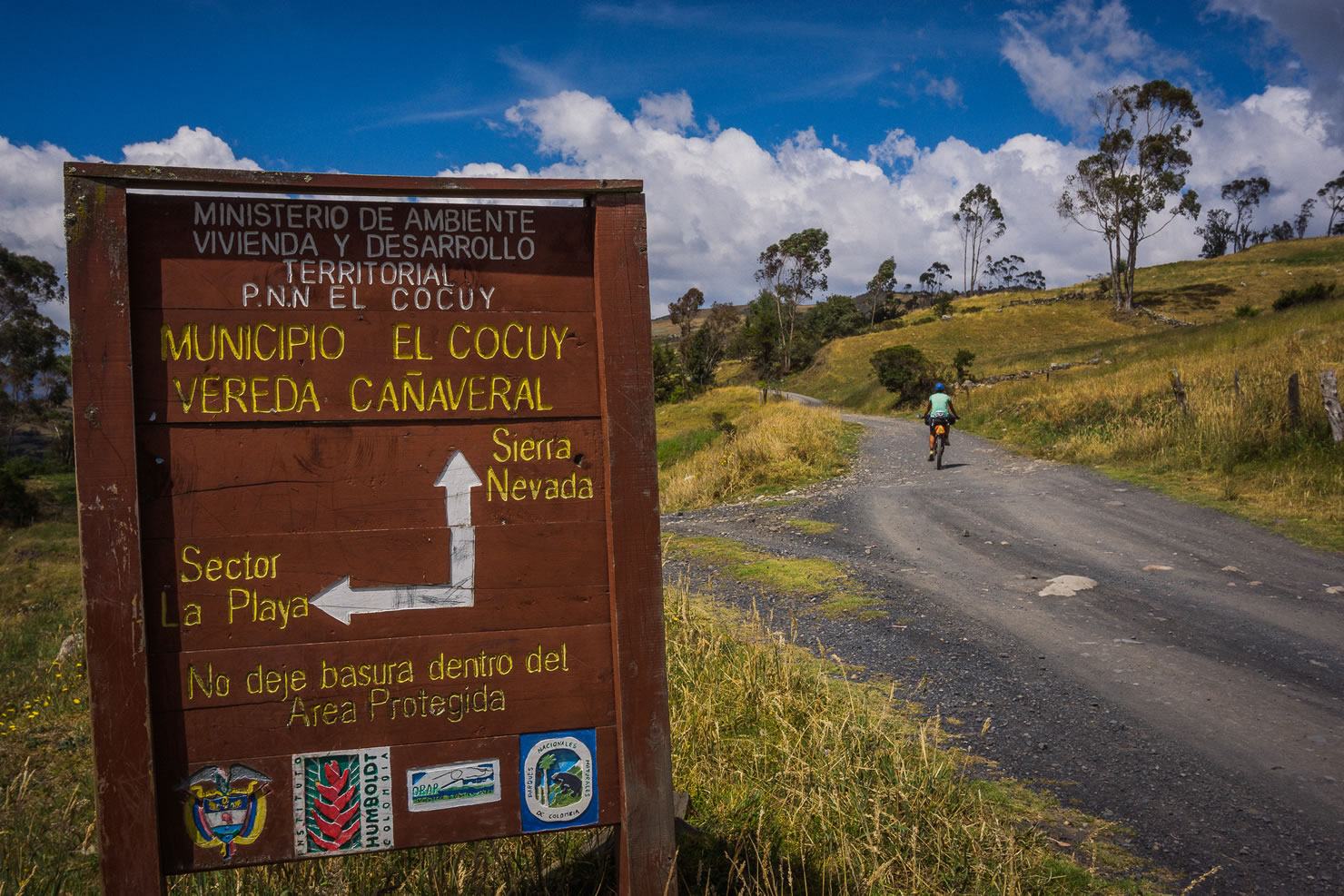
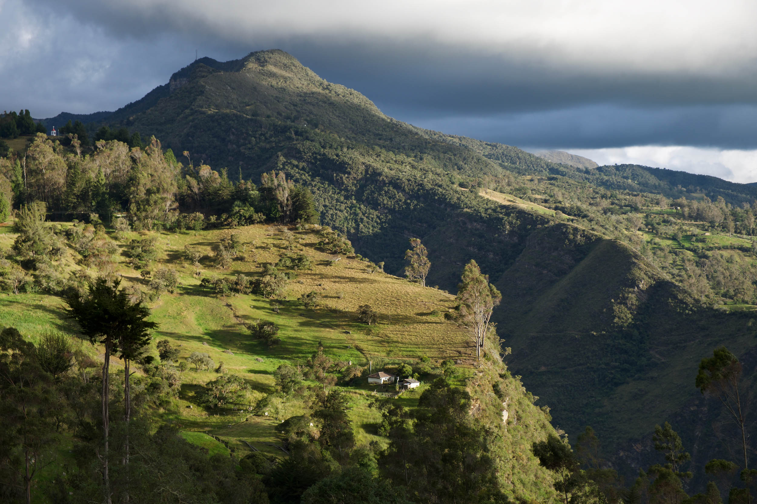
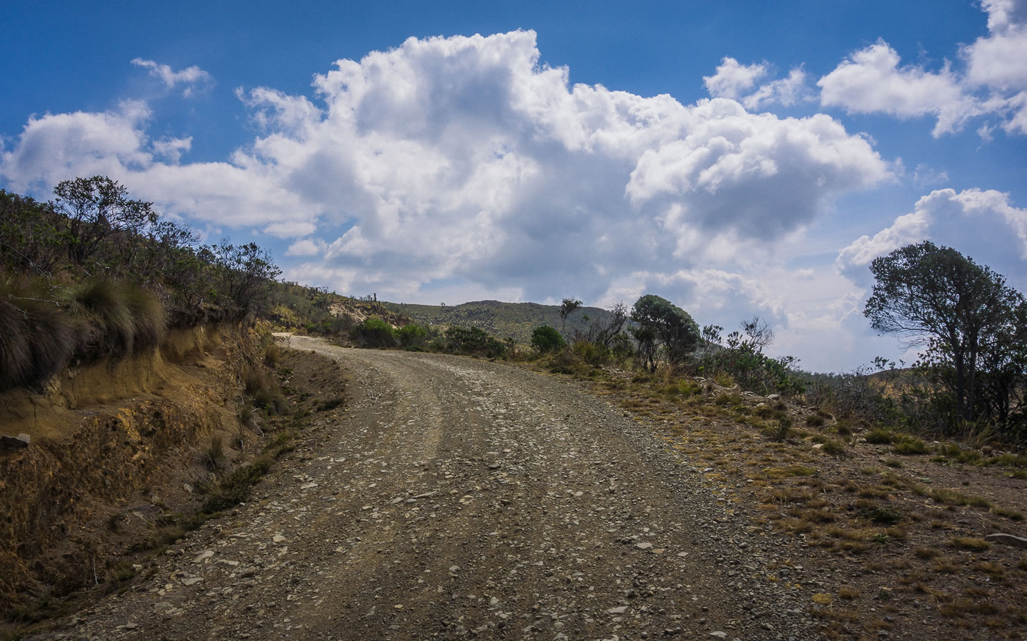
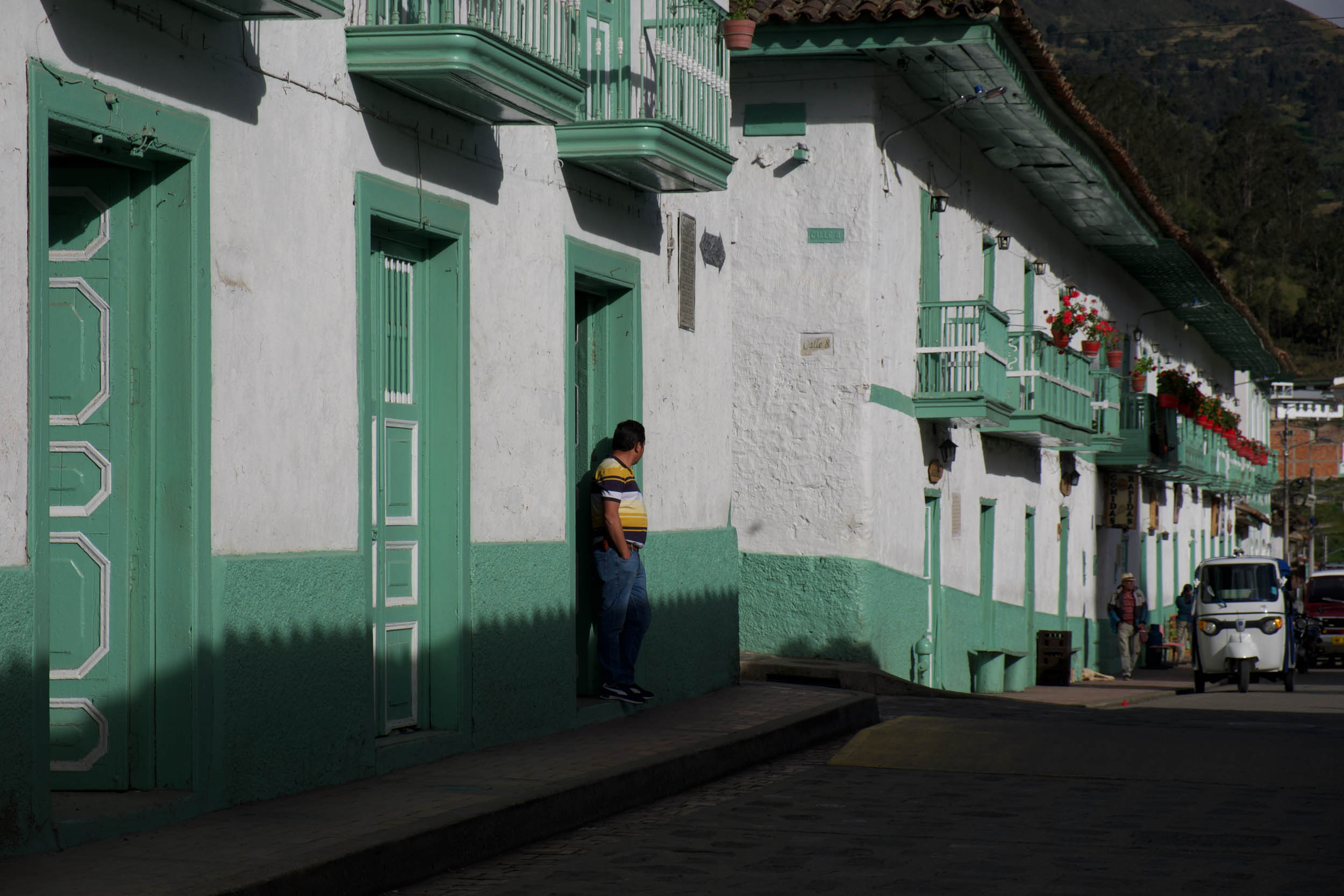
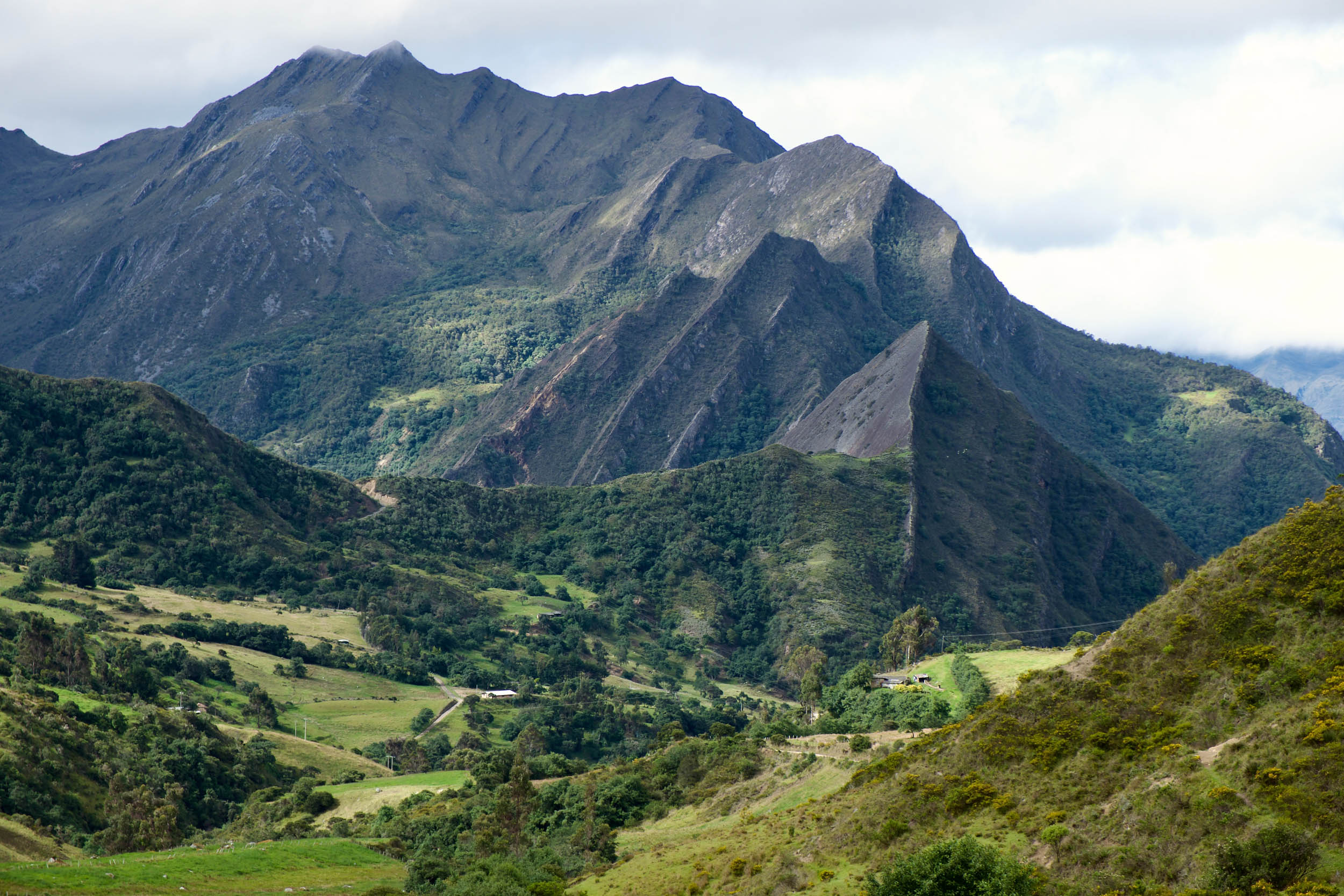
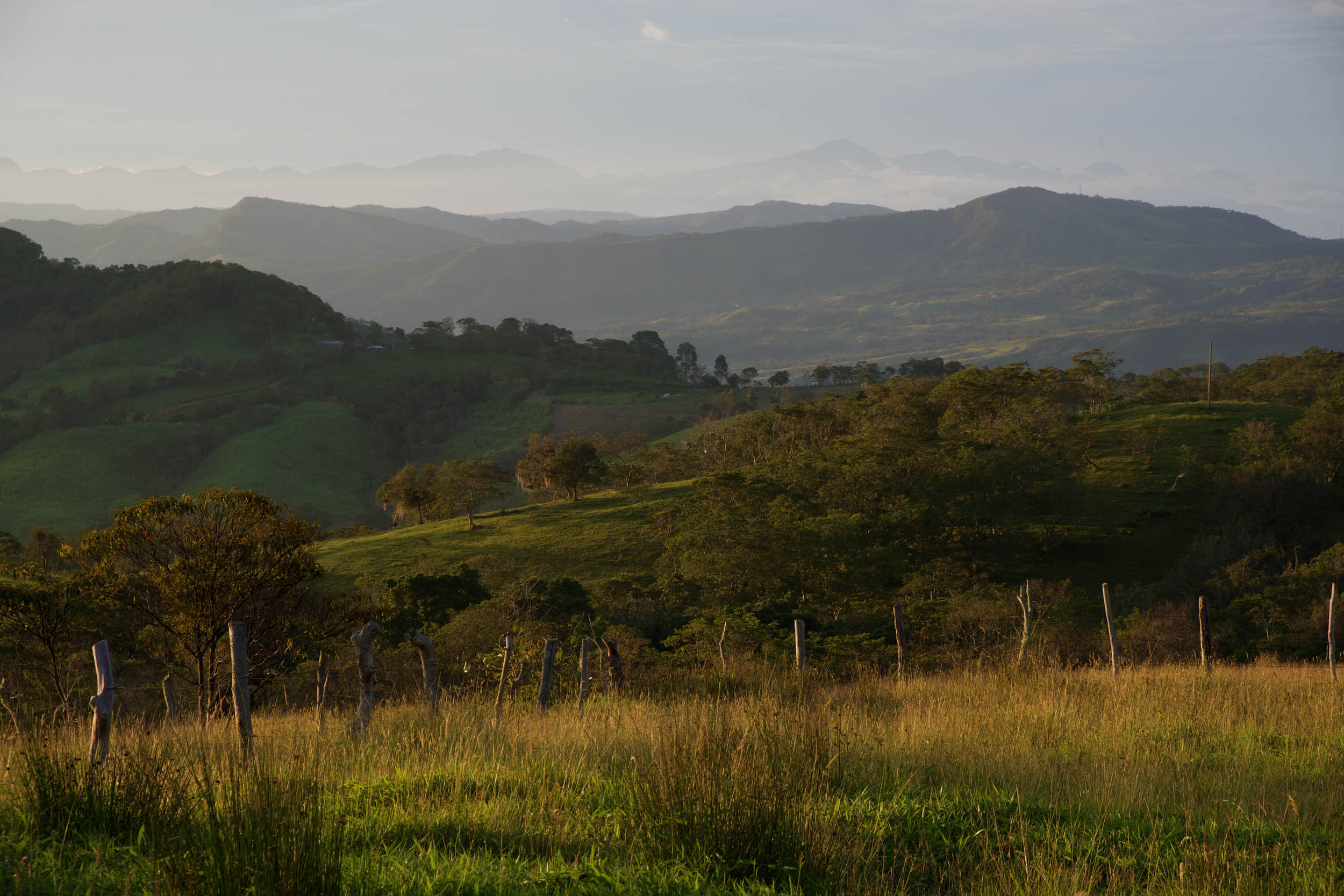
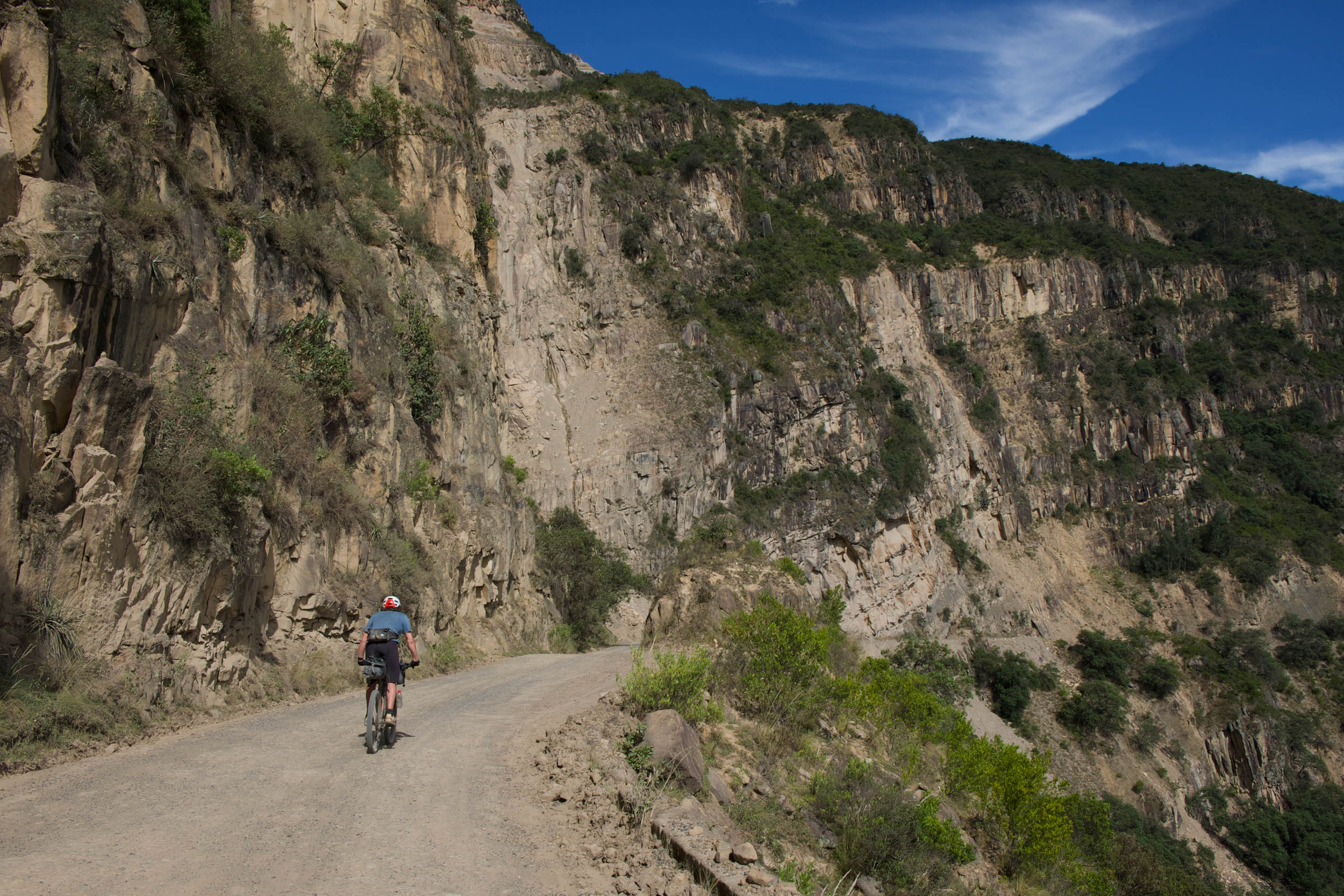
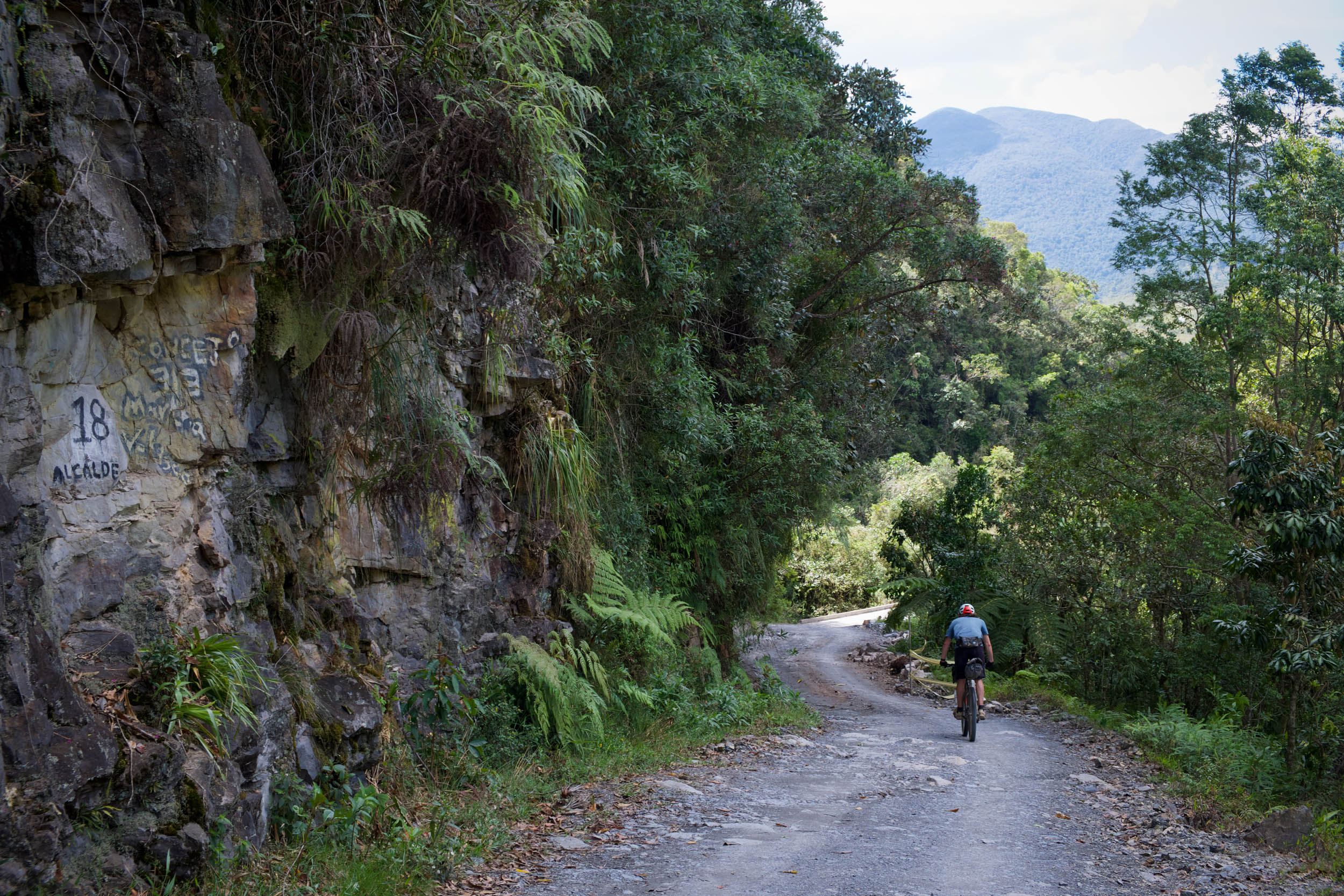
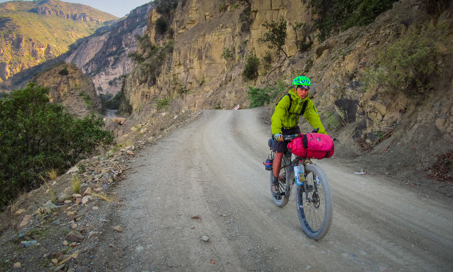
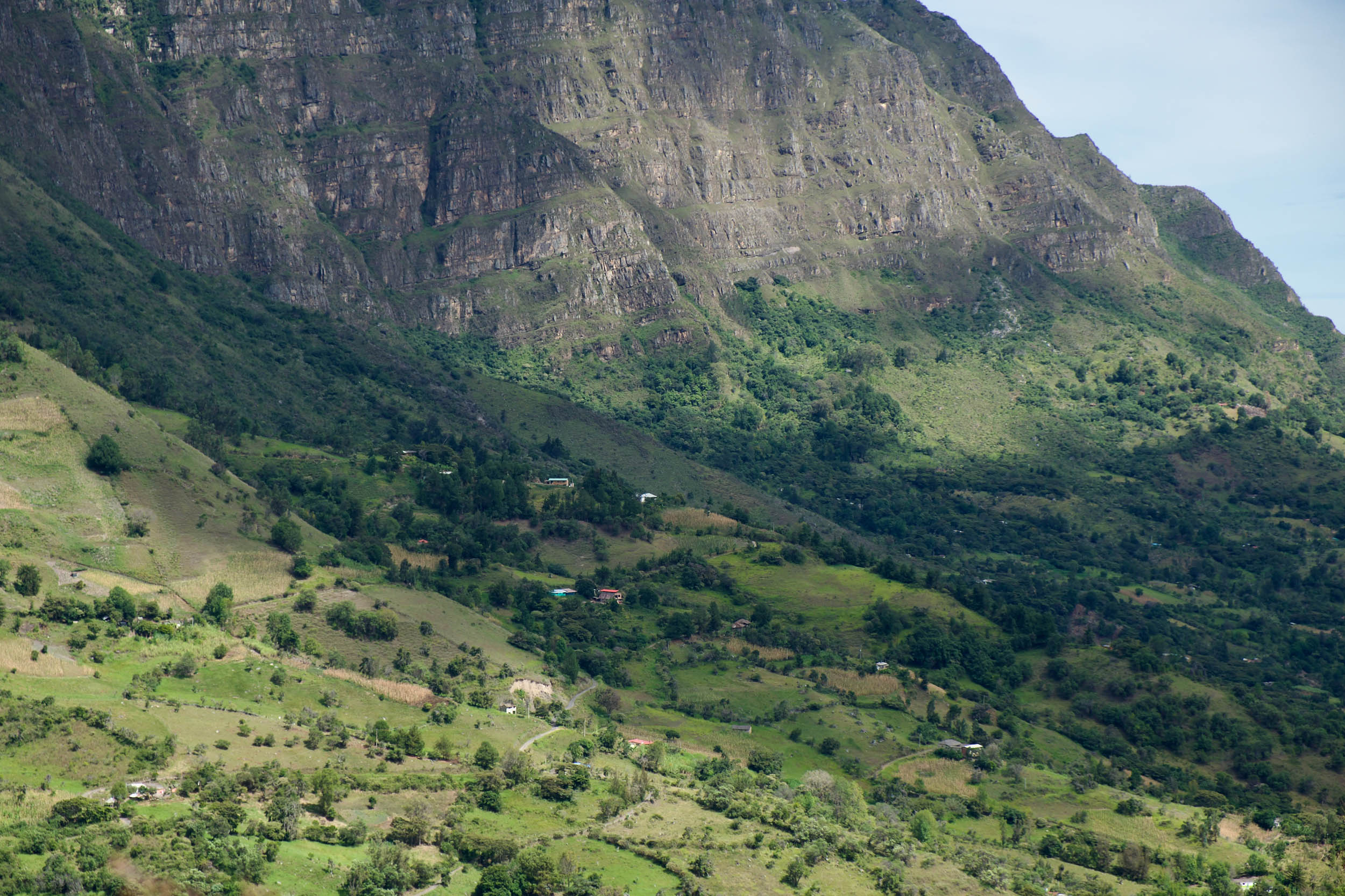
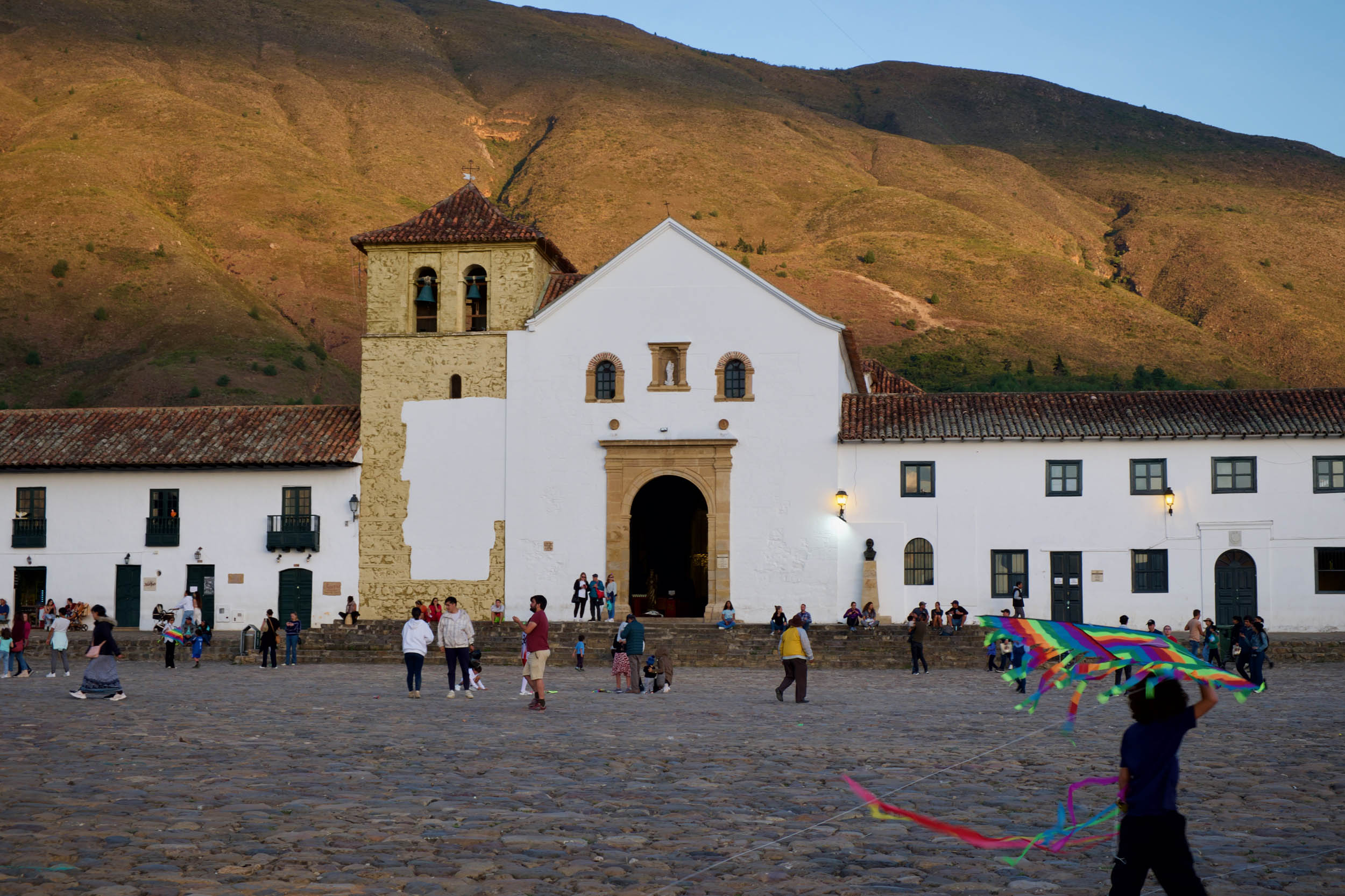
Connecting the pretty village of Barichara with the mountains of the Sierra Nevado del Cocuy and finishing in the colonial town of Villa de Leyva, Oh Boyaca! is a treat of seldom-used dirt tracks, overlapping mountains, striking geology, and whimsical páramos. Dotted with towns and villages, the route collectively creates a rich and varied impression of this pocket of Colombia.
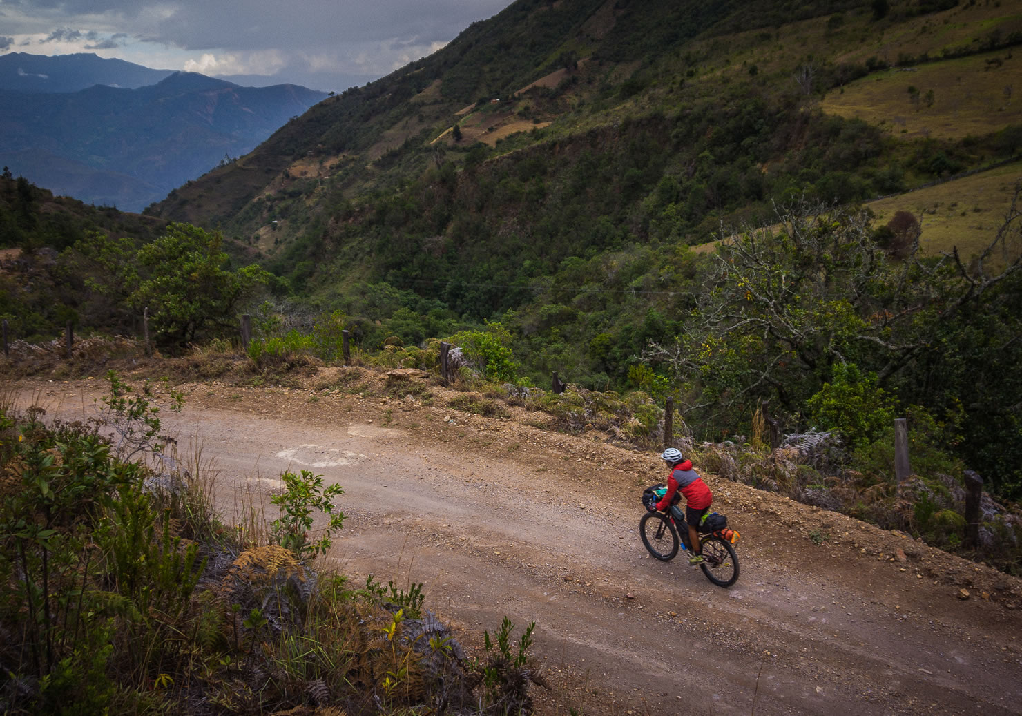
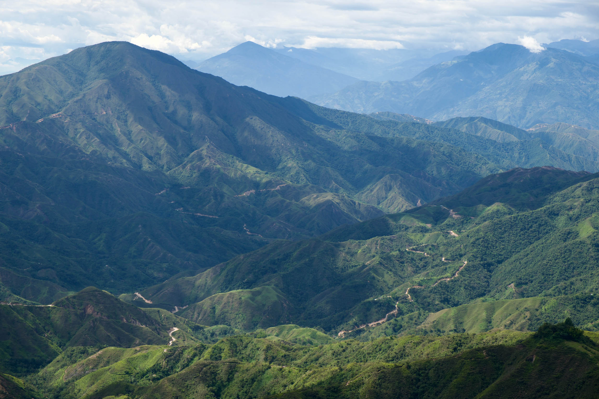
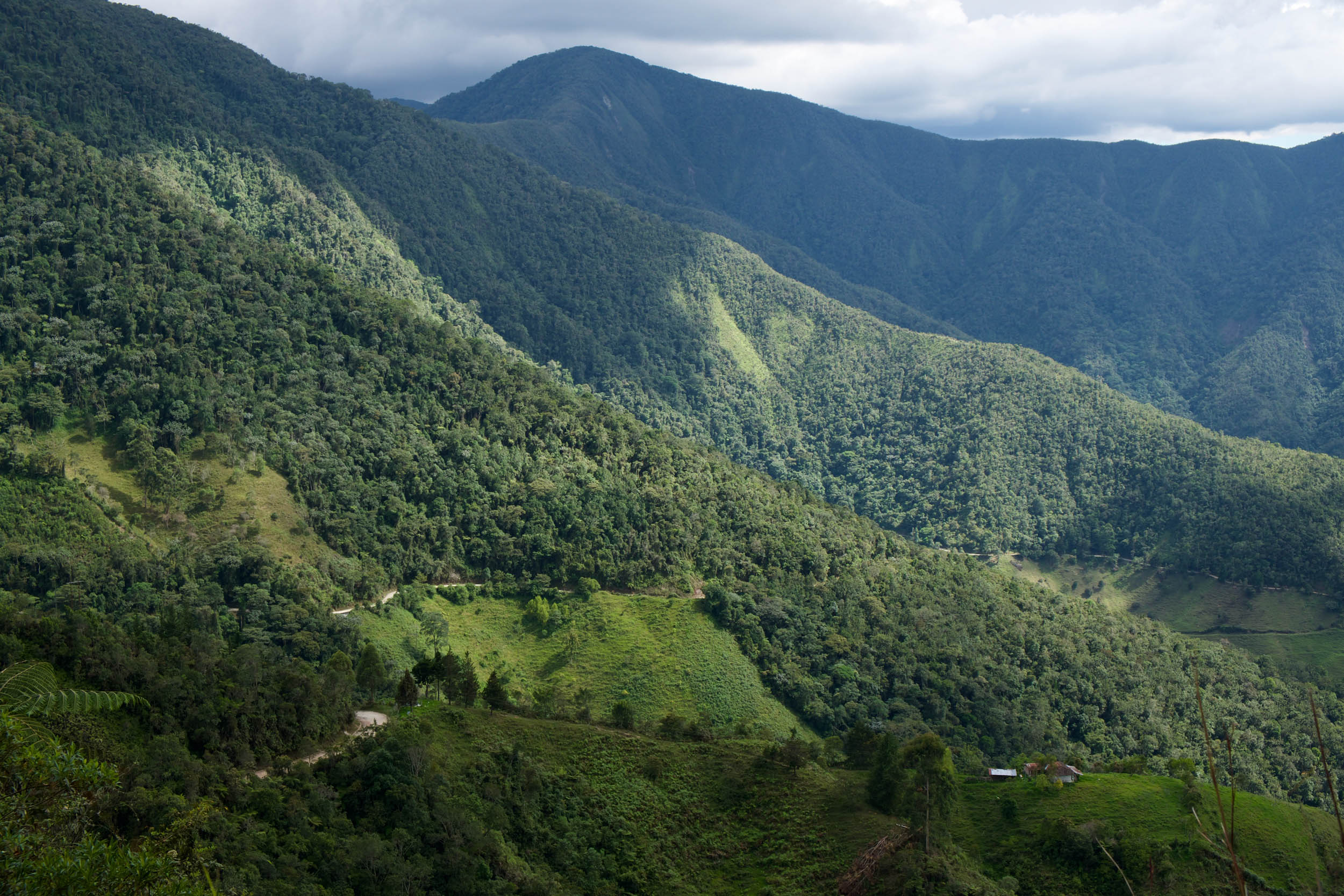
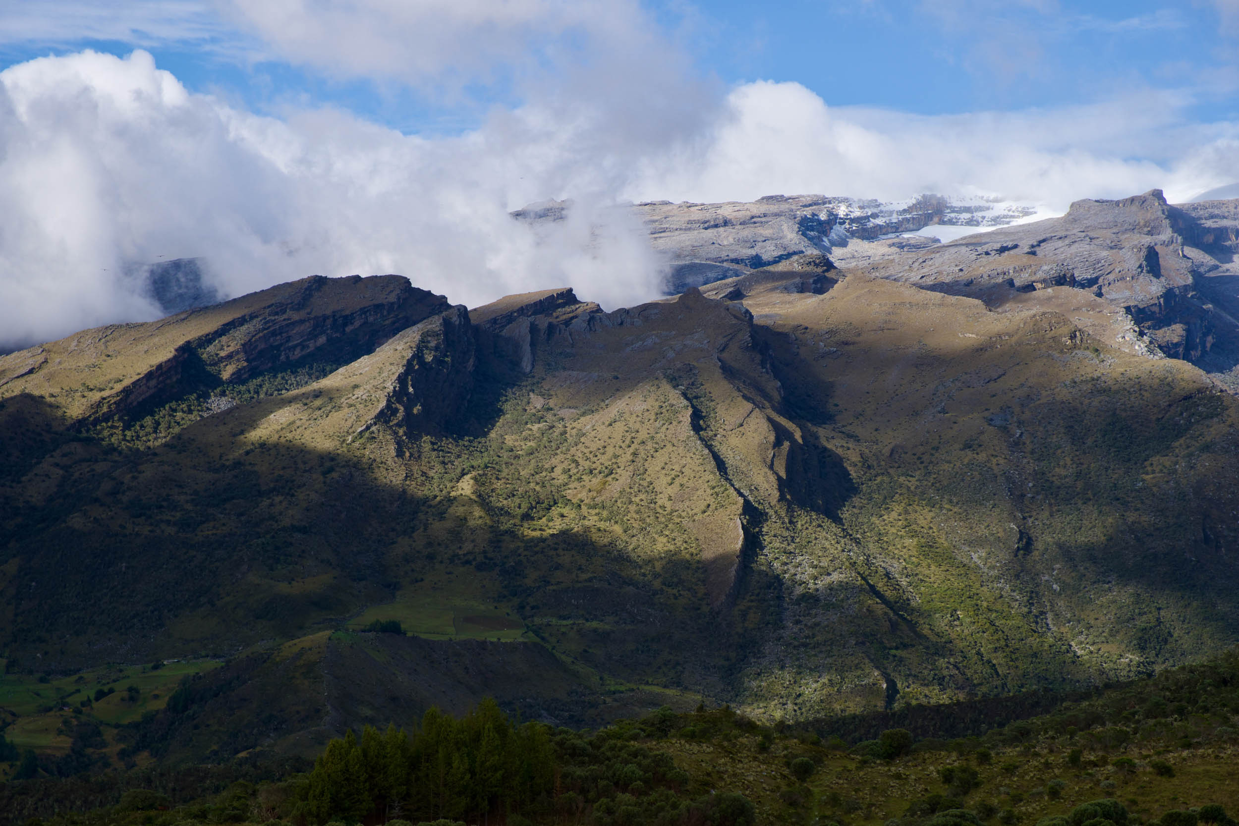
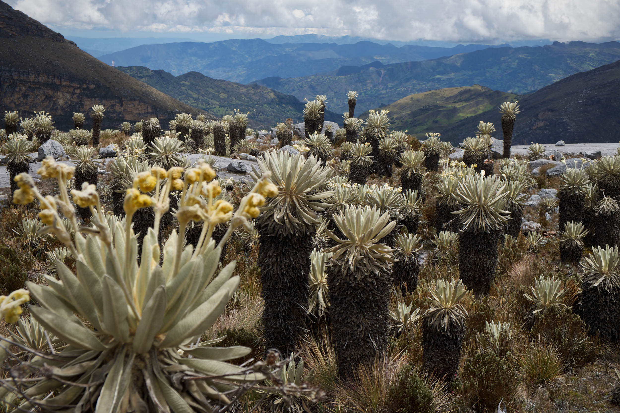
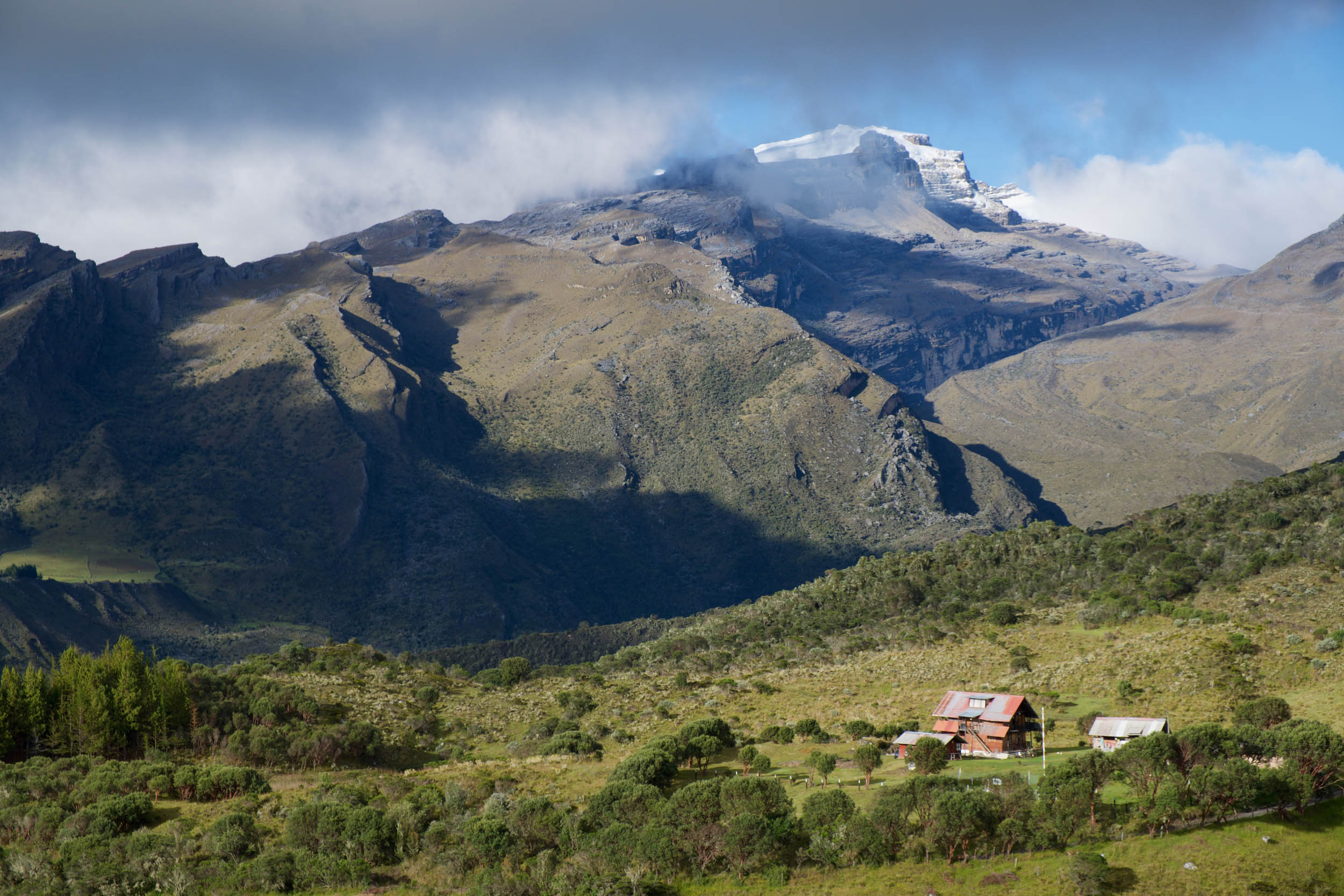
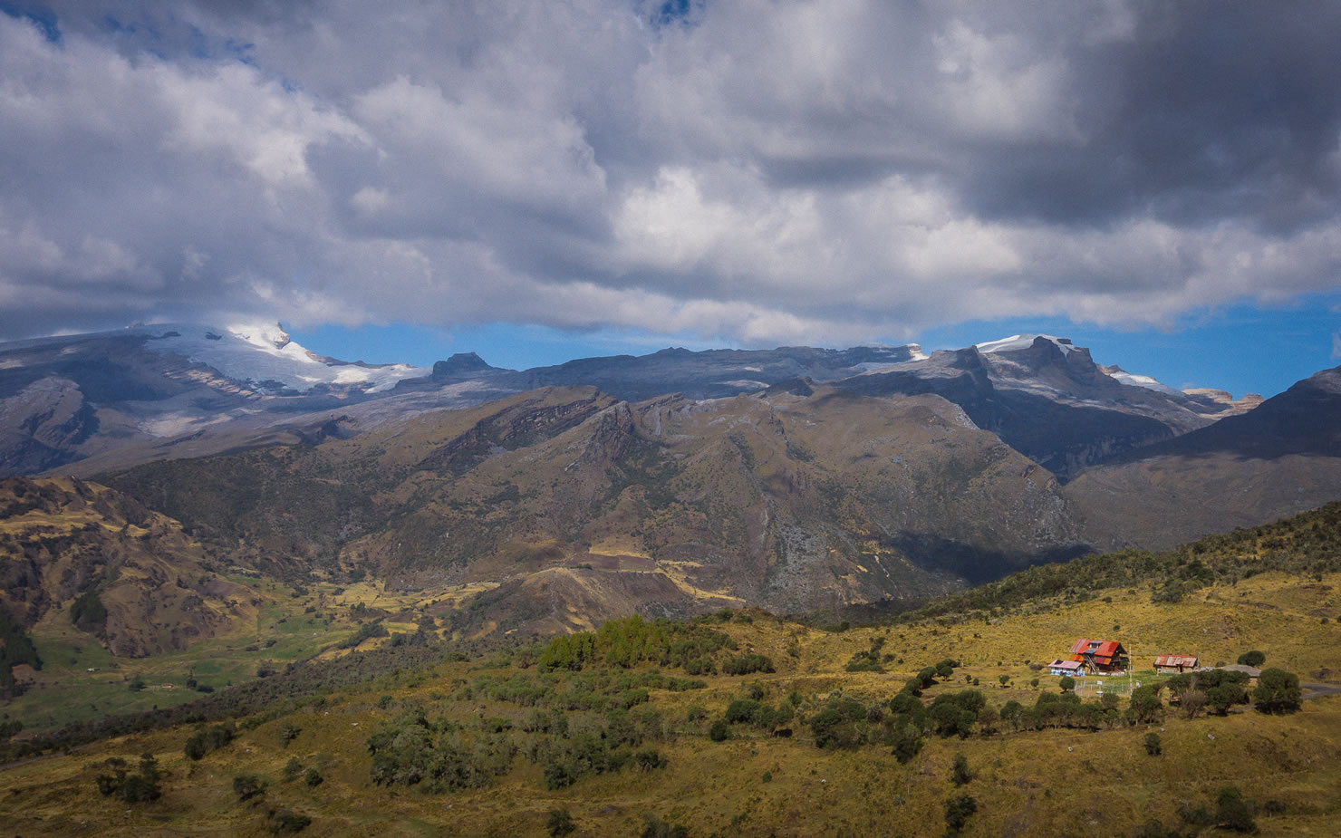
The ride begins with an introduction to some highlights of the Santander region, known for its rugged terrain around the Chicamocha Canyon, lovely Barichara, and the adventure activity hub of San Gil. It’s also one of the drier areas in a notoriously rainy country. The route soon meanders into Boyacá, a department fueled by agriculture and mining and home to several heritage towns, most notably Villa de Leyva. Its crown jewel is the spectacular Sierra Nevada del Cocuy, where glacial and tectonic forces have sculpted the dramatic mountains and the unique páramo alpine ecosystem flourishes.

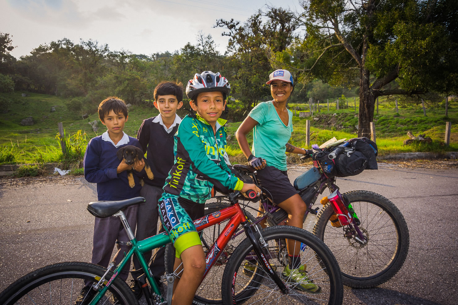
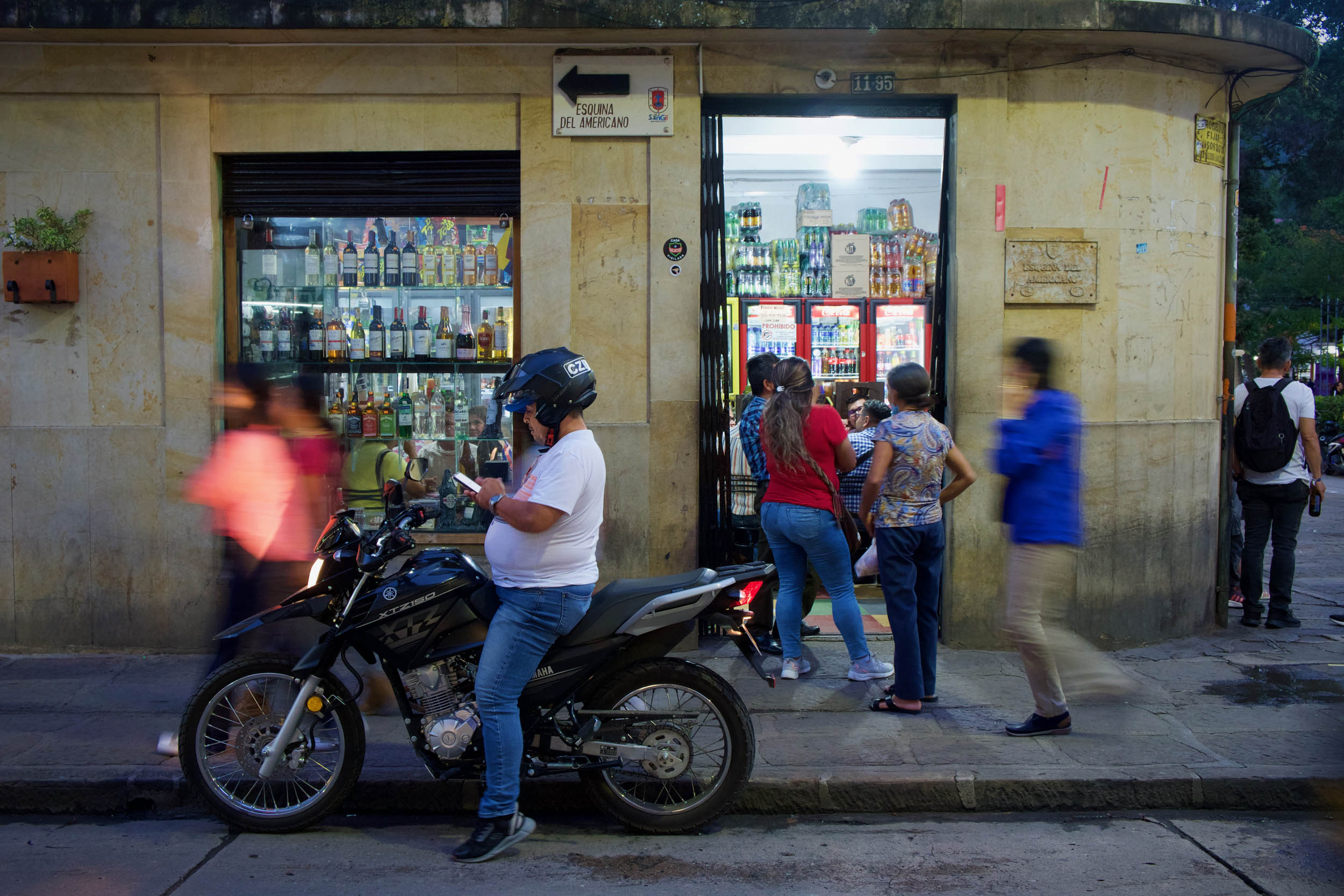
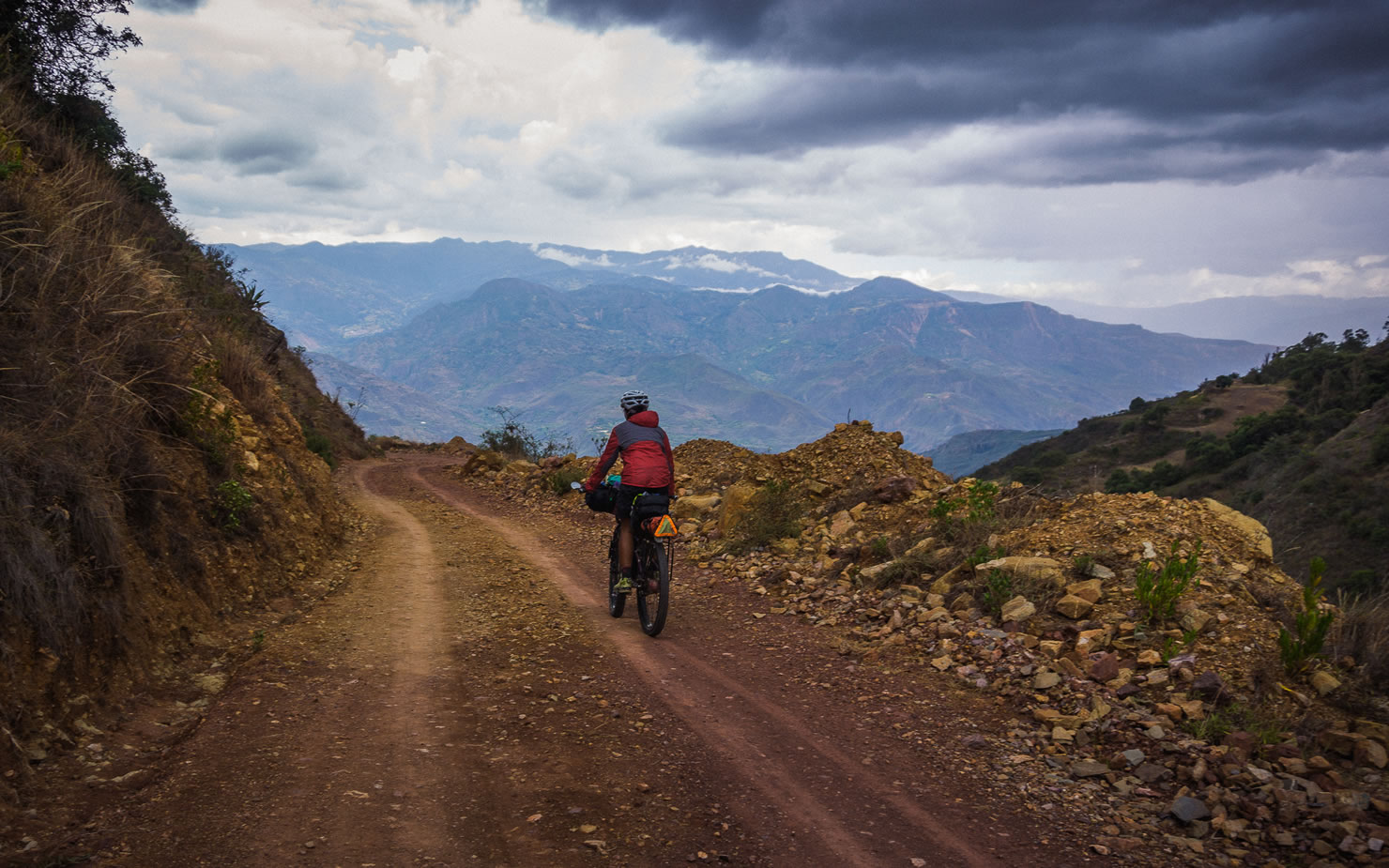
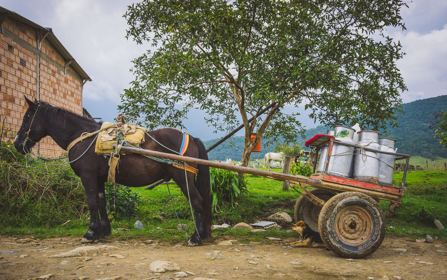
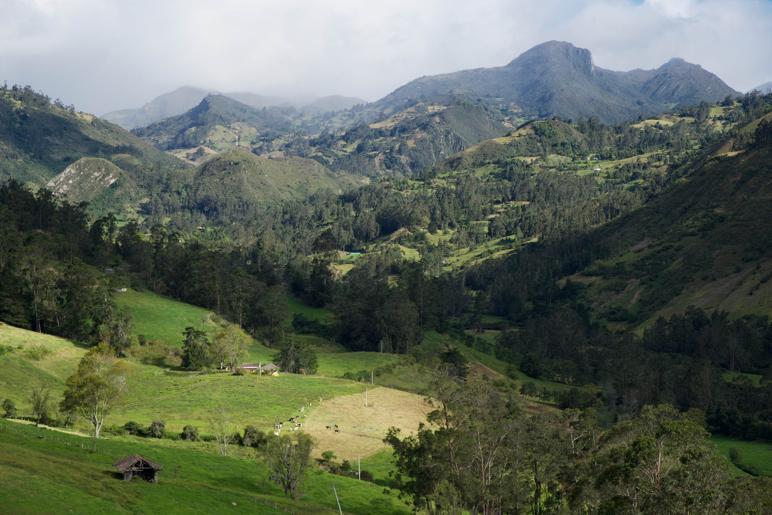
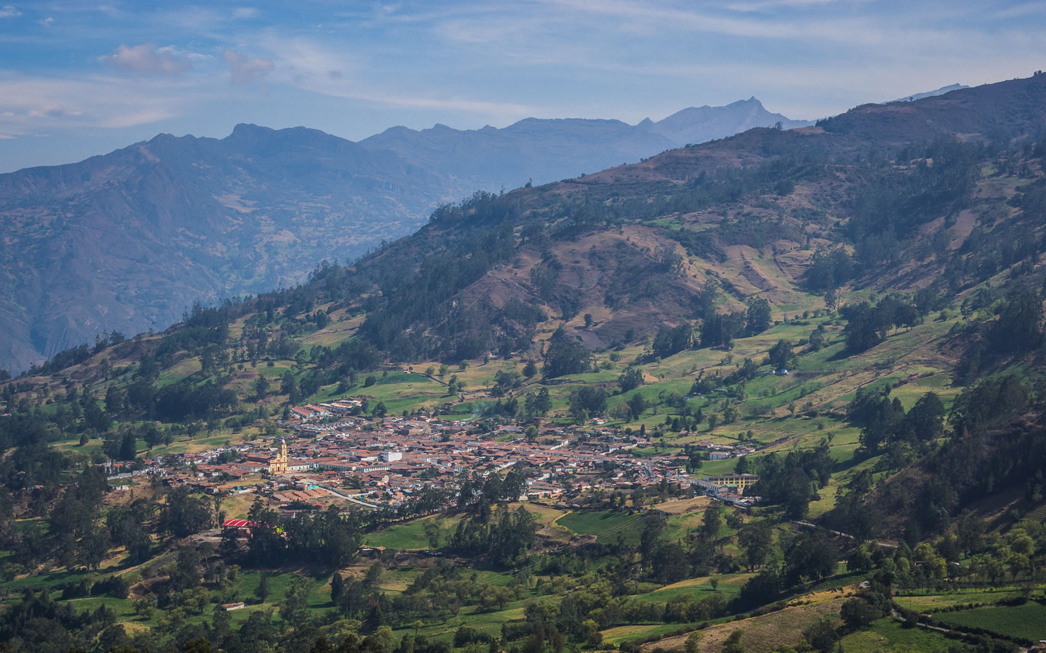
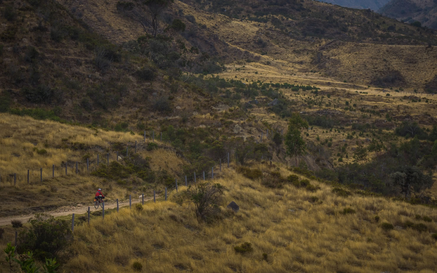
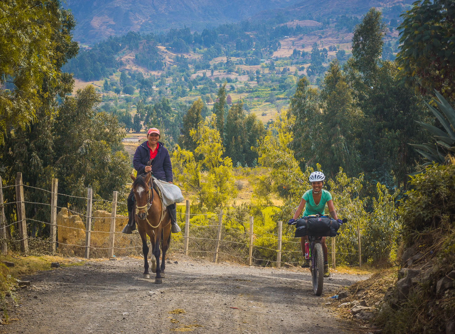
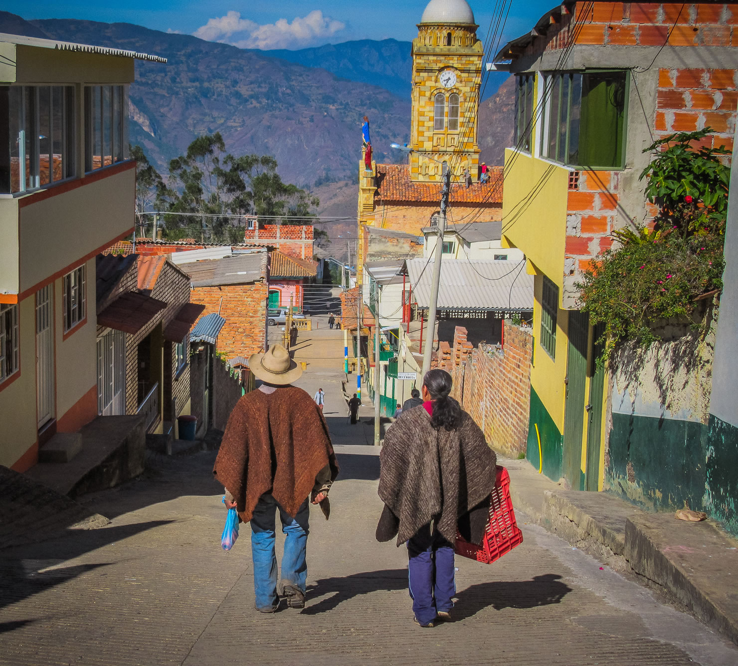
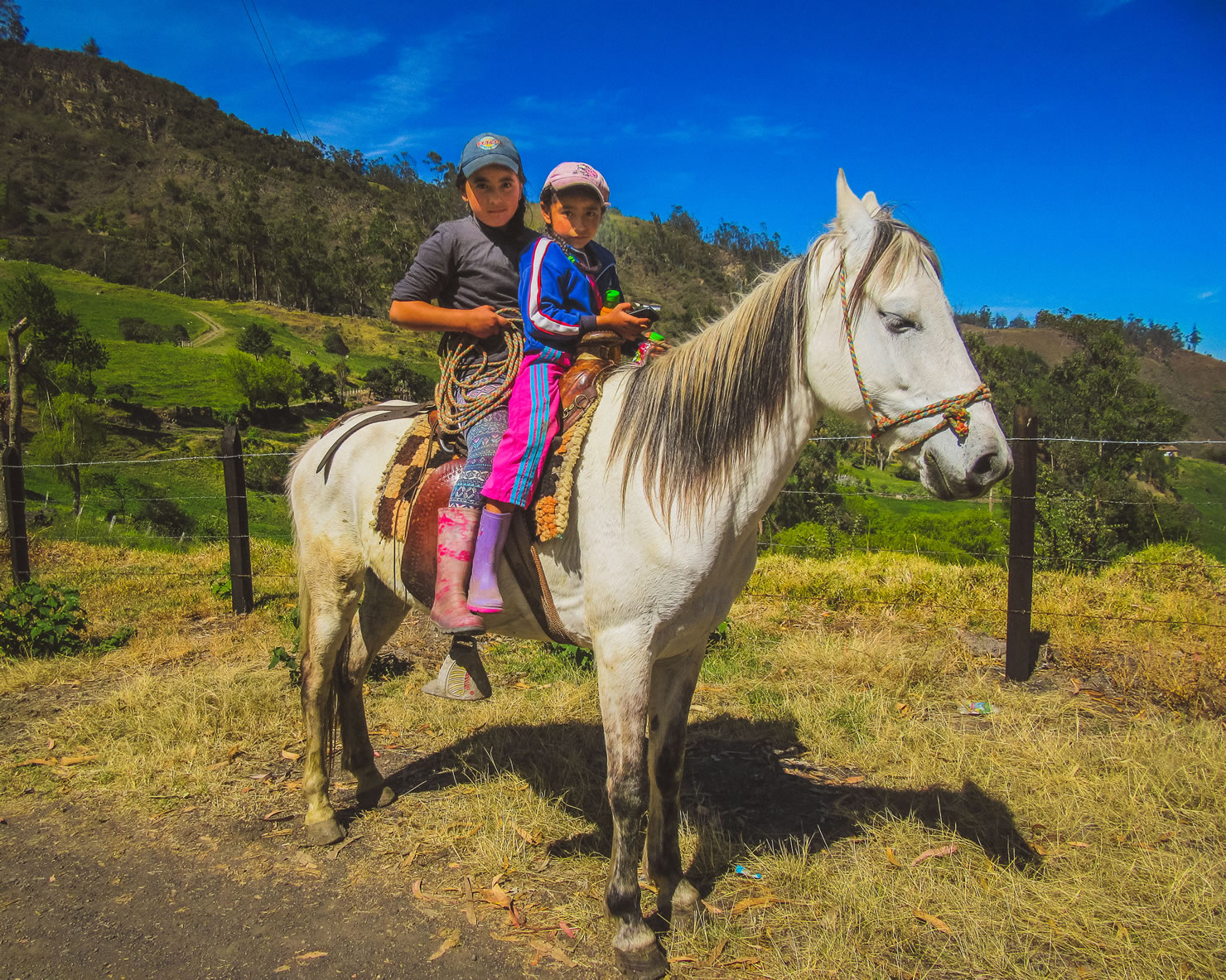
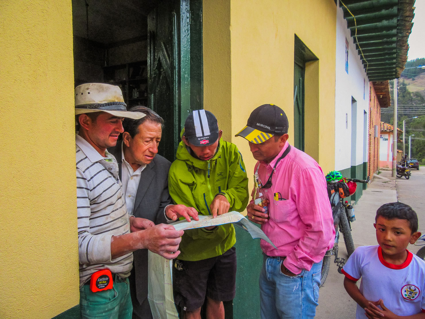
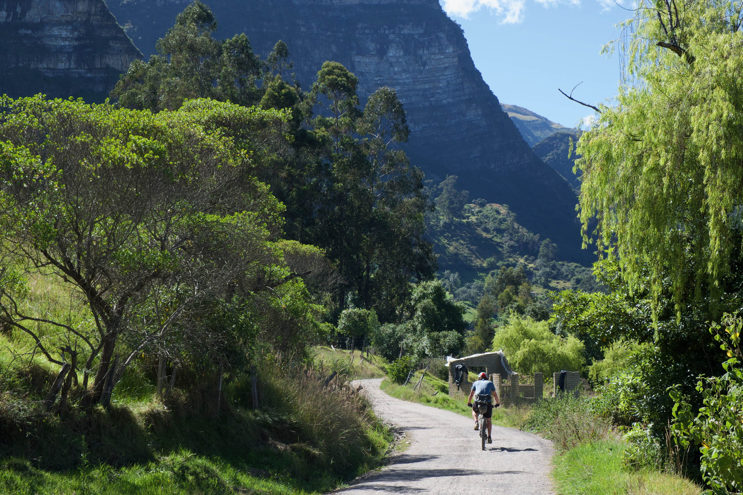
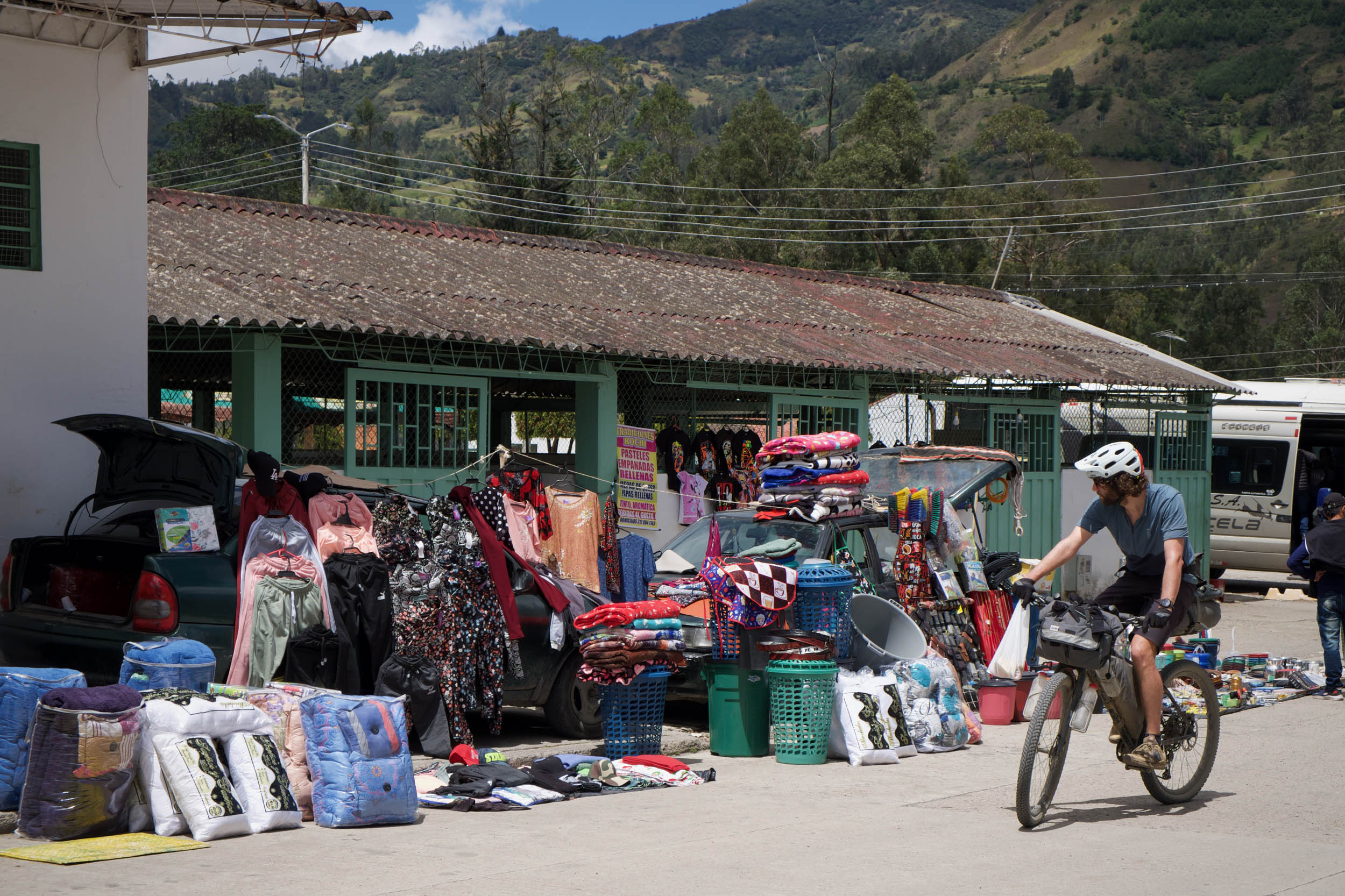
The rural countryside traveled is consistently populated below the alpine zones, and riders will encounter a patchwork of farms woven together by a dense network of incredibly squiggly backroads that navigate the challenging landscape. Motorbikes far outnumber cars as the most common form of transportation, and horses are a regular sight too. The route strikes a comfortable balance of mostly peaceful riding without feeling overly isolated.
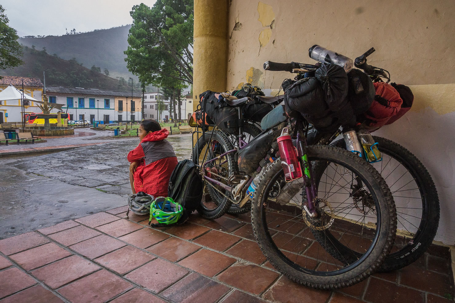
Hefty climbs, lumpy roads, energy-sapping heat, and torrential rainfall can combine to make the riding demanding and travel times longer than you might expect. Despite this, the living—by bike, at least—feels easier than elsewhere in the Andes. It’s common to pass through several villages a day, so water, food, a bed, and a shower are rarely a concern, and the warmth of Colombian people and their love of bikes (it’s practically their national sport) makes for an inviting environment. The settlements are hugely varied, from manicured heritage towns to gritty mining villages, from sleepy and quaint to gregarious and rowdy, and part of the fun is discovering their personalities. The altitude of each also changes the character, with different schedules, environments, food, and more. Wherever you are, though, having a tinto (black, usually sweet coffee) near the town plaza, watching the town go about its business, is an enjoyable pastime for locals and bikepackers alike.
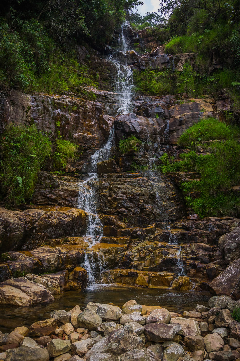
Although the distances covered can be modest, the surroundings can change quickly. Frequent passes mean constant changes in altitude, delivering you into different mircoclimates. It’s at times hot, stark, dry, and cactus-filled, then humid and jungly, then brisk and alpine. As butterflies flit and flutter around you, unusual birds sing out from the trees, and the weird and wonderful forms and scales of the plant life are on display, it’s easy to see how this little slice of Colombia is part of one of the world’s most biodiverse countries.
Route Difficulty
Climbing, weather, and altitude can make Oh Boyaca! challenging, but the riding isn’t technical. Balancing this out though, the logistics are relatively straightforward, so hearty days of slow, hot climbs are easily recovered from with readily available comforts, if you want them.
A high point of 4,100 meters (13,450 feet) means altitude is an important factor to consider. You don’t need to spend long periods of time riding or sleeping at high altitude, but if you’re planning on hiking in Cocuy or camping in the páramos, you may need to give yourself extra time to acclimatize. At 2,700 meters (8,860 feet), the town of El Cocuy is a good place to spend an extra day or two before heading to the higher sections of the route.
It’s generally not necessary to carry more than a few litres of water at a time. While streams aren’t always abundant, villages are frequent enough that water is never a great concern. Food is readily available, though the selection and be limited and vegetables aren’t abundant; small shops often sell little other than soft drinks and packets of crisps.
Route Development: Dean and Dang developed the route while touring the continent in 2015, when information on riding in the region was scarce. It’s become a popular route as part of transcontinental journeys and as a trip in its own right. This guide was updated in 2024 by Eileen Schwab following a 2023 Colombian tour that included the route.


Submit Route Alert
As the leading creator and publisher of bikepacking routes, BIKEPACKING.com endeavors to maintain, improve, and advocate for our growing network of bikepacking routes all over the world. As such, our editorial team, route creators, and Route Stewards serve as mediators for route improvements and opportunities for connectivity, conservation, and community growth around these routes. To facilitate these efforts, we rely on our Bikepacking Collective and the greater bikepacking community to call attention to critical issues and opportunities that are discovered while riding these routes. If you have a vital issue or opportunity regarding this route that pertains to one of the subjects below, please let us know:
Highlights
Must Know
Camping
Food/H2O
Trail Notes
Resources
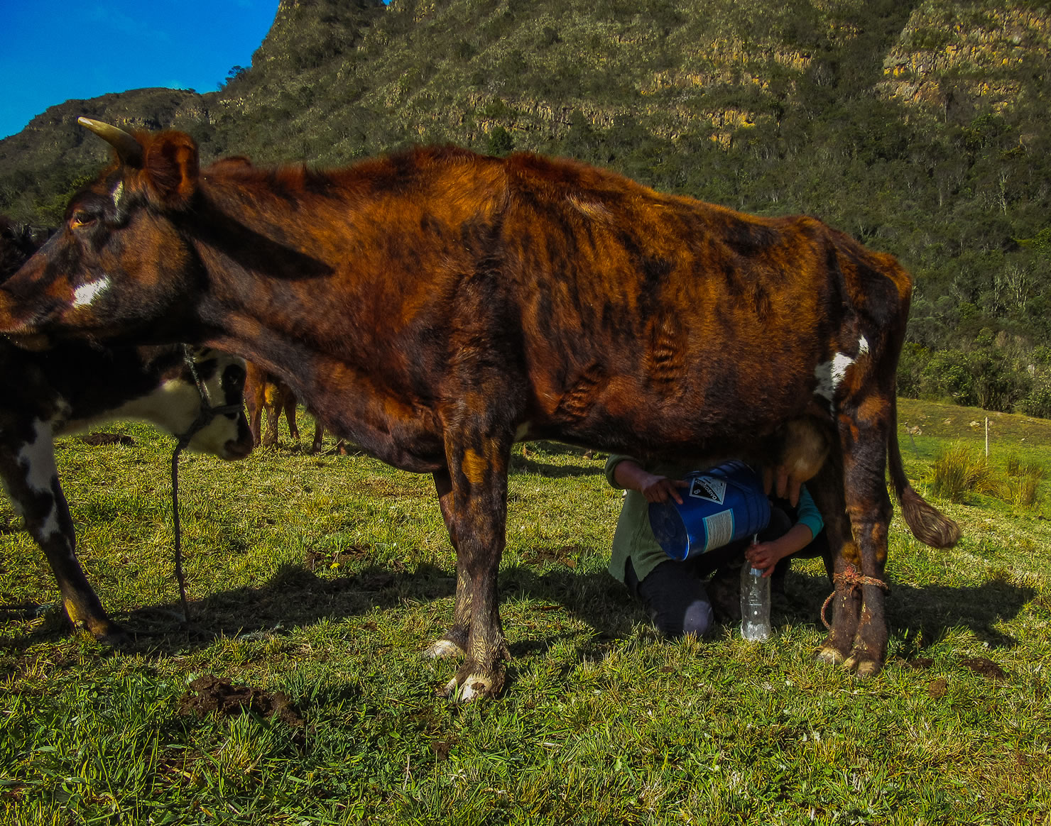
- Milk farms along the route.
- The warmth of Colombians makes this a fun place to ride. We were told (in Santander!) that the people of Boyacá are the friendliest in the land. We won’t claim to have researched this thoroughly but can’t disagree.
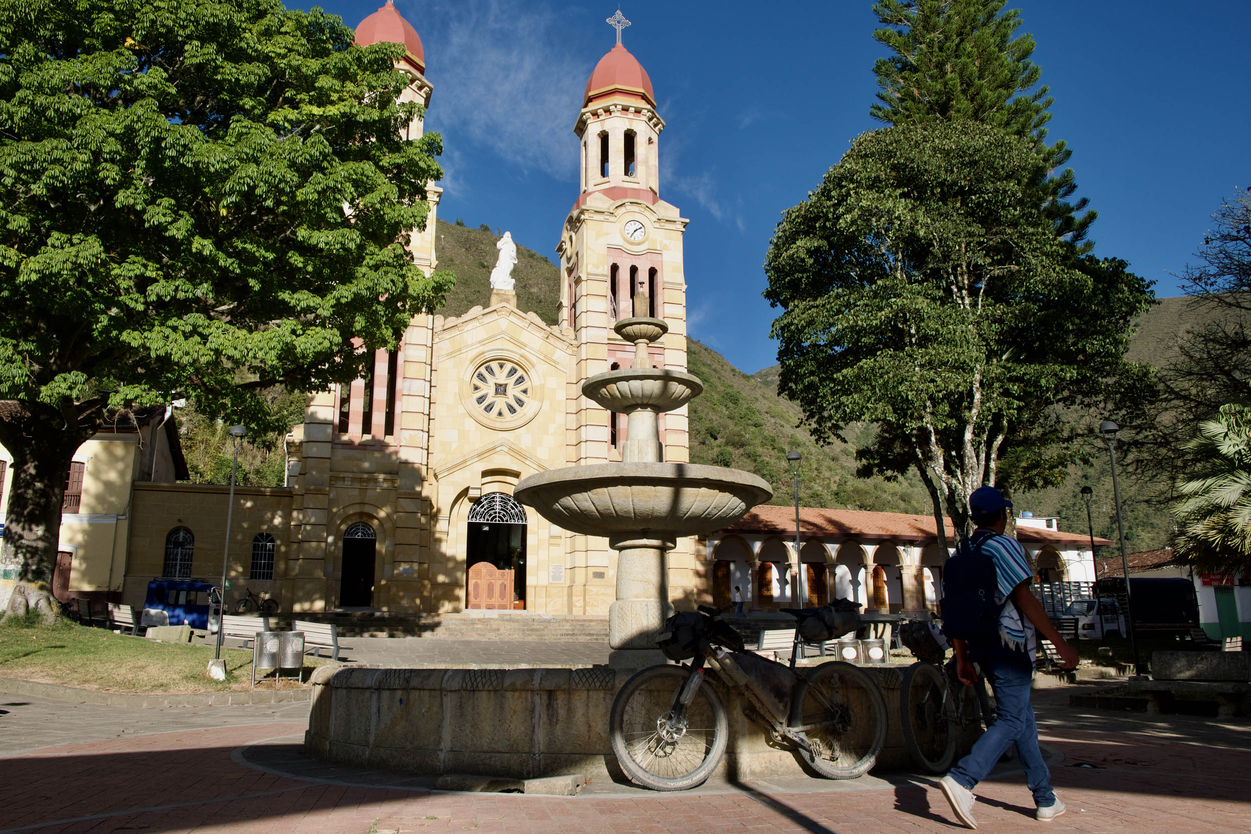
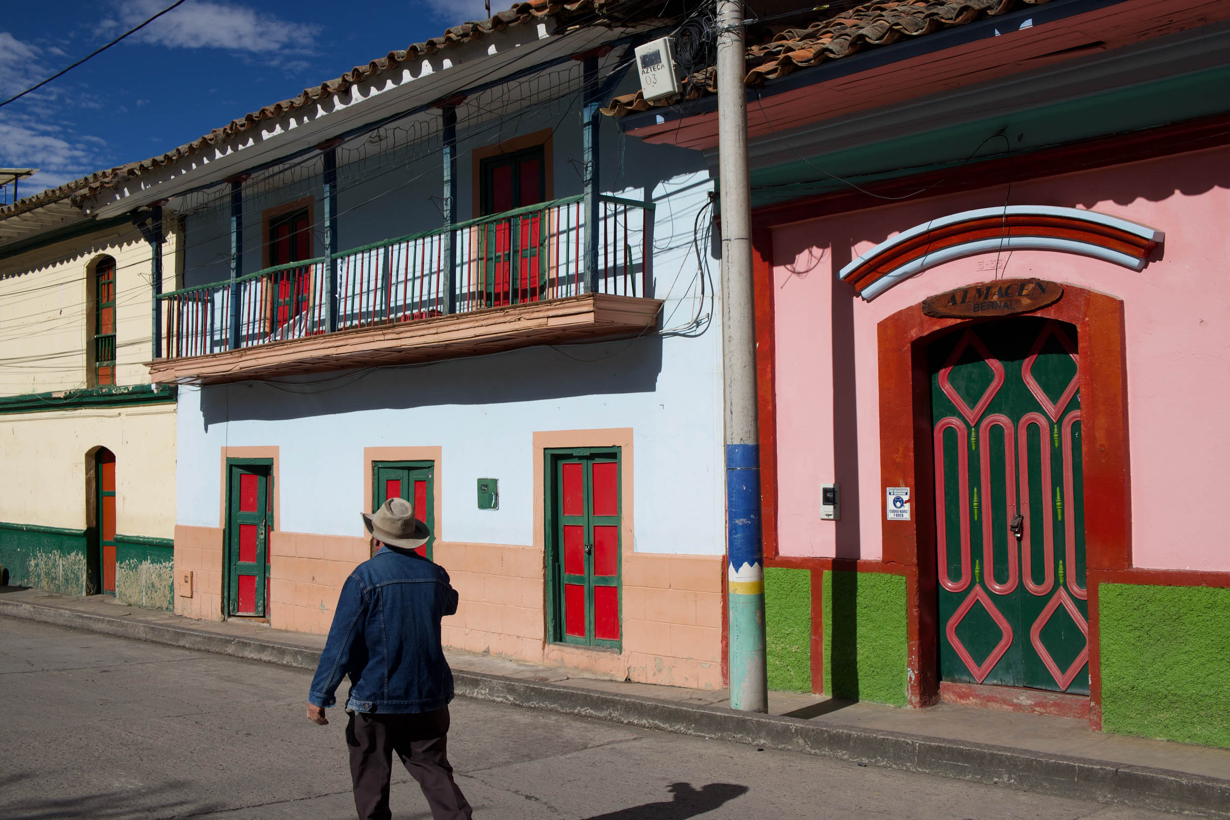
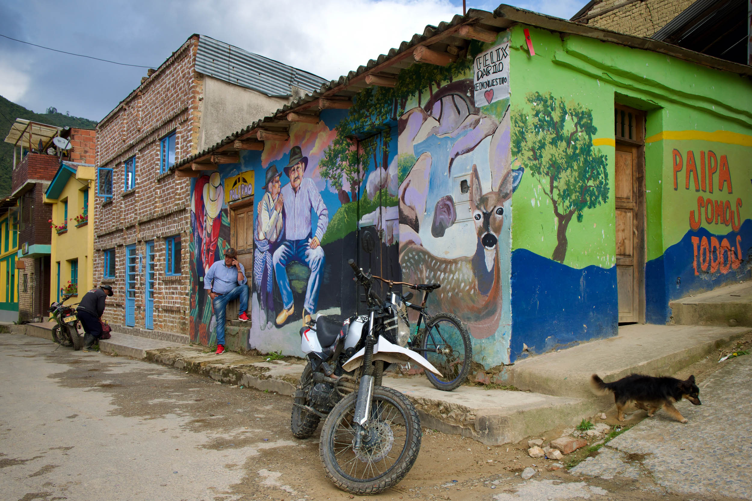
- A diverse range of interesting towns, from beautiful colonial villages to gritty mining towns, give an insight into life in the area.
- Picture-perfect Barichara is a laid-back place to spend some time before you hit the trail. You can also easily access the tiny village of Guane, which is a popular side trip.
- While Barichara and Villa de Leyva have the status of being part of the 17 official Heritage Towns, El Cocuy holds its own too, with distinctively coloured heritage buildings lining its meandering streets.
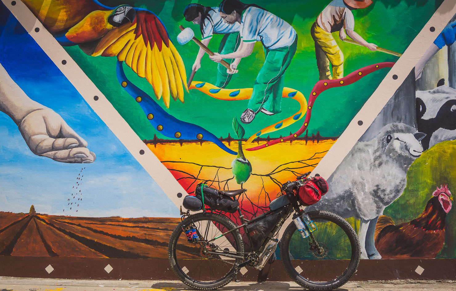
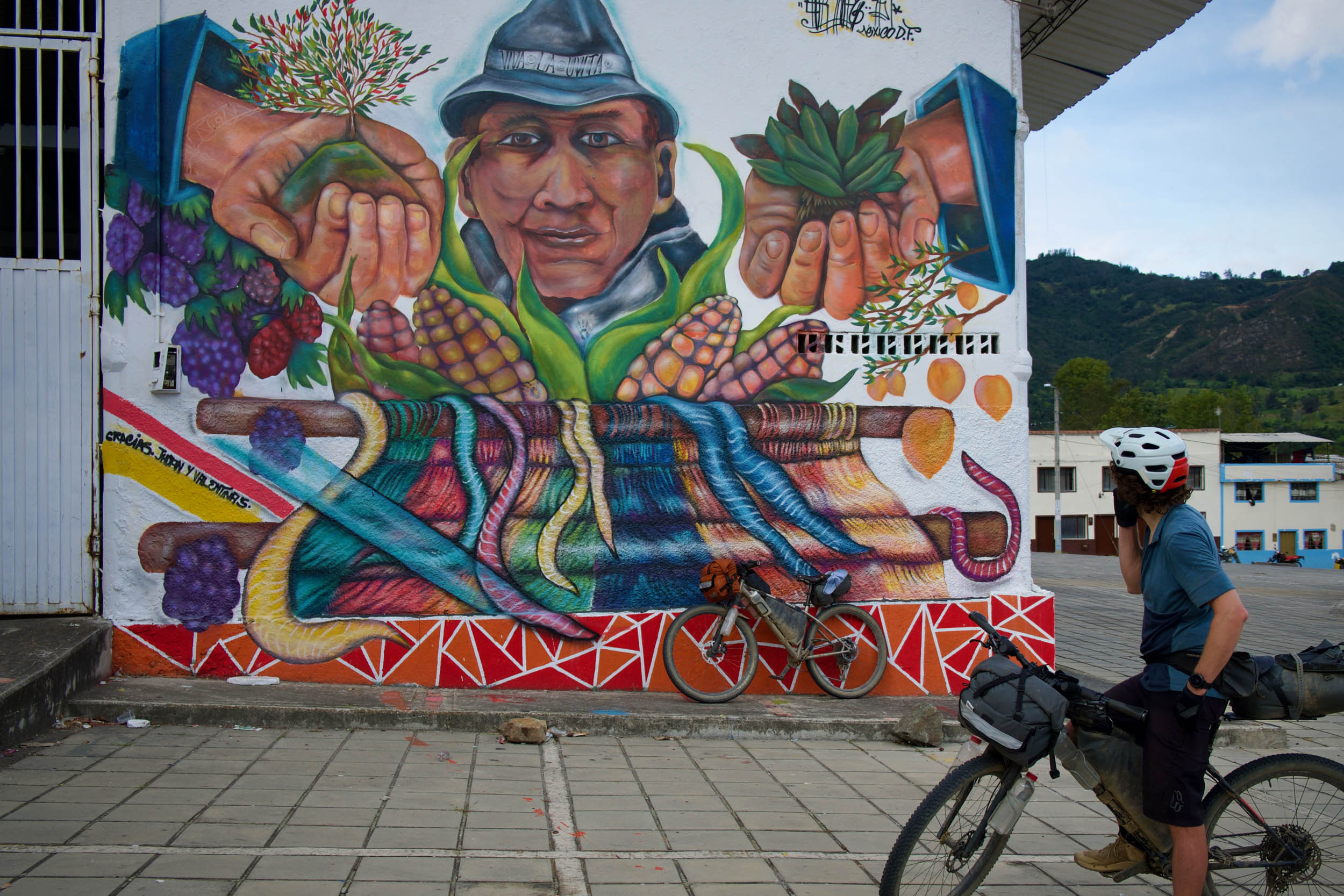
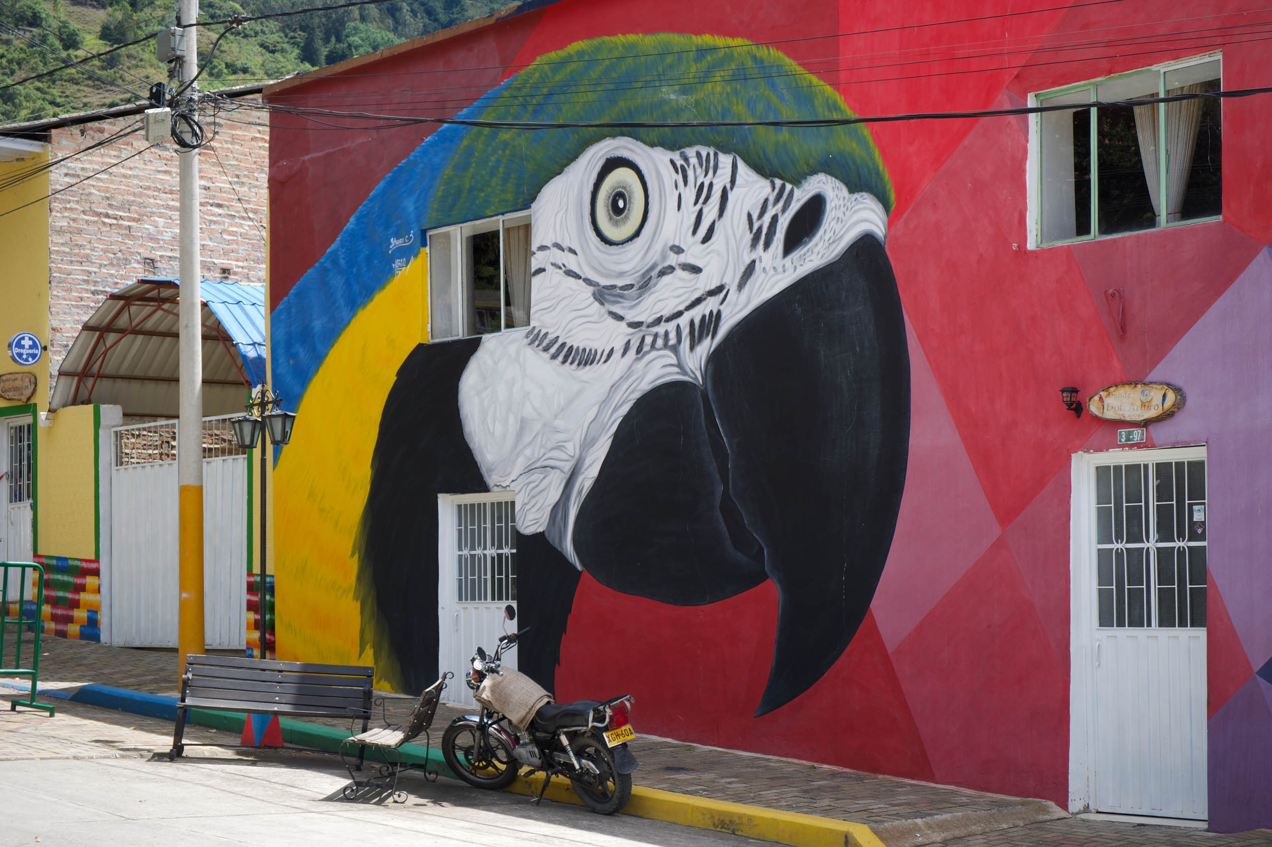
- Lively street art and murals put the impressive artistic talents of locals on display, especially in the artisan town of Guacamayas
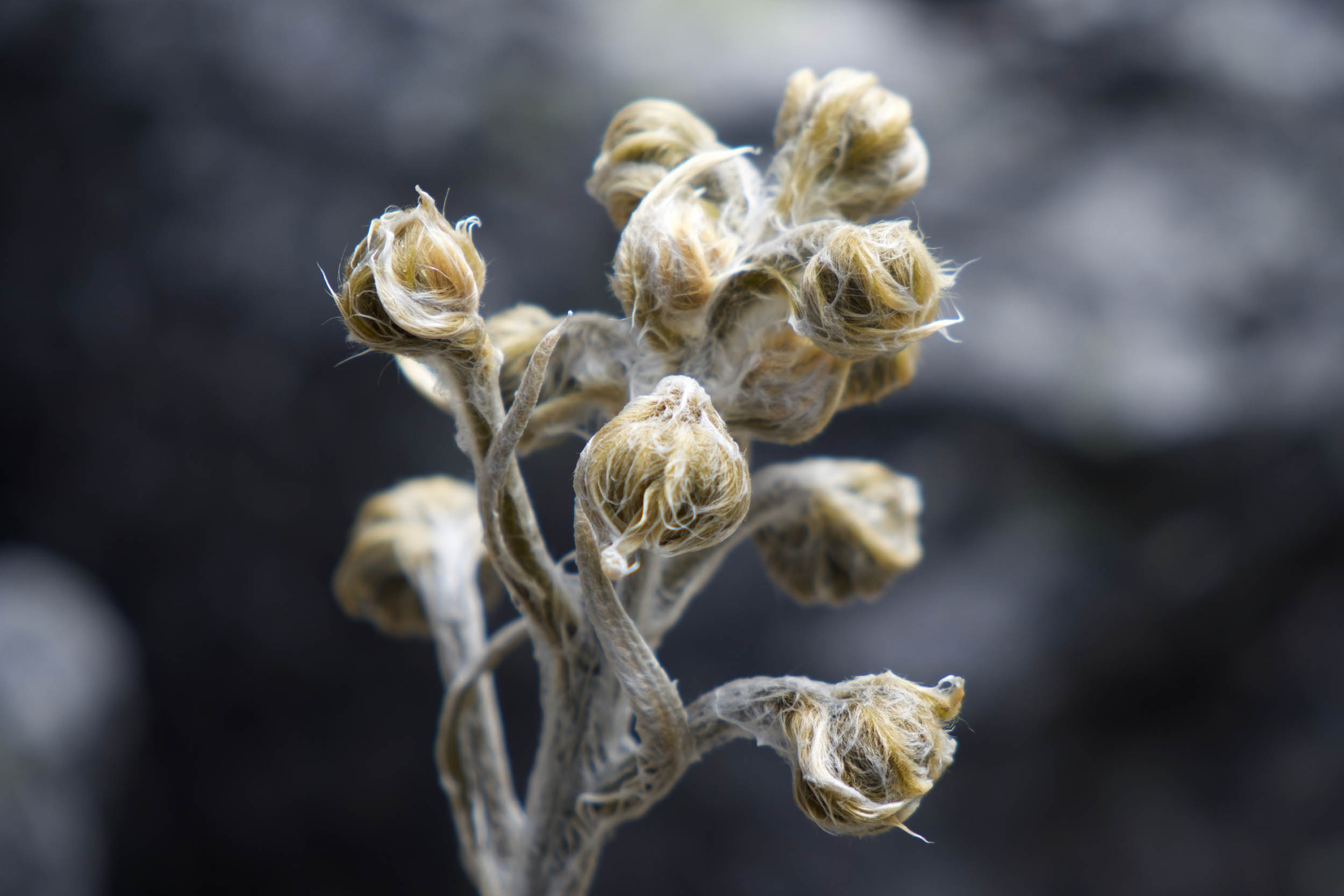
- Colombia is one of the world’s most biodiverse countries, and this is evident on route. Dramatic variations in climate take you between cactus-filled canyons, lush forests, and glaciated valleys with birds and butterflies for company.
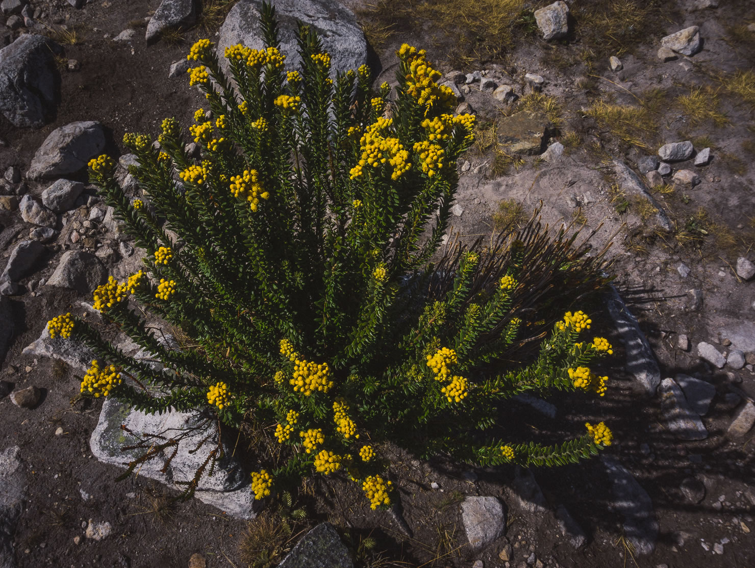
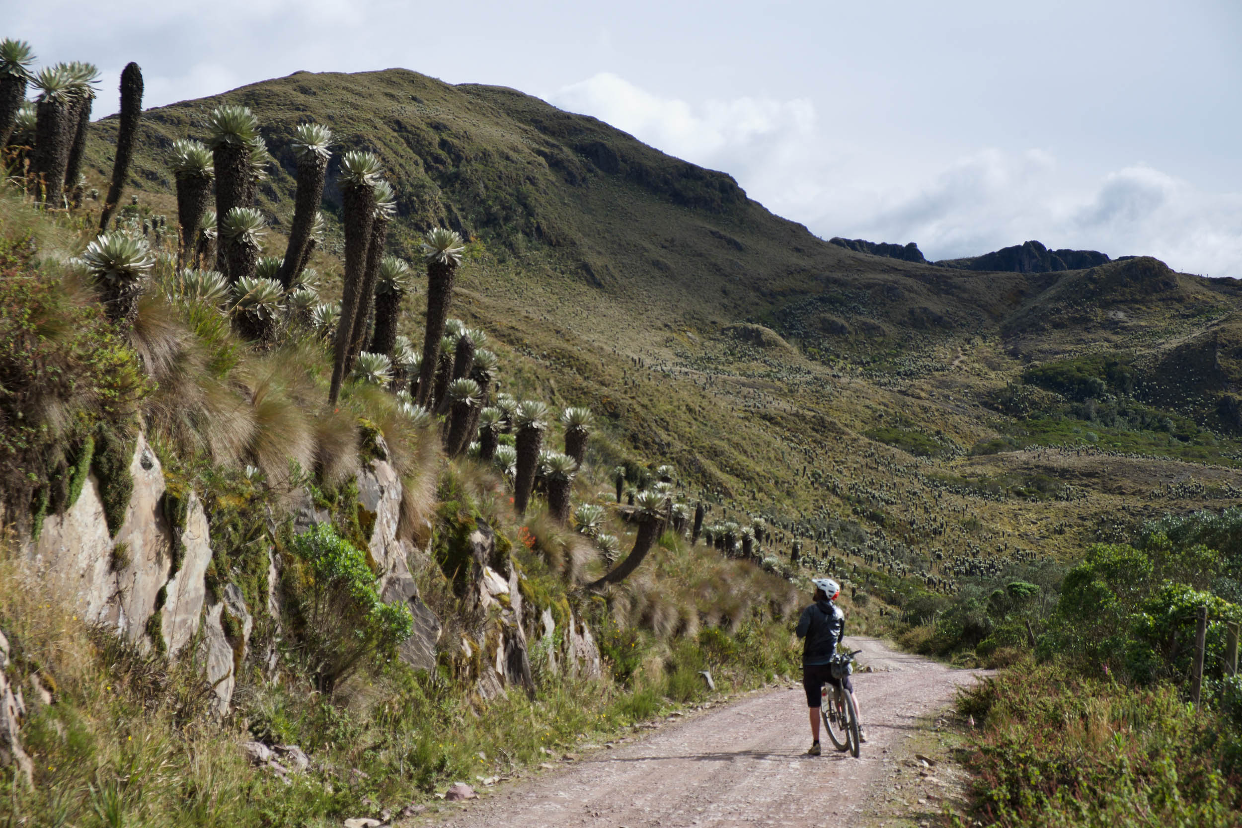
- Páramo are high tropical mountain ecosystems only found in Colombia and Northern Ecuador and feature the impressive frailejon plants.
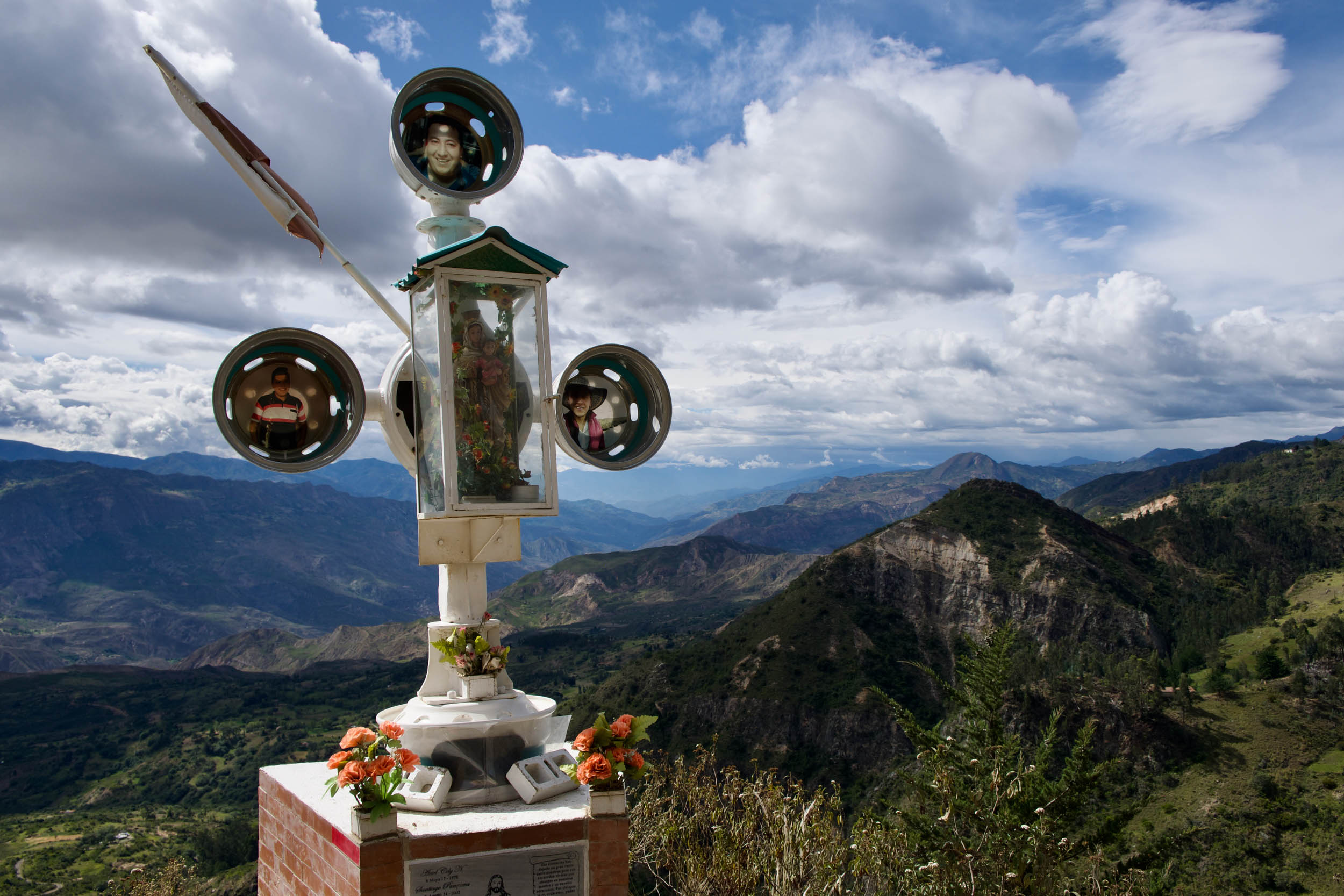
- The views on the El Cocuy loop are stunning. Taking some extra time to hike in the Parque Nacional Natural (PNN) El Cocuy, while pricey and logistically challenging, will get you deeper into these dramatic landscapes.
- Sundays are when the local cyclists are out in force, and it’s fun to see the country’s bike culture spring to life.
- Rest up in Villa de Leyva for a few days of great food, craft beer, and people-watching in the impressive Plaza Mayor.
.
When to go
- Colombia’s proximity to the equator keeps temperatures stable throughout the year, but the main consideration is rainfall. In the Andean region, the driest months are from December to March, with a shorter second dry season from July to August.
Logistics
- There are excellent and frequent buses around the country, making it relatively easy to show up to a station and find your way somewhere.
- Bucaramanga has an airport, and if you have a few extra days, it’s worth riding to the start via this route from Giron to Barichara. Beware that the heat below 1,000 meters (3,280 feet) can be really challenging.
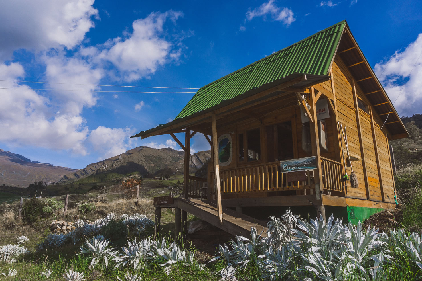
- National park access is complicated. The ride doesn’t require any permits, but if you want to enter Parque Nacional Natural El Cocuy for day hikes while you’re there, it currently requires a permit and a mandatory guide, which can be arranged in El Cocuy or Guican. Visit the national park office for a list of guides, which you’ll need before getting a permit. You’ll also need to attend a mandatory briefing at the office at set times.
- You can ride the route in either direction.
- Most Colombian villages (shops included) along the route shuts down around siesta time (1 to 3 p.m.) save for the restaurants/comedor. Ask around town; someone is always willing to prep a meal for a hungry cyclist for a few pesos.
- Most nationalities are exempt from needing a visa to enter Colombia for up to 90 days.
- Very little English is spoken outside of tourist spots, so learning some Spanish will markedly improve your interactions.
- There are numerous dirt-road side trips in San Gil if you have some time to spare.
Dangers and Annoyances
- Colombia has undergone a transformation over the past few decades, but its troubled history hasn’t faded entirely, and it’s not without its safety concerns. Although we felt safe and never encountered any danger, many locals will be quick to tell you to maintain a level of caution.
- High altitude can pose serious dangers, so read up on how to prepare and manage this and be aware of the tell-tale signs of altitude sickness like headaches, nausea, and dizziness.
What Bike?
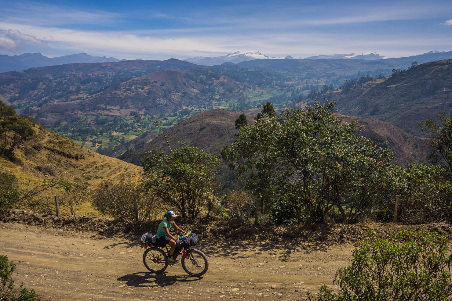
- A range of bikes would work on this route, and they’ll all be the right bike at some point. Rigid is fine, but a hardtail wouldn’t be over the top. A gravel rig is okay too. It might be a little underbiked at times, particularly if you run into some dreaded Colombian mud. Around 2” tires or bigger are recommended. We had 2.3” on rigid bikes.
- You won’t find much flat riding here. It’s mostly climbing or descending, so easy gearing and packing light are worth prioritizing. It’s rideable on a touring setup, but some of the gradients may have you pushing.
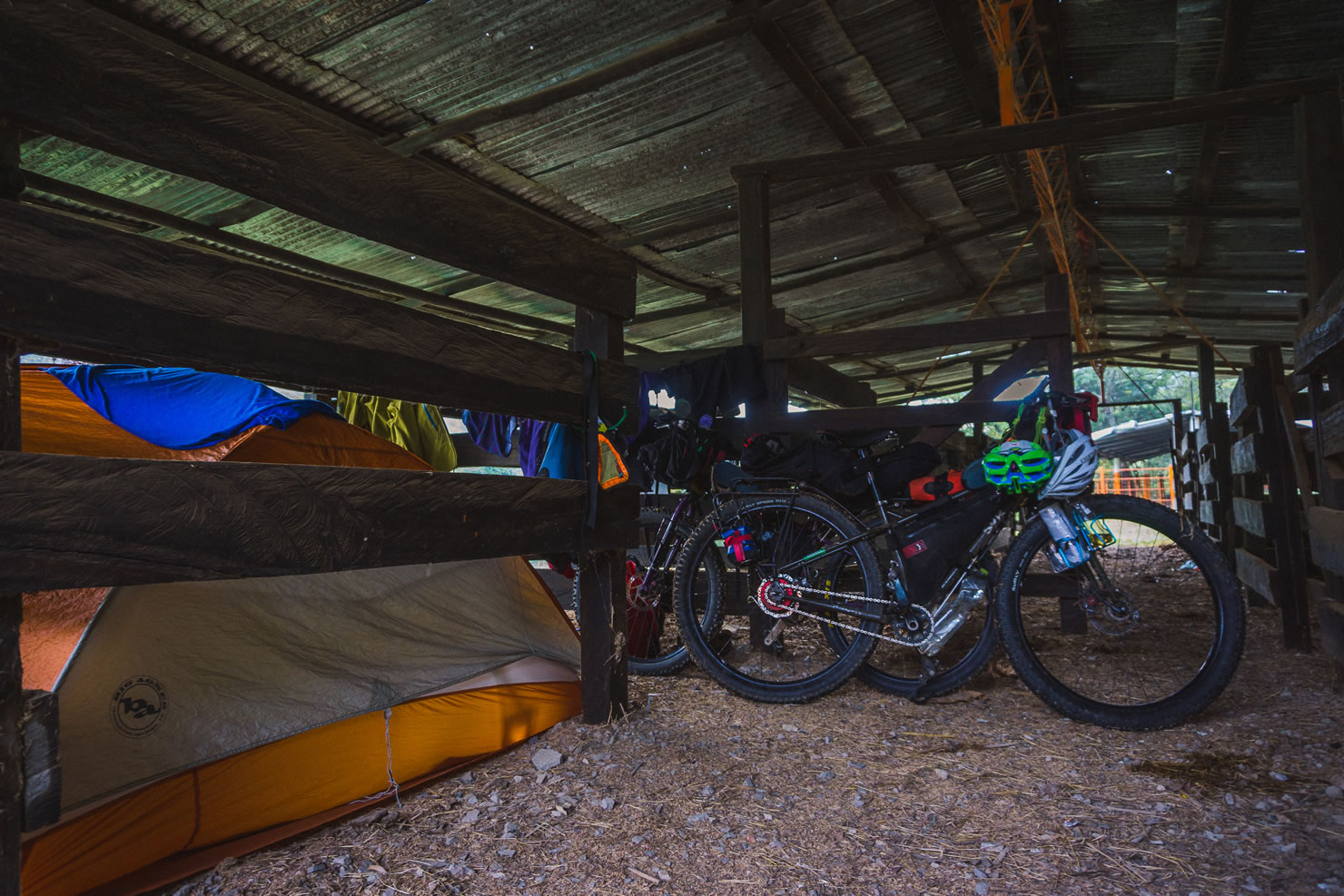
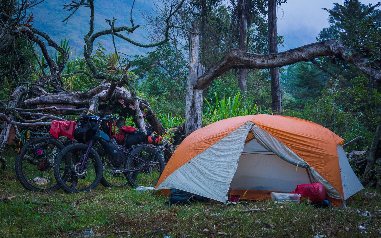
- The route travels through areas with a lot of fenced private land and steep topography, so camping isn’t always the easiest, but it’s certainly possible. Official campgrounds aren’t common.
- Almost every town will have some form of accommodation, which is usually reasonably priced and comfortable.
- Ask the police stations in the villages to point you toward the prime camping spot in the area.
- Water isn’t a big concern, and there’s no need to carry more than a few litres at a time.
- Tap water is often fine to drink in towns, but it pays to ask and filter/treat if you’re unsure.
- Food is mostly easy to come by, and although diverse options aren’t always available, it’s not necessary to carry a lot with you.
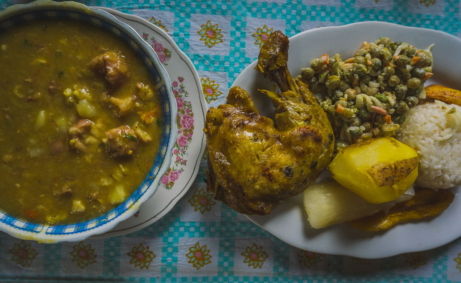
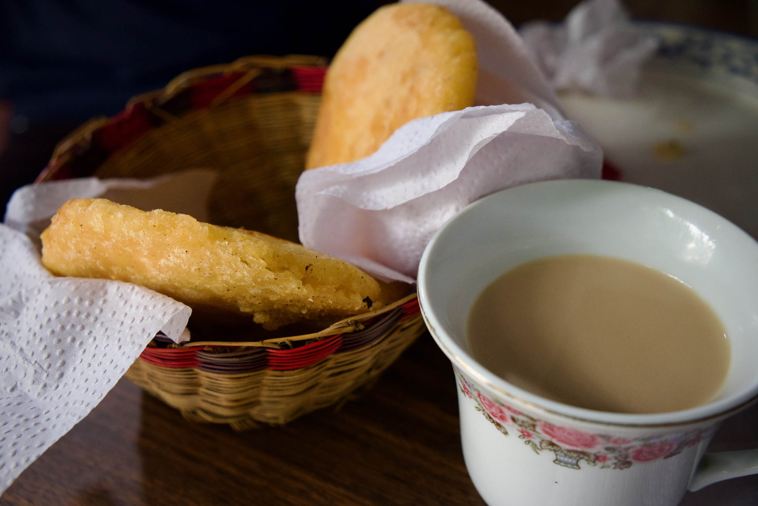
- Papas rellenas, arepas, empanadas, and tamales are commonly available street foods, making affordable meal options that are also portable.
- Local dishes include Santander’s famous hormigas culonas (which translates to “big-ass ants”), bandeja paisa (a meat feast), and the more veggie-friendly patacones (flattened, fried plantains with a variety of toppings).
- The almuerzo ejectivo or menu del dia is an affordable and hearty lunch deal offered almost everywhere that comes with soup, a main, and often a glass of juice. The main might include rice, fries, salad, a meat or fish of your choice, egg, beans, and fried plantains. It usually costs around $3 to 6 USD.
- Bakeries are everywhere but wildly varied, usually depending on the size of the town. Some will offer freshly baked, heavenly pillows of dough (almojabanas), others will serve several-day-old stale offerings.
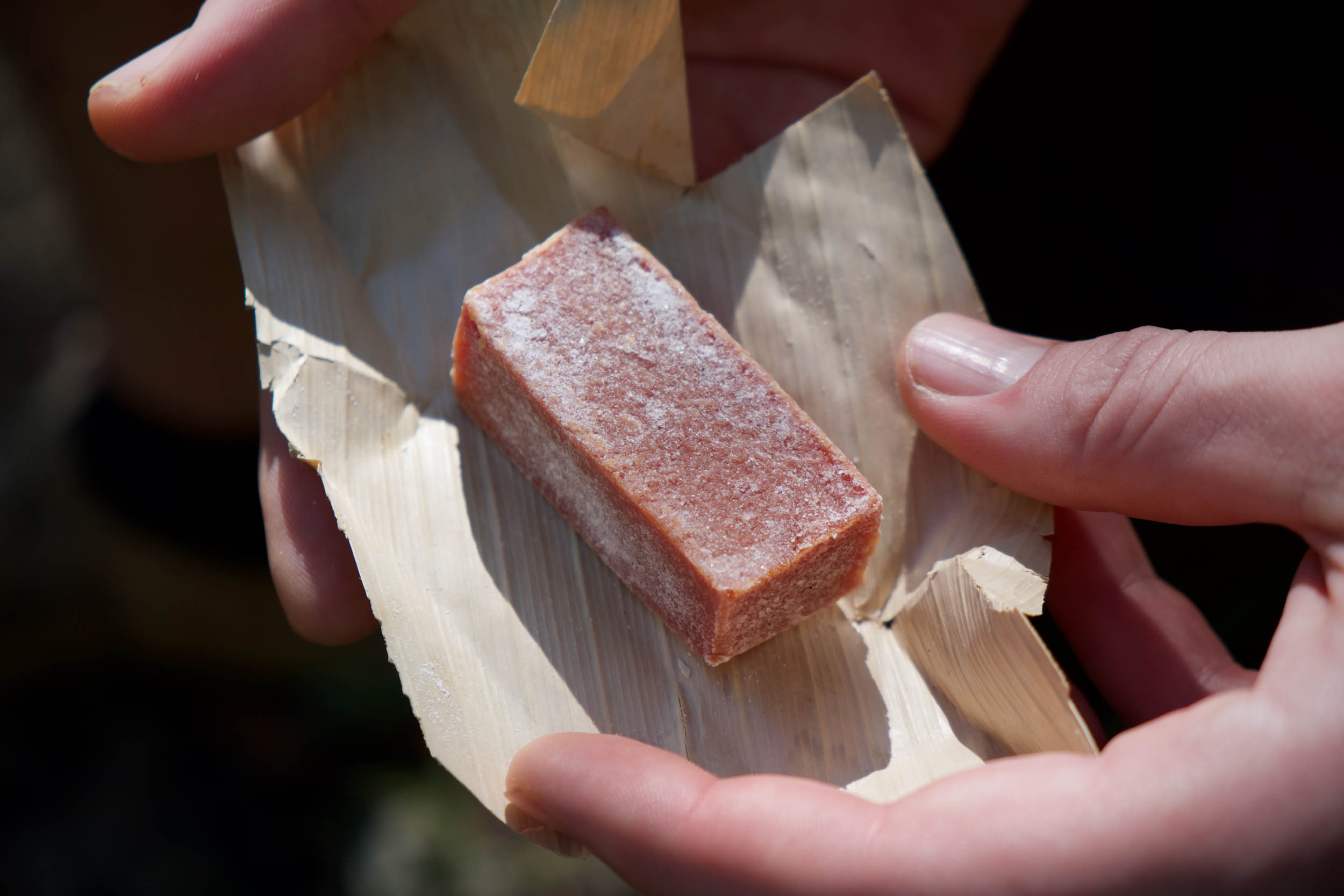
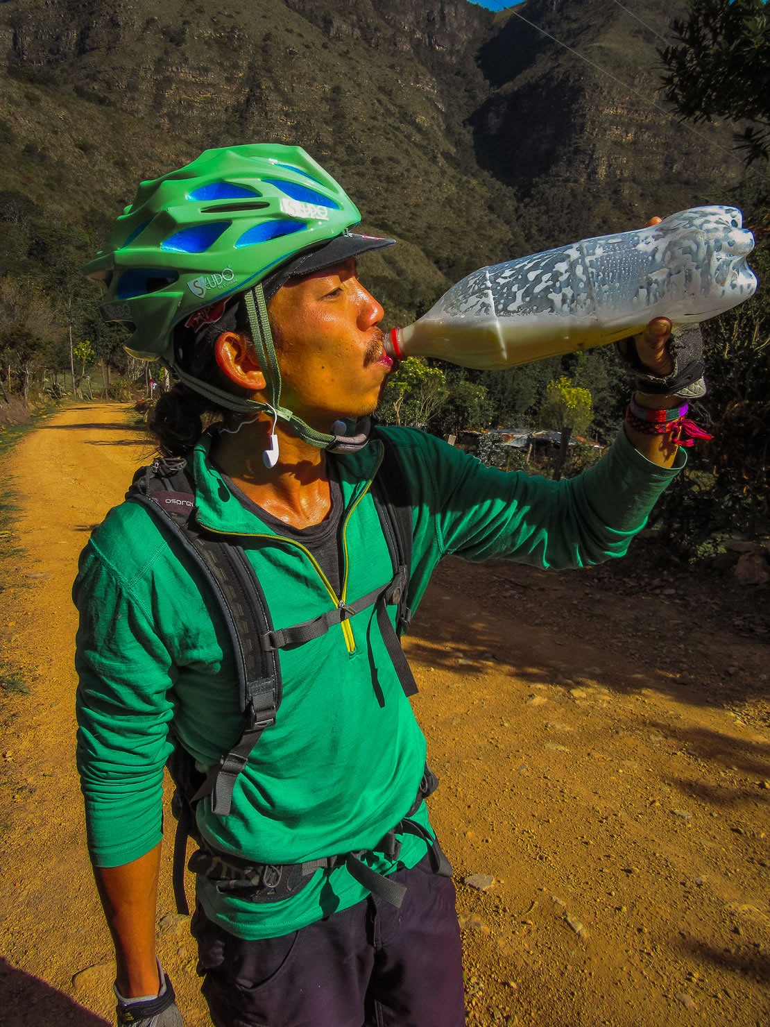
- For folks with a sweet tooth, bocadillo, the instensely sweet and ubiquitous guava pulp, makes great riding fuel. Fruit is abundant and fruit salads, salpicon (a fruit salad drink), and ice creams with fruit are refreshing when things heat up.
- Colombians love to mix sweet and savoury. Expect to find cheese everywhere, including in hot chocolate, on fruit, with bocadillo, and on ice cream.
- El Chingon de Villa in Villa de Leyva is an unmissable spot for a delicious Mexican meal.
- Note that if you’re using an alcohol stove, high-percentage alcohol is very difficult to find. We gave up looking! A stove isn’t a necessity, but a multifuel/petrol stove is your best bet.
- Make sure to try agua de panela con queso (sugary water dunked with a chunk of local cheese) in one of the small restaurants.
- If you’re not a vegetarian, ask for bandeja de paisa, a typical Antioquian dish consisting of beans, rice, plantain, meat, meat, and more meat.
Route Summary
By Dean and Dang
Overshadowed by the immensely popular Sierra Nevada del Ruiz, one would never think much of Boyacá, a department of Colombia in the mountainous region of the Eastern Cordillera. To its right lies Venezuela, and to the left is San Gil, the so-called adventure capital of Colombia.
Internet research yields scarce information about the route from San Gil going east since most transcontinental bike travelers arrive in Colombia from the north in Cartagena and ride south. In some respects, I was glad not to find anything I was looking for online. It adds some surprise to the route on top of the vagaries of mountain weather.
This route connects the town of San Gil to the dirt-road loop in Sierra Nevado El Cocuy/Parque Nacional Natural El Cocuy (PNN El Cocuy) and finishes in the colonial town of Villa de Leyva. We were treated to endless seldom-used dirt tracks, overlapping mountains (read: numerous passes), and páramos.
The first 200-kilometer section is an appetizer to a steady main course of at least 3,000-foot climbs. The entire route is rideable, passing through cobbled colonial towns where you can restock with food and bocadillo, the instensely sweet guava pulp, which is my preferred riding fuel.
Sample Itinerary
By Eileen Schwab
With many villages on the way and the choice of whether or not to camp, there are plenty of ways to break up the ride. Around 8–10 days would be a faster pace, 12 days would be more relaxed, and 14 would give some shorter rest days. This describes a 12-day option, not including time to visit the national park.
location Barichara to Mogotes
Day 1 (65km +1,800m)
Leaving Barichara, the route takes you through quiet, rolling farmland to a ledge overlooking San Gil before swooping down into town.
If you want to ease into things and take in some activities, consider extra time in the boisterous adventure capital of San Gil to break up this stretch. The departure from San Gil on the 45A highway is a little terrifying with many trucks, but it improves as soon as you leave this road. It quickly leads onto some tiny backroads, serving up some of the steepest climbing on the route, with a few stock gates to pass through. The reward is the views from the traverse once you reach the top. This reconnects with the paved 64 road, and if you don’t fancy the circuitous start, you can bypass it by staying on this stretch of pavement. From here, it’s an uncharacteristically fast, smooth, and flattish ride to Mogotes, where you’ll find food and accommodation.
For a more adventurous, hike-a-bike-filled alternative between Barichara and San Gil, check out the old Camino Real trail Mark and Hana took.
location Mogotes to Onzaga
Day 2 (45km +1,100m)
The road gets a little rougher shortly after leaving Mogotes, and you’ll climb your way up some lush hillsides before a swooping descent to tiny San Joaquín, which has accommodation and food. Then it’s onwards to Onzaga, following the river valley all the way there. Onzaga’s highly recommended Casa Lacambra was one of our favourite places to stay, with a wonderful host and lovely rooms. We were able to have our meals here, too, and the food was excellent, though you’ll also find some basic food and supplies around town.
location Onzaga to Soata
Day 3 (48km +1,500m)
A couple of hearty climbs straight out of Onzaga reach 3,000 metres of elevation. If you’re lucky, a small tienda with cold drinks might be open at the top of the first climb. The second climb has some steep and loose sections, then a long descent will see you reach Soata, a bigger, grittier town that’s quite spread out and doesn’t have an obvious centre.
location Soata to San Mateo
Day 4 (47km +1,600m)
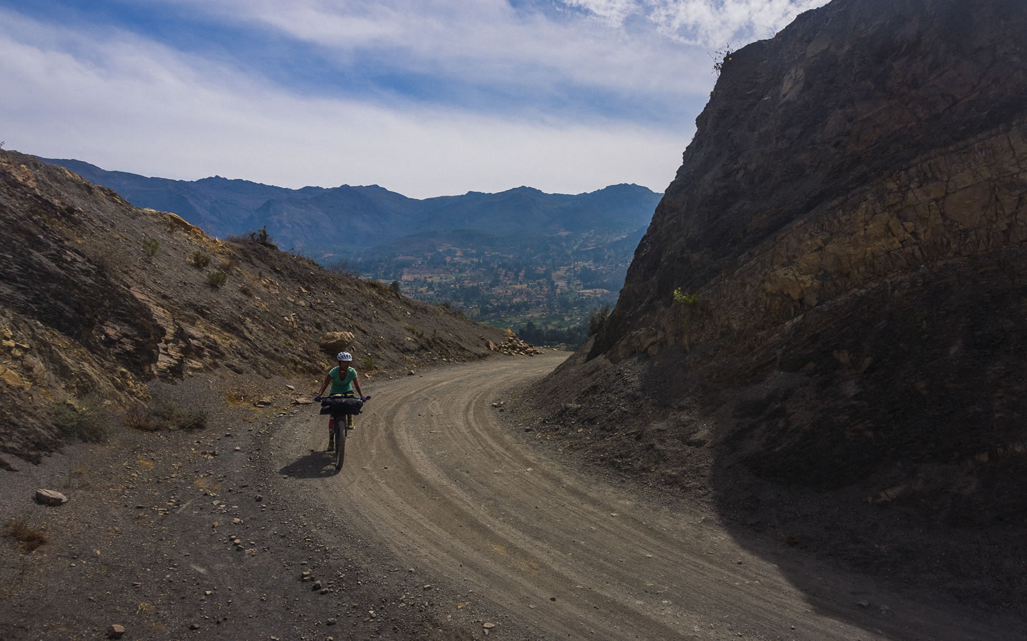
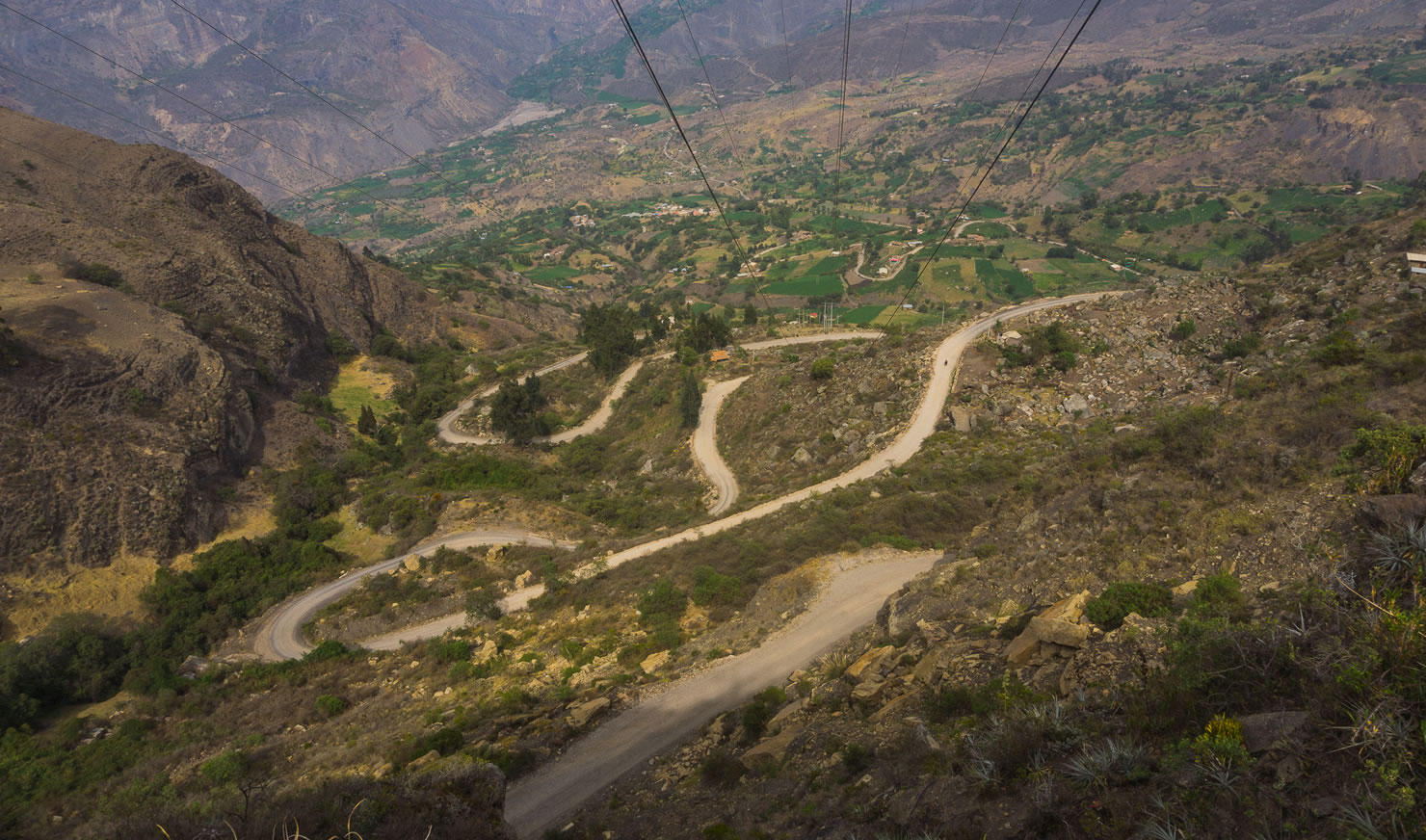
A rapid and loose downhill bypasses the main road and drops you through dry, dusty, cactus country to the Rio Chicamocha. If you’re heading in the opposite direction on a hot day, the paved climb might be a kinder option. Smooth tarmac winds up the other side of the canyon, past gritty Boavita and the tidier La Uvita with its nice murals. The last stint passes by some lovely craggy hills and cliffs on the way to San Mateo.
location San Mateo to El Cocuy
Day 5 (40km +1,400m)
This is a relaxed day through scenic country. Stop in for food and admire the amazingly colourful murals in the sleepy artisan town of Guacamayas (meaning macaw). Continue to El Cocuy, the main base for activities in the Parque Nacional Natural El Cocuy. This being a tourist town means you have a few more food and accommodation options. The town sits at 2,700 metres in altitude, and the temperature is notably cooler. It’s a good spot to acclimatise, so if you’re feeling the altitude here, it could be worth spending some extra time before going higher.
location El Cocuy to Guaicany
Day 6 (19km +1,100m)
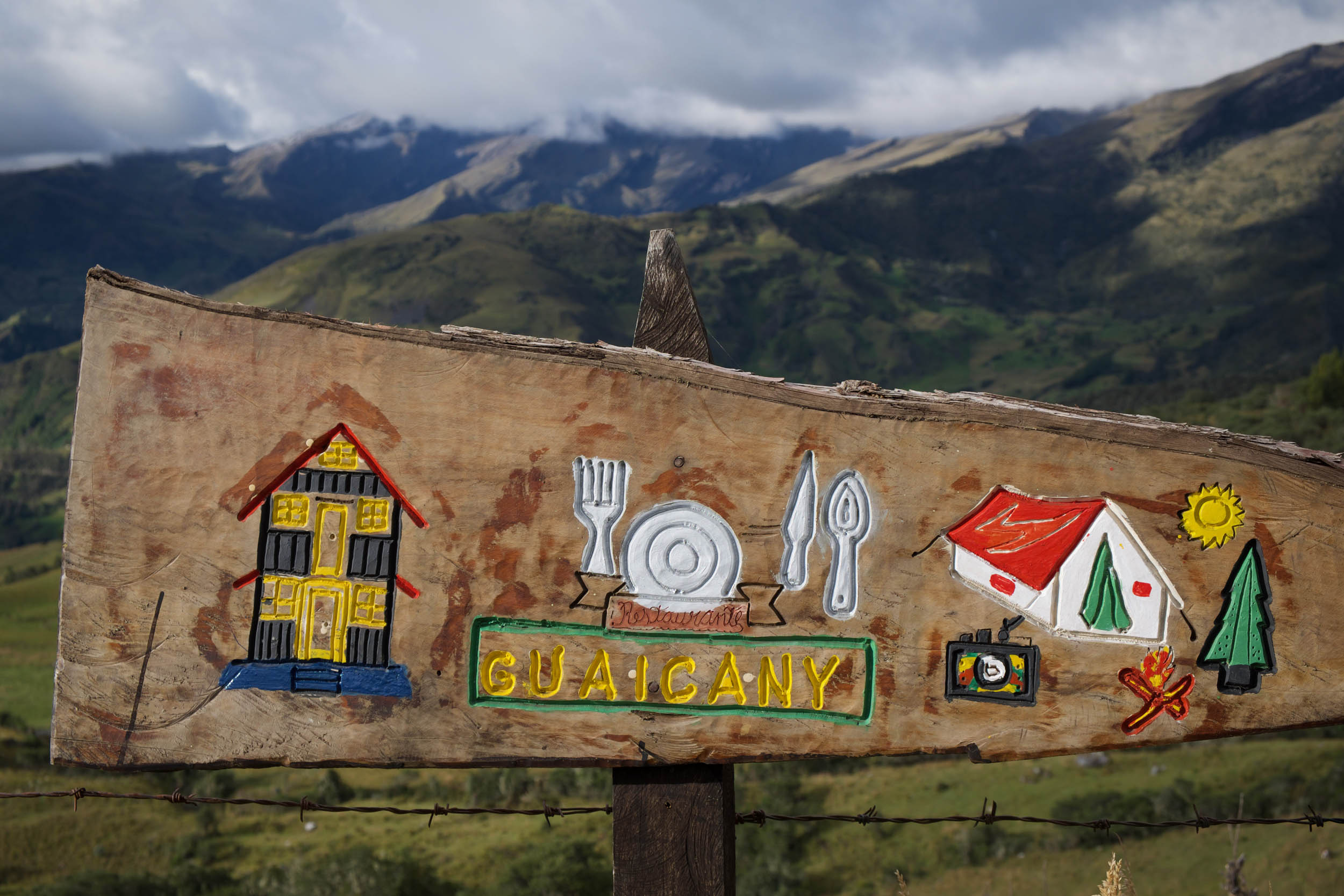
This day 6 and 7 suggestion could easily be split different ways: a couple of nights in El Cocuy with an unloaded day loop, or staying at Guaicany, La Hacienda Esperanza, or Guican for a more even split of days. If not camping, carry on to Chita or Jerico.
The cabaña at Guaicany, just after the first climb, has fantastic views and offers rooms or camping. Note: it’s fairly chilly at 3,800 metres! It could be worth calling ahead to see if it’s open and whether food will be available (Juan Carlos: +57 310 566 7554). Most hikers stay a bit further on at La Hacienda Esperanza, where the trail to Laguna Grande de la Sierra begins, though the views aren’t quite as lofty. You could also stay in Guican, an alternate base for the park, where you can also arrange access.
location Guaicany to Páramo camp
Day 7 (59km +1,900m)
If you’re keen to camp among the frailejones, the páramo around the high point of the route offers a magical, lofty perch in good weather. At a touch over 4,000 metres, you’ll want to be well acclimatised and prepared for cold temperatures. Alternatively, carry on to Chita (which is quite run down) or Jerico (making for a long day).
location Páramo to Socota
Day 8 (74km +1,300m)
Descend from the Páramo past some wild scenery with fin-like shards of rock dominating the views to Chita. Patches of farmland between exposed and contorted rock layers make a scenic ride all the way to Jerico and on to Socota. Socota’s a busy little place, but with only few accommodation options.
location Socota to Belen
Day 9 (54km + 1,250m)
Deeper into mining country, the route runs through Socha, skirts around Paz del Rio, then carries on to Belen. This area can be busy and feel treacherous with mining traffic so you might choose to catch a ride. We conveniently hit it on a Sunday when traffic was minimal and many riders were out enjoying the road.
Bakeries are a feature of Belen, which is convenient because the next stretch is the longest without services, so load up on snacks before you set off again. There are also several supermarkets.
location Belen to Hacienda los Iconos
Day 10 (33km +1,200m)
From Belen to Palermo there are big climbs, almost no services and not much flat land. We broke up the ride and enjoyed great hospitality at the Hacienda Los Iconos homestay (map and contact). There’s also a shortcut option taking a left turn at 25km from Belen, bypassing a big descent to the Rio La Laja and climb out, which could see you get from Belen to Palermo in a day more comfortably.
location Hacienda los Iconos to Palermo
Day 11 (48km +1,600m)
A steep, fun descent drops you to the river before a demanding climb back up to the high point of the day, then more great descending – first through the Páramo, some road, then a rough track almost all the way to little Palermo, where you can find some accommodation and a restaurant. .
location Palermo to Villa de Leyva
Day 12 (80km +1,800m)
Follow a lovely river valley with some dramatic cliffs before climbing out towards Gambita (more accommodation and food options make this a good alternative to Palermo). Pass through tiny La Palma and the busier Arabuco on your way to the beautiful Villa de Leyva. This is a local tourism hotspot with all the comforts to reward your efforts – accommodation, great food, museums and even a craft beer brewery.
Additional Resources
- Information on El Cocuy National Park: ParquesNacionales.gov.co
- A brief background on the U’wa people and El Cocuy National Park: AmazonWatch.org


Terms of Use: As with each bikepacking route guide published on BIKEPACKING.com, should you choose to cycle this route, do so at your own risk. Prior to setting out check current local weather, conditions, and land/road closures. While riding, obey all public and private land use restrictions and rules, carry proper safety and navigational equipment, and of course, follow the #leavenotrace guidelines. The information found herein is simply a planning resource to be used as a point of inspiration in conjunction with your own due-diligence. In spite of the fact that this route, associated GPS track (GPX and maps), and all route guidelines were prepared under diligent research by the specified contributor and/or contributors, the accuracy of such and judgement of the author is not guaranteed. BIKEPACKING.com LLC, its partners, associates, and contributors are in no way liable for personal injury, damage to personal property, or any other such situation that might happen to individual riders cycling or following this route.
Please keep the conversation civil, constructive, and inclusive, or your comment will be removed.