


Bikepacking Trans Germany
Distance
1,024 Mi.
(1,648 KM)Days
14
% Unpaved
70%
% Singletrack
15%
% Rideable (time)
97%
Total Ascent
55,260'
(16,843 M)High Point
3,985'
(1,215 M)Difficulty (1-10)
6?
- 3Climbing Scale Fair54 FT/MI (10 M/KM)
- -Technical Difficulty
- -Physical Demand
- -Resupply & Logistics
Contributed By
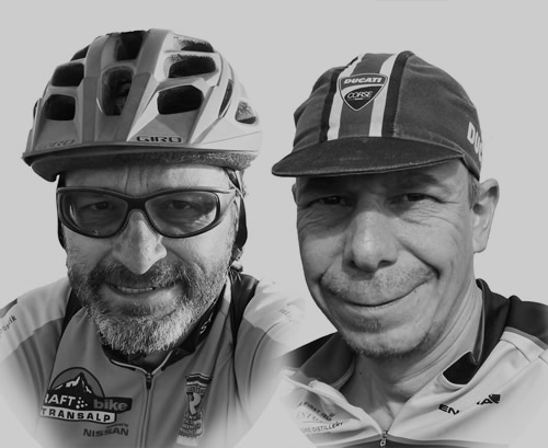
Thomas Borst and Achim Walther
Guest Contributor
Thomas (left) and Achim (right) have been infected by the Tour Divide virus and after both have ridden the Divide themselves they decided to give something back to the bikepacking community by creating similar routes in Europe. First results an ideas can be seen on btg.voidpointer.de.
UPDATE: Bikepacking Trans Germany was updated for the 2023 season removing several critical passages that posed an issue regarding legality. It is now fully rideable. Note that the BTG was originally published in 2016, then closed in 2021 due to access issues.
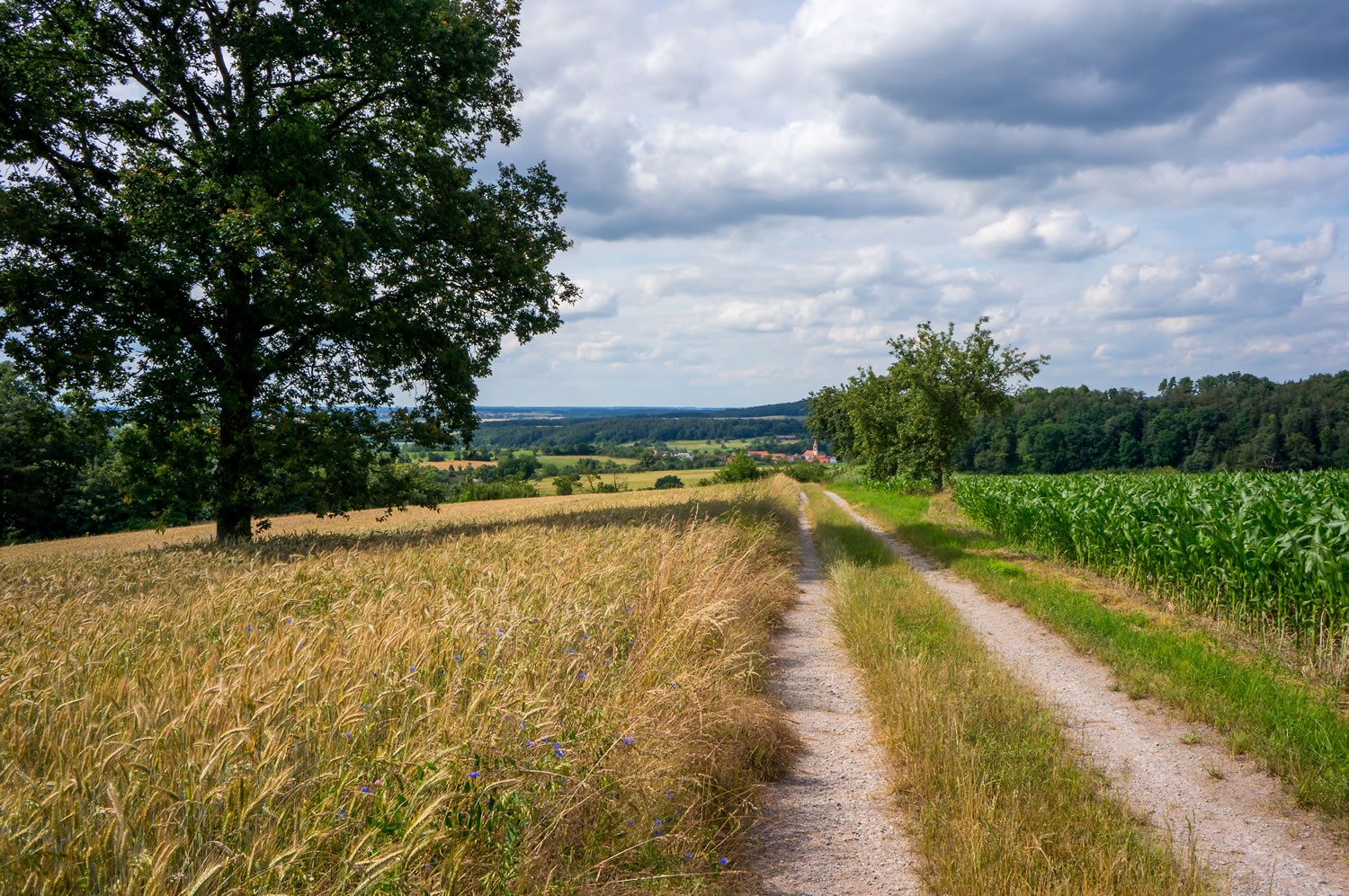
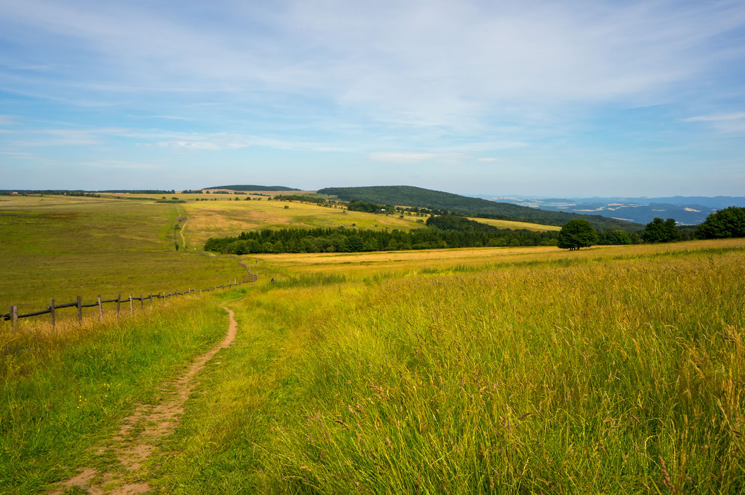
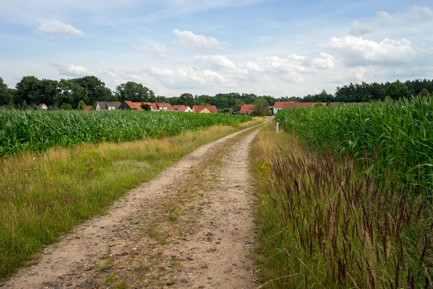
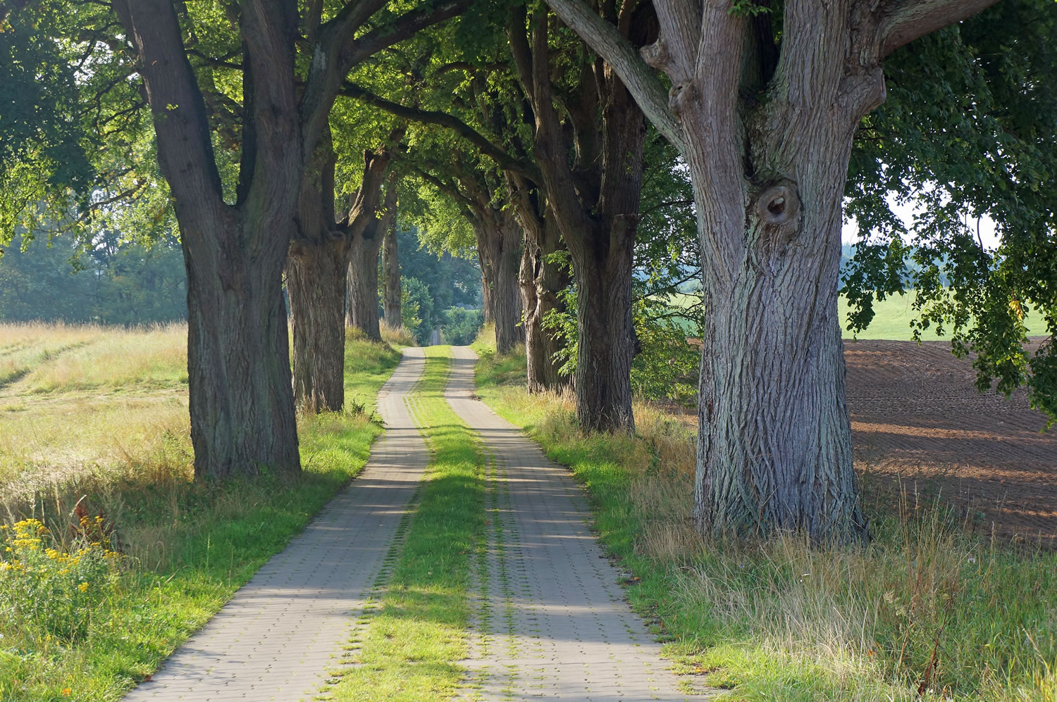
The route was originally designed to cross Western Europe following the continental watershed – same as the Great Divide Mountain Bike Route. Bikepacking Trans Germany is a spin-off that focuses more on connecting existing biking and hiking trails to traverse Germany through sparsely populated areas. The result is a 1000 mile route across the full length of Germany that covers some of the most beautiful and often unknown parts of the country.
In 2016 there was a first edition of a race along this route and the fastest finisher took a little over six days to reach the northern terminus of the route on the island of Rügen in the Baltic Sea. A peloton of five riders finished after 12 days which is an appropriate timeframe for a bikepacker in touring mode. You will face virtually all of the climbing on the first 700 miles of the route. But even with the climbs behind you, the remaining route is far from being a joyride. The Eastern German region of Brandenburg for instance is notorious for its sandy tracks. To read more description of the route, click the Trail Notes tab below…


Submit Route Alert
As the leading creator and publisher of bikepacking routes, BIKEPACKING.com endeavors to maintain, improve, and advocate for our growing network of bikepacking routes all over the world. As such, our editorial team, route creators, and Route Stewards serve as mediators for route improvements and opportunities for connectivity, conservation, and community growth around these routes. To facilitate these efforts, we rely on our Bikepacking Collective and the greater bikepacking community to call attention to critical issues and opportunities that are discovered while riding these routes. If you have a vital issue or opportunity regarding this route that pertains to one of the subjects below, please let us know:
Highlights
Must Know
Camping
Food/H2O
Trail Notes
Resources
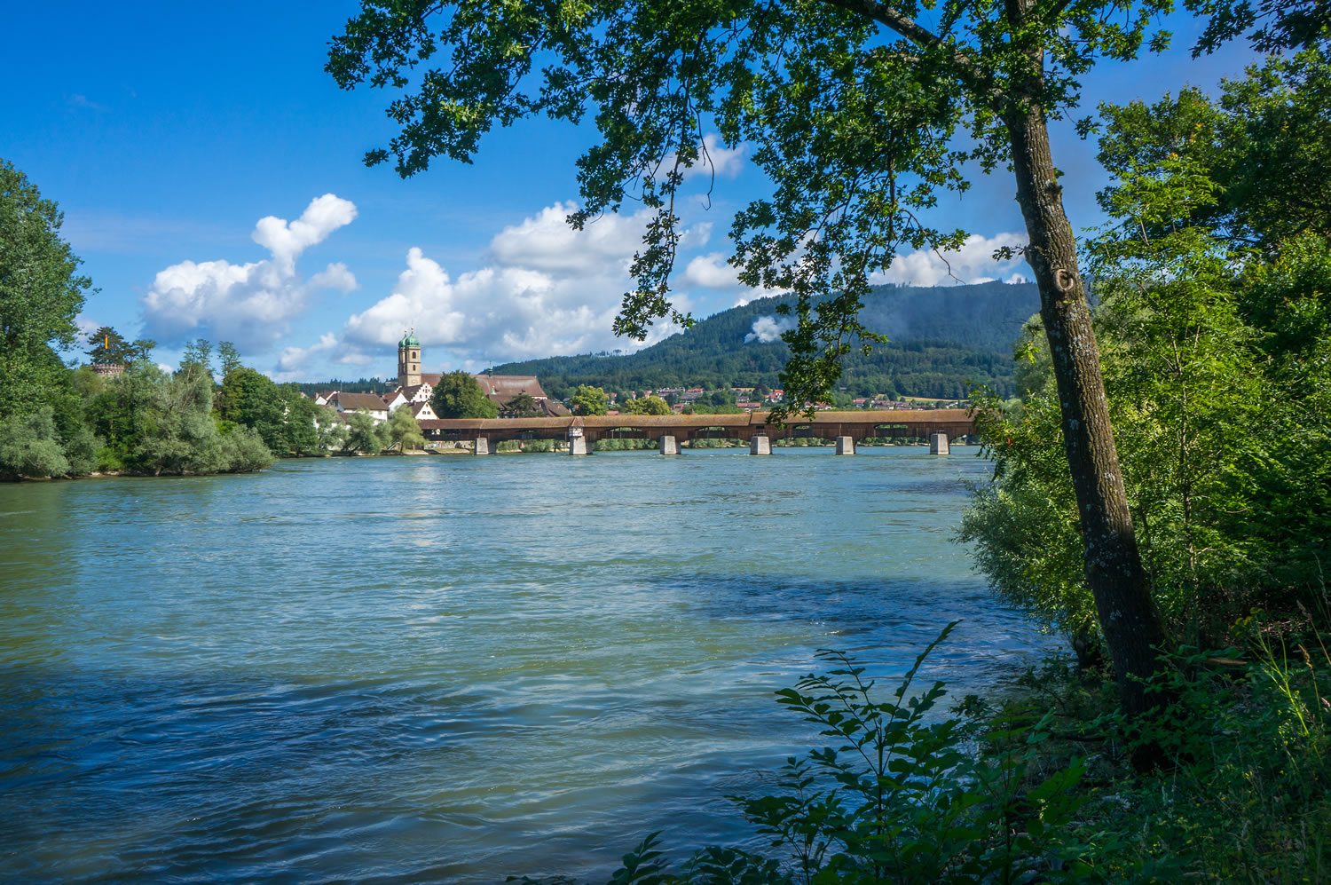
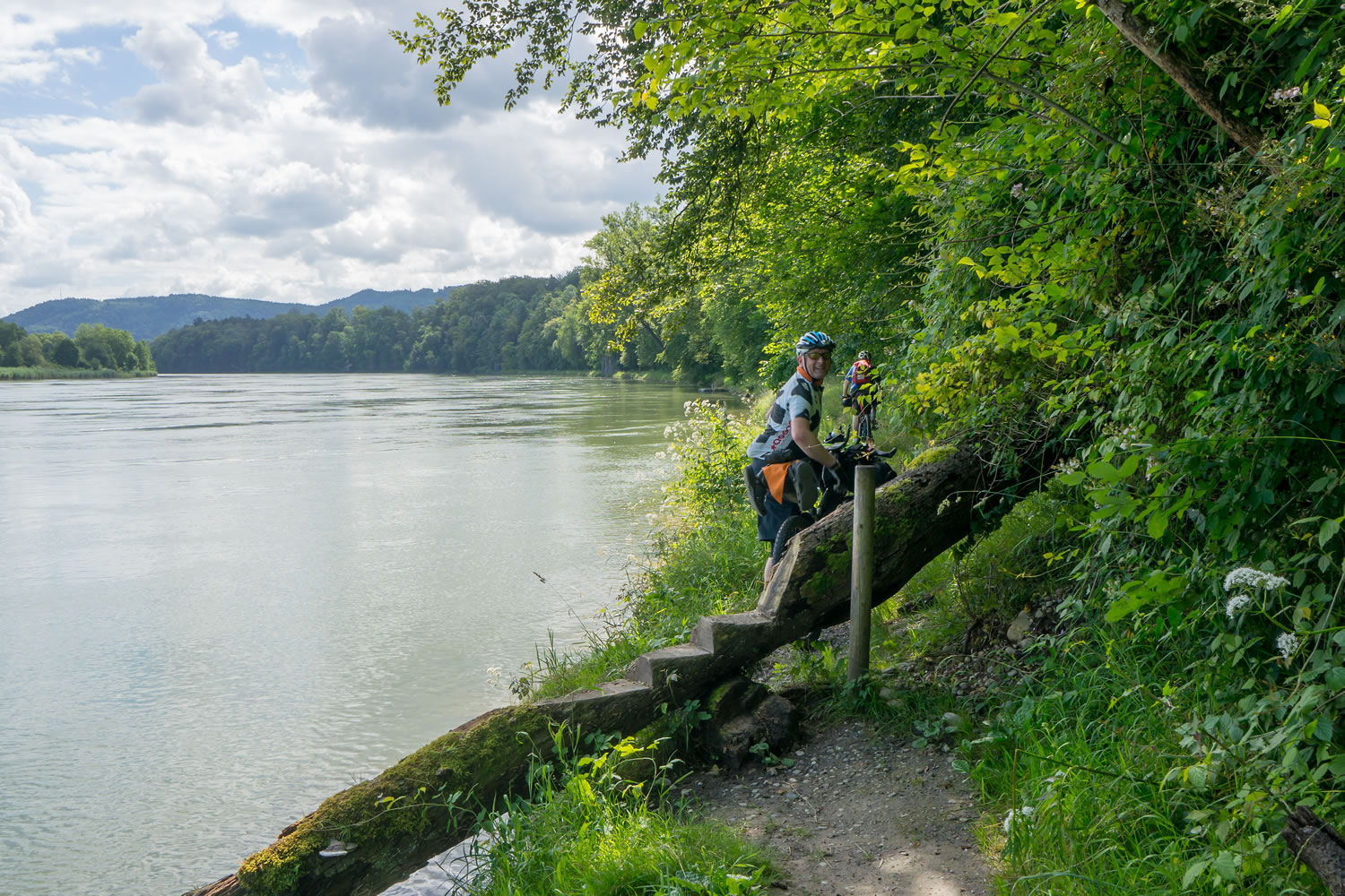
- Rhine river trails Immediately after the start, you will face a few tricky trails along the Rhein river
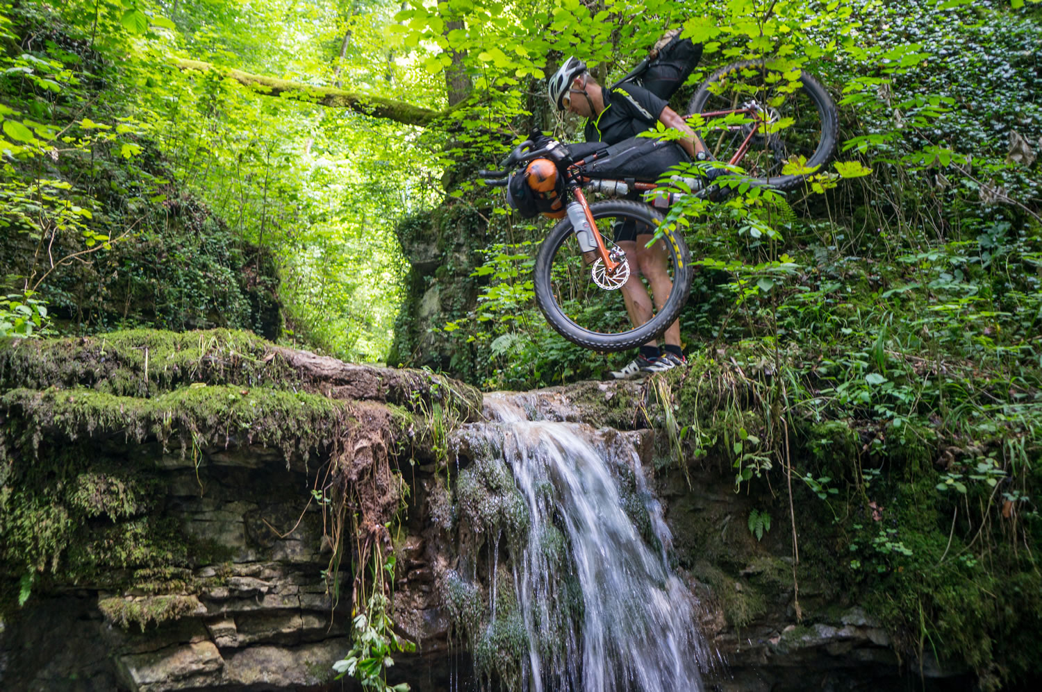
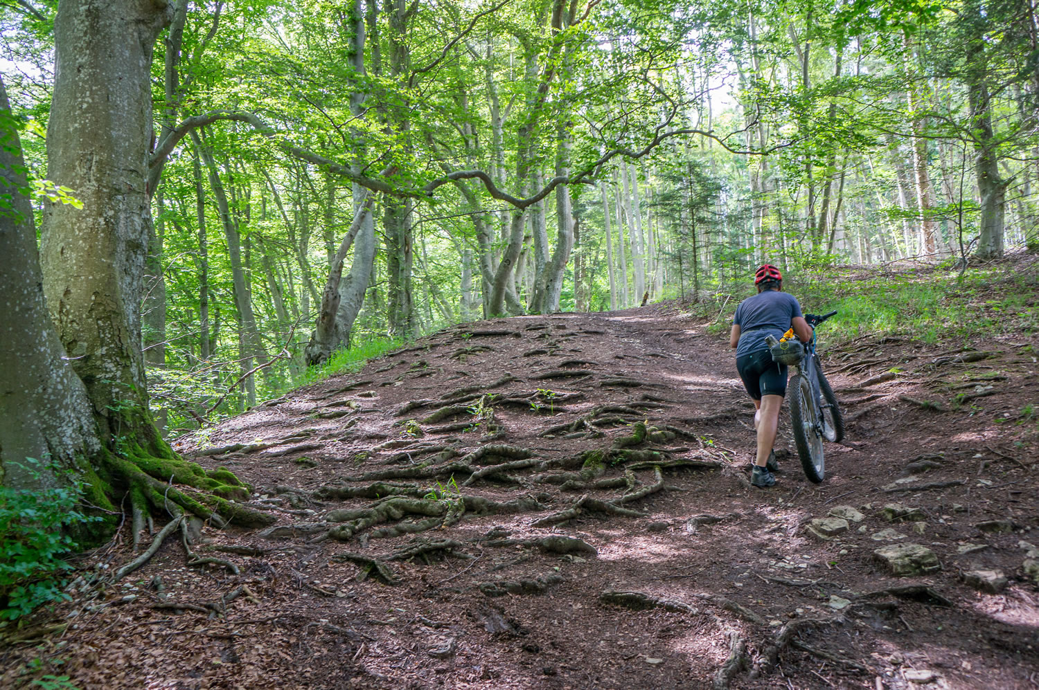
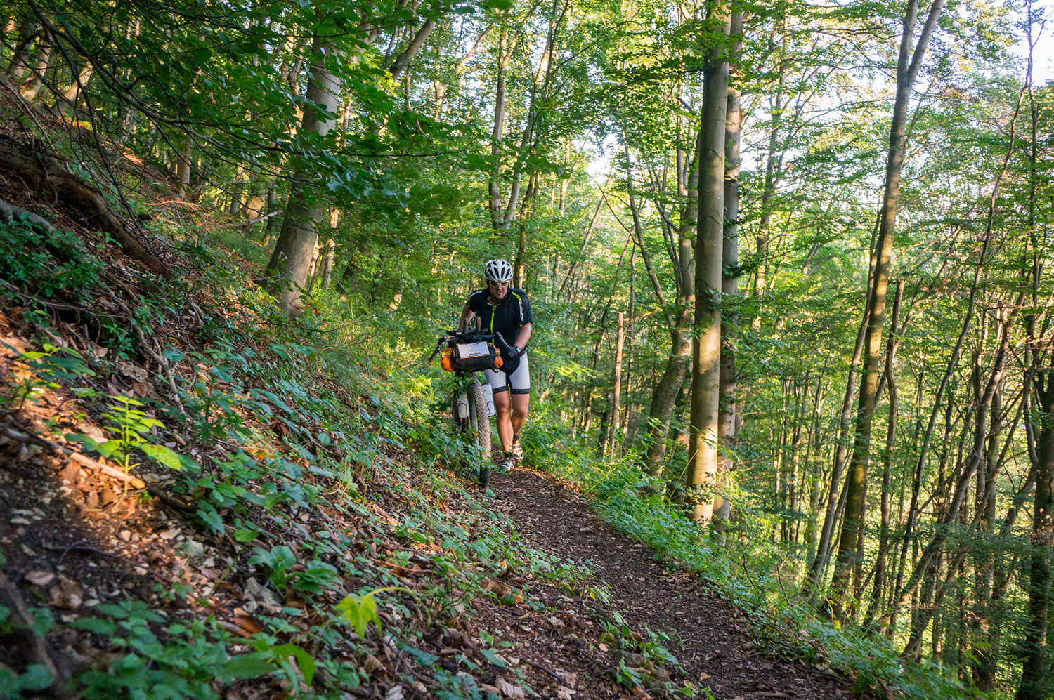
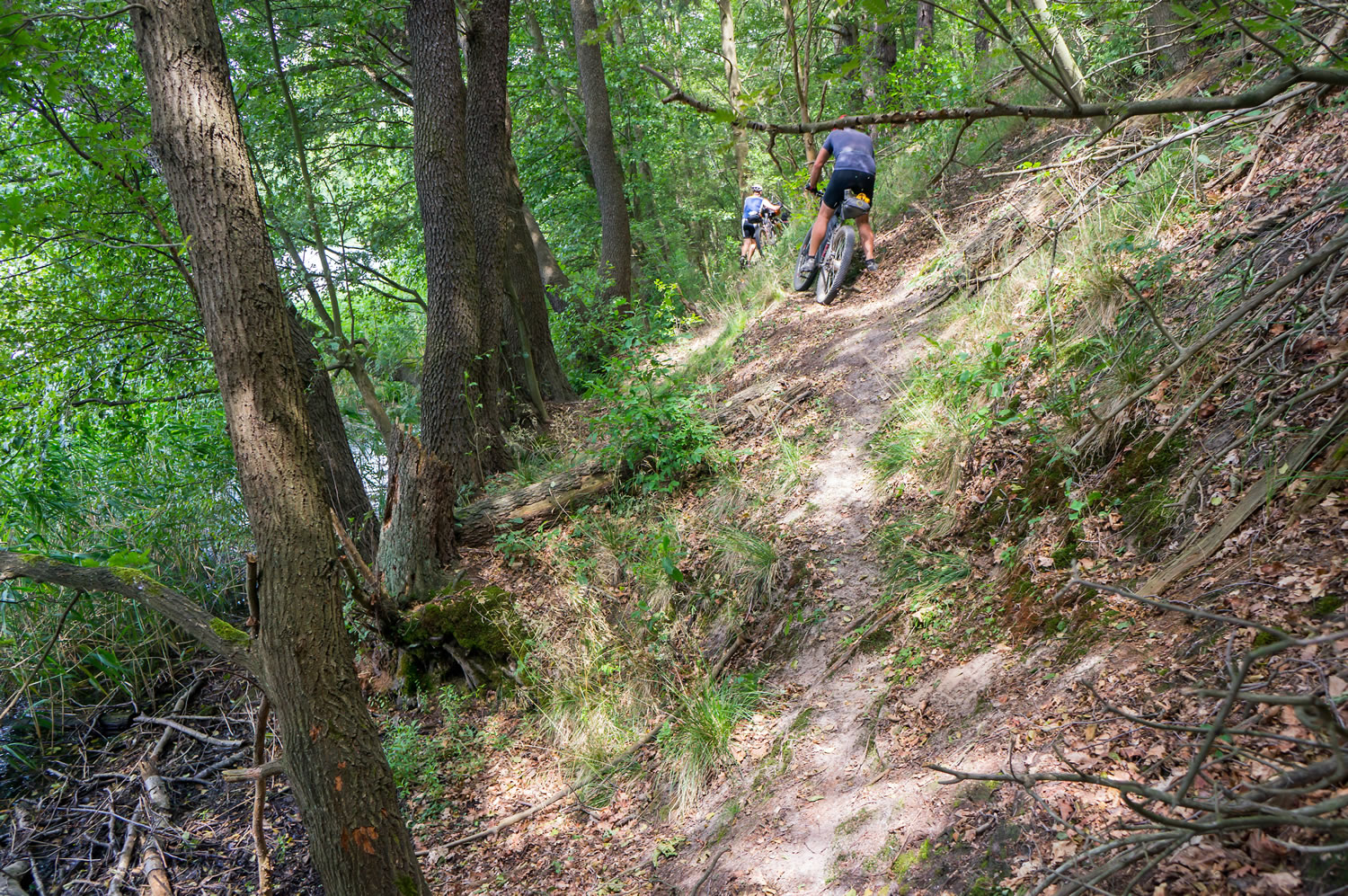
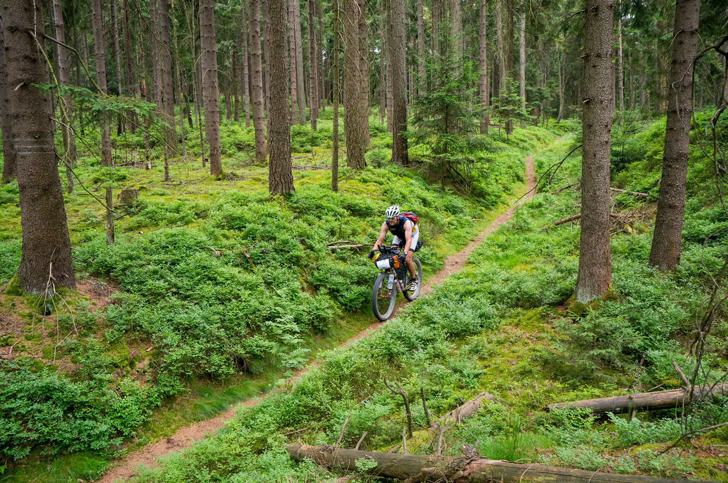
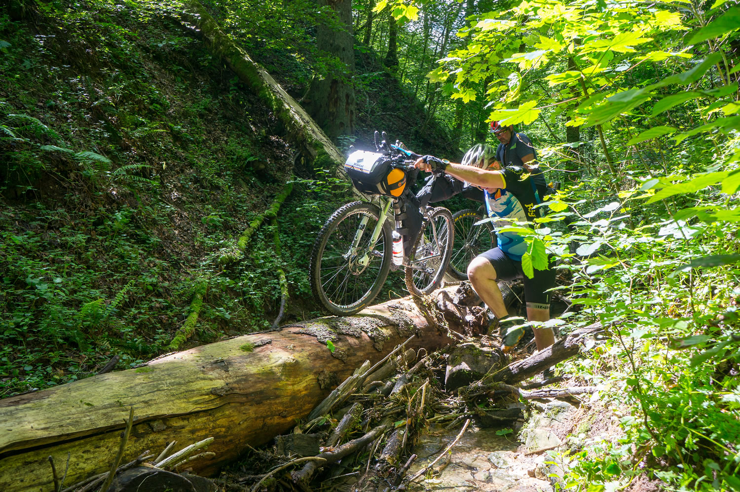
- Hell’s Kitchen gorge Just when you got used to easy rolling you will face a section of serious hike-a-bike through a narrow cascading gorge. None of the racers of the first edition wants to miss this section.
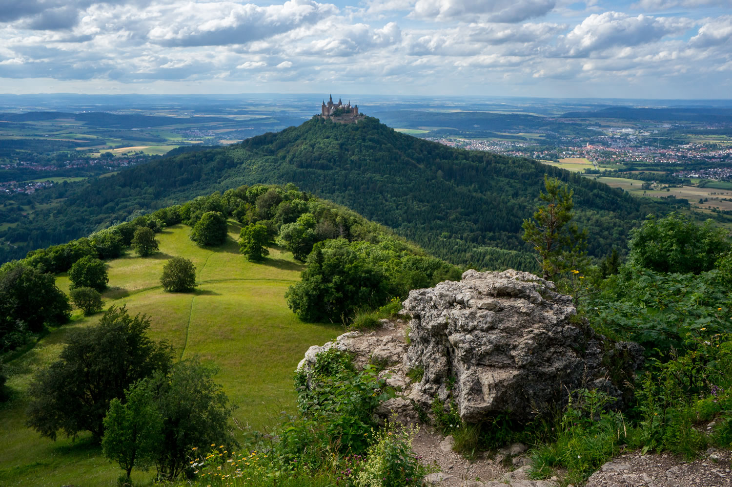
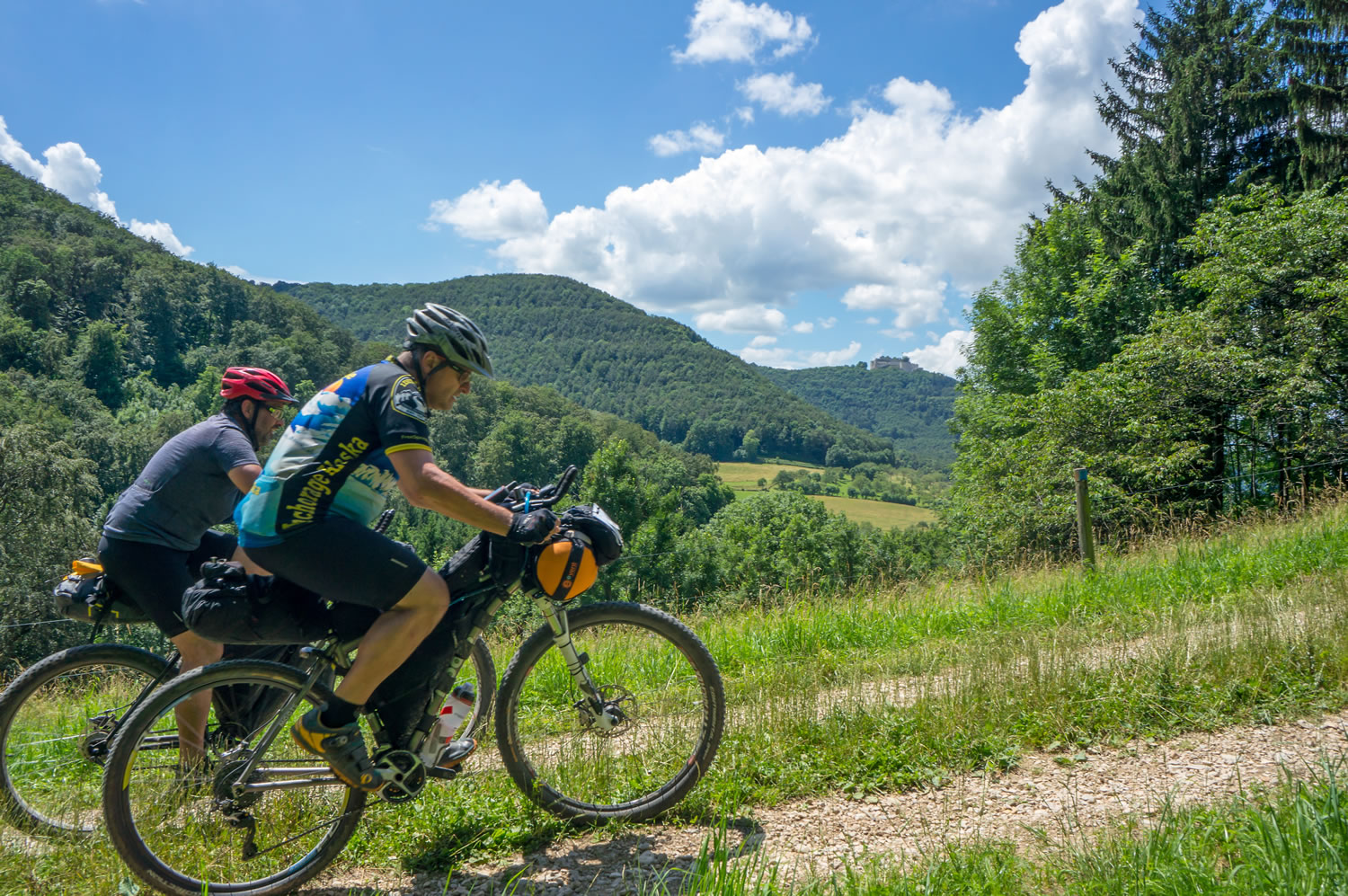
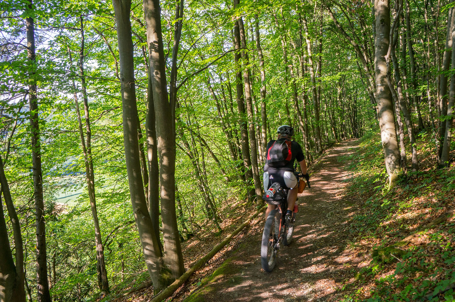
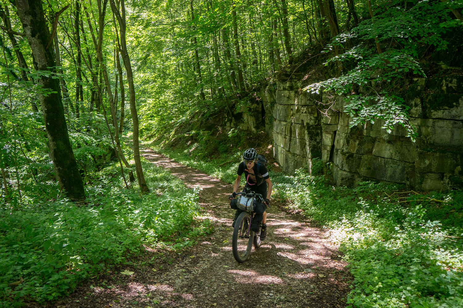
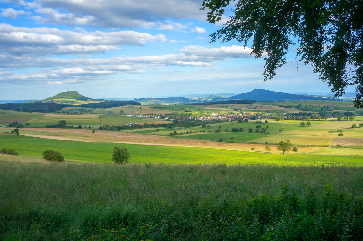
- Schwäbische Alb A geological phenomenon of a plateau that drops steeply into the plains below. The route follows the rim for quite a while on technical single track and offers spectacular views over the plains, the most spectacular of them at Zeller Horn with a breathtaking view over Hohenzollern Castle.
- The iron curtain In eastern Germany the route follows the borders between Germany and – back then – Czechoslovakia for a long time and also crosses it for long sections. Be prepared to learn a lesson about the separation of Europe that is still visible.
- Saxonian Switzerland Spectacular limestone formations with some difficult single trail in between and one of the race checkpoints on top of a limestone rock with a view that you will never forget.
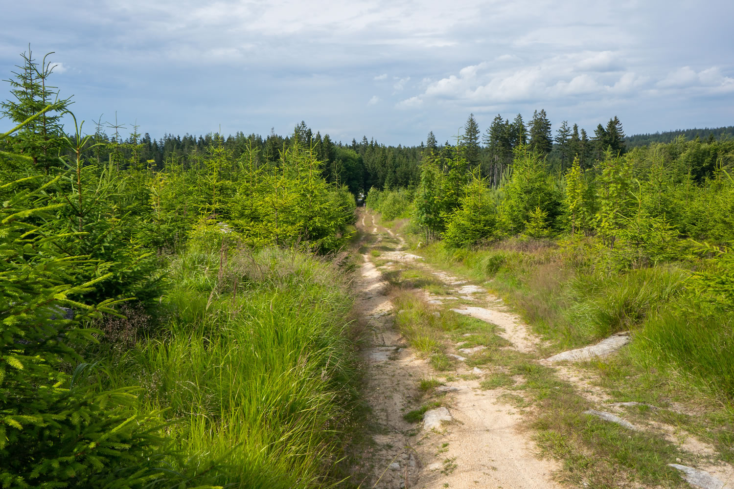
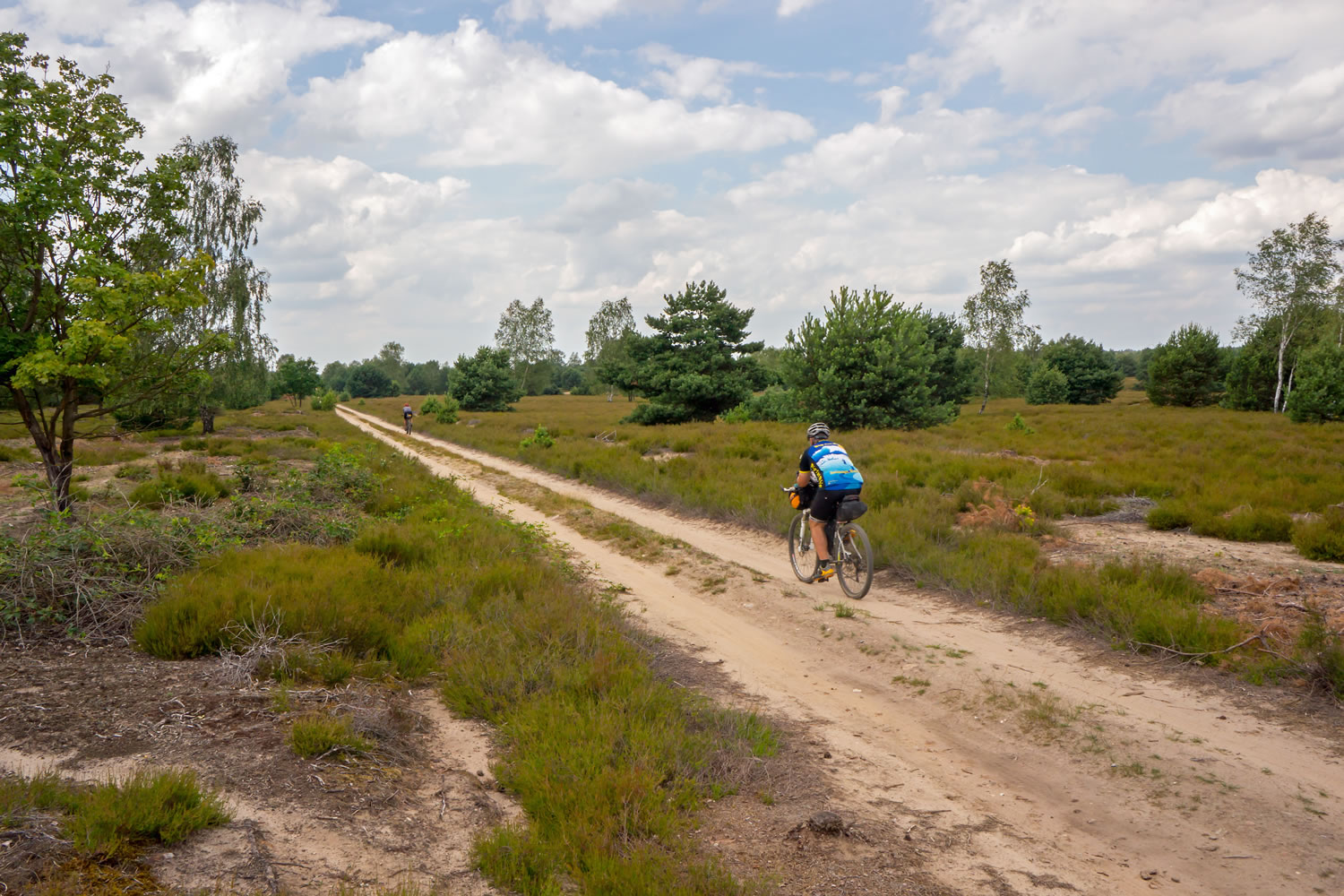
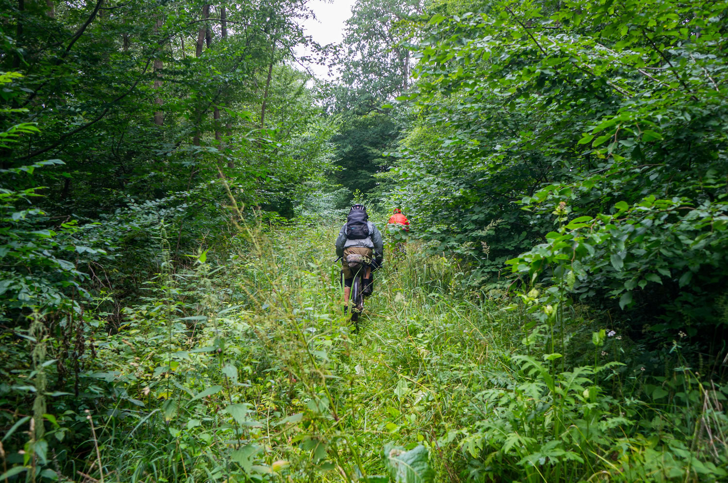
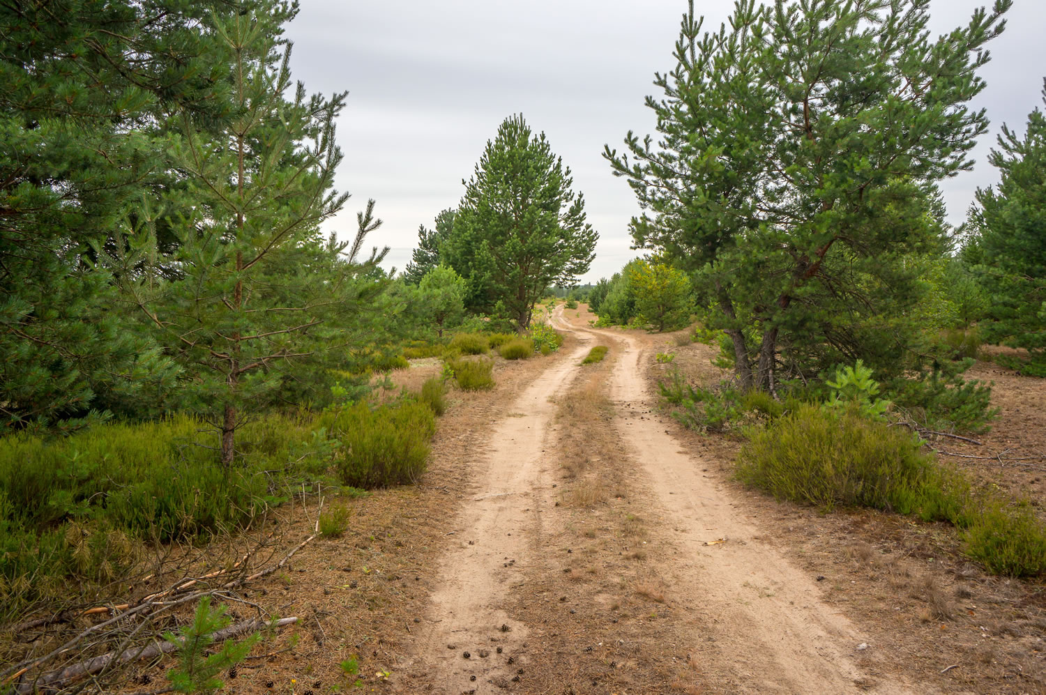
- Eastern Germany Be prepared for some sandy passages that make the going tough and for long stretches through deserted countryside where even the wolf has returned to Germany.
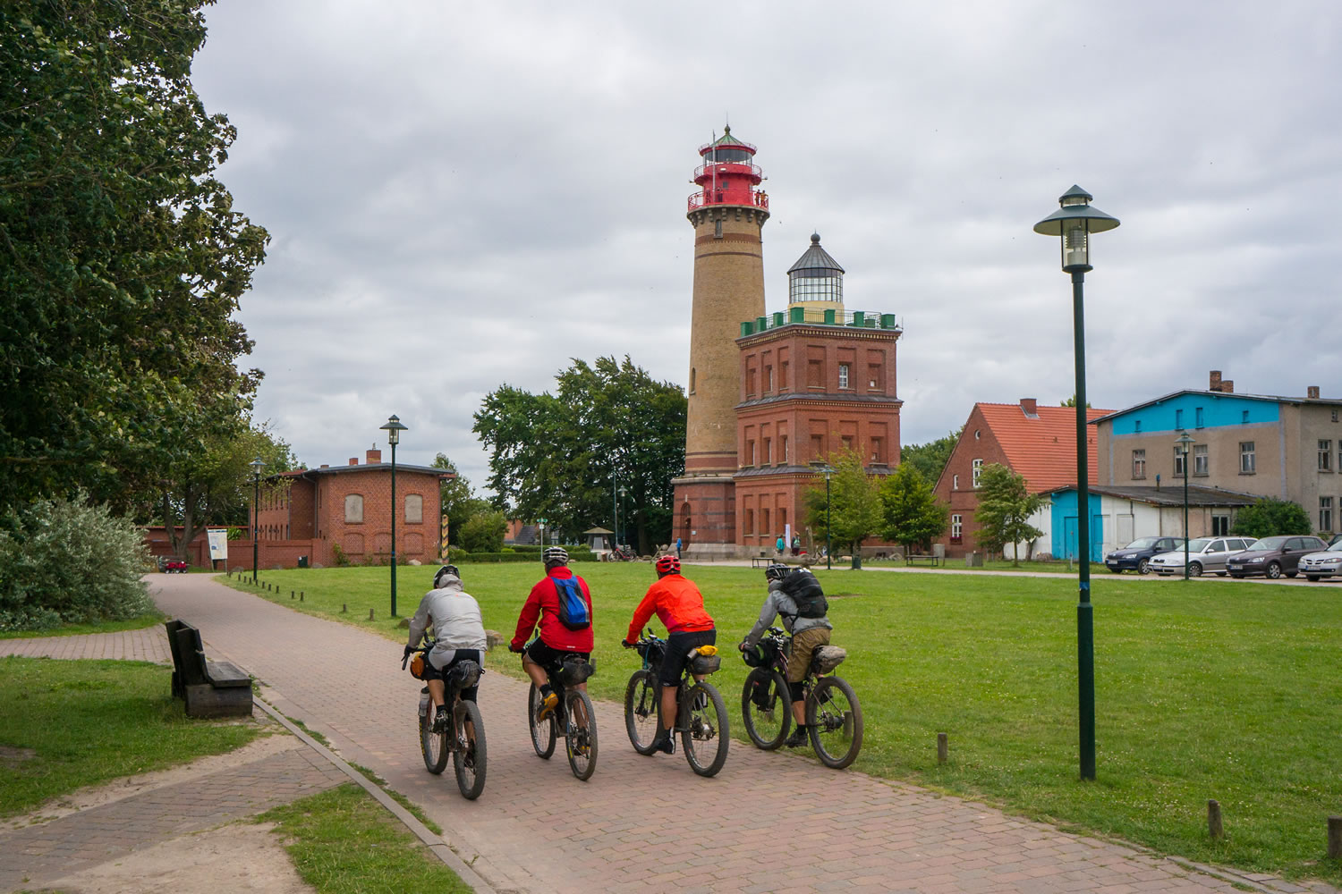
- Rügen If you have another day off after finishing the route please take the chance to watch the breathtaking and legendary white limestone cliffs in Jasmund National park, which have been made famous by the German artist Caspar David Friedrich.
- The route is best travelled between April and September Before April and after September snow might be a problem on the route
- Trail etiquette Especially in the Schwäbische Alb you will ride on narrow hiking trails. Please give way to hikers at any time.
- Language You will pass through remote countryside where English will not be spoken. A set of common German phrases will be helpful here.
- Mosquitos Especially in the eastern part of Germany you will be travelling in river valleys with a high density of mosquitos. Make sure to bring a repellent!
- Border crossings In the first part of the ride you will cross into Switzerland, in the middle you will be riding through Czech Republic for significant parts. Both countries are not part of the Euro-zone. Although most of the restaurants accept Euros: Be prepared to carry local currency or plan ahead to avoid spending money within these sections. Passports are not necessary for border crossing.
- Ferries In the northern section there are two ferry-crossings. Ferries have limited operating hours. Check these beforehand and plan your trip accordingly.
- Shop opening hours Especially for American bikers it might be a surprise: Shops in Germany don’t open at Sundays and in rural areas opening times on Saturdays are limited. Check this beforehand. Gas stations are more flexible with their opening hours but don’t rely on them.
- The route is compiled from various sources: Marked hiking trails, short sections of publicly available GPS-tracks and sections that have been scouted by local bikers. It is not marked throughout. You will need to follow our GPS track.
- There will be long, steep and demanding climbs especially in the first half of the route. Some of them (especially in the Schwäbische Alb) are so steep that you’ll need to push your bike.
- There are technical sections along the route but almost all of them are rideable, even with a heavy loaded bike. The only exception is a 2km section through Hell’s Kitchen gorge that you will face on the first day of the ride. This section will require you to carry your bike in some ridiculously steep sections.
- The route can be ridden in both directions. In Switzerland the route can be extended by choosing one of the three Swiss National Mountain Bike Routes. (http://www.mountainbikeland.ch/en/routen/nationale-routen.html)
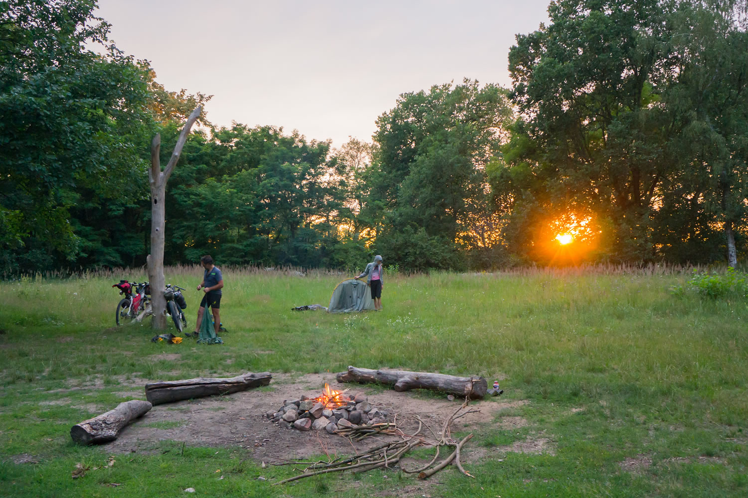
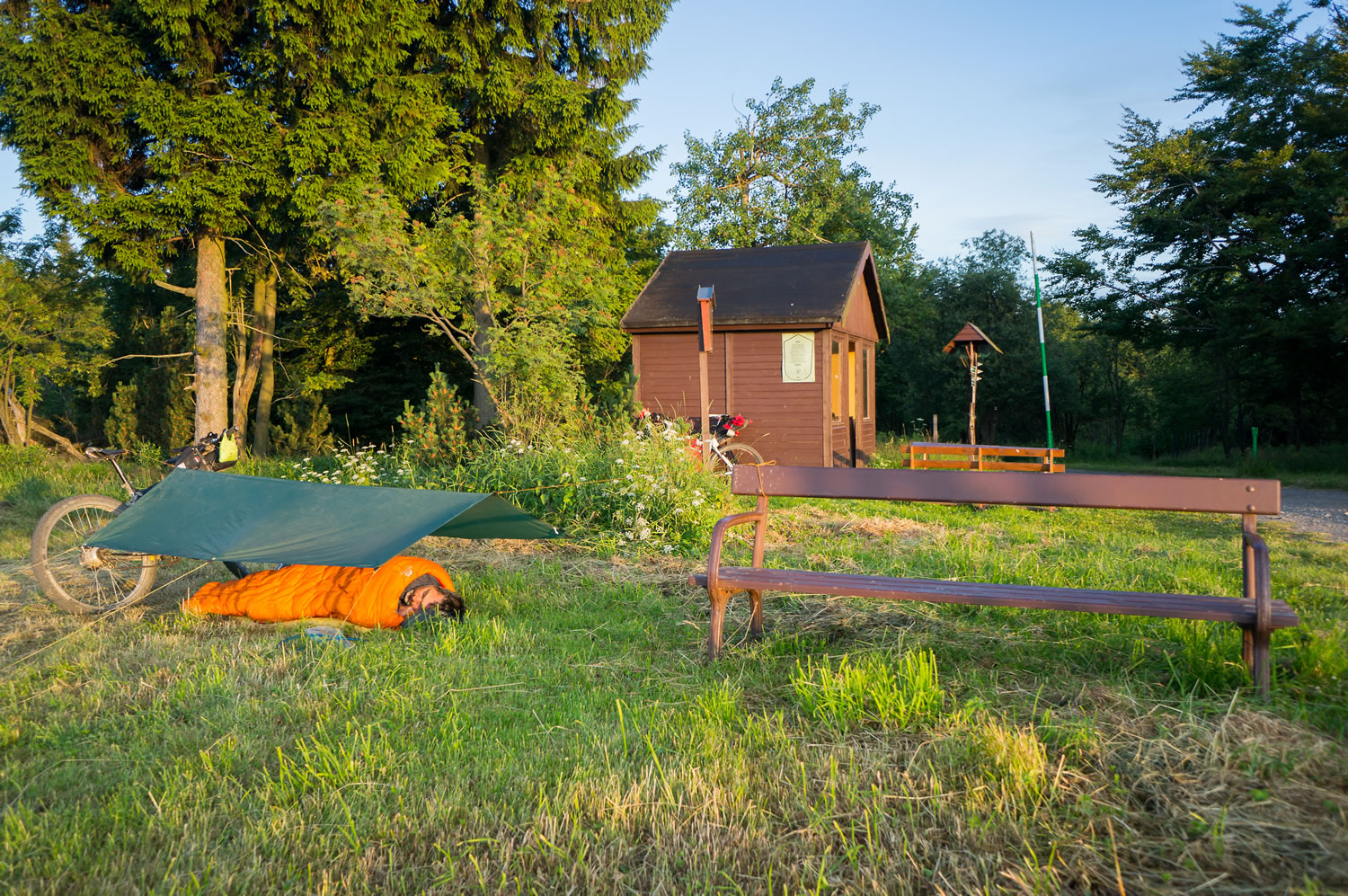
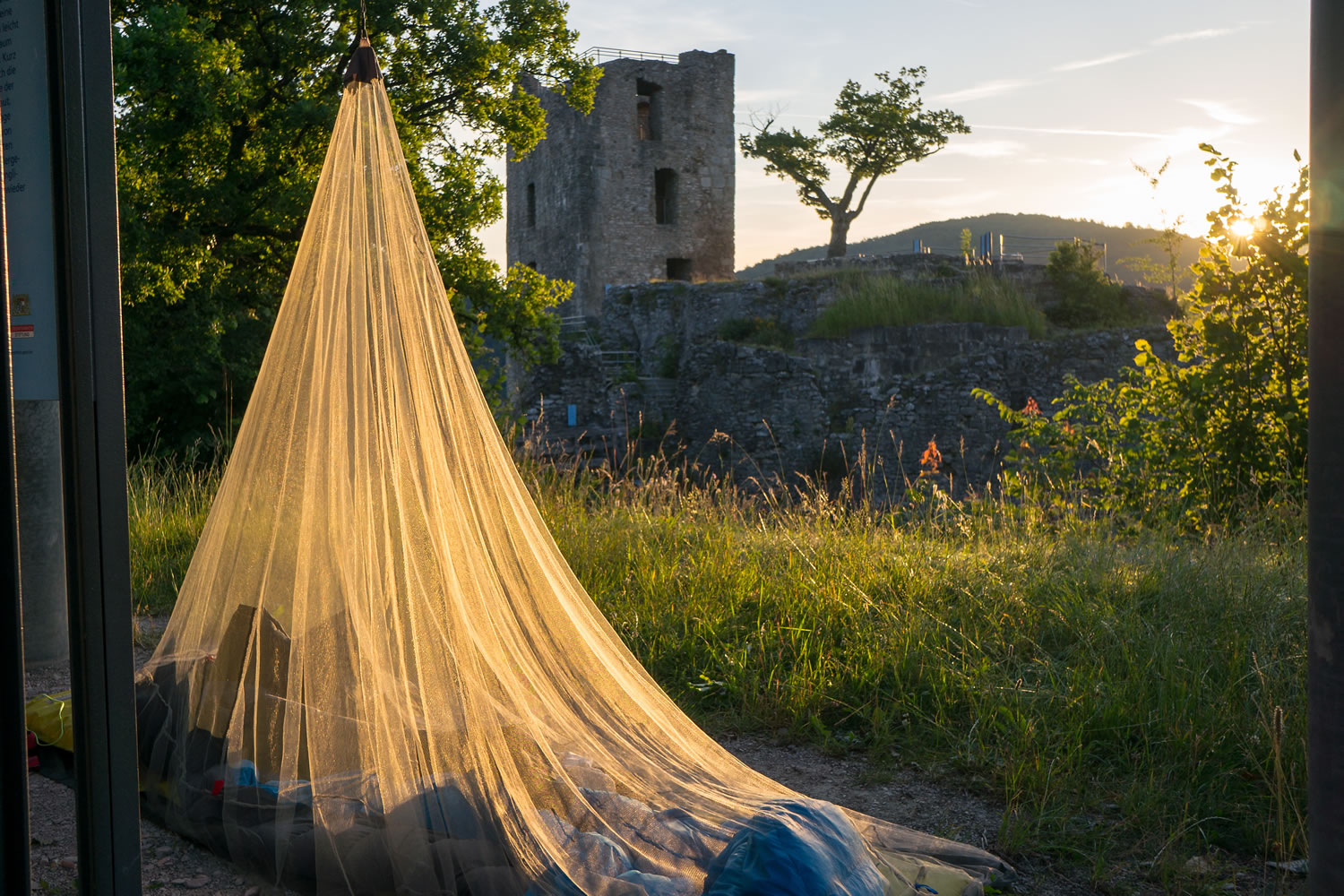
- Wild camping is forbidden in Germany, at least if you plan to pitch a tent. It is tolerated if you sleep in a sleeping bag and bivy bag. But it’s a good idea to search for a bivy spot that is hidden from view.
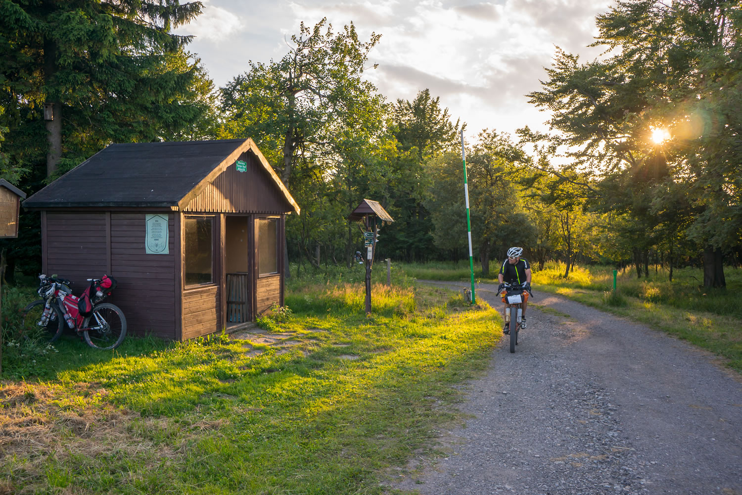
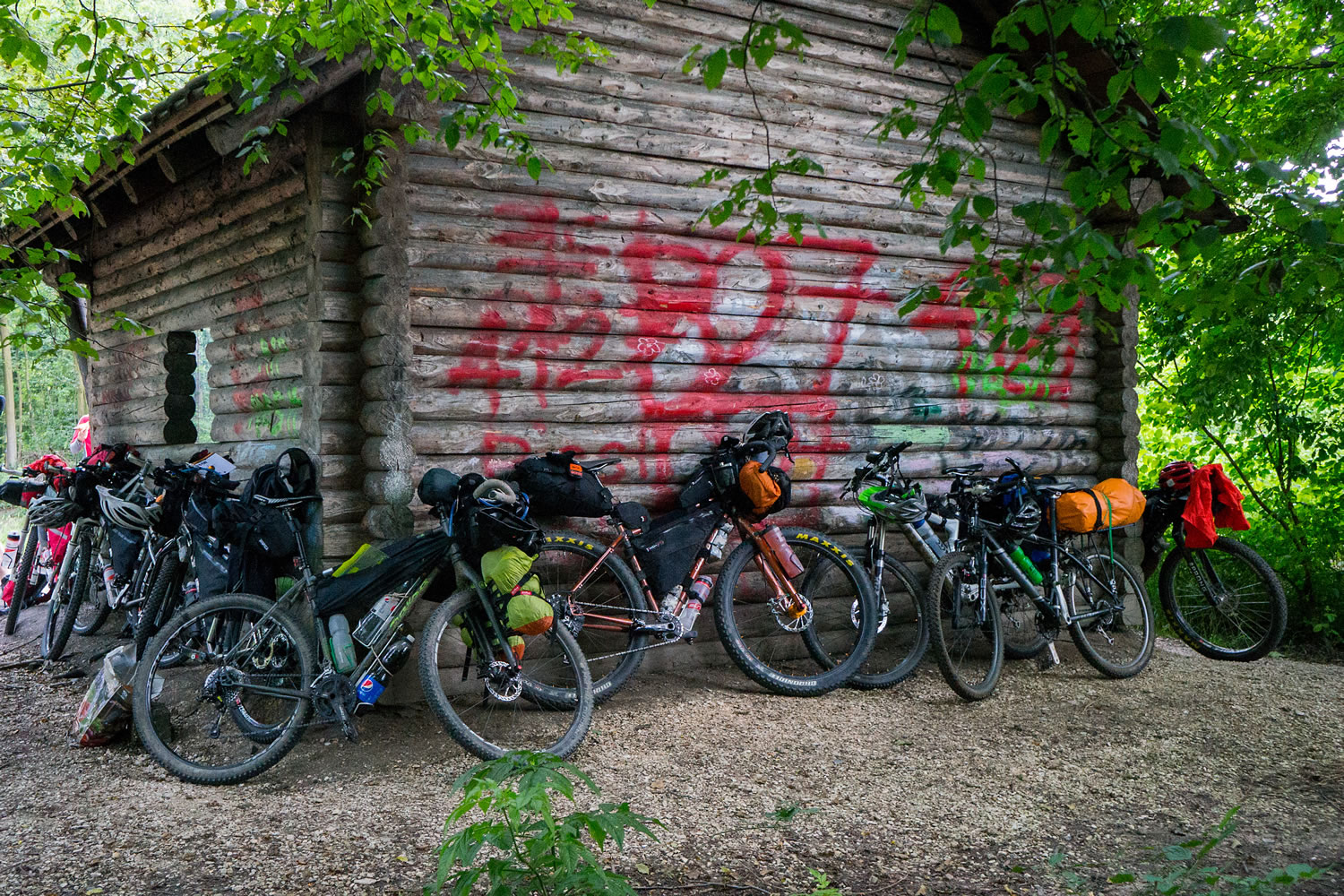
- Shelter cabins Throughout the route there are many primitive open shelter cabins. Expect those to have a rainproof roof but nothing else. Sleeping inside these cabins is tolerated.
- Commercial Campgrounds Touristic areas feature a high density of commercial campgrounds along the way. In many larger communities you’ll find one that offers campsites for 10-20€.
- Hotels & Restaurants In rural areas accommodation and food will be affordable but at some places it won’t be available at all because many businesses have closed down, especially in the eastern parts of Germany. If you want to rely on them: Plan ahead!
- Surface water: Along the route there are lakes and streams inviting to refresh and swim. However, drinking water from streams without treatment (filter, Katadyn etc.) is not recommended!
- Water from natural springs can be trusted but is very sparse along the route.
- Some towns have artificial fountains for decoration purposes. They usually show a ‘no drinking water’ sign and should not be trusted without treatment.
- Cemetaries usually have publicly accessible water taps. Tap water is drinkable and of high quality all across Germany.
- In rural areas most of the people living along the track will be happy to provide tap water if you ask them. This is also the case in all of the shops and gas stations along the route.
- Restaurants are abundant on most parts of the route, except for some remote parts in eastern Germany. Especially in southern Germany you will come across a few tempting beer gardens which might be quite hard to resist.
- Shops and supermarkets are available in almost all towns that you pass through except for remote areas in Eastern Germany and Czech Republic. Discounters like Aldi and Lidl are best for a low budget, supermarkets like Rewe and Edeka carry high quality food, especially as far as fresh food (meat, vegetables, fruits) is concerned.
- Open fire is prohibited almost all over Germany but at most of the shelter huts it is tolerated. Watch out for fire places. If you find any you can be sure that it is safe to build a fire.
Rhine valley-Schwäbische Alb
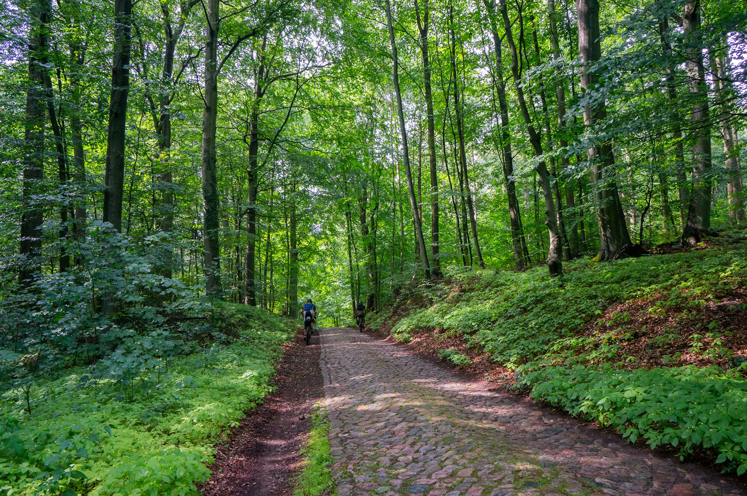
After the start in Basel you will follow a series of nice trails along the river Rhine. Leaving the lovely Rhine valley you will soon face a shock as you have to carry your bike through a cascading gorge that we nicknamed ‘Hell’s Kitchen’. Soon you will cross into the hillrange of the Schwäbische Alb which holds some of the most scenic terrain, but also some of the most challenging climbs of the route. You will find yourself pushing your bike quite a few times here.
Bavarian Frankonia
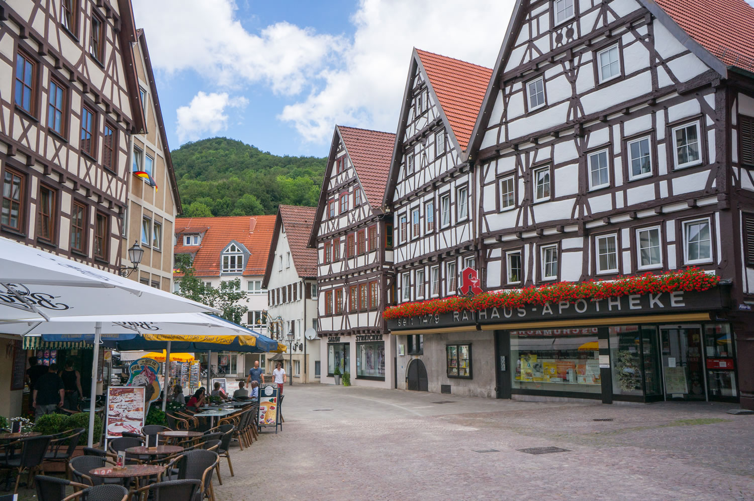
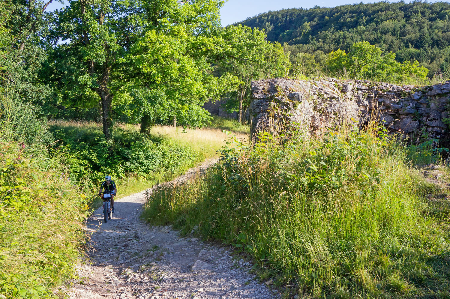
Crossing into the Bavarian region of Frankonia you will transit some country that breathes history in every square inch: You will pass by the famous historic town of Rothenburg ob der Tauber, which is just a few kilometers off-route, and into a region called Frankonian Switzerland with neat little historical town centers and castles along the route.
Grenzsteintrophy
Cruising on deserted forest roads through the Fichtel Mountains you will reach the point where the borders of Eastern Germany, Western Germany and Czechoslovakia met during the Cold War. Today it has become a lovely place that shows no signs of the terror that this border imposed onto Europe. And it is the starting venue of the grandma of the German bikepacking routes, the Grenzsteintrophy.
The Iron Curtain
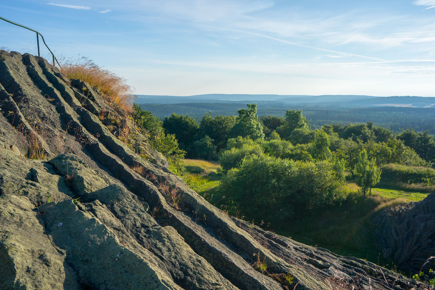
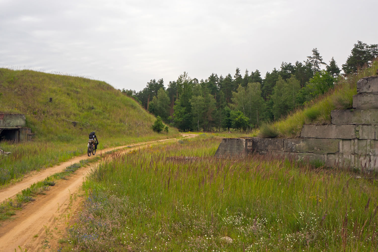
From there on, the former iron curtain will be on your mind for a long time as you cross into Czech Republic quite a few times on your easy cruise towards the highest point of the route, the Fichtelberg at 1215m. Soon after that the landscape changes dramatically as you ride into the limestone cliffs of Saxonian Switzerland. Be careful: Some tricky sections of singletrack will be waiting for you.
The Oberlausitz
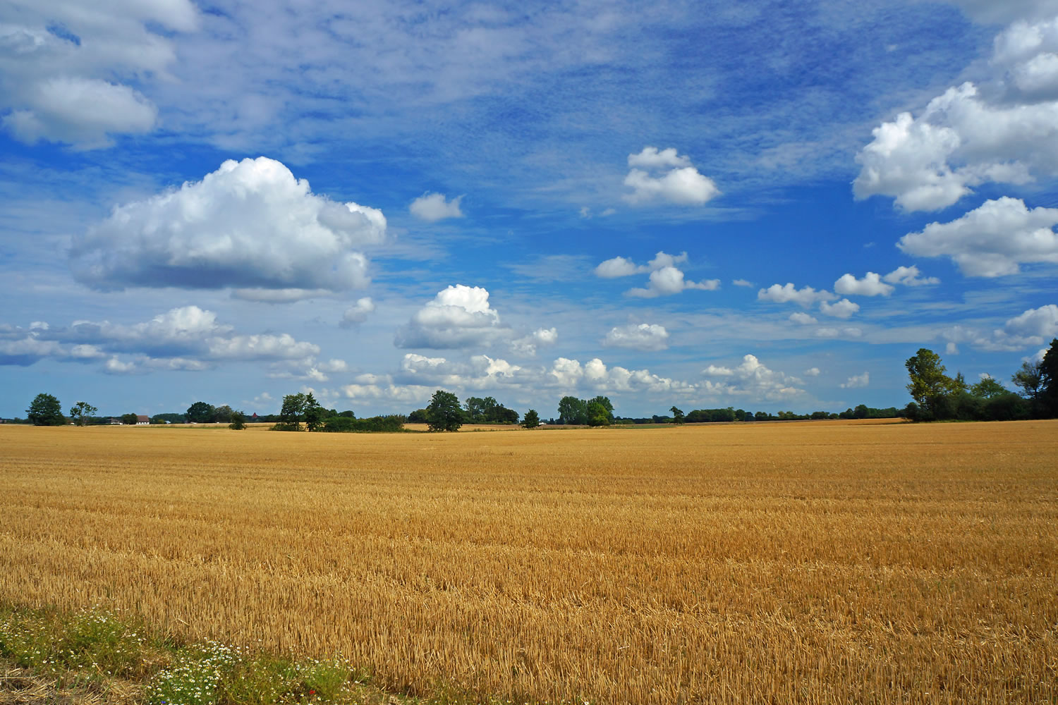
Once you’ve made it through this part of the route, the climbing is virtually done: The route continues into the plains of the Oberlausitz, along the Polish border and into the vast forests that surround the German capital Berlin, which is also not far off-route. Expect some extremely sandy trails in this section which make it tough to keep going at times.
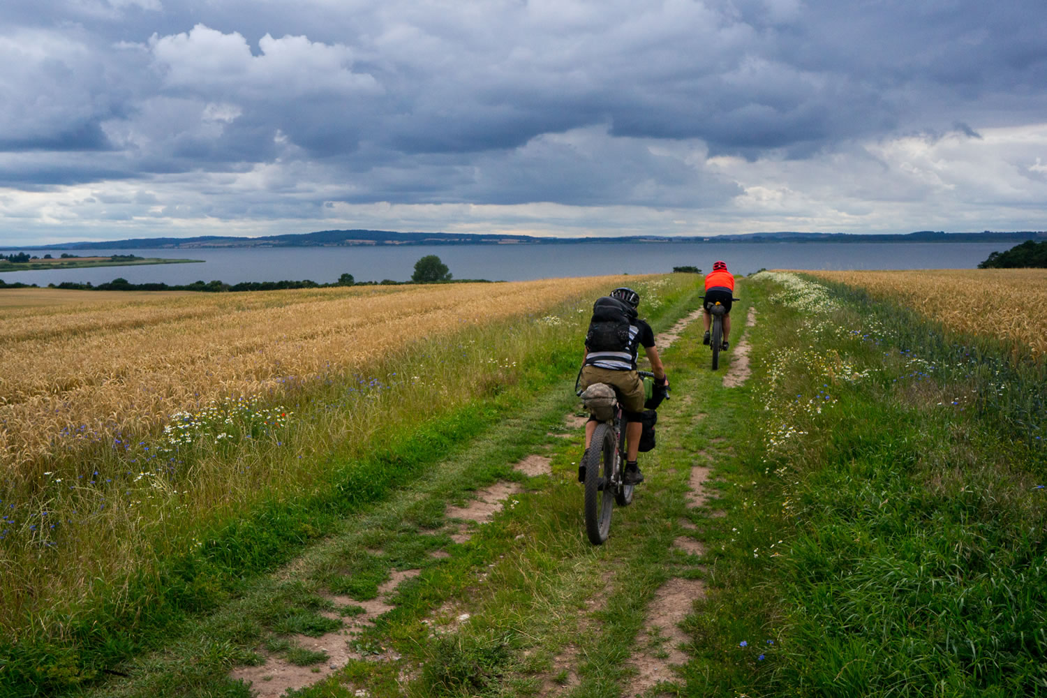
The Baltic Sea
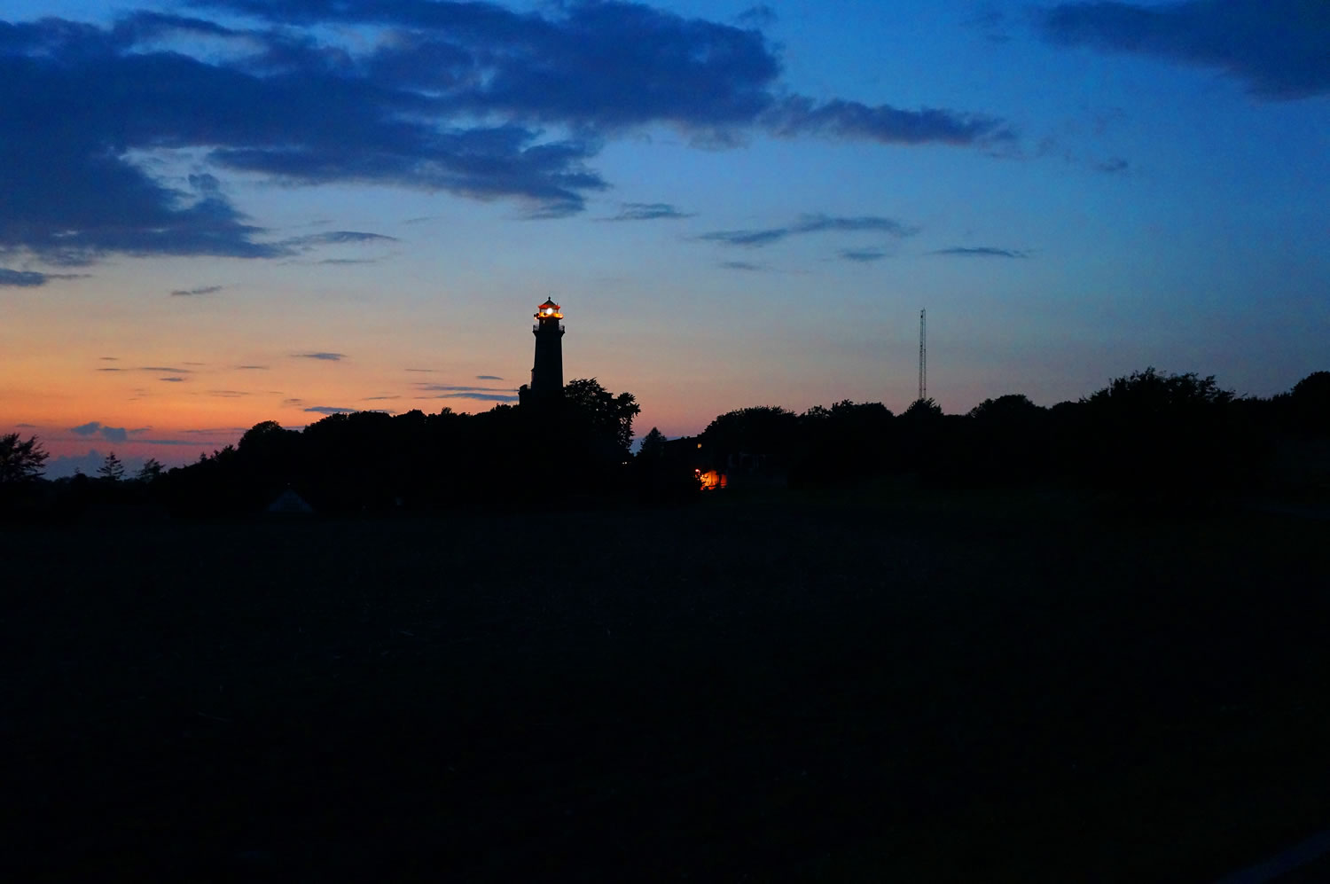
After passing along the shores of countless scenic lakes you will reach the Baltic Sea in Stralsund crossing onto the island of Rügen on a levee. Many scenic seaside views and a last ferry crossing will be the highlights on the last miles towards the two lighthouses of Cape Arkona which mark the northern terminus of the route.
Additional Resources
- btg.voidpointer.de – the official site of the Annual race along this route
- rolandsturm.blogspot.de/2016/07/bikepacking-trans-germany.html – race report by participant Roland Sturm
- mtb-news.de/news/2016/11/13/bikepacking-trans-germany/ – race report by participant Olaf Haensch (german)
- deutschebahn.com – portal of German Railway services. This will be your most important resource for returning to where you started. Railway stations are abundant in Germany. All trains except high speed trains (ICE) carry bikes. But you will need to pay for them
- Watch the Bikepacking Trans Germany Film by Lukas Winkelmann and Sven Garbe


Terms of Use: As with each bikepacking route guide published on BIKEPACKING.com, should you choose to cycle this route, do so at your own risk. Prior to setting out check current local weather, conditions, and land/road closures. While riding, obey all public and private land use restrictions and rules, carry proper safety and navigational equipment, and of course, follow the #leavenotrace guidelines. The information found herein is simply a planning resource to be used as a point of inspiration in conjunction with your own due-diligence. In spite of the fact that this route, associated GPS track (GPX and maps), and all route guidelines were prepared under diligent research by the specified contributor and/or contributors, the accuracy of such and judgement of the author is not guaranteed. BIKEPACKING.com LLC, its partners, associates, and contributors are in no way liable for personal injury, damage to personal property, or any other such situation that might happen to individual riders cycling or following this route.
Please keep the conversation civil, constructive, and inclusive, or your comment will be removed.