


Cedar Mesa Loop: Ruins and Monuments
Distance
154 Mi.
(248 KM)Days
3
% Unpaved
60%
% Singletrack
0%
% Rideable (time)
100%
Total Ascent
9,607'
(2,928 M)High Point
7,090'
(2,161 M)Difficulty (1-10)
6?
- 4Climbing Scale Fair62 FT/MI (12 M/KM)
- -Technical Difficulty
- -Physical Demand
- -Resupply & Logistics
Contributed By
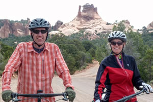
Todd & Charlotte
Guest Contributor
After our first two night bikepacking trip we went “All In” and tackled the GDMBR in 2015. Since then we’ve been mapping out adventures in CO and UT while trying to figure out the next big trip. Follow on Instagram at @bergersride and @bergersrider
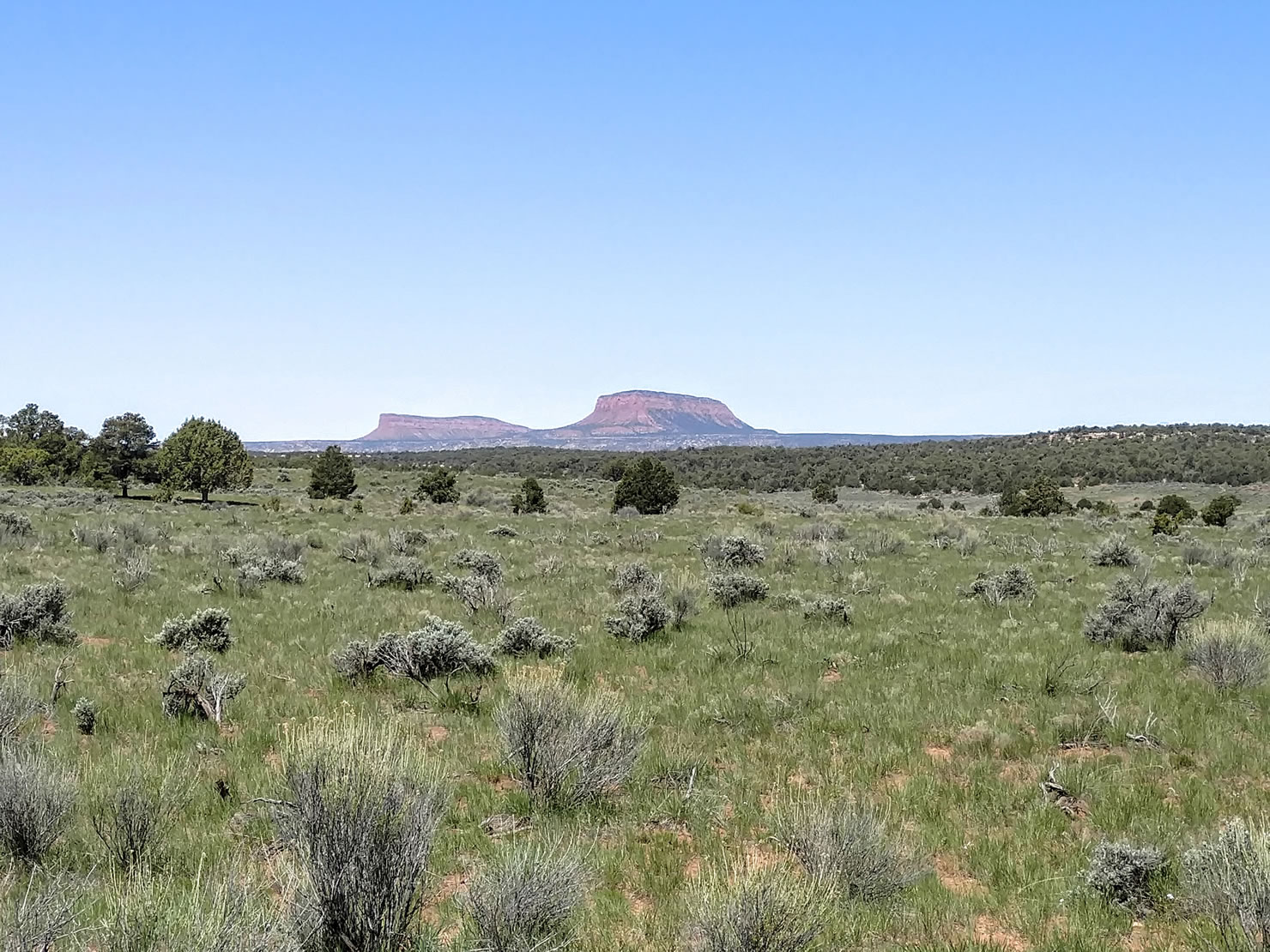
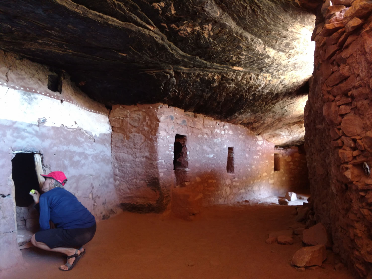
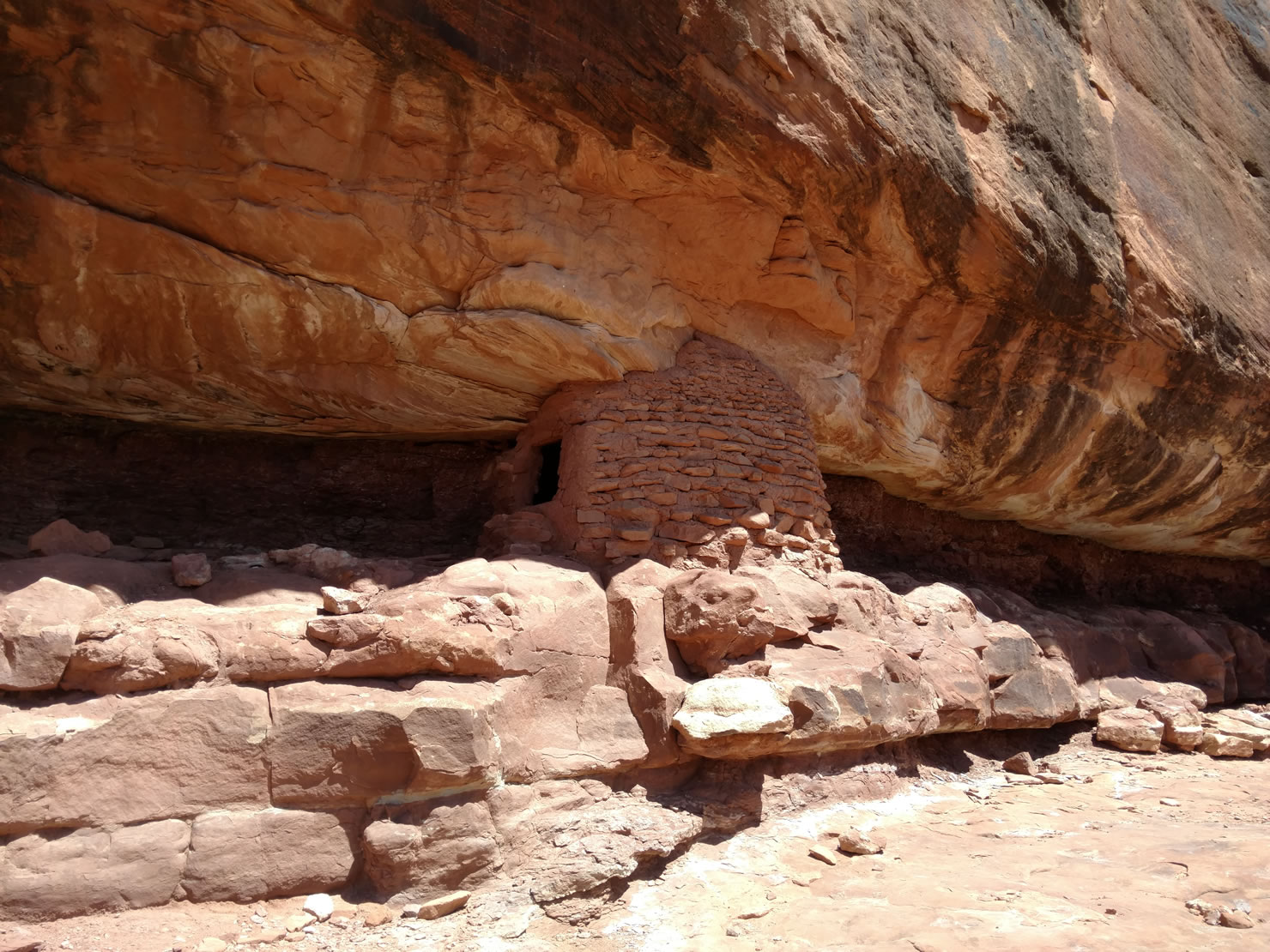
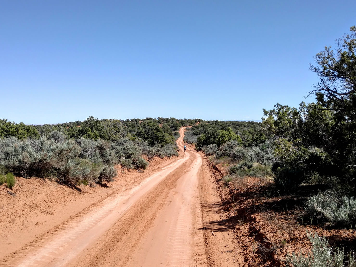
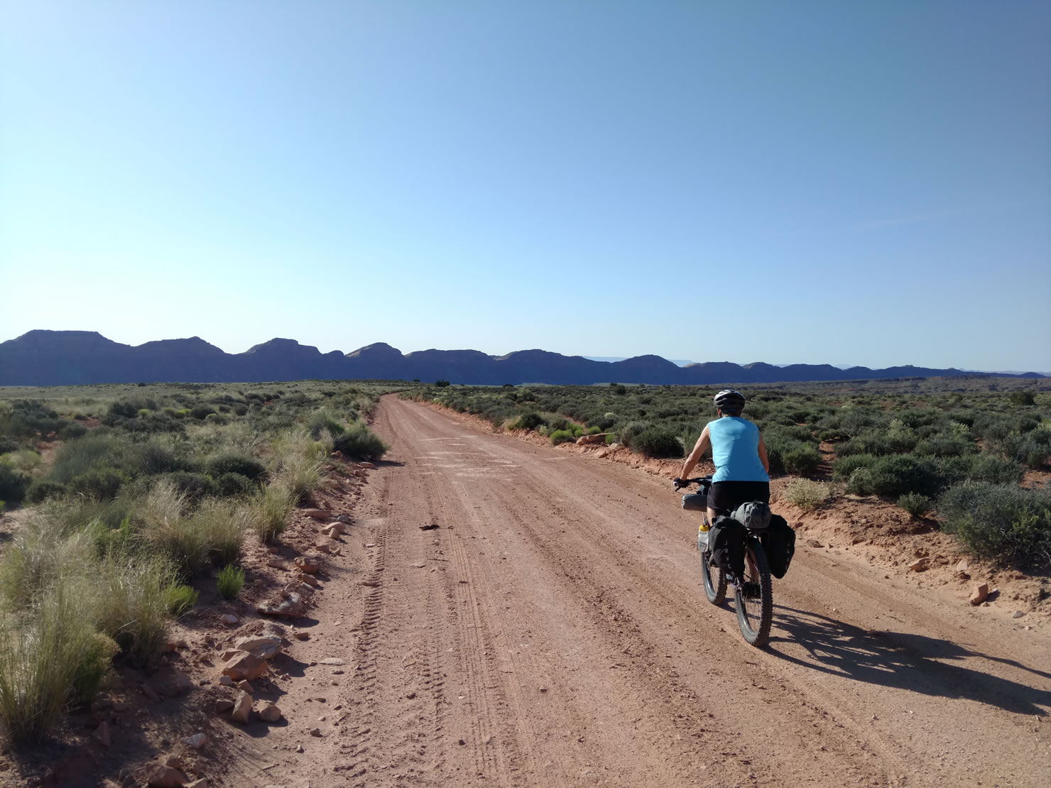
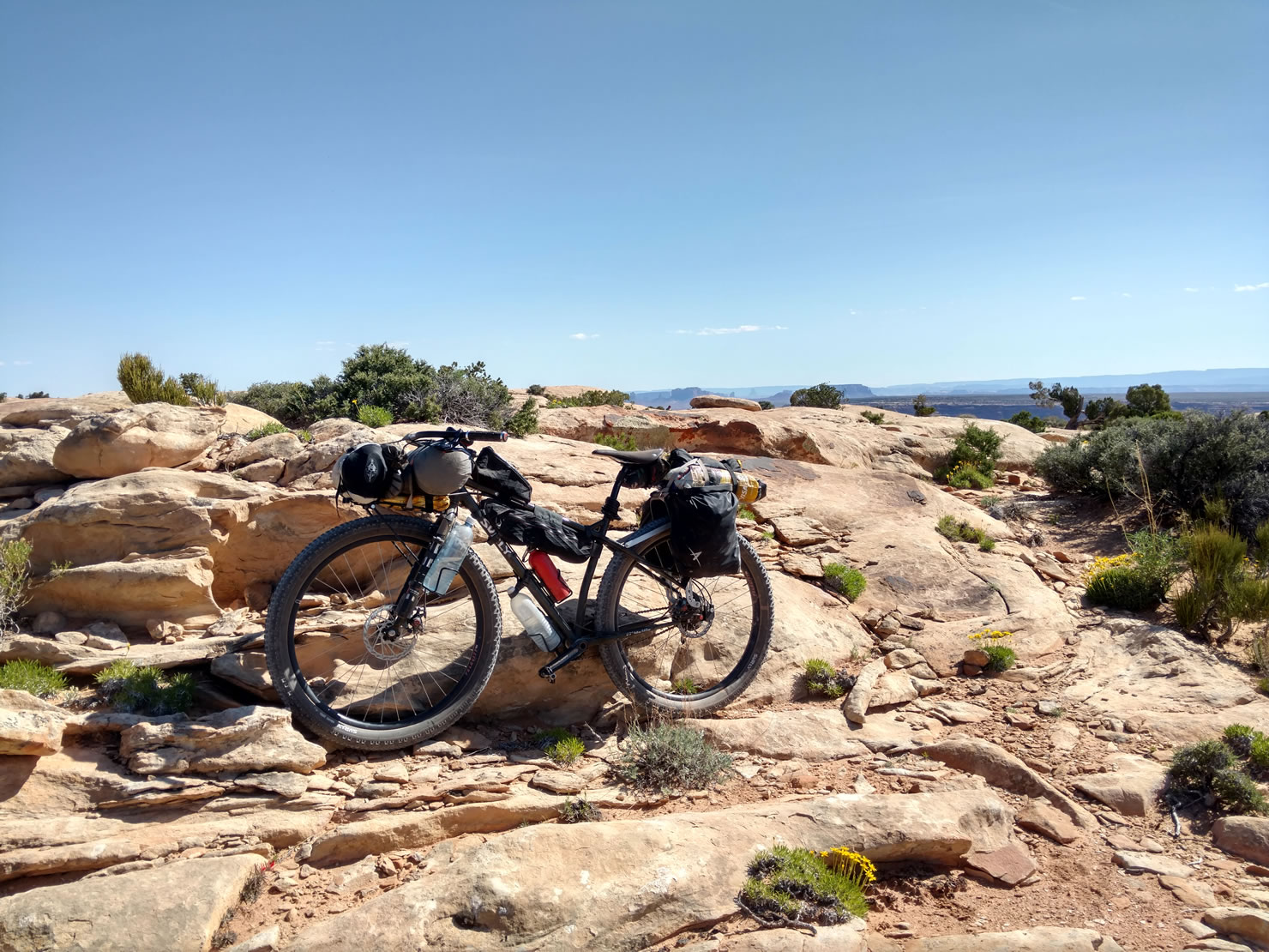
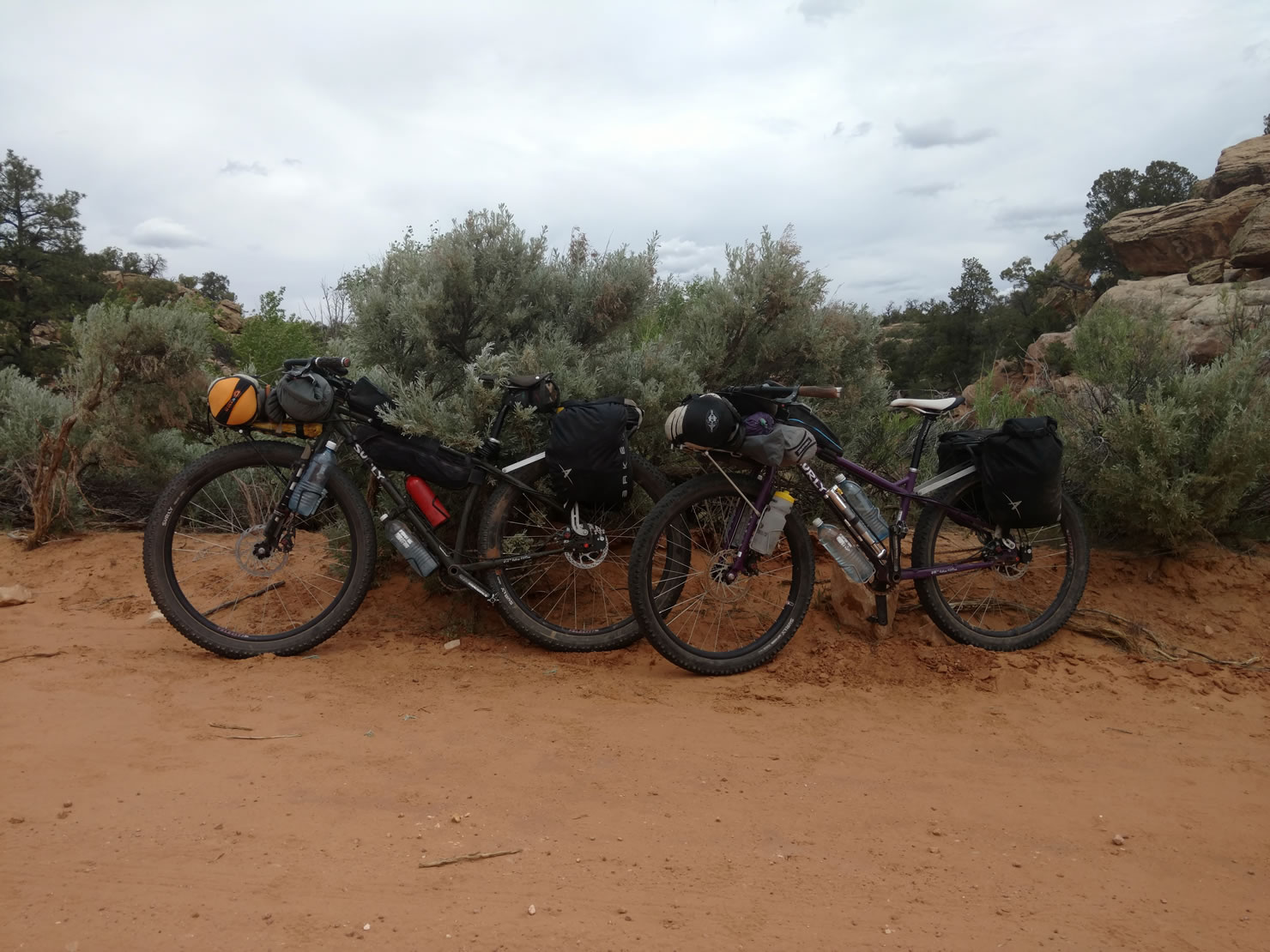
We spent most of May exploring Southeast Utah’s San Juan County and this 154 mile loop gave us the chance to ride thru incredible desert landscapes and explore some of the many Ancestral Puebloan ruins in the area. We spent plenty of time off the bikes exploring the Moon House and Mule Canyon ruins during our 3.5 day loop.
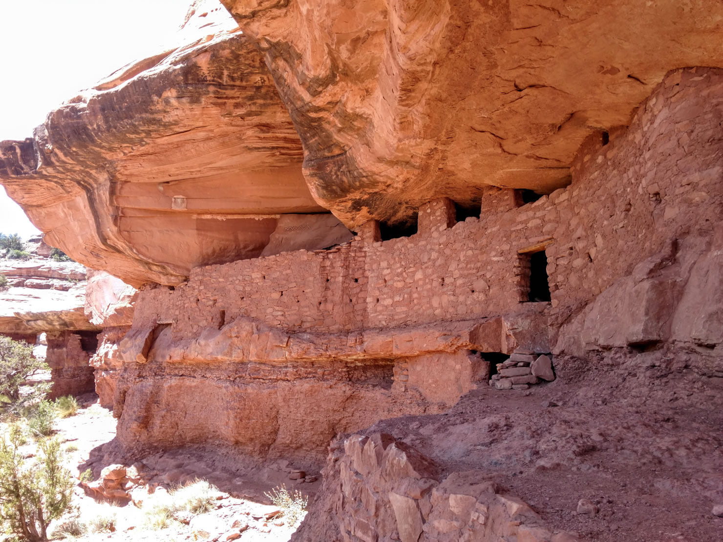
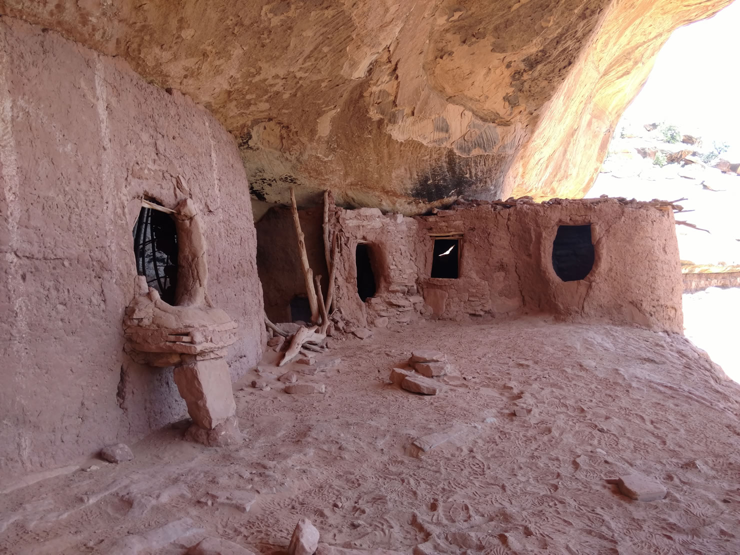
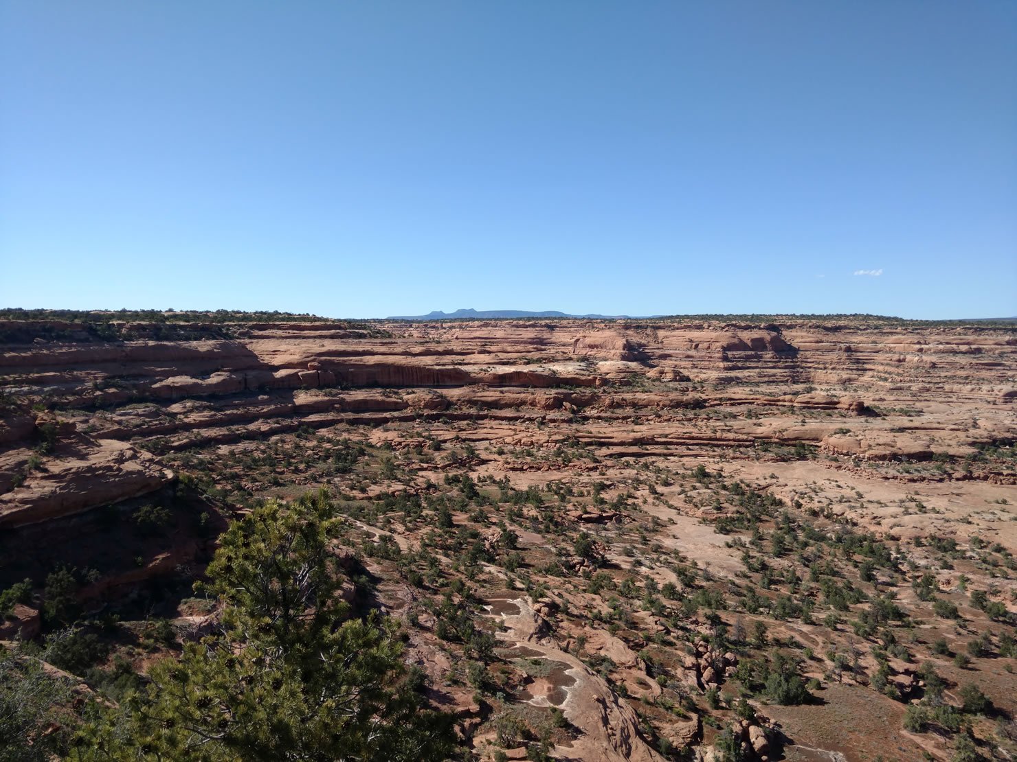
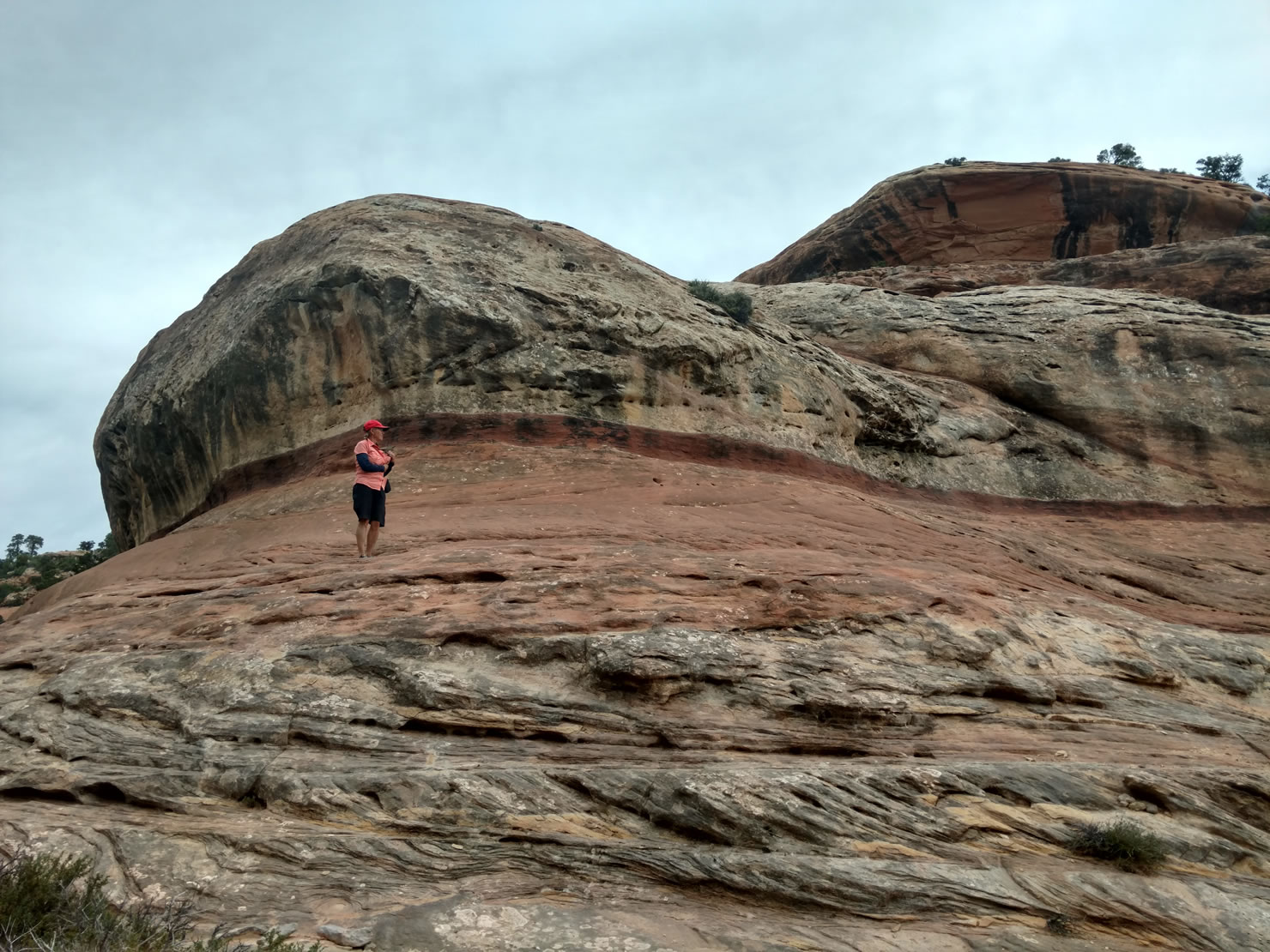
Our first stop was the Kane Gulch BLM Ranger Station to pick up the required, day-use permit for the Moon House Ruins. We then rode across the mesa on Snow Flats Rd to the trailhead. A steep one mile hike into McLoyd Canyon leads to a well preserved kiva and granaries. It took us a while to find the pictograph of the lunar cycle which gives the site its name. After camping the first night high above the mouth of McLoyd Canyon we dropped down off the mesa and headed south towards Valley of the Gods.
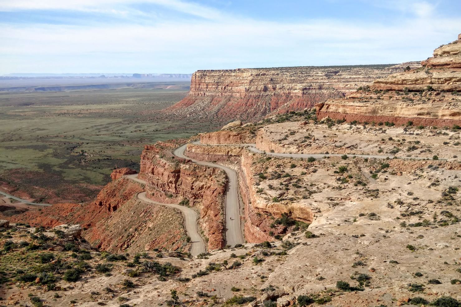
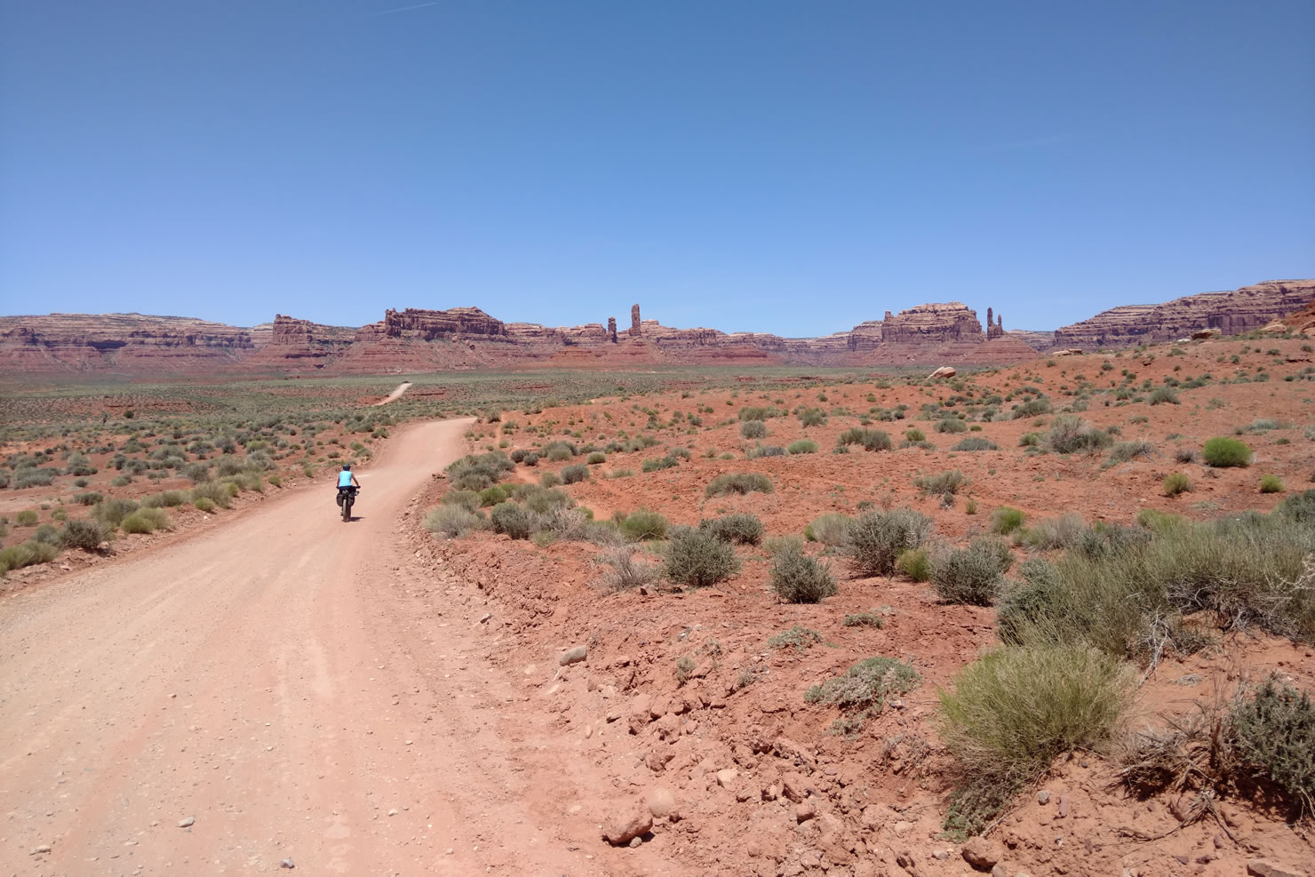
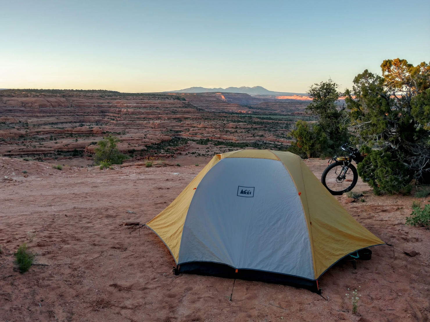
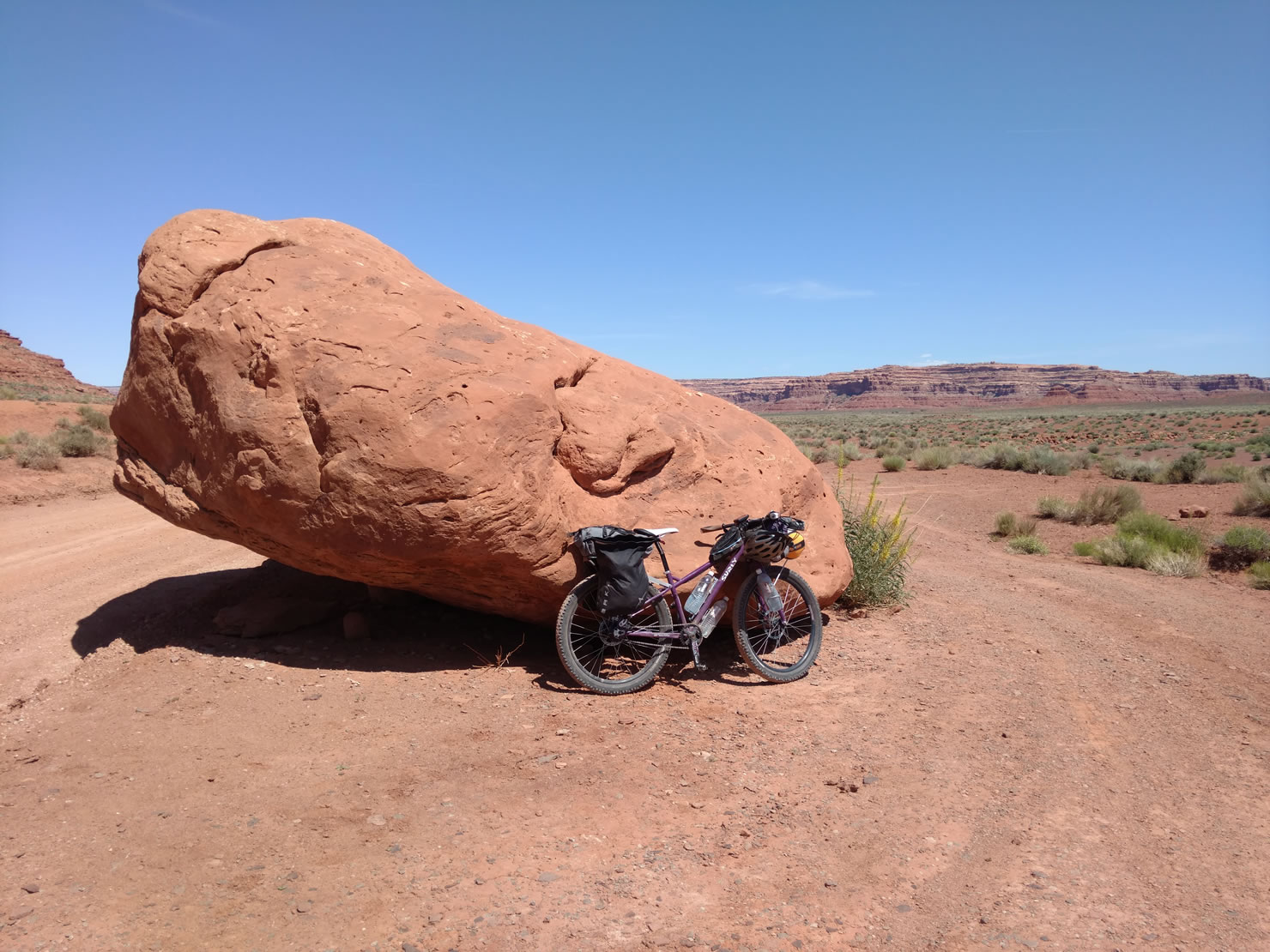
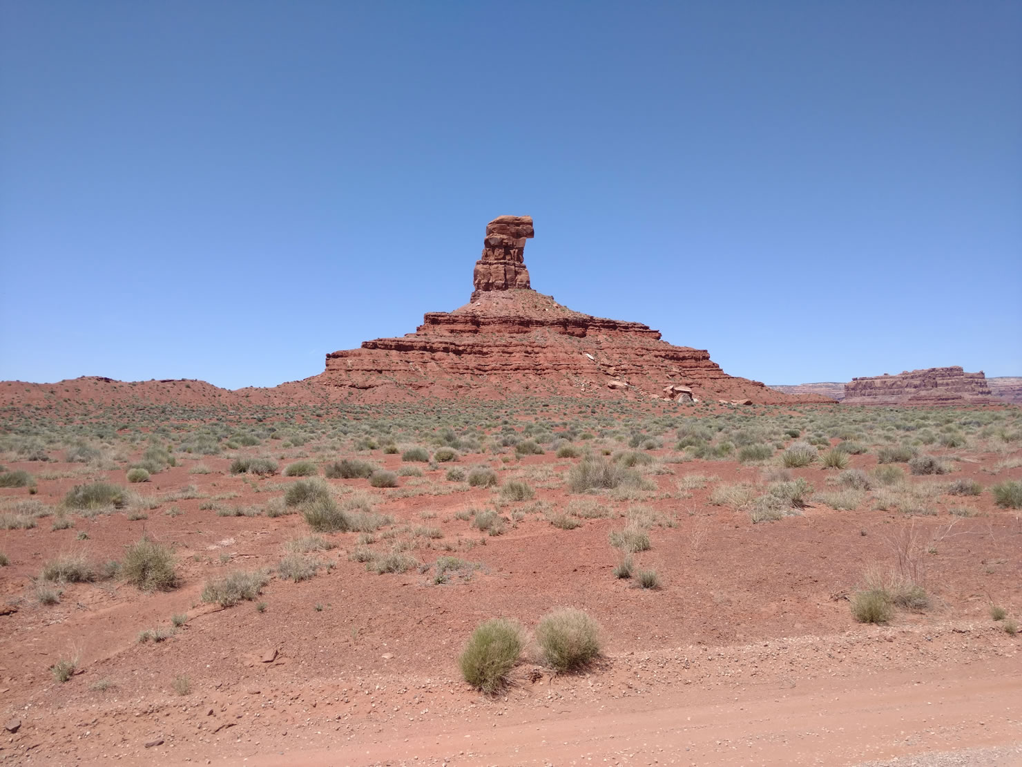
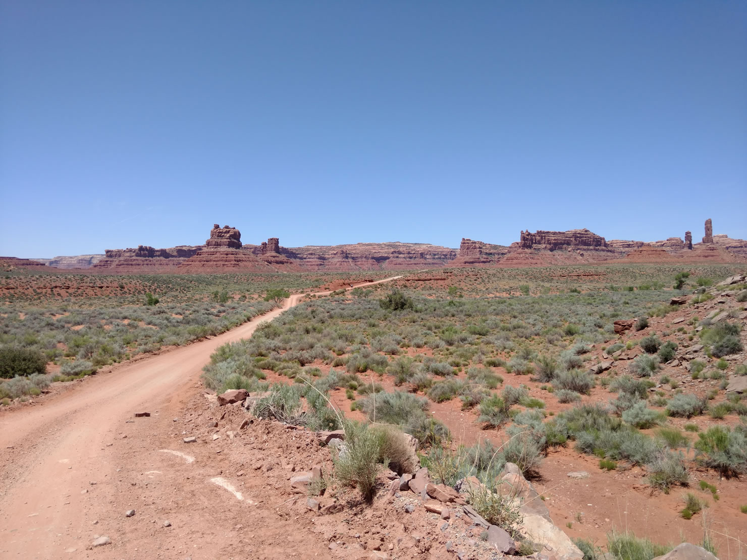
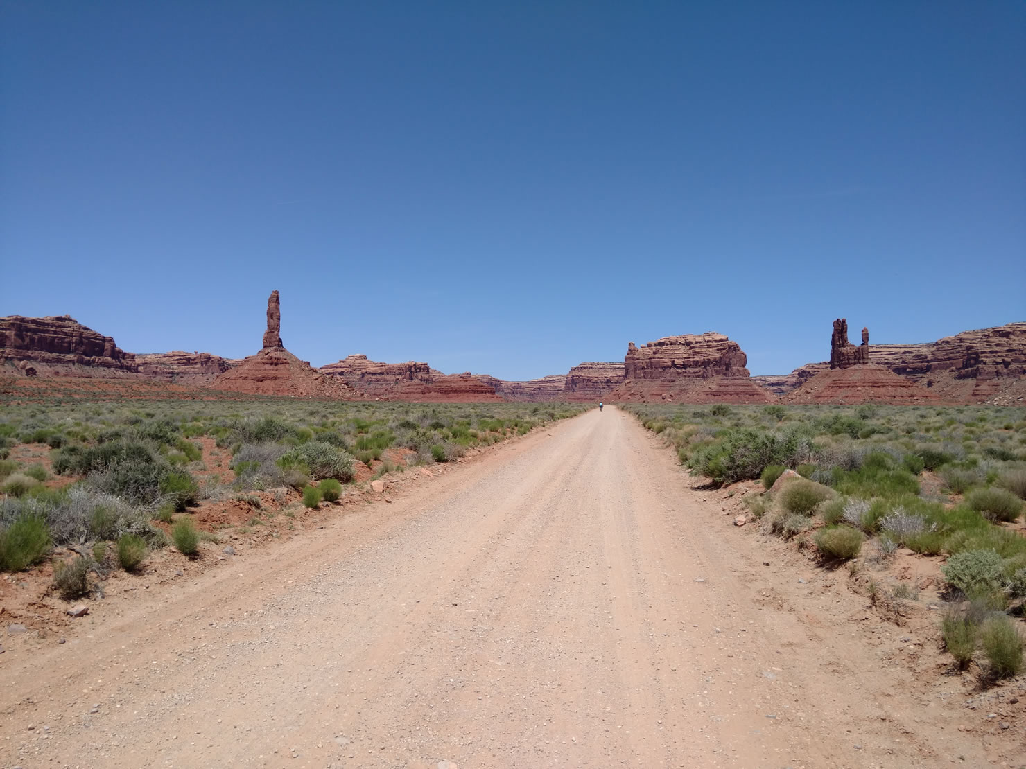
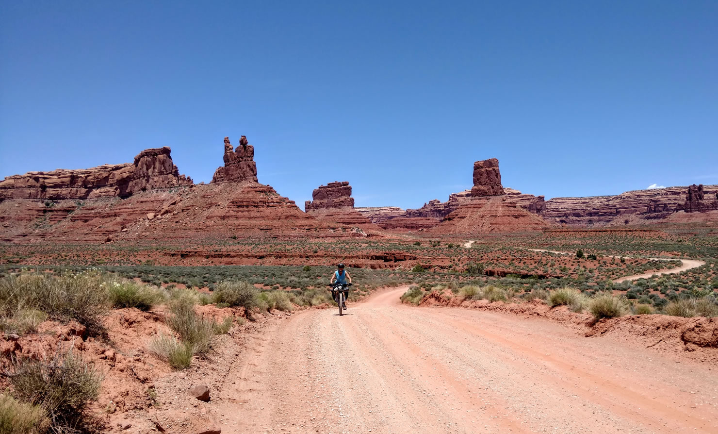
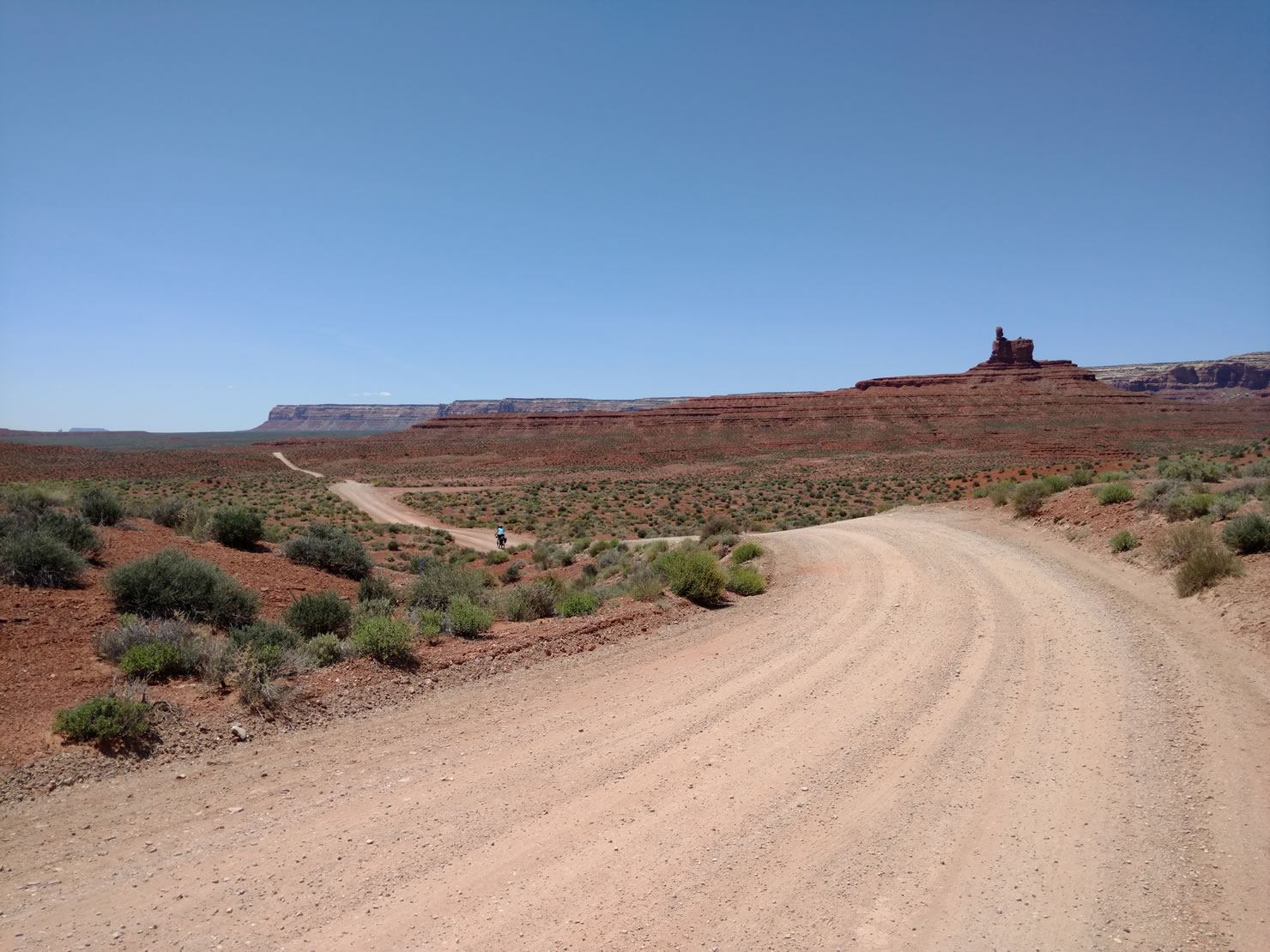
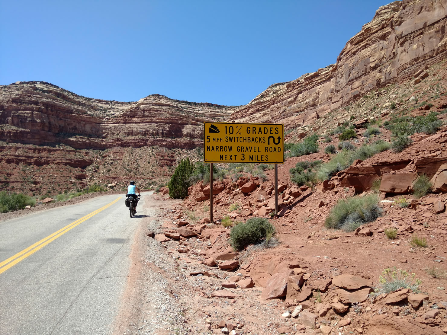
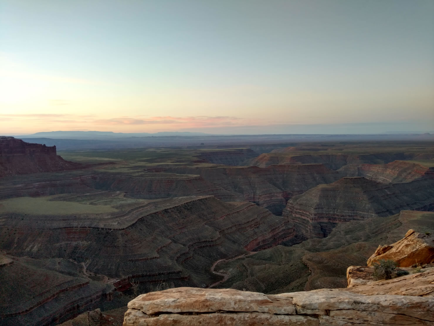
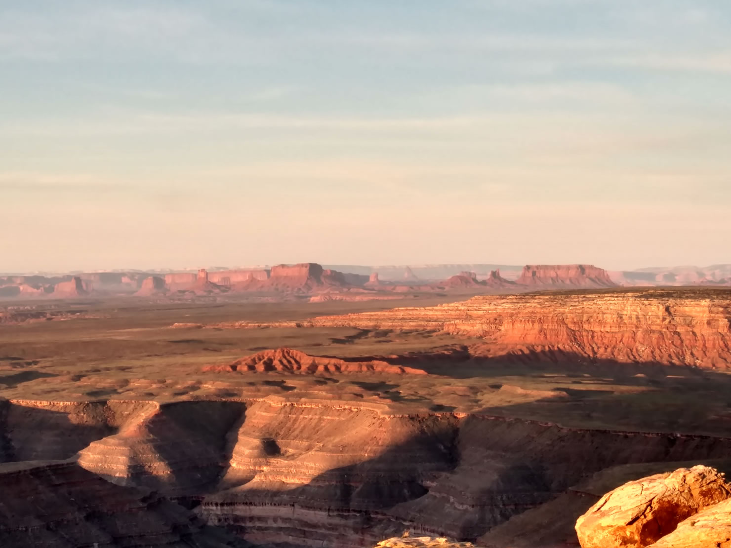
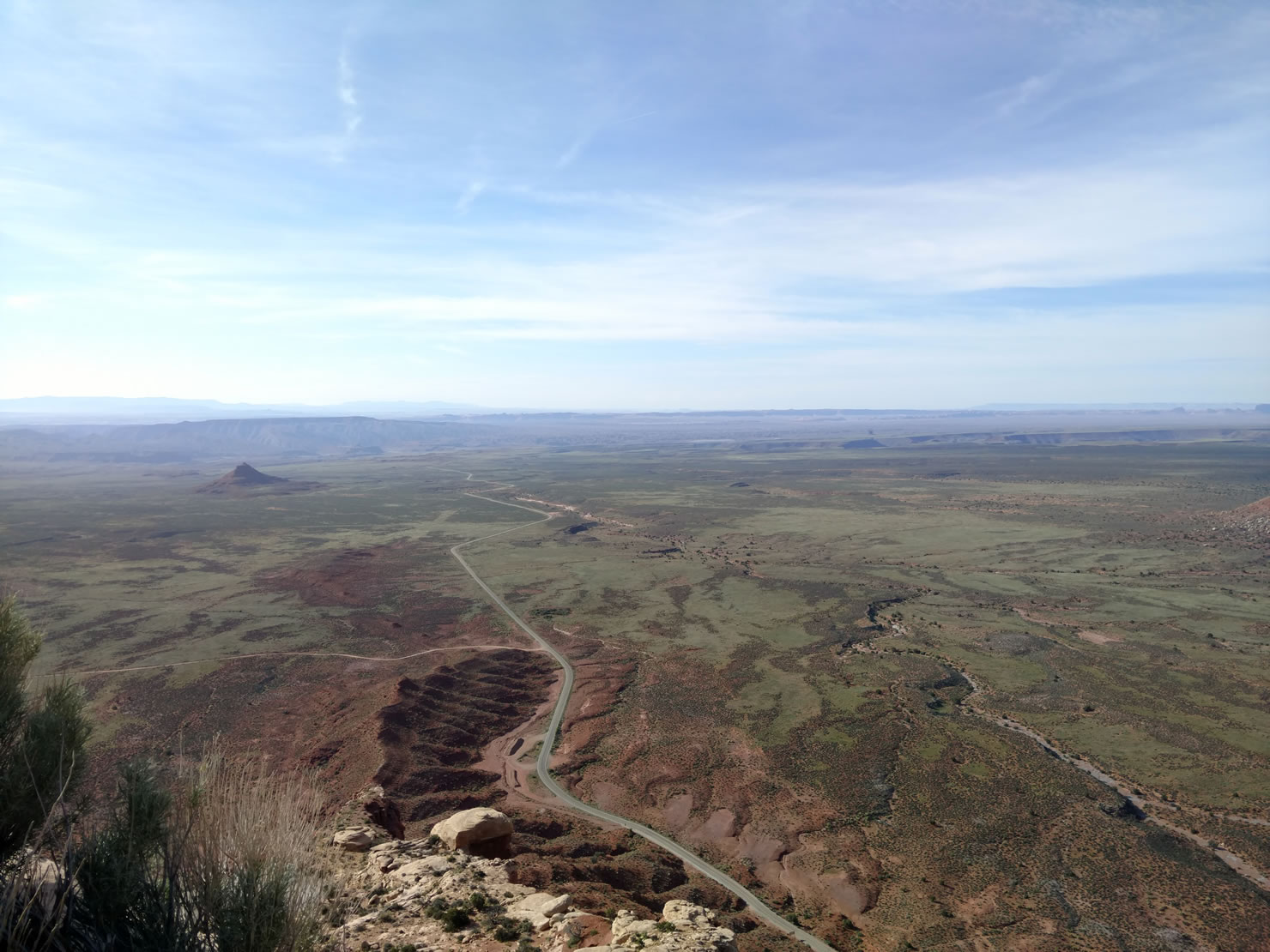
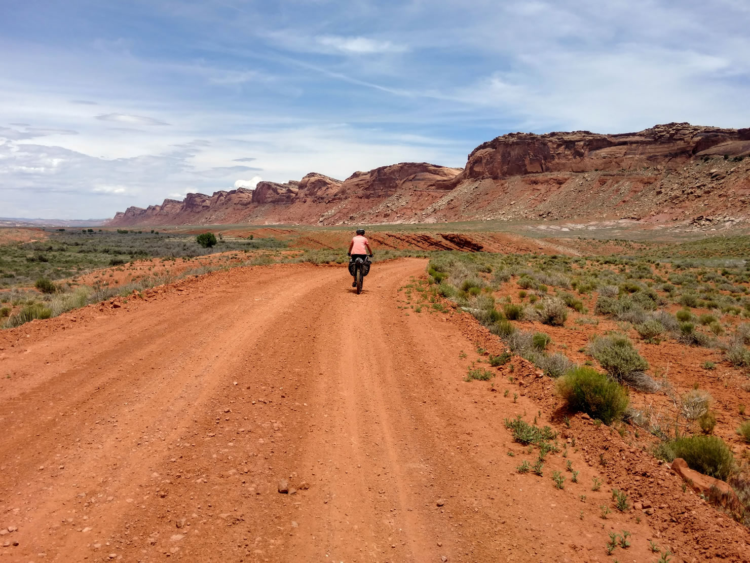
A 17 mile gravel road winds thru Valley of the Gods passing fantastic buttes and freestanding monuments. Valley of the Gods is a smaller version of the more famous Monument Valley in AZ. As temps rose in the afternoon we sweated our way up the Moki Dugway, a 3 mile/1200 ft climb from the valley floor to the edge of Cedar Mesa. The campsite at the top of Muley Point definitely is worth the climb. The Goosenecks of the San Juan river are just below the point and views all the way to Monument Valley were spectacular at sunset . The next morning we made a fast descent back down the Moki Dugway and into Mexican Hat to refill water, grab snacks and enjoy a slushie at the 7-11 gas station.
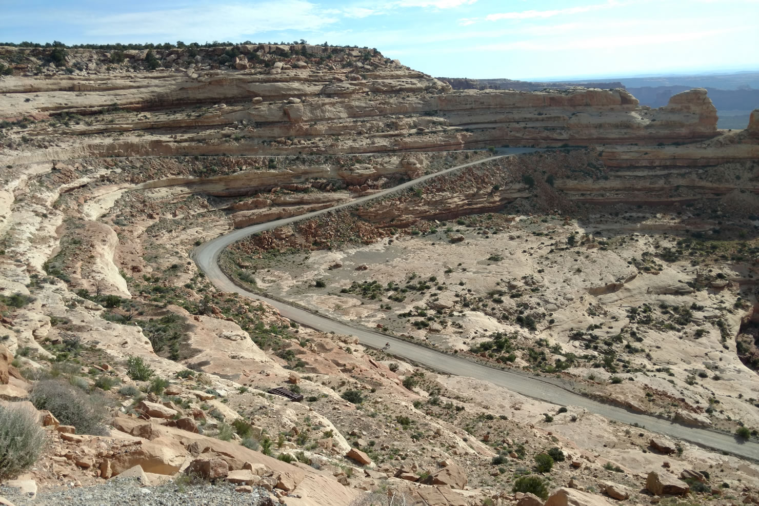
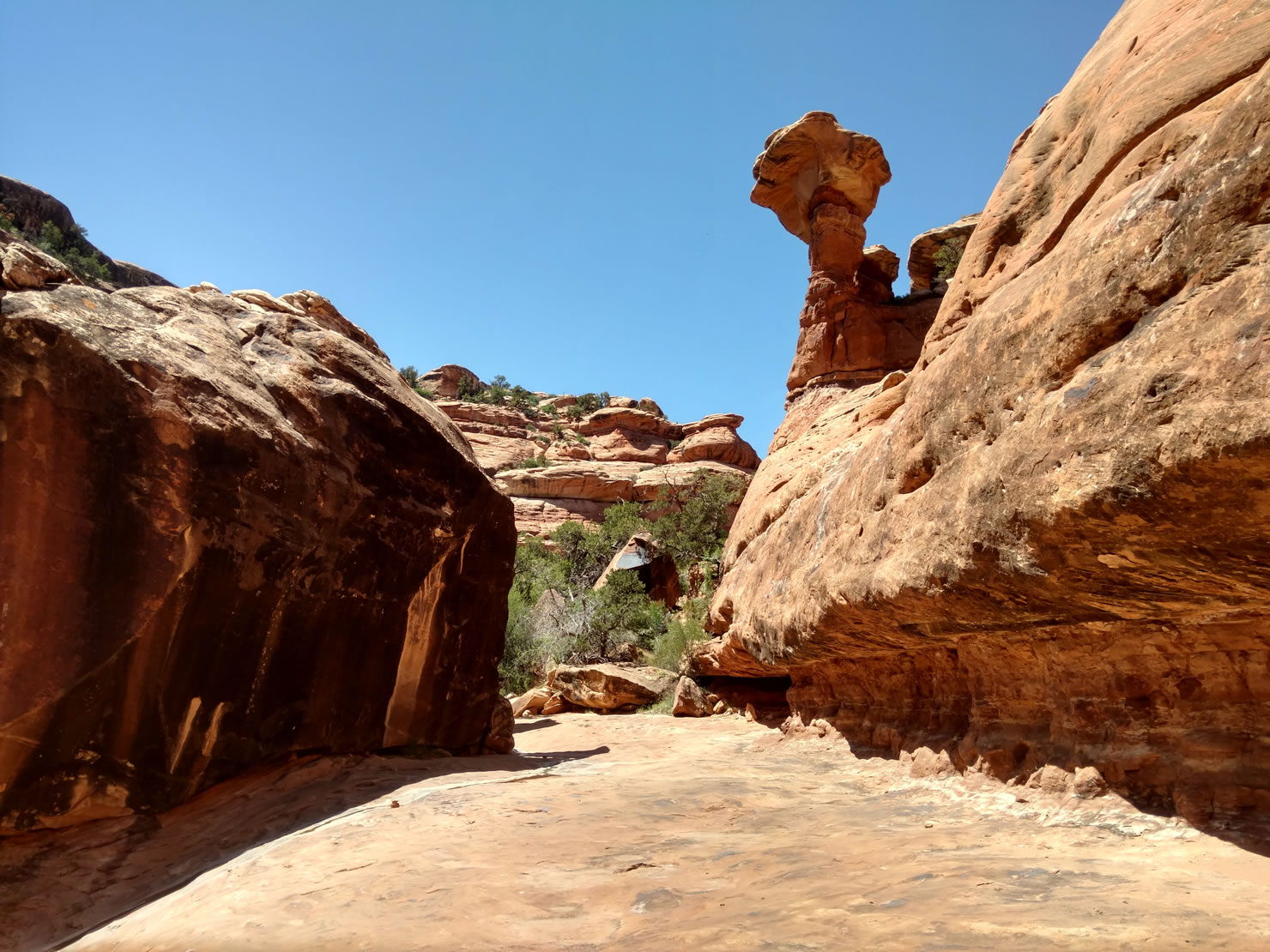
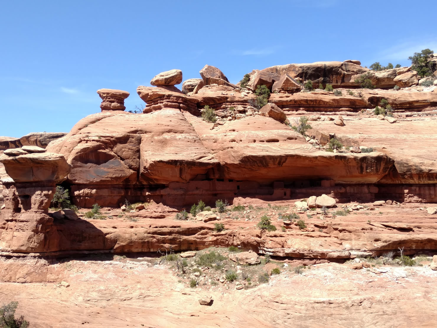
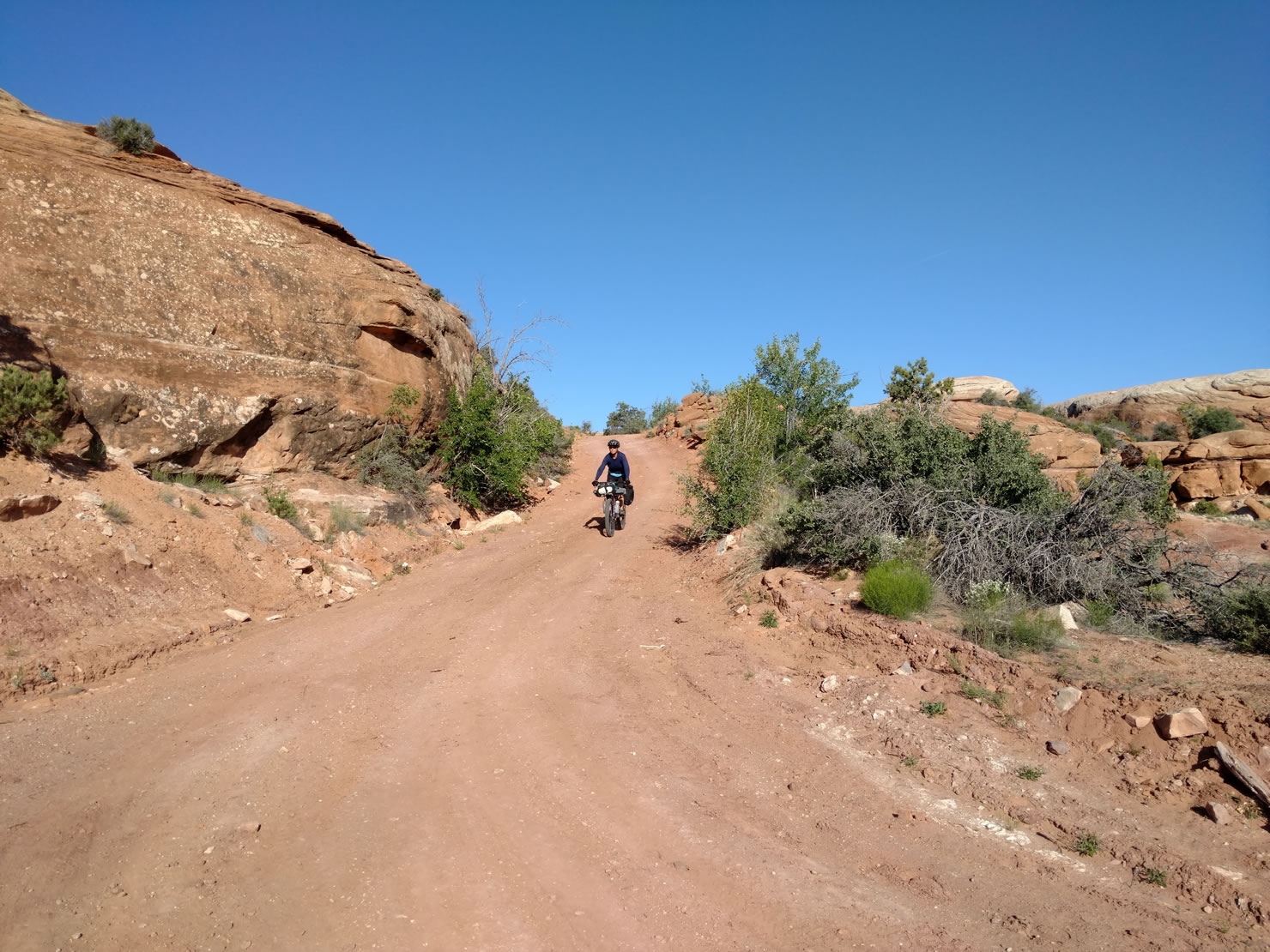
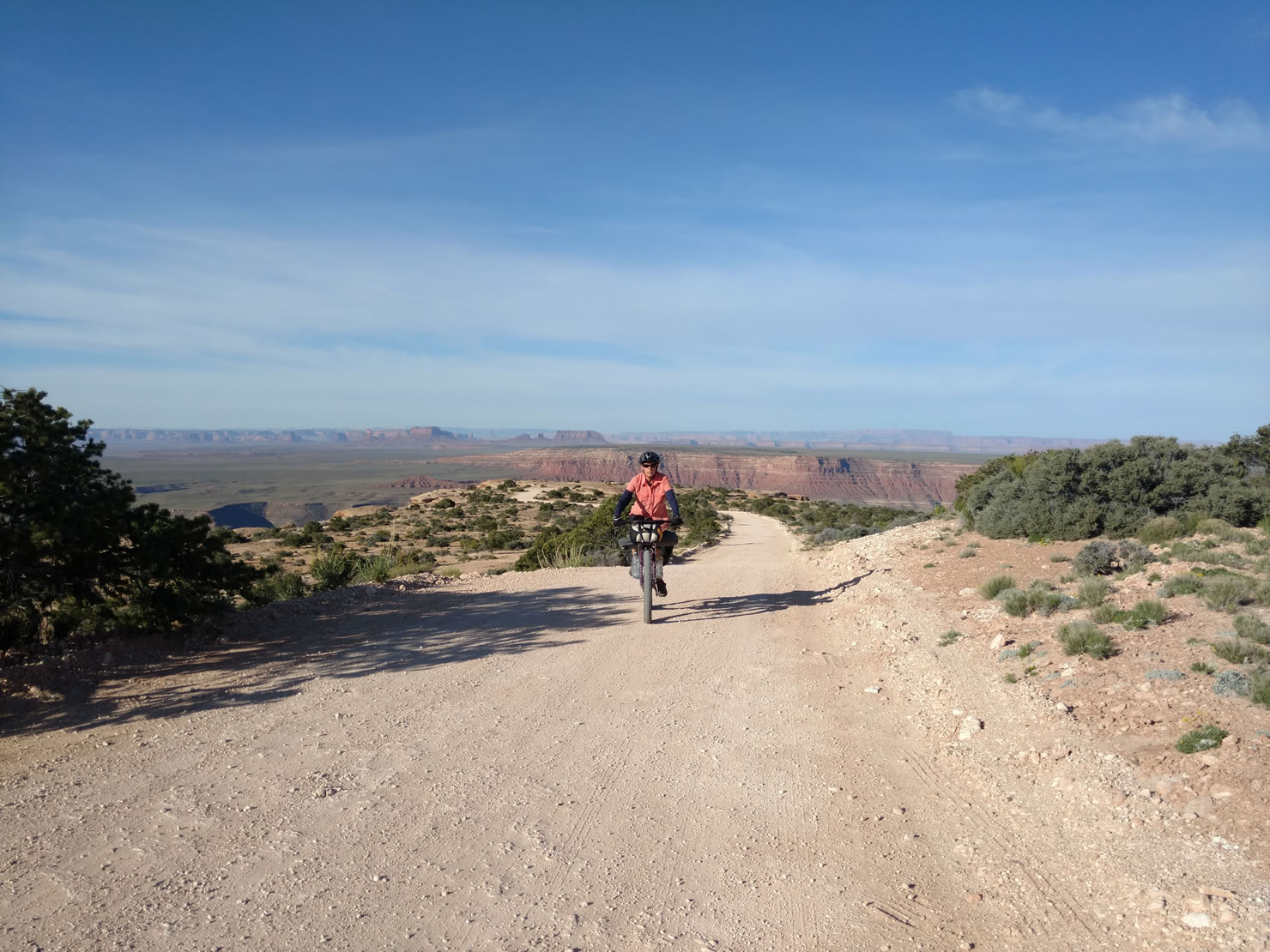
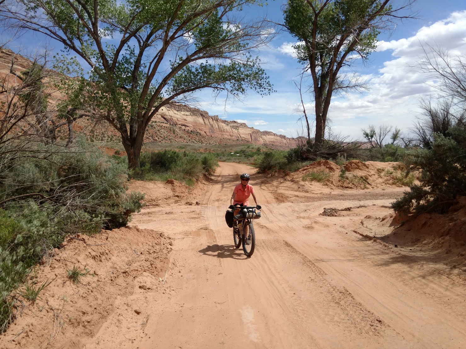
From Mexican Hat we rode north and along Comb Wash Rd on the western side of Comb Ridge. On our last day after camping at the head of Comb Wash we stopped at Mule Canyon. An easy 1 mile hike up the canyon brought us to the House on Fire ruin, a cliff dwelling which when viewed or photographed at the right time in the morning appears to be bursting with flames. We were a little early to get the full effect but continued hiking to find additional ruins further up the canyon.


Submit Route Alert
As the leading creator and publisher of bikepacking routes, BIKEPACKING.com endeavors to maintain, improve, and advocate for our growing network of bikepacking routes all over the world. As such, our editorial team, route creators, and Route Stewards serve as mediators for route improvements and opportunities for connectivity, conservation, and community growth around these routes. To facilitate these efforts, we rely on our Bikepacking Collective and the greater bikepacking community to call attention to critical issues and opportunities that are discovered while riding these routes. If you have a vital issue or opportunity regarding this route that pertains to one of the subjects below, please let us know:
Highlights
Must Know
Camping
Food/H2O
Trail Notes
Resources
- Explore the Moon House, one of the best preserved Ancestral Puebloan cliff dwellings on the mesa.
- Camp on Muley Point high above the Goosenecks of the San Juan River.
- Climb and descend the switchbacks of the Moki Dugway, a National Scenic Byway.
- Ride in the shadows of Comb Ridge, an 80 mile long monocline that extends into northeast AZ.
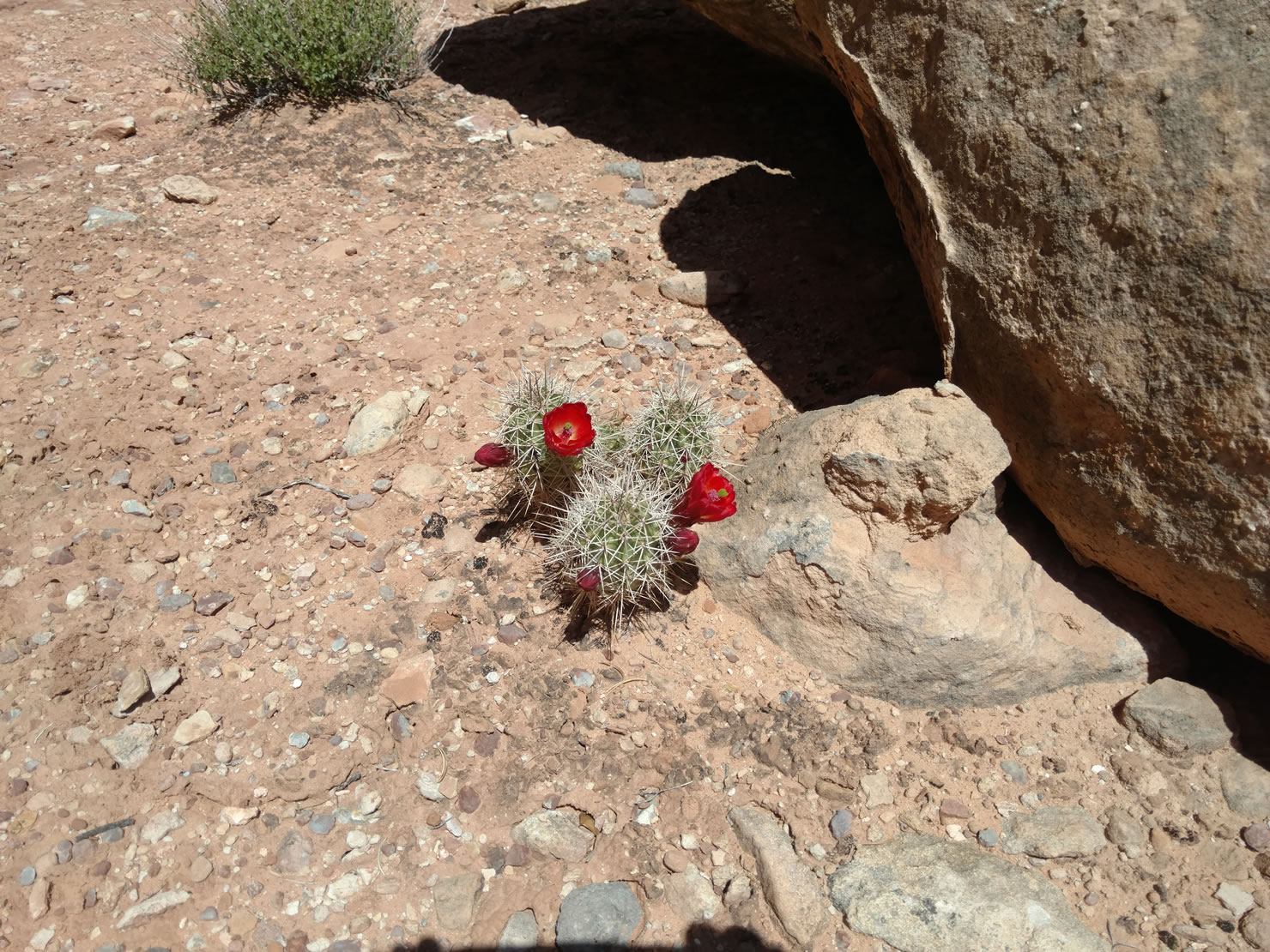
- Late spring or fall is the best time to ride, summer temps can often reach 100F.
- A permit is required for the Moon House and can be reserved in advance — Link here.
- Route start/finish with overnight parking at Natural Bridges National Monument (entry fee or park pass required) or Kane Gulch Ranger Station.
- The route is almost entirely on BLM land with many opportunities for wild camping.
- Natural Bridges National Monument has a small campground but it fills early each day.
- The Four Corners Inn in Blanding is clean and affordable.
- Stock up on food in Blanding, 40 miles east of the start/finish.
- Mexican Hat is the only resupply point on the route, it has two small cafes and two convenience stores.
- You will need to carry all water, there may be water in the canyons but its not be accessible by bike.
- BYOB – Blanding is a dry town so bring your own post-ride beer and then stop at Patio Drive In for burgers and shakes.
- The NatGeo Trails Illustrated map 706 (Grand Gulch/Cedar Mesa) is helpful in addition to the gpx track.
- The roads on top of the mesa can be muddy and/or impassible after rain but they dry quickly.
- Carrying all your food and water makes this route challenging, but the stunning landscapes and solitude in this part of UT are outstanding.
Additional Resources
The Cedar Mesa is part of the proposed Bears Ears National Monument which aims to protect up to 1.9 million acres in SE Utah. More information at http://www.friendsofcedarmesa.org/ and http://www.bearsearscoalition.org/.


Terms of Use: As with each bikepacking route guide published on BIKEPACKING.com, should you choose to cycle this route, do so at your own risk. Prior to setting out check current local weather, conditions, and land/road closures. While riding, obey all public and private land use restrictions and rules, carry proper safety and navigational equipment, and of course, follow the #leavenotrace guidelines. The information found herein is simply a planning resource to be used as a point of inspiration in conjunction with your own due-diligence. In spite of the fact that this route, associated GPS track (GPX and maps), and all route guidelines were prepared under diligent research by the specified contributor and/or contributors, the accuracy of such and judgement of the author is not guaranteed. BIKEPACKING.com LLC, its partners, associates, and contributors are in no way liable for personal injury, damage to personal property, or any other such situation that might happen to individual riders cycling or following this route.
Please keep the conversation civil, constructive, and inclusive, or your comment will be removed.