


Attack of The Buns
Distance
201 Mi.
(323 KM)Days
3-4
% Unpaved
63%
% Singletrack
0%
% Rideable (time)
98%
Total Ascent
15,395'
(4,692 M)High Point
3,460'
(1,055 M)Difficulty (1-10)
3?
- 5Climbing Scale Moderate77 FT/MI (15 M/KM)
- -Technical Difficulty
- -Physical Demand
- -Resupply & Logistics
Contributed By

Adam Lee
Guest Contributor
Adam’s love of cycle touring started as a child when he was taken on multi-day charity rides with his mother. Luckily he now needs the sag-wagon less as he explores more remote places. While he’s currently balancing bikepacking with his work/family life, he dreams of one day riding across Canada and South America. More at endlesscycle.com.au and Instagram @endless_cycle.
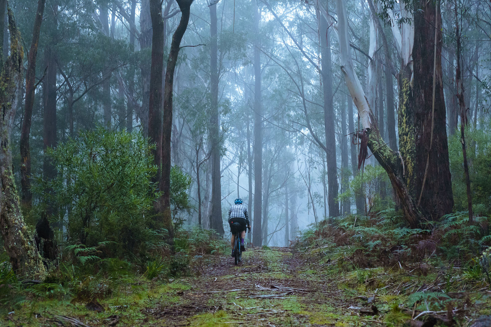
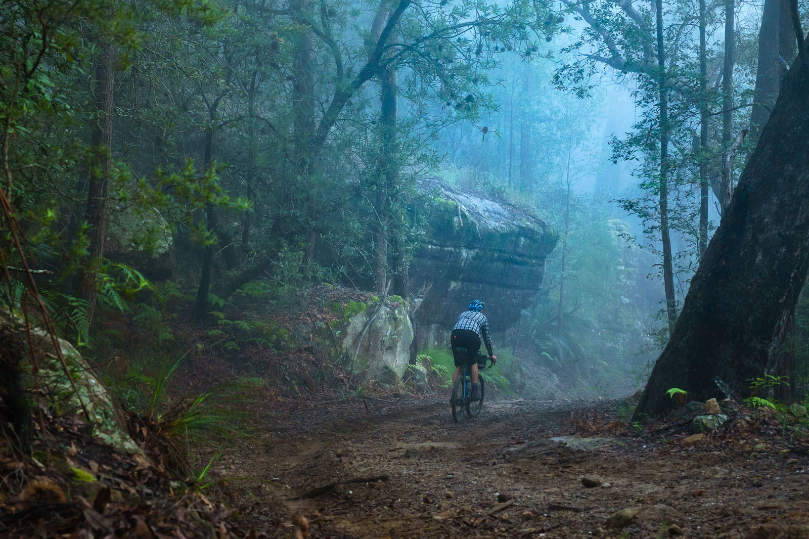
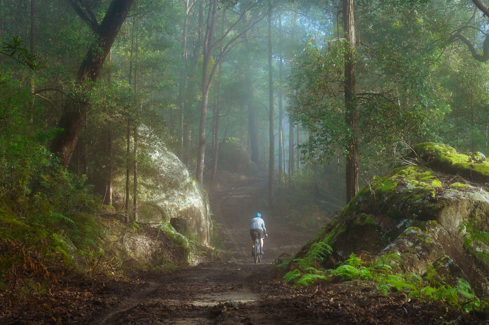
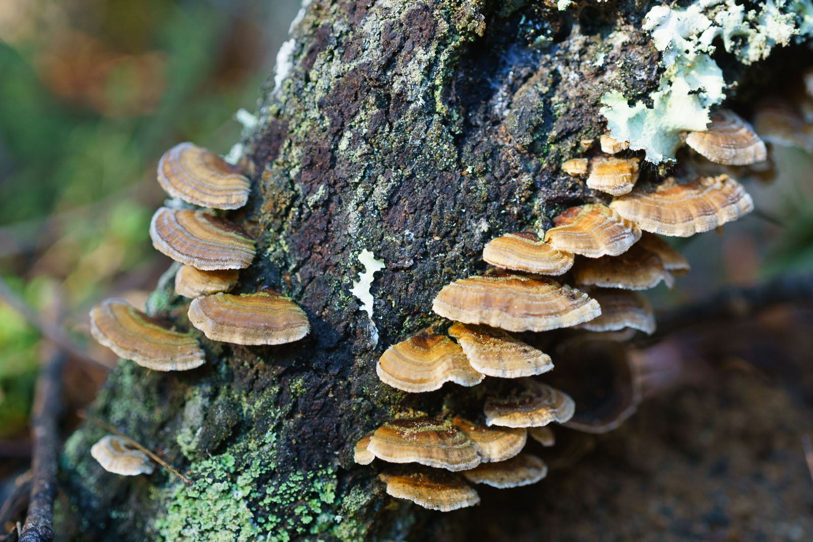
This route was designed with the intention of sharing some of the most beautiful areas in the New South Wales region of Australia within a three or four day trip. It is the perfect balance of smile-inducing landscapes, remote adventure, and accessibility for those of us who aren’t elite athletes. This is one for the nature lovers. Riders will be delighted with the amount of variety this route packs into three days, from the expanses of forest to the the abundance of camping options, the countless little side trips, and especially the hidden treasures including waterfalls, babbling streams, mossy rock formations and awe inspiring cliffs. In addition, there are plenty of opportunities for spotting iconic Australian wildlife, including wombats, kangaroos, wallabies and lyrebirds
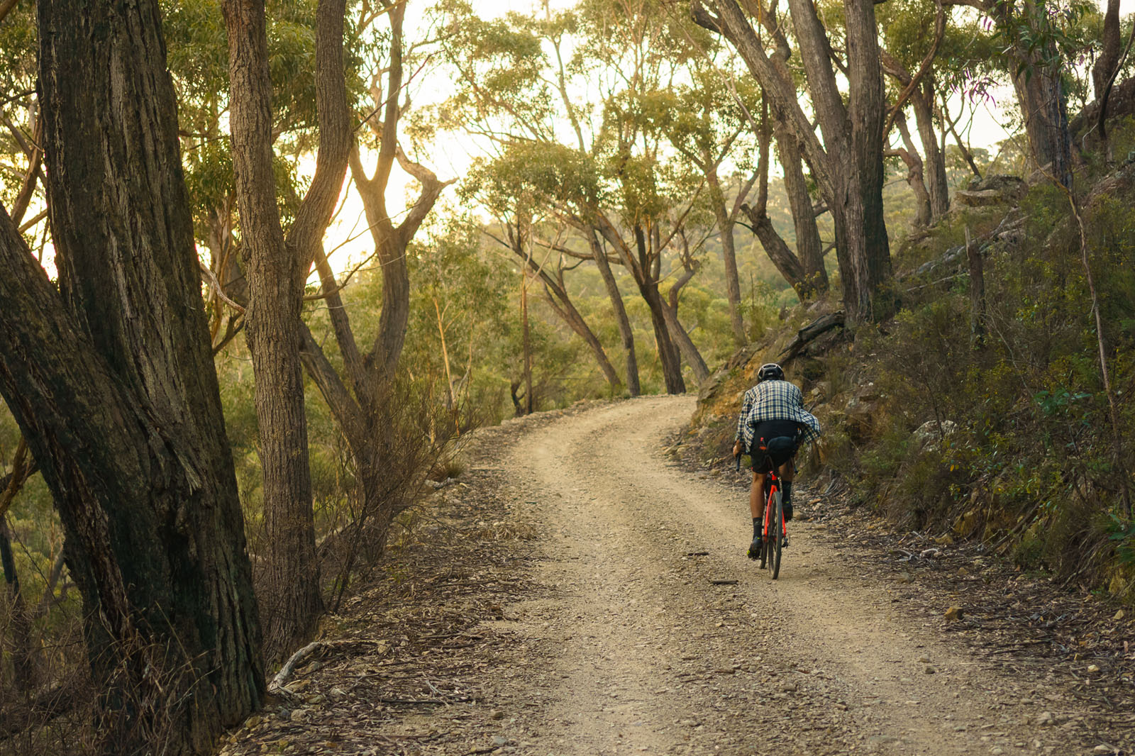
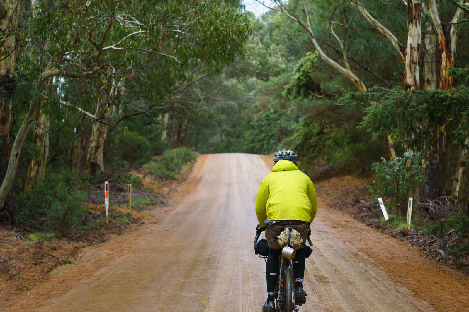
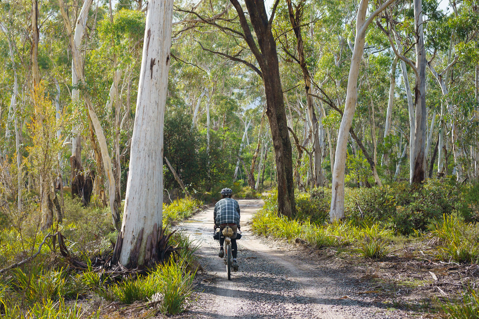
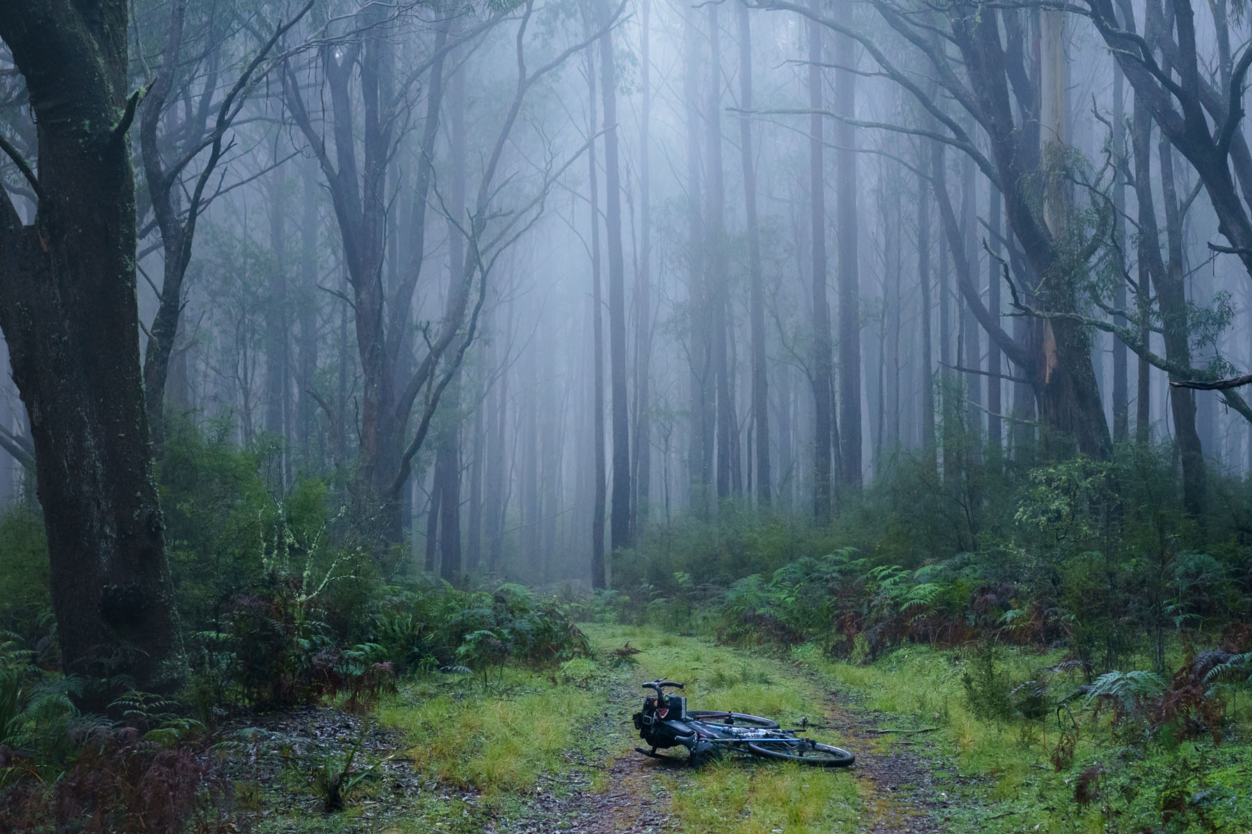
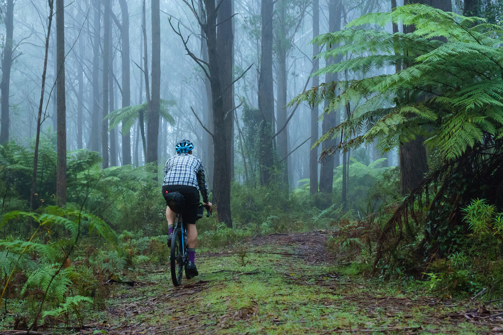
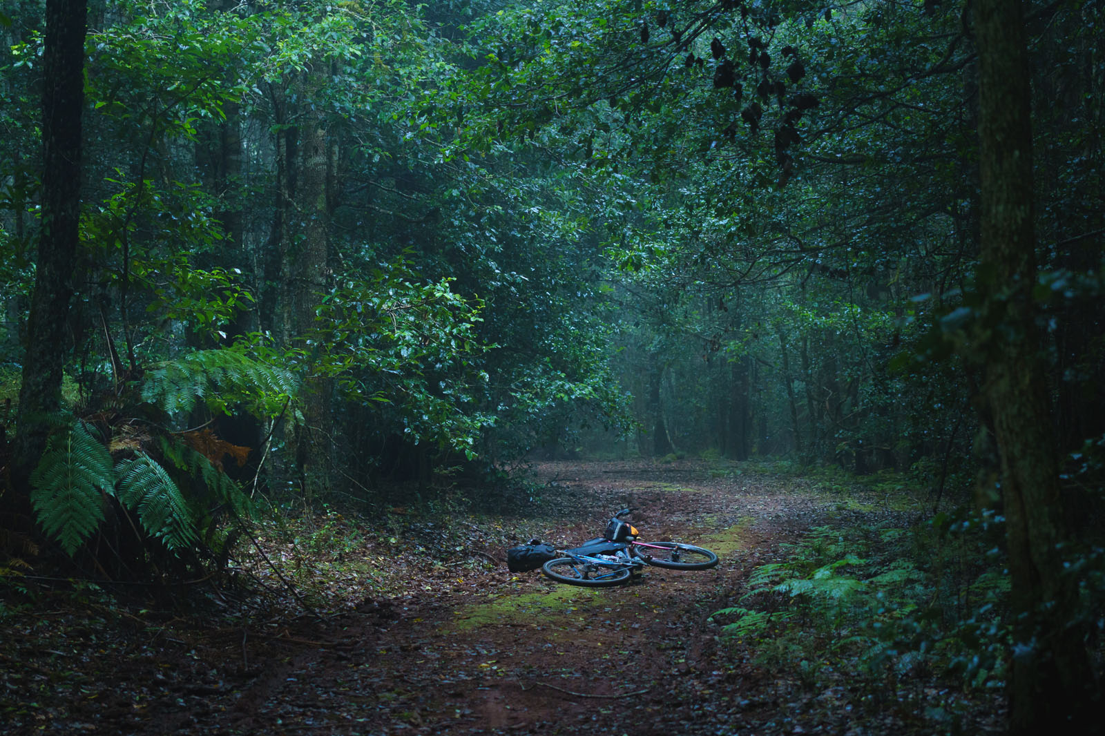
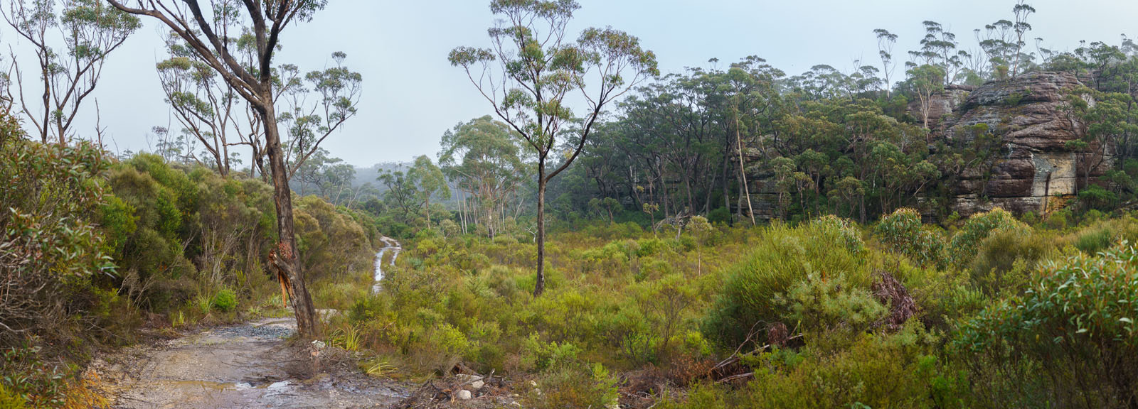
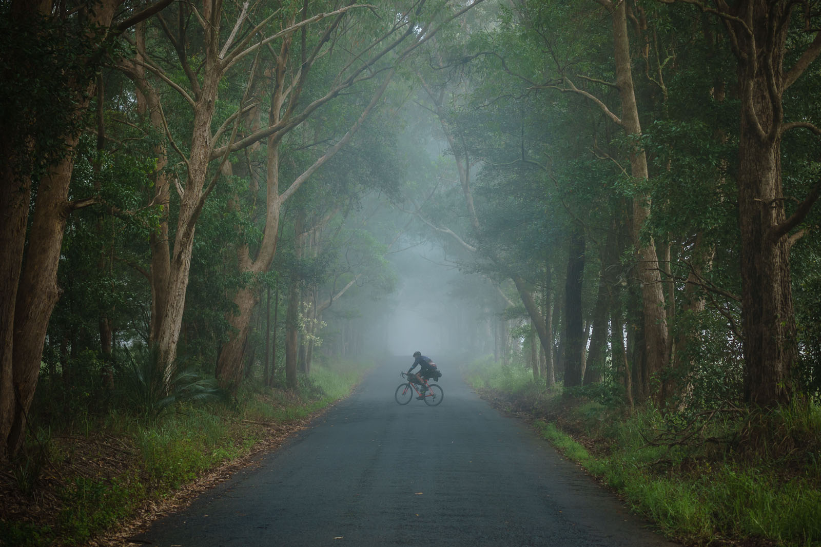
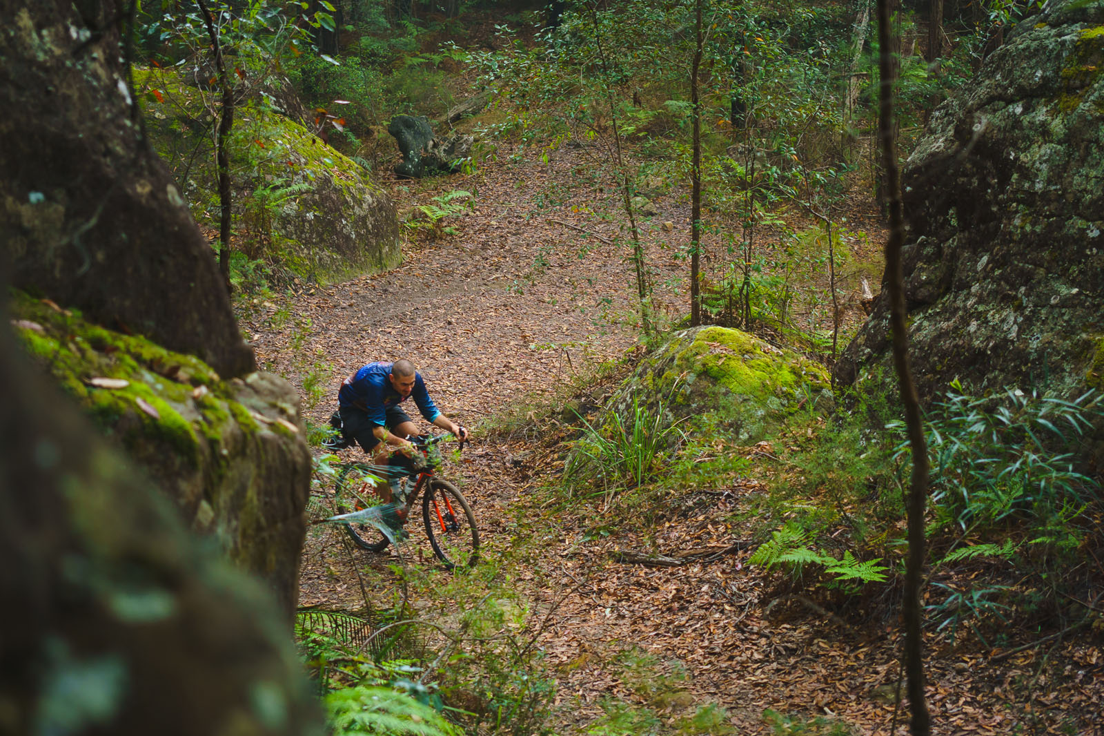
Dominated by wide, smooth gravel country roads and car-free fire trails (fire roads for those in the USA), each day the route will take you through an ever-changing buffet of Australian landscapes, including dry eucalypt, sandy coastal woodlands and lush rainforest. You’ll crisscross through national parks several times and have plenty of time away from civilisation without being too far away from supplies.
Route Difficulty: Contrary to its somewhat scary name and logo, Attack of the Buns has very little in the way of technicality, with the hardest trails being only mildly rough and overgrown 4WD tracks. There’s only one notably steep section of climbing, which may necessitate some hike-a-bike for all but the strongest riders. There is only one extended section of about 160km between Braidwood and Nowra without supply points, but there are plenty of water and camping options in between.


Submit Route Alert
As the leading creator and publisher of bikepacking routes, BIKEPACKING.com endeavors to maintain, improve, and advocate for our growing network of bikepacking routes all over the world. As such, our editorial team, route creators, and Route Stewards serve as mediators for route improvements and opportunities for connectivity, conservation, and community growth around these routes. To facilitate these efforts, we rely on our Bikepacking Collective and the greater bikepacking community to call attention to critical issues and opportunities that are discovered while riding these routes. If you have a vital issue or opportunity regarding this route that pertains to one of the subjects below, please let us know:
Highlights
Must Know
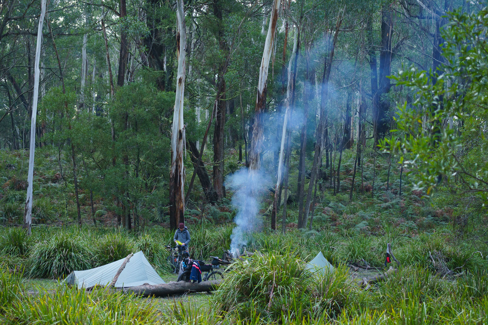
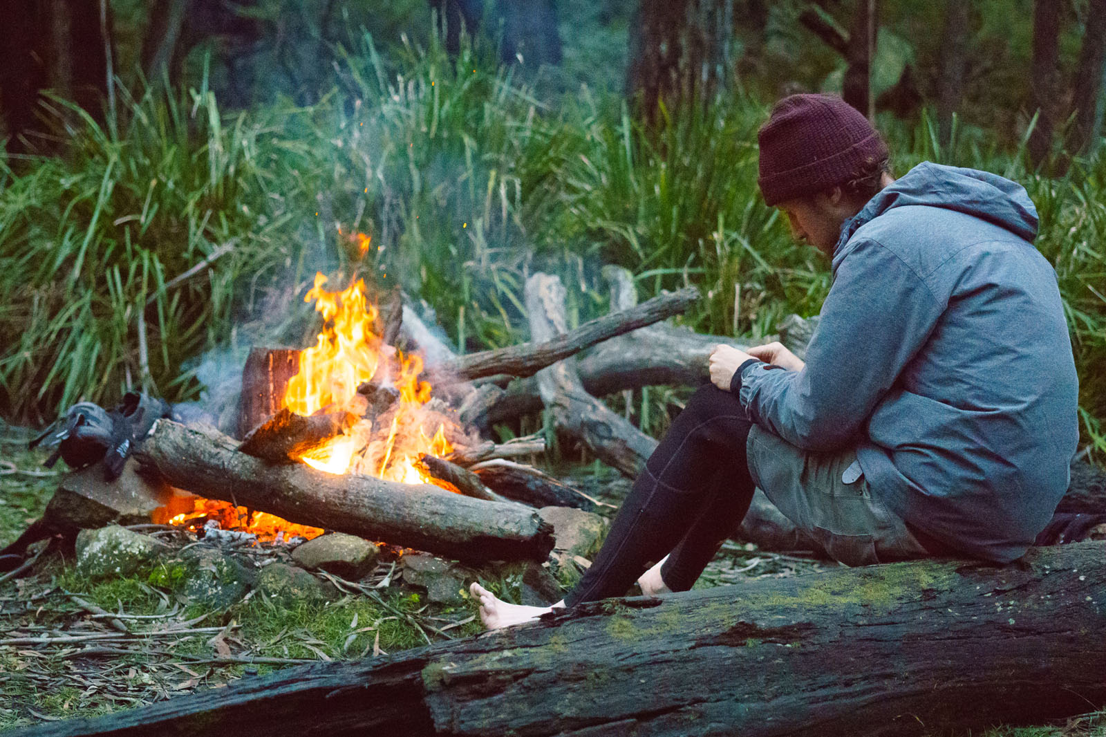
Camping
Food/H2O
Trail Notes
Resources
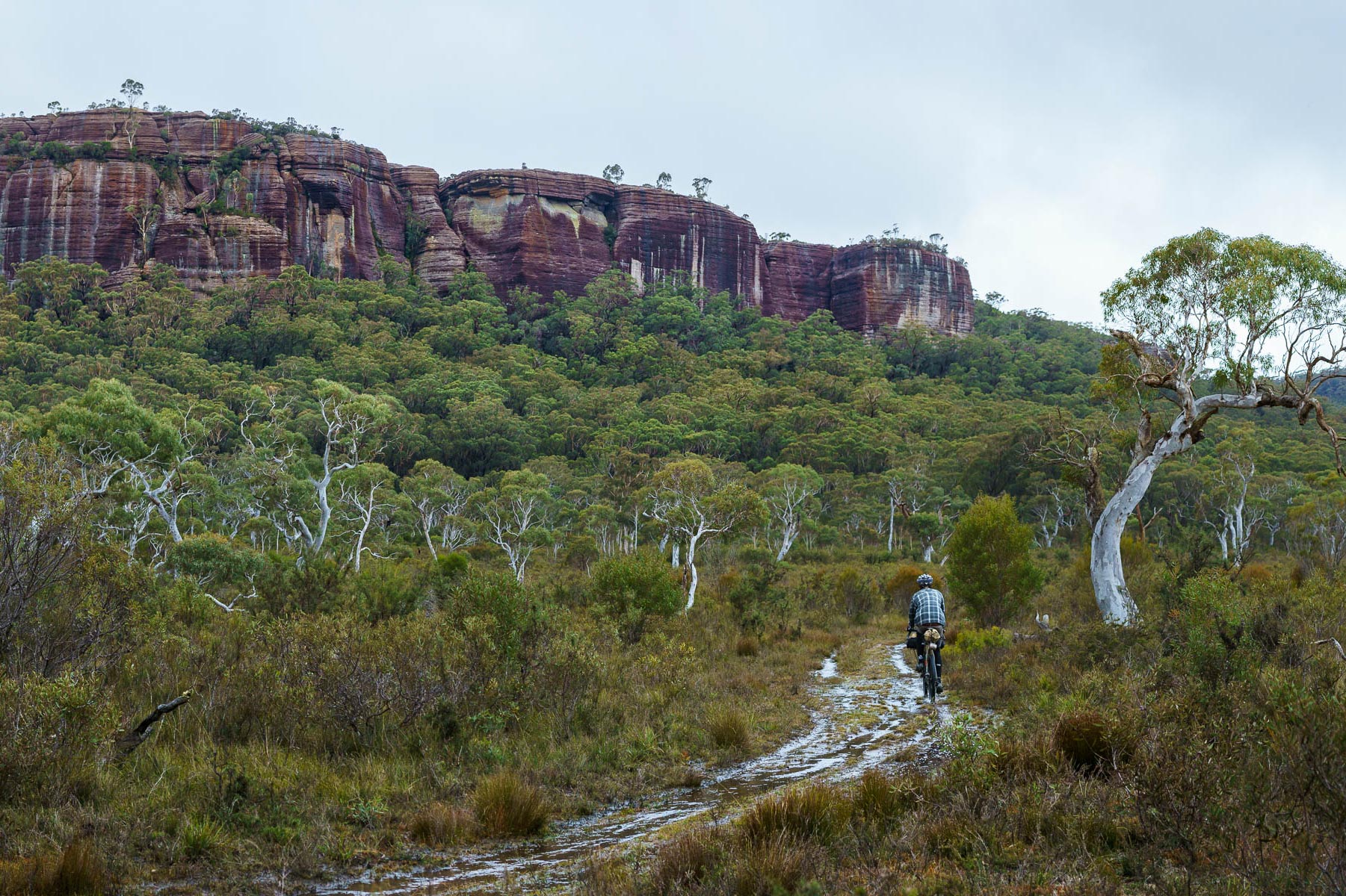
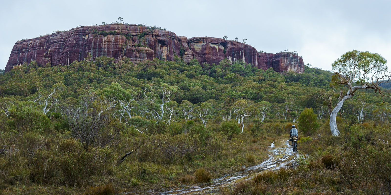
- The incredibly diverse Red Ground Track will continually put a smile on your face, especially the red cliffs and The Vines.
- The short detour to get to Tianjara Falls provides a stunning view of a majestic waterfall cascading high above a forested valley.
- The many little creek crossings provide great opportunities to rest and relax.
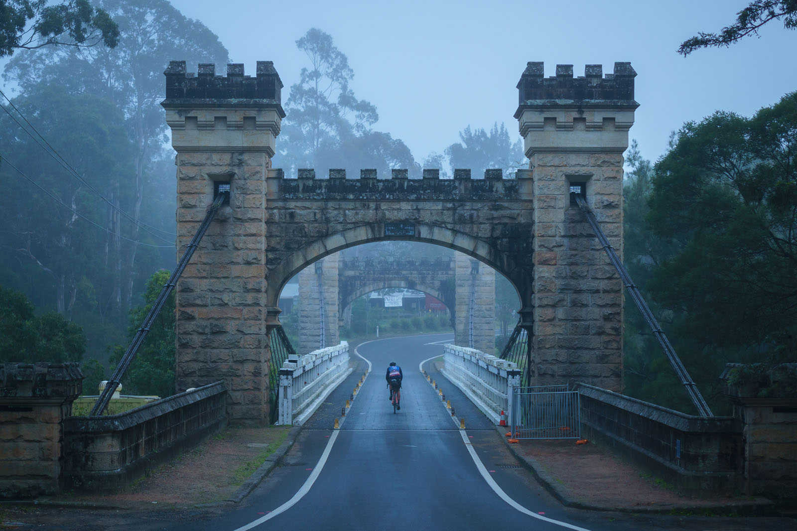
- Kangaroo Valley has lots of great food and Australia’s oldest suspension bridge.
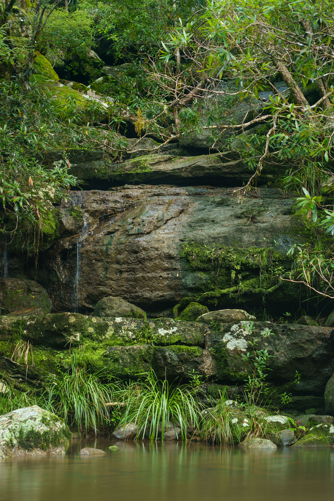
- The car-free, rainforested Griffins Firetrail has an abundance of mossy rocks and peaceful streams.
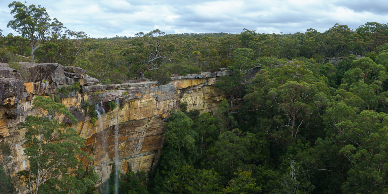
- The series of 4-5 waterfalls at Fitzroy Falls cascade around 80m into the canyon below, which you just rode out of.
When to go
- September-November and March-May would be best, and winter (June-August) is fine as long it hasn’t rained recently, which can raise rivers to waist-high and create some very slippery mud on the Red Ground Track. Australian summers (December-February) can get quite hot and may dry up some of the natural water sources.
Logistics
- The start is only a 30 minute drive from Canberra, Australia’s capital.
- There are regular buses and a train to Bungendore from Canberra, and a train from Sydney.
- The end of the route is halfway between Canberra and Sydney (2-3 hour drive), and on a train line (bikes need to be boxed) with regular services. You can also ride to Sydney in 1-2 days, or continue north into the Blue Mountains for some more adventure.
- No travel permits are required, but fires may be banned during summer; check the NSW National Parks and Wildlife Service website or local signs for details of fire bans and other alerts
- Australia is a fairly safe and friendly place to travel.
- Nearby Sydney is a major international airline hub.
- Check here for Australian visa requirements.
Dangers and Annoyances
- You may see snakes during summer; be careful around water sources and keep out of their way as best as possible. They’ll soon slither away if not provoked.
- The first few kilometres of the Red Ground Track goes through private land, but access is permitted to cyclists and walkers who stay on the trail.
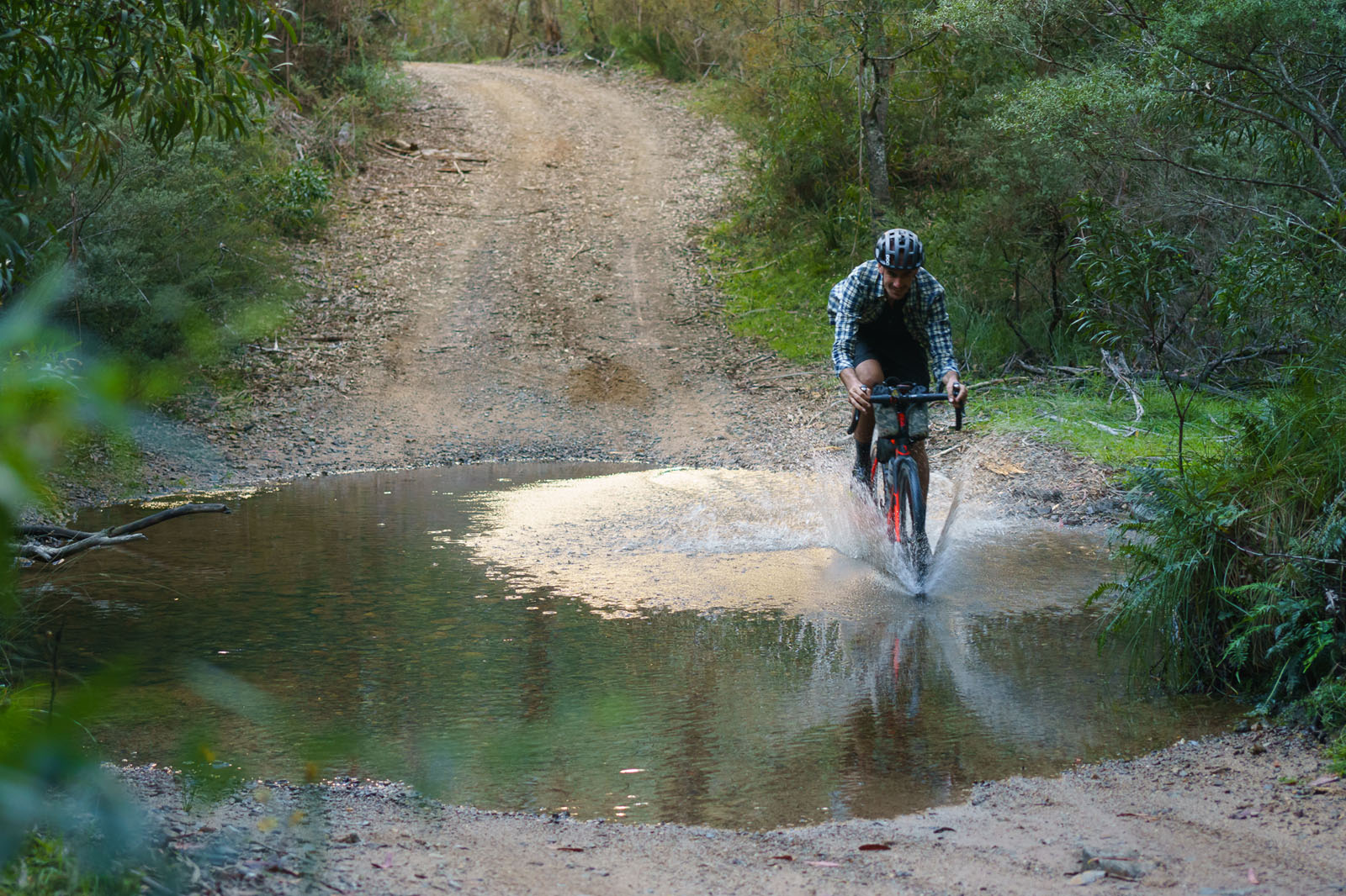
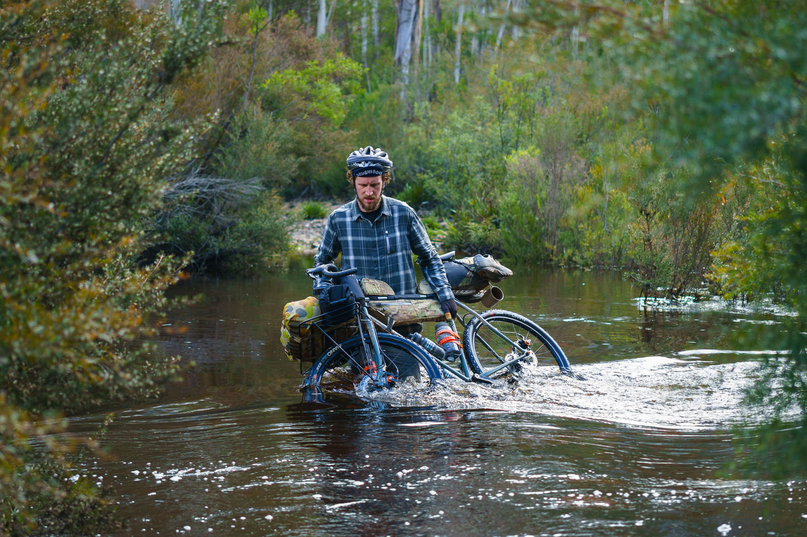
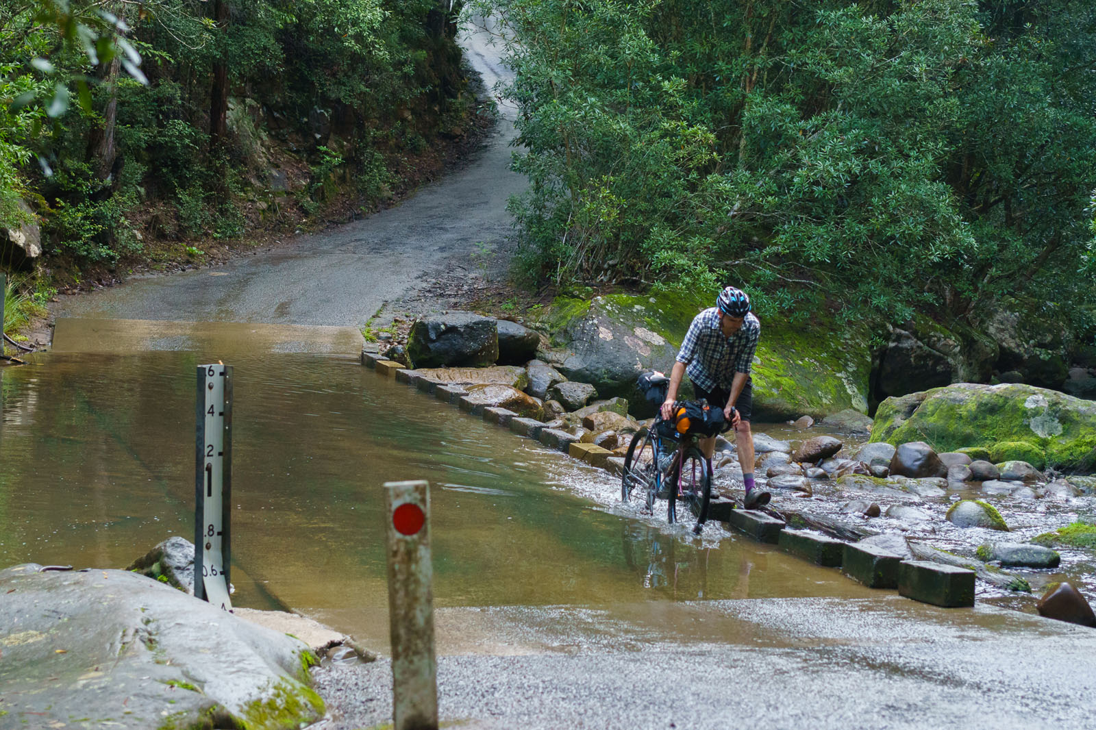
- The two Endrick River crossings can peak at over 1m after recent rains (see photo), but will recede quickly.
- There are several smaller creek crossings that won’t cause any problems.
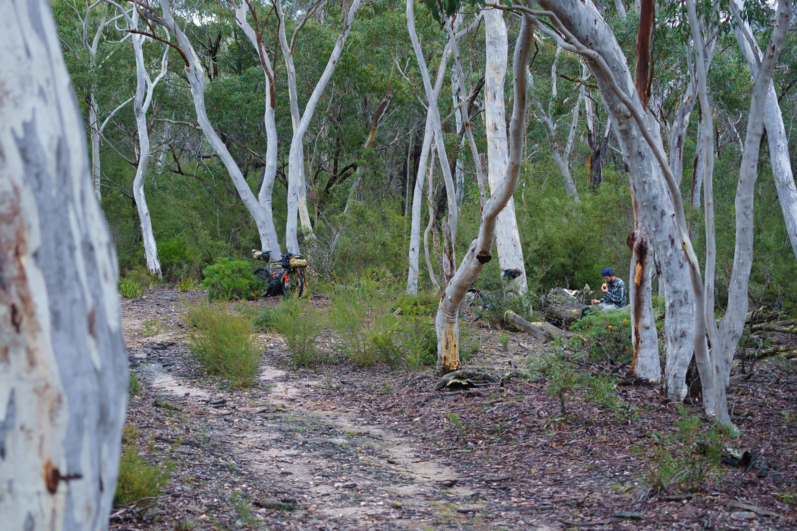
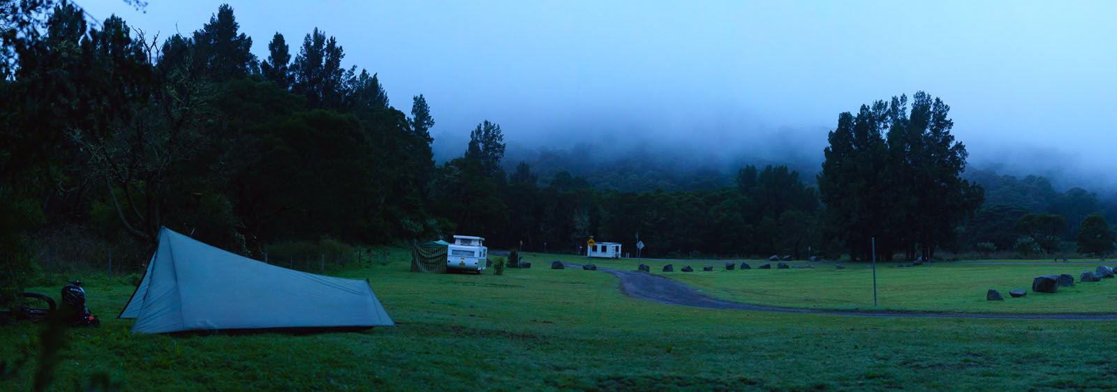
- There’s an abundance of camping options on the route, both wild and civilised, as well as accommodation in the towns. With plenty options, it even suits those looking for a relaxed 4 or 5 day jaunt.
- At 97km, Wog Wog is a good campsite for those taking it easy. For the price of free you get grass and a toilet.
- Those willing to go further will be rewarded with Piercys Clearing at the 134km mark. Miles away from the nearest road and only a few hundred metres from a river, it’s a perfectly peaceful grassy clearing surrounded by forest. There’s no toilet, however.
- Hidden a few kilometres down the trail are Red Johnnys Cave and Camp Rock. These rock formations can provide shelter for around 4 people, but you need to keep an eye out on your right hand side to spot them. If you see the first unexploded ordinance warning sign you’ve gone a few hundred metres too far.
- Sassafras Campground is in pleasant surrounds, but is close to the trailhead and main road so it might not be as peaceful if others are also staying there.
- Yalwal camping area is huge, with room for hundreds. It’s popular with bogans (Australian red-necks) so I’d recommend avoiding if you like peace and quiet.
- Being a major regional town, Nowra has countless accommodation and camping options.
- Kangaroo Valley has many bed and breakfast options, as well as a decent motel and two campgrounds in town. However, it’s worth heading 7km out of town to Bendeela, a large but pleasant camping area that has river frontage, drinking water, toilets, showers and guaranteed sightings of wombats and kangaroos.
- The last remote campsites, Gales Flat and Griffins Farm are near the end of Griffins Firetrail and situated in rainforest.
- On route there are five large towns with ample food options.
- There are plenty of creeks and rivers along the route, with at least two per day, although filtration is recommended for all of them.
- Dojo Bakery, Braidwood has the best artisan breads and other baked goods. However, get in early as they close at 1pm. A selection of their bread can also be found in the IGA local supermarket.
- The Friendly Inn Hotel, Kangaroo Valley has a fine selection of craft and commercial beers, good food and plenty of outdoor seating. Unfortunately they no longer provide accommodation, but there are several camping options nearby.
- On the way out of Nowra riders will pass the popular Cambewarra Estate Winery. Be sure to stop at the cellar door and try their white port.
The route has three highlight sections:
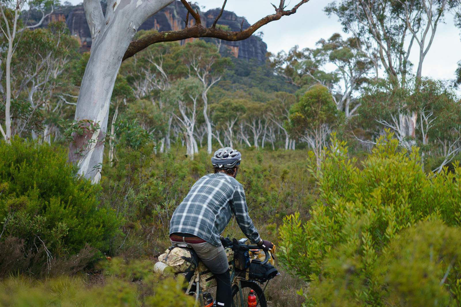
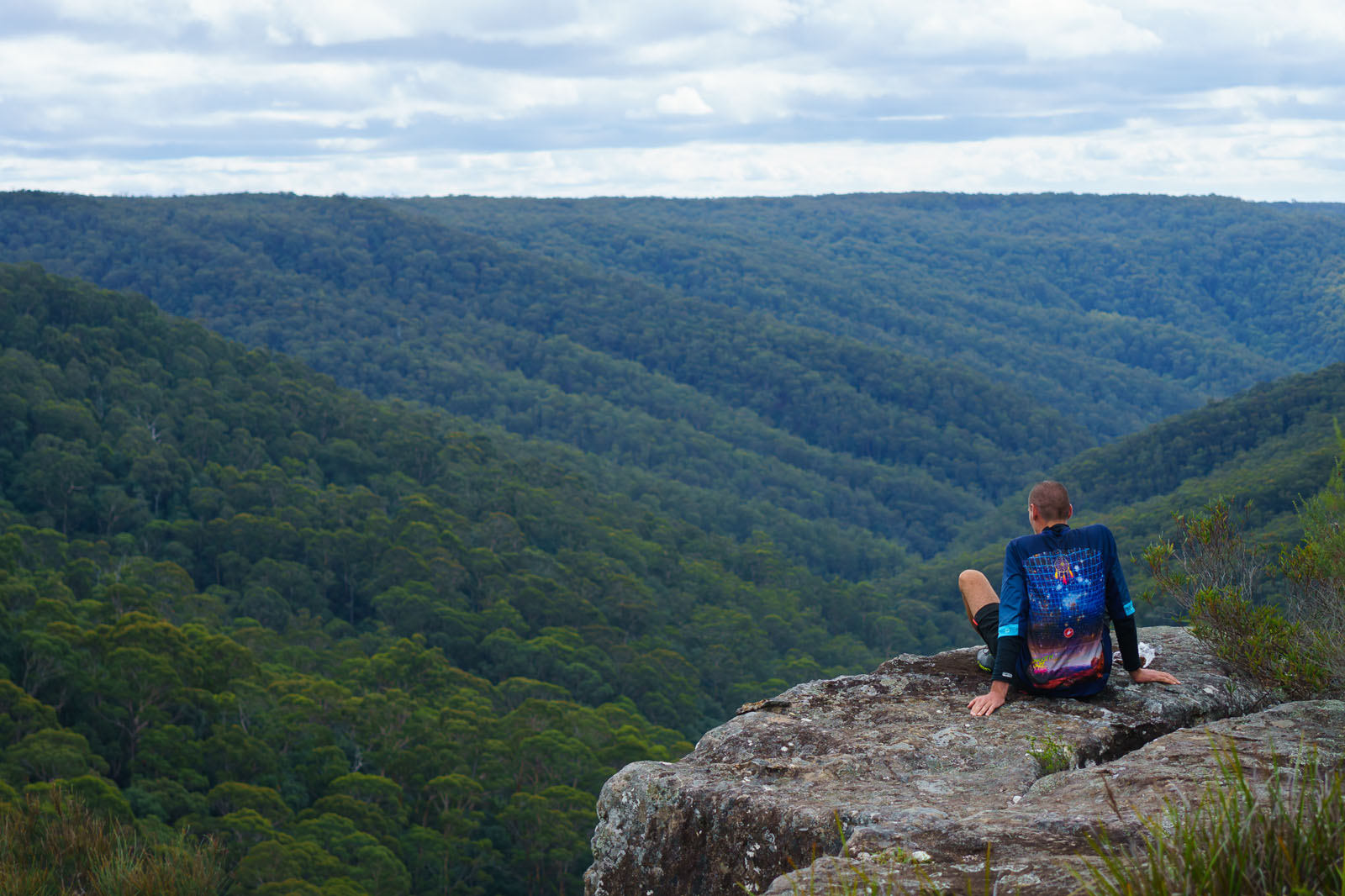
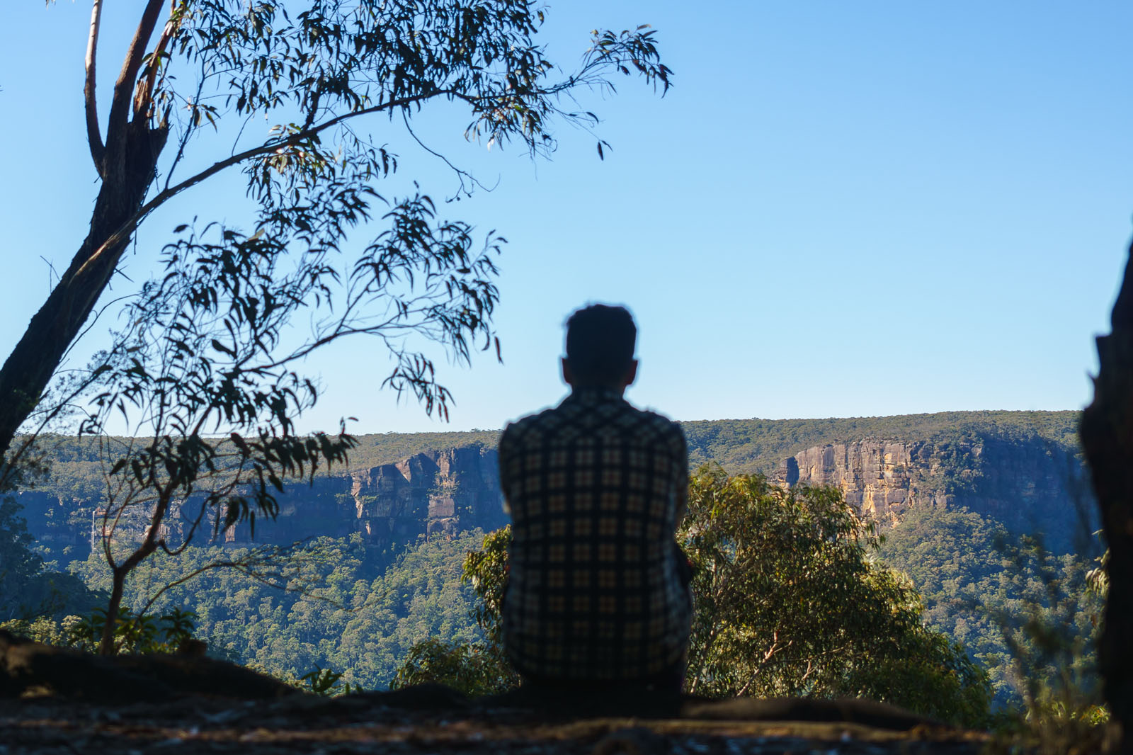
Budawang National Park
The first is the car-free trails deep into Budawang National Park, with its cliff views, diversity of breathtaking forests and rocky overhangs to camp under. At the end of the trail, take the short detour to Tianjara Falls for breathtaking views over the valley.
Into Kangaroo Valley
Next, quiet gravel back roads wind through lush forests and quintessential countryside. Listen to the water and the birds at beautiful Bugong Creek. Take in the view from the summit before descending into quaint Kangaroo Valley for a beer at The Friendly Inn and treats from the Fudge House.
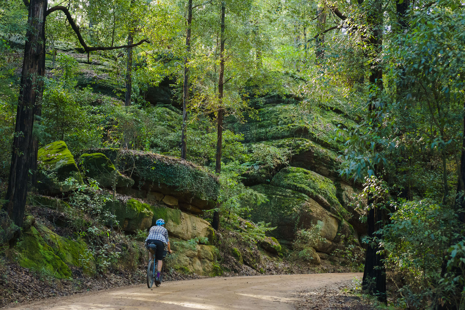
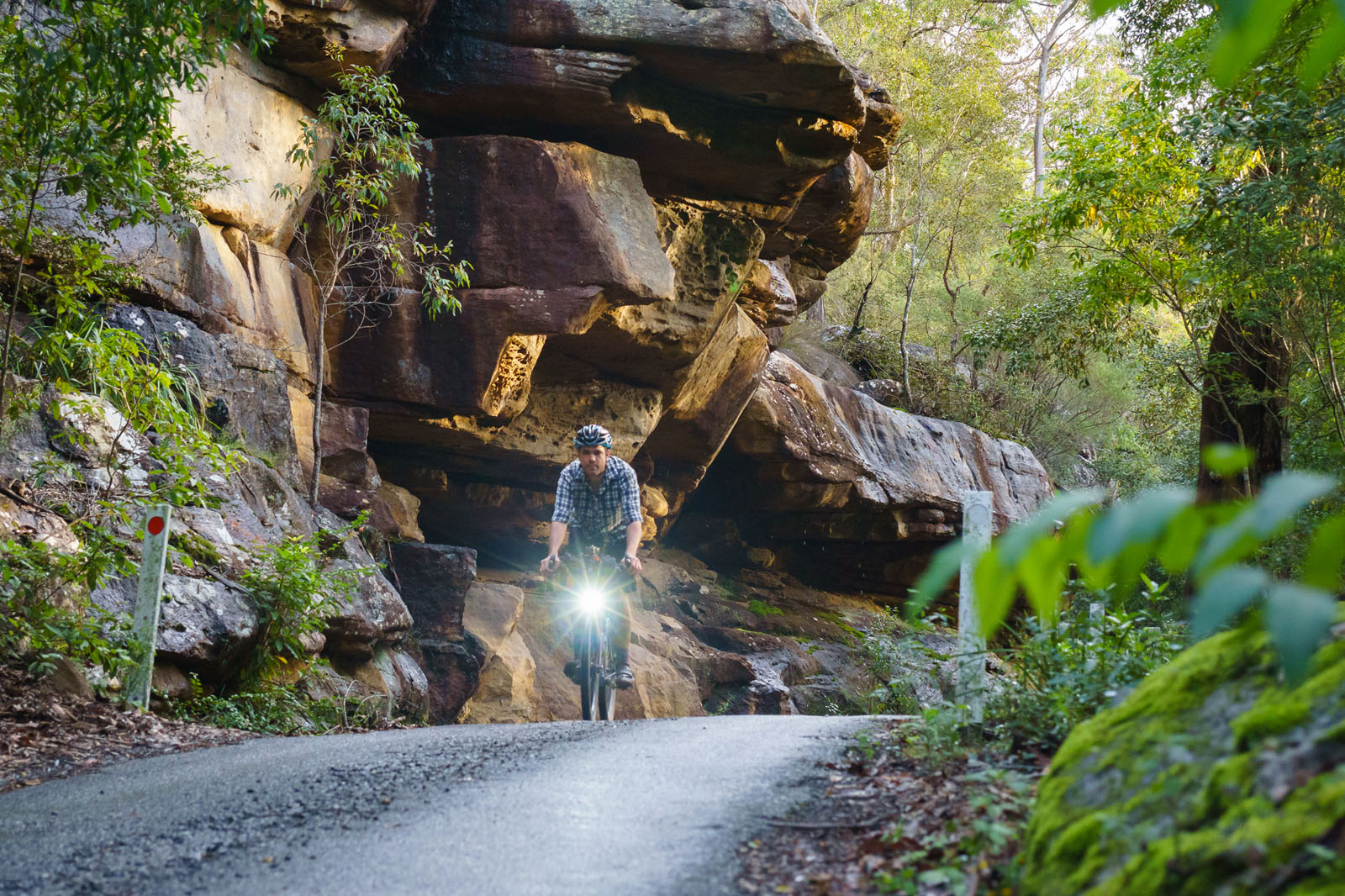
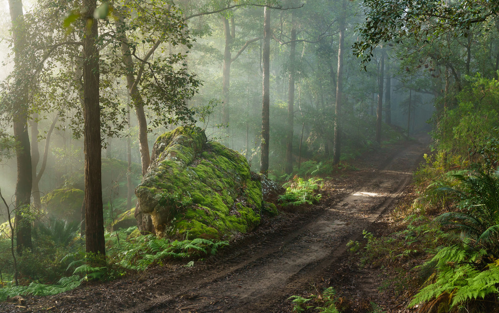
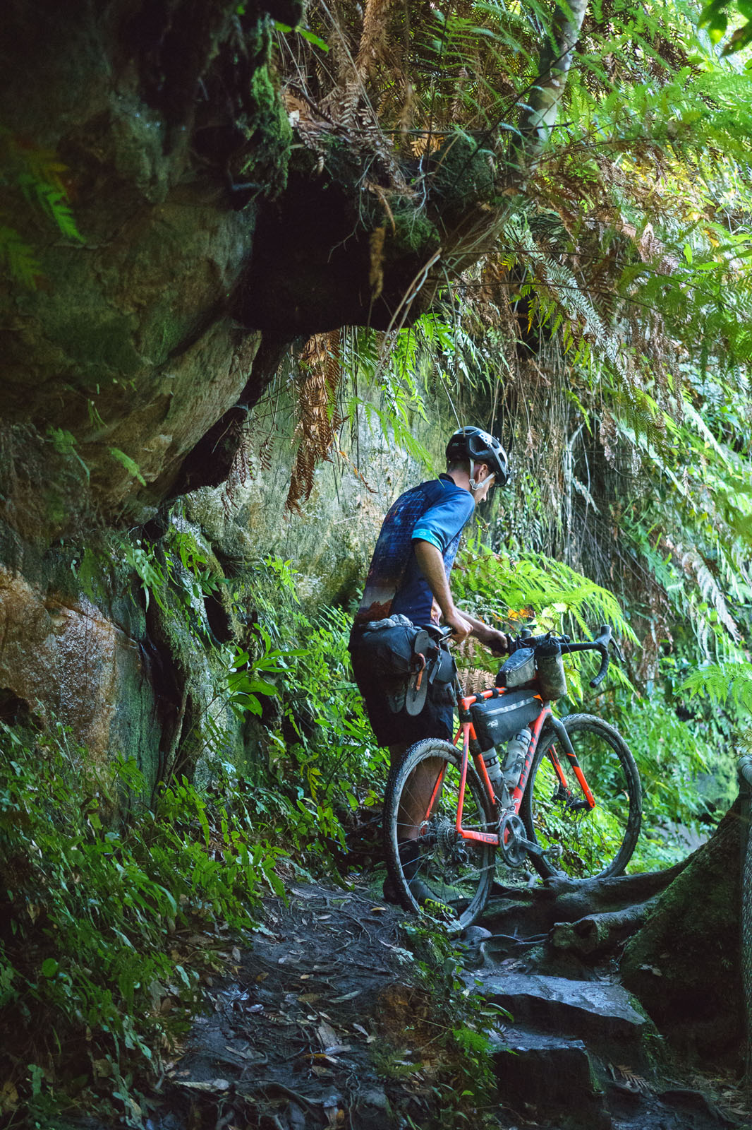
Griffins Firetrail
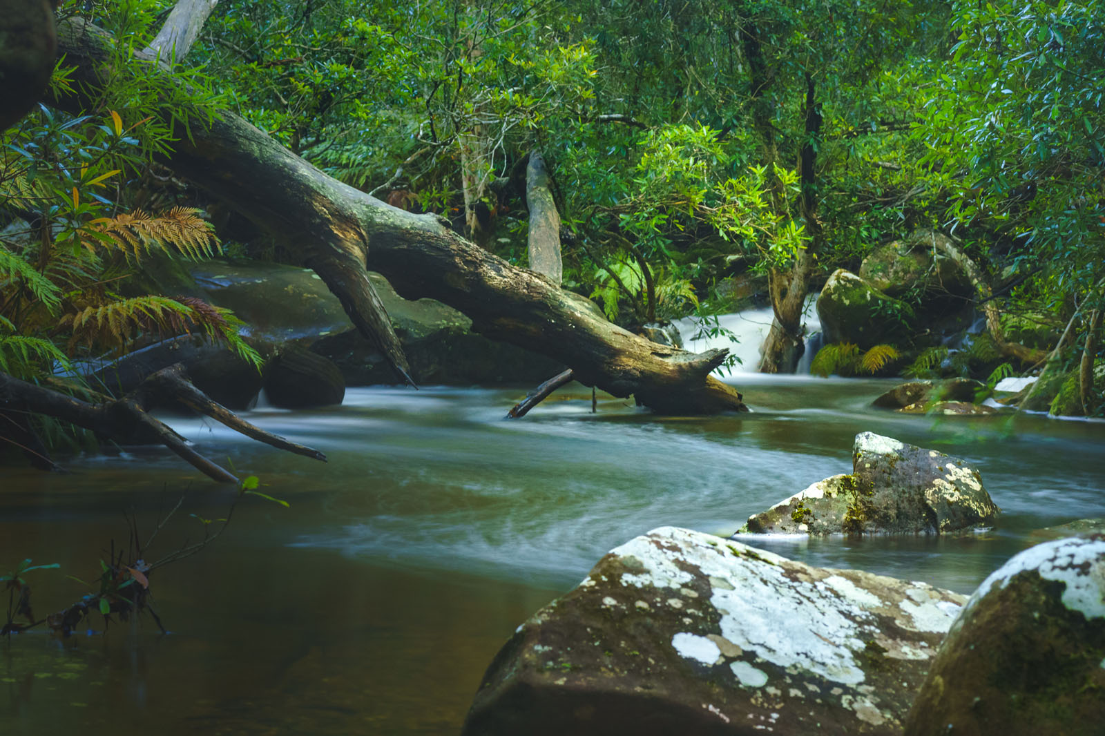
Finally, the route finishes with the most spectacular of trails. Griffins Firetrail hosts the longest climb of the route, but also the most beautiful, wild forest. Climb the mossy boulders and dip your toes in one of the creeks. For the most Zen snack stop, scramble along the bank upstream at Crankeys Creek to the small cascade. Once you conquer Meryla Pass, stop at the popular Fitzroy Falls and the various lookouts over the majestic forested valley.
Additional Notes
Near Fitzroy Falls, the trail joins the popular walking track from the visitor’s centre. If you choose to walk this section instead of riding the 2km gravel road you will have a short hike-a-bike up 20-30 slippery rock stairs.
Bungendore is a 45 minute drive or only one train stop from Canberra. Finishing half way between Canberra and Sydney, riders can easily catch a train from Bundanoon or continue their bikepacking adventure.
Additional Resources
- Explore more of Morton National Park.
- An old sketch map of the Northern Budawang Range shows some interesting features.
- This blog has some pictures of Camp Rock and the surrounding area.


Terms of Use: As with each bikepacking route guide published on BIKEPACKING.com, should you choose to cycle this route, do so at your own risk. Prior to setting out check current local weather, conditions, and land/road closures. While riding, obey all public and private land use restrictions and rules, carry proper safety and navigational equipment, and of course, follow the #leavenotrace guidelines. The information found herein is simply a planning resource to be used as a point of inspiration in conjunction with your own due-diligence. In spite of the fact that this route, associated GPS track (GPX and maps), and all route guidelines were prepared under diligent research by the specified contributor and/or contributors, the accuracy of such and judgement of the author is not guaranteed. BIKEPACKING.com LLC, its partners, associates, and contributors are in no way liable for personal injury, damage to personal property, or any other such situation that might happen to individual riders cycling or following this route.
Please keep the conversation civil, constructive, and inclusive, or your comment will be removed.