


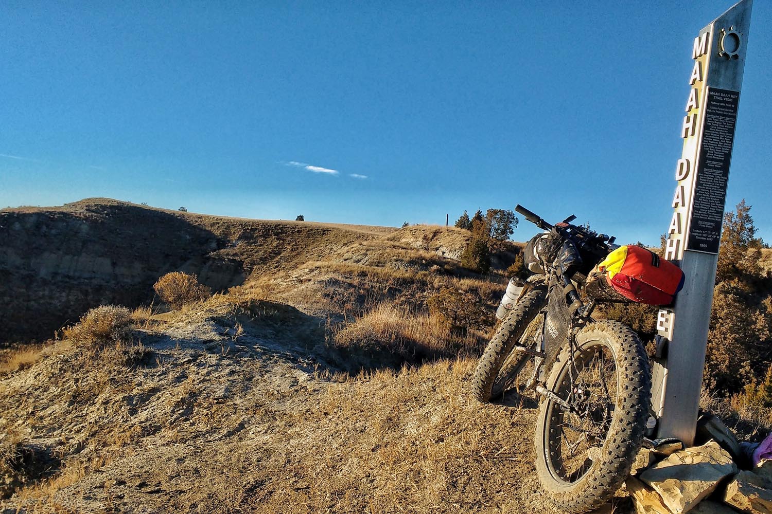
Maah Daah Hey
Distance
158 Mi.
(254 KM)Days
4-5
% Unpaved
100%
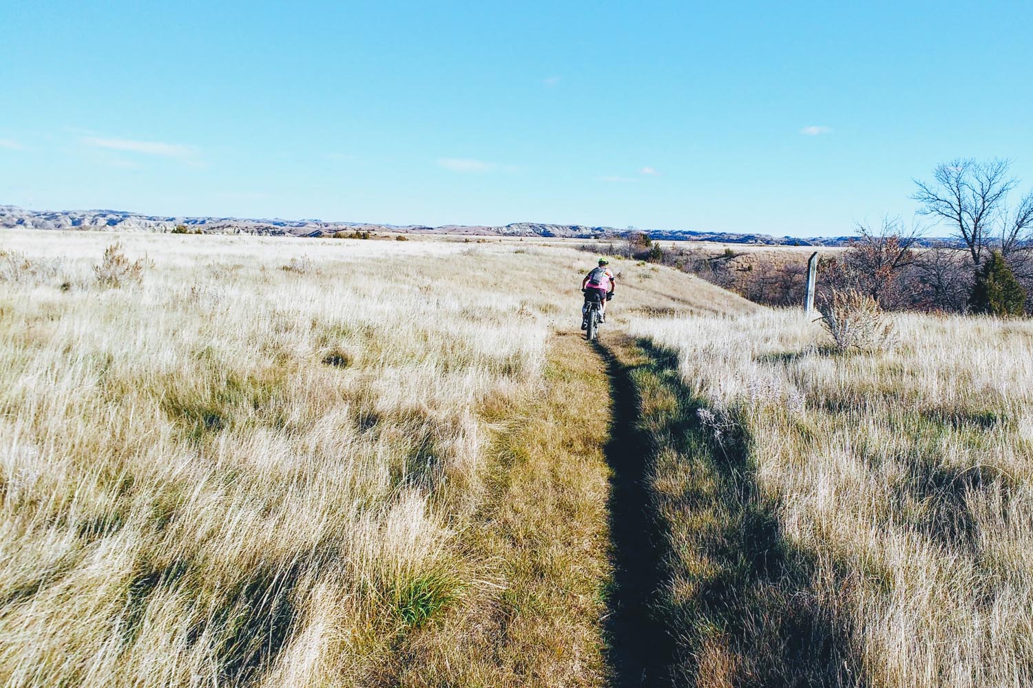
% Singletrack
94%
% Rideable (time)
95%
Total Ascent
15,086'
(4,598 M)High Point
2,941'
(896 M)Difficulty (1-10)
7?
- 6Climbing Scale Moderate95 FT/MI (18 M/KM)
- -Technical Difficulty
- -Physical Demand
- -Resupply & Logistics
Contributed By
Aaron Couch
Guest Contributor
Aaron Couch (Teton Valley, Idaho) is a human-powered adventure enthusiast and a sucker for epic hiking and biking routes that often bring about thoughts like, “I really thought this would be more of a trail.” In addition, Aaron is passionate about sustainable recreation and conserving our land’s resources. Aaron’s currently employed by Fitzgerald’s Bicycles, Team #BarYak member and runs his own blog, Destination Reroute, in hopes to encourage others to step out of their comfort zones and seek adventure.
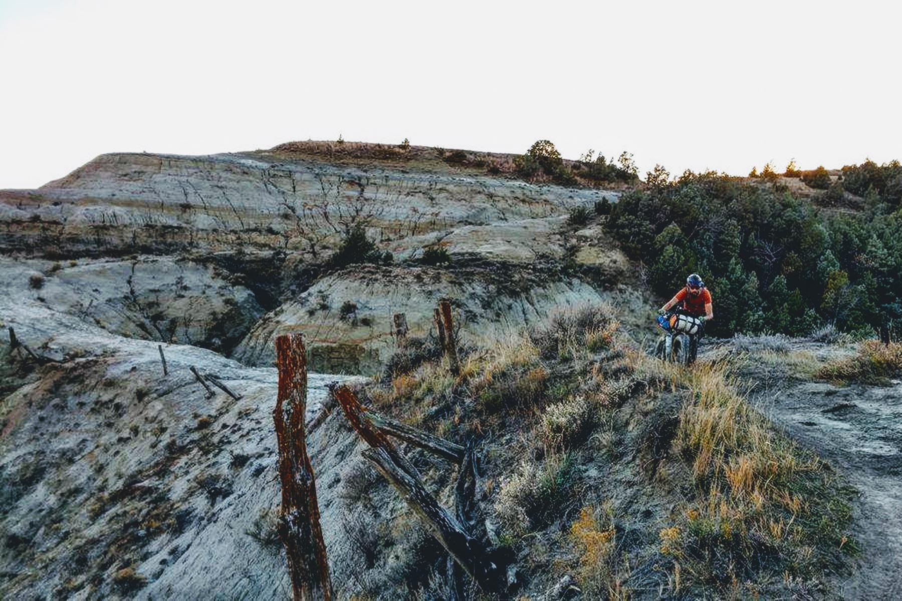
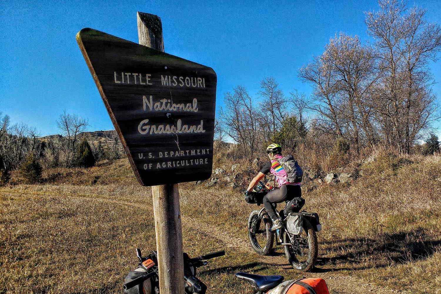
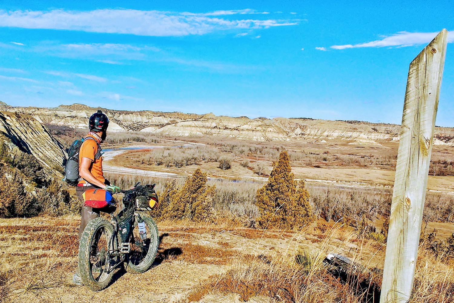
The trail got its name “Maah Daah Hey” after the aboriginal Mandan tribe. In simple english the phrase translates to “An area that will be around for a long time.” The complete 150-mile trail begins 50 miles south of Medora, ND and ends just south of the park entrance to the North Unit of Theodore Roosevelt National Park. The Maah Daah Hey crosses some of the most beautiful landscapes in North America. The ride can be done in either direction and meets a number of gravel roads, providing endless start and end points with a shuttle (or even providing a return route via gravel), however the most rewarding bikepacking routes are the 100 and 150-mile point-to-point trips.
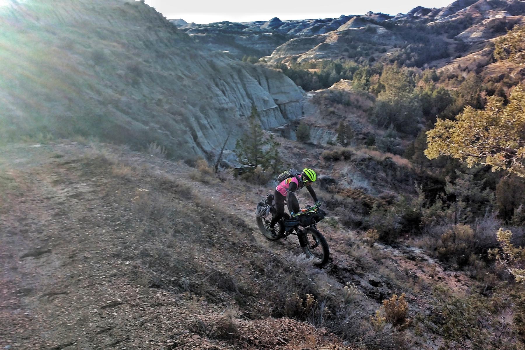
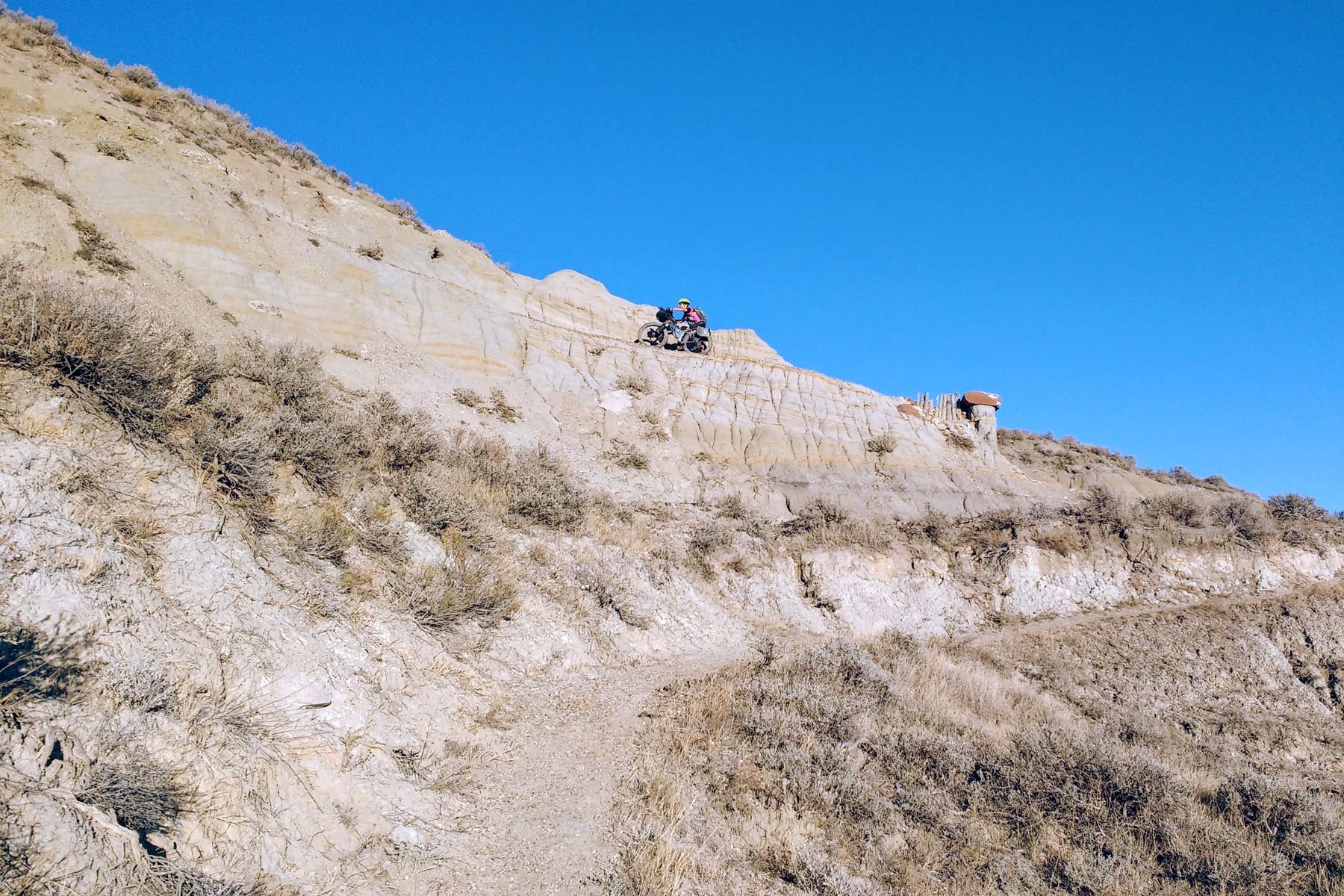
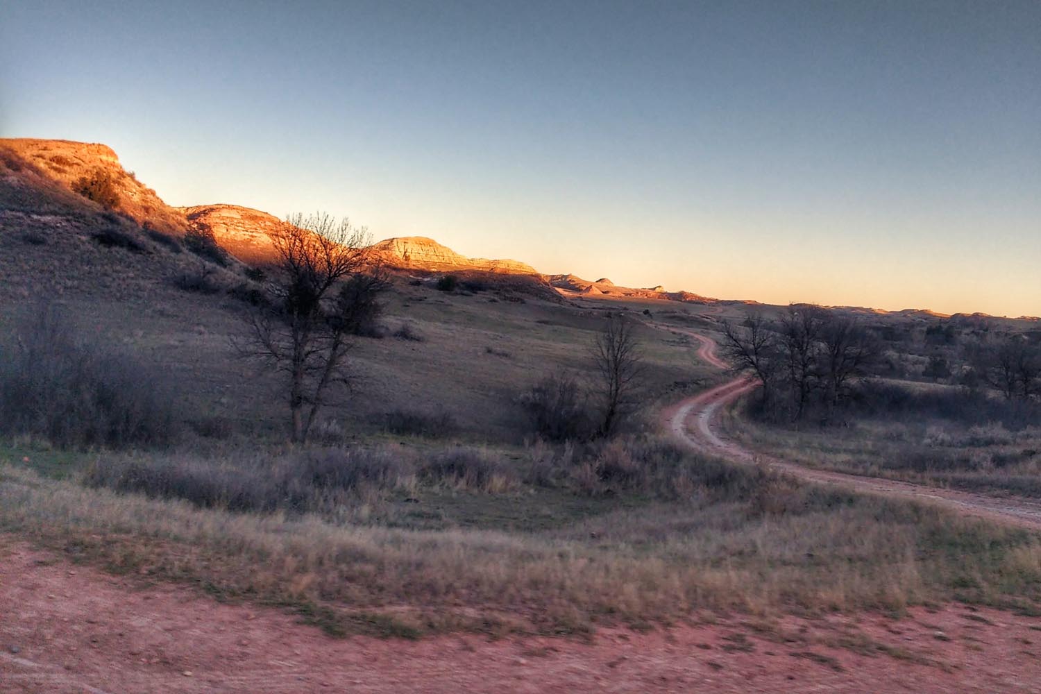
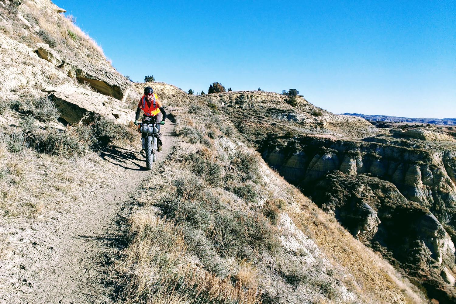
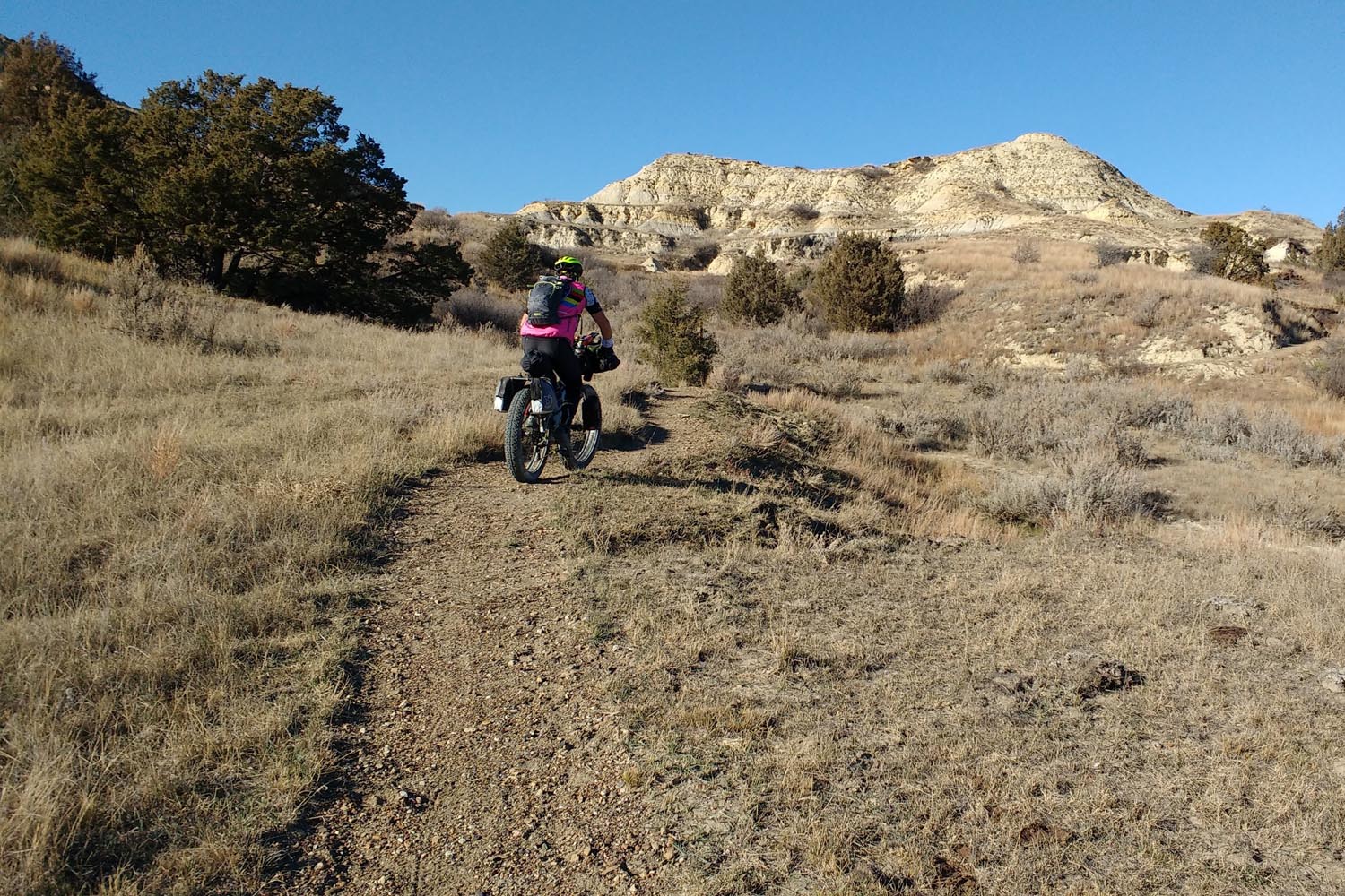
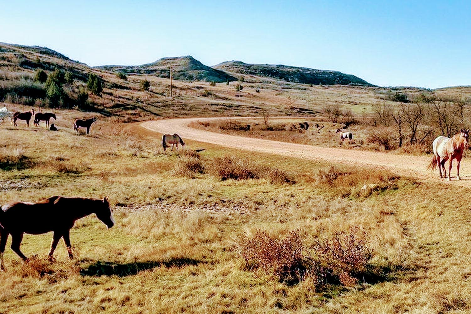
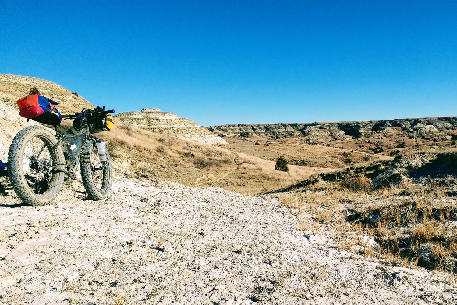
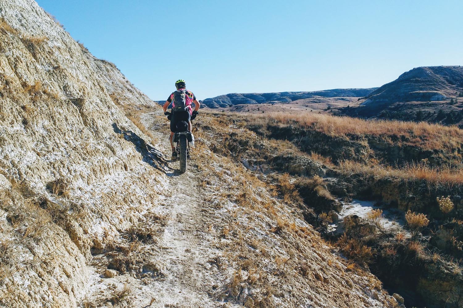
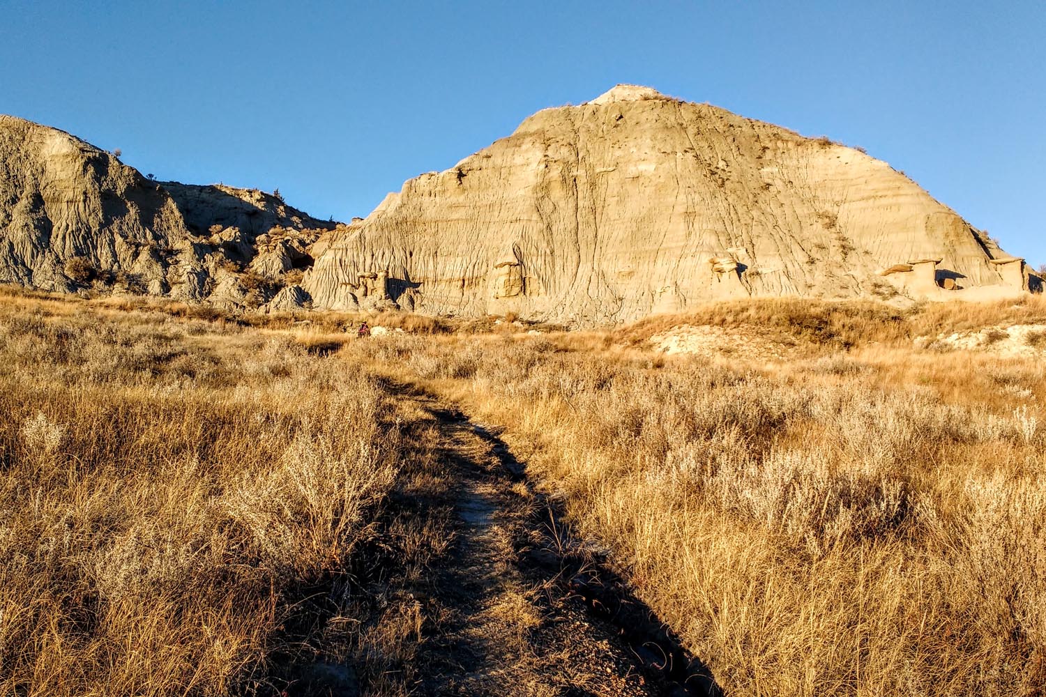
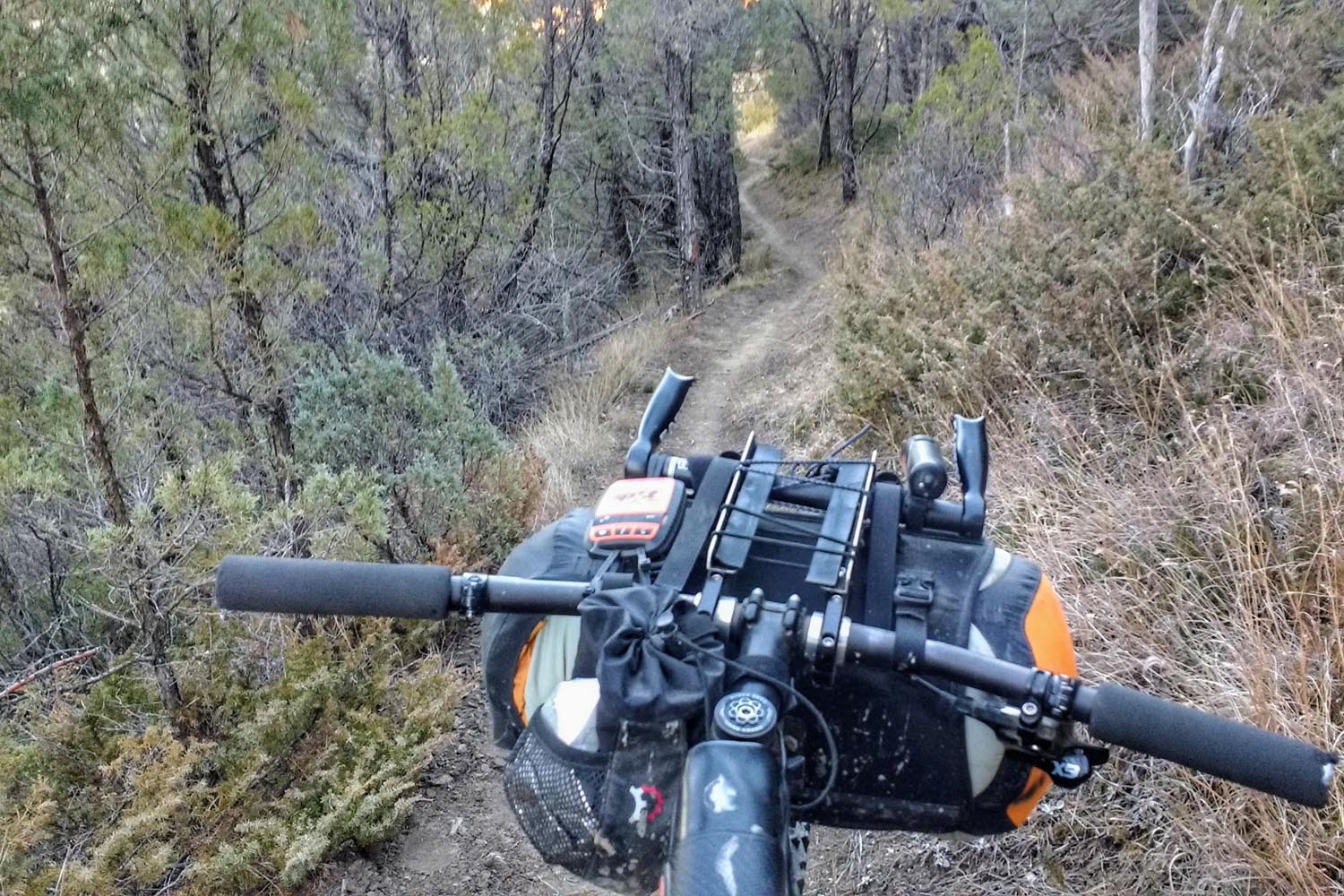
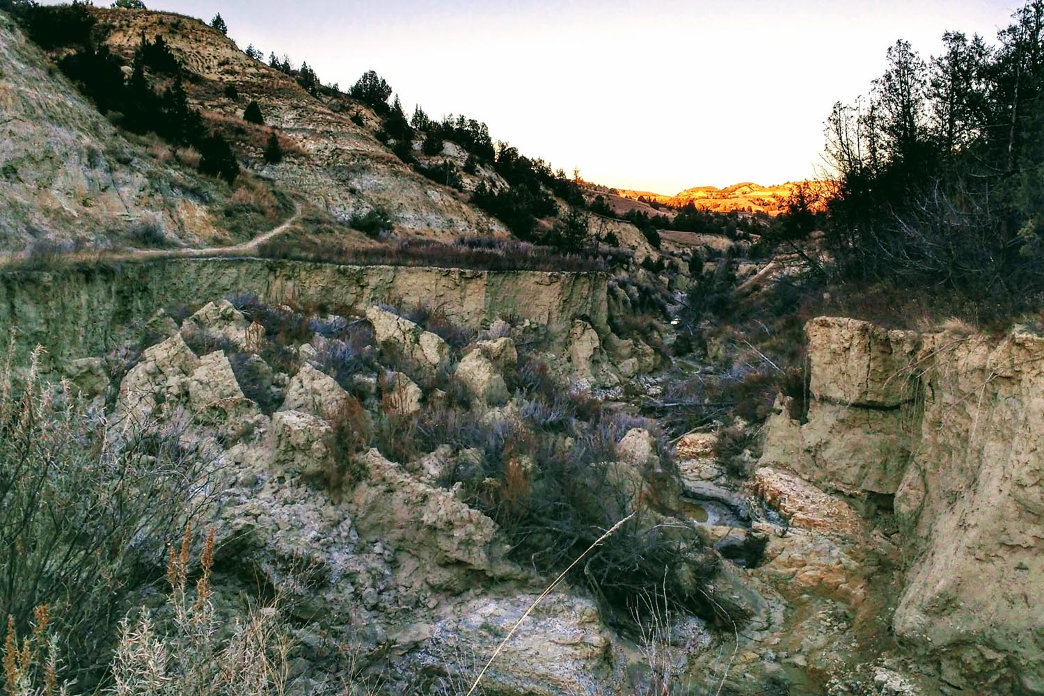
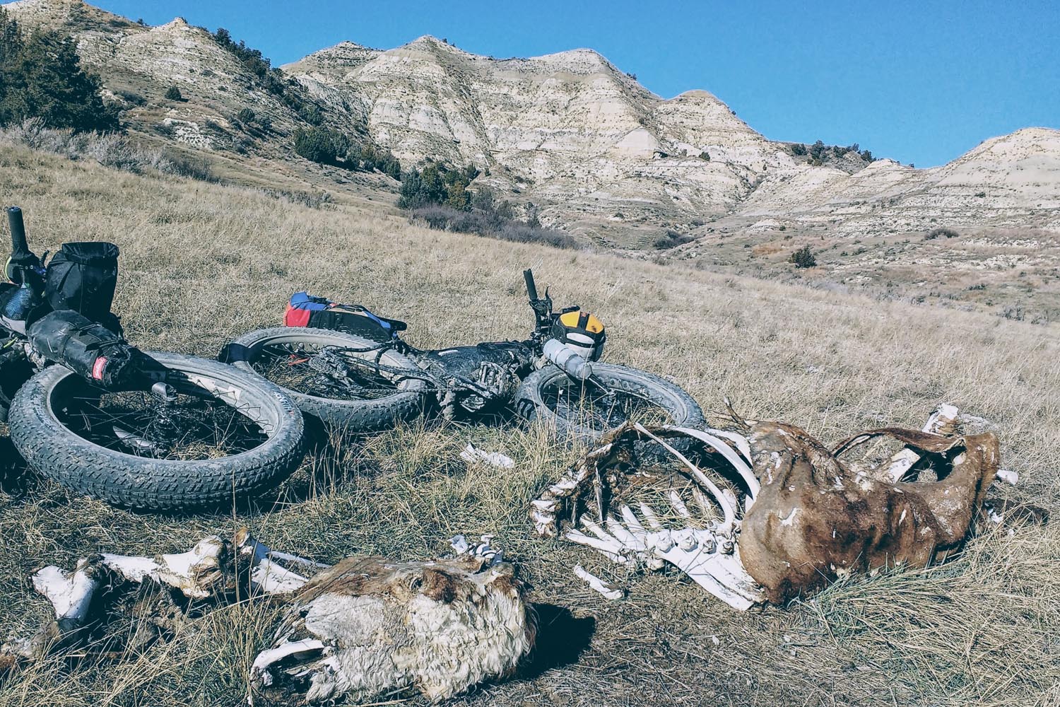
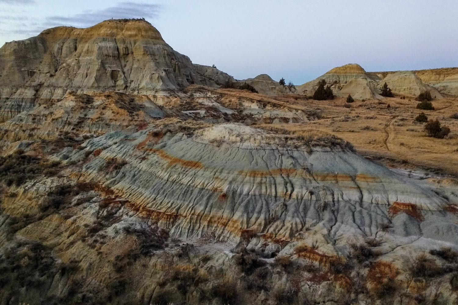
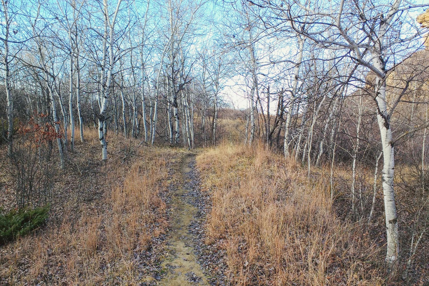
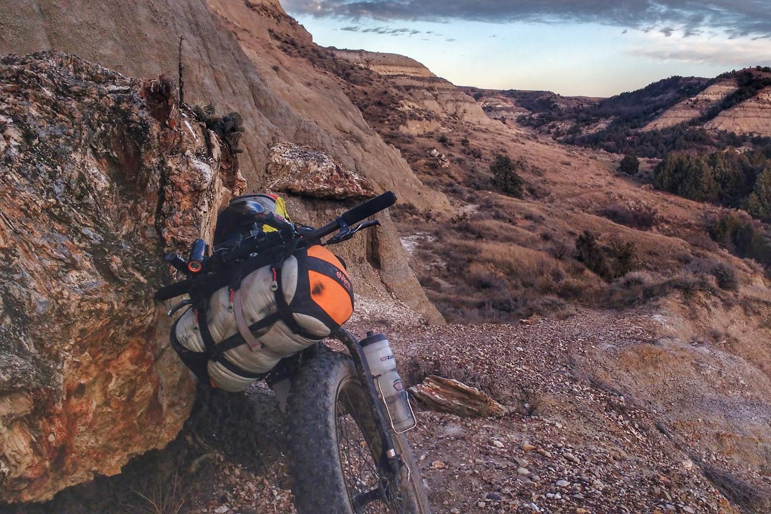
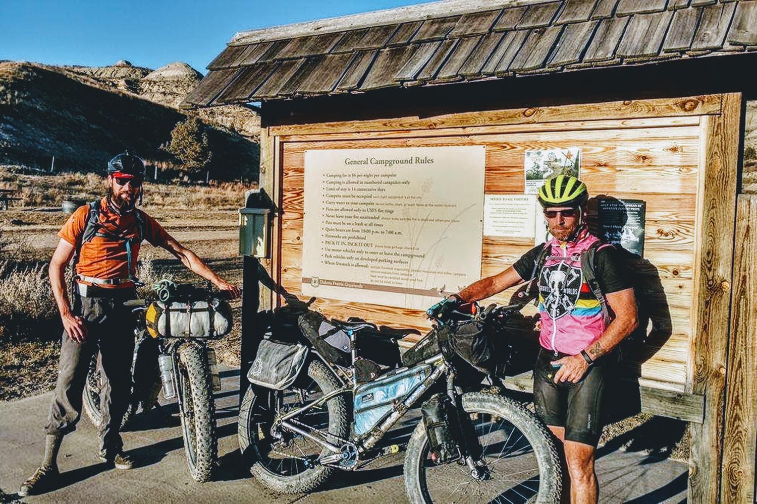
As the singletrack trail traverses through the varying landscape, it drops into several steep creek bottoms and ascends many more steep buttes. Pushing and walking your bike will occur, but you’ll make up the time across the open grasslands. What may come as a surprise to you are the wooded draws you coast through. Though short, these aspen groves are a refreshing touch on the otherwise vast and open plains of Western North Dakota. At any moment, you may feel completely removed from society and out in the middle of nowhere. And you are. However, Little Missouri National Grassland is open to all forms of recreation and a variety of additional uses, such as oil drilling, cattle ranching and hunting. The Maah Daah Hey trail itself is non-motorized, but even late in the season you’ll likely encounter horseback riders, backpackers and other mountain bikers.
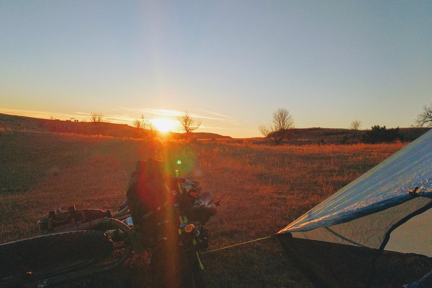
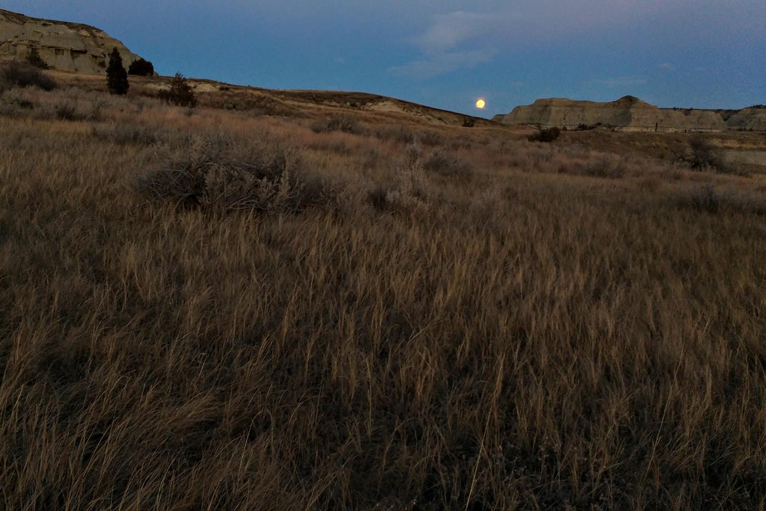
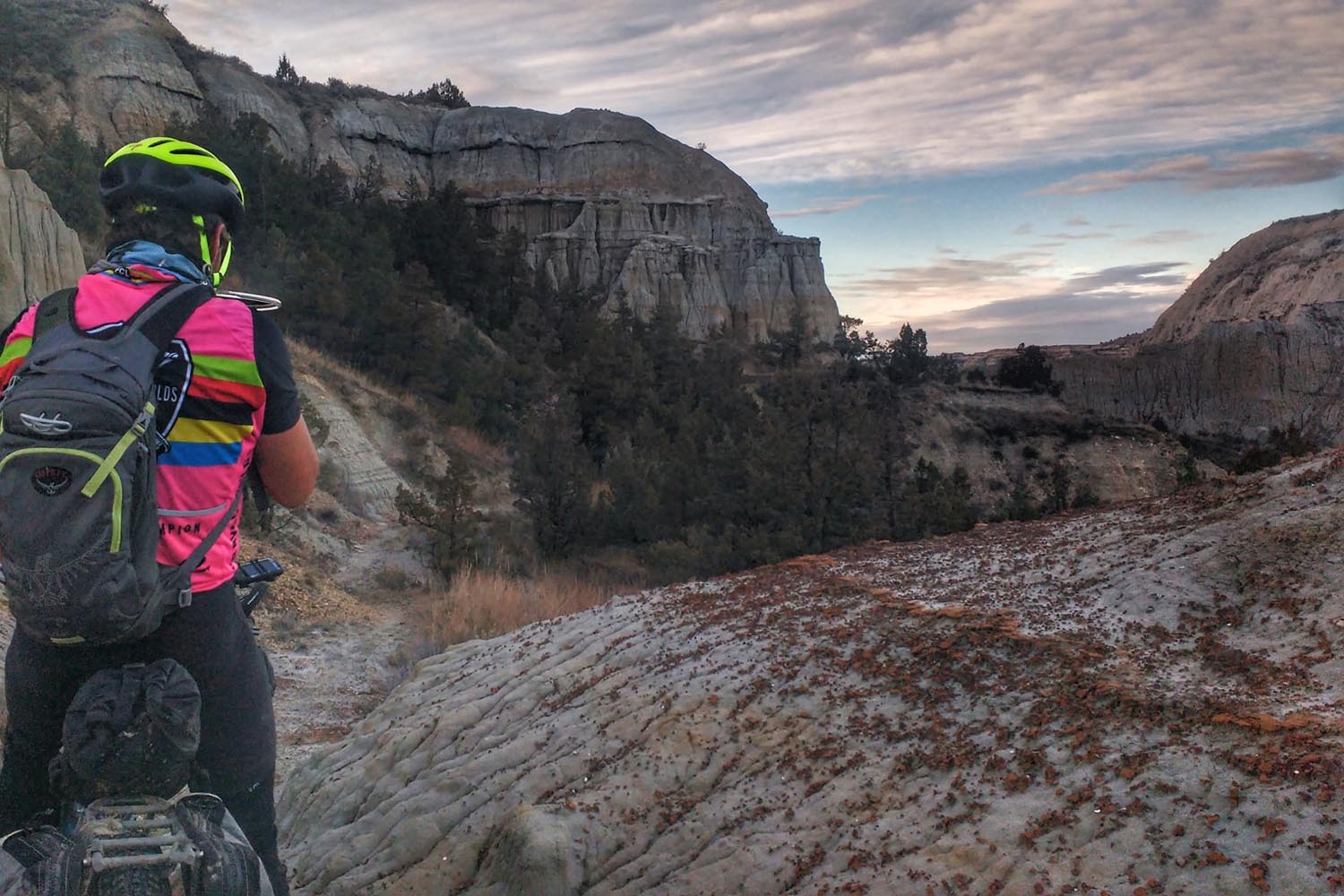
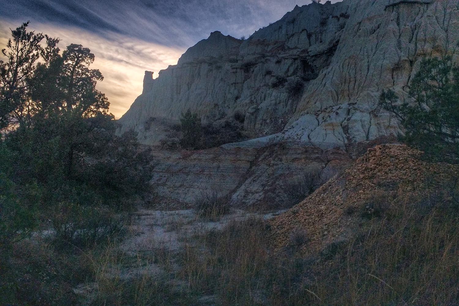
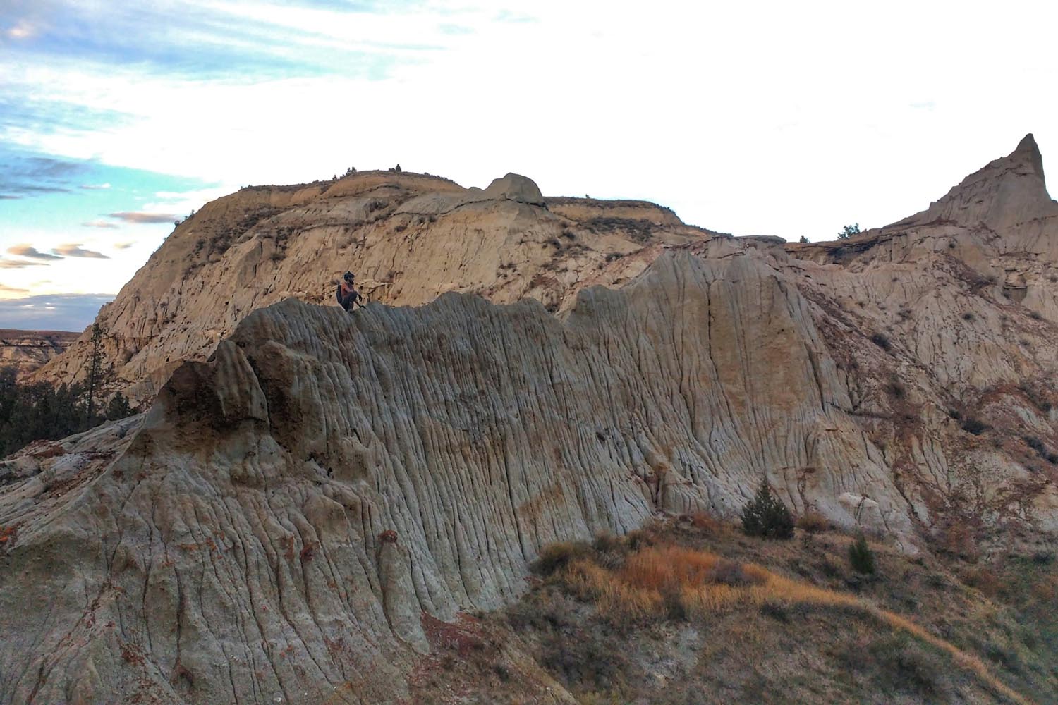
At the end of each day, you’ll be torn between exhaustion from that day’s terrain and in awe of the sun setting between clay buttes in the lush grassland before you.
Route Development: The Maah Daah Hey was almost a trail of the past. With several sections untraveled and unmaintained due to the lack of resources, the trail with a name that indicates it will be around forever, almost fell apart. Luckily, a passionate individual, Nick Ybarra, stepped up to steward the trail in cooperation with the Forest Service. The organization Save The Maah Daah Hey was born to create events and establish funding for ongoing upkeep. The Maah Daah Hey Trail Association is another non-profit organization working alongside the USDA Forest Service providing volunteer power, funding as well as a phenomenal online resource with an interactive map, all the water cache and campground locations and everything else you need to know to get on the trail. In addition, both of these organizations as well as the Forest Service as willing to talk to you an answer your questions. Since these organizations came into the picture, the trail has gained national attention, outdoor enthusiasts come from all over to experience the North Dakota badlands. The Maah Daah Hey won a slot in the ROUT3 competition.
NOTE: Some photos were contributed by fellow rider, Joe Stiller, a winter-ultra cyclist and creator of BarYak.


Submit Route Alert
As the leading creator and publisher of bikepacking routes, BIKEPACKING.com endeavors to maintain, improve, and advocate for our growing network of bikepacking routes all over the world. As such, our editorial team, route creators, and Route Stewards serve as mediators for route improvements and opportunities for connectivity, conservation, and community growth around these routes. To facilitate these efforts, we rely on our Bikepacking Collective and the greater bikepacking community to call attention to critical issues and opportunities that are discovered while riding these routes. If you have a vital issue or opportunity regarding this route that pertains to one of the subjects below, please let us know:
Highlights
Must Know
Camping
Food/H2O
Trail Notes
Resources
- Sully Creek State Park has all amenities: campground, vault toilets potable water and showers.
- Devil’s Pass viewpoint
- China Wall natural wonder — worth going out of the way
- Taking a break from riding to explore the Ice Caves
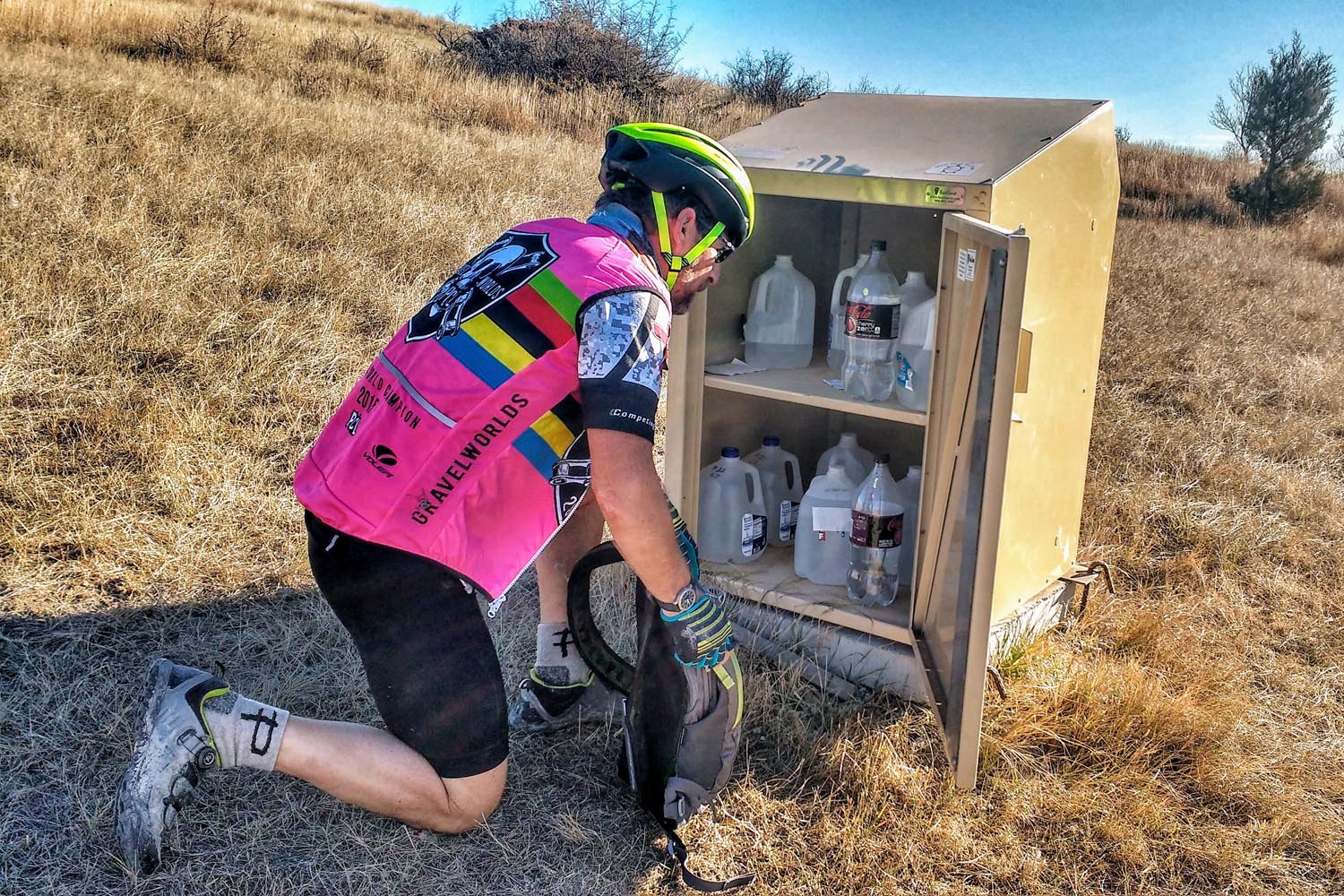
- Potable water at most campgrounds (tip use a small pebble to keep the valve open if riding solo)
- Friendly trail users you meet along the way who give you cookies or leave free water in the cache boxes
- Seeing herds of big horn sheep, pronghorn, bison and other wildlife
- Gazing up into the unpolluted starry night sky
- Riding into badland sunsets and waking up to gorgeous sunrises
- Potable water is available from pumps at most campgrounds (check with Forest Service for updates)
- April through June and September through November are the best times to ride to avoid the heat.
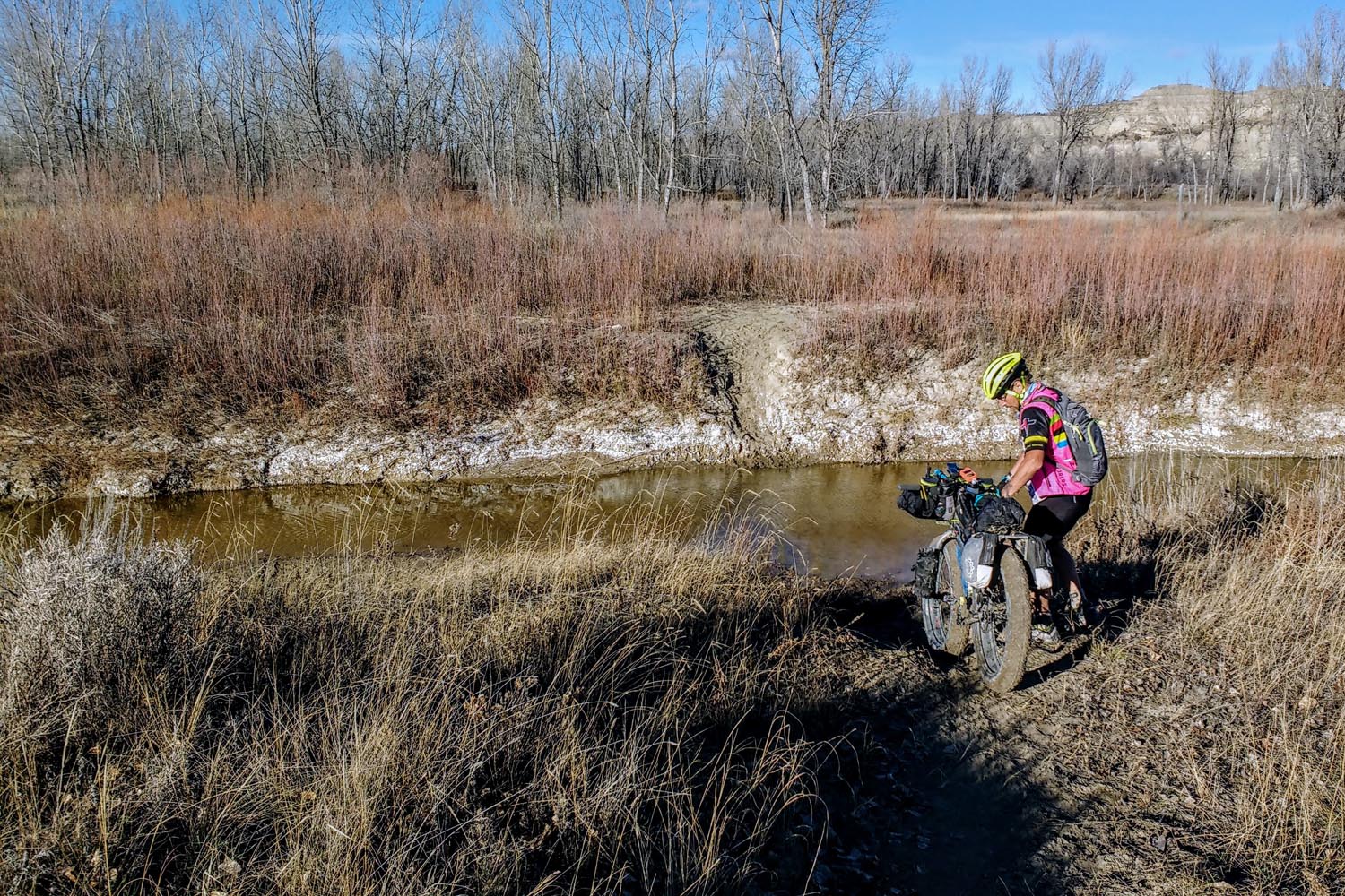
- Bentonite clay when wet will destroy everything — don’t ride if the trail is wet, period
- Shuttling services are available in the peak season (contact Dakota Cyclery), otherwise reserve a day for shuttling vehicles
- Cattle and wildlife will be present — ride responsibly and respectfully
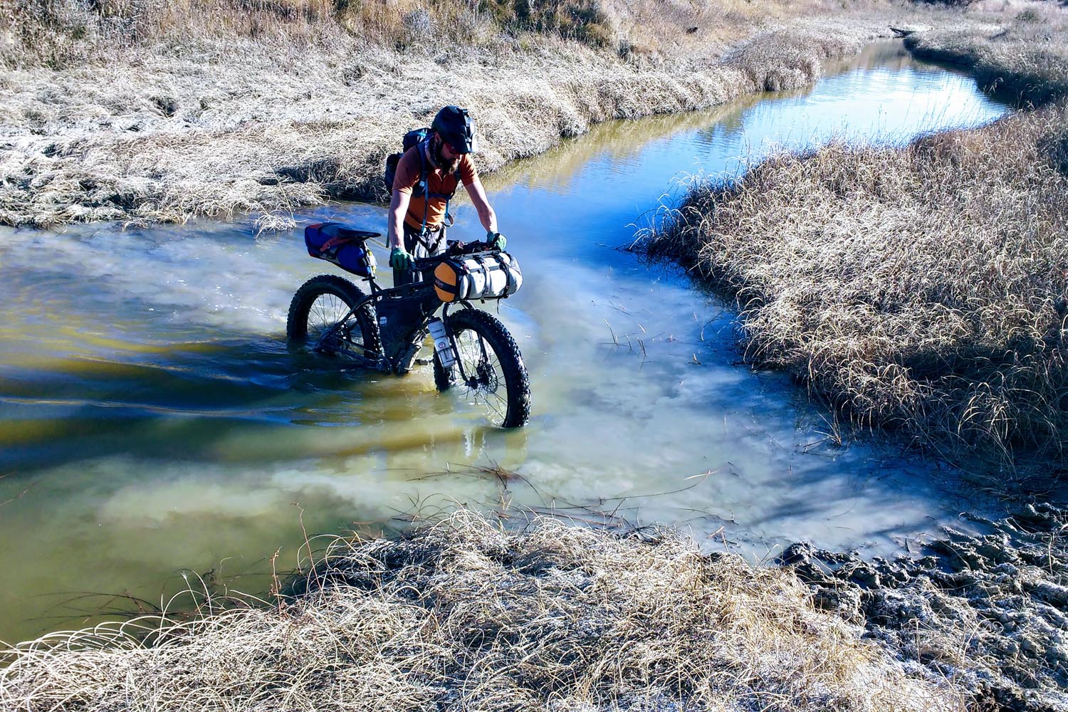
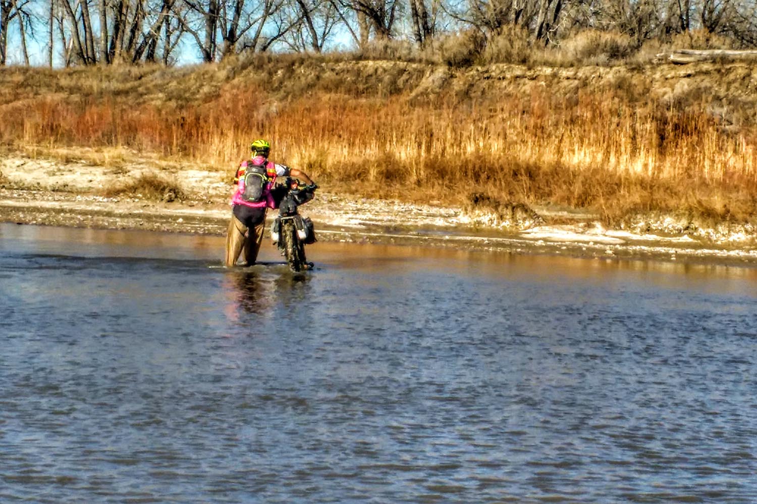
- River crossings can be dangerous in the springtime or gum up drivetrain with clay sediment
- Bring a chain cleaning tool, packable waders and handkerchief or neck gaiter — dual purpose. Protects neck from sun and works as a “pre-filter” to avoid clogging your water filter
- Wilderness areas and private land border the Maah Daah Hey — do not cross or trespass into these areas without prior permission.
- Two detours occur, rerouting you off the official Maah Daah Hey trail to ensure you will not ride through any wilderness areas, national parks or private land. The first occurs when you veer west towards Buffalo Gap Campground, a reroute created for mountain bikers to bypass the South Unit of Theodore Roosevelt National Park. The second reroute, 137 miles in, goes toward Bennett Campground. From there you’ll take 8 miles of gravel roads back to the trail and finish at the CCC campground and trailhead. It’s highly recommended that before you go to Bennett Campground, to continue out of the way on the Maah Daah Hey towards the incredible China Wall and then turn around.
- Campsites with water, vault toilets, and tables are spread out along the trail — fees are required for overnight stays
- Dispersed camping is legal within the Little Missouri National Grassland, but you are responsible for following regulations
- Camping is not permitted in State Land Trust zones (clearly marked on maps and the trail)
- Water cache boxes are available along the trail — use your own cached water unless a jug says “free”
- There is one steakhouse at an inconvenient 57 miles into the ride. You’ll most likely pass this the morning of the second day, but riding north to south, this could be a much-enjoyed stop.
- Creeks and streams are along the trail and offer decent filterable water — best to use a neck gaiter or handkerchief as a pre-filter to avoid clogging your filter with small particles of clay in the water.
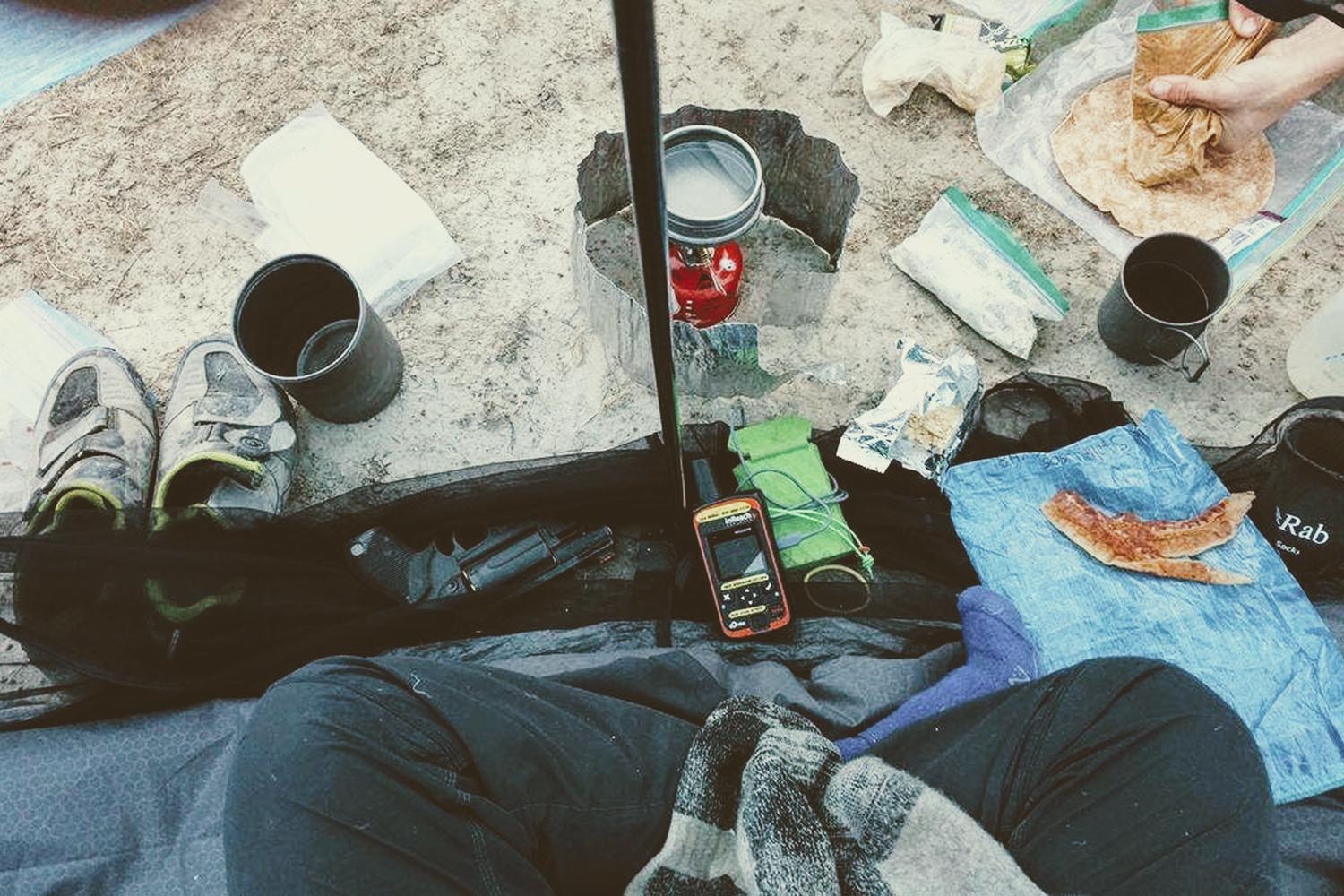
- It’s recommended to carry all the food you will need for the 4 to 5 day trip.
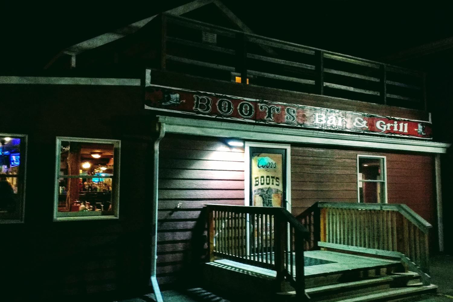
- In Medora both the Boots Bar & Grill and the Little Missouri Saloon and Dining Room served delicious meals. For coffee, Hidden Springs Java serves delicious coffee and breakfast food.
We recommend 4 days for this trip. 5 days will work, but the longer you’re riding, the more food you need to carry and water becomes a more logistical challenge. Any longer you will need to anticipate where along the trail you’ll need water and possibly drive hours down long dirt roads.
The Maah Daah Hey is 95% rideable. Some days will be more demanding. The steep inclines, though relatively short, simply aren’t worth trying to pedal up and burning yourself up. There also are two significant crossings of the Little Missouri River, the Sully Crossing and Elkhorn crossing. There are a few other creek crossings that there may not be planks to cross on. We found it very useful to have packable waders — keeping our feet clean and dry on the 50 degree fall days in November.
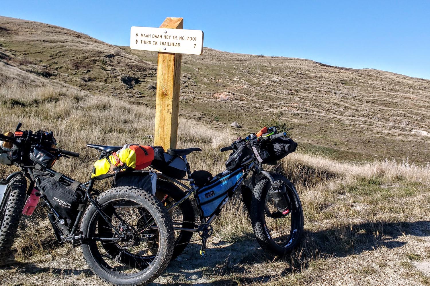
It’s recommended to bring a map and use the GPS route provided. The great thing is the Maah Daah Hey is very easy to follow — just look for the turtle.


Terms of Use: As with each bikepacking route guide published on BIKEPACKING.com, should you choose to cycle this route, do so at your own risk. Prior to setting out check current local weather, conditions, and land/road closures. While riding, obey all public and private land use restrictions and rules, carry proper safety and navigational equipment, and of course, follow the #leavenotrace guidelines. The information found herein is simply a planning resource to be used as a point of inspiration in conjunction with your own due-diligence. In spite of the fact that this route, associated GPS track (GPX and maps), and all route guidelines were prepared under diligent research by the specified contributor and/or contributors, the accuracy of such and judgement of the author is not guaranteed. BIKEPACKING.com LLC, its partners, associates, and contributors are in no way liable for personal injury, damage to personal property, or any other such situation that might happen to individual riders cycling or following this route.
Please keep the conversation civil, constructive, and inclusive, or your comment will be removed.