


Caucasus Crossing: Georgia
Distance
794 Mi.
(1,278 KM)Days
21
% Unpaved
65%
% Singletrack
5%
% Rideable (time)
97%
Total Ascent
103,636'
(31,588 M)High Point
11,500'
(3,505 M)Difficulty (1-10)
8?
- 9Climbing Scale Very Strenuous131 FT/MI (25 M/KM)
- -Technical Difficulty
- -Physical Demand
- -Resupply & Logistics
Contributed By

Cass Gilbert
While Out Riding
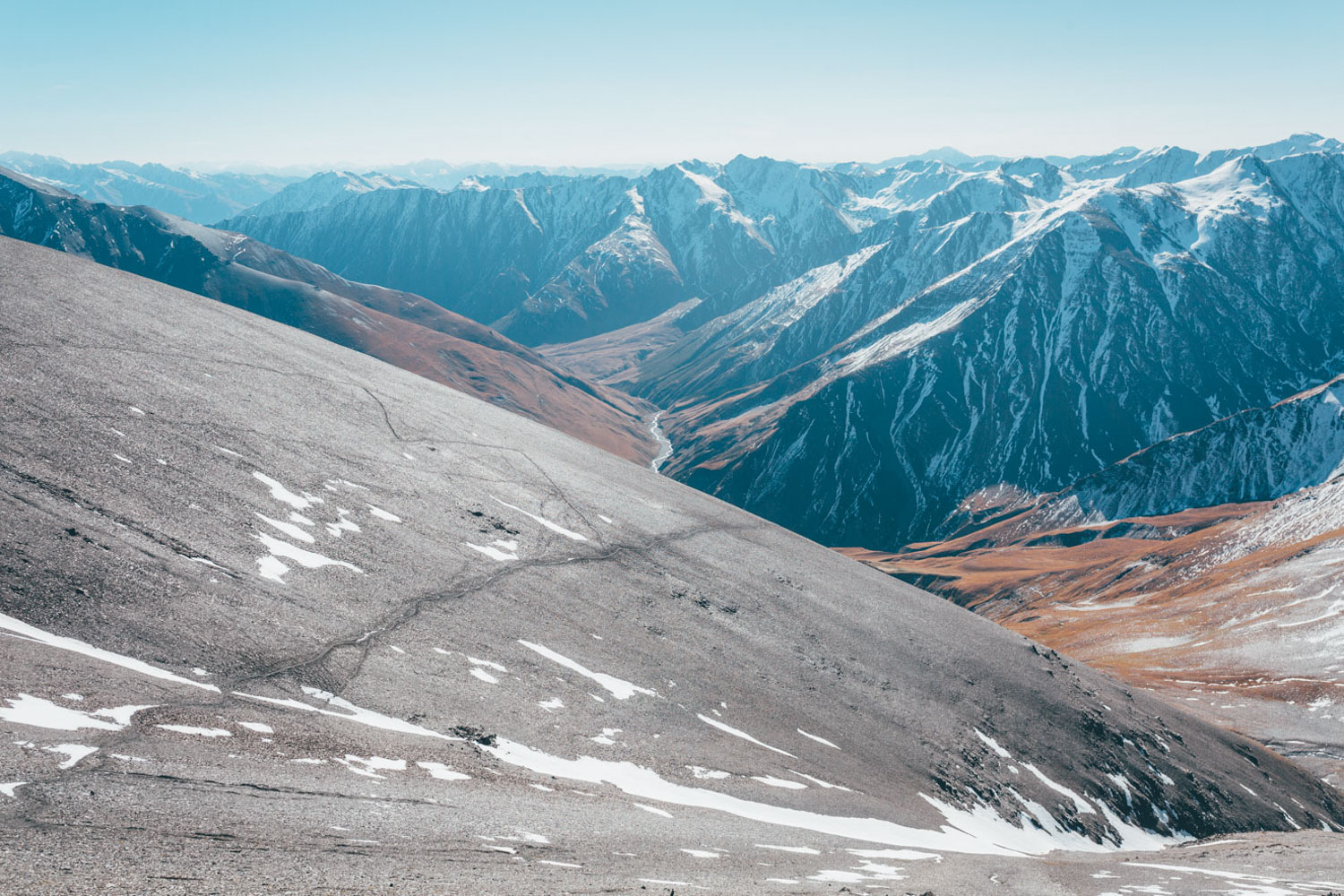
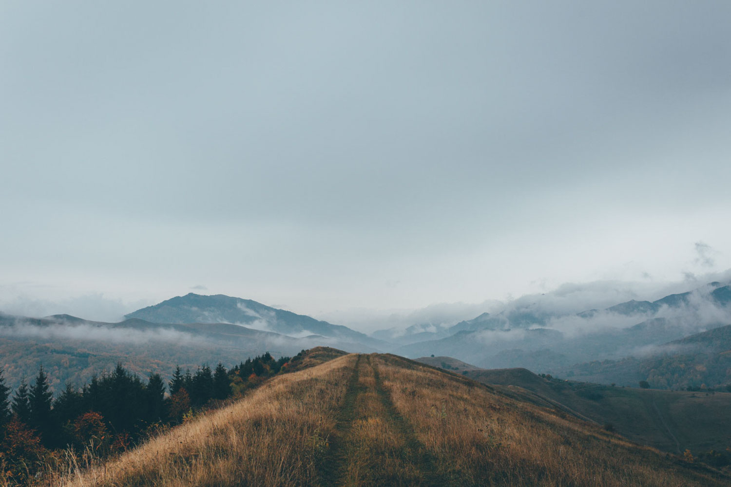
Diminutive, post-Soviet Georgia is a fascinating land, considerably more dense in heritage and culture than its size would suggest. It’s also a country with an important present-day geopolitical role, being the buffer that it is between Russia and the West. Putting an element of this in context, the route wends its way between the Upper and Lower Caucasus, as a way of bypassing South Ossetia, the partially recognised state that encompasses the Tskhinvali region, for which travel isn’t permitted since a series of conflicts a decade ago.
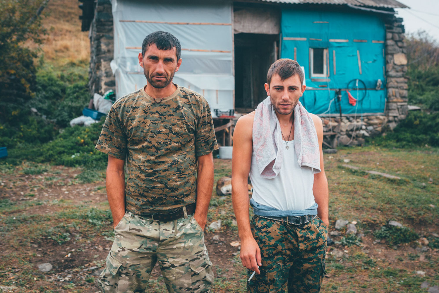
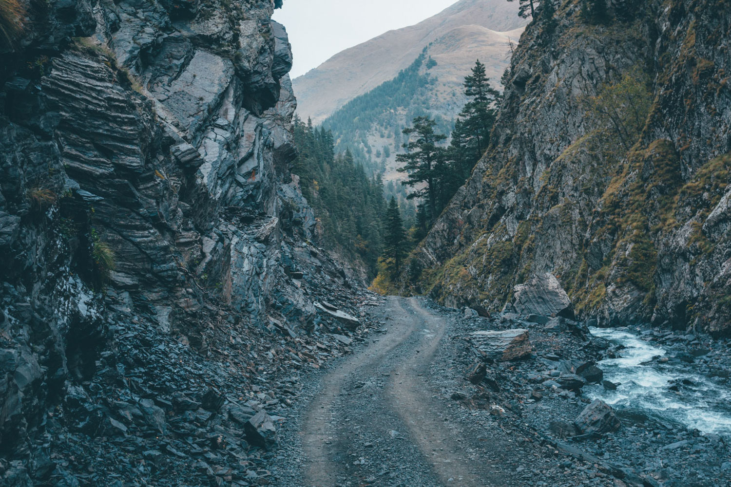
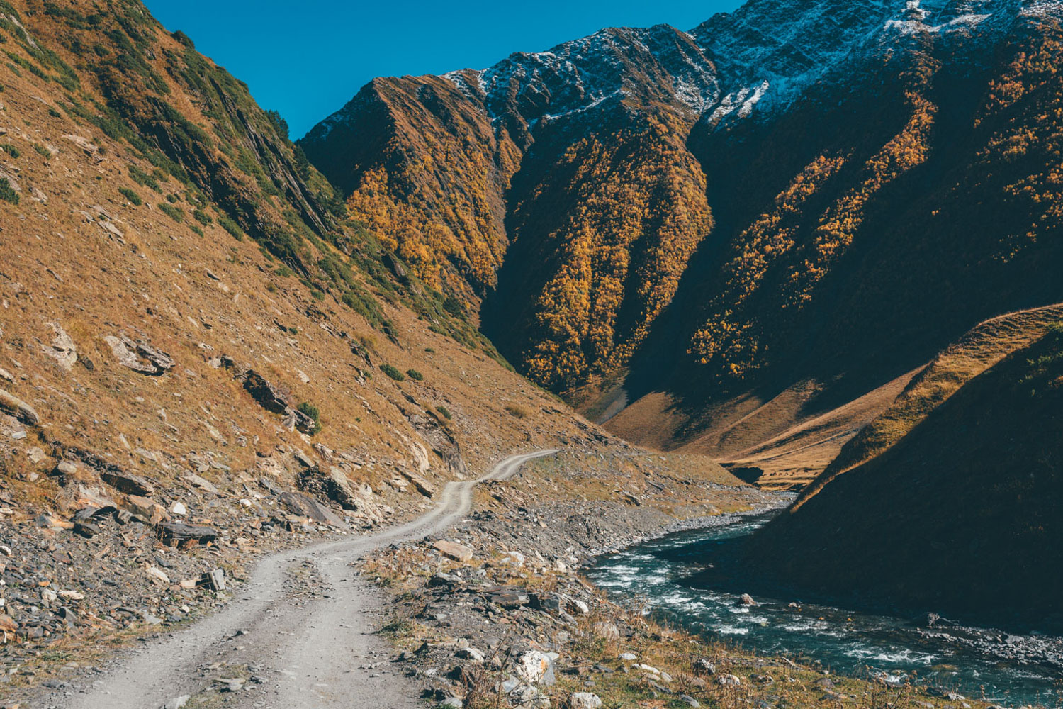
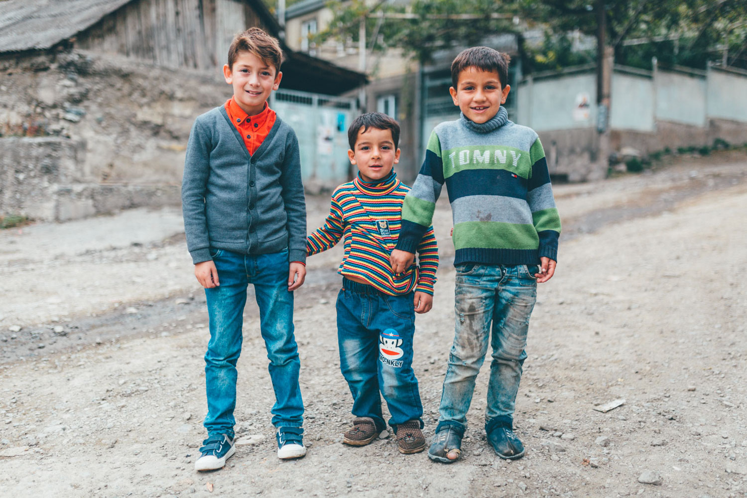
This said, Georgia is an incredibly safe place to travel, populated by a people only to eager to engage with travellers, overcoming linguistic hurdles with sheer enthusiam. For the most part, the route keeps to dirt roads and tertiary paved roads for its 800 mile/1300km length, enlivened by a beautiful ribbons of high altitude singletrack, as well as few hike-a-bikes thrown in for good measure, offering a beguiling overview of the country’s Higher and Lower Caucasus.
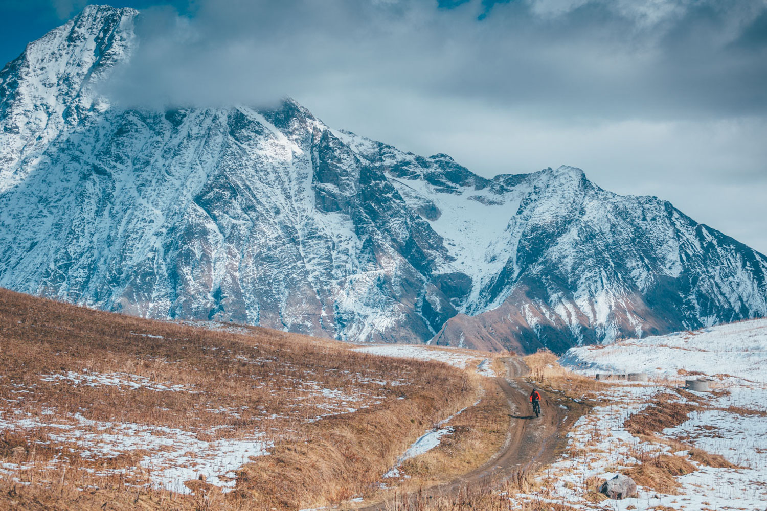
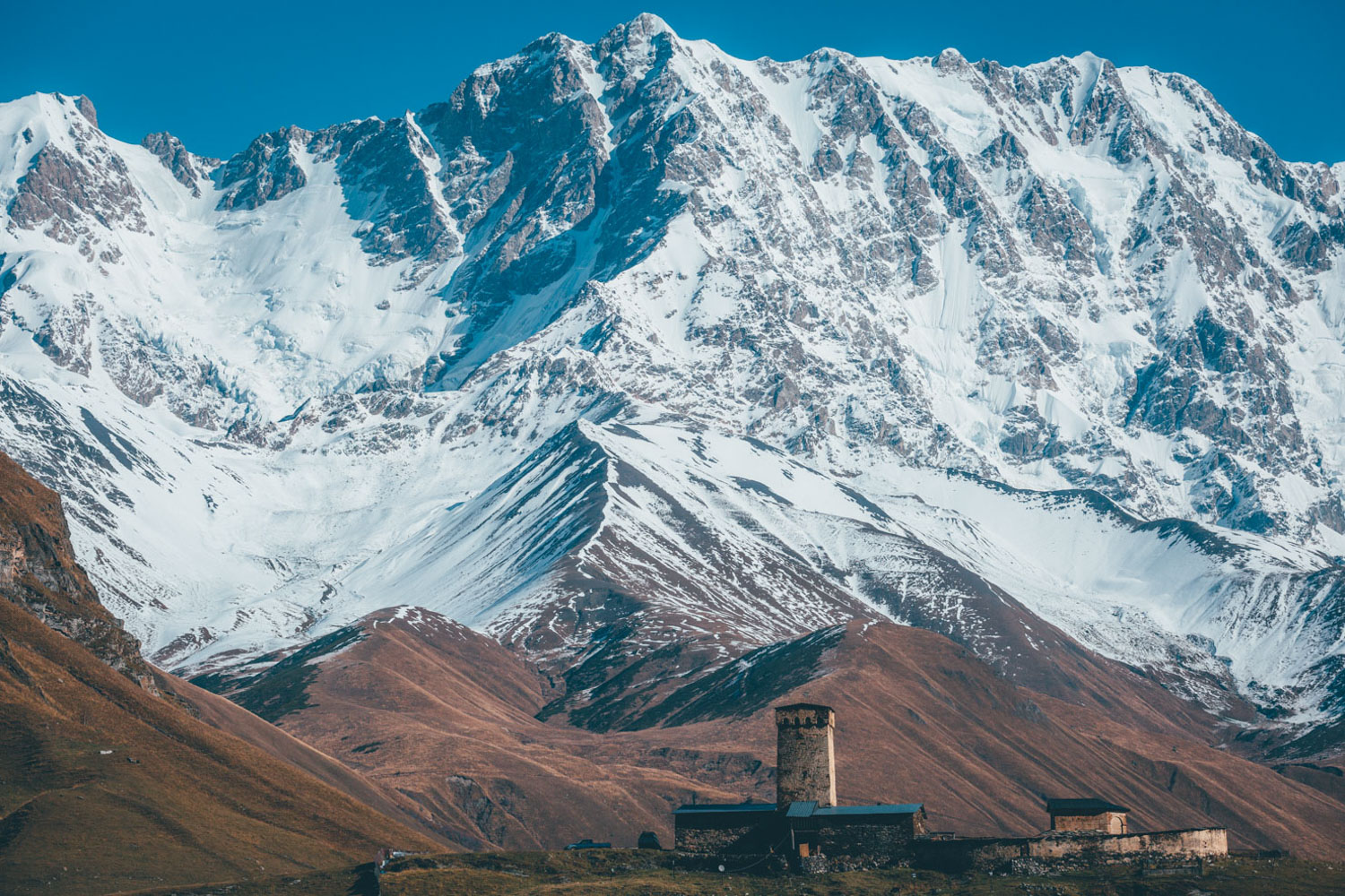
Bookending the ride are two of most popular hiking destinations – Svaneti and Tusheti – long popular amongst those who live in countries that form part of the former Soviet block, like Poland and the Ukraine. Of these, Mestia and Omalo are the main bases for those interested in hiking and exploratory mountain biking. The latter is far less developed and only open to the rest of the world by public transportation for six months of the year. Outside of this, the small population of locals who stay in the valley year-round have to rely on army helicopters, that keep the sensitive border with Chechnya under guard. Given that Mestia is also home to a ski station, the paved roads are kept clear in the winter too, with a more developed infrastructure as a result.
As the cradle of winemaking, Georgians take their drinking seriously. A recycled plastic bottle of chacha, a potent, homebrew grape brandy is never far at hand – Georgian’s like nothing more than to toast life, friendship, peace, family, even sheepdogs…
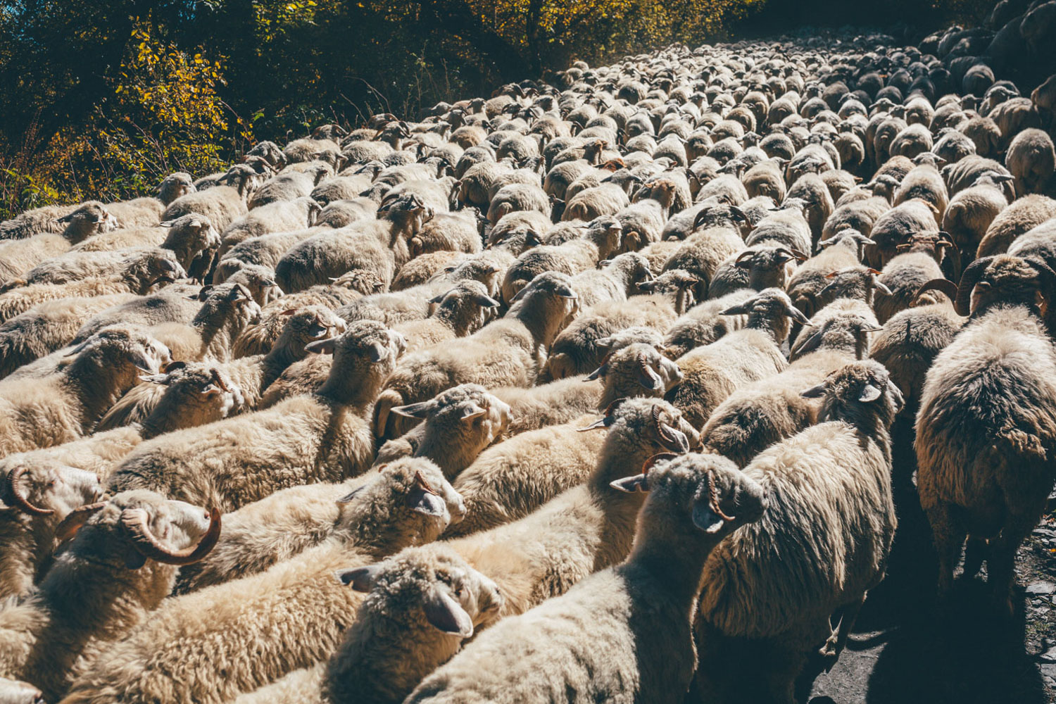
Oh, the sheepdogs! Tushetian sheepdogs are legendary; more often than not, shepherds will help steer them away, but if they’re too drunk or lazy, you’ll have to negotiate them yourself. Svaneti is largely clear of sheep (and thus sheepdogs too) but you’ll encounter them on the rolling plains that border Turkey too. Be prepared to run the gauntlet!
Route Development
Thanks are due to Joey Schusler (see the awesome Trail to Kasbegi for inspiration) and Kyle von Hoetzendorff of Yonder Journal (see their brilliantly observant Sweaty in Svaneti series) for their generous input with piecing together singletrack/hike-a-bikes links in Tusheti and Svaneti. If you ride this route and have any improvements, please let me know so they can be worked in. Thanks too to Ben Page for joining me when I re-rode the Svanetian portion of the ride, having been thrwated by foul weather and snow the first time round.
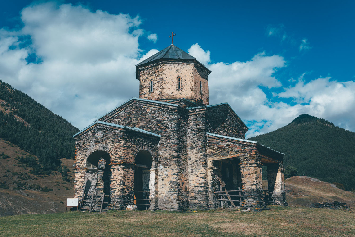
Along the way, the ride crosses the Borjomi-Kharagauli National Park, heading towards the lesser travelled border with Turkey, passing the 12th-century monastery complex of Vardzia, a labyrinth of two hundred cave dwellings excavated into a hillside. Within, the Church of the Dormition houses a remarkable set of 12th Century wall paintings and frescos, closed off to the world by a monk’s keys and a set of heavy wooden doors.
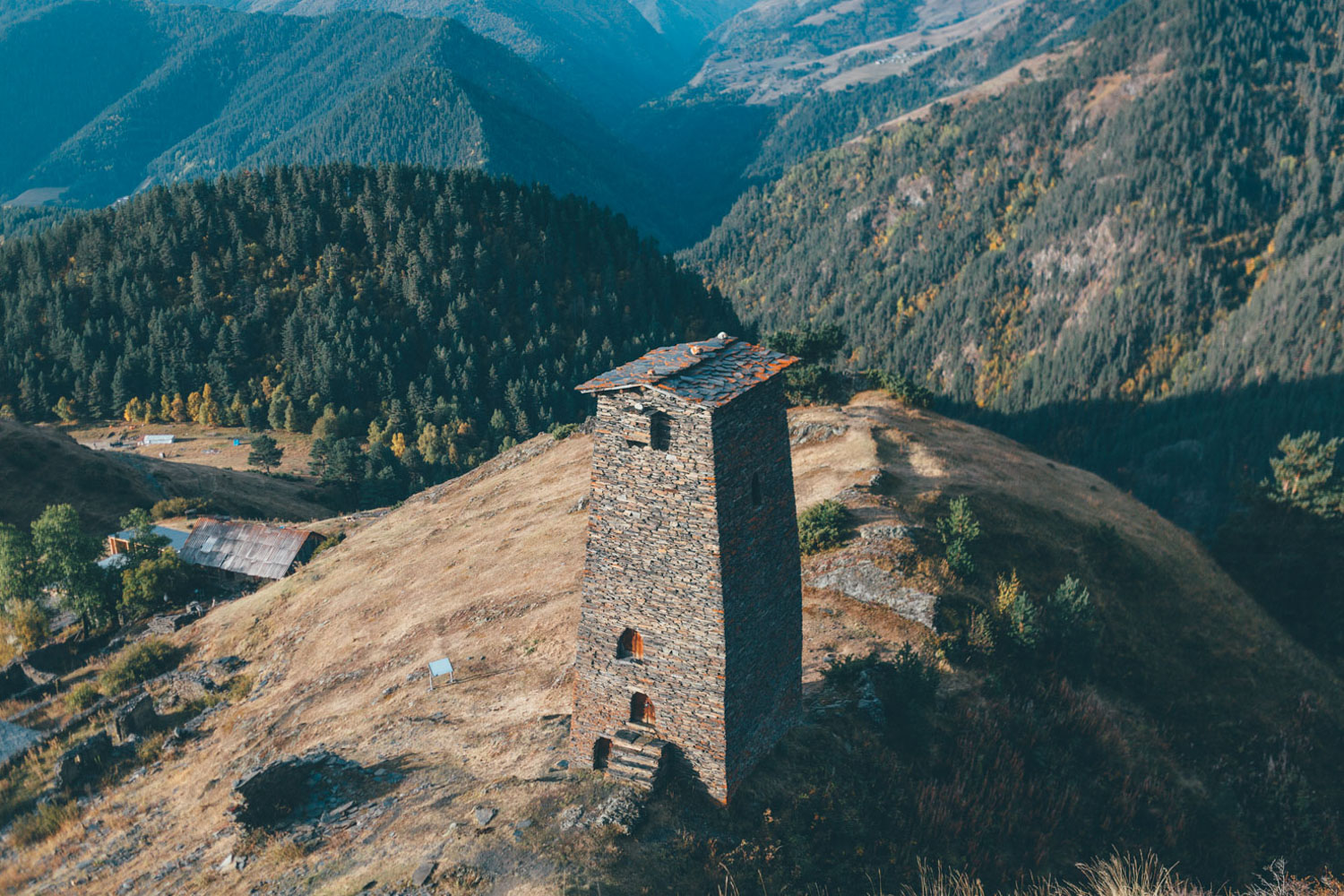
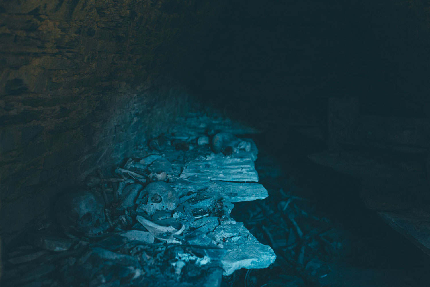
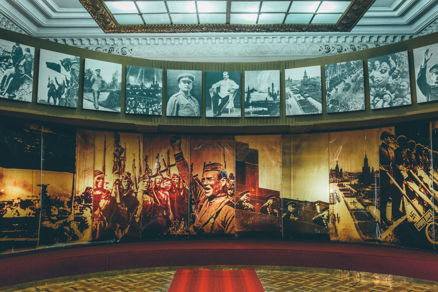
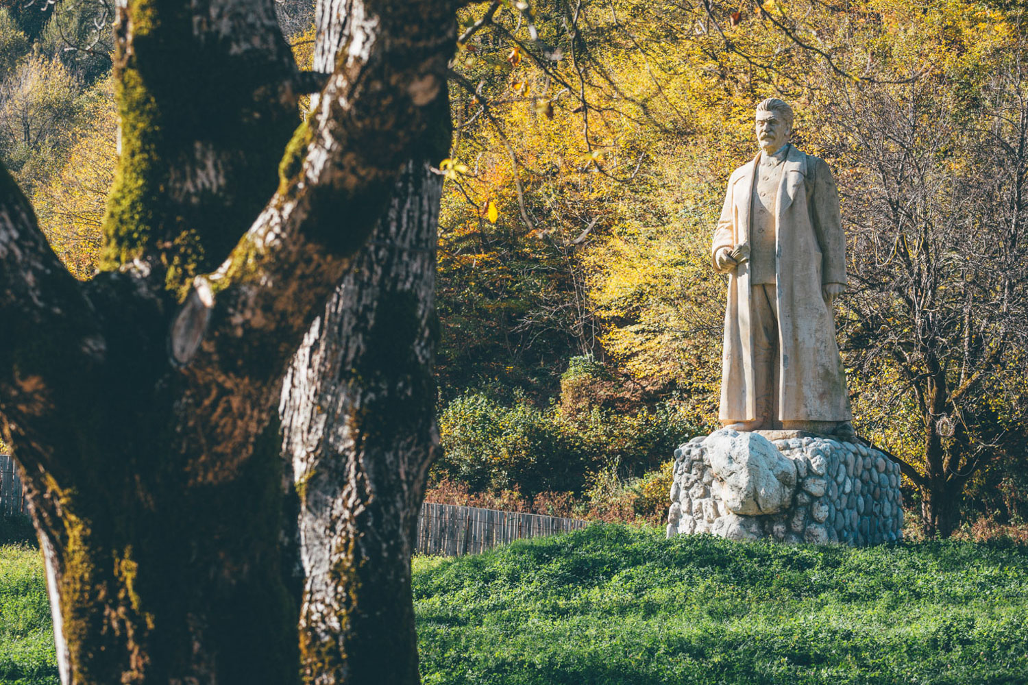
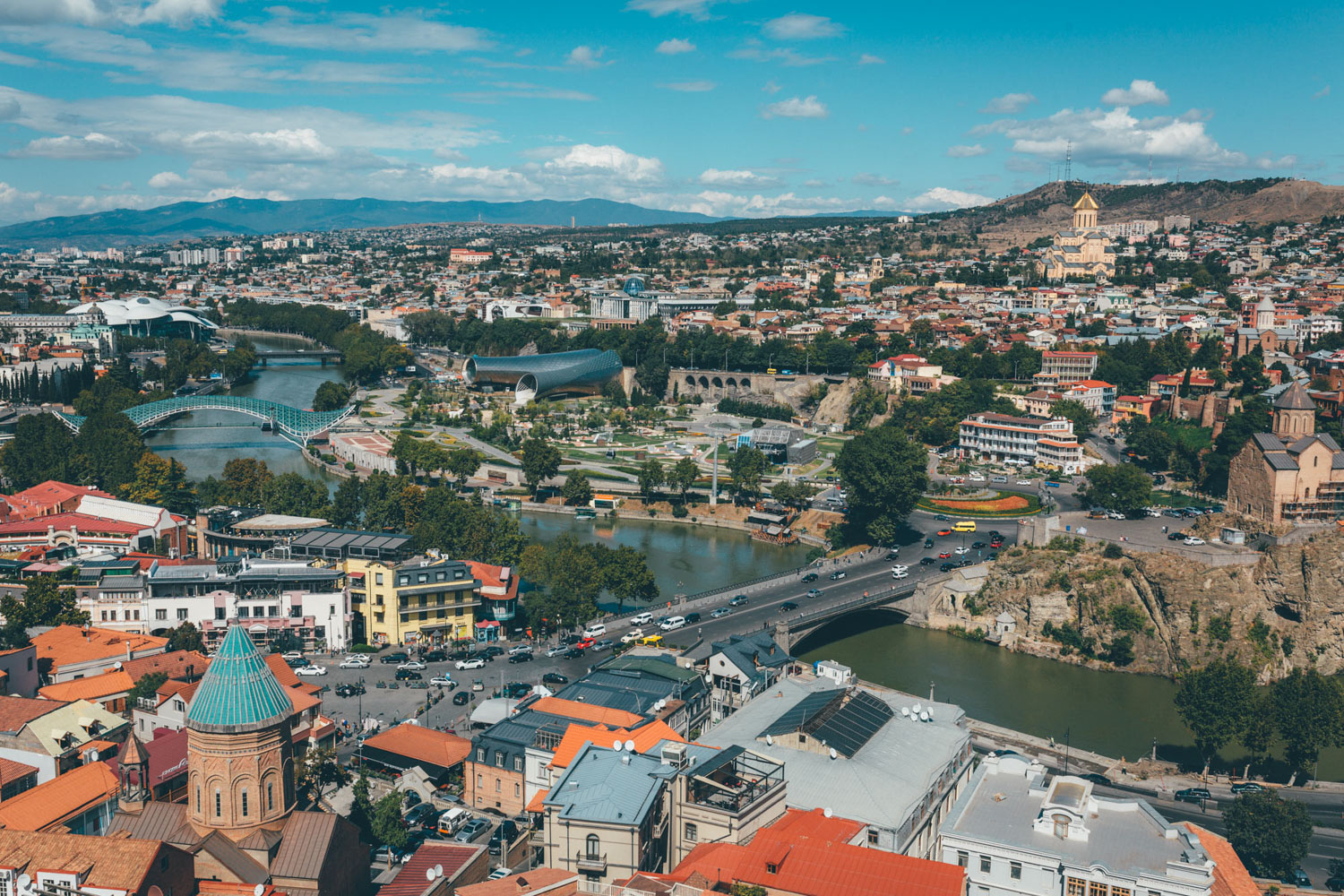
Later, it loops around tranquil Lake Parani, speckled with grass-roofed dwellings, before hurdling a series of rugged mountain folds to Gori, infamous as the birthplace of Joseph Stalin, his childhood home now entombed within a mausoleum that stands alone in the city’s central square. Returning to the high mountains, other intrigue includes Khevsureti’s Crypts of Anatori, an eery, medieval communal tomb piled high with human skulls and bones. And of course, the beautiful stone watchtowers, in various states of repair, that stand sentinel across much of the Upper Caucasus. From there, the route’s hardest hike-a-bike, the gruelling Atsunta Pass, lies like a gateway to Tusheti, a tight parcel of ragtag mountains enclosed by the Russian Republics of Chechnya to one side and Dagestan to the other. In stark contrast to this time bubble, beautiful Tbilisi, in the midst of being reconstructed and renovated, reflects Georgia’s headfirst dive into capitalism and free enterprise.
For thoughts and advice on which direction is best to ride this route and ways shorten the ride, see Trail Notes. I’ve also suggested a couple of possible sections that could be incorporated into the route, that I wasn’t able to investigate fully.
Difficulty
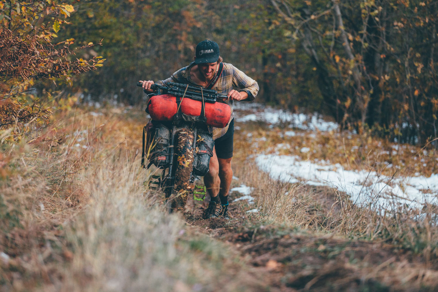
The route has been awarded an 8. For the most part, it’s a fairly straightforward ride that’s challenging in places. However, the two-day hike-a-bike between Shatili and Tusheti (the only way into the region, aside from Abano Pass) is extremely gruelling, which bumps up its overall score. If you’re not used to a multi-hour hike-a-bike, it will take you well out of your comfort zone. Be sure to pack as light as you can. See Trail Notes for ways to make this easier by mixing directions or even skipping it out if you’re on an inappropriate bike or carrying too much gear. More manageable are the smaller hike-a-bikes in Svaneti. The connector between Gori and Tedjisi stands out as being a demanding section with a number of short but steep grades.
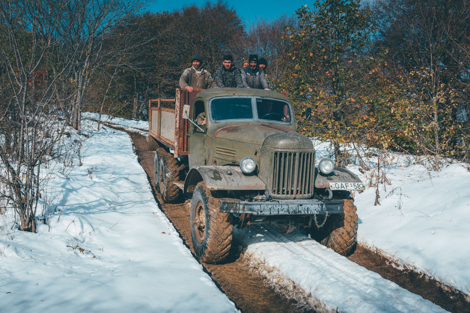
Other than this, road conditions are mostly good, ranging from packed dirt to grassy two track, tufty singletrack, and broken paved roads; they’re almost completely rideable, bar muddy or steep stretches. Resupply options are straightforward and frequent, with an abundance of fresh water, although communication in Georgia can also be a challenge, as few speak English outside of the capital. Thankfully, inherent generosity and friendliness transcend linguistic differences. I’ll repeat my canine warning here: sheepdogs are a formidable opponent, particularly for those travelling solo in Tusheti. I only met one who liked a tummy rub!


Submit Route Alert
As the leading creator and publisher of bikepacking routes, BIKEPACKING.com endeavors to maintain, improve, and advocate for our growing network of bikepacking routes all over the world. As such, our editorial team, route creators, and Route Stewards serve as mediators for route improvements and opportunities for connectivity, conservation, and community growth around these routes. To facilitate these efforts, we rely on our Bikepacking Collective and the greater bikepacking community to call attention to critical issues and opportunities that are discovered while riding these routes. If you have a vital issue or opportunity regarding this route that pertains to one of the subjects below, please let us know:
Highlights
Must Know
Camping
Food/H2O
Trail Notes
Resources
- Hurdling Abano Pass, gateway to rugged Tusheti, and said to be the division between Europe and Asia.
- Testing your hike-a-bike tenacity during the crossing from Tusheti to Shatili.
- Visiting Vardzia, a 12th Century monastery that tunnels deep into the rockface.
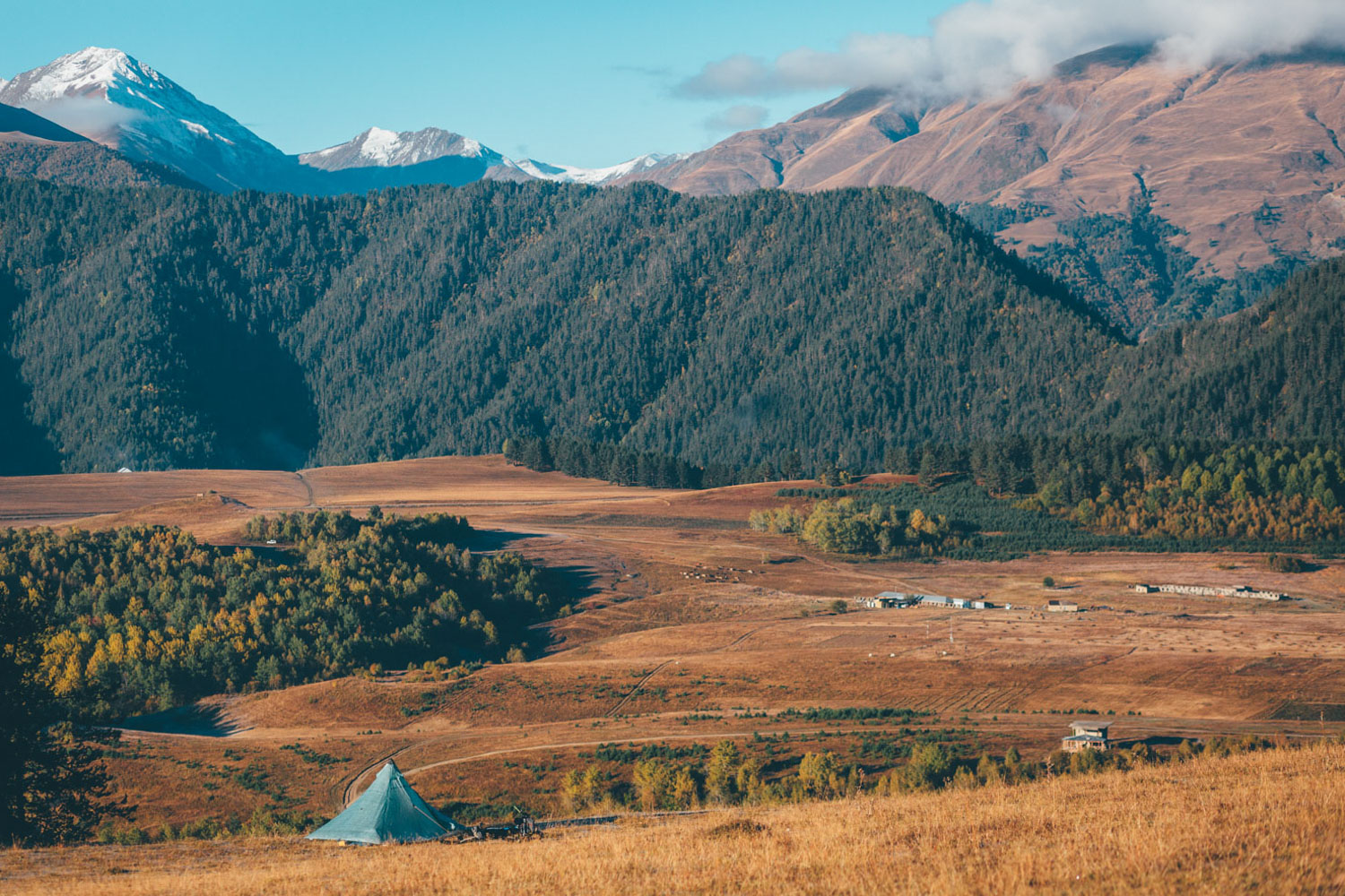
- Riding around Lake Paravani… home to semi-nomadic Turkish shepherds, displaced Armenian communities, and grass-roofed traditional dwellings.
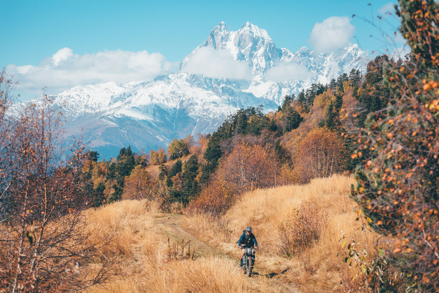
- Ripping along sweet Svanetian singletrack.
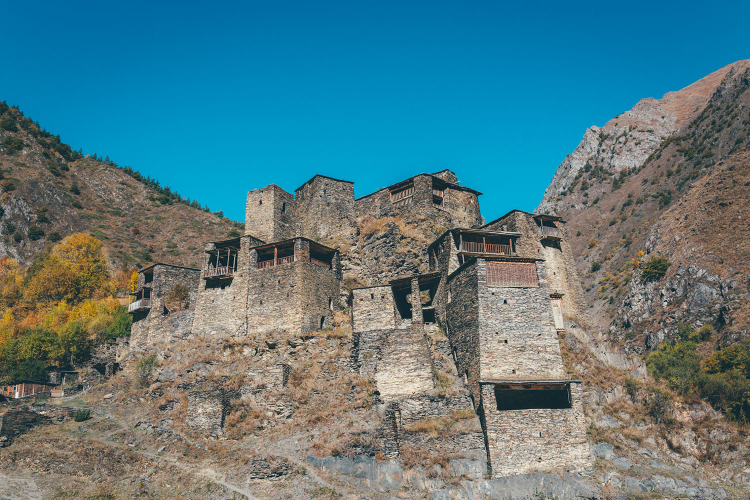
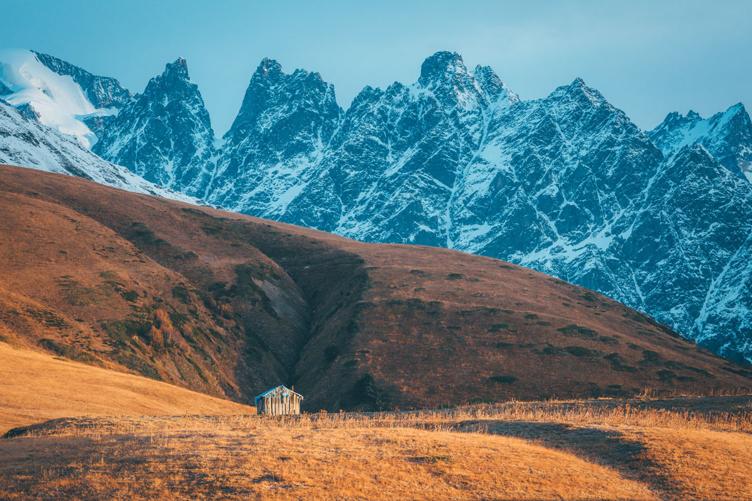
- Ogling medieval watchtowers that stand sentinel around the Upper Caucasus.
- Experiencing warm (and often drunken) Georgian hospitality, washed down with homebrew wine.
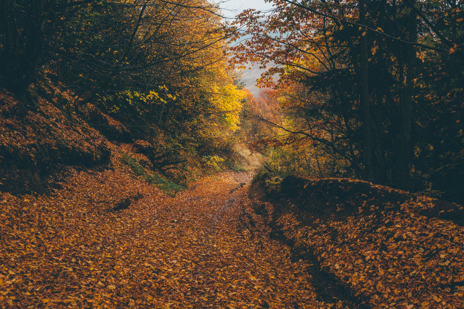
- Mid-June to early September is the best time to be in Georgia’s Higher Caucasus; just bear in mind that summer can be extremely hot, especially in the lowlands. Fall is likely ideal. Venture into October and you’ll risk increased rain and snow, as I experienced. On a general note, be aware that travelling at the beginning or tail end of the riding season may mean snow/challenging conditions/closed passes/river crossings.
- Keep an eye on the weather. If there’s heavy snowfall, Atsunta Pass is likely to be closed. I used the YR weather app, finding it to be accurate for much of the region. On the whole, the west side of the country tends to be wetter than the east.
- In the height of summer, expect T-shirt weather in the mountains, tempered by cool evenings. The lowlands can be extremely hot and muggy. A sleeping bag that’s comfortable to temperatures a little below freezing should be fine, supplemented with extra clothes as needed. In late summer/early autumn, the weather is fresher and the views clearer, but there is more of a risk of rain.
- At the time of writing, there are no visa issues to contend with for most nationalities. Always check for updates.
- Communication can be an issue, especially given the complexities of Georgian script. Google Translate can come in handy!
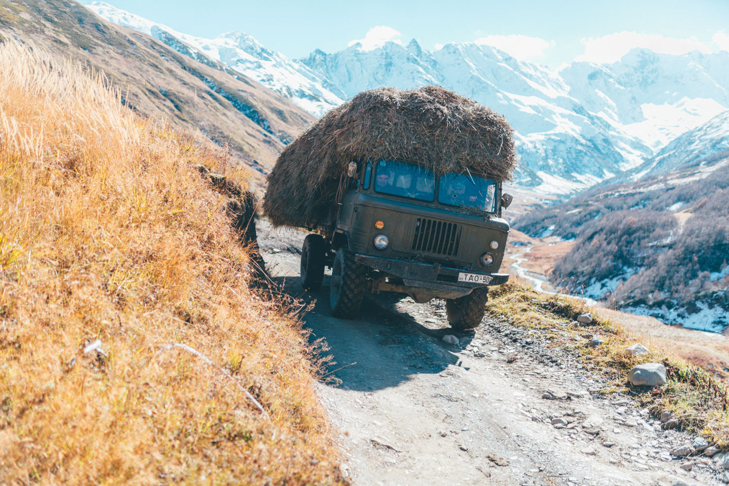
- Georgia is an extremely safe country to travel across. The caveats are the death-defying driving (this route avoids main roads where possible) and the impossibly fierce Tushetian sheepdogs.
- The best tactic for appeasing sheepdogs is to give them as wide a birth as possible. Try and remember that they are just doing their job… one they take especially seriously.
- In terms of maps, the TerraQuest series is recommended. I used Georgia Caucasus Mountains Adventure Map (1:400,000), but for a more detailed investigation of Tusheti, the Georgian Caucasus (1:75,000) is best. I also managed to pick up an excellent 1:55,000 Trekking Map at the tourist information centre outside Omalo, complete with excellent topo and details. But I don’t believe they always have it in stock. Other than that, I relied on my iPhone and Gaia app for navigating.
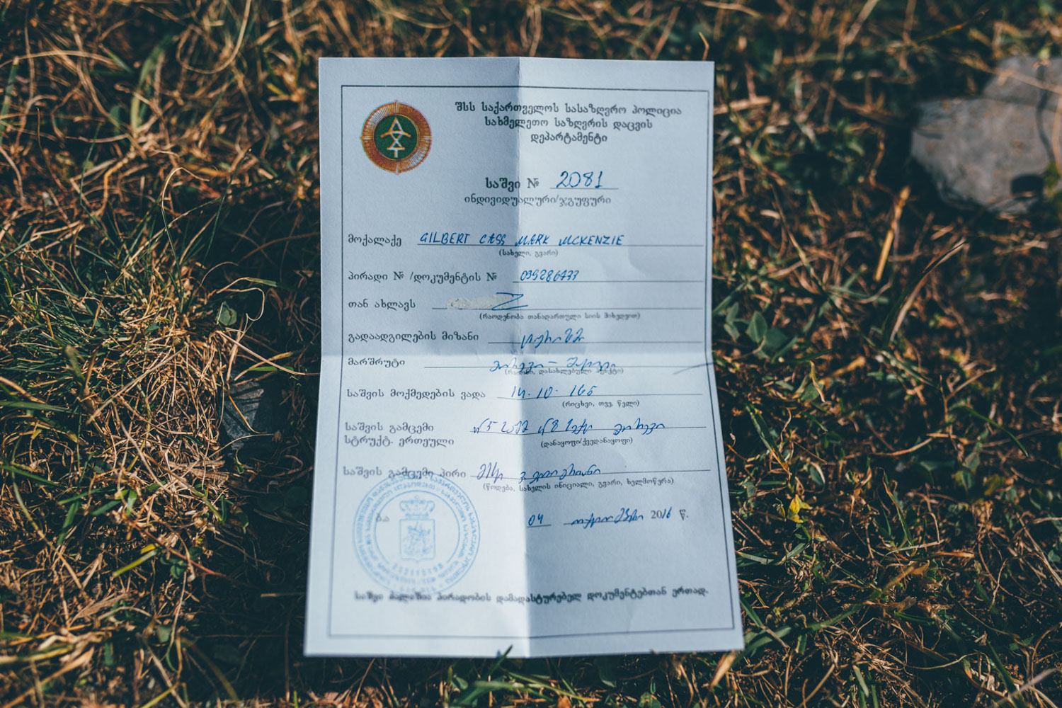
- To cross Atsunta Pass between Shatili and Omalo, be sure to stop in at the army checkpoint and procure the necessary paperwork, as this popular trekking route runs close to the border with Chechnya. This is a quick process during the summer, but can take more persuasion during the shoulder seasons if the weather is mixed. Note that this is an extremely challenging, multi-day hike-a-bike… take your time and enjoy the scenery (-; It’s a considerably gentler climb coming from the east, but features more satisfying singletrack if traveling from the west.
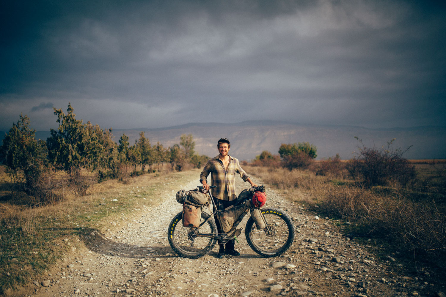
- Best bike: to complete this route in its entirety, a mountain bike is highly recommended. Front suspension isn’t required but useful in places. If you’re on a gravel/adventure bike and want to avoid singletrack, it’s easy enough to ride through Svaneti without hopping onto trails. However, there’s no way of avoiding Atsunta Pass if you want to make a linear journey (rather than a loop in and out of Tusheti via Abano Pass), so adjust your route accordingly, depending on your bike. Aside from Atsunto, all the route should be rideable with a 45mm tire and some extra tenacity, bar some very minor hike-a-bikes in Svaneti and some very steep (and potentially muddy) sections on the crossing between Gori and Lake Paravani.
- For background reading and practical info on the more travelled areas of the country, the Lonely Planet’s Georgia guidebook can be downloaded to your phone.
- Cell phone access is surprisingly good. Pick up a local SIM card (Magti is the recommended carrier) for incredibly cheap, and relatively fast, data access. Reception is surprisingly widespread.
- There are plenty of good bike shops in Tbilisi, though they’re several kilometres from the old city. Picking up a bike box may be possible but don’t rely on it. Best to stow a box or bag during your trip.
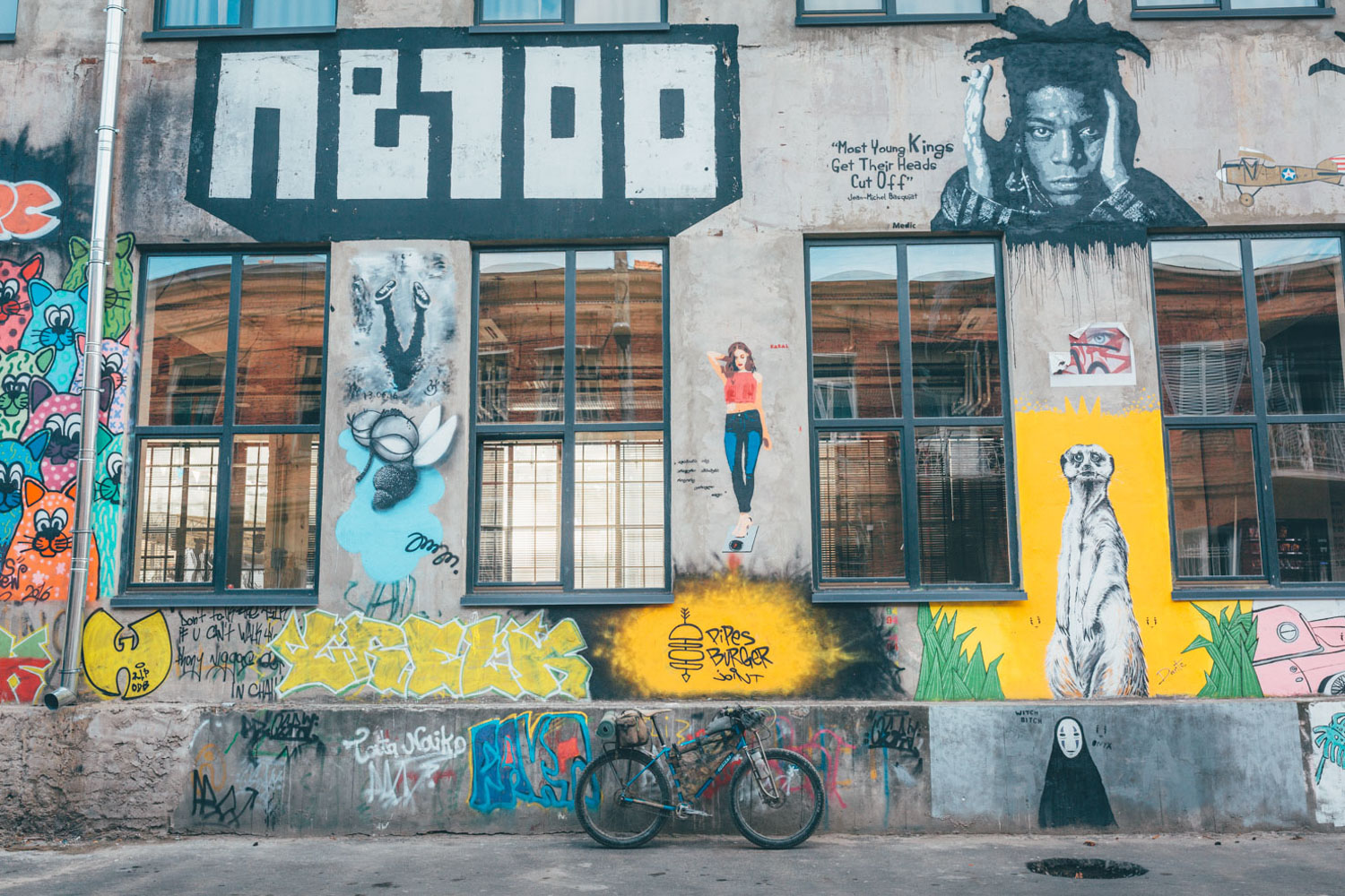
- Tbilisi has some great local singletrack trails too, most of which start near Vake Park, if you have a day or two spare. There’s plenty of rides to be found on Strava and Wikiloc. The trail to Udzo Monastery is a classic and well worth riding – you could even incorporate it into this route.
- For local guide hire, check out Geo Riders – their site has some suggested day rides with links to gpx files.
- For gear rental, contact expat mountain biker James Dean, who has a shop in Tbilisi.
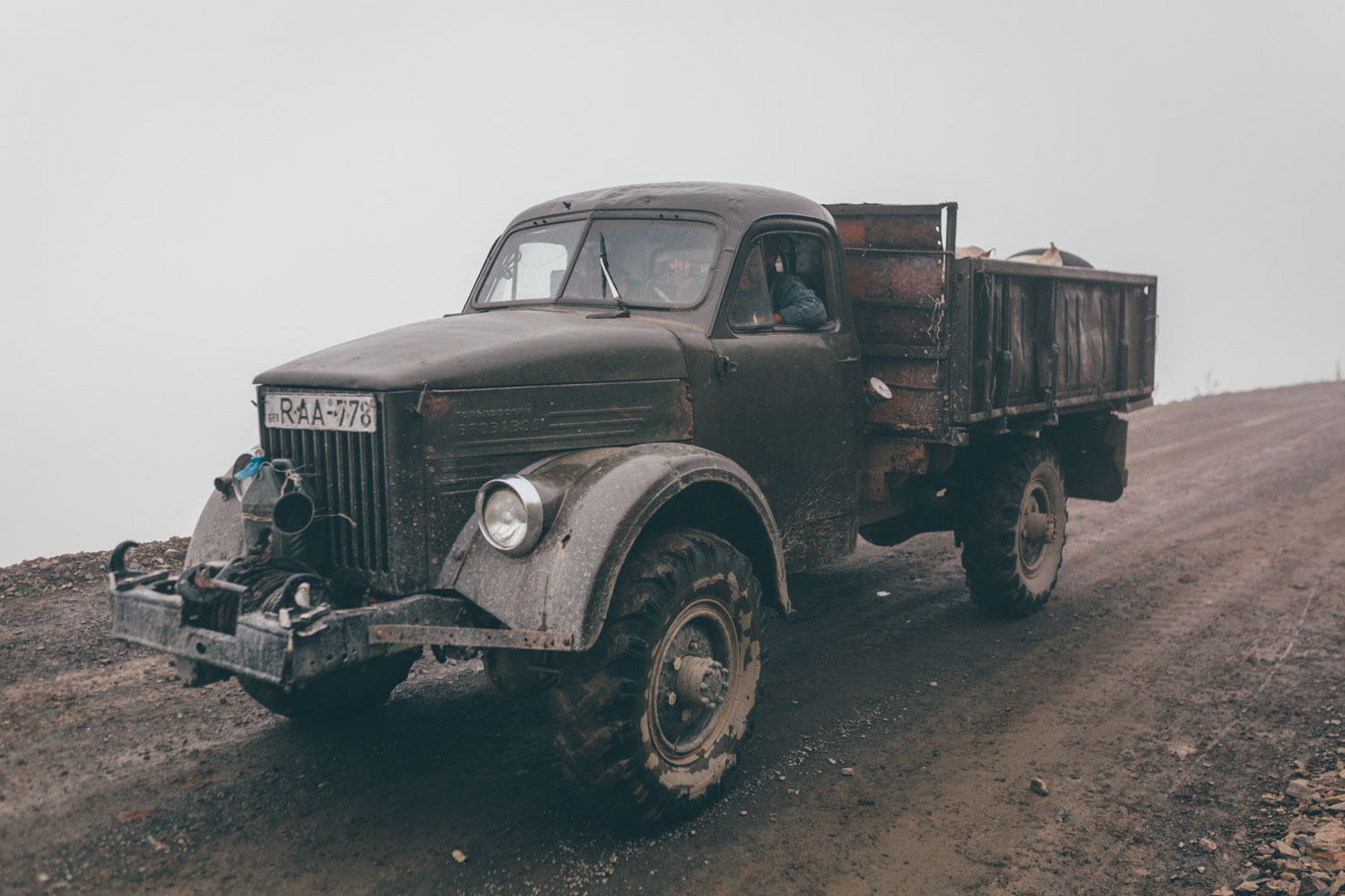
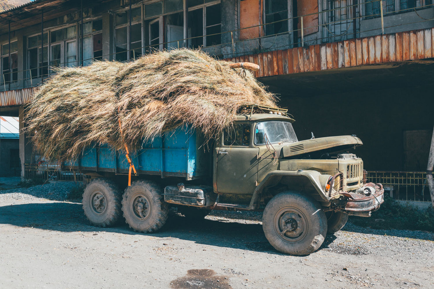
- If you need to skip a section of the ride, it’s generally easy enough to hop in a marshutka, the minibuses that ply the Georgian roads a death-defying speed. Countryside versions tend to have roof racks but more modern, intercity marshutkas have little or no room for more than one bike – and even that can be a squeeze/take some persuasion. Marshutkas tend to congregate on street corners, depending on the destination – just ask a local for details. Buses ply some of the country roads. Their timetables are more limited but they will have more room for bikes than marshutkas. There are various transportation hubs around Tbilisi that serve different areas of the country; just ask a local for where to go.
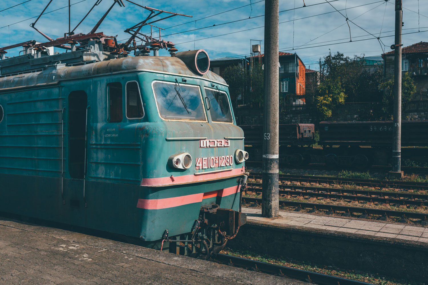
- A far more relaxing, though slower option is to take the train. There’s a daily train to Zugdidi (and a night one too). Bikes cost an extra 5 Lari (whatever the distance ), paid to the conductor, who will give you a receipt. For train times and routes, see the Georgia Railway site.
- Getting there: Tbilisi is the main airport in the country (taxis cost 20l into town – there’s a very helpful Tourist Info desk) and the city itself makes a great place to start and end a trip. I flew with Turkish Airlines, as it had the best bike policy. However, Kutaisi offers a number of budget flights from Europe and makes for a good base to leave a bike bag or box. Like Tbisili, you can catch the train or minibus to the start point in Zugdidi.
- At the time of writing, 1 Lari is worth $0.4 USD.
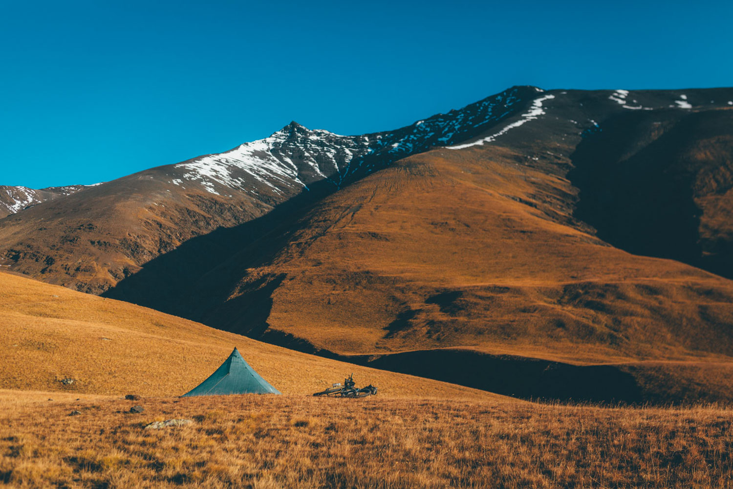
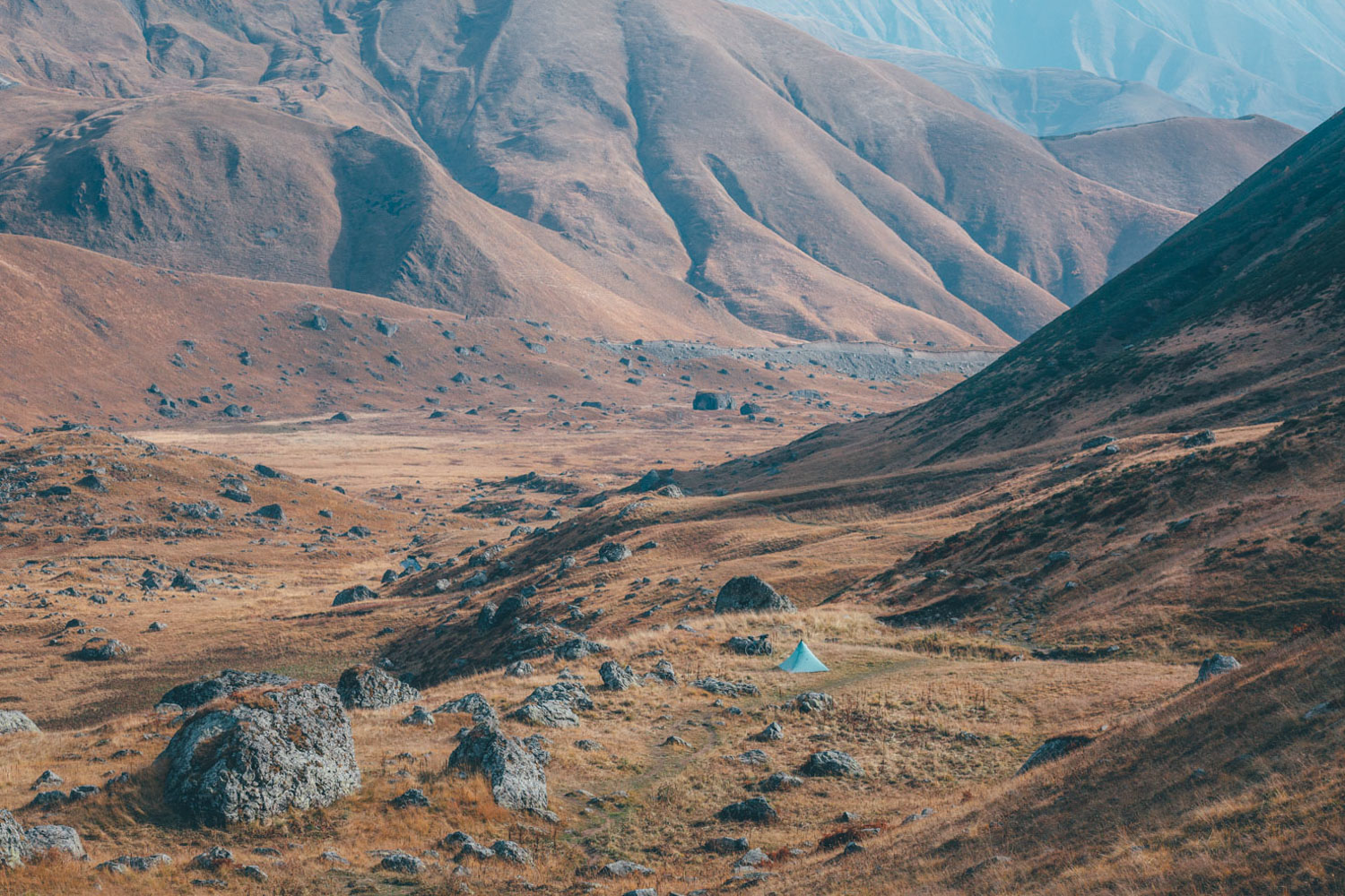
- Camping in Georgia is safe and generally very easy.
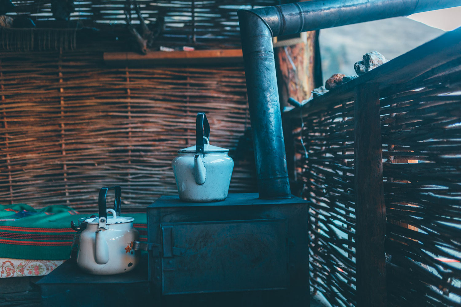
- Tourist enclaves offer hotels and hostels (with cheap dorms). Otherwise, there are many homes that offer extremely affordable, B&B style accommodation. On some occasions, I camped in gardens and ate in homes. Just ask around if you can’t find anywhere. Many businesses are signed up with booking.com
- The areas of Svaneti and Tusheti are well served by mountain huts/lodges/homes, as both areas are very popular with East European hikers. In fact, you could explore both these regions without a tent/stove, though you’d be missing out on some wonderful morning vistas.
- There are too many hostels to recommend. But here’s few that I stayed at ate in and liked. Omalo: Hostel Tishe (Eteri Markhvaidze), great lunch, has a good shop too. Tusheti: Guesthouse Giveri, near the army checkpoint for Atsunta Pass. Etseri (Svaneti): Hanmer GH, I camped in the garden and ate great food, UK/Georgian owners. Shatili: Nina Chincharauli (995 591 11 64 24, 595 34 74 76), I camped in her garden and she cooked me up a big meal. Roshka: Guesthouse Roshka. More expensive than most, but fantastic food, camping available. For the most part, my MO was to camp wild, using guesthouses to enjoy a good lunch. But I often camped at guesthouses too, eating dinner, breakfast, and using the facilities.
- Hostels/Guesthouses in Kutaisi and Tbilisi can get busy at weekends; you may need to book in advance through booking.com
- Aside from the pass over Atsunta, it’s generally possible to travel through Georgia without a tent. However, this puts pressure on reaching destinations. And means missing out on some beautiful camp spots! At the minimum, a lightweight tarp setup is recommended.
- Georgia is abundant with clean water spigots in villages and natural springs in the mountains. I rarely needed to carry more than two bottles at any one time and never used my filter.
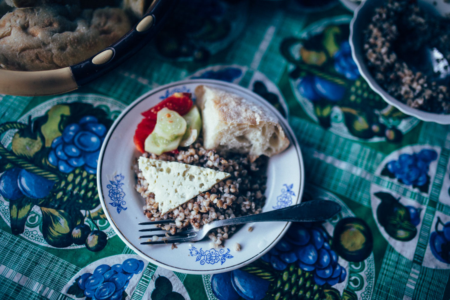
- Small, simple grocery stores can be found in almost every settlement, offering vegetables, cheese, and an impressive assortment of cookies. Large cities have big supermarkets. You’ll rarely need to carry more than a day or two of food.
- In Lower Omalo, Hostel Tishe (run by Eteri Markhvaidze) has a good shop and delicious food.
- Local honey, walnuts, cheese, and kefir abound.
- Georgia’s traditional bread (shotis puri) is made in clay ovens; when it’s fresh and piping hot, nothing beats it. It’s cheap and huge!
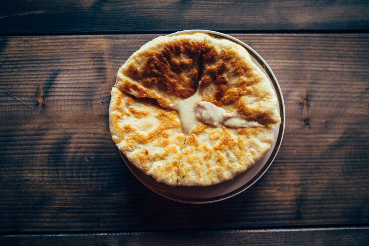
- Georgian cuisine is heavy on cheese, Khachapuri (molten cheese stuffed in a pizza-like dough) being a firm favourite.
- Chacha is the tipple of choice. This grape-based vodka is brandished at any excuse for a toast, often complimented with homemade wine. Ironically, drivers stop and drink it when they’re passing roadside memorials, of which there are plenty on the road over Abano Pass, said to be amongst the most dangerous in the world.
This route was designed to be ridden in its entirety for the full Caucasus Crossing experience – some of its most challenging sections are also the most memorable. However, there are many possible permutations, depending on the time you have, the bike you’re riding, the weather, and how much you enjoy hike-a-bikes! The beauty of Georgia is that it has a good (and relatively bike-friendly) public transport infrastructure, be it by train or bus, so you can easily tune the route to taste.
Riding the complete route eastbound:
The advantage to riding this route west to east is that it’s an easy, paved climb from Zugdidi, and a dirt road/singletrack descent out of the mountains. In terms of Tusheti, the hike-a-bike out of Shatili towards is considerably shorter but a lot sharper than coming from the Tusheti direction. The descent down from Atsunta Pass is long and more rideable, depending on your bike and skills, that is.
Riding the complete route westbound:
It’s a big climb over Abano Pass to Omalo to kick off the ride, but a stunning one nonetheless. The hike-a-bike over Atsunta Pass, towards Shatili, is more gradual and largely rideable with an appropriately light bike and setup – until the last few kilometres before the pass itself. The steep initial descent can be a challenge but later becomes predominantly rideable with a light bike and good mountain biking skills, unless there’s ice/snow. Locals mountain bikers are divided as to which direction is best when tackling Atsunta, as they both have pros and cons. The rest of the route can be ridden in either direction, although most prefer an eastbound direction for Tusheti, as most of the singletrack will be climbs, with a paved descent finale to Zugdidi.
Mix and Match Directions:
Given that the route runs through Tblisi, which you may well be flying into, consider first riding from Zugdidi to Tblisi. Then, riding (or busing) to Telavi, returning to Tblisi via Abano and Atsunto Passes.
Other Options:
Using this route as a backbone, many loops that can be made, depending on your time schedule and the kind of bike you’re riding. Here are just a few ideas…
– If you’re short on time, consider creating a loop out to Tusheti and back – this is where Georgia’s wilder, more remote riding is to be found. The mountain scenery is arguably more impressive in Svaneti, but I definitely preferred Tusheti as a complete travel experience, given its less developed tourist infrastructure. Although I recommend tackling Atsunta Pass as its a formidable crossing, Tusheti would make for a wonderful trip in itself simply riding in and out of Abano Pass. It’s easy to get a marshrutka to Alaverdi Monastery or Telavi, near the base of Abano Pass; a week will give you plenty of time to cover most of the riding there, including exploring its side valleys.
– Fly in and out of Kutaisi and enjoy a short loop through Svaneti. This is best ridden in a clockwise direction, beginning with the train to Zugdidi. Want to go light? This section is easy to explore without a tent, as there are a number of accommodation options suited to hikers. This is Georgia’s most popular hiking destination, so expect company.
– If you’re not adverse to hike-a-bikes, consider taking a bus to touristy but beautiful Stepantsminda (Kasbegi), riding to the trailhead, and hike-a-biking from Juta to Roshka via the Chaukhi pass (the trail becomes rideable again from the three Abudelauri lakes). Then, rejoin the route from there. The first place to find food after Roshka (where there’s a guesthouse) is Shatili. After that, Giveri has a number of guesthouses, on the other side of the pass in Tusheti.
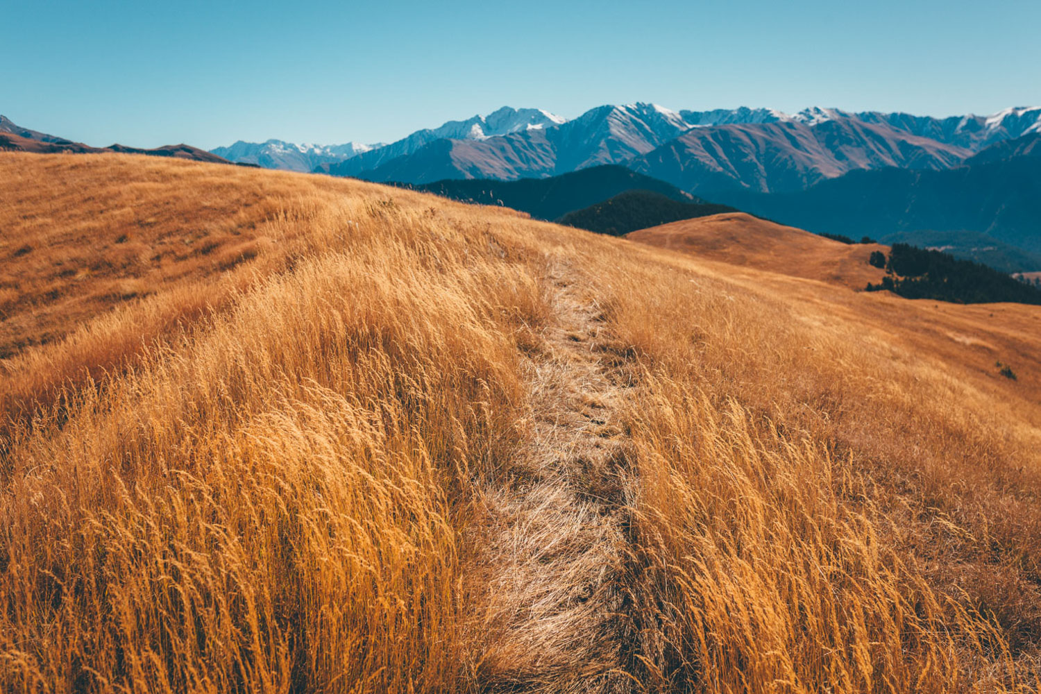
– The Lower Caucasus is often overlooked. The ride between Gori and Akhaltsike was actually a highlight for me, as much of this region sees extremely little tourist traffic, bar the monastery complex of Vardzia. The Lower Caucasus is less dramatic but offers wonderful, distant views of snowy peaks and beautiful, high altitude rolling steppe. There’s a convenient train between Gori and Tbilisi, and there are regular Marshutkas between Kutaisi/Tbilisi and Akhaltsike. A loop would be easy to make, especially if the weather in the higherCaucasuss is looking unfavourable.
Option for places I didn’t visit:
Other areas worthy of exploration for lightweight bikepacking include the Borjormi-Kharagauli National Park, served by two excellent park offices at the northern and eastern entrances. There, you can find maps and local information for a few well-established treks. I would have attempted such a traverse but heavy rain forced me to reconsider.
Algeti/Trialeti National Parks are also recommended bikepacking destination – Ben and I tried valiantly to complete the route we’d planned but snow turned us back, given the onset of winter. If you’d like to incorporate my original route, suggested to me by local mountain bikers, try this Tbilisi to Gori segment. Please let me know how it goes. An alternative to entering/exiting Tbilisi is to follow the singletrack/jeep track to Udzo Monastery, a classic local trail ride that I enjoyed as a day trip.
There’s more potential singletrack in Svaneti, but most involve a very high percentage of hike-a-biking. Eg: Guli Pass, between Mestia and Mazeri, for views of North and South Ushba. It’s worth climbing up to the Koruldi Lakes (a dirt road out of Mestia) for some great, up close views of the Upper Caucasus and prime camping potential. We also rode out to Zaargashi and hiked to the tongue of the Chalaati glacier. Hike-a-bikers may also ‘enjoy’ crossing from Adishi to Iprali, via the Chkhutnieri Pass. We weren’t able to attempt it due to snow.
Additional Resources
- Check out Lee and Cherry’s route report from their 2018 ride.
- I wrote a feature on the ride for Cranked Magazine, Issue 9.
- Caucasus Trekking is an extremely useful site for those considering riding the country’s trekking routes.
- Watch the wonderful Trail to Kasbegi for inspiration! Just don’t attempt to ride this route outside of summer, and without a suitably light setup.


Terms of Use: As with each bikepacking route guide published on BIKEPACKING.com, should you choose to cycle this route, do so at your own risk. Prior to setting out check current local weather, conditions, and land/road closures. While riding, obey all public and private land use restrictions and rules, carry proper safety and navigational equipment, and of course, follow the #leavenotrace guidelines. The information found herein is simply a planning resource to be used as a point of inspiration in conjunction with your own due-diligence. In spite of the fact that this route, associated GPS track (GPX and maps), and all route guidelines were prepared under diligent research by the specified contributor and/or contributors, the accuracy of such and judgement of the author is not guaranteed. BIKEPACKING.com LLC, its partners, associates, and contributors are in no way liable for personal injury, damage to personal property, or any other such situation that might happen to individual riders cycling or following this route.
Please keep the conversation civil, constructive, and inclusive, or your comment will be removed.