


The Blackfoot Hackle: Bikepacking/Packrafting Montana
Distance
161 Mi.
(259 KM)Days
5
% Unpaved
90%
% Singletrack
0%
% Rideable (time)
60%
Total Ascent
6,877'
(2,096 M)High Point
4,998'
(1,523 M)Difficulty (1-10)
6?
- 3Climbing Scale Fair43 FT/MI (8 M/KM)
- -Technical Difficulty
- -Physical Demand
- -Resupply & Logistics
Contributed By
Casey Greene
Cartographer
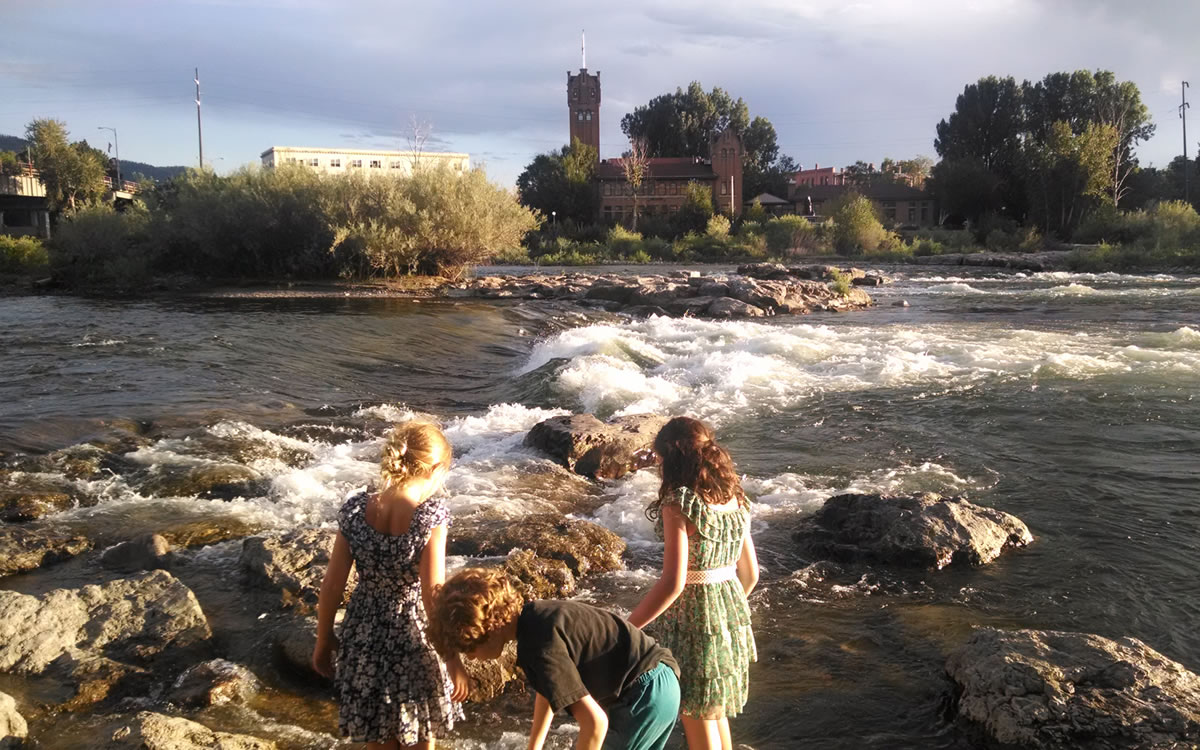
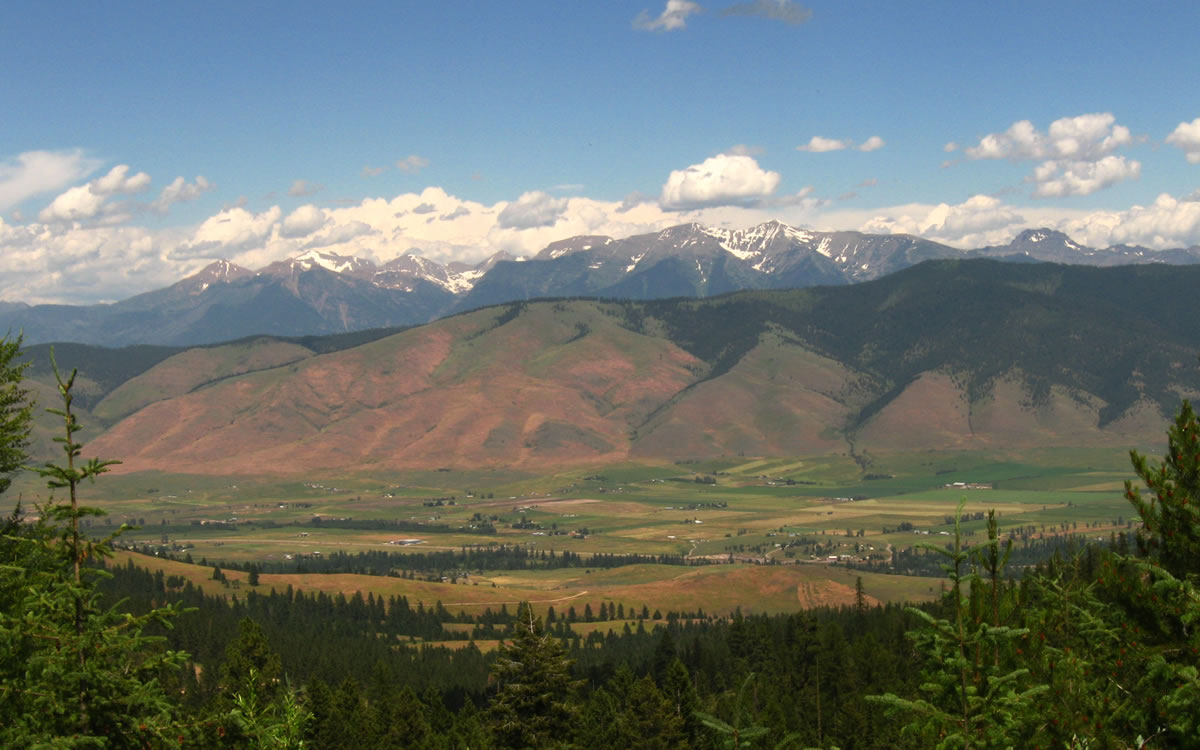
The Blackfoot Hackle starts when you step off your plane at the Missoula Airport. It heads up and over the Reservation Divide to the small town of Arlee before traversing between two federally designated Wilderness Areas – the Mission Mountains Wilderness and the Rattlesnake Wilderness. The riding then continues to the town of Seeley Lake, nested against Montana’s beautiful Swan Range. From here, the routing follows Adventure Cycling Association’s Great Divide Mountain Bike Route, where riders will be smack up against one of the most storied Wilderness Areas in the lower 48, the Bob Marshall. The bike friendly hamlet of Ovando is the final stop to resupply before riders inflate their boats, and swap methods of travel.
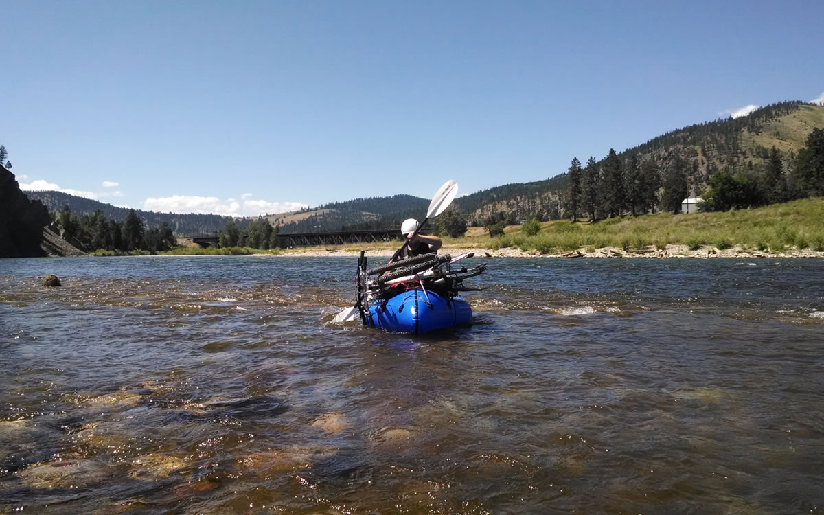
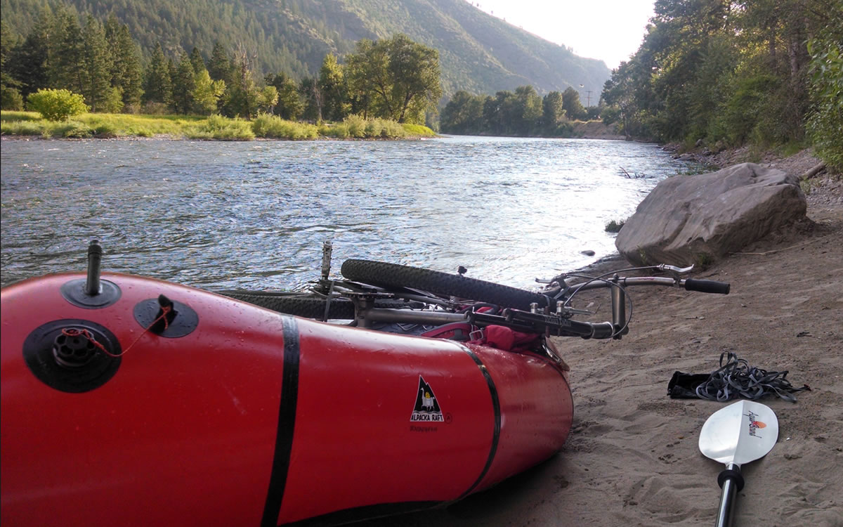
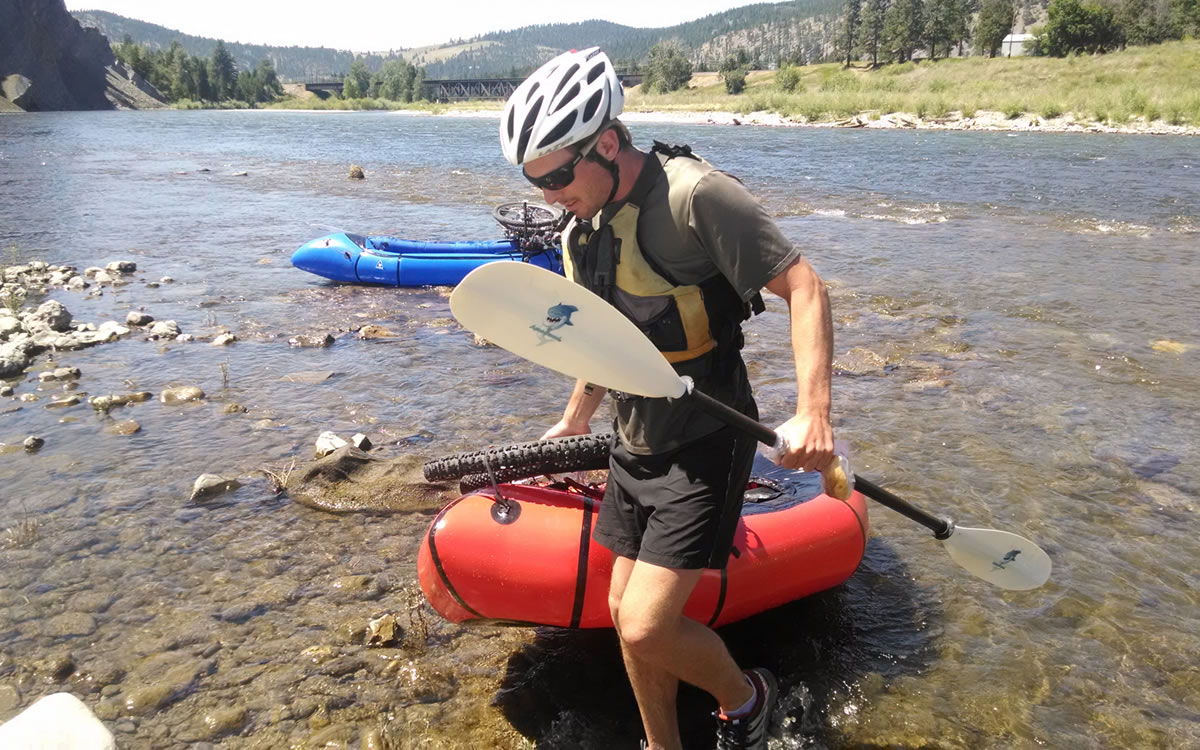
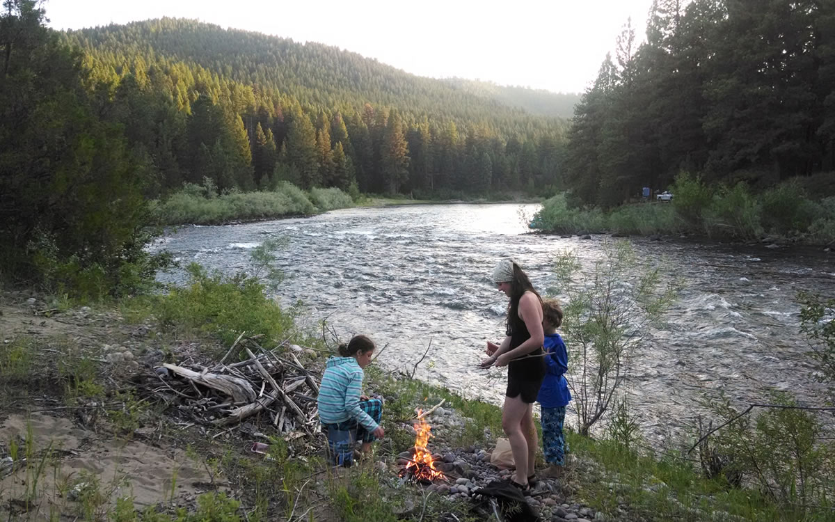
The put-in location is just a few miles south of Ovando on the North Fork of the Blackfoot. Within 3 river miles, boaters will reach the confluence with the “Big” Blackfoot River. After that, it’s 54 river miles to the confluence with the Clark Fork, and 7 more to the Silver Park boat ramp in downtown Missoula. The full route was made runnable to boaters for the first time in 2014 with the opening of the confluence of the Clark Fork and Blackfoot rivers in Bonner, MT, following the 2008 removal of the Milltown Dam.
Following a brief ride on downtown Missoula’s riverfront bike paths, the routing ends at the doors of Adventure Cycling Association. Stop in for some free ice cream, a tour, and get your picture taken and posted alongside the hundreds of other riders who journey to our little bicycle touring mecca each year… And, we’ll have a chance to discuss your boat/bike routing options to get back to the airport.


Submit Route Alert
As the leading creator and publisher of bikepacking routes, BIKEPACKING.com endeavors to maintain, improve, and advocate for our growing network of bikepacking routes all over the world. As such, our editorial team, route creators, and Route Stewards serve as mediators for route improvements and opportunities for connectivity, conservation, and community growth around these routes. To facilitate these efforts, we rely on our Bikepacking Collective and the greater bikepacking community to call attention to critical issues and opportunities that are discovered while riding these routes. If you have a vital issue or opportunity regarding this route that pertains to one of the subjects below, please let us know:
Highlights
Must Know
Camping
Food/H2O
- Class II packrafting experience is mandatory! Class III is highly recommended.
- Figure out how to use these two websites, and the historic data found within, to know what level the river will be running at: USGS Water Data & NOAA National Snow Analysis.
- Get a river map, and figure out what rapids you will be running. All rapids are easily portaged. Class III Thibodeau gives boaters the biggest problems, but a number of others can work you over.
- The Benchmark Atlas of Montana – specifically pages 62,63,64,76,77,78 – is a great resource to use for overview navigation.
- Stay away from all logs upon approaching Bonner.
- You pass under 5 bridges in Bonner before the confluence with the Clark Fork. The last 2 can be very dangerous.
- When you can see the lights of the University of Montana football stadium, stay way right to ride through the small rollers of the “Dog Park” rapid.
- After going through Brennan’s Wave in downtown Missoula, and passing under a railroad bridge, stay way left though some small roller to access the Silver Creek Park boat ramp. The small eddy will come up fast, and is not very noticeable.
- You are in bear country the entire time! (I have had a bear break into my home within Missoula city limits.)
- Read and watch A River Runs Through It beforehand. Also More Tracks, and The Lochsa Story.
- Primitive camping is permitted on all National Forest Service land, unless posted otherwise.
- Primitive camping is permitted below the high water mark on all Montana waterways.
- The Blackfoot River has a number of small islands to camp on.
- Cow patties can be prevalent around the Blackfoot River.
- Lodging in Seeley Lake, Ovando and Missoula.
- Plan accordingly, and resupplying with food and water are non-issues.
- Treat all water.


Terms of Use: As with each bikepacking route guide published on BIKEPACKING.com, should you choose to cycle this route, do so at your own risk. Prior to setting out check current local weather, conditions, and land/road closures. While riding, obey all public and private land use restrictions and rules, carry proper safety and navigational equipment, and of course, follow the #leavenotrace guidelines. The information found herein is simply a planning resource to be used as a point of inspiration in conjunction with your own due-diligence. In spite of the fact that this route, associated GPS track (GPX and maps), and all route guidelines were prepared under diligent research by the specified contributor and/or contributors, the accuracy of such and judgement of the author is not guaranteed. BIKEPACKING.com LLC, its partners, associates, and contributors are in no way liable for personal injury, damage to personal property, or any other such situation that might happen to individual riders cycling or following this route.
Please keep the conversation civil, constructive, and inclusive, or your comment will be removed.