


Using Your Smartphone as a GPS Unit
Did you know your smartphone is a powerful navigational tool, whether you have cell service or not? Download an app and the world is literally at your fingertips. Read our guide for more info on using your iPhone or Android as a GPS, which apps to use, and how best to keep it charged up.
The best GPS could be the one you already own…
Chances are, you don’t need to buy a GPS. You already have one. Modern day smartphones incorporate both a cell antenna and GPS antenna. Although the combined efforts of both – Assisted GPS – is a faster and a more accurate way of figuring out exactly where you are, the smart phone’s GPS works perfectly well when your adventures take you into the wonderful world that lies beyond the range of cell towers. This means that as long as you’ve pre-downloaded basemaps or even just gpx file – via wifi at home – you’ll still be able to locate yourself and navigate even the most complex bikepacking routes.
Of course, paper maps are a valuable resource too, and we’d always recommending carrying one as a backup when you can. But given that there are plenty of places in the world where quality maps are hard to come by, delving into the world of GPS, smartphones and apps will open up a great deal of potential in your bikepacking explorations.
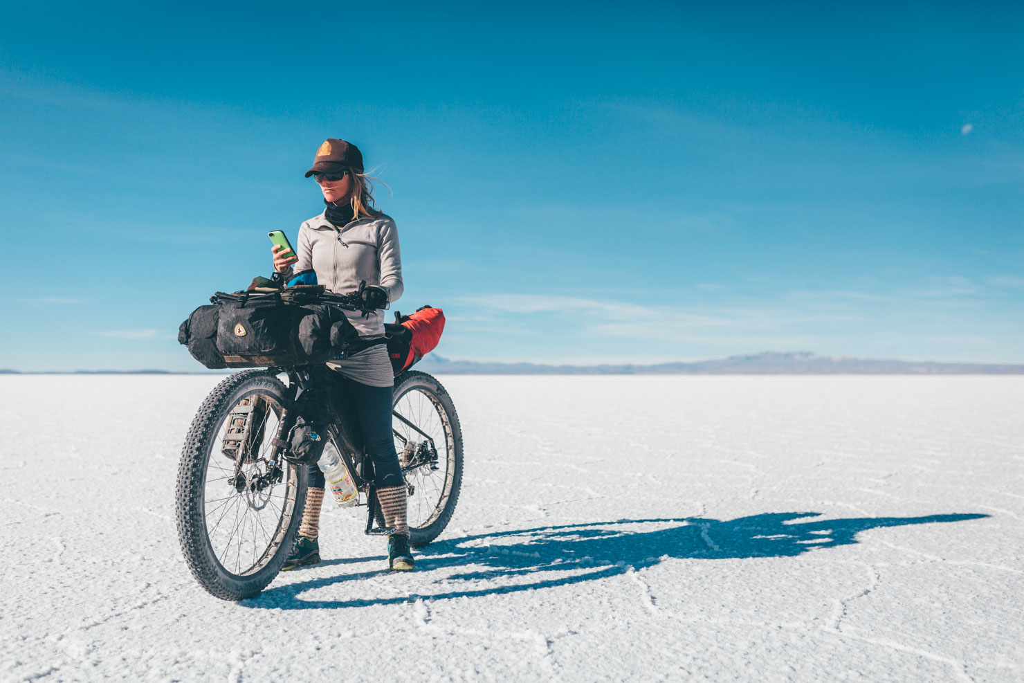
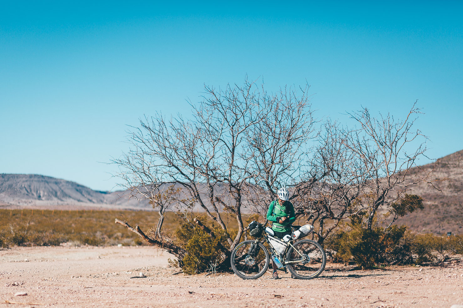
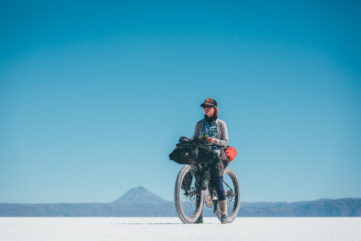
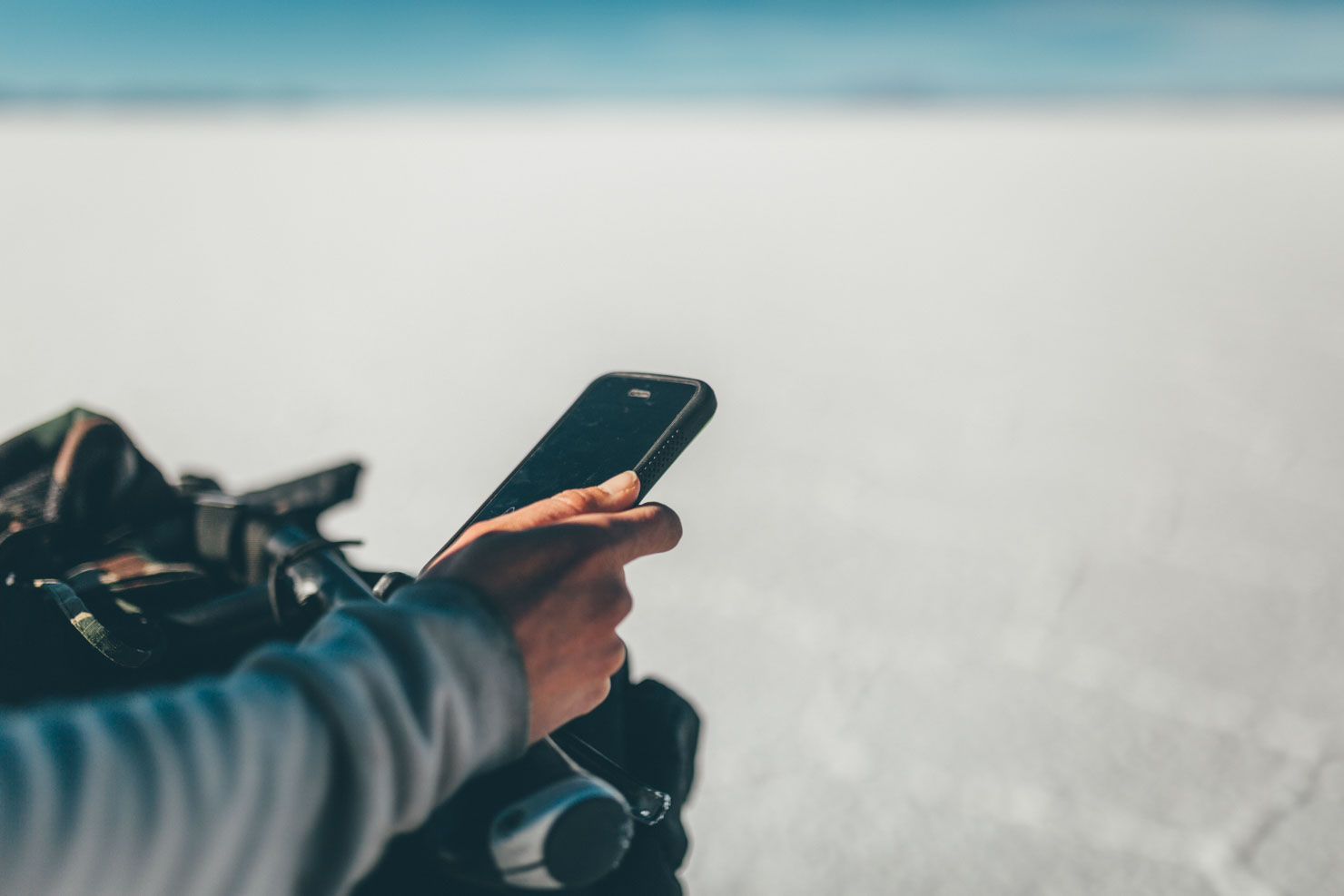
There are various ways to carry your phone. Stowing it in a Bedrock Tapeats, for quick and easy one-handed access, is a favourite method. If you’re keeping it on your body, smaller phones can be more travel-friendly than the ‘phablets’, even if the latter have enticingly large screens. Gossamer Gear does a nice shoulder strap pocket, or there are mounts that attach to the handlebars. Watch out for dust and rain though, unless you use a Lifeproof case with their Life Active Bike Mount. Loksaks are cheap and work very well too, if you’re on a budget. And always apply a protective glass screen, like those from Zagg.
Navigation Apps
There are several good mapping apps available geared towards biking and hiking, their differing price points generally a reflection of the diversity of maps that come included – some are more suited to backcountry exploration than others. Free apps are great, but bear in mind a one off fee still represents excellent value for money, given all the hard work that’s gone into them. Each of these apps utilize the built-in GPS of your smartphone to work with their supplied basemaps, along with downloaded GPX files.
Gaia GPS
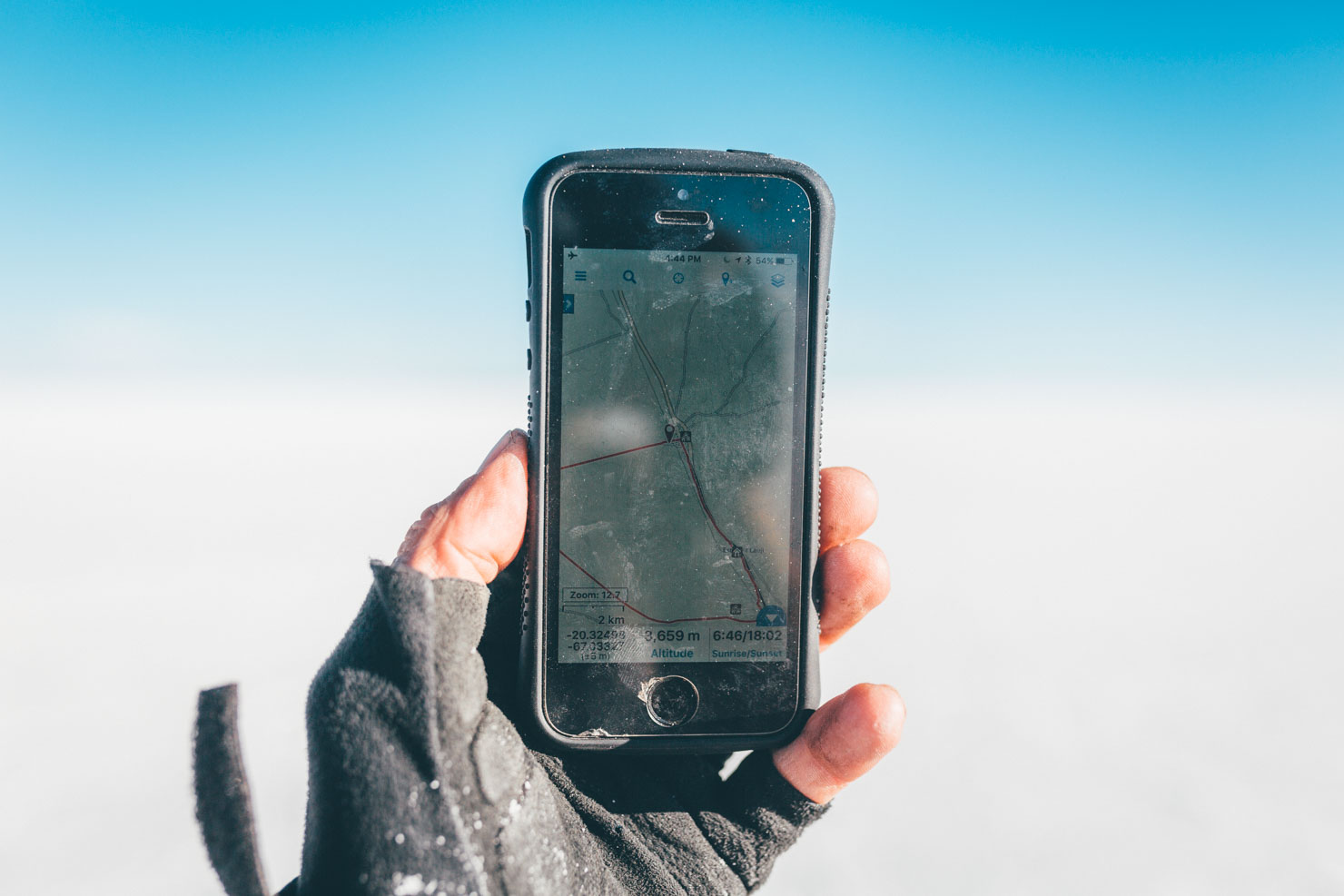
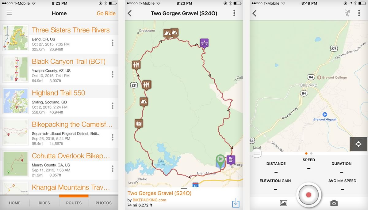
Our favourite app for backcountry bikepacking is Gaia GPS, which works on both iOS and Android devices. It costs $20, which you’ll quickly discover is money extremely well spent, given all of Gaia’s functionality. What’s more, Gaia is updated regularly, the support service is excellent, and you’ll enjoy unlimited access to a whole host of worldwide mapping layers, including USGS in the US and IGN maps in Spain, as well as various Google and OpenStreetMap (OSM) options. We’ve used it to navigate across the States, Europe, South America, Africa and Mongolia with great success.
Prior to your trip, we’d suggest tracking down the map that best serves your area, as these can vary from region to region. On a recent bikepack through Peru, for example, OSM’s OpenHikingMap proved the best option as it includes topo, altitudes, trails markings and an impressive level of detail. In Europe, we’ve found that OpenCycleMap offers highlighted trails and greenways as well. In the US, there’s a whole wealth of forest service topo maps to choose from.

Map tiles can be downloaded at different levels of detail, resulting in different file sizes. We favour Level 14 (1:48 000), as the download sizes are relatively compact, but the detail level is still very good. Here’s where Android devices score over iPhones – many models have an expandable memory, allowing you to use a dedicated Micro SD card to store all your maps, rather than having them eat into your device’s memory. If you only intend to follow a track, then Gaia has an option to download 5 tiles on either side of the line, called Download Map Along Track.
Gaia is far easier to use than a Garmin simply because your phone’s operating system is so much less clunky. For instance, it’s quick and easy to create named waypoints, or zoom in and out of areas you’re planning to explore, and make a quick outline of your intended route. If your route ends up changing or evolving as you ride, it’s a much better tool for scoping out the surrounding areas – Garmins are laggy and awkward in comparison.
Unlike many GPS units, smartphones don’t need to be tethered to a computer to import and export your files. If you want to import a gpx file of an intended route – whether it’s one that’s been shared with you, or you’ve created in a tool like Google Earth – it’s simply a case of attaching it to an email, and opening it straight into Gaia. You can sync all your routes online, creating both backups and an opportunity to share them. You can also access a web version that with a snap-to-trail function, which makes route planning and measuring the routes that you’ve created a breeze – and it syncs with your phone. Like any program, it takes some time to discover and familiarise yourself with all its functions. But apps go, it’s fairly intuitive and quick to use.
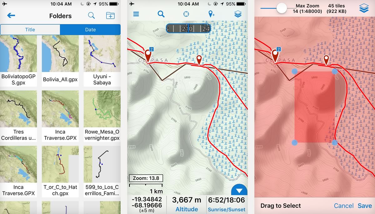
As an upgrade from the base model, a Pro version costs an additional $40 a year. This offers a whole new level of customisation and functionality, opening up extra features online and on your phone. Our favourites are the use of multi-layered maps – this can be particularly handy as layers include hill shading and public land boundaries. There’s also the ability to download polygon-shaped maps rather than rectangles, saving download time and memory, and print as many custom maps as you like.
NOTE: The new Gaia App launched on May 22, 2017. Read more here. If you’d like to try Gaia, their team has offered BIKEPACKING.com readers a free 6 month Premium Membership (which includes NatGeo Trails Illustrated maps). To redeem this offer, click here, download the app on your mobile device, and log in to your account from the app Settings to start using your Premium Membership.
Google Maps
We’ve long used Google Maps for general navigation and route planning, especially around urban areas. It’s also extremely handy for tracking down bike shops, gas stations, places to eat and lodgings. Until recently, you needed to be online to access it. The good news is that you can now download relatively large sections of maps – 120,000 square kilometres – onto your phone for a limited period of 30 days. It’s a function that’s particularly useful when navigating through a city on a bikepacking route, particularly in situations where you don’t have cell service – when you’re overseas, for instance.
As a tool for backcountry navigation, Google Maps can be more limited. For a more thorough examination of the lay of the land, it’s generally best to swap over to Google Terrain or even Google Earth – both of which we’ll be discussing in a future instalment. Although Google Maps can be used to plan cycling routes, we’ve noticed it often suggests journeys that cross private land. Be aware that the voice of Google is not infallible.
Ride with GPS
Ride With GPS is another of our favorites. The basic version is free but you’ll need to subscribe it access all its features. RWGPS allows you to navigate your route with the Offline Maps feature, where you can pre-download the route and map tiles before heading out. It also enables access to routes from thriving community with a vast selection of shared routes – in fact, this is the program we use to share routes on BIKEPACKING.com. Unlike Gaia, however, there’s no means to plan a route directly from your phone, and it doesn’t include useful map layers such as USGS. The functionality is also far more limited from your phone; you’ll need to use the web browser version to access all its great route-planning features. You can download GPX files seamlessly from your RWGPS account and use the app to navigate while offline.
Other useful apps
Of course, you can use your phone to plan and then record your rides as well. There are several other good apps available, including Google Earth, Wikiloc, and MTB Project, all of which are valuable resources when seeking out new places to ride. Strava can a useful way to plana route too. Its Heatmap is a great way of seeing popular placesto ride and gpx files can be downloaded if you have the Premium version.
Maps.me is favourite. This free offline mapping is often favoured by long distance, international bike travelers. Although lacking in topography, Maps.me is surprisingly powerful and the level of detail can be very good, depending on the region. The mapping itself is really clear, which helps offer a good overview of an area. We find it particularly useful for navigating big, unfamiliar cities, as you can quickly download the mapping for entire country before you arrive. Its routing feature works offline too, which is especially handy.
Amongst Android users, Orux, AlpineQuest, and Backcountry Navigator come highly praised too. Bear in mind that some navigational apps are especially good at certain regions, in terms of the basemaps they provide. If you’re headed to Russia, Mongolia or other countries in the former Soviet Union, the free Soviet Military Maps are a fascinating resource. Unfortunately, this is only for for Android users.
For more details and ideas on how to put a good ride together, see our Complete Route Planning Guide.

Battery Life
As powerful as it is, a smartphone’s Achilles tendon is a distinctly poor battery life, especially when recording a route. If it’s an overnight or weekend bikepack, chances are you can get away with get away with a backup battery. This could be a replaceable battery, in the case of most Android phones, or a USB external ‘cache’ battery pack for integrated devices like iPhones. Nowadays, there’s a large range of very affordable USB battery packs available online and in big box stores, sized relative to their capacity and output. 1500-3000 mHA will generally garner a single charge, depending on the smartphone and its screen size. There are also larger battery packs, 6000 mHA and upwards, that can boost the lifespan of your phone to several days, and will charge your device more quickly. These are inevitably bulkier and heavier, but can be worth it depending on where you’re heading. We’re planning a post on the best models suited to bikepacking – in the meantime, the Wirecutter has a very thorough roundup. Anker is a brand that often comes recommended with a wide range of options. Technology is changing quickly. When purchasing a battery, consider both the charge time of the unit itself and its output to your phone, as these can vary greatly.
Above all, be thoughtful with your phone usage. Turn off all background apps and keep your phone in Airplane mode in the backcountry – you’ll still be able to access the GPS. If it’s cold, stow your phone in your sleeping bag at night to help preserve battery life. And consider how bright you need to run your screen. As a rule of thumb, it pays to turn it off if you’re not planning on using your phone for six hours or more.
For recording longer routes, pairing a smartphone with a relatively cheap and compact GPS cycling computer is a good option – there’s a range on the market from Lezyne, Garmin, Mio and Cateye – which are fairly efficient for recording. Lezyne’s Macro GPS is an excellent option.
Dynamo hubs and solar panels
For longer trips, consider carrying solar panels in areas where the sun is consistent, or a dynamo hub for charging at all but the slowest speeds of riding/hike-a-biking. We prefer dynamo hubs, though solar panels have their place when terrain is particularly challenging. They’re a lot cheaper too.
Although it requires a large financial investment, our current ultimate dynamo setup is Schmidt’s SON 28, combined with Sinewave Cycles’ Revolution or Reactor, devices that convert electricity generated by your hub into a USB-friendly outlet. The Shutter Precision PD 8X is a more economical hub option, though earlier models have had issues with bearing life (Logan’s failed after just a few hundred miles – newer models are said to feature superior bearings.) In the US, have a chat to Cycle Monkey, who have experience building wheels with both brands of dynamo hubs.
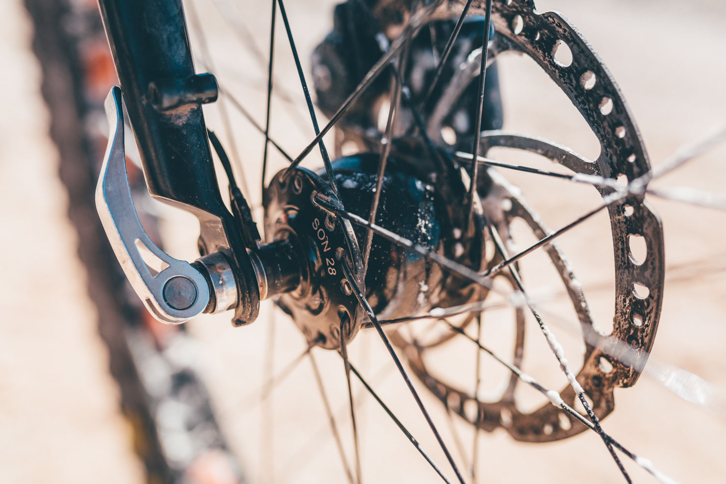

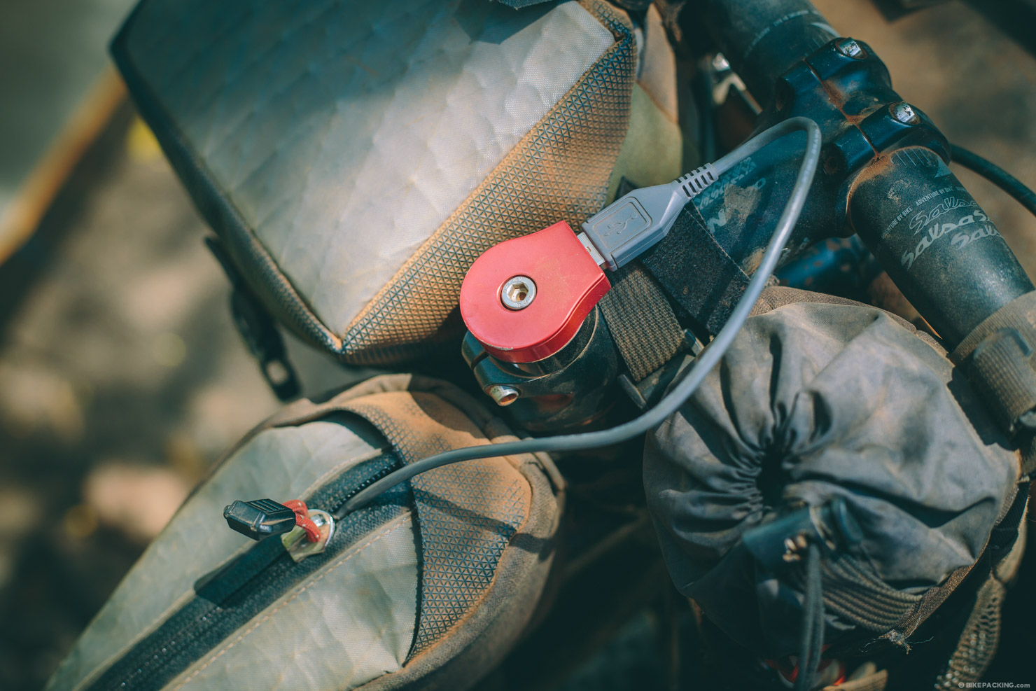
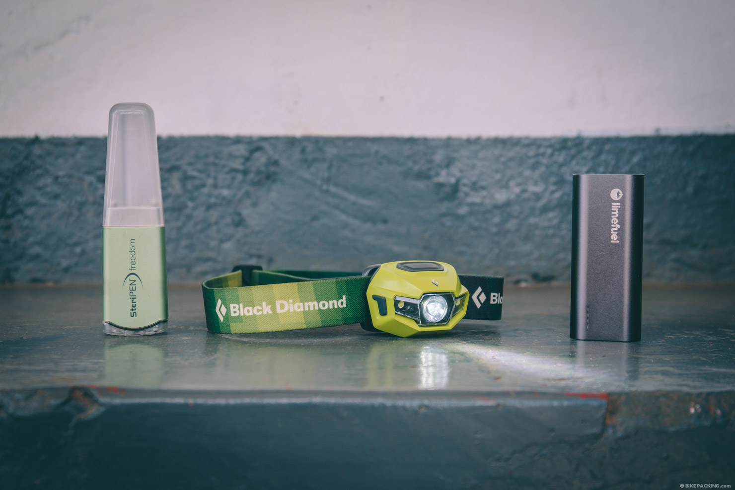
Once your bikepacking rig is set up with a dynamo, you’ll likely wonder how you ever survived without it. We use ours to charge a whole host of USB-powered devices, like Black Diamond’s ReVolt headlamp, a SteriPEN Freedom water purifier, a backup battery pack and even camera batteries. Test it all out first though. Dynamo hubs produce a relatively low wattage so charging times tend to be slower, depending on the kind of terrain you’re riding, and the speed it dictates. Sinewave Cycles’s Revolution kicks in at 3.5mph (5.6kph) but doesn’t offer a full charge until you hit 9mph (14.5kph). Great for dirt roads, less so for technical singletrack.
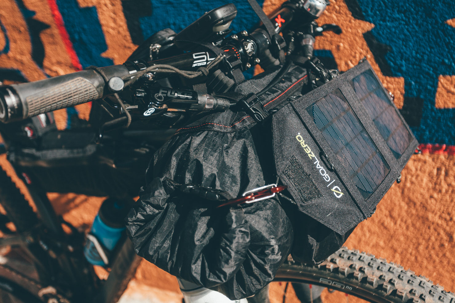
Otherwise a solar panel – strapped to a roll bag, seat pack or backpack work – works well too, especially when riding slow going singletrack. We’ve had success with Goal Zero’s range, finding a day of riding in the likes of New Mexico was enough to charge an iPhone in the evening. For incredibly fast charging, and a robust build, Anker’s Powerport Solar comes highly recommended. It’s $60 and weighs 417g, making it a great option for a longer trip.
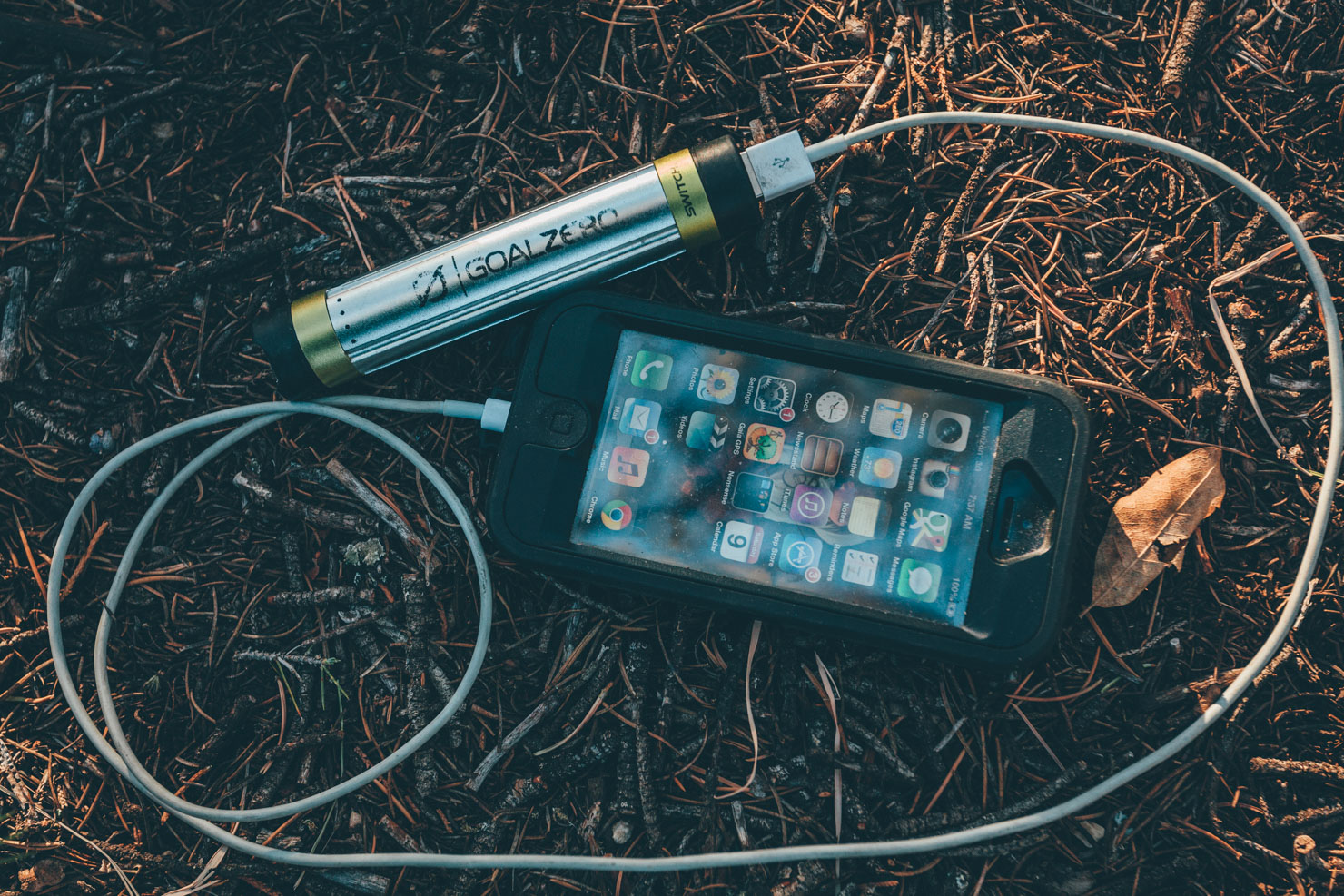
Whether using a dynamo or a solar panel, we’re recommend leaving an external ‘cache battery’ charging throughout the day in your framebag or top tube bag – see Battery Life above. It’s less efficient than charging your phone directly, but given how sensitive smartphones can be to being charged – particularly iPhones – it seems to work best. It could also help preserve your expensive device’s battery life in the long run. Make sure the battery is secure – if it rattles around, it’s likely to damage the cable port. If you’re using an iPhone, invest in a more rugged third party cable. The stock ones are woefully prone to splitting.
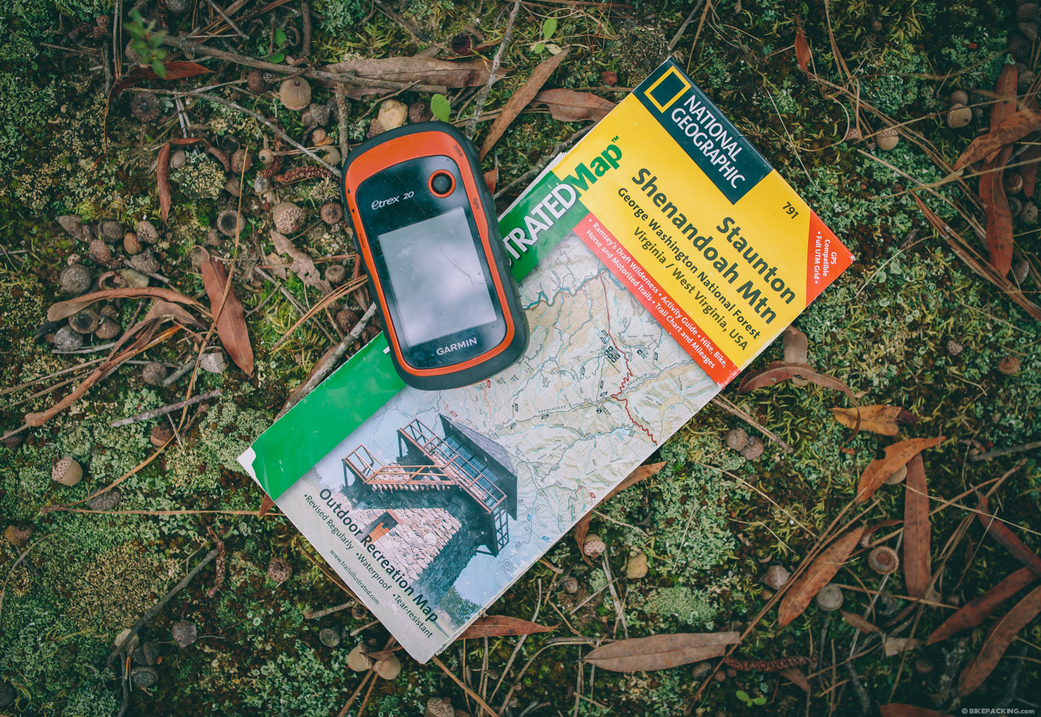
Dedicated GPS
A traditional GPS still has its place
If it’s a complicated, challenging multi-track route – like the Stagecoach 400 – we still recommend a dedicated GPS unit, mounted to your handlebars. The screen is much clearer, and it’s easier to orientate in the direction you want, at a scale that works for the speed of your ride.
A GPS is also easier to use with thick gloves, and out in the rain – even with a protective case, smartphone screens can be sensitive to droplets of water. A GPS like the Garmin eTrex 20 is inherently much tougher. And most important, the battery life is really good. A set of double lithiums will garner 40 or more hours of use, even recording a track – though they’re expensive and ecologically unsound. Rechargeable NiMH batteries are an option too – get the best ones you can find, ideally 2800mAh in capacity, like these ones from B&H.
Pros
- Smart phones have an intuitive advanced operating system that makes traditional GPS units seem very dated and clunky.
- Considerably easier than a GPS unit for route finding out on the trail.
- A quality navigation app gives you a massive variety of maps to draw upon.
- Creating and naming waypoints is quick, as you can use your smartphone’s ‘keyboard’.
- Smartphones don’t need to be tethered to a computer to import and export gpx files.
- You probably already have one!
- Doubles as a phone, of course! And they feature a whole gamut of other useful tools.
Cons
- Poor battery life means carrying a spare battery, or a USB cache battery, is likely to be required for any multi day camping trip. Or running a dynamo hub/solar panel.
- Less suited to fast, turn by turn singletrack navigation compared to a dedicated GPS, whose screens tend to be clearer to see.
- Much less robust than a GPS unit, unless you invest in a specialist case, which is expensive.
- Tricky to use with gloved hands, or when the screen has moisture on it.
- Less suited to extremes in temperature.
- In some situations, a dedicated GPS offers superior mapping, although Garmin’s basemaps are region specific and can be very expensive.
- Drains battery quickly if recording a route – consider using your phone in conjunction with a simple (and very affordable) GPS cycling computer.
Wrap up
In our day to day city life, we may lament how tethered we’ve become to our electronic devices. Out in the wilds, combined with satellite imagery and detailed mapping that’s now available, they open up a whole new vein of exploration potential.
Depending on where you’re headed, the ultimate bikepacking setup is still a combination of both a dedicated GPS and a smartphone, as they both offer distinct advantages. When it comes to fast singletrack with multiple junctions, a Garmin is still the better choice – and the battery life is hard to beat too. But the more you experiment with your smartphone, the more you’ll appreciate what a powerful navigational tool it can be. For exploratory rides, or routes that don’t require quick, turn by turn navigation, it’s definitely our preferred option.
And besides, there’s almost nothing to buy, as you probably already have one…
Do you have any tips, cell phone apps or gear feedback you’d like to share? Leave us a comment!
Please keep the conversation civil, constructive, and inclusive, or your comment will be removed.
Share This


