


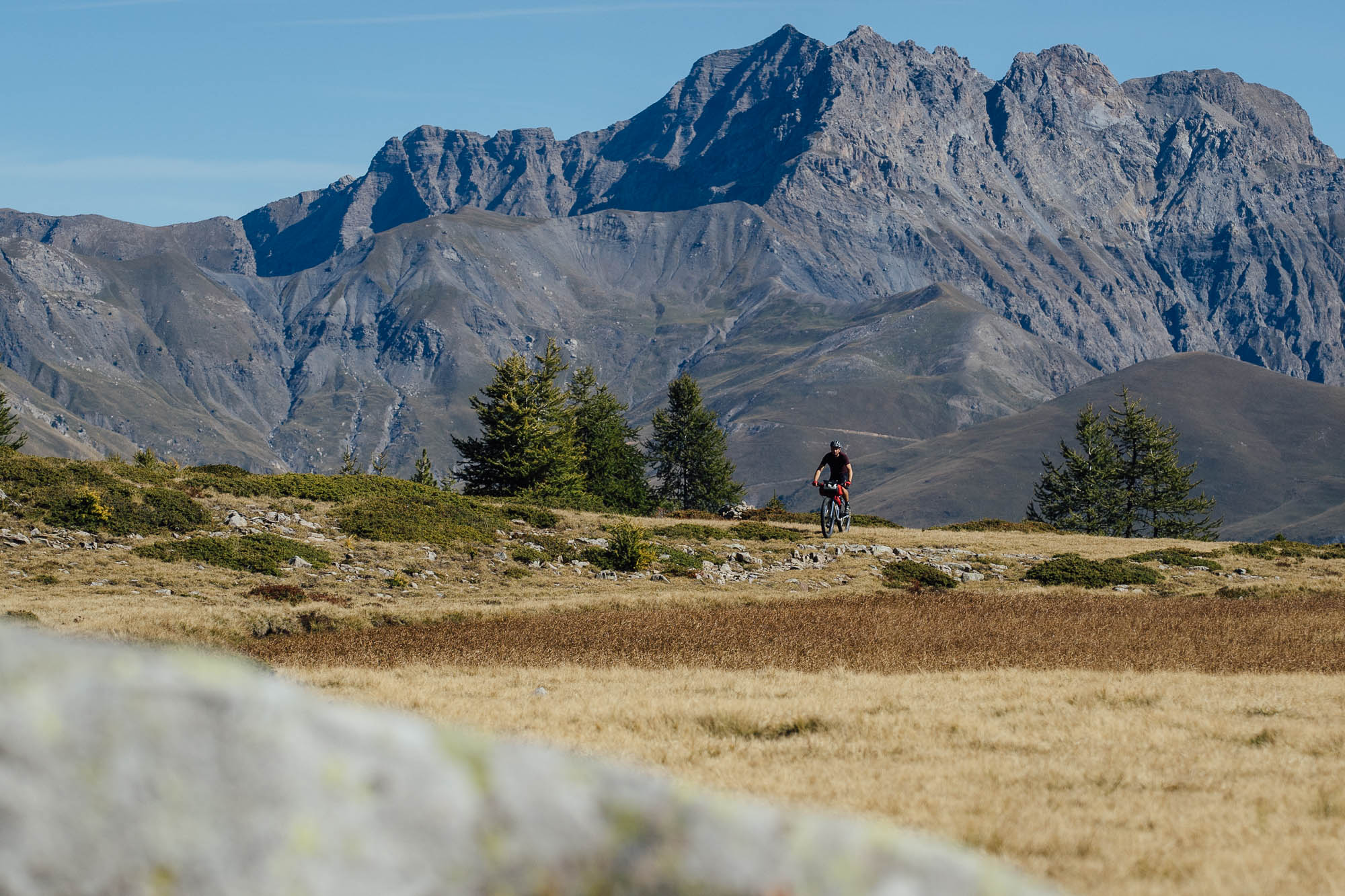
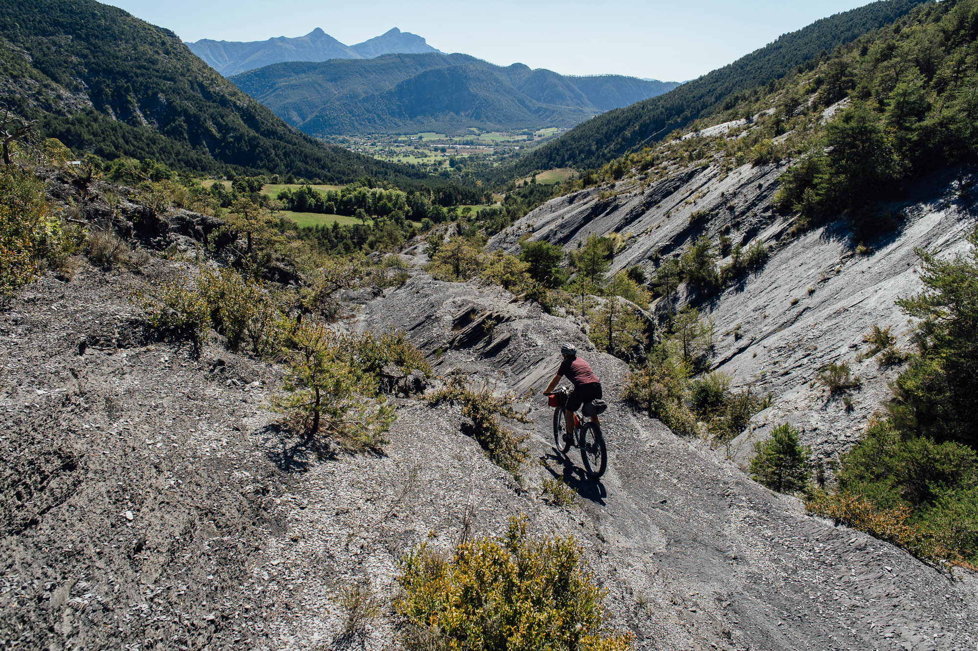
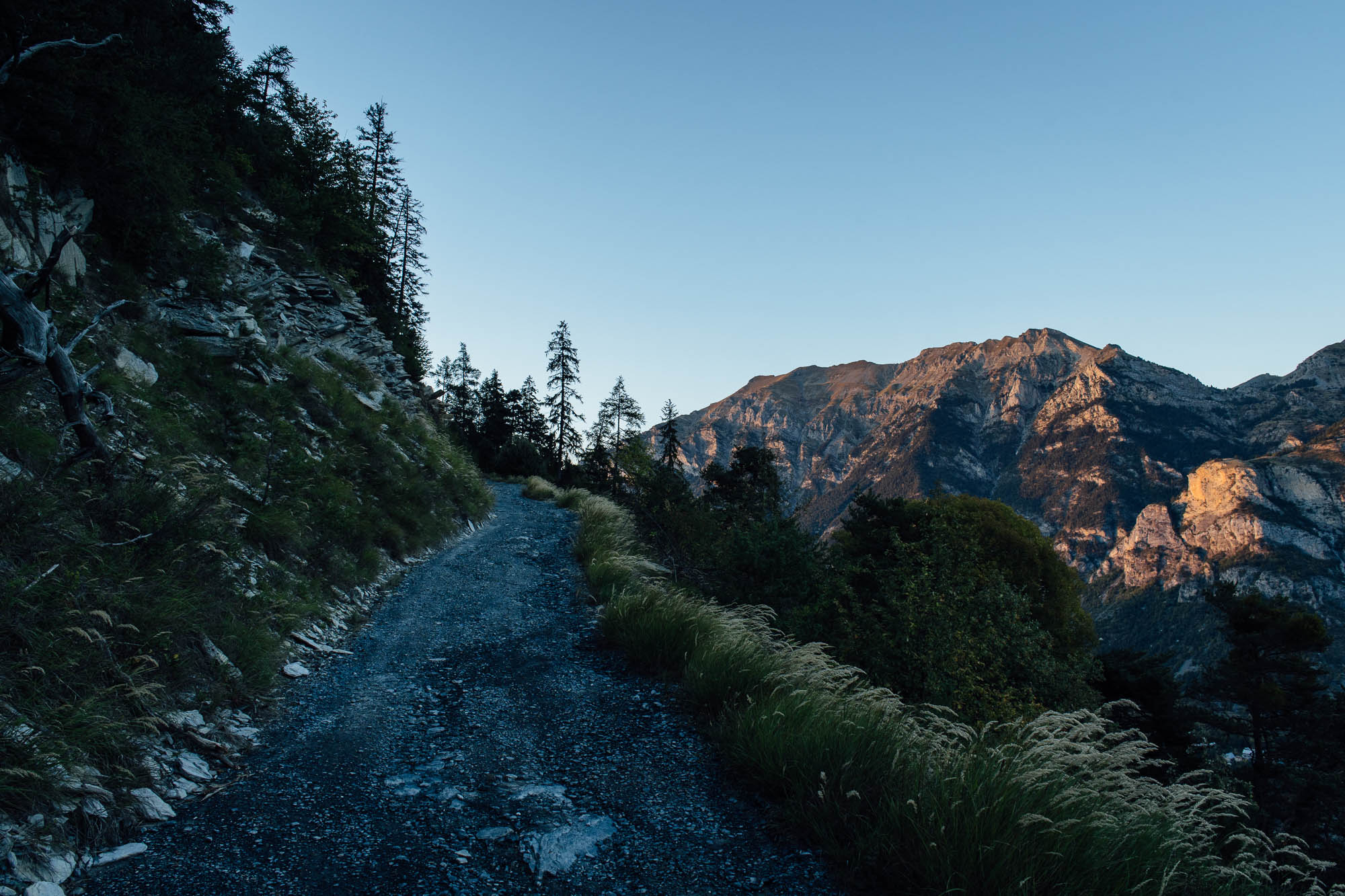
Ride Gallery: Cass Gilbert on the Grande Traversee L’Alpes-Provence
Share This


Hot on the heels – or should we say, the tire tracks – of posting our Grande Traversée L’Alpes-Provence route guide, Cass Gilbert and amigo Mike Howarth head out to the south of France, before the season comes to an end. Check out the gallery, and if you’re planning on riding the route, read on for extra hints and tips on deciphering the logistics of the ride…
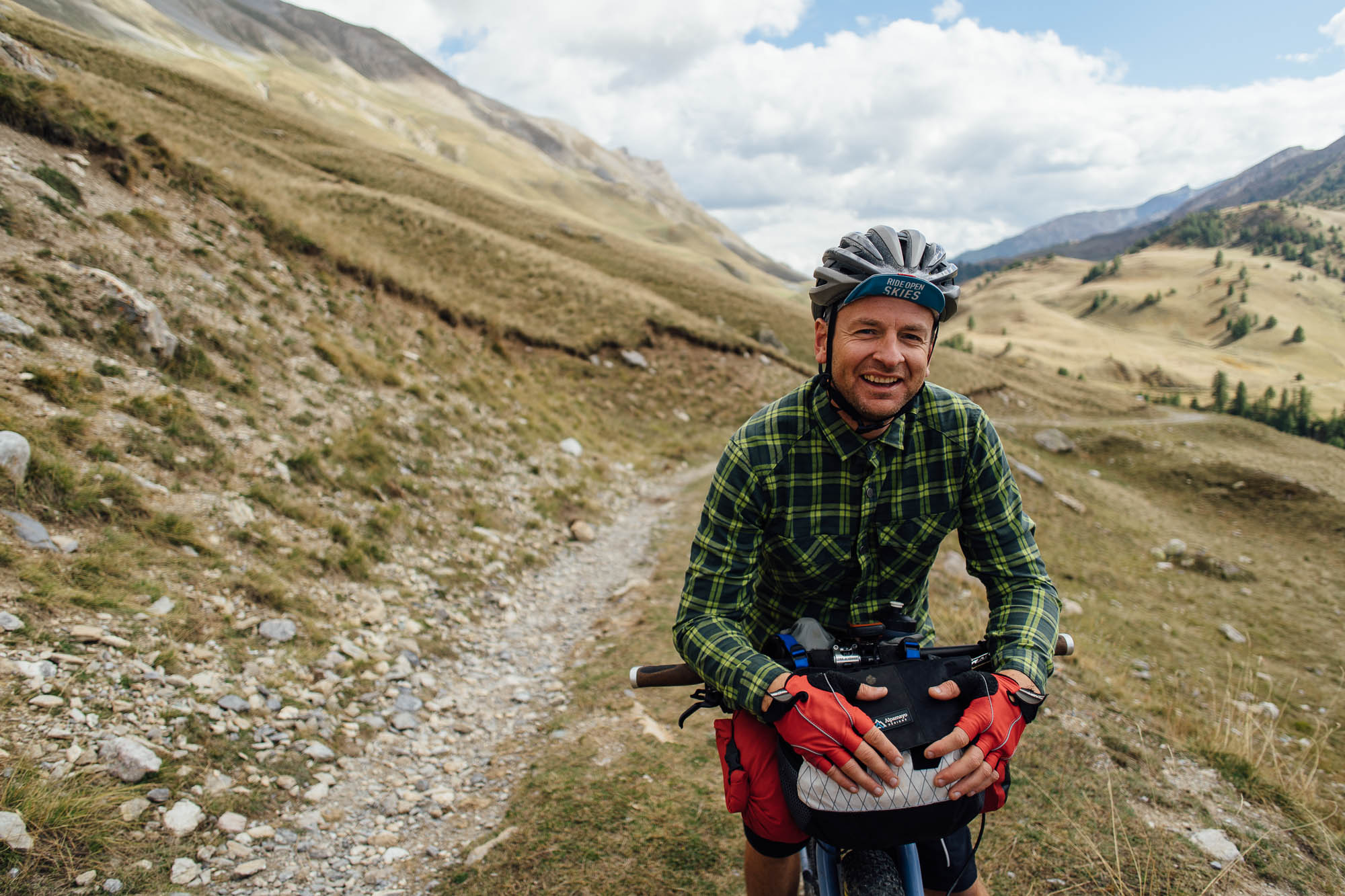
Several years ago, Mike and I were pedaling our way through South America at the same time. We met up for a beer in Santiago, Chile, and ended up spending nigh on six months riding together through the Andes. Looking for an excuse to share some mountain miles again – and inspired by Tales on Tyres’ imagery and their high praise of riding in Provence – we settled on the Grande Traversée L’Alpes-Provence, as it’s a route that fit within our timeline and travel logistics.
Actually, travel logistics needs a little expanding upon from our original post. As wonderful as this ride is, it begins at the very tip-top of the Col de Larche, a high mountain pass on the French/Italian border. And, as lovely as that spot may be, it’s actually kind of awkward to reach by public transport.
Logistics expanded
Here’s how we did it. As Mike’s based in the UK, he flew with EasyJet into Nice. But if your bike is bagged small enough (120x90x40cm), in a Ground Effect Tardis for example, you can also take the Eurostar/TGV.
The #99 bus runs from Nice airport to Nice Ville train station for 6 Euros and takes 20 mins. Or, if you’re in a hurry to catch a connection, an Uber will cost 10 Euros and takes 15 minutes. He left his bike bag in the train station’s left luggage (7.50 Euros for the first day, then 6 Euros a day afterwards), which is half the price of the one at the airport. Opening times are 8:00 am to 8:00 pm in the summer, and 9:00 am to 7:00 pm in the winter. If you do want to leave your bag at the airport left luggage, which has longer hours, there’s a stand and tools for building up your steed, and a bike path straight into town.
As Barcelonette – the closest town to the start point of the route – doesn’t have a train station, the logistics of getting to the top of the pass to begin the ride involve a catching a train from Nice to Aix-en-Provence and onwards to Gap (7hr 45mins), followed by two regional two buses. Given how tricky it can be to line up connections – and that buses can’t guarantee they’ll take bikes – we decided instead to take the train to Cuneo in Italy (18 Euros + 3 Euros for a bike, 4hr) and ride to the start point. There are early morning trains from Nice that arrive around midday. We had lunch on the square, then followed the signposted cycleway (Lungo Gesso cycleway PFGS1) up to the Col de Larche. It’s around 65km and climbs from 500 to 2000m. Surfaces are mostly paved, but it’s a lovely, mellow ride, and almost completely traffic free. As we left late, we wild camped half way up the valley, then finished off the climb in the morning. There’s even an Italian refugio at the top for an espresso and lunch! Note that there’s also a bus from Cuneo to Argentera, the last village before the pass, but the timings didn’t coincide with our trip, and it takes four hours for a relatively short distance. Also, we couldn’t figure out if it takes bikes or not.
Getting back to the starting point is more straightforward. The train from Manosque to Nice takes around 5.5 hours, changing in Marseilles. It’s 50 Euros and there’s no charge for bikes. Make sure you buy a standard train ticket, as the TGV that runs along the coast doesn’t always have spots for bikes. We tied in our last day with a midday train (timetables can be found here). On his return, Mike bagged his bike at the train station, changed into fresh clothes that he’d left in his bike bag for the flight, then hopped on the airport shuttle bus for an evening flight home.
If you’re coming from the UK or elsewhere in Europe, note that another option would be to catch a train down to Aix-en-Provence or a flight to Marseilles, store your gear, and catch a bus from there to Barcelonette (you’ll need to make sure your bike is bagged small enough, 120x90x40cm, if you want to put it in the TGV from Paris). LER 28 runs between Marseilles and Barcelonette, via Aix-en-Provence. Bikes aren’t guaranteed though, and you probably won’t be able to fit more than two on the bus at a time, with the front wheels removed.


Timeline
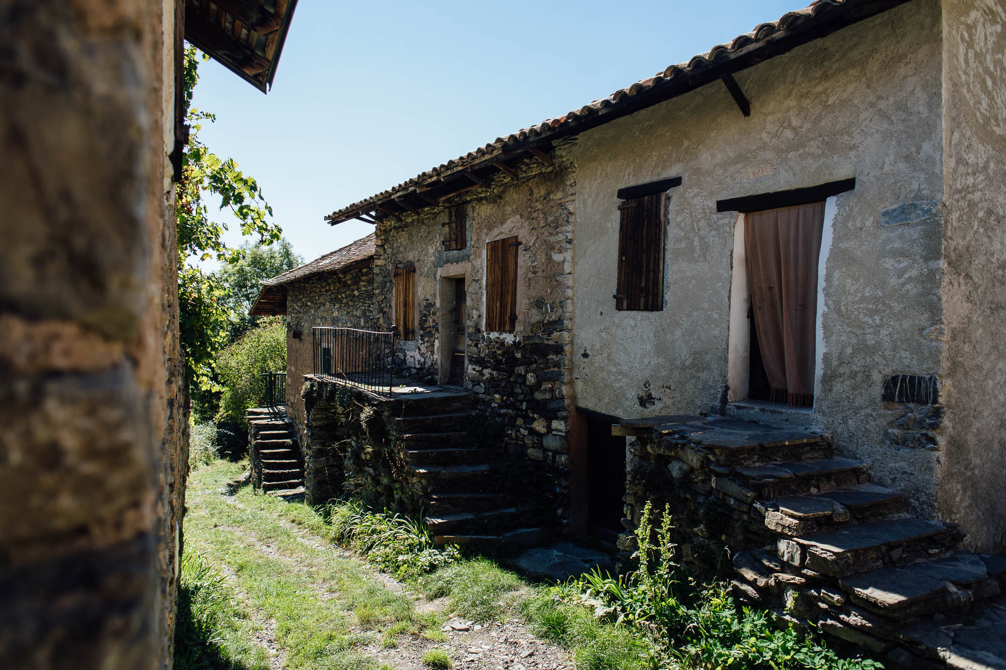
Including the time spent getting there via Cuneo, the ride took us seven days, as well as a short last morning in the saddle to get to the train station in Manosque, followed by the rest of the day for travel logistics back to the airport. We’d happily have allowed another half day en route for some time off and to explore more Provençal nooks and crannies; wandering village backstreets is a pastime in itself. If you end up behind schedule, there’s plenty of chances to shortcut the official route using minor, low traffic D roads, as it takes a number of indirect loops.
Weather
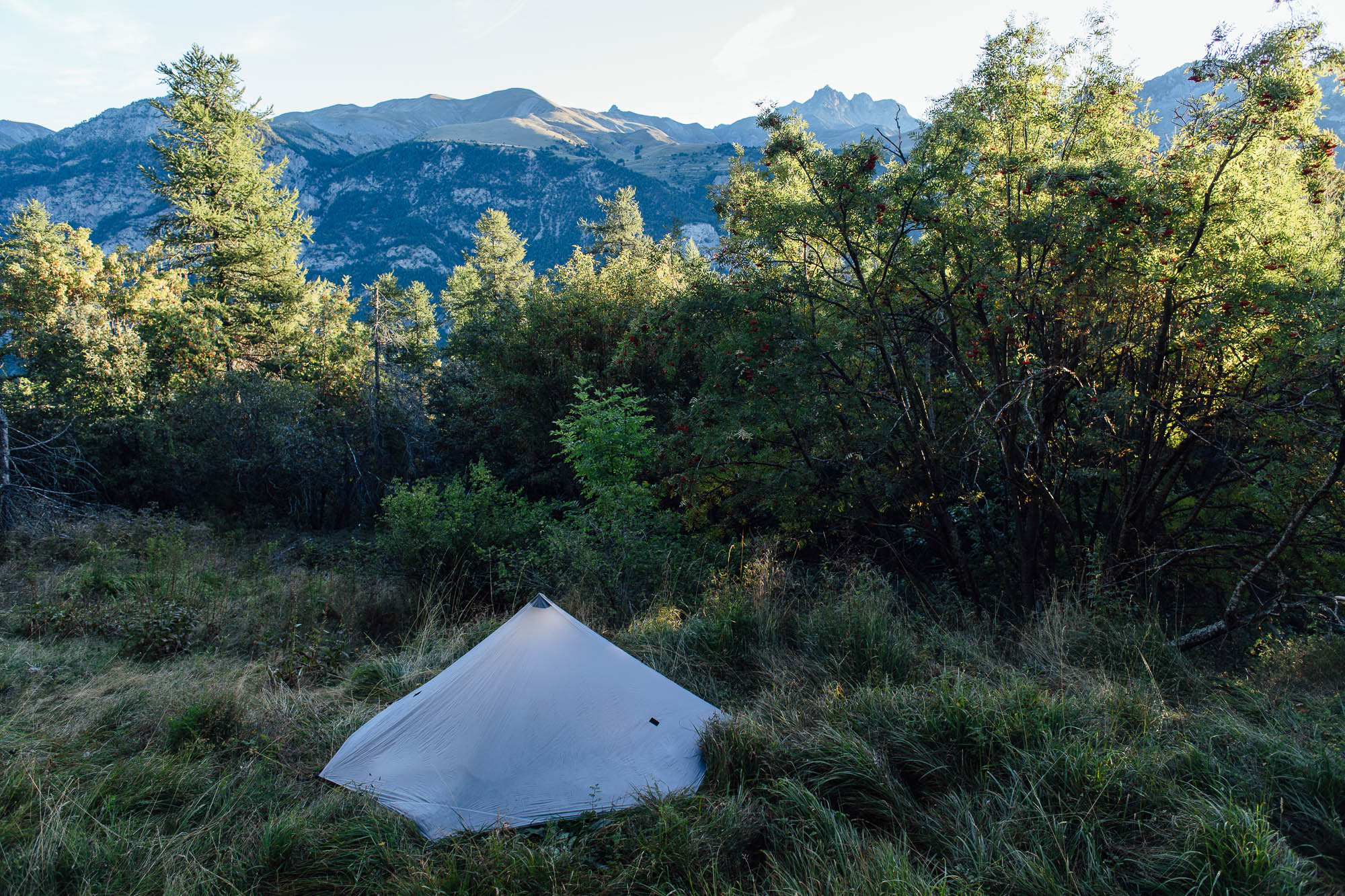
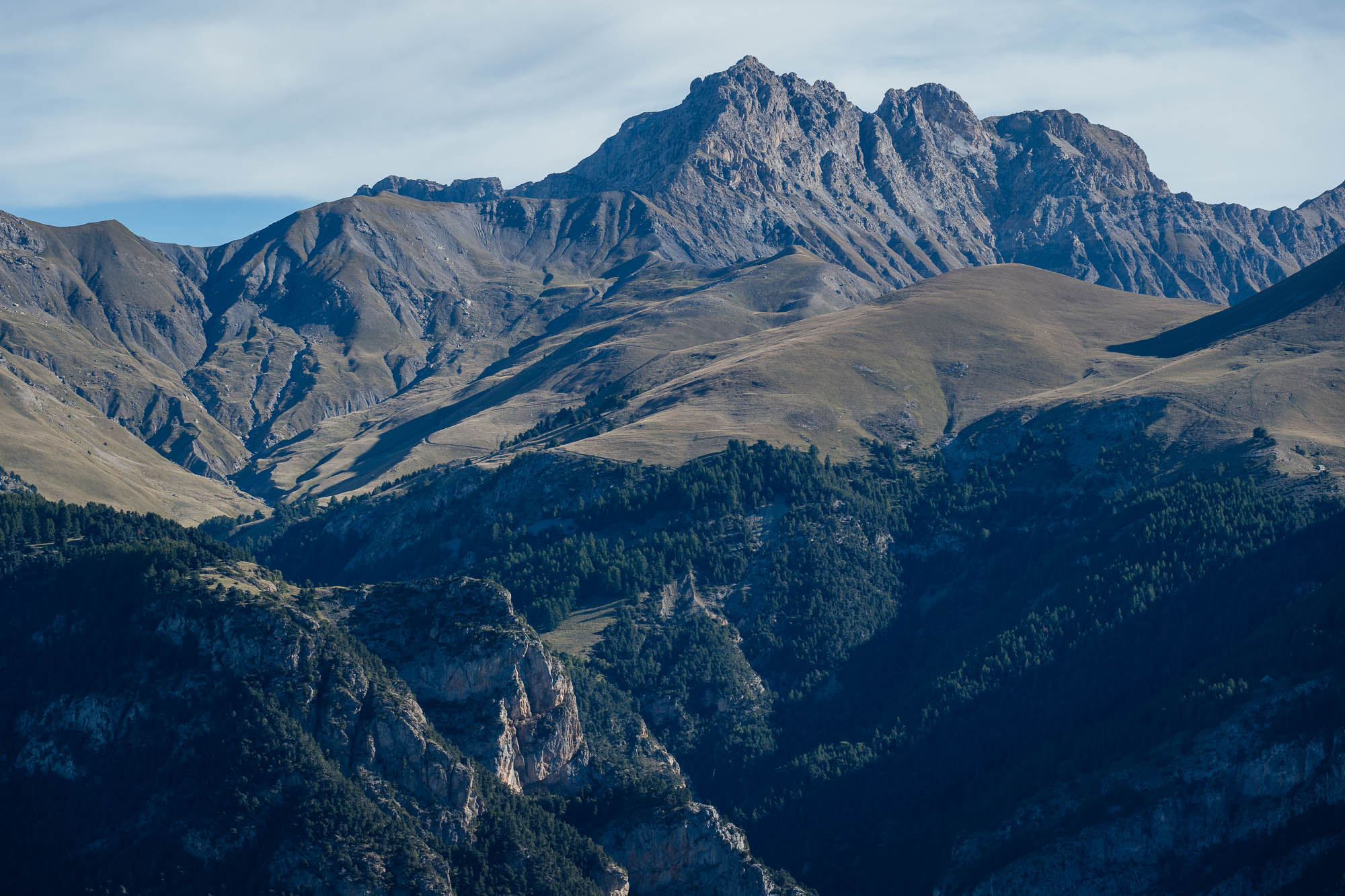
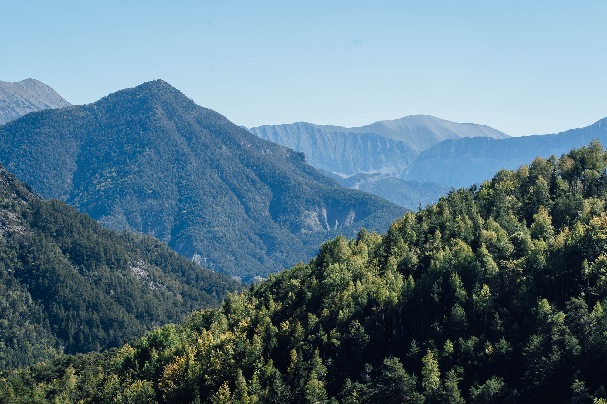
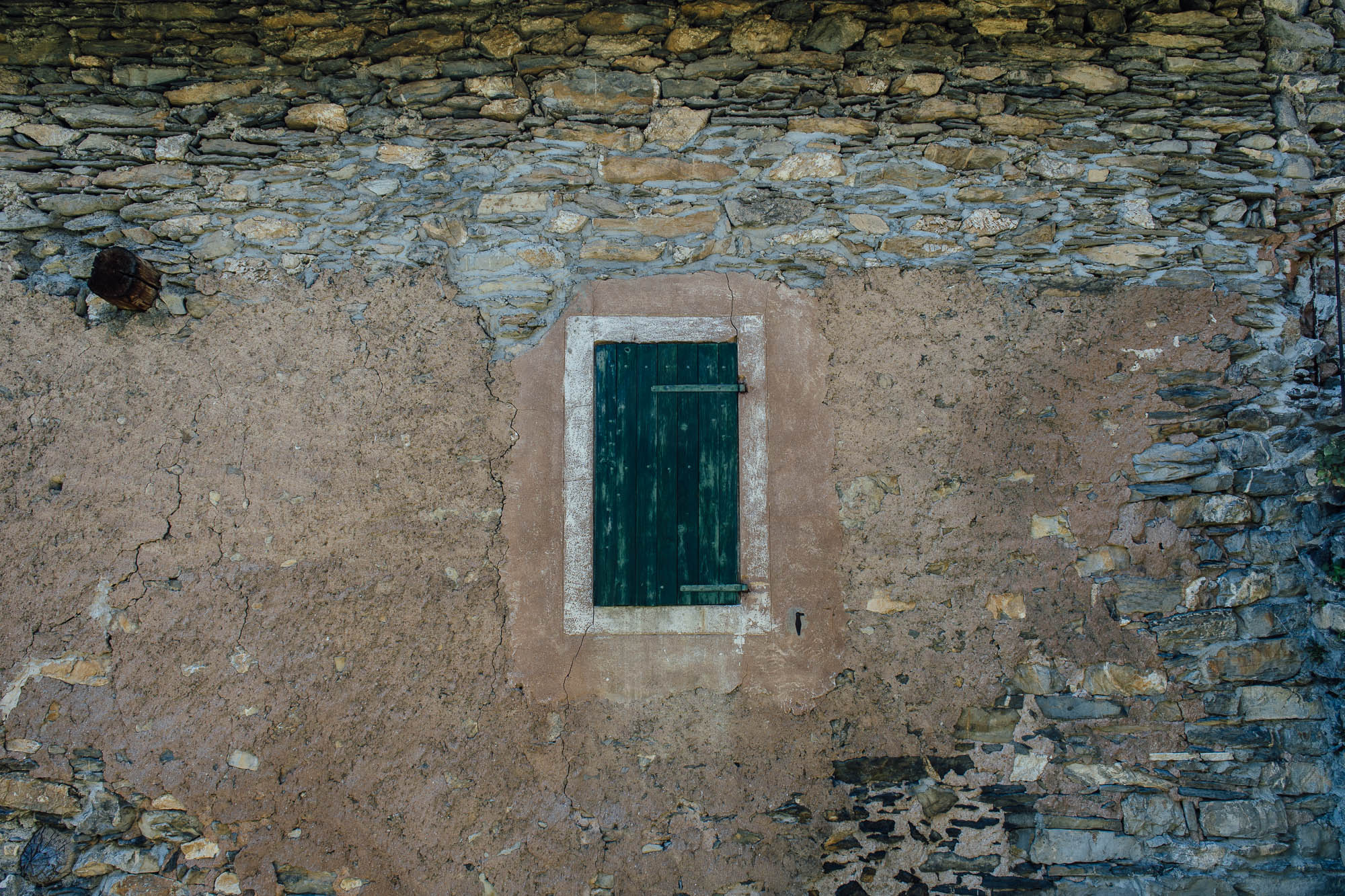
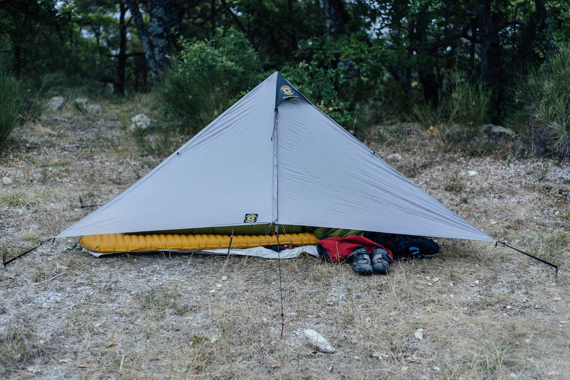
The Grande Traversée L’Alpes-Provence connects Provence’s high alpine passes to its warmer lowlands. Mike had his sleeping setup pretty much dialed: a 0°C (32°F) Cumulus 250 quilt, a Therm-a-Rest NeoAir, a Six Moon Designs Deschutes, a Tyvek groundsheet, and an ultralight Bora Gear bivy bag for additional protection if it rained, or a barrier against dew if sleeping out under the stars. We were really lucky with the weather, hitting heavy rain only on our last night and the final day. But even if the weather gods aren’t on your side, a good quality waterproof and warm layers are a must in the mountains. And be sure to check for storms. Oh, and much of this route’s steep and techy singletrack – particularly prior to Digne-Les-Bains – is on limestone, so beware when wet.
We rode the route in early October, which is about as late as I’d want to tackle it. Mid-September is likely ideal, when the days are a little longer. The mornings were chilly and often damp, delaying our departure whilst we waited for the sun the dry out our gear and warm our spirits. Official campsites are also beginning to close around this time of year, so make sure you check their websites if you intend to use them.
We missed the full bloom of the lavender fields, but we were glad not to be hitting the route in mid-summer, when the lowlands are extremely hot. Carrying two bottles of water was generally enough when we rode it, given the number of fountains and streams there are along the way. You’d certainly need more in the summer. We had a Steripen, too, just in case we needed to purify water from streams, as not all the fountains have potable water (look for an Eau Potable sign to be sure the water’s been checked).
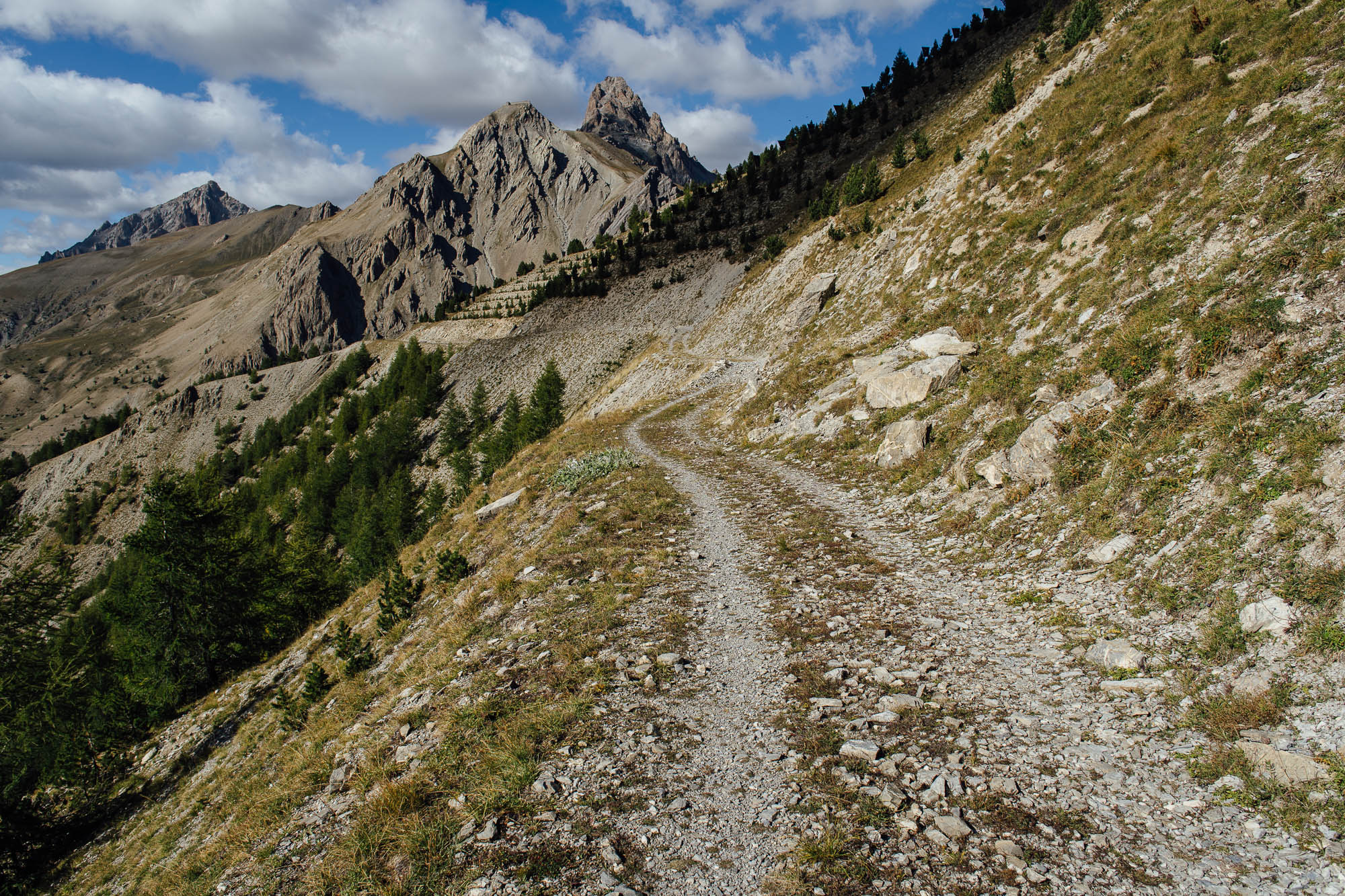
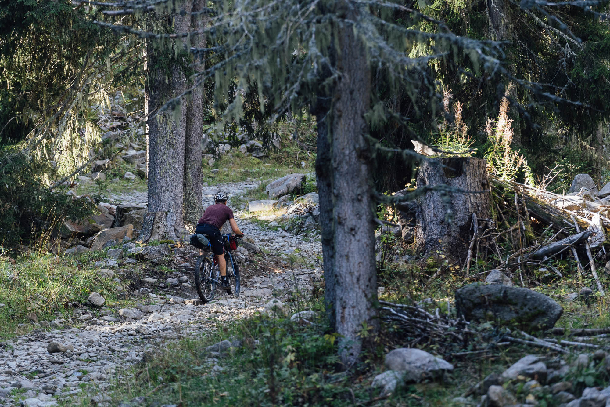
Trails
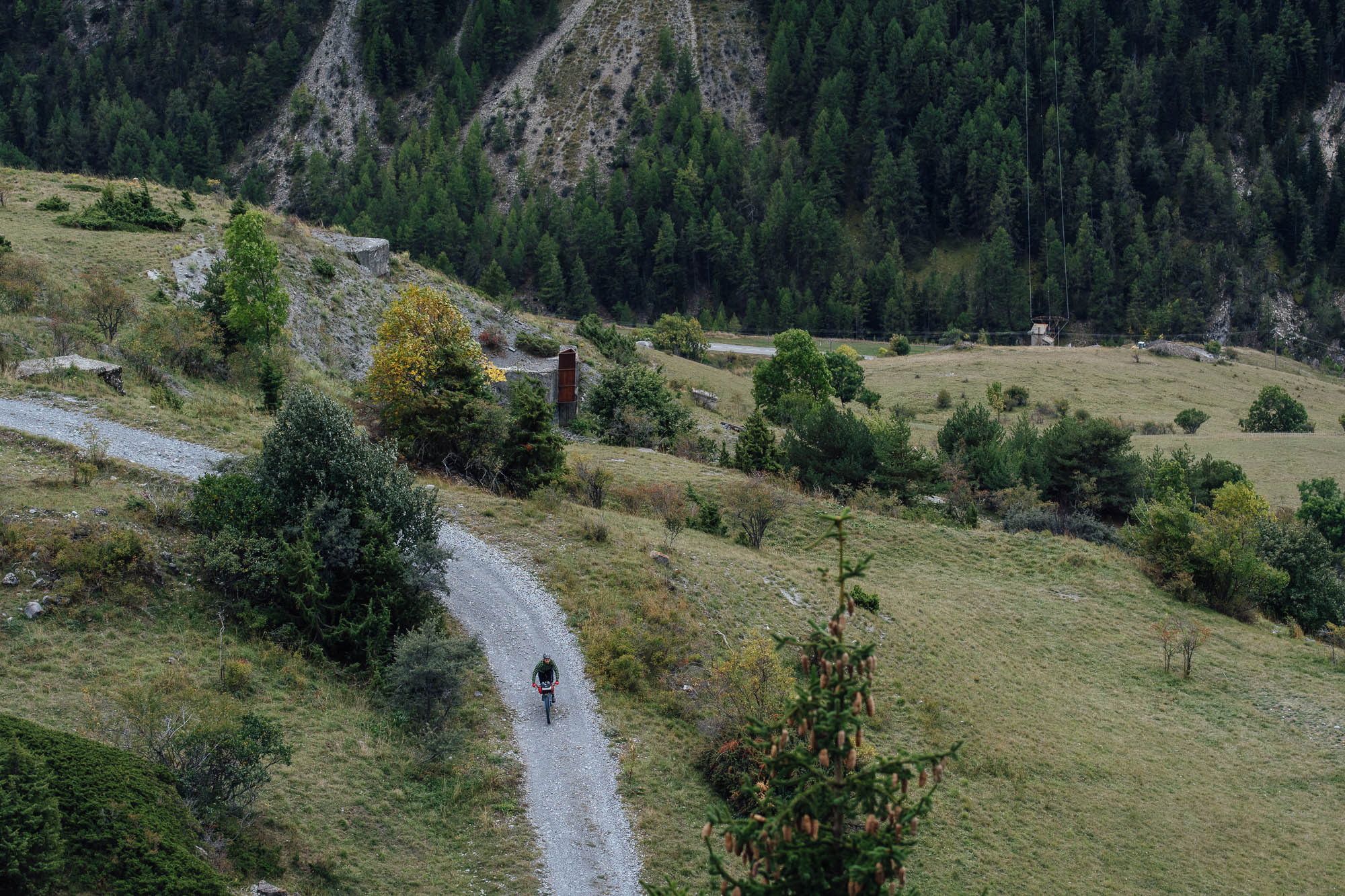
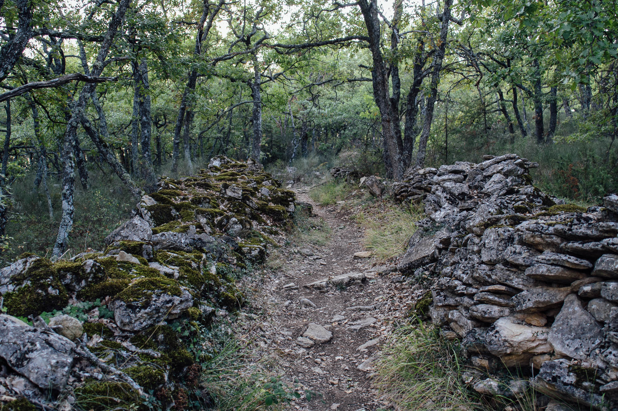
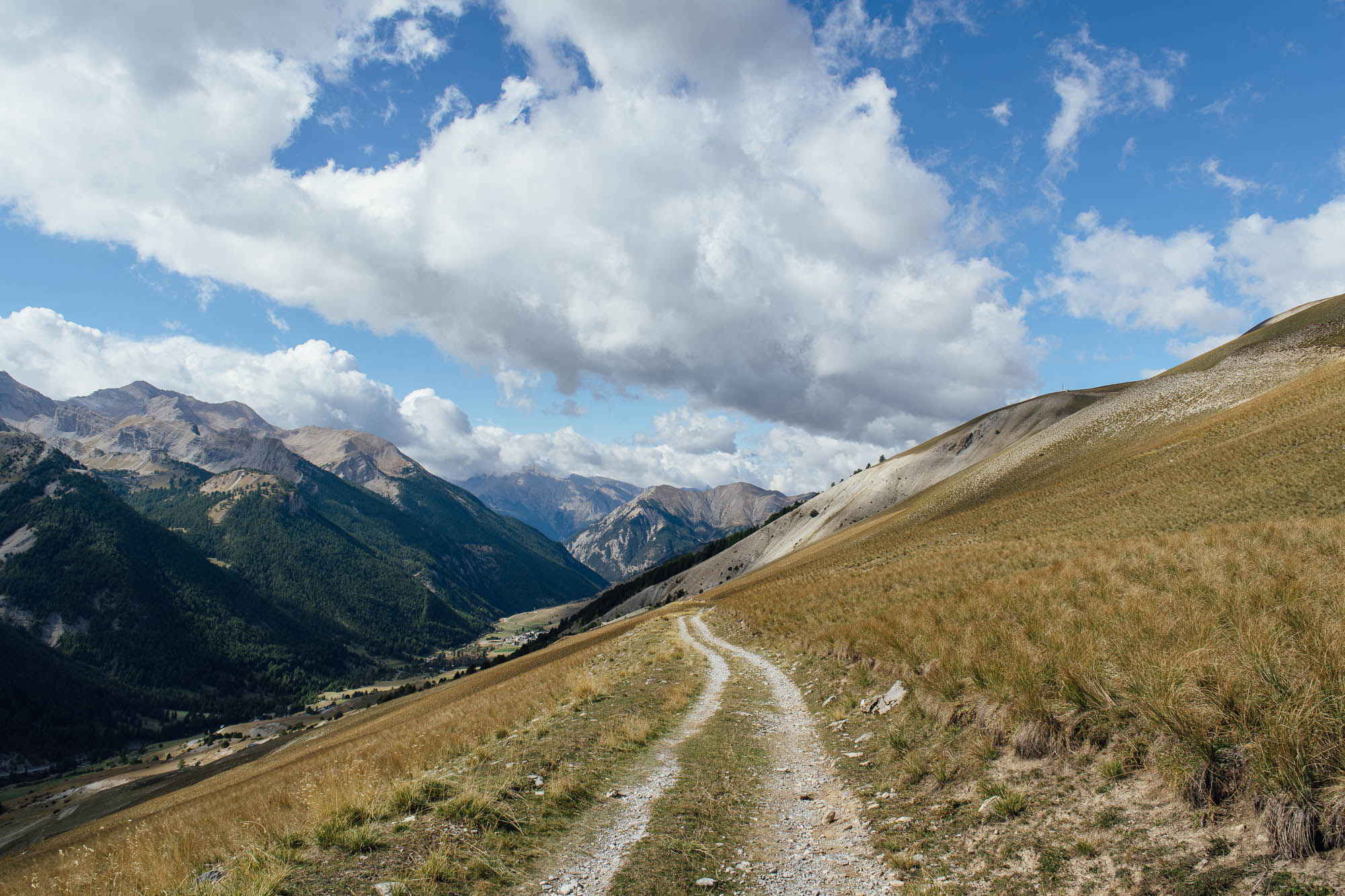
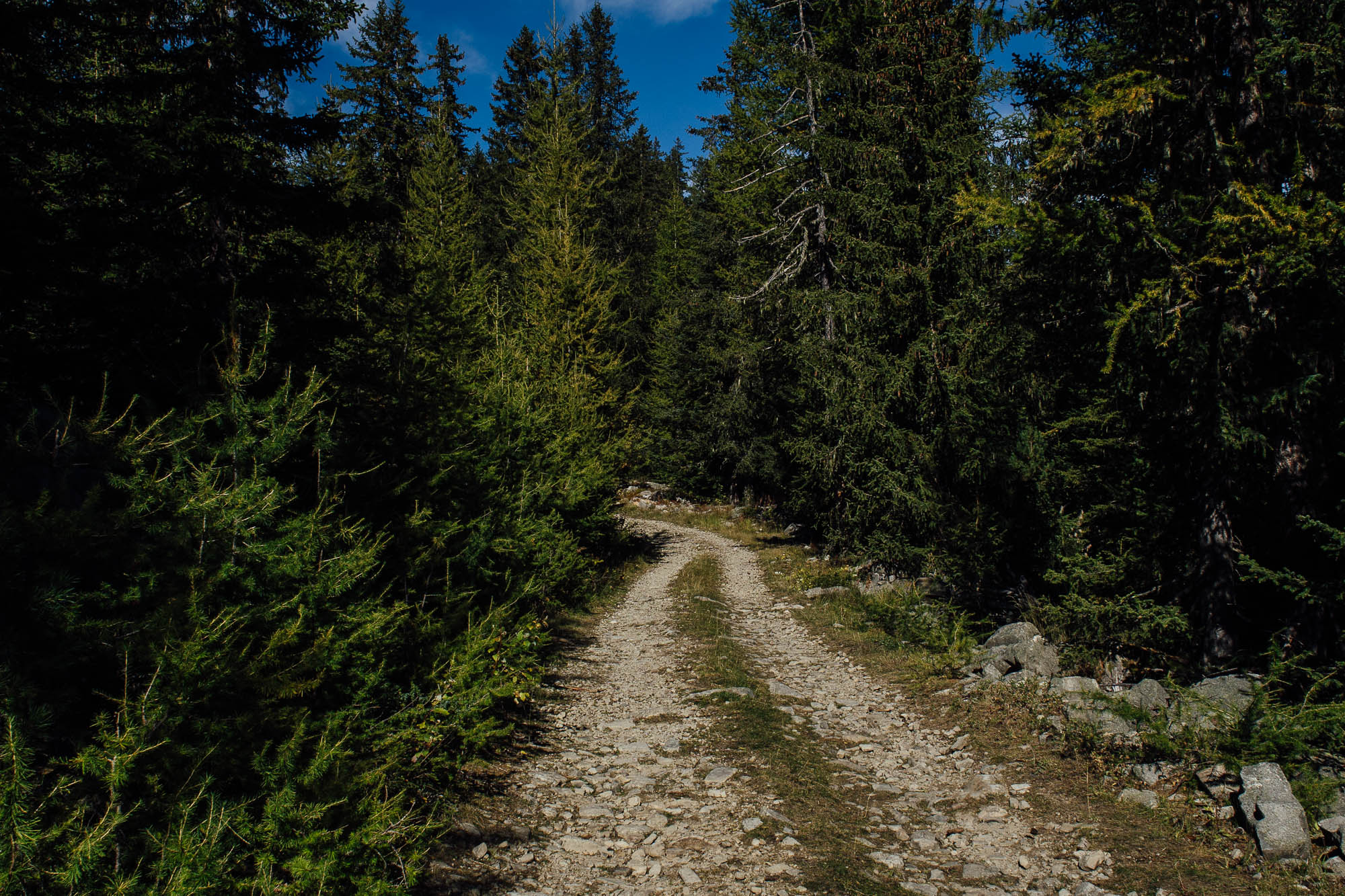
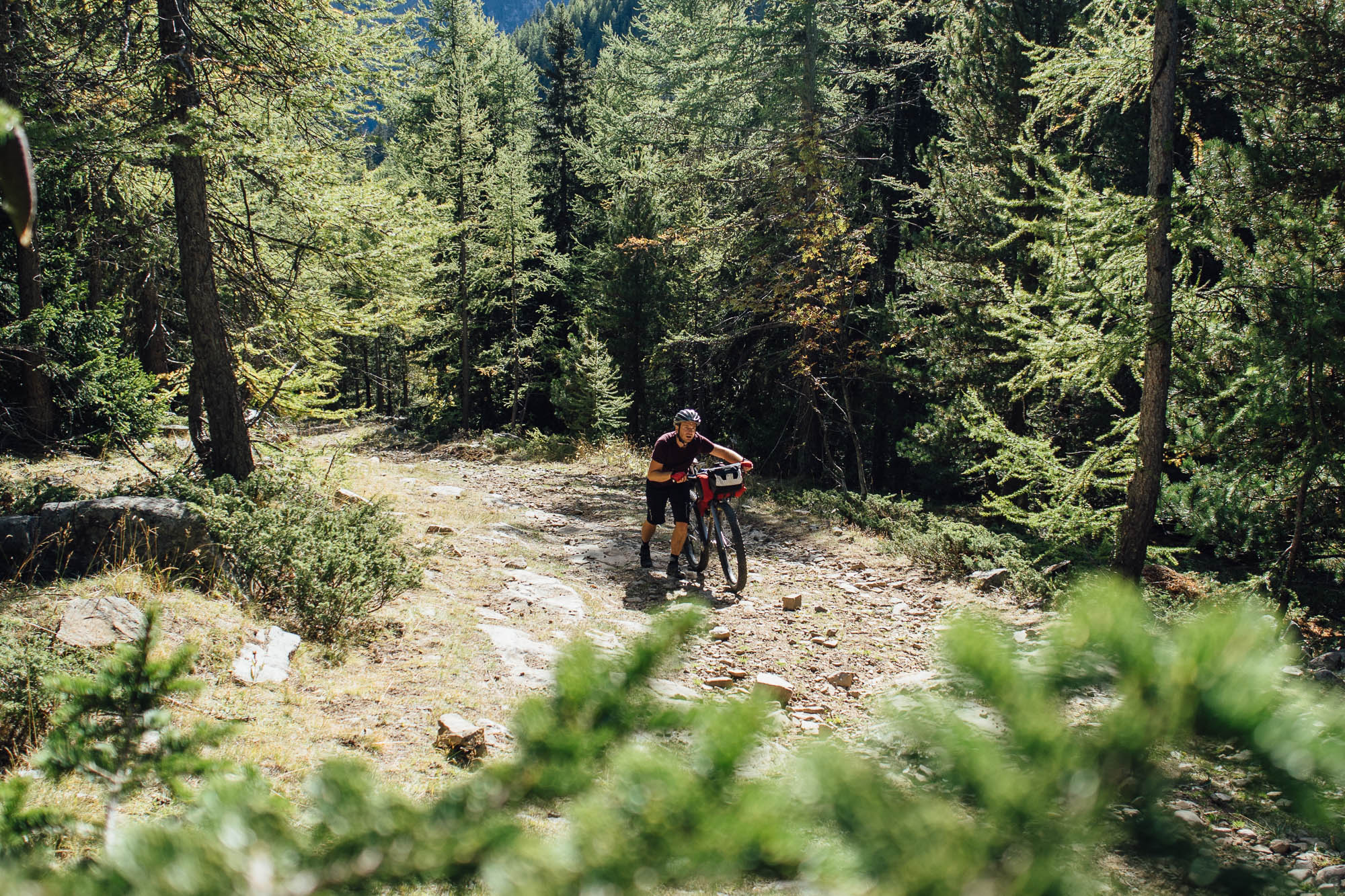
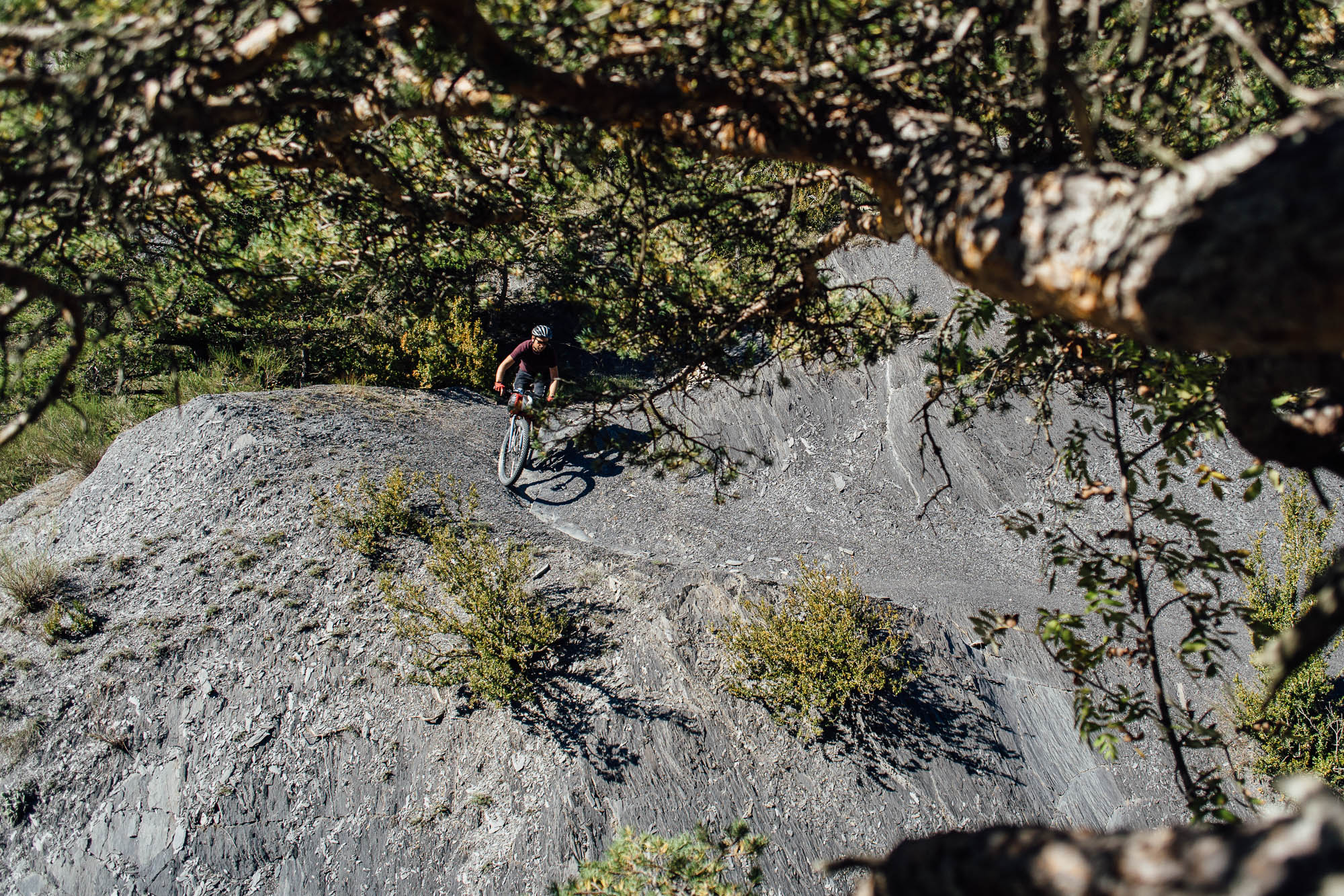
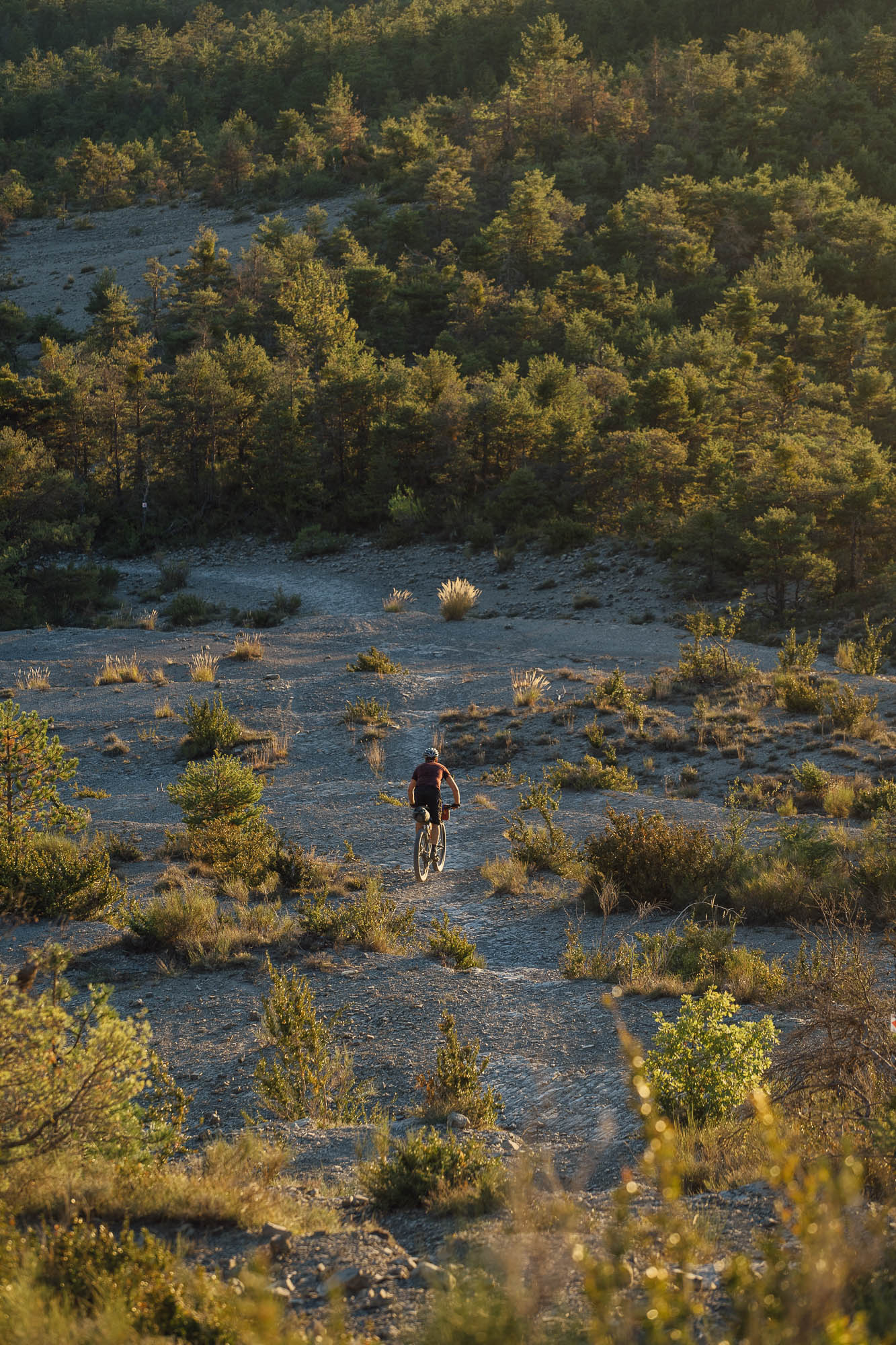
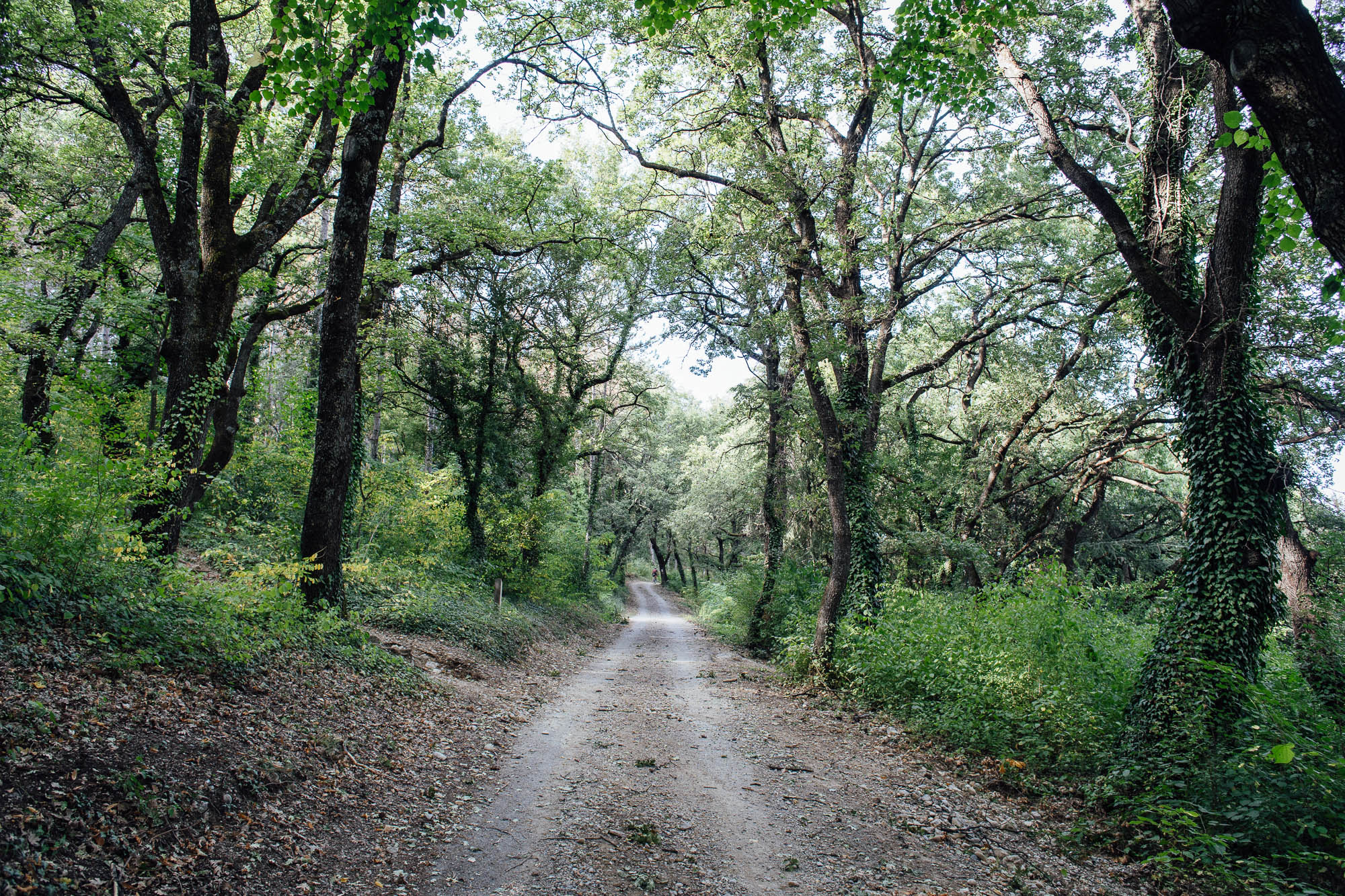
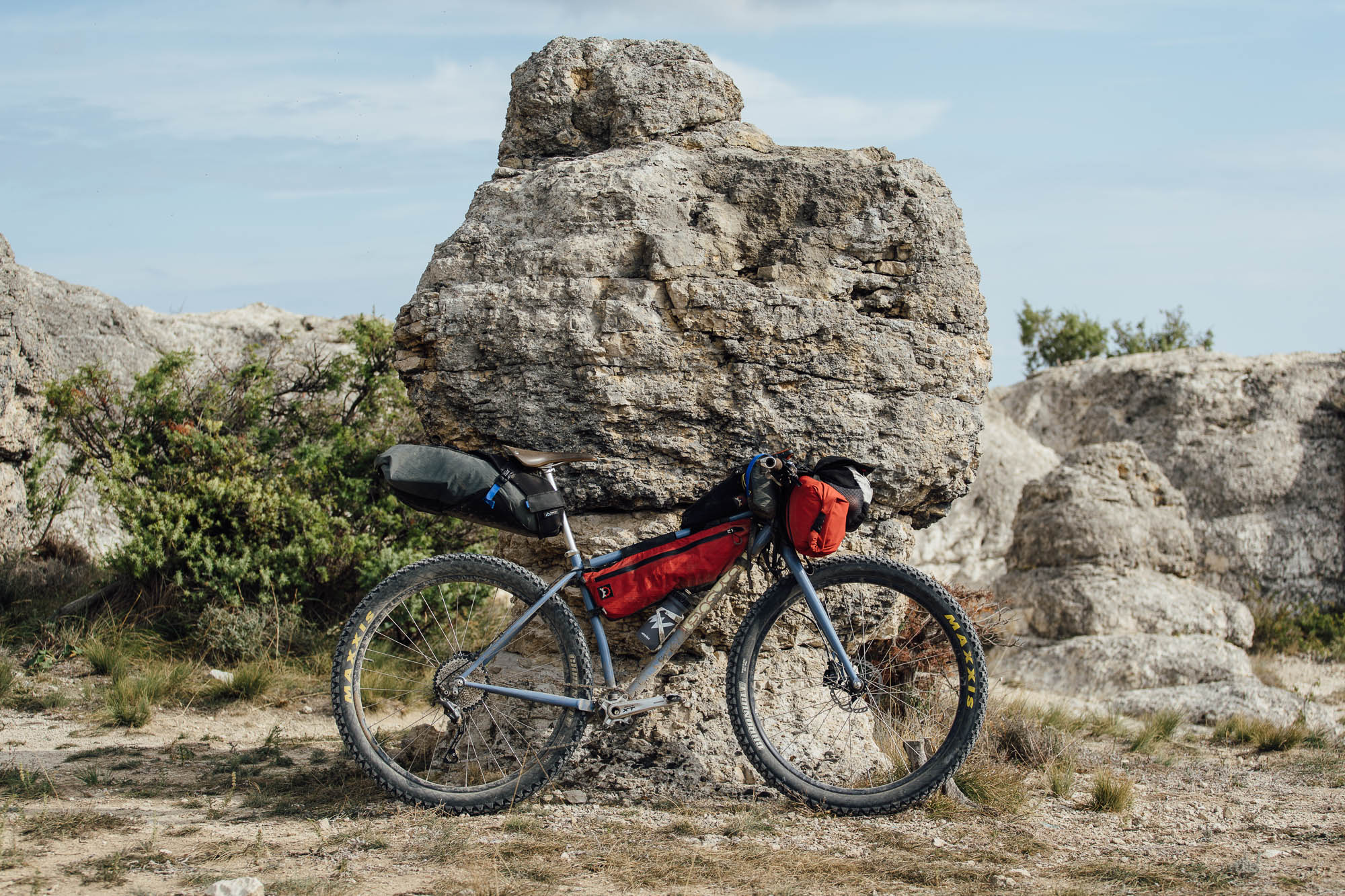
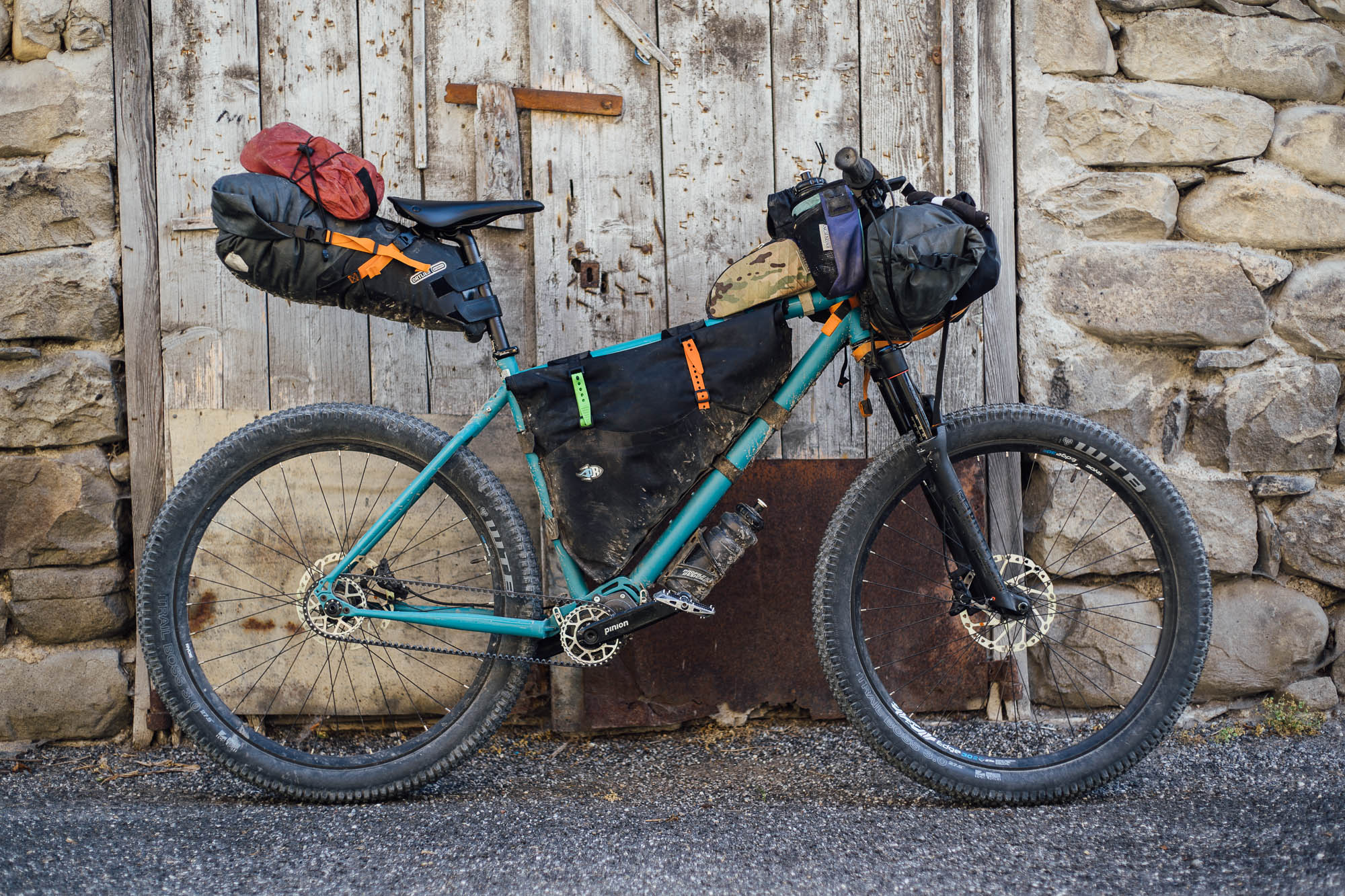
All in all, we enjoyed the route immensely and were thrilled by how involved the riding can be. In fact, some of the trails are extremely committing: think steps, tight switchbacks, and narrow corridors of baby heads. You’ll definitely want to be a confident mountain biker to make the most of this route; there are a number of very technical descents, especially before Digne-Les-Bains, which will need extreme care with a loaded bike. There was probably more pushing than we were expecting, too… generally up and occasionally down! Although the hike-a-bikes are mostly short – just a couple of longer grafts stand out – expect to hop on and off your bike regularly in places. It pays to have a light setup and a broad gear range; a 30T chainring with an 11-42 cassette is about the minimum I’d recommend but a lower ratio will help save your legs. And Provence certainly knows how to do rocks! Fit the widest tires you can, especially if you’re not running suspension. These aside, the riding is relatively mellow. Mike was on a Singular Rooster with 29×3″ wheels, and I was on a Tout Terrain Outback with a 2.8s and a 130mm fork. Both were great setups for the trip. I was certainly happy to have suspension but a rigid 29+ setup didn’t hold Mike back.
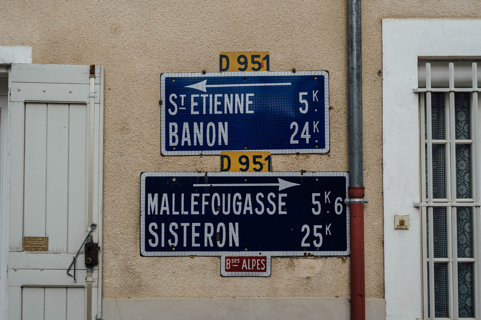
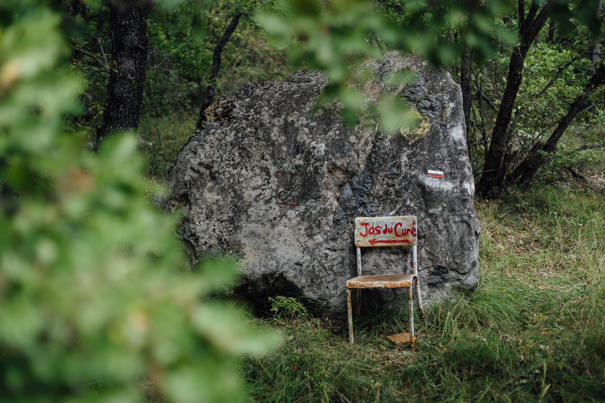
The ride itself is signposted for the most part, but it’s really easy to miss the signs themselves as they’re often tucked away behind corners, and it’s a little confusing as they don’t always tally with the official GPX track, as published on this site. In any case, I’d definitely recommend a GPS/phone to help with navigation; we used a Garmin Etrex and an iPhone with Mapout and Gaia GPS.
Food
As the Tales On Tyres folk extol and warn, enjoy the food, but watch out for lunchtime closing times, typically between 12:30 pm and 3:00 pm. Even many of the larger supermarket chains can be closed on Sunday, and in Provence, small shops often take Mondays off, too. Proxi appears to be a local chain but we never had any luck finding one open! The behemoths of Casino, Intermarche, and Carrefour are your most reliable bets for longer opening hours. The Biocoop, like the one in Barcelonette, has bulk produce, rather than the plastic wrapped vegetables found in the supermarkets. We also found a number of regional stores selling excellent local yoghurt, salamis, and cheeses, and if you’re lucky, you’ll tie in with some markets along the way too. The quality of food in France is definitely a big perk of this awesome ride.
We took a stove and were glad to have it given the time of year, for warm meals, tea, and coffee. But you can definitely do the ride without one. If you’re running an alcohol stove, look for alcool à brûler, found in 1-litre bottles in Casino supermarkets, for a couple of Euros. We carried Firepot’s excellent dehydrated meals for dinner, which are now available in biodegradable pouches.
For the full route guide and GPX file, visit Tales on Tyres original post, here. This is a great ride that takes in a real mix of terrain and vistas, in a country that loves cycling! Overall, it’s highly recommended.
Please keep the conversation civil, constructive, and inclusive, or your comment will be removed.