Wahoo Elemnt Review: GPS Simplified
Designed to tether with your smartphone and sync with your Ride With GPS or Strava account, the Wahoo ELEMNT aims to simplify the process of navigating with a dedicated GPS. After a year of regular use, here’s our full report on how it’s fared, what we really like about it, and what we think could be improved (because Wahoo is constantly rolling out firmware updates)…

For the most part, Garmin has long ruled the roost when it comes to GPS devices, even if their user interface often leaves something to be desired. Designed to be set up and used in conjunction with a smart phone, the ELEMNT is one of three models from US-based Wahoo that aims to usher in a more intuitive, straightforward way to navigate, record your rides, and train.

For the purposes of this review, I’ve zoned in on how the ELEMNT works as a tool for bikepacking, i.e. for multi-day rides following a route. Given its myriad functions aimed at more goal-orientated cycling and training, I’ll point you over to DC Rainmaker’s write up for an in-depth analysis of a perplexing wealth of workout data, as well as using it with the likes of SRAM eTap, ANT+, and all the rest.
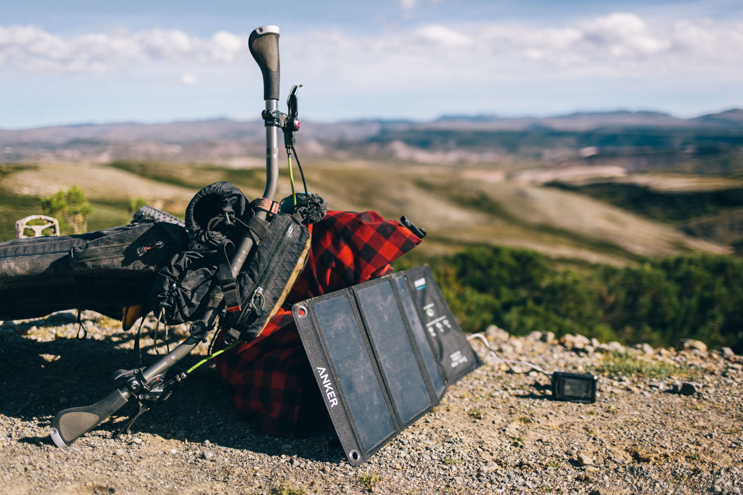
With this mind, we should probably start with the battery life, generally the main downfall of any electronic device when it comes to bikepacking. Don’t expect the 40hr+ usage of a Garmin installed with lithium batteries: I was only able to run the ELEMNT for a full day to a day and a half between charges, stretching it out to two if I was careful. Although this might sound disappointing, the good news is that the device can actually be used whilst being charged, which I did in a variety of ways; a cache battery that I kept in my feed bag, charged directly from my solar panel when taking a lunch stop, or running it in conjunction with my dynamo hub and Sinewave Beacon. As a result, I rarely ending up running it flat, just so long as I kept on top of things. What’s more, the ELEMNT is quick to charge, replenishing around 25 percent of its capacity during a typical half hour lunchtime break.

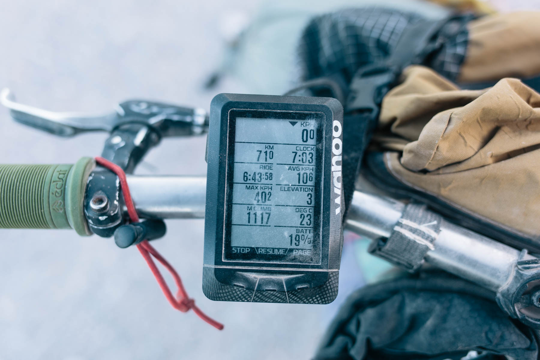
In comparison to Garmins that can complicated to set up and sometimes bug-prone, the ELEMNT is intuitive and reliable. Once you’ve downloaded the Wahoo app, you’ll initially need to choose the information you want each page to show and the order you’d like it to be presented in; synced via Bluetooth with the device, watch it miraculously appear in real time so you can fine tune it as you go. The more you data fields you choose to have per page, the smaller the numbers become.
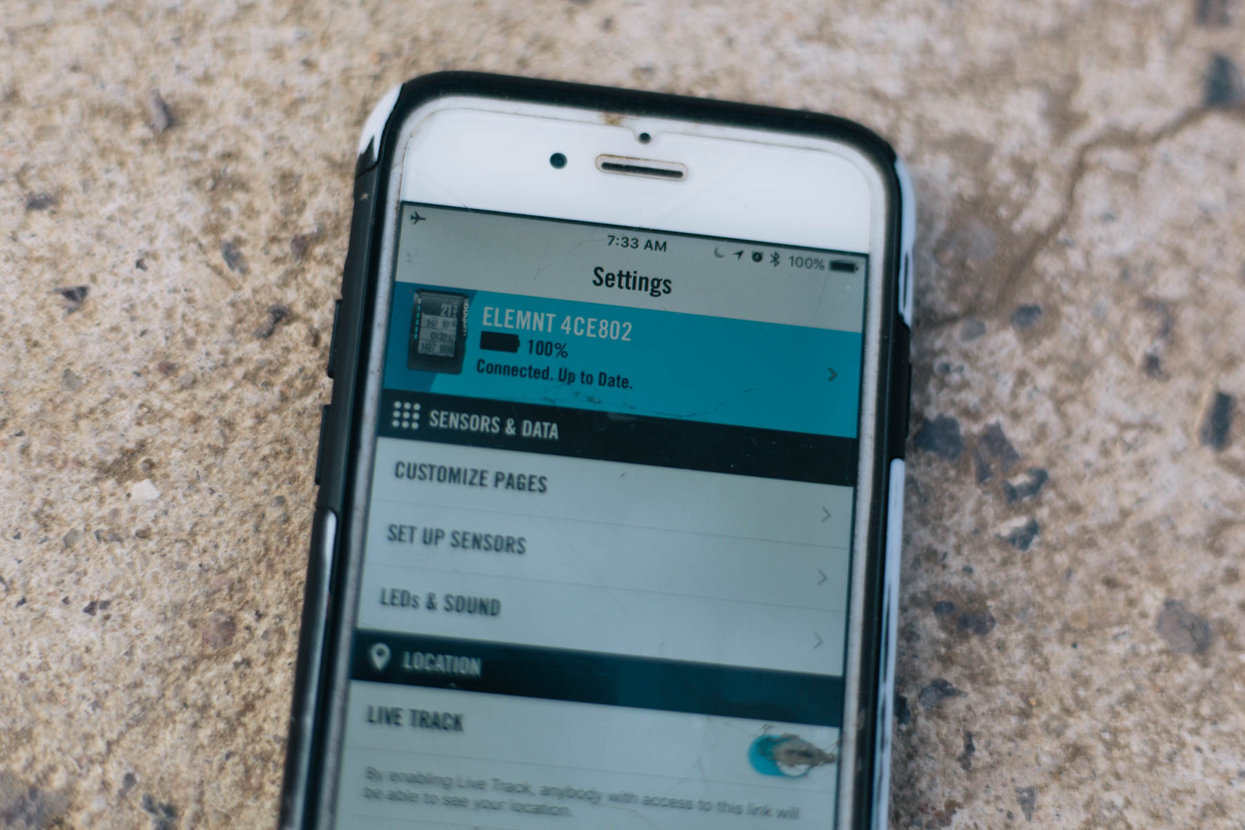
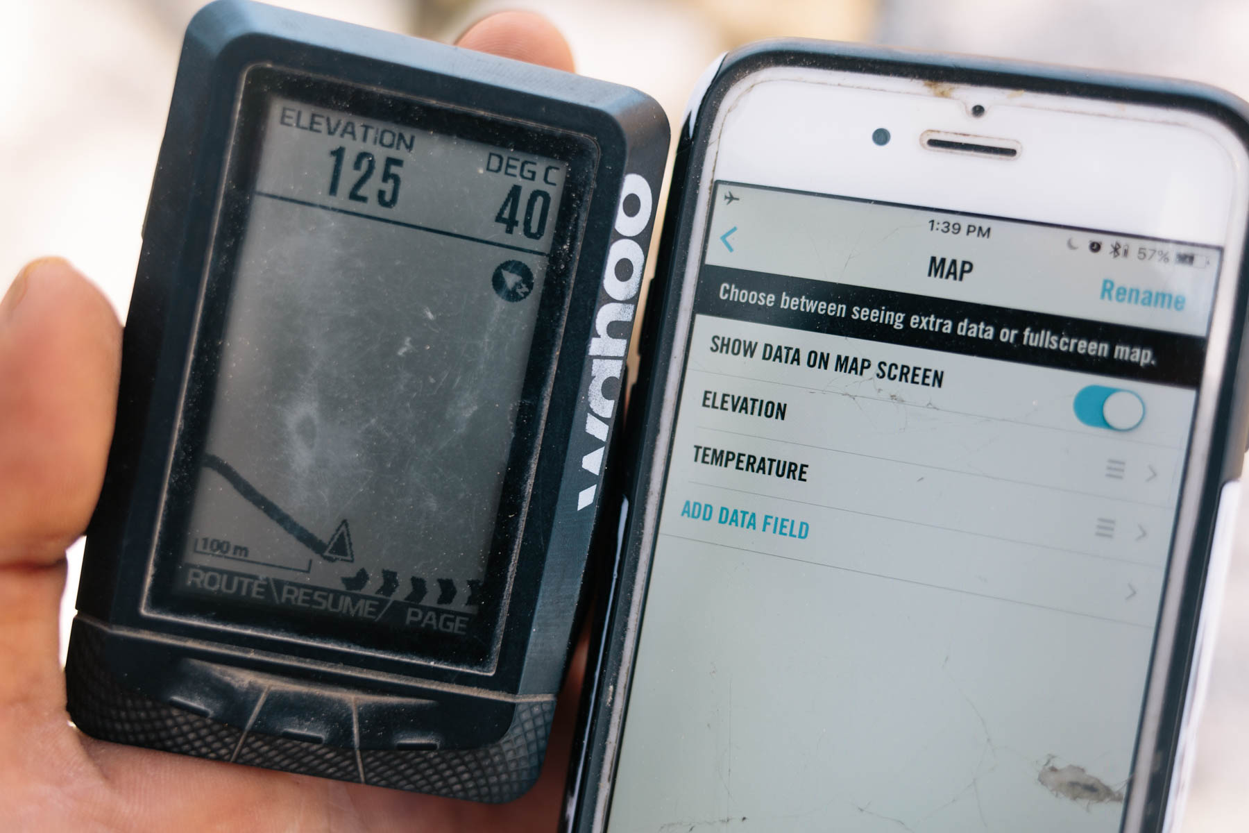
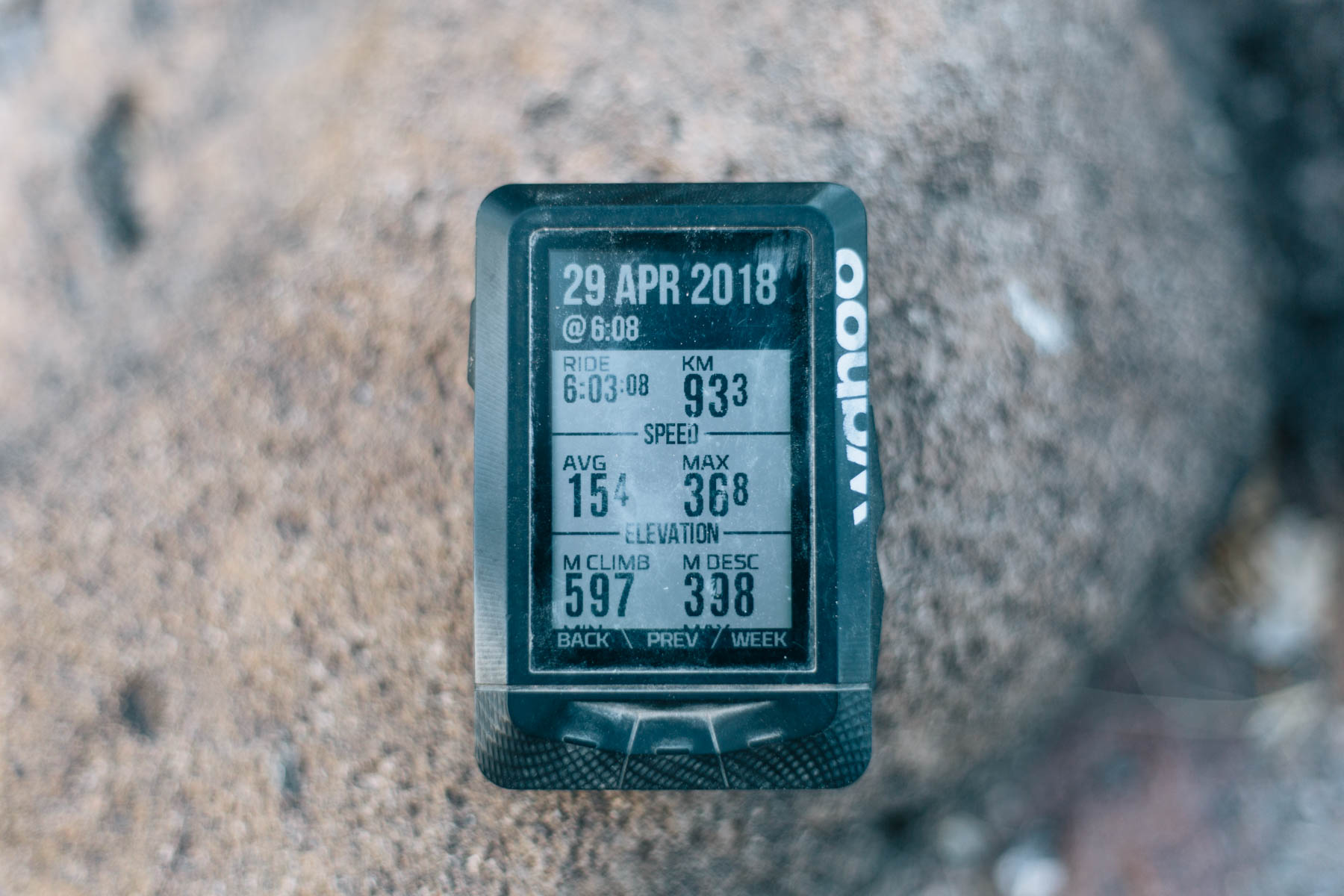
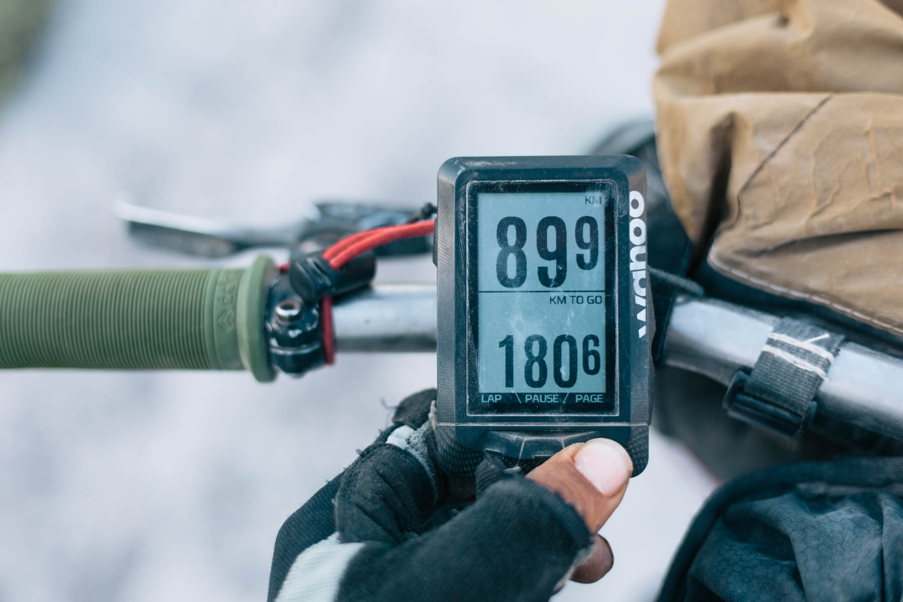
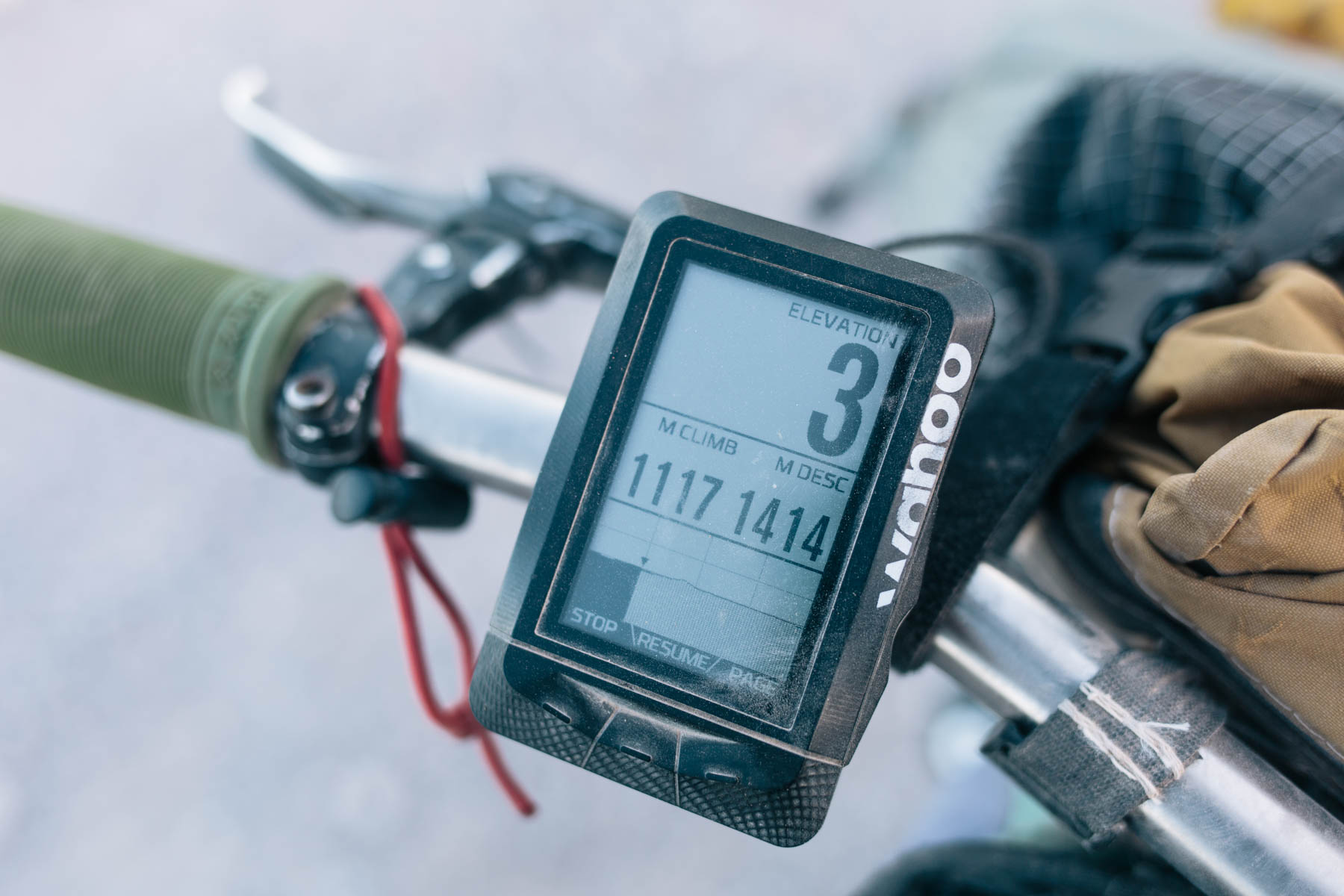
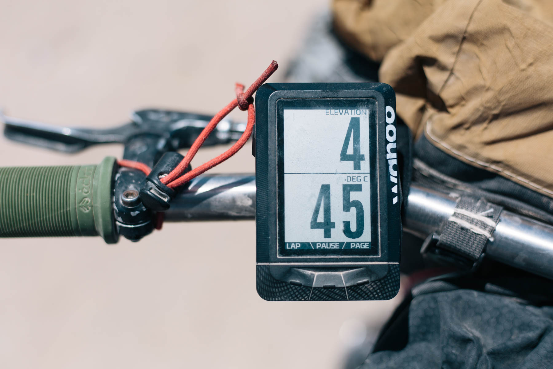
I like to keep my data harvesting relatively simple, so I’ve generally settled on the following: one page shows an overview of everything, a data-free map page displays the route, an elevation page (with meters climbed and descended) lets me know how climbs are going, and another page covers distance ridden/distance to go. When following a preloaded route (more on that below), the device also displays the profile of what’s coming up – a very handy feature. As for the app, it works very well for the most part, though occasionally mine was a little laggy unless I had airplane mode turned on, and Bluetooth enabled, on my iPhone 6.
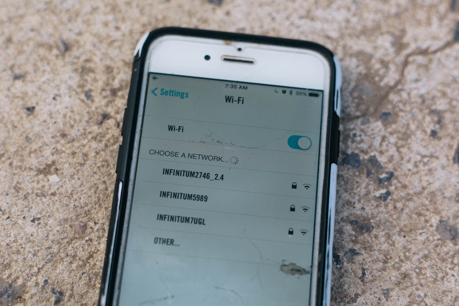
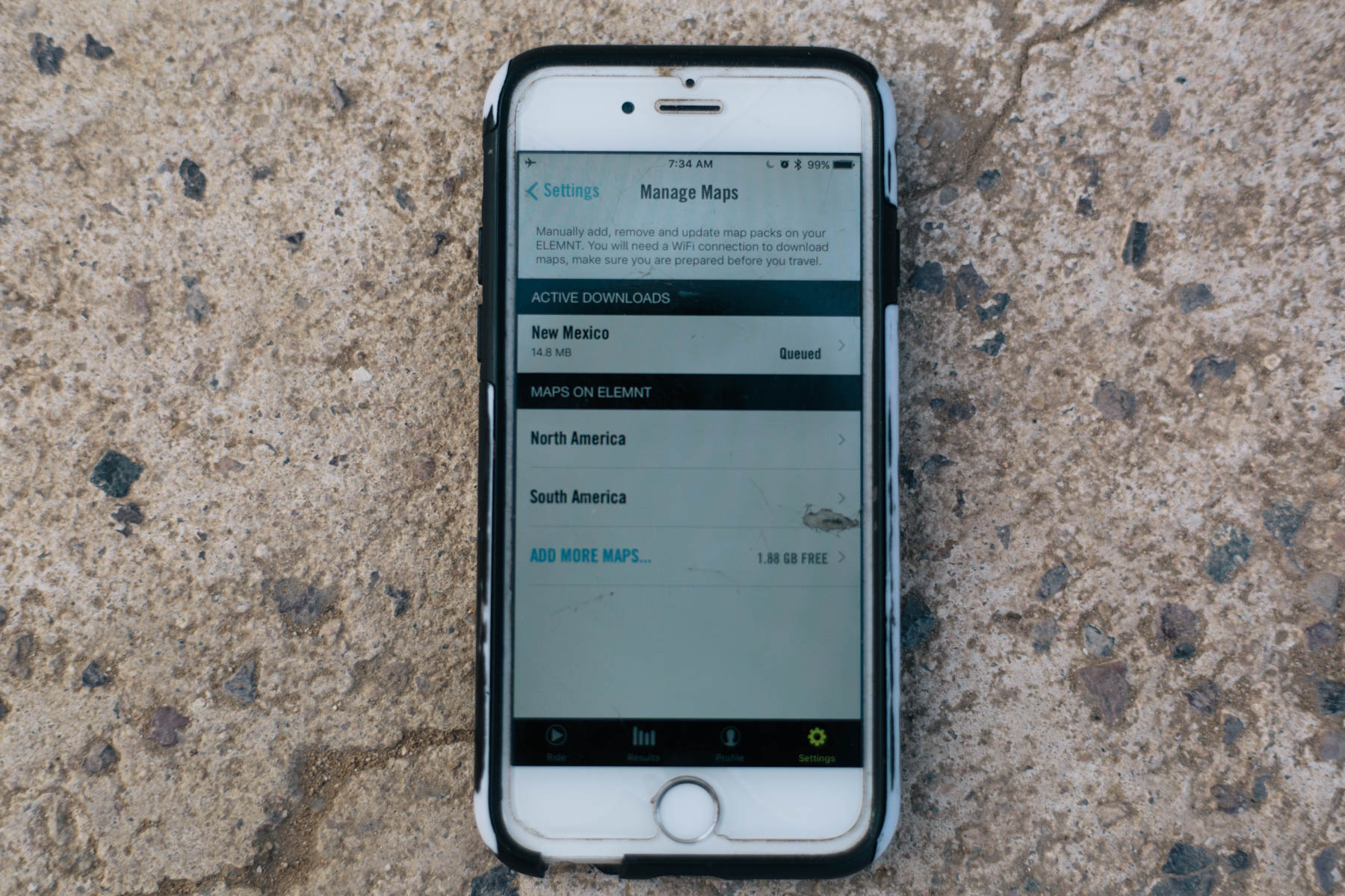
Once your device is set up, you’ll need to load in maps and a route. Unlike Garmins, where basemaps need to be installed via your laptop or a micro SD chip, a collection of worldwide maps can be quickly and easily downloaded individually via wifi, country by country, and state by state in the US (note that they can’t, oddly enough, be downloaded via your phone’s data connection, should you forget to do so before heading out).
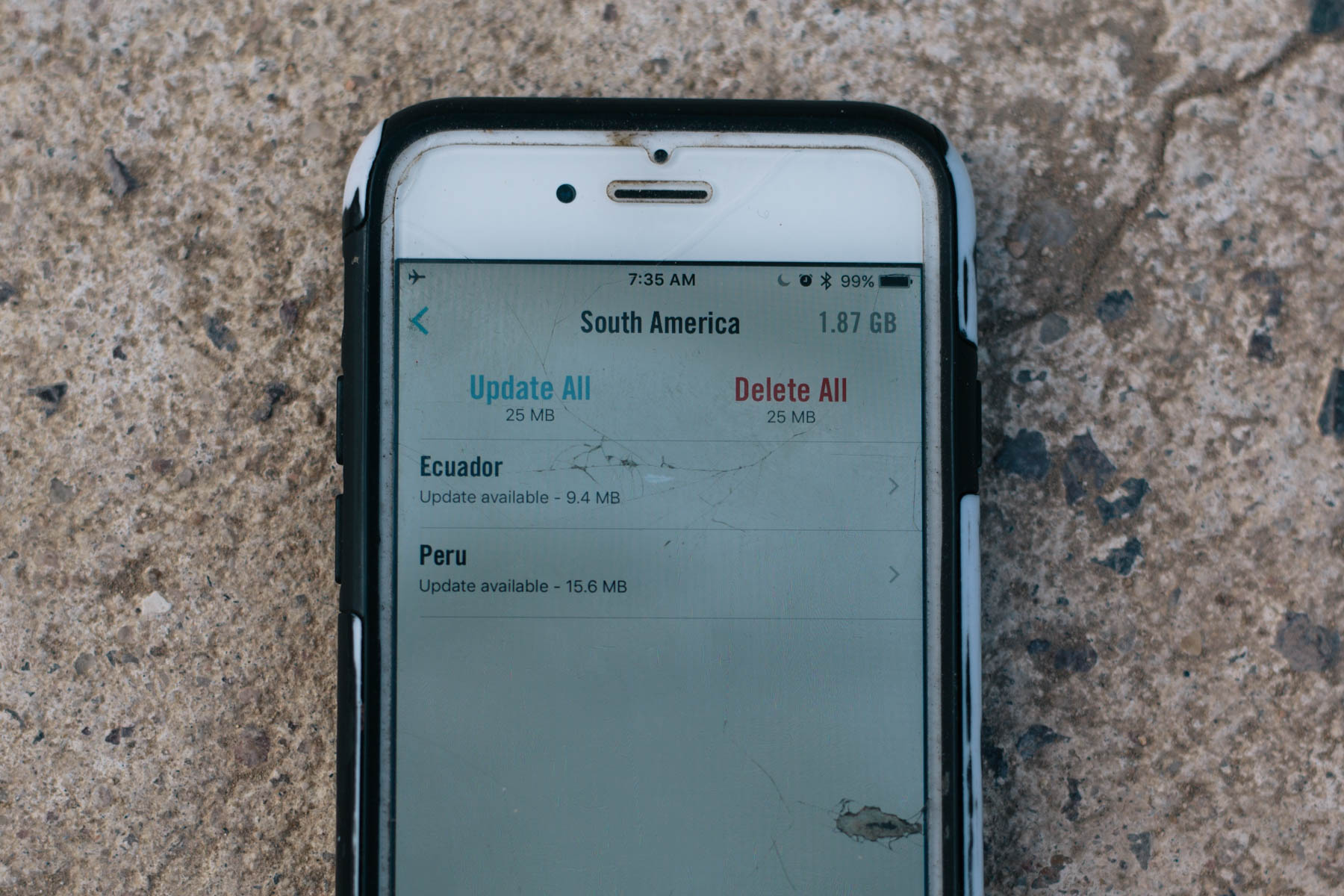
The maps themselves are OSM-based; this means that details are relatively good for more well-travelled areas, but sometimes a little scant overseas. The maps just show roads, with no topo lines, mountain bike trails, or points of interest. Connect to wifi and the app will let you know if any maps need to be updated.
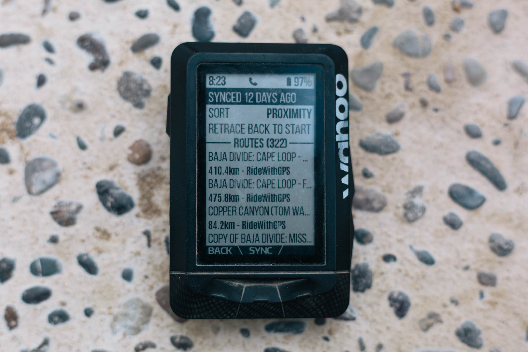
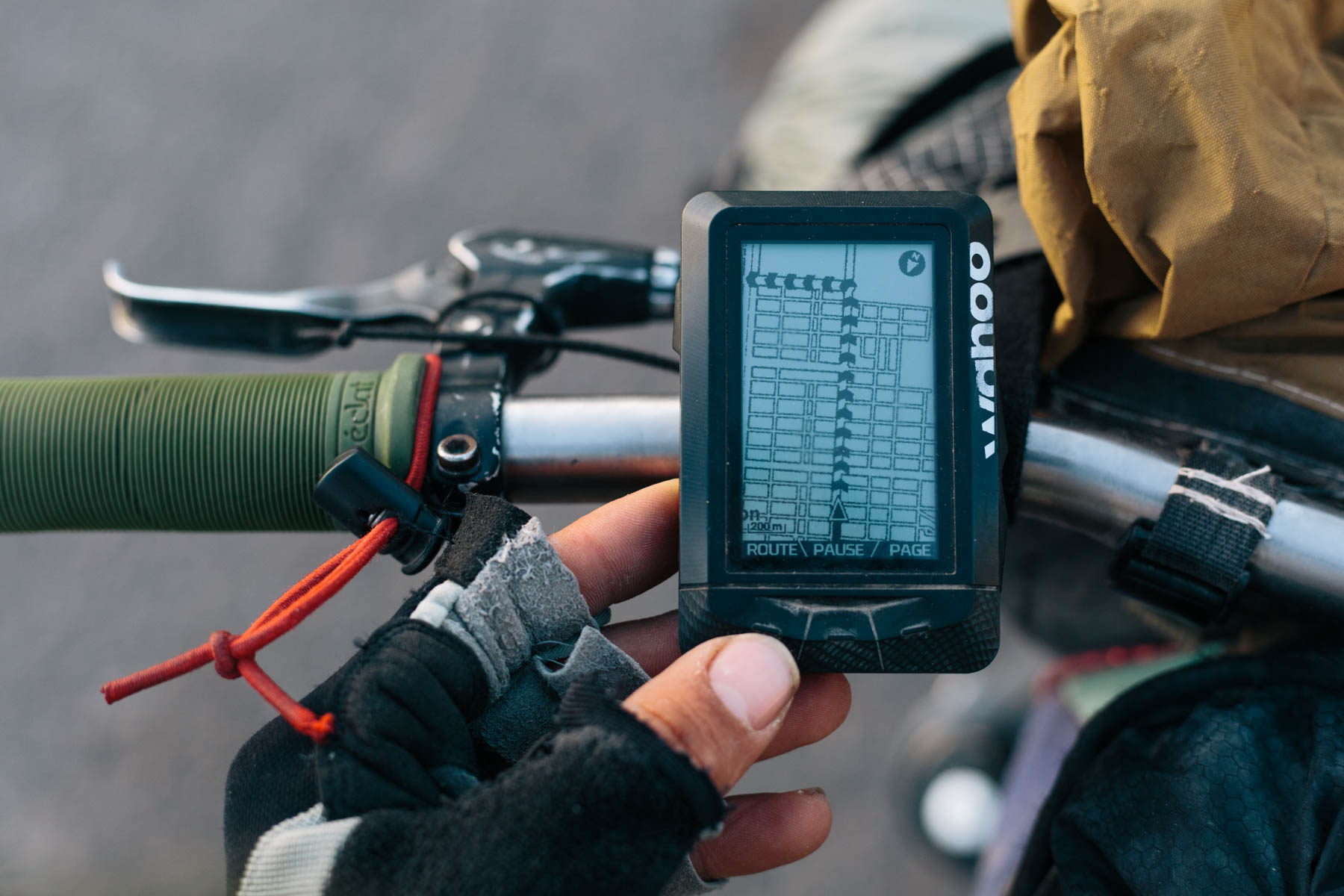
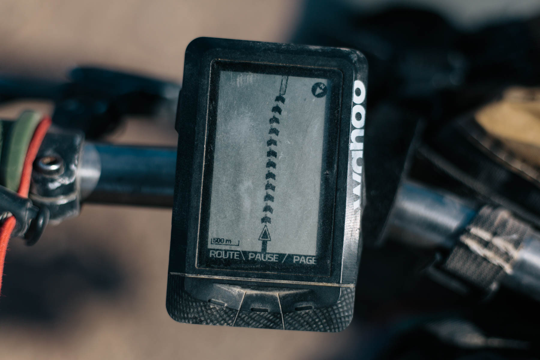
Where the ELEMNT really comes into its own is how well it syncs with 3rd party, web-based route planning software, such as Ride With GPS, Strava, and Komoot. I use RWGPS for planning most of my tours, so it’s simply a case of creating a route (or copying one from this site, for instance), syncing your account with the device, and then choosing the route you want to load into the ELEMNT (routes can be organised by date created or by location). Assuming you’re in the right spot, a clear series of chevron markers shows the route ahead, though unfortunately, it doesn’t show any waypoints that you may have included with your route (I was told this functionality scheduled to be introduced, which would be great). When turned on, it also sometimes takes the unit a few minutes to recognise you’re on route and for the chevrons to appear, which can be a bit disorientating.
Scale can be toggled in and out, depending on how quick the terrain is changing, so I’ve had no issues using it with multi-turn, singletrack routes, even if the trail itself wasn’t actually showing on the basemap (zoom out too much and the map looses all its detail, though). Usefully, the device bleeps if you go off course and there are countdown prompts as you approach a key turn. Complete with LEDs, it can even flash right or left; I turned it off to save battery, but I imagine it would be good for night riding.

All in all, the ELEMNT is refreshingly easy and intuitive to set up and follow. My only gripe is that the actual Wahoo app requires you to log in to a local wifi network, even if you’ve already done so on your phone, to download maps, make firmware updates, and most importantly, backup your rides (which you can set it up to do automatically). When I asked the company why, I was told, “The wifi connection you are punching in to the app is actually not connecting our app to wifi, but is authenticating the ELEMNT itself to wifi.” Hmm…
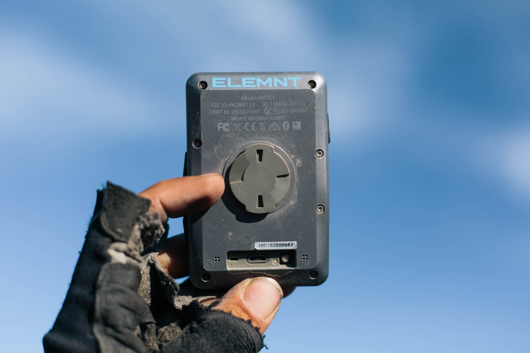
The device has 2GB of internal memory and is non-expandable. I couldn’t get my head around what that means in terms of how many basemaps you can download and routes you can prepare, before it wipes over old recorded data. When I asked for some clarification, I was told, “The ELEMNT, when preloaded with maps, has at approximately 300MB of free space, which equates to 3,000 hours of riding.” I guess it’s a moot point, as the reality was that I never ran out of space.
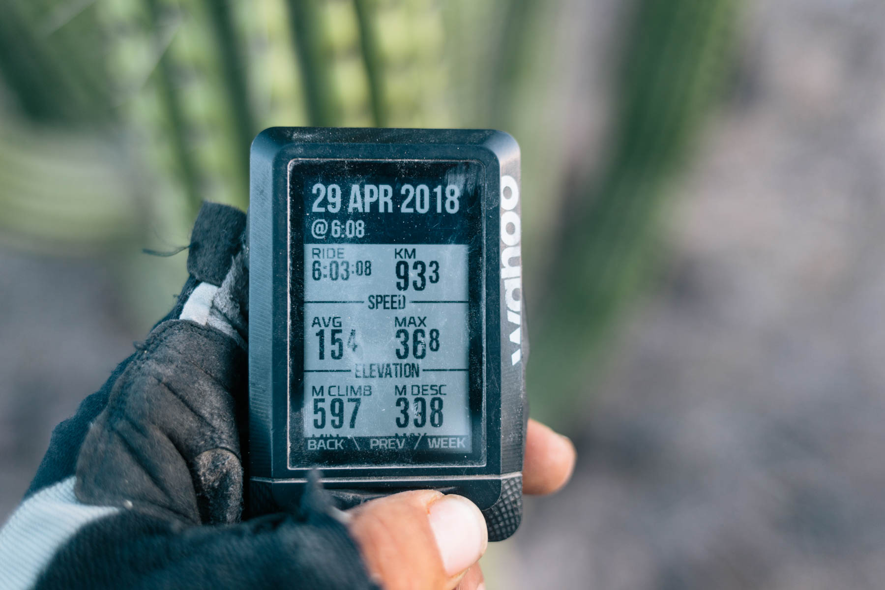
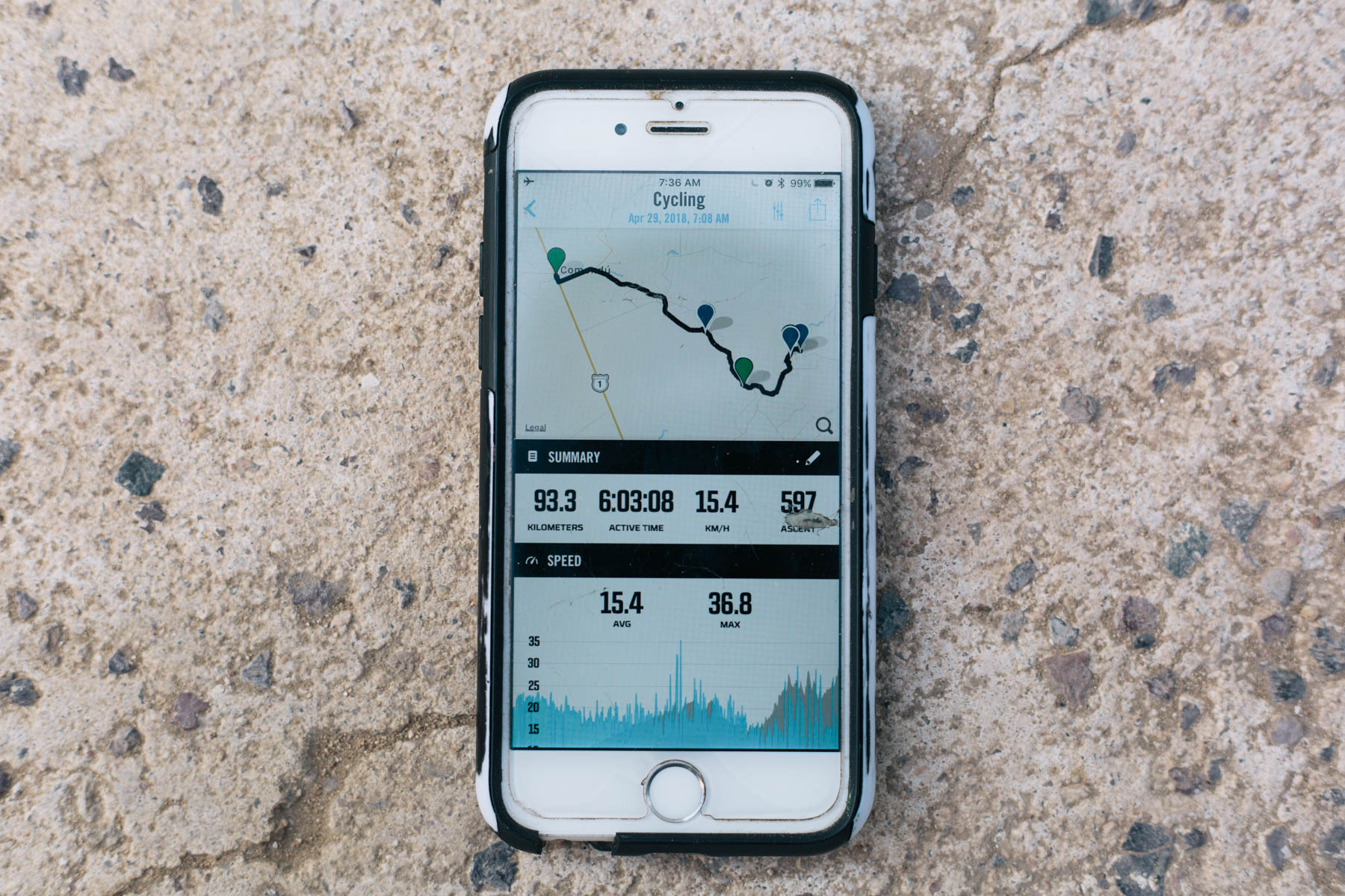
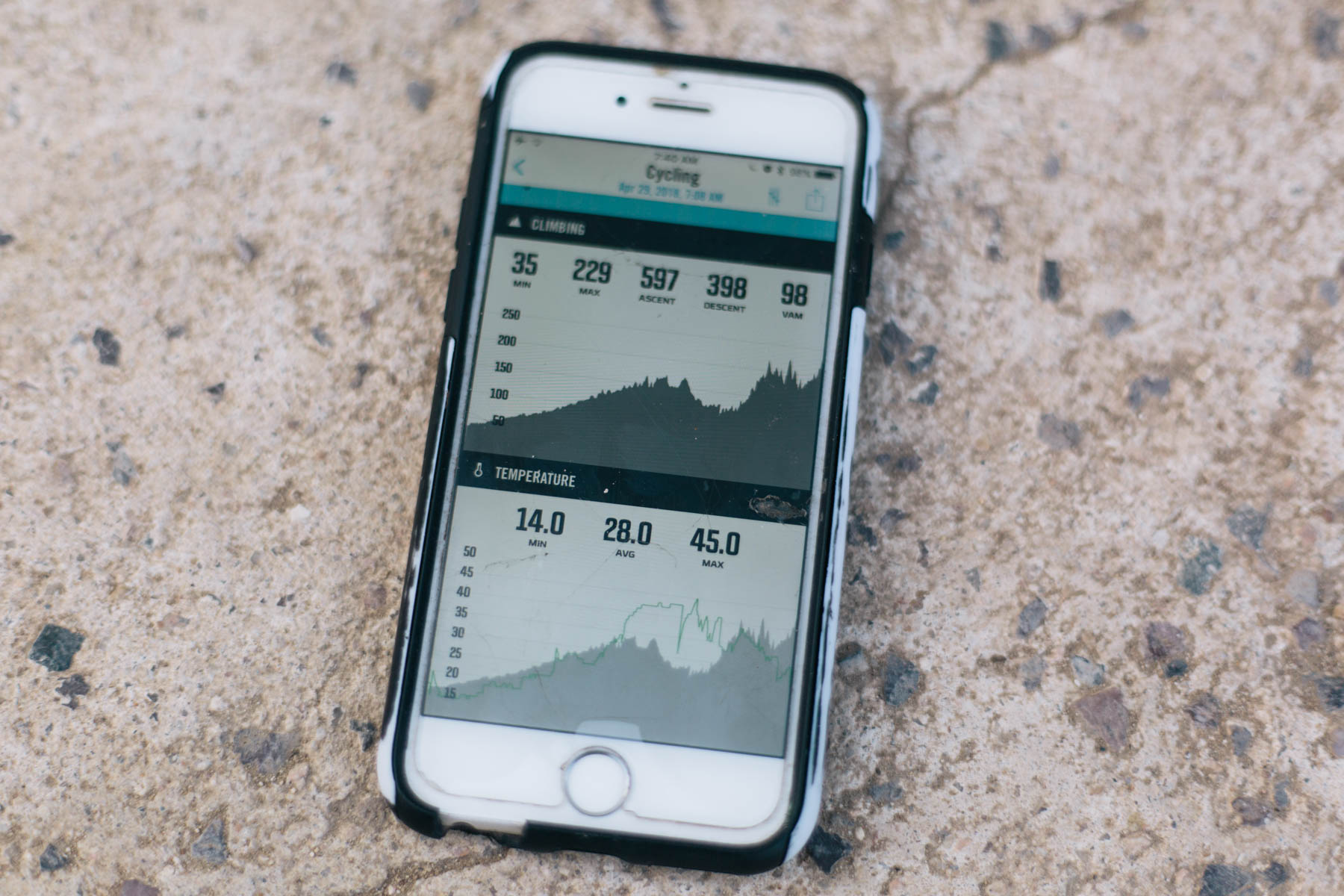
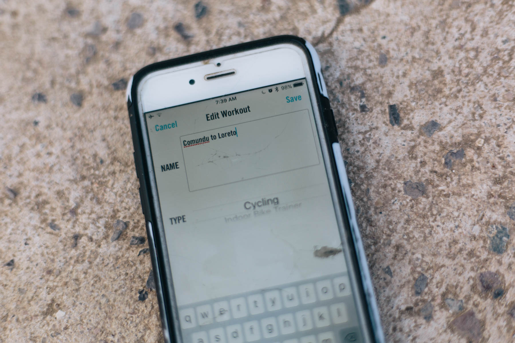
The ELEMNT records as you ride, of course, giving you all the stats listed above and countless more. When your day in the saddle is done, it displays an overview of everything you’ve achieved (once synced to your phone, you can nerd out on the full minutiae, in all its glory). One point worth mentioning is if you’re recording a series of rides with the intention of creating a longer route at the end, it won’t continue from your previous track once the device is turned off. Each segment is saved separately as a .fit file. You can send these over to your phone and rename them individually – to help keep track of what’s what – or sync them with your Dropbox/RWGPS/Strava accounts to back them up, though this can take some time via Bluetooth. The only way that I can see to continue a file – and avoid the laborious process of sewing them all together in RWGPS – is to turn the unit off while recording, which forces it to retrieve the file and continue where you left off. This works well enough, though it can take several minutes to implement. I’d also like a function to choose not to automatically save a ride, so it doesn’t store data that I don’t want to keep.

Although somewhat obvious, what came as a surprise to me is that there’s no touchscreen on the greyscale display. This segues in to the main issue I had with this device. Given that the ELEMNT has only a few glove-friendly buttons, it means there’s no way of locating yourself if you need to leave your route. As you can imagine, this can be very limiting; after all, it’s easy to stray off your planned path to resupply, for example. Not only that, but if you do so, the route you’re following is no longer shown on the display. As such, the ELEMNT only works for bikepacking in tandem with a separate navigation app (my favourites being Gaia, Maps.me, MapOut, or even RWGPS’s own app, backed up with the gpx/kml file). Granted, you already need the phone to make all your setup changes and backups, so it’s less of a big deal than it might otherwise be. But still, it really means it’s a device primarily designed to follow routes rather than create them. On a positive note, running the ELEMNT as your day to day navigation tool means you can save your phone’s battery life, which is depleted especially quickly when recording a track. And we shouldn’t forget one of the other main advantages of running a separate, handlebar-mounted GPS – it provides extremely clear navigation, even in the rain or bright sunshine.
$329 (£250) is no loose change, and I’d consider the ELEMNT relatively costly given the lack of colour display and touchscreen. Perhaps this simplicity makes it into a more robust unit; a year in and I’ve had no durability issues despite subjecting it to a hard life. If you intend to use it for training purposes or as a day-to-day bike computer – at which it excels – you’ll probably see it as a better deal. There are some other features that may or may not add value; for those joined at the hip to their cell phones, rest assured that the unit can display texts and alert you to incoming calls, too.
Lastly, it’s worth mentioning that Wahoo is a small company and updates come thick and fast; the people there are well known for being responsive to suggestions. As an example, a few other minor grievances I had when I first received the unit have since been addressed as part of their frequent firmware updates.
Pros
- Extremely easy to set up
- Clear display, whatever the weather
- Syncs seamlessly with Ride With GPS/Strava/Komoot
- Robust and well made
- Can be used while charging whether from a cache battery or a dynamo hub
- Great as a GPS for following more established routes (rather than striking out into new territory)
- Regular updates mean the device is constantly being refined and improved
- Includes worldwide and state by state OSM maps (though they’re basic and there’s no topographic detail)
Cons
- Battery life isn’t that great for multi-day rides
- If used primarily as a GPS, relatively expensive, given it’s greyscale and non touchscreen
- Currently impossible to view areas of maps beyond the track you’re following and route chevrons aren’t always shown unless you’re close to it
- OSM basemaps can only be downloaded via wifi, not cellular data
- Rides can be renamed within the app via Bluetooth but the new names aren’t propegated to RWGPS when exported
- POIs that are exported as waypoints with RWGPS don’t show up on the map
- Price $329.99 (£250)
- Weight 99g (3.5 oz)
- Size 57.5mm x 90.5mm x 21.2mm (2.3″ x 3.5″ x 0.8″)
- BatteryUSB rechargeable, 16 hours
- Waterproof RatingIPX7 (waterproof up to 5 ft)
- Supported SatellitesGPS, GLONASS, BEIDOU Galileo, and QZSS
- Place of manufacture China
- Manufacturer’s Details Wahoo
Buy from your LBS or check pries at REI Amazon
Wrap Up
Simplicity is the name of the game when it comes to the ELEMNT. Forget those years of complicated tricks to convince your GPS and laptop to talk, let alone figuring out the complexities of uploading tracks and basemaps to a unit. Assuming you have access to an online route planning program like Ride With GPS (whether your account features routes you’ve created yourself or curated from outside sources) and a wifi network, it really is a simple, streamlined process that the least tech-savy bikepacker should be able to master. It also means you don’t need to carry a computer for longer trips, as planning or updating a route in a library becomes an option.
But the ELEMNT isn’t perfect. It’s very much a system designed to be used to follow a route rather than create or modify one on the fly, primarily because there’s no way to navigate around the screen; i.e. to see what’s all around you. And, once you stray off route, there’s no way to locate yourself in relation to it again. There are plans to introduce an update that will solve this, though I don’t quite see how, given the lack of buttons and touchscreen. Battery life is okay, rather than stellar, though as mentioned, thankfully the unit charges quickly, and can do so while being used. There’s also a few quirks – needing to log in to the app’s wifi even if your phone is already connected is fiddly – showing basic waypoints would be very handy, and allowing maps to be downloaded and data backed up via your phone’s cell connection (rather than waiting for a wifi network) would be welcome.
All this said, having used the ELEMNT solidly for over a year, this is a tool that’s proved itself to be extremely robust and has really helped simplify the way I follow routes that I’ve made in RWGPS. Compared to solely carrying a phone, it’s been especially useful when riding routes with multiple junctions; I no longer waste time pausing to check and see where I am or worrying about the battery life of my phone. Although its own route planning functionality is limited compared to some of the more powerful Garmins, there’s no doubt it’s much more straightforward to use, and you can circumvent this issue by supporting the ELEMNT with a good smartphone navigation app when needed (besides, it’s always to have a backup gpx file anyway). As I’ve mentioned above, Wahoo is committed to making regular software updates, so if I spot anything significantly different or improved, I’ll update this review.
As it stands right now, the ELEMNT is undoubtedly an excellent device for training rides, day rides, overnighters, and short trips. However, with its inability to allow you to deviate off your chosen route, using it for extended travels takes more forethought and preparation, as does keeping it charged. I recommend it highly to anyone who uses RWGPS, Strava or Komoot and either likes to follow other people’s routes (such as the ones we publish here), or design their own from the comforts of a computer and keep to them in the field. But, it’s not the right tool for bikepackers who like to strike out and make things up as they go, or are following a track that will likely need significant modifications on the fly.
Please keep the conversation civil, constructive, and inclusive, or your comment will be removed.
We're independent
and member-supported.
Join the Bikepacking Collective to make our work possible: